NORWICH WESTERN LINK ROAD - Norfolk County Council Great Crested Newt eDNA Survey Report - Great Crested Newt ...
←
→
Page content transcription
If your browser does not render page correctly, please read the page content below
Norfolk County Council

NORWICH WESTERN LINK ROAD
Great Crested Newt eDNA Survey Report

70061370-09-07
JUNE 2021                               PUBLIC
Norfolk County Council

NORWICH WESTERN LINK ROAD
Great Crested Newt eDNA Survey Report

TYPE OF DOCUMENT (VERSION) PUBLIC

PROJECT NO. 70061370-09
OUR REF. NO. 70061370-09-07

DATE: JUNE 2021

WSP
62-64 Hills Road
Cambridge
CB2 1LA
Phone: +44 1223 558 050
Fax: +44 1223 558 051
WSP.com
QUALITY CONTROL

 Issue/revision         First issue         Revision 1      Revision 2      Revision 3

 Remarks                First Issue         1st Client      2nd Client
                                            Review          Review

 Date                   October 2020        December 2020   June 2021

 Prepared by            UKRED002            UKMCW003        UKMCW003

 Checked by             UKODP001            UKHDS001        UKSJM011

 Authorised by          UKARH003            UKARH003        UKARH003

 Project number         70061370-09         70061370-09     70061370-09

 Report number          70061370-09-        70061370-09-07 70061370-09-07
                        07

NORWICH WESTERN LINK ROAD                                                             WSP
Project No.: 70061370-09 | Our Ref No.: 70061370-09-07                           June 2021
Norfolk County Council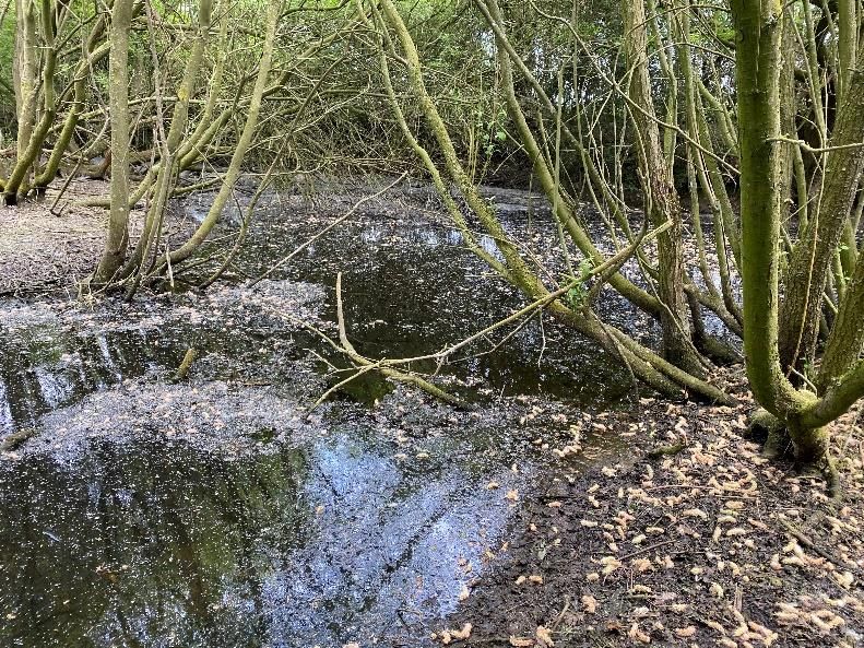
CONTENTS

1.     INTRODUCTION                                                    1

1.1.   PROJECT BACKGROUND                                              1
1.2.   ECOLOGICAL BACKGROUND                                           1
1.3.   BRIEF AND OBJECTIVES                                            1
1.4.   STUDY AND SURVEY AREA                                           2

2.     RELEVANT LEGISLATION                                            3

2.1.   LEGAL COMPLIANCE                                                3

3.     METHODS                                                         4

3.1.   OVERVIEW                                                        4
3.2.   DESK STUDY                                                      4
3.3.   HABITAT SUITABILITY INDEX (HSI) ASSESSMENT                      4
3.4.   EDNA WATER SAMPLING                                             5
3.5.   DATES OF SURVEY AND PERSONNEL                                   6
3.6.   NOTES AND LIMITATIONS                                           8

4.     RESULTS                                                         9

4.1.   DESK STUDY                                                      9
4.2.   HABITAT SUITABILITY INDEX (HSI) ASSESSMENT                      9
4.3.   EDNA WATER SAMPLING                                             9
4.4.   SUMMARY OF HSI AND EDNA RESULTS                                10

5.     REFERENCES                                                     17

5.1.   PROJECT REFERENCES                                             17
5.2.   TECHNICAL REFERENCES                                           17

       NORWICH WESTERN LINK ROAD                                     WSP
       Project No.: 70061370-09 | Our Ref No.: 70061370-09-07   June 2021
       Norfolk County Council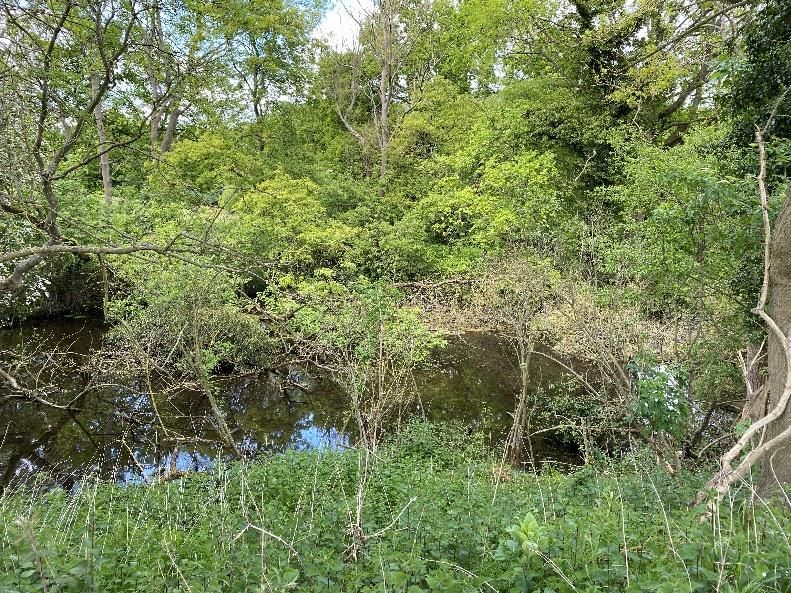
TABLES
Table 3-1 – Pond suitability categorisation based upon HSI score          5
Table 3-2 – Survey Dates                                                  6
Table 4-1 – Summary of HSI and eDNA results                              11

APPENDICES
Appendix A – Survey and Desk Study Area (see separate document)
Appendix B – EDNA Results 2020 (see separate document)
Appendix C – HIS Results 2020 (see separate document)
Appendix D – HSI Calculations
Appendix E – Photographs
Appendix F – Laboratory Results (see separate document)

NORWICH WESTERN LINK ROAD                                               WSP
Project No.: 70061370-09 | Our Ref No.: 70061370-09-07             June 2021
Norfolk County Council
1.       INTRODUCTION

1.1.     PROJECT BACKGROUND
1.1.1.   The Norwich Western Link Road (NWL) is a highway scheme linking the A1270 Broadland
         Northway from its junction with the A1067 Fakenham Road to the A47 trunk road near
         Honingham.
1.1.2.   The NWL, hereafter referred to as the Scheme, will comprise the following listed below.
         ▪ Dualling the A1067 Fakenham Road westwards from its existing junction with the A1270
           to a new roundabout located approximately 400m to the north west.
         ▪ Construction of a new roundabout.
         ▪ Constructing a dual carriageway link from the new roundabout to a new junction with the
           A47 near Honingham.
1.1.3.   As part of a separate planned scheme, Highways England proposes to realign and dual the
         A47 from the existing roundabout at Easton to join the existing dual carriageway section at
         North Tuddenham. If that scheme proceeds, it is expected that Highways England will
         construct the Honingham junction and the Norwich Western Link will connect to the north-
         eastern side of that junction.
1.1.4.   The Scheme will cross the River Wensum and its floodplain by means of a viaduct. The
         Scheme will also cross four minor roads by means of overpass or underpass bridges. The
         Scheme will include ancillary works such as provision for non-motorised users, necessary
         realignment of the local road network and the provision of environmental mitigation
         measures.
1.2.     ECOLOGICAL BACKGROUND
1.2.1.   A Phase 1 Habitat Survey (WSP UK Ltd., 2020), undertaken in 2020, identified suitable
         aquatic and terrestrial habitat which could support Great Crested Newt Triturus cristatus
         (GCN). Habitats included numerous water bodies and terrestrial habitat such as tussocky
         grassland, woodland, scrub, wetland, field margins and other boundary features such as
         ditches and hedgerows. It was therefore recommended that a GCN environmental DNA
         (eDNA) survey be undertaken to establish a sufficient baseline to inform impact
         assessment.
1.3.     BRIEF AND OBJECTIVES
1.3.1.   WSP UK Ltd was commissioned by Norfolk County Council to complete GCN surveys, with
         the following objectives:
         ▪ Complete a Habitat Suitability Index (HSI) assessment of water bodies within the
           Scheme boundary and within 500m of the Scheme boundary to assess their suitability as
           aquatic habitat for great crested newts.

         NORWICH WESTERN LINK ROAD                                                               WSP
         Project No.: 70061370-09 | Our Ref No.: 70061370-09-07                             June 2021
         Norfolk County Council                                                           Page 1 of 18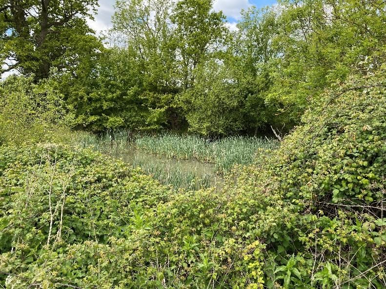
▪ Complete a GCN eDNA survey to determine the presence or likely absence of this
           species from water bodies within the Scheme boundary and within 500m of the Scheme
           boundary.
         ▪ Present the findings of the survey in a baseline report.
1.3.2.   The survey findings will be used to inform the impact assessment and proposed mitigation
         for GCN and other amphibian species present across the Scheme. Details of the impact
         assessment and mitigation will be included within the Biodiversity Chapter of the
         Environmental Statement for the Scheme.
1.4.     STUDY AND SURVEY AREA
1.4.1.   An ecological Desk Study was completed in March 2020 to include recent data relevant to
         the Route. The Desk Study Area for this was defined as a 2km radius of the Scheme
         boundary (drawing 70061370-09-07-0001 see separate document, Error! Reference
         source not found. ).
1.4.2.   The Survey Area in relation to GCN comprised a 500m buffer of the Scheme. All suitable
         water bodies, where access was permitted, identified as having potential to support GCN
         populations were surveyed. The Scheme and Survey Area are shown on drawing
         70061370-09-07-0001, see separate document Error! Reference source not found.).
1.4.3.   This report will be updated with the results of further great crested newt surveys to be
         undertaken in 2021 to complete the baseline. This will include further population size class
         estimate surveys on waterbodies which returned positive results for great crested newt
         eDNA, as well as further eDNA surveys of ponds which could not be surveyed in 2020 due
         to access or being dry, or where the result was classed as inconclusive/indeterminate.

         NORWICH WESTERN LINK ROAD                                                                WSP
         Project No.: 70061370-09 | Our Ref No.: 70061370-09-07                              June 2021
         Norfolk County Council                                                            Page 2 of 18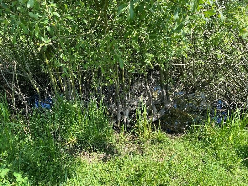
2.       RELEVANT LEGISLATION

2.1.     LEGAL COMPLIANCE
2.1.1.   GCN are afforded a high level of protection under the Conservation of Habitats and Species
         Regulations 2017 (the ‘Habitats Regulations’), the legislation means that it is an offence to;
         ▪ deliberately capture, injure or kill a wild great crested newt;
         ▪ deliberately disturb wild great crested newts; ‘disturbance of animals includes in
           particular any disturbance which is likely:
            • (a) to impair their ability —
               − (i) to survive, to breed or reproduce, or to rear or nurture their young; or
               − (ii) in the case of animals of a hibernating or migratory species, to hibernate or
                 migrate; or
            • (b) to affect significantly the local distribution or abundance of the species to which
              they belong.’
         ▪ damage or destroy a breeding Site or resting place used by this species.
2.1.2.   Protection is also afforded under the Wildlife and Countryside Act 1981 (as amended) with
         respect to disturbance of animals when using places of shelter, and obstruction of access to
         places of shelter.
2.1.3.   Due to the high level of protection afforded to GCN and their habitat, mitigation for this
         species is governed by a strict licensing procedure administered by Natural England
         (normally, planning permission must be obtained before a licence can be sought. However,
         works which do not require planning permission must still adhere to licensing requirements).
2.1.4.   Licencing is subject to three tests, as defined under the Habitats Regulations, these must
         also be applied by a planning authority before granting permission for activities affecting
         GCN. For permission to be granted the following criteria must be satisfied;
         ▪ the proposal is necessary ‘to preserve public health or public safety or other imperative
           reasons of overriding public interest including those of a social or economic nature and
           beneficial consequences of primary importance for the environment’;
         ▪ ‘there is no satisfactory alternative’; and
         ▪ the proposals ‘will not be detrimental to the maintenance of the population of the species
           concerned at a favourable conservation status in their natural range’.
2.1.5.   GCN are also listed as a Species of Principal Importance (SPI) for the Conservation of
         Biodiversity in England in accordance with Section 41 of the Natural Environment and Rural
         Communities (NERC) Act 2006. Under Section 40 of the NERC Act (2006) public bodies
         (including local planning authorities) have a duty to have regard for the conservation of SPI
         when carrying out their functions, including determining planning applications.

         NORWICH WESTERN LINK ROAD                                                                   WSP
         Project No.: 70061370-09 | Our Ref No.: 70061370-09-07                                 June 2021
         Norfolk County Council                                                               Page 3 of 18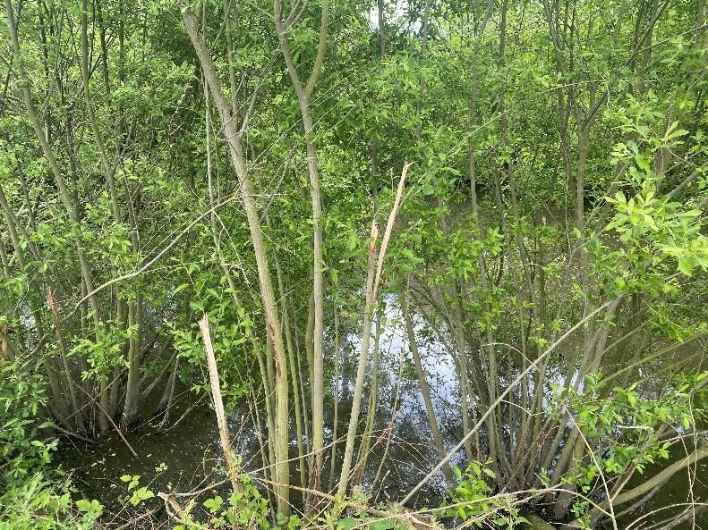
3.       METHODS

3.1.     OVERVIEW
3.1.1.   In total, 49 water bodies were identified. Of these, 39 were visited as part of an HSI
         assessment and 24 subject to an eDNA survey.
3.1.2.   Each water body identified, access permitting, was subject to an HSI assessment. Water
         bodies that were found to be suitable for GCN were then subject to water sampling for
         eDNA testing. The surveys took place within in the eDNA testing season on the 15th, 19th
         and 20th May and 30th June 2020. Only one water body, 23, was subject to surveys outside
         the GCN eDNA testing season on 14th July 2020.
3.2.     DESK STUDY
3.2.1.   An ecological desk study was completed in March 2020 to include recent data relevant to
         the Scheme. Records of any notable or legally protected species, including GCN and other
         amphibians, from within the Study Area were requested from Norfolk Biodiversity
         Information Service (NBIS). Freely downloadable datasets (available from Multi Agency
         Geographic Information for the Countryside (MAGIC), Department for Environment, Food
         and Rural Affairs) were consulted for information regarding records of European Protected
         Species Mitigation Licence (EPSML) and survey class licence returns within the Desk Study
         Area.
3.3.     HABITAT SUITABILITY INDEX (HSI) ASSESSMENT
3.3.1.   All water bodies within the Survey Area to which access was possible were assessed for
         their suitability to support great crested newts using the standard HSI assessment method
         (ARG UK, 2010) and Oldham et al. 2000.Water bodies were identified using 1:25,000 OS
         mapping; this was also cross referenced against aerial photography.
3.3.2.   Water bodies were assessed and scored on ten key variables which are known to influence
         breeding populations of great crested newts, in accordance with standard methods (ARG
         UK, 2010). These variables are;
         ▪   geographic location;
         ▪   water body area;
         ▪   water body permanence;
         ▪   water quality;
         ▪   water body shading;
         ▪   impact of waterfowl;
         ▪   fish stocks;
         ▪   number of water bodies within 1km;
         ▪   terrestrial habitat around the water body; and
         ▪   macrophyte cover of the water body.

         NORWICH WESTERN LINK ROAD                                                                  WSP
         Project No.: 70061370-09 | Our Ref No.: 70061370-09-07                                June 2021
         Norfolk County Council                                                              Page 4 of 18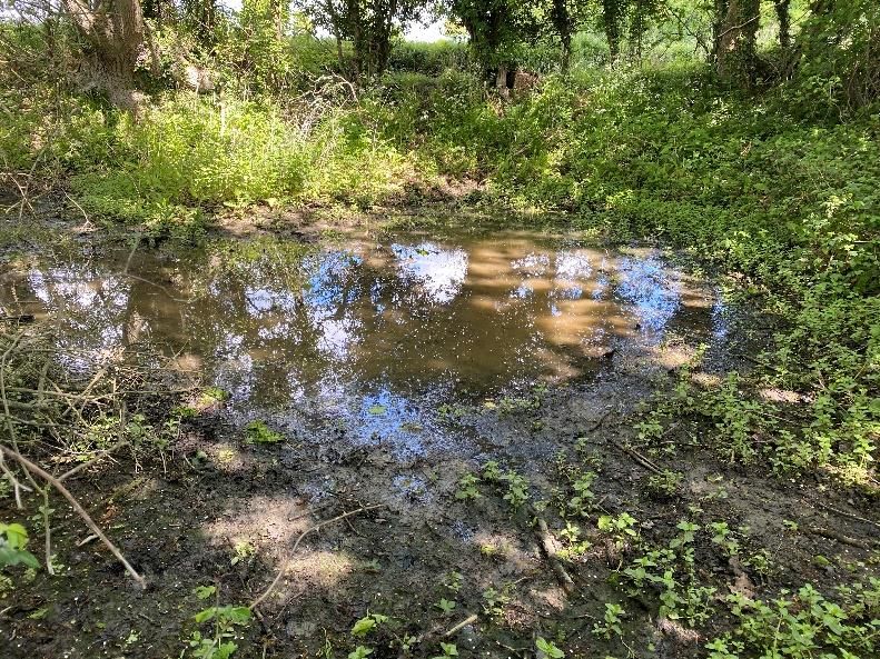
3.3.3.   Scores for each of the above variables were used to calculate an overall HSI value for each
         water body. This was then cross referenced with the guidelines (ARG UK, 2010) to assign
         the pond to one of five categories, poor, below average, average, good or excellent, as
         shown in Table 3-1. Index calculation is not a failsafe method of identifying whether a water
         body supports great crested newts or not; therefore, professional judgement and availability
         of records of GCN in the locality has also been used to inform the requirement for further
         survey.

         Table 3-1 – Pond suitability categorisation based upon HSI score

          HSI score                                           Pond suitability

          0.8                                                Excellent

3.4.     eDNA WATER SAMPLING
3.4.1.   All water bodies found to provide suitable habitat for GCN, e.g. those ranging from poor to
         excellent suitability (see Table 3-1 above), to which access was possible, were subject to
         further survey to determine the presence or likely absence of this species. A small number
         of water bodies though were excluded from the eDNA survey effort. Their exclusion was
         based on professional judgement and where the habitat was considered completely
         unsuitable for GCN due to the size, depth and nature of the water body (for example, a
         concrete well with no features present to support GCN). Water bodies isolated from the
         Scheme by significant barriers to dispersal such as busy main roads were also discounted.
         The survey comprised eDNA water sampling. Sampling of eDNA was undertaken
         concurrently with the HSI survey. Professional judgement gained from previous experience
         and knowledge of GCN ecology, was exercised in selecting water bodies appropriate for
         sampling.
3.4.2.   Research published in 2013 established a technique for reliably detecting newt eDNA in
         water bodies, and Natural England subsequently approved a protocol for this to become a
         survey method. The surveys were undertaken following survey techniques described in
         Biggs et al. (Biggs et al., 2014):

         NORWICH WESTERN LINK ROAD                                                                WSP
         Project No.: 70061370-09 | Our Ref No.: 70061370-09-07                              June 2021
         Norfolk County Council                                                            Page 5 of 18
▪ A single visit to each target water body was made between mid-April and late-June,
during the newt breeding season. One water body, pond 23, was subject to a visit in July,
outside the newt breeding season.
▪ Twenty sub-samples of water were taken from each water body using sterile sampling
equipment provided by the laboratory (ADAS).
▪ The locations of the 20 sub-samples were spaced as evenly as possible around the
water body margin, and where possible targeted areas of vegetation which could be used
as egg laying substrate and open water areas which newts could use for displaying.
▪ The sub-samples were mixed and pipetted into six sample tubes containing an alcohol
and pH buffer solution.
▪ The samples were sent to ADAS for laboratory testing using real time polymerase chain
reaction (PCR) to amplify part of the cytochrome 1 gene found in mitochondrial DNA.
▪ The water samples from each water body were assigned a positive or negative result as
well as a score between 0 and 12 representing the number of positive replicates from a
series of 12.
3.4.3. A positive eDNA result concludes that GCN DNA is present in the water sample, whilst a
negative result concludes that the presence of GCN is considered unlikely within that water
body. Negative eDNA results cannot conclusively say that a GCN are not present within the
water body, rather that DNA from the species was not detected. GCN expel DNA into the
ponds in which they live when they deposit; skin cells, faeces, mucus, sperm or eggs into
the water. The DNA in this material can persist, and be detected, in the water for several
weeks.
3.5. DATES OF SURVEY AND PERSONNEL
3.5.1. Lead surveyors were competent and experienced in conducting these surveys and both
hold a Natural England survey licence for this species (licence numbers can be made
available on request).
3.5.2. The date for each survey visit is displayed in Table 3-2 beneath.
Table 3-2 – Survey Dates
Water Body Ref. Date of HSI Date of eDNA
1 15/05/2020 N/A
2 15/05/2020 15/05/2020
3 15/05/2020 15/05/2020
4 15/05/2020 15/05/2020
5 15/05/2020 15/05/2020
6 30/06/2020 30/06/2020
7 15/05/2020 15/05/2020
NORWICH WESTERN LINK ROAD WSP
Project No.: 70061370-09 | Our Ref No.: 70061370-09-07 June 2021
Norfolk County Council Page 6 of 18Water Body Ref. Date of HSI Date of eDNA 8 15/05/2020 N/A 9 15/05/2020 15/05/2020 10 15/05/2020 15/05/2020 11 N/A N/A 12 19/05/2020 19/05/2020 13 19/05/2020 19/05/2020 14 19/05/2020 19/05/2020 15 19/05/2020 19/05/2020 16 19/05/2020 19/05/2020 17 19/05/2020 19/05/2020 18 19/05/2020 19/05/2020 19 19/05/2020 19/05/2020 20 30/06/2020 N/A 21 30/06/2020 N/A 22 N/A N/A 23 14/07/2020 14/07/2020 24 30/06/2020 N/A 25 30/06/2020 30/06/2020 26 30/06/2020 N/A 27 20/05/2020 N/A 28 20/05/2020 20/05/2020 29 20/05/2020 20/05/2020 30 20/05/2020 20/05/2020 31 30/06/2020 N/A 32 20/05/2020 20/05/2020 33 N/A N/A 34 30/06/2020 30/06/2020 35 20/05/2020 20/05/2020 36 19/05/2020 N/A 37 N/A N/A NORWICH WESTERN LINK ROAD WSP Project No.: 70061370-09 | Our Ref No.: 70061370-09-07 June 2021 Norfolk County Council Page 7 of 18
Water Body Ref.                  Date of HSI                Date of eDNA

          38                               N/A                        N/A
          39                               N/A                        N/A
          40                               19/05/2020                 N/A
          41                               N/A                        N/A
          42                               N/A                        N/A
          43                               N/A                        N/A
          44                               N/A                        N/A
          45                               20/05/2020                 N/A
          46                               20/05/2020                 N/A
          47                               20/05/2020                 N/A
          48                               N/A                        N/A
          49                               30/06/2020                 N/A

3.6.     NOTES AND LIMITATIONS
3.6.1.   One water body, 23, was sampled for eDNA testing outside the recommended survey
         period (mid- April to late-June). As the water body returned a negative result, further survey
         will be required in the 2021 survey season as this year’s result cannot be used as evidence
         of likely absence of GCN.
3.6.2.   Seven water bodies were dry at the time of survey. Sampling took place within the
         recommended period (mid-April – late June), however dry, warm weather prior to the
         surveys in May and June may have caused water bodies to dry prematurely and therefore
         may still be suitable for GCN breeding in other years. Therefore, these water bodies should
         be subject to a walkover during the next suite of GCN surveys and should be sampled for
         GCN eDNA if found to be holding water.
3.6.3.   Due to access restrictions water samples were unable to be taken from two ponds. The
         status of these ponds and likelihood that they could support GCN will be reviewed after
         further survey has taken place.
3.6.4.   Survey data is considered to be out of date after three years (CIEEM, 2019). As such, this
         conclusion of likely absence can be considered valid until 2023, after which time an
         ecologist should be consulted as to the need for updated GCN surveys.

         NORWICH WESTERN LINK ROAD                                                                 WSP
         Project No.: 70061370-09 | Our Ref No.: 70061370-09-07                               June 2021
         Norfolk County Council                                                             Page 8 of 18
4. RESULTS
4.1. DESK STUDY
4.1.1. The data search returned by NBIS did not contain any records of amphibians, including
GCN, within 2km of the Scheme used for the data search. The Scheme and Study Area is
included within separate document Error! Reference source not found..
4.1.2. A review of freely available data from MAGIC (Defra) returned a record of a GCN EPSML
mitigation licence approximately 100m from the Scheme boundary. However, a freedom of
information (FOI) request found that this licence was in relation to construction of the
Broadland Northway. The junction of the Broadland Northway (west) with the A1067 lies
within the Study Area, however the water bodies covered by the EPSML are outside the
2km Desk Study Area, with the nearest water body being approximately 3km from the
Scheme.
4.1.3. A further five records for GCN class survey licence returns were found on MAGIC within
2km, the nearest being approximately 0.8km south of the Scheme.
4.2. HABITAT SUITABILITY INDEX (HSI) ASSESSMENT
4.2.1. A summary of the HSI results and location information for the water bodies is included on
drawing 70061370-09-07-0003, see separate document Appendix C. Water body numbers
correspond to those in separate document Appendix B and the HSI calculation is included
in Table D-1, Appendix D. Photographs of each water body are included in Appendix E.
4.2.2. A total of 49 water bodies were identified as part of the aerial mapping, prior to the HSI
surveys, one water body, 48, was ruled out as it was determined that the A47 provided a
sufficient barrier to GCN movement. Nine water bodies were not subject to HSI survey due
to access restrictions.
4.2.3. As a result, a total of 39 water bodies were visited as part of an HSI assessment. Of these
water bodies, three were no longer present, seven were dry and two were classed as
unsuitable because they lacked the appropriate habitat to support GCN. Therefore, 27
water bodies were able to be assessed for GCN suitability. The water bodies in each
category is as follows;
▪ poor – five water bodies (3, 6, 7, 18 and 30)
▪ below average – six water bodies (2, 5, 15, 21, 32 and 34)
▪ average – seven water bodies (12, 13, 17, 23, 29, 36, and 40)
▪ good – seven water bodies (4, 9, 10, 14, 16, 25 and 35); and
▪ excellent – two water bodies (19 and 28).
4.3. eDNA WATER SAMPLING
4.3.1. A summary of the results is provided alongside the HSI scores in Table 4-1 and shown on
drawing 70061370-09-07-0003, see separate document Appendix C. Full laboratory results
are available in separate document Appendix F.
NORWICH WESTERN LINK ROAD WSP
Project No.: 70061370-09 | Our Ref No.: 70061370-09-07 June 2021
Norfolk County Council Page 9 of 184.3.2. Water sampling for eDNA analysis, where possible, was undertaken immediately following
the HSI assessment.
4.3.3. Of the 27 suitable water bodies, 23 were able to be subject to eDNA sampling during the
optimal period (mid-April – late-June), with one water body subject to sampling outside this
optimal period. The remaining three water bodies could not be sampled due to either low
water levels (assessed as dry in the eDNA result) or as being inaccessible for water
sampling.
4.3.4. Of the 23 water bodies sampled within the optimal period, two, 15 and 16, returned positive
results and the 20 remaining water bodies (2 – 7, 9 and 10, 12 – 14, 17, 19, 25, 28 – 30, 32,
34 and 35) returned negative results. One of the water bodies, 18, returned an
indeterminate1 result and therefore will likely require further survey.
4.3.5. The water body, 23, tested outside the optimal survey season for GCN eDNA returned a
negative eDNA result. This though has been classed as inconclusive, as the negative result
cannot be used to confirm likely absence of GCN and therefore will require further survey.
4.4. SUMMARY OF HSI AND eDNA RESULTS
4.4.1. The Desk Study did not return any records of amphibians, including GCN, within 2km of the
Scheme Boundary used for the data search. A review of freely available data from MAGIC
(Defra) returned a record of a GCN EPSL mitigation licence outside the 2km Desk Study
Area and a further five GCN class licence returns within the 2km Desk Study Area.
4.4.2. A total of 49 water bodies were identified through aerial mapping. Prior to the surveys, water
body 48 was ruled out of surveys as it was determined that the A47 provided a significant
barrier to GCN movement. Nine of the water bodies were not subject to surveys due to
access restrictions and therefore will require further survey once access is available.
Therefore, only 39 water bodies were subject to surveys.
4.4.3. Out of the 39 water bodies that were surveyed, three were found to be no longer present
and seven were dry. As a result, 29 waterbodies were assessed for their suitability to
support GCN. The results of the HSI assessment were as follows: two ponds were
immediately ruled out as unsuitable, five ponds were categorised as poor, six as below
average, seven as average, seven as good and two as excellent suitability for GCN.
4.4.4. Of the 27 suitable water bodies, 23 were able to be subject to eDNA sampling during the
optimal period (mid-April – late-June), with one water body subject to sampling outside this
optimal period. The remaining three water bodies could not be sampled due to either low
water levels (assessed as dry in the eDNA result) or as being inaccessible for water
sampling.
1
Results will be recorded as indeterminate if the GCN result is negative and the degradation result is recorded as:
a. evidence of decay - meaning that the degradation control was outside of accepted limits
b. evidence of degradation or residual inhibition - meaning that the degradation control was outside of accepted
limits but that this could have been due to inhibitors not being removed sufficiently by the dilution of inhibited
samples (ADAS, 2020).
NORWICH WESTERN LINK ROAD WSP
Project No.: 70061370-09 | Our Ref No.: 70061370-09-07 June 2021
Norfolk County Council Page 10 of 184.4.5. The results returned two positive results, 20 negative results and one indeterminate result
for GCN eDNA. The water body, pond 23, tested outside the optimal survey season for
GCN eDNA and returned a negative result. This has been omitted from the above results
and classed as inconclusive.
Table 4-1 – Summary of HSI and eDNA results
Water Grid Proximi Connectiv HSI HSI eDNA Result
body Reference ty to ity to Score Category
Ref. Schem Scheme
e (m)
1 TG10377120 377 Over 250m Dry Dry Not suitable for
12 from eDNA testing -
Scheme dry
2 TG10371120 Over 250m 0.53 Below
365 Negative
32 from Average
Scheme
3 TG10192122 Good 0.41 Poor
144 Negative
72
4 TG10078122 Good 0.77 Good
25 Negative
72
5 TG10360123 Over 250m 0.56 Below
327 Negative
69 from Average
Scheme
6 TG09547126 Isolated 0.46 Poor
123 Negative
01 within
arable field
7 TG10185126 Good 0.43 Poor
198 Negative
35
8 TG09976129 Good Dry Dry Not suitable for
12
05 eDNA testing -
dry
9 TG10119134 Good 0.80 Good
69 Negative
82
10 TG10220134 Good 0.71 Good
65 Negative
44
11 TG11219132 Not N/A Not Not Not present
88 present present
present
12 TG11517137 Good 0.63 Average
87 Negative
00
NORWICH WESTERN LINK ROAD WSP
Project No.: 70061370-09 | Our Ref No.: 70061370-09-07 June 2021
Norfolk County Council Page 11 of 18Water Grid Proximi Connectiv HSI HSI eDNA Result
body Reference ty to ity to Score Category
Ref. Schem Scheme
e (m)
13 TG10073141 Over 250m 0.62 Average
323 Negative
11 from
Scheme
14 TG10094142 Over 250m 0.70 Good
388 Negative
18 from
Scheme
15 TG10200141 Over 250m 0.56 Below
280 Positive
65 from Average
Scheme
16 TG10388142 Over 250m 0.76 Good
272 Positive
19 from
Scheme
17 TG10338142 Over 250m 0.68 Average
259 Negative
19 from
Scheme
18 TG11358142 Isolated 0.25 Poor
162 Indeterminate
49 within
arable field
19 TG11483145 Within 0.84 Excellent
14 Negative
57 Scheme
20 TG11395148 Over 250m Dry Dry Not suitable for
317
61 from eDNA testing -
Scheme dry
21 TG11769152 Over 250m 0.51 Below Not suitable for
356
18 from Average eDNA testing -
Scheme
dry
22 TG11392157 Over 250m No No
408 No access
64 from access access
Scheme
23 TG11636163 Good 0.68 Average
150 Inconclusive2
80
2
Due to late sampling outside the recommended survey period, this result cannot be used to confirm likely absence of
GCN and therefore will be subject to further survey.
NORWICH WESTERN LINK ROAD WSP
Project No.: 70061370-09 | Our Ref No.: 70061370-09-07 June 2021
Norfolk County Council Page 12 of 18Water Grid Proximi Connectiv HSI HSI eDNA Result
body Reference ty to ity to Score Category
Ref. Schem Scheme
e (m)
24 TG12470158 Over 250m Unsuitabl Unsuitabl Unsuitable for
445
04 from e for e for GCN
Scheme GCN GCN3
25 TG12832159 Good 0.74 Good
246 Negative
54
26 TG13004163 Not N/A Not Not Not present
67 present present
present
27 TG13291152 Within 0.51 Unsuitabl Unsuitable for
0
09 Scheme
e for GCN
GCN4
28 TG13490153 Within 0.83 Excellent
0 Negative
53 Scheme
29 TG13549157 Over 250m 0.63 Average
361 Negative
40 from
Scheme
30 TG13727158 Over 250m 0.31 Poor
258 Negative
65 from
Scheme
31 TG13668155 Not N/A Not Not Not present
16 present present
present
32 TG13803157 Good 0.59 Below
149 Negative
33 Average
33 TG14457161 Over 250m No No
480 No access
95 from access access
Scheme
34 TG13849151 Good 0.55 Below
127 Negative
63 Average
35 TG14069154 Within 0.71 Good
21 Negative
09 Scheme
3
Unsuitable for GCN as water body was identified to be a concrete well with no features present to support GCN.
4
HSI assessment categorised water body as below average suitability, however categorised as unsuitable for GCN due
the size, depth and nature of the water body (Water Grid Proximi Connectiv HSI HSI eDNA Result
body Reference ty to ity to Score Category
Ref. Schem Scheme
e (m)
36 TG14097150 Over 250m 0.70 Average Not suitable for
326
79 from eDNA testing -
Scheme inaccessible
37 TG14276153 Good No No
187 No access
35 access access
38 TG14367152 Good No No
212 No access
63 access access
39 TG14353152 Good No No
249 No access
37 access access
40 TG14464150 Over 250m 0.70 Average Not suitable for
365
82 from eDNA testing -
Scheme inaccessible
41 TG14535149 Over 250m No No
425 No access
73 from access access
Scheme
42 TG14570149 Over 250m No No
466 No access
27 from access access
Scheme
43 TG14585150 Over 250m No No
412 No access
14 from access access
Scheme
44 TG14570149 Over 250m No No
485 No access
27 from access access
Scheme
45 TG14819153 Within Dry Dry Not suitable for
0
93 Scheme eDNA testing -
dry
46 TG14819153 Within Dry Dry Not suitable for
0
93 Scheme eDNA testing -
dry
47 TG14819153 Within Dry Dry Not suitable for
0
93 Scheme eDNA testing -
dry
NORWICH WESTERN LINK ROAD WSP
Project No.: 70061370-09 | Our Ref No.: 70061370-09-07 June 2021
Norfolk County Council Page 14 of 18Water Grid Proximi Connectiv HSI HSI eDNA Result
body Reference ty to ity to Score Category
Ref. Schem Scheme
e (m)
48 TG09494119 Isolated by Surveys Surveys Surveys not
434
24 A47 not not required
required5 required
49 TG11478146 Good Dry Dry Not suitable for
87
49 eDNA testing -
dry
5
Surveys were not required for water body 48 as it is considered that the A47 provides a sufficient barrier to prevent GCN
moving onto the Scheme.
NORWICH WESTERN LINK ROAD WSP
Project No.: 70061370-09 | Our Ref No.: 70061370-09-07 June 2021
Norfolk County Council Page 15 of 185. FURTHER SURVEY WORK IN 2021
5.1.1. Recommended survey work to be conducted in 2021 which follows on from the 2020
surveys includes:
− Population size class assessment surveys of ponds 16 and 17 which tested positive for
GCN eDNA;
− An update walkover of ponds found to be dry or inaccessible for sampling in 2020, with
follow-up eDNA surveys where ponds are found to be accessible or holding water
sufficient for sampling;
− Repeat eDNA surveys of ponds which returned an inconclusive (i.e. 23) or indeterminant
(i.e. 18) result in 2020.
NORWICH WESTERN LINK ROAD WSP
Project No.: 70061370-09 | Our Ref No.: 70061370-09-07 June 2021
Norfolk County Council Page 16 of 186. REFERENCES
6.1. PROJECT REFERENCES
WSP UK Ltd. (2020). Phase 1 Habitat Survey. Cambridge
6.2. TECHNICAL REFERENCES
ARG UK, 2010. ARG UK Advice Note 5: Great Crested Newt Habitat Suitability Index. UK:
Amphibian and Reptile Groups of the United Kingdom.
Biggs, J. et al., 2014. Analytical and methodological development for improved surveillance
of great crested newt. Appendix 5. Technical advice note for field and laboratory sampling of
great crested newt (Triturus cristatus) environmental DNA.. Oxford: Freshwater Habitats
Trust.
CIEEM, 2019. Advice Note on the Lifespan of Ecological Reports and Surveys, Winchester:
CIEEM.
Oldham, R., Keeble, J., Swan, M. & Jeffcote, M., 2000. Evaluating the suitability of habitat
for the great crested newt.. Herpetological Journal, Issue 10, pp. 143-155.
NORWICH WESTERN LINK ROAD WSP
Project No.: 70061370-09 | Our Ref No.: 70061370-09-07 June 2021
Norfolk County Council Page 17 of 18SURVEY AND DESK STUDY AREA (SEPARATE DOCUMENT)
EDNA RESULTS 2020 (SEPARATE
DOCUMENT)

                              Public
HSI RESULTS 2020 (SEPARATE
DOCUMENT)
PublicHSI CALCULATIONS
PublicTable D-1 – Habitat Suitability Indexes
Pond reference
Grid reference
Water quality
Macrophytes
HSI category
Permanence
Geographic
Pond count
Date of HSI
Terrestrial
Pond area
HSI score
location
Shade
Fowl
Fish
1 TG1037712012 15/05/2020 N/A Dry
2 TG1037112032 15/05/2020 1 0.1 0.5 0.33 0.6 1 1 0.85 0.67 0.3 0.53 Below average
3 TG1019212272 15/05/2020 1 0.1 0.1 0.33 0.2 1 1 0.9 0.67 0.3 0.41 Poor
4 TG1007812272 15/05/2020 1 0.6 1 0.67 1 0.67 0.67 0.9 0.67 0.7 0.77 Good
5 TG1036012369 15/05/2020 1 0.2 0.5 0.33 0.6 1 1 0.9 0.33 0.5 0.56 Below average
6 TG0954712601 30/06/2020 1 0.9 0.5 0.33 1 1 1 0.9 0.01 0.35 0.46 Poor
7 TG1018512635 15/05/2020 1 0.4 1 0.33 0.6 1 1 0.95 0.01 0.3 0.43 Poor
8 TG0997612905 15/05/2020 N/A Dry
9 TG1011913482 15/05/2020 1 0.8 0.9 0.67 1 0.67 1 0.9 1 0.35 0.80 Good
10 TG1022013444 15/05/2020 1 0.8 1 0.33 0.6 0.67 1 0.9 1 0.35 0.71 Good
11 TG1121913288 N/A N/A Not present
NORWICH WESTERN LINK ROAD WSP
Project No.: 70061370-09 | Our Ref No.: 70061370-09-07 June 2021
Norfolk County CouncilPond reference
Grid reference
Water quality
Macrophytes
HSI category
Permanence
Geographic
Pond count
Date of HSI
Terrestrial
Pond area
HSI score
location
Shade
Fowl
Fish
12 TG1151713700 19/05/2020 1 0.85 1 0.67 0.3 0.67 0.67 0.65 0.67 0.3 0.63 Average
13 TG1007314111 19/05/2020 1 1 0.5 0.33 0.2 1 1 0.85 1 0.3 0.62 Average
14 TG1009414218 19/05/2020 1 0.85 0.9 0.33 1 0.67 0.67 0.85 1 0.3 0.70 Good
15 TG1020014165 19/05/2020 1 1 0.5 0.01 1 1 1 0.85 1 0.7 0.56 Below average
16 TG1038814219 19/05/2020 1 0.6 0.9 0.67 1 0.67 1 0.85 0.33 1 0.76 Good
17 TG1033814219 19/05/2020 1 0.8 0.33 0.2 0.67 1 1 0.85 1 0.7 0.68 Average
18 TG1135814249 19/05/2020 1 0.2 0.1 0.01 0.6 1 1 0.85 0.01 1 0.25 Poor
19 TG1148314557 19/05/2020 1 0.95 0.9 1 1 0.67 0.67 0.7 0.67 1 0.84 Excellent
20 TG1139514861 30/06/2020 N/A Dry
21 TG1176915218 30/06/2020 1 0.2 0.1 0.33 1 1 1 0.65 0.67 0.4 0.51 Below average
22 TG1139215764 N/A N/A No access
23 TG1163616380 14/07/2020 1 0.4 0.5 0.67 0.8 0.67 0.67 0.45 1 1 0.68 Average
NORWICH WESTERN LINK ROAD WSP
Project No.: 70061370-09 | Our Ref No.: 70061370-09-07 June 2021
Norfolk County CouncilPond reference
Grid reference
Water quality
Macrophytes
HSI category
Permanence
Geographic
Pond count
Date of HSI
Terrestrial
Pond area
HSI score
location
Shade
Fowl
Fish
24 TG1247015804 N/A N/A Unsuitable for GCN6
25 TG1283215954 30/06/2020 1 0.4 1 0.67 1 1 0.33 0.85 1 0.7 0.74 Good
26 TG1300416367 30/06/2020 N/A Not present
27 TG1329115209 20/05/2020 1 0.1 0.5 0.33 0.33 1 1 1 0.7 0.3 0.51 Unsuitable for GCN7
28 TG1349015353 20/05/2020 1 0.9 1 0.67 0.7 0.67 0.67 0.95 1 0.9 0.83 Excellent
29 TG1354915740 20/05/2020 1 0.8 0.9 0.67 0.3 0.67 0.33 1 1 0.3 0.63 Average
30 TG1372715865 20/05/2020 1 0.1 0.1 1 0.3 1 1 1 0.01 0.3 0.31 Poor
31 TG1366815516 30/06/2020 N/A Not present
32 TG1380315733 20/05/2020 1 0.1 0.5 1 1 1 1 1 0.33 0.3 0.59 Below average
33 TG1445716195 N/A N/A No access
6
Unsuitable for GCN as water body was identified to be a concrete well with no features present to support GCN.
7
HSI assessment categorised water body as below average suitability, however classed as unsuitable for GCN due the size, depth and nature of the water body (Pond reference
Grid reference
Water quality
Macrophytes
HSI category
Permanence
Geographic
Pond count
Date of HSI
Terrestrial
Pond area
HSI score
location
Shade
Fowl
Fish
34 TG1384915163 30/06/2020 1 0.2 1 0.33 1 0.67 0.33 1 0.33 0.5 0.55 Below average
35 TG1406915409 20/05/2020 1 0.8 0.9 0.67 1 0.67 0.33 1 1 0.3 0.71 Good
36 TG1409715079 19/05/2020 1 1 0.1 0.33 1 1 1 1 1 0.8 0.70 Average
37 TG1427615335 N/A N/A No access
38 TG1436715263 N/A N/A No access
38 TG1435315237 N/A N/A No access
40 TG1446415082 19/05/2020 1 0.95 0.1 0.33 1 1 1 1 1 0.85 0.70 Average
41 TG1453514973 N/A N/A No access
42 TG1457014927 N/A N/A No access
43 TG1458515014 N/A N/A No access
44 TG1457014927 N/A N/A No access
45 TG1481915393 20/05/2020 N/A Dry
NORWICH WESTERN LINK ROAD WSP
Project No.: 70061370-09 | Our Ref No.: 70061370-09-07 June 2021
Norfolk County CouncilPond reference
Grid reference
Water quality
Macrophytes
HSI category
Permanence
Geographic
Pond count
Date of HSI
Terrestrial
Pond area
HSI score
location
Shade
Fowl
Fish
46 TG1481915393 20/05/2020 N/A Dry
47 TG1481915393 20/05/2020 N/A Dry
48 TG0949411924 N/A N/A Not subject to survey
49 TG1147814649 30/06/2020 N/A Dry
NORWICH WESTERN LINK ROAD WSP
Project No.: 70061370-09 | Our Ref No.: 70061370-09-07 June 2021
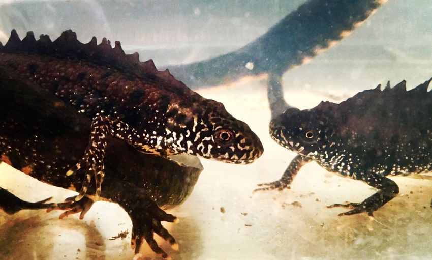
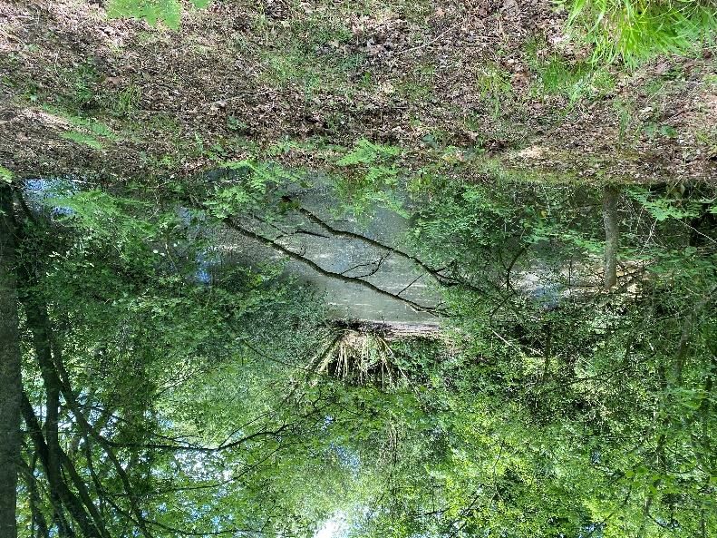
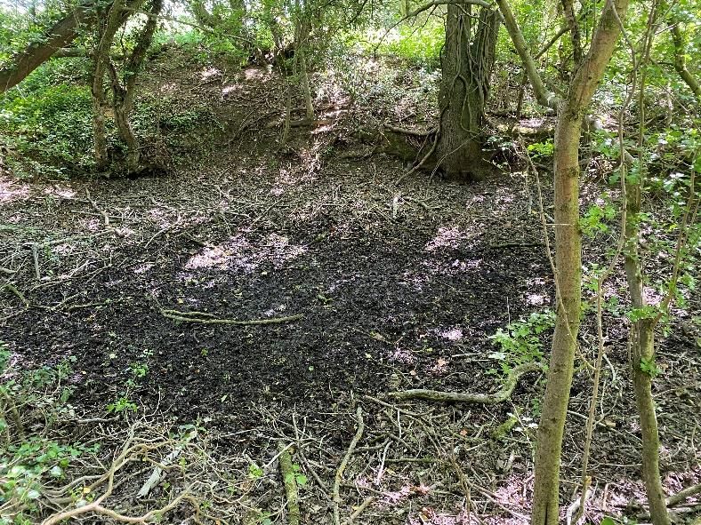
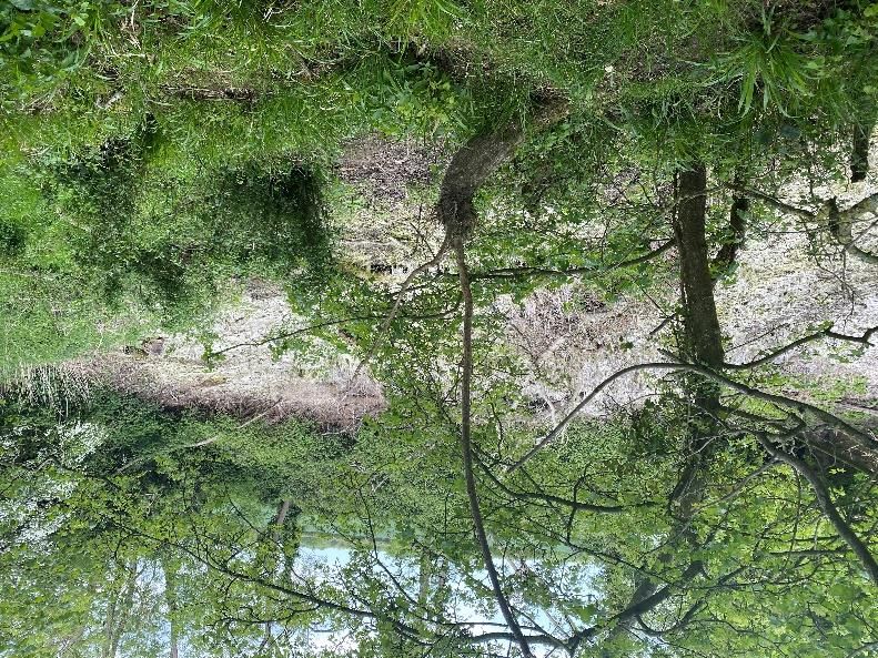
Norfolk County CouncilPHTOTOGRAPHS
PublicTable E-1 - Photographs of Ponds
Pond Ref. Image
1
2
NORWICH WESTERN LINK ROAD WSP
Project No.: 70061370-09 | Our Ref No.: 70061370-09-07 June 2021
Norfolk County CouncilPond Ref. Image
3
4
NORWICH WESTERN LINK ROAD WSP
Project No.: 70061370-09 | Our Ref No.: 70061370-09-07 June 2021
Norfolk County CouncilPond Ref. Image
5
6
NORWICH WESTERN LINK ROAD WSP
Project No.: 70061370-09 | Our Ref No.: 70061370-09-07 June 2021
Norfolk County CouncilPond Ref. Image
7
8
NORWICH WESTERN LINK ROAD WSP
Project No.: 70061370-09 | Our Ref No.: 70061370-09-07 June 2021
Norfolk County CouncilPond Ref. Image
9
10
11 Water body not present
NORWICH WESTERN LINK ROAD WSP
Project No.: 70061370-09 | Our Ref No.: 70061370-09-07 June 2021
Norfolk County CouncilPond Ref. Image
12
13
NORWICH WESTERN LINK ROAD WSP
Project No.: 70061370-09 | Our Ref No.: 70061370-09-07 June 2021
Norfolk County CouncilPond Ref. Image
14
15
NORWICH WESTERN LINK ROAD WSP
Project No.: 70061370-09 | Our Ref No.: 70061370-09-07 June 2021
Norfolk County CouncilPond Ref. Image
16
17
NORWICH WESTERN LINK ROAD WSP
Project No.: 70061370-09 | Our Ref No.: 70061370-09-07 June 2021
Norfolk County CouncilPond Ref. Image
18
19
NORWICH WESTERN LINK ROAD WSP
Project No.: 70061370-09 | Our Ref No.: 70061370-09-07 June 2021
Norfolk County CouncilPond Ref. Image
20
21
22 No access in 2020
23 No picture taken
NORWICH WESTERN LINK ROAD WSP
Project No.: 70061370-09 | Our Ref No.: 70061370-09-07 June 2021
Norfolk County CouncilPond Ref. Image
24
25
26 Water body not present
NORWICH WESTERN LINK ROAD WSP
Project No.: 70061370-09 | Our Ref No.: 70061370-09-07 June 2021
Norfolk County CouncilPond Ref. Image
27
28
NORWICH WESTERN LINK ROAD WSP
Project No.: 70061370-09 | Our Ref No.: 70061370-09-07 June 2021
Norfolk County CouncilPond Ref. Image
29
30
31
NORWICH WESTERN LINK ROAD WSP
Project No.: 70061370-09 | Our Ref No.: 70061370-09-07 June 2021
Norfolk County CouncilPond Ref. Image
32
33 No access in 2020
34
NORWICH WESTERN LINK ROAD WSP
Project No.: 70061370-09 | Our Ref No.: 70061370-09-07 June 2021
Norfolk County CouncilPond Ref. Image
35
36
37 No access in 2020
38 No access in 2020
39 No access in 2020
NORWICH WESTERN LINK ROAD WSP
Project No.: 70061370-09 | Our Ref No.: 70061370-09-07 June 2021
Norfolk County CouncilPond Ref. Image
40
41 No access in 2020
42 No access in 2020
43 No access in 2020
44 No access in 2020
45
NORWICH WESTERN LINK ROAD WSP
Project No.: 70061370-09 | Our Ref No.: 70061370-09-07 June 2021
Norfolk County CouncilPond Ref. Image
46
47
48 Surveys not required
NORWICH WESTERN LINK ROAD WSP
Project No.: 70061370-09 | Our Ref No.: 70061370-09-07 June 2021
Norfolk County CouncilPond Ref. Image
49
NORWICH WESTERN LINK ROAD WSP
Project No.: 70061370-09 | Our Ref No.: 70061370-09-07 June 2021
Norfolk County CouncilLABORATORY RESULTS (SEPARATE
DOCUMENT)
Public62-64 Hills Road Cambridge CB2 1LA wsp.com
You can also read