(Open)Data for enhanced and inclusive mobility options for European citizens - Workshop No. 1 - BMVI
←
→
Page content transcription
If your browser does not render page correctly, please read the page content below
Welcome to the workshop series
 Data Innovations for Smart Mobility in Europe

 Workshop No. 1
 (Open)Data for enhanced and inclusive
 mobility options for European citizens

Federal Ministry of Transport and Digital Infrastructure
Division DG 21
08.07.2021

The critical role of (open) data for
improving mobility options and systems
 Sandra Witzel
 CMO, Board Member
 SkedGo

 @sandrawitzel sandra@skedgo.com sandra witzel
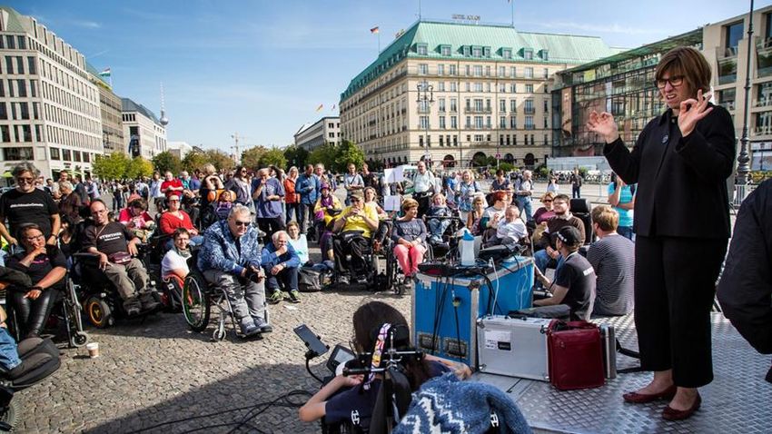
More often than not
 transport sucks
 when you have mobility issues

@tripgo @sandrawitzel
Disability in the EU

 70M 1 in 3
live with some form of see transport as major
 disability in the EU barrier to participate in life
 and work
 @tripgo @sandrawitzel

Why is this so hard?

@tripgo @sandrawitzel
 01

5

@tripgo @sandrawitzel
Can Open Data help?

@tripgo @sandrawitzel
 02
@tripgo @sandrawitzel
“
Mobility as a Service (MaaS) is the integration of
various forms of transport services into a single
mobility service accessible on demand.
For its users, MaaS should be the best value
proposition, by helping them meet their mobility
needs.
 MaaS Alliance

 @tripgo @sandrawitzel
Open data is crucial

TripGo uses open data to provide wheelchair-friendly
routing, real-time alerts

With open data we can achieve routing to avoid crowds

Open data can enable re-routing to avoid obstacles (lift
outages, inaccessible side walks etc)

 @tripgo @sandrawitzel
Accessible Mobility

 New
Regulation
 technologies

 Awareness
 Accessible
 Funding Encouragement TSPs Open data
 Mobility
 Pressure

Advocacy Universal
 groups design

 @tripgo @sandrawitzel
“
Open data gives us a unique chance to look at trip
chains in a holistic way, foster innovation and give
people with different abilities equal access to
transport.

Access to transport is access to life. Let’s not miss
this opportunity. Sandra Witzel | SkedGo

 @tripgo @sandrawitzel
Resources

https://maas-alliance.eu/library/

https://mobilitydata.org/

https://skedgo.com/tripgo-api/

 @tripgo @sandrawitzel
Web-Based Ultrasonic
Indoor Navigation in Clinics
Dr. Jonas Flint
WebCliNav - 19F2120B
Koopango / DEJ Technology GmbH
Navigation
Today
Using smartphones to go from
A to B on the streets
Need to install an indoor navigation system
 is 5.34 out of 7 on a 7-likert-scale
 “
Wichmann, J., Leyer, M. (in print):
"Why do Visitors intend to use Indoor Navigation and Indoor Localization Systems in Hospitals? A Quantitative Survey from Germany"
HICSS 2021
Navigation
Tomorrow
Using smartphones to go from
A to B everywere, also
inside buildings
Technology Indoor / Outdoor Accuracy Range Infrastrucuture Cross-Plattform

GPS Indoor & Outdoor 5 – 30 m global existing

WIFI Indoor & Outdoor 5 – 15 m < 150 m mostly existing

BLE Indoor & Outdoor 1–3m < 30 m installation necessary

 Indoor room don‘t care

 Indoor positioning technologies today
Inaudible sounds transmit position data

Existing Loudspeaker Koopango SDK
Technology Indoor / Outdoor Accuracy Range Infrastrucuture Cross-Plattform

GPS Indoor & Outdoor 5 – 30 m global existing

WIFI Indoor & Outdoor 5 – 15 m < 150 m mostly existing

BLE Indoor & Outdoor 1–3m < 30 m installation necessary

Ultrasound Indoor 1–3m room mostly existing

 Indoor positioning technologies
Web-based Clinic
Indoor Navigation
Project with DRK-Clinic in Grevesmühlen
hospital.com
Loudspeaker

 Infrastructure
 Reuse existing loudspeakers
Adopt and update floor plans
Using an individual content management system
Setup
Loudspeakers and lines
Technical Challenges
- Coping with an energy-saving environment (mobile browser)
- Adopting nurses and patients expectactions
- Keeping infrastrcuture in sync
Project pitch in the BMVI mFUND workshop
‘(Open)Data for enhanced and inclusive mobility
options for European citizens’ (8th July, 2021) Samyajit Basu (VUB MOBI)
 This project has received funding from European Union’s Horizon 2020 research and innovation programme under grant agreement No. 875533
The INDIMO project enables developers, policymakers
 and service operators to advance accessible, inclusive
 and user-centric digital mobility solutions

 Project duration: January 2020 - December 2022

 EU contribution: € 2,999,773

 Coordinator: VUB - Vrije Universiteit Brussel

This project has received funding from European Union’s Horizon 2020 research and innovation programme under grant agreement No. 875533
Coordinator:

Partners:

 This project has received funding from European Union’s Horizon 2020 research and innovation programme under grant agreement No. 875533
Project Objectives

 #1 #5
 To improve the understanding of the To influence future policy by feeding
 users’ needs towards the digital project results into European, regional
 transport system. and local policy making.

#2 #4
 To improve knowledge about users’ To foster the Universal Design approach throughout
 requirements in personalised digital the planning and design process of digital application
 transport systems. and services, both for accessibility and inclusion.

 #3
 To co-create tools that can help engineers, developers,
 operators and policy makers to generate an inclusive,
 universally accessible personalised digital transport system.

 This project has received funding from European Union’s Horizon 2020 research and innovation programme under grant agreement No. 875533
Concept and Stakeholders involved

 This project has received funding from European Union’s Horizon 2020 research and innovation programme under grant agreement No. 875533
Motivation

 Future Digital Mobility: for ALL, not the few

 This project has received funding from European Union’s Horizon 2020 research and innovation programme under grant agreement No. 875533
Some vulnerable-to-exclusion people groups

 Lower- Rural Ethnic Foreigners Lower-
 income residents minorities educated
 citizens citizens

 People Non-connected Older People with Women
 lacking people people reduced
 digital skills mobility

 This project has received funding from European Union’s Horizon 2020 research and innovation programme under grant agreement No. 875533
 7
Pilot projects

This project has received funding from European Union’s Horizon 2020 research and innovation programme under grant agreement No. 875533
Main findings (so far)

This project has received funding from European Union’s Horizon 2020 research and innovation programme under grant agreement No. 875533
User requirements for accessible and inclusive
digital mobility

• Technology accompanied by the right guidance, channel and assistance.
• Human contact points when needed, services aligned with user values,
 principles and ideas.
• Data security and privacy, no overload of information.
• Proper coupling of digital experience and physical experience of the service.
• Autonomy and self-confidence.
• High perceived usefulness, security and good user experience.

• Personas and journey maps: Marie, Miriam, Maria Carmen, Luisa, Johanna

 10

 This project has received funding from European Union’s Horizon 2020 research and innovation programme under grant agreement No. 875533
Stakeholder issues vis-à-vis deployment of
inclusive and accessible digital mobility services
 Barriers Drivers
 Regulatory framework Comprehensive regulatory framework
 Trust between private and public Stakeholder collaboration and info
 organisations sharing
 Lack of User involvement and co-creation Consultation with users and their
 representatives

 Knowledge about potential Bottom-up co-creation events, modular,
 vulnerable-to-exclusion users agile development approach
 Unstable market conditions Stable market conditions, support
 schemes (subsidies or incentives)
 Limited willingness to share mobility data Integration of mobility modes
 11

 This project has received funding from European Union’s Horizon 2020 research and innovation programme under grant agreement No. 875533
Snippets from some more recent
stakeholder related findings
 Cyber security and data protection
 Clear guidelines are
 are important. Good
 needed, but not at the
 understanding of user needs,
 cost of stifling
 requirements, capabilities is
 ‘innovation’.
 essential.

 Co-creation, accessibility and
 inclusivity are important, but they
 are either never or rarely
 considered.
 Understanding of
 Policymakers are uncertain about these terms varies
 impact of newer digital mobility from one stakeholder
 services on society. group to another.

 Financing, subsidy and licensing
 requirements should foster and
 encourage research, innovation and 12
 inclusion of all citizens.
INDIMO Inclusive Digital Mobility Toolbox

 Universal Design Universal interface Cybersecurity and Policy evaluation
 manual for digital language icons for privacy assessment tool
 transport services digital transport guidelines
 services

 This project has received funding from European Union’s Horizon 2020 research and innovation programme under grant agreement No. 875533
Co-creation Community
 www.indimoproject.eu
 The co-creation process
 in INDIMO is based on a
 Co-creation Community,
 composed of transport
 user representatives,
 policymakers, operators,
 and developers.

 The community is strongly Take-up cities Online forum Co-creation workshops
 involved in the co-
 creation of the INDIMO
 ToolBox, through a series
 of workshops,
 consultations, and
 interviews.

 The Co-creation
 Community is closely
 linked to the European
 Transport and Mobility
 Forum. www.etmforum.eu

 This project has received funding from European Union’s Horizon 2020 research and innovation programme under grant agreement No. 875533
Thank you for your attention!
Contacts:
 Project Project Website and Social
 Website and Social
 coordinator Coordinator: Media: Media:
[Name Surname] Imre Keseru @INDIMO-H2020
youraddress@mail.co imre.keseru@vub.b www.indimoproject.eu
m
 Imre Keserü e linkedIn/INDIMO-H2020
 imre.keseru@vub.be @INDIMO-H2020
 www.indimoproject.eu
 @indimo-h2020

 This project has received funding from European Union’s Horizon 2020 research and innovation programme under grant agreement No. 875533
OpenData2Guide ScaleUp
„Scalable platform with acoustic
signage for barrier-free public
transport for people with visual
impairment“
 BMVI Workshop,
 08/07/2021
contagt GmbH Background: Founded in July 2013 as university spin-off Headquarters in Mannheim (Germany) .” Awards: Research funding through EXIST internship 2013 Sonderpreis Innovation der Stiftung MRN 2013 SAP Startup Forum People's Choice Award 2014 Telekom Innovation Contest Germany Finalist 2014 Mannheimer Existenzgründungspreis MEXI 2015 Bundesteilhabepreis 2020 Partner meng Informationstechnik : European leader in analogue signage systems The smart Indoorguide.
2. 1. Super-simple Technology Bedienung contagt Positioning System + App-in-App Model Outdoor & indoor navigation Combination of GPS, Galileo, QR/NFC markers, WiFi/BLE trilateration and smartphone sensorfusion Location-based services and content Maps based on the free OpenStreetMap (OSM) standard Module system for additional functions The smart Indoorguide.
2. Background: OpenData2Guide

 - Feasibility study on context-based
 cues in public transport for travellers
 with visual impairment

 - Integration of open building and
 transportation data

 - Integration of smartphone depth
 sensor recognition

 - Evaluation of the prototypical
 platform in a „Living Lab“

 - Concept of a Business Plan

 → How can we scale up?
 The smart Indoorguide.Design
3. Project Overview

 The smart Indoorguide.
3. Focus and Activities

 The smart Indoorguide.
3. Project Goals & Innovative Approach

 - Prototypical development of a scalable acoustic signage platform

 - Special interaction concept with audio chatbot and feedback channel

 - Research on positioning algorithms (depth sensors of smartphone, Galileo, Bluetooth)

 - Conceptualization and prototype of a beacon retrofit module that is optimized for public
 transport use cases (e.g. timetables)

 - Inclusive, collaborative data collection events and evaluation

 - Integration of available Open Data (mCLOUD, BIM, MDM) and data of the feedback
 channel

 - Testing of prototype with people with visual impairment

 - PR

 The smart Indoorguide.
4. Role of Open Data

 - Integration and Generation of Open Data
 - Wayfinding cues for people with visual impairment in public transport
 use cases
 - New data generated in mapathons
 - Users can create and automatically geo-reference smartphone cues
 with audio feedback channel

 - Integration of available Open Data:
 - Indoor maps (e.g. of train stations) of CAD data from BIM and OSM
 projects (e.g. OpenStationMap)
 - Relevant cue data, e.g. current status of elevators, connection data of
 public transport from mCLOUD projects
 - Possibly MDM data sets

 The smart Indoorguide.
Thank you for your attention!

 Flora Kawohl,
 contagt GmbH
 Langstraße 83
 68169 Mannheim
 +49 621 82039965
 info@contagt.com
 @contagt
 fb.com/contagt

 The smart Indoorguide.
 .

 MADE IN "MONNEM"
MAKING THINGS HAPPEN
Can everyone hear me well?
● Please mute the microphone.
● Feel free to ask questions in the chat at any time.
 I will answer them after the presentation.
● I will speak slowly and describe each slide.
Inclusive Mobility
mFUND-Project “MIKI - Mobil im Kiez” (“Mobility in the Neighborhood”)
Holger Dieterich
Photo by Fikri Rasyid on Unsplash
Inclusive Mobility
 =
Everybody can get around
Mobil im Kiez
+
Graphic: https://gisgeography.com/
Sir Tim Berners-Lee

Picture by Paul Clarke on Wikimedia (CC-BY-SA)
https://5stardata.info
OpenStreetMap
highway=steps

Photo by Fikri Rasyid on Unsplash
https://www.opensidewalks.com/
/sozialhelden
 @SOZIALHELDEN
 SOZIALHELDEN

Holger Dieterich
holger@sozialhelden.de
Project presentation EDDA+
 BMVI-Workshop “(Open)Data for enhanced and
 inclusive mobility options for European citizens”
 Virtual Meeting on 08.07.2021

 Platform:

funded by:

 p. 1 I 08.07.2021 © EDDA+ Project partners - confidential
EDDA+
The project consortium

 funded by: Associate partners:

 Current International
 status participation

 2017/12 2018/11 2019/07 2022/09
 Funding line 1 Funding line 2 to be continued by
 Feasibility study Implementation phase Initiative for Safer Roads

p. 2 I 08.07.2021
 © EDDA+ Project partners - confidential
EDDA+

p. 3 I 08.07.2021 © EDDA+ Project partners - confidential
EDDA+
Trend in the number of road fatalities (in thousands)

 Germany (Source: DESTATIS) EU (Source: CARE database)

 ? „Vision Zero“ until 2050 (EU)
 © dietermann/pixelio.de

 p. 4 I 08.07.2021 © EDDA+ Project partners - confidential
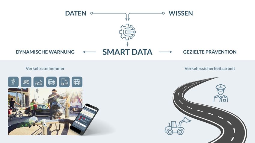
EDDA+
Idea / Our Goal
 DATA KNOWLEDGE

 ADAPTED BEHAVIOUR / WARNINGS PREVENTIVE MEASURES

 Road users Road safety work

p. 5 I 08.07.2021 © EDDA+ Project partners - confidential
EDDA+
Approach of EDDA+ (German: FeGiS+)
 Collision data Road user reports Kinematic data

 Hazard score

 Dynamic context
 4/10
p. 6 I 08.07.2021 © EDDA+ Project partners - confidential
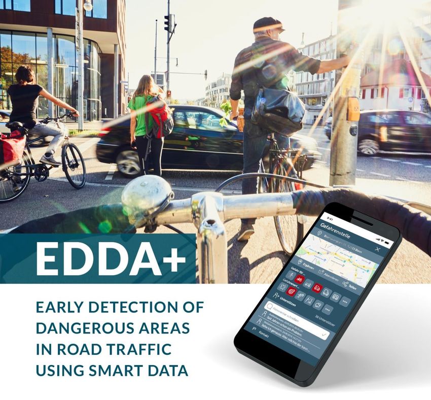
EDDA+
Basic feature: Systematic risk mapping and safety rating

 ▪ Road network all over Germany (urban roads / highways)
 and 1-2 European countries (see last point)
 ▪ Segmentation of road network into small sections or nodes
 ▪ Multitude of filters/analysis options (fading in/out of danger
 types, type of road users, urban or highway roads...)
 ▪ Testing of EDDA+ approach in other countries starting in the
 2nd half of 2021

 p. 7 I 08.07.2021 © EDDA+ Project partners - confidential
EDDA+
Example for illustration of hazard score

p. 8 I 08.07.2021 © EDDA+ Project partners - confidential
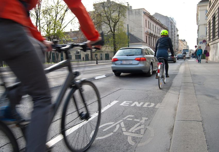
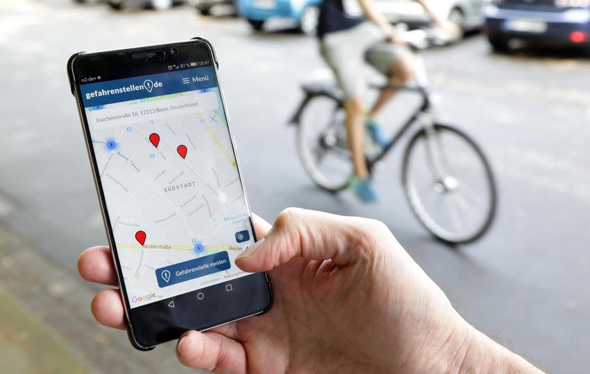
EDDA+
Use cases: early warnings/ driver assistance

 ▪ Intuitive, dynamic warnings according to hazard score at
 danger spots

 ▪ Suspend distracting (smartphone-) notifications in
 dangerous areas with higher risk levels

 ▪ Investigating safer routes for e.g. cyclists, pedestrians /
 Advanced Driver safest way to school
 Assistance Systems
 EDDA+ App
 ▪ Apps for high risk groups: young drivers, elderly drivers

 Navigation devices

p. 9 I 08.07.2021 © EDDA+ Project partners - confidential
EDDA+
Use cases: cities and police authorities

 ▪ Early detection of new danger spots

 ▪ Additional information for road safety work

 ▪ Danger spots can be prioritized according to risk level

 ▪ Comparison btw. blackspots vs. public opinion

 ▪ Public authorities can get in contact with citizens

 ▪ Targeted presence of police at specific danger spots

p. 10 I 08.07.2021 © EDDA+ Project partners - confidential
EDDA+
Call for international partners
The following criteria influences the feasibility of EDDA+ in other countries:

▪ Road safety and “vision zero” needs to play an important role in national policy and plans

▪ Level of access to official police collision data

▪ Existing public project collecting feedback from road users or willingness to support implementation of
 dangerspots.org in the country

▪ Potential partners in the area of road safety/mobility motivated to drive the project on the national level

p. 11 I 08.07.2021 © EDDA+ Project partners - confidential
EDDA+
 Do you know a
 dangerous spot?

 Report now on
 www.dangerspots.org

 Interested in more
 information or to
 collaborate?

 Contact:
 Arno Wolter
 CEO – Initiative for safer roads
 Tel. 0228 – 52 27 99 91
 a.wolter@sichere-strassen.org

p. 12 I 08.07.2021 © EDDA+ Project partners - confidential
EDDA+
Credits
Chart 1: upixa - stock.adobe.com
Chart 3: Foto links: Jörn Wolter, rechts: Timelynx/Pixabay
Chart 7: Foto rechts: Jörn Wolter
Chart 8: Foto links: Rico Löb/Pixabay, rechts: algre - stock.adobe.com
Chart 12: Foto links: Scanrail - stock.adobe.com, rechts oben: Stockwerk-Fotodesign - stock.adobe.com, rechts unten: Jörn Wolter
Chart 14: Jörn Wolter

p. 13 I 08.07.2021 © EDDA+ Project partners - confidential
You can also read