Parcel Data for Hurricane Ike - Lessons Learned - Prepared for the FGDC Subcommittee for Cadastral Data David Stage, Nancy von Meyer and Kevin ...
←
→
Page content transcription
If your browser does not render page correctly, please read the page content below
Parcel Data for Hurricane Ike - Lessons
                Learned

  Prepared for the FGDC Subcommittee for Cadastral Data

                           By

      David Stage, Nancy von Meyer and Kevin Hyde

                      October 2008
Parcel Data for Hurricane Ike – Lessons Learned
Parcel Data for Hurricane Ike - Lessons Learned
Introduction
Before Hurricane Ike made land fall the US Forest Service (USFS) asked the FGDC
Subcommittee for Cadastral Data (Subcommittee) to provide them with assistance for the
acquisition of parcel data in those counties that were in the path of Ike and were in
proximity to USFS lands. The data was being used to prepare the USFS’s Emergency
Funding Request that was submitted to the President and Congress and was passed by the
House at the end of September. The Subcommittee and the USFS have been working
together for more than two years in the Western states to acquire parcel data in
preparation for the wildland fire seasons so the requirements and capabilities of both
organizations were well known to each other. The Subcommittee contacted each of the
states and FEMA to ensure that efforts weren’t being duplicated. Informally the
Subcommittee took on the responsibility of coordinating the identification, acquisition
and standardization of available parcel data in the impacted counties. Where digital
parcel data was available and public it was shared between USFS and FEMA with the
Subcommittee providing coordination. States, counties and private vendors were
contacted to identify available data. A status report was developed and distributed to
interested parties with updates occurring as new information was made available1.
Hurricane Ike2
Ike was designated as a
Tropical Depression on
September following a
course that brought it
through the Caribbean
and into the Gulf of
Mexico making landfall
in Texas. On September
1, it became a tropical
storm west of the Cape
Verde islands. By the
early morning hours of
September 4, Ike was a
Category 4 hurricane,
hitting its peak intensity
with maximum sustained
winds of 145 mph (233 km/h) and a pressure of 935 mbar (27.61 in Hg). That made it the
most intense storm so far in the 2008 Atlantic hurricane season. At one point the diameter
of Ike's tropical storm and hurricane force winds were 550 and 240 miles (885 and
1
FGDC Cadastral Data Subcommittee, Hurricane Ike Parcel Acquisition Project, September 2008,
http://www.nationalcad.org/showdocs.asp?docid=1049&navsrc=Search&navsrc2=
2
Wikipedia, Internet, September 2008, http://en.wikipedia.org/wiki/Hurricane_Ike
FGDC Cadastral Subcommittee 1
October 2008Parcel Data for Hurricane Ike – Lessons Learned
390 km), respectively, making Ike the most massive Atlantic hurricane recorded. Ike also
had the second highest IKE (Integrated Kinetic Energy) of any Atlantic storm in the past
40 years. Integrated Kinetic Energy is a measure of storm surge destructive potential,
similar to the Saffir-Simpson Hurricane Scale, though in many ways more accurate. On a
scale that ranges from 1 to 6, with 6 being highest destructive potential, Ike earned a 5.2
on September 11 at 12:30pm (EDT). In comparison to Ike, hurricanes Katrina and
Wilma, both from the 2005 Atlantic hurricane season peaked at 5.1. As such, had Ike
made landfall as a Category 3 or higher, the hurricane would have likely had a record
breaking storm surge and the potential for damage could have been worse than what was
seen with Hurricane Katrina. However, Ike made its final landfall in Texas, United States
as a Category 2 hurricane on September 13 at 2:10am CDT. The 2:00 am NHC advisory
cited tropical storm and hurricane force winds extending 275 miles (445 km) and
120 miles (190 km), respectively, from the center.
During the day of September 13, Ike began a slow turn to the north and then northeast.
After losing strength to Tropical Storm force winds, it passed 100 miles to the east of
Dallas, Texas; and west of Little Rock, Arkansas. It became a Tropical Depression and
continued northeast, passing near St. Louis, Missouri. It brought heavy rainfall all along
its path, but moved more quickly the farther north it went.
Parcel Data for Disaster Response and Funding Request of Recovery Operations
(Stafford Act)
Federal and state governments have two critical tasks in the first weeks of a disaster,
rescue and response and making accurate damage assessment. Parcel data is extremely
valuable for both operations because a digital parcel database provides the most detailed
information about the location, use and value of properties and is the only source that can
provide this data on a parcel by parcel basis. At the same time that rescue operations are
taking place information is being gathered to provide the President and Congress with an
emergency funding request using guidelines established in the Robert T, Stafford Act.
This act defines the roles of FEMA and other agencies for determining the process to
acquire funding for a response and recovery operations. The Assessor’s parcel data can
be used to identify the types of properties (residential, commercial, agriculture) that have
sustained damage which is then combined with additional information (value) that is used
as a component for developing a cost estimate for the response.
Lessons Learned - Again
Disasters such as hurricanes that broadly impact entire communities make post event data
collection particularly difficult. Experience from Hurricane Andrew to Katrina and Rita
and now Ike have found the same thing over and over again. When it comes to gathering
information, “you have to build the fire station before there is a fire”.
Community Impact:
FGDC Cadastral Subcommittee 2
October 2008Parcel Data for Hurricane Ike – Lessons Learned
When hurricanes strike they typically damage the entire community taking out power,
flooding homes and business, overwhelming the community emergency response
operations and impacting the large majority of the citizenry in the impact area. As a
consequence it is extremely difficult to get at the parcel data that is stored in production
databases from those impacted communities because not only is power not available to
operate the computer systems and the streets are clogged with debris blocking access for
personnel to get to their offices but more significantly the staff that can access the data3
live in the impacted community and as a result most are not available within the first
twenty-four to forty-eight hours because they are taking care of their own families and
properties. Furthermore, as one of the authors has personally experienced during
hurricane Andrew, when those staff do become available the data request for property
information can be overwhelming. Key personnel can only work for 24 to 48 hours
before they simply have to stop and get some sleep and the user community must wait
again while they recuperate.
What does the ideal situation look like?
The FGDC Subcommittee for Cadastral Data (Subcommittee) has worked with local,
state and federal agencies to identify the basic requirements for emergency responders for
hurricanes and wild land fire events. The product is very straight forward:
• Publish Local Government Data
o Local governments (local stewards) publish or provide a minimal set of
parcel data in a GIS format and provide it to a state agency.
o Publication data consists of approximately fourteen data elements
published following the Subcommittee’s publication standard.
o States standardize the data if it is not provided in standard format.
• Update Schedule
o The data is updated on an annual basis before hurricane season.
o Contacts in each county are identified to acquire the most recent data.
• State is Steward for Local Government Publication Data (Core Attributes)
o Agreements with local governments are acquired to use this data for
emergency situations.
o A state agency acting as the steward for this published data compiles it
into a statewide coverage that is provided in standard format.
• Federal Agencies and Others Contact State Publication Stewards
o Initial requests for data are made to the state publication service.
o Follow up for more current information is coordinated with the local
stewards.
Observations for acquiring parcel data for the impacted area of hurricane Ike
3
Although the data may be stored off site generally these data bases are so complicated that only the
persons that work with the data on daily basis can effectively provide accurate products.
FGDC Cadastral Subcommittee 3
October 2008Parcel Data for Hurricane Ike – Lessons Learned
Ike had a large impact area, coastal damage was most significant in Texas but Louisiana
which was well east of the land fall experienced tidal surges in the same communities
that were impacted by Hurricane Gustav. Inland Ike caused forest blown down in Texas,
Arkansas and as far north as Tennessee and Kentucky. At the close of the parcel search
effort there were one-hundred and fifteen (115) counties in five states where parcel data
was pursued and of those fifty-five (55) were listed as available, acquired and/or
standardized and sixty (60) were identified as indeterminate, not available, unknown or
the status was still being pursued4.
Table 1 Parcel Status
To Be Determined 21
Not Available 26
Pursuing 13
Available 8
Acquired 22
Acquired and Standardized 25
Total No of Counties 115
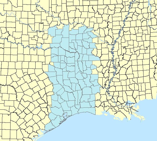
Figure 1 Initial estimated area of impact
4
These numbers demonstrate the completeness of parcel coverage or the lack there of, although there is
some confounding of the data. In critical counties where the US Forest service did not have access to local
parcel data they relied on the US Geological Survey to identify structures using air photos. The short
coming of this method is that the structures are not tied to the Assessor’s database and hence the use and
value information for individual properties are not available.
FGDC Cadastral Subcommittee 4
October 2008Parcel Data for Hurricane Ike – Lessons Learned
The Ideal Situation: Arkansas and Tennessee
Arkansas – Number of Counties in State (75); Counties in impact areas (21)
Arkansas publishes available parcel data through their data portal in a
standardized ready to use format. It was ready to go as soon as it was
downloaded. Total resource requirements three hours.
Tennessee – Number of Counties in State (95); Counties in impact area (1)
Tennessee creates and compiles parcel data for most of the state. The data is not
available from a portal but it can be ordered. They do have procedures in place to
share data in the event of an emergency. Data was acquired within eight hours
and it was ready to use. The only short coming in Tennessee was that the federal
agency had not worked out procedures for acquiring parcel data in a disaster
situation. A twenty-four hour delay was caused because we were not able to
contact the right person in the Tennessee Information Office. Once the situation
was explained and the requirements provided it only took an hour for the data to
be delivered. This argues strongly for contacts to be made and procedures
established before there is an emergency situation.
Data in Kentucky, Louisiana, Texas and Oklahoma is not centrally compiled at the state
level. Contacts had to be identified for the counties.
Louisiana - Number of Counties in State (64), Counties in impacted area (26)
Kentucky - Number of Counties in State (120); Counties in impacted area (5)
Texas - Number of Counties in State (254); Counties in impacted area (57)
Oklahoma - Number of Counties in State (77), Counties in impacted area (6)
Disaster impact on state resources: Texas was most severely impacted by Hurricane
Ike. State personnel that were knowledgeable about the status of parcel data at the local
government level were not available for approximately five days after the hurricane made
land fall because they were involved in search and rescue operations.
Resource requirements to contact individual counties by non state organizations:
Where individual counties had to be contacted the elapsed time was considerable. It
required four to twenty-four hours to identify state personnel that could provide a local
government contact list for the counties. Once the list was provided, contacting the
appropriate persons required two to eight hours to “catch the right person” and another
twenty-four to forty eight hours to acquire the data. For persons working outside of
county, contacting local government personnel is almost impossible outside of regular
business hours.
FGDC Cadastral Subcommittee 5
October 2008Parcel Data for Hurricane Ike – Lessons Learned
Barriers to Data Acquisition:
Technical Issues: One county in Kentucky had a thirty-six hour download time, once the
data was provided it was necessary to download a program to process the ASCII files into
a usable format. Once the data was converted we weren’t able to find a common field
between the attributes and maps. We were able to process legal description and find
approximate matches for a portion of the data. There are a number of other technical
issues including issues with last minute emails and filtering compressed files and non
standard formats for the data that makes processing difficult.
Agreements of Understanding: There was a concerted effort to acquire data for the US
Forest Service (USFS) in those counties that had significant blow down. There were a
few counties that required signed agreements to share their data. As a result of the USFS
efforts to acquire and pre-deploy parcel data in the western states in preparation for two
wildland fire seasons they had procedures in place to enter into agreements with local
governments where it was needed. This was not available in other agencies and as a
result the USFS was not able to provide data from counties that required agreements
outside of its own organization. Repeated requests of other federal agencies for a point of
contact to sign agreements were not answered.
Metadata: FGDC Metadata was not available from any of the counties where parcel data
was acquired with the exception of Arkansas. Arkansas works with its individual
counties to develop and quality control their metadata. The minimal set of FGDC
information if it had been available would not have been useful. There are a few key
components in parcel data that if available would greatly simplify the conversion process.
This includes datum, map projection(s), date of data, the intended scale of use, code
definitions (parcel use codes), linkage description between geometry and attributes,
description of special conversion requirements, known data gaps, expected accuracy and
a source contact for follow up for more recent and more detailed data.
Access Failure: The Subcommittee was notified by the USFS that they would need
parcel data twenty-four hours prior to Ike land fall. The Subcommittee staff used the
Subcommittee’s existing inventory and other resources and immediately began looking
for available internet sources of parcel data. Galveston, Texas published their parcel data
on the Internet so that it could be downloaded from their website. Thursday evening the
data was downloaded. When Ike made landfall the site went down due to the failure of
the local power and communication network and as a result the parcel data was no longer
available. Fortunately the data was in the right hands; it was standardized and passed
onto FEMA within forty-eight hours. Trusting to luck is not the best way to prepare for a
disaster.
Complex Data Sources: After Ike made landfall data was received from a secondary
source for one of the larger counties in Texas (over a million parcels). The data was
received in two files, three projections and was undocumented. It stumped the initial
efforts to process the data due to its size and unusual presentation. It was then passed to a
person that had considerable experience and expertise with parcel databases and it still
FGDC Cadastral Subcommittee 6
October 2008Parcel Data for Hurricane Ike – Lessons Learned
required two days to convert the data into a standard format that could be readily used for
response and recovery operations. It then took four hours to upload the data to the USFS FTP site
so it could be accessed by all parties.
Private Sector Data: The private sector had data for many of the counties. There was
considerable difficulty working out the data use details for proprietary data. Issues included
accessing the content and quality of private sector data, its applicability to the emergency
response including both the extent and the availability of core elements such as use codes, date of
acquisition, county contacts to provide the most current data.
Inventories of Available Parcel Data: Knowing where parcel data does not exist is just as
important as knowing where it is. Having a complete and accurate inventory of the availability of
parcel data allows those in pursuit of the data to determine how to best allocate resources (See
State GIS Inventory for more information5). Arkansas, Tennessee and Louisiana were able to
quickly provide current inventories for the affected counties allowing the user community to
make quick decisions as to the best course of action. The USFS prefers to have parcel data
because of the detail that it provides but where it is not available they work with the USGS to use
aerial photography to identify probable structures in their risk assessments.
Conclusions:
Just as with prior hurricanes, Ike confirmed the need to identify the availability and access to
parcel data before the storm hits. In 2004 the Subcommittee completed an analysis of the parcel
data needed to support hurricane response6.
The workshop revealed that parcel data sets from local and county governments can
provide essential detail about the land that serves emergency responders during all
phases of an event. Knowledge of who owns the land, the value of improvements, current
use, and the materials used in the construction of buildings is all essential information
for emergency response staff in any disaster.
Since 2004 the Subcommittee has further validated these findings, developed and refined a
publication (core data) standard, documented procedures and needs to support making this data
accessible and completed a status inventory on the national availability of parcel data.
The parcel response for hurricane Ike was unique because the Subcommittee provided
coordination for multiple federal agencies and was identified for coordination support early on in
the recovery process. FEMA and USFS shared a data download site and communication about
needs and available data went well.
Given the short notice and the complexity of parcel data, the coordination effort was successful
and considerable data was provided to the responders. It is hoped that future efforts will
recognize the benefits, the lessons learned and will support the acquisition and compilation of
parcel data prior to a disaster so that all states will be prepared to readily provided parcel data like
Arkansas and Tennessee.
5
State GIS Inventory, Powered by RAMONA, Internet, http://in.gisinventory.net/about.html
6
Stage, von Meyer, Hurricane Isabel, A Case Study, FGDC Cadastral Data Subcommittee, July, 2004,
Internet, October 2008, http://www.nationalcad.org/showdocs.asp?docid=86&navsrc=Search&navsrc2=
FGDC Cadastral Subcommittee 7
October 2008You can also read