Results-based Payments for Biodiversity Result indicators used in Europe - Supplement to Guidance Handbook - European Commission
←
→
Page content transcription
If your browser does not render page correctly, please read the page content below
Results-based Payments for
          Biodiversity
Supplement to Guidance Handbook

Result indicators used in Europe
The selection, testing, measurement and
 verification of indicators of biodiversity
                   results

                  Environment
                       1
Led by:
With support from:
Jaroslav Pražan
Natacha Yellachich
Tim Hudson
Disclaimer: The arguments expressed in this report are solely those of the authors, and do
not reflect the opinion of any other party.
The report should be cited as follows: Underwood, E (2014) Result indicators used in
Europe: Results-based Payments for Biodiversity - Supplement to Guidance Handbook.
Prepared for the European Commission, DG Environment, Contract No
ENV.B.2/ETU/2013/0046. Institute for European Environmental Policy, London.
Corresponding author: Evelyn Underwood (Eunderwood@ieep.eu)
Acknowledgements:
We thank Andreas Bosshard, Pete Carey, Christine De Sainte Marie, Irene Herzon, Clunie
Keenleyside, Rainer Oppermann, Sharon Parr, Xavier Poux, Geoff Radley, Paul Terwan,
Graham Tucker and Astrid Zabel von Felten.
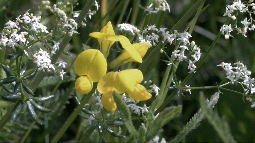
Front cover image: Lotus pedunculatus, French Flowering Meadows Scheme, Tim Hudson ©
2
Institute for European Environmental Policy
London Office
11 Belgrave Road
IEEP Offices, Floor 3
London, SW1V 1RB
Tel: +44 (0) 20 7799 2244
Fax: +44 (0) 20 7799 2600

Brussels Office
Quai au Foin, 55
Hooikaai 55
B- 1000 Brussels
Tel: +32 (0) 2738 7482
Fax: +32 (0) 2732 4004

     Follow us on Twitter: IEEP_EU

                                              3
Contents
1 Introduction ............................................................................................................... 7
2 Species-rich grassland (indicator: characteristic plant species) ..................................... 8
2.1 Biodiversity objective ......................................................................................................... 8
2.2 Indicators ........................................................................................................................... 8
2.3 Indicator thresholds ......................................................................................................... 10
2.4 How the indicators were developed ................................................................................ 10
2.5 How the indicators were tested ...................................................................................... 11
2.6 Protocols for measuring the indicators on the farm ....................................................... 12
2.7 Verification of indicators and controls for payment ....................................................... 13
2.8 Advantages of the indicator and the measurement protocols ....................................... 13
2.9 Limitations of the indicator and the measurement protocols ........................................ 14
2.10 Schemes using this indicator ........................................................................................... 14
3 Semi-natural grazed habitats (indicator: composite quality index) ............................. 16
3.1 Biodiversity objective ....................................................................................................... 16
3.2 Indicators ......................................................................................................................... 16
3.3 Indicator thresholds ......................................................................................................... 17
3.4 How the indicators were developed ................................................................................ 18
3.5 How the indicators were tested ...................................................................................... 18
3.6 Protocols for measuring the indicators on the farm ....................................................... 18
3.7 Verification of indicators and controls for payment ....................................................... 19
3.8 Advantages of the indicator and the measurement protocols ....................................... 19
3.9 Limitations of the indicator and the measurement protocols ........................................ 20
3.10 Schemes using this indicator ........................................................................................... 20
4 Mosaic habitats (farm-specific indicators) ................................................................. 21
4.1 Biodiversity objective ....................................................................................................... 21
4.2 Indicators ......................................................................................................................... 21
4.3 Indicator thresholds ......................................................................................................... 22
4.4 Protocols for measuring the indicators on the farm ....................................................... 22
4.5 Verification of indicators and controls for payment ....................................................... 22
4.6 Advantages of the indicator and the measurement protocols ....................................... 22
4.7 Limitations of the indicator and the measurement protocols ........................................ 22
4.8 Schemes using this indicator ........................................................................................... 22
5 Vineyards (indicator: composite quality index) .......................................................... 24
45.1 Biodiversity objective ....................................................................................................... 24
5.2 Indicators ......................................................................................................................... 24
5.3 Indicator thresholds ......................................................................................................... 25
5.4 How the indicators were developed ................................................................................ 25
5.5 How the indicators were tested ...................................................................................... 25
5.6 Protocols for measuring the indicators on the farm ....................................................... 25
5.7 Verification of indicators and controls for payment ....................................................... 26
5.8 Advantages of the indicator and the measurement protocols ....................................... 26
5.9 Limitations of the indicator and the measurement protocols ........................................ 26
5.10 Schemes using this indicator ........................................................................................... 26
6 Traditional orchards (indicator: number of trees, and quality criteria) ....................... 27
6.1 Biodiversity objective ....................................................................................................... 27
6.2 Indicators ......................................................................................................................... 27
6.3 How the indicators were developed ................................................................................ 28
6.4 Protocols for measuring the indicators on the farm ....................................................... 28
6.5 Verification of indicators and controls for payment ....................................................... 28
6.6 Advantages of the indicator and the measurement protocols ....................................... 28
6.7 Limitations of the indicator and the measurement protocols ........................................ 29
6.8 Schemes using this indicator ........................................................................................... 29
7 Arable weed populations (indicator: arable plant species) ......................................... 30
7.1 Biodiversity objective ....................................................................................................... 30
7.2 Indicators ......................................................................................................................... 30
7.3 Indicator thresholds ......................................................................................................... 30
7.4 How the indicators were developed ................................................................................ 30
7.5 How the indicators were tested ...................................................................................... 31
7.6 Protocols for measuring the indicators on the farm ....................................................... 31
7.7 Verification of indicators and controls for payment ....................................................... 31
7.8 Advantages of the indicator and the measurement protocols ....................................... 31
7.9 Limitations of the indicator and the measurement protocols ........................................ 31
7.10 Schemes using this indicator ........................................................................................... 32
8 Breeding birds of grassland and arable land (indicator: protected nest sites) ............. 33
8.1 Biodiversity objective ....................................................................................................... 33
8.2 Indicators ......................................................................................................................... 33
8.3 How the indicators were developed ................................................................................ 33
8.4 How the indicators were tested ...................................................................................... 33
58.5 Protocols for measuring the indicators on the farm ....................................................... 34
8.6 Verification of indicators and controls for payment ....................................................... 34
8.7 Advantages of the indicator and the measurement protocols ....................................... 35
8.8 Limitations of the indicator and the measurement protocols ........................................ 35
8.9 Schemes using this indicator ........................................................................................... 36
9 Populations of large predators (indicator: predator offspring) ................................... 37
9.1 Biodiversity objective ....................................................................................................... 37
9.2 Indicators ......................................................................................................................... 37
9.3 How the indicators were developed ................................................................................ 37
9.4 How the indicators were tested ...................................................................................... 37
9.5 Protocols for measuring the indicators on the farm ....................................................... 38
9.6 Verification of indicators and controls for payment ....................................................... 38
9.7 Advantages of the indicator and the measurement protocols ....................................... 38
9.8 Limitations of the indicator and the measurement protocols ........................................ 39
9.9 Schemes using this indicator ........................................................................................... 39
10 Genetic diversity of farm animals (indicator: number of animals with breed
characteristics) ............................................................................................................... 40
10.1 Biodiversity objective ....................................................................................................... 40
10.2 Indicators ......................................................................................................................... 40
10.3 Indicator thresholds ......................................................................................................... 40
10.4 How the indicators were developed ................................................................................ 40
10.5 Protocols for measuring the indicators on the farm ....................................................... 41
10.6 Verification of indicators and controls for payment ....................................................... 41
10.7 Advantages of the indicator and the measurement protocols ....................................... 41
10.8 Limitations of the indicator and the measurement protocols ........................................ 41
10.9 Schemes using this indicator ........................................................................................... 41
11 References .............................................................................................................. 42
61 Introduction
The Guidance Handbook explains that the indicators of biodiversity results are the key to
successful results-based payments schemes and demonstrates how to select effective and
reliable result indicators.
This Supplement provides more detailed technical information about the many different
types of results indicators being used in results-based schemes in Europe. It will be of
particular interest to biologists, agricultural experts and managing authority staff working on
the selection of indicators for results-based schemes
Drawing on information from the inventory and published material this Supplement
presents, for nine different types of results-based schemes the following information
(where available):
the biodiversity objectives
the related indicators and thresholds
how the indicators were developed and tested
how the indicators are measured and verified for payment purposes;
the advantages and limitations of the indicator; and lists
the schemes using the indicator, with references to relevant literature.
Illustrations of some of the field guides for farmers developed for results-based species-rich
grassland schemes can be found in a separate Supplement to the Guidance Handbook.
72 Species-rich grassland (indicator: characteristic plant species)
2.1 Biodiversity objective
Maintain species-rich grasslands with their typical plant communities.
The meadow communities and other mesophile grasslands identified in the Habitats
Directive Annex I1 are in an unfavourable-poor or unfavourable-bad conservation status all
over Germany, and both the area and condition of these habitats is continuing to decline
rapidly (BfN, 2014a; BfN, 2014b; Dieterich and Kannenwischer, 2012). In France and
Switzerland, grasslands are in a similar situation, and the biodiversity objective of the
schemes is similar. This is the context against which the results-based schemes are trying to
maintain the management and species diversity of these habitats.
Plant species diversity in these grasslands is a good indicator for animal diversity and for the
provision of ecological services, as research demonstrates a strong positive correlation
between plant species diversity in grasslands and pollination (Albrecht et al, 2007), and pest
regulation functions (Balvanera et al, 2006). Flower-rich grasslands also contribute to the
aesthetic and recreational value of the landscape.
2.2 Indicators
Indicators can be either species or groups of several species (from the same genus or several
similar species from different genera within the same family) that are characteristic of the
particular grassland habitat.
Because indicators must be suitable for the habitat and bio-geographical region they are
used in, each of the regions implementing these schemes has developed its own indicator
list. The importance of this was demonstrated in Germany, where a standardised botanical
survey of grasslands in all the biogeographic regions showed that grassland species richness
is lowest in the north-west (12 species per 25 square metres) and highest in the south-west
(21 species per 25 square metres), whilst in central-east and central-west Germany it is at
the average level (17 species per 25 square metres) (Güthler and Oppermann, 2005;
Oppermann et al, 2009). Some species that could be used as indicators of species-rich
grassland in the north would not be suitable as indicators in the south-west, where they are
too common.
1
Lowland hay meadows (Habitats Directive Annex I 6510) characterised by Alopecurus pratensis, Sanguisorba
officinalis, belonging to the Arrhenatherion and the Brachypodio-Centaureion nemoralis alliances (other
characterising species: Arrhenatherum elatius, Trisetum flavescens ssp. flavescens, Pimpinella major,
Centaurea jacea, Crepis biennis, Knautia arvensis, Tragopogon pratensis, Daucus carota, Leucanthemum
vulgare, Alopecurus pratensis, Sanguisorba officinalis, Campanula patula, Leontodon hispidus, Leontodon
nudicaulis, Linum bienne, Oenanthe pimpinelloides, Rhinanthus lanceolatus, Malva moschata, Serapias
cordigera); Mountain hay meadows (Habitats Directive Annex I 6520) of the montane and subalpine levels
usually dominated by Trisetum flavescens (and with Heracleum sphondylium, Viola cornuta, Astrantia major,
Carum carvi, Crepis mollis, Crepis pyrenaica, Bistorta major/Polygonum bistorta, Silene dioica, Silene vulgaris,
Campanula glomerata, Salvia pratensis, Centaurea nemoralis, Anthoxanthum odoratum, Crocus albiflorus,
Geranium phaeum, Geranium sylvaticum, Narcissus poeticus, Malva moschata, Valeriana repens, Trollius
europaeus, Pimpinella major, Muscari botryoides, Lilium bulbiferum, Thlaspi caerulescens, Viola tricolor ssp.
subalpina, Phyteuma halleri, Phyteuma orbiculare, Primula elatior, Chaerophyllum hirsutum and many others).
8The indicator lists of the current schemes in Germany contain between 24 and 36
indicators, covering the main grassland types in that federal state, with photos and
identification guide. Some of the indicator lists are presented in a way that shows clearly the
different grassland types being targeted (wet, dry and mesic), which makes it easier to
identify them in the field.
In Germany:
In Baden-Württemberg, the results-based scheme agri-environment MEKA B 4 used
(until 2014) an indicator list of 28 flowering plant species groups of species. From
2015, in the follow up programme FAKT B 3, it will have a slightly longer list of 30
indicator species).
The Bayern indicator list contains 35 flowering plant species and groups including
one easily recognisable grass species (LfL 2014). The list includes species typical of
alpine meadows and pastures, as well as wet, mesic and dry grassland types.
The Brandenburg indicator list contains 27 flowering plant species and groups,
including a grass, two sedge groups (large species and small species), and a rush
group (Land Brandenburg 2007).
The Hessen indicator list contains 31 flowering plant species and groups including
one easily recognisable grass species, and sedges and rushes as grouped indicators
(Hessen 2014).
The Niedersachsen and Bremen indicator list contains 31 flowering plant species and
groups including sedges (as a group) and a rush and a grass species (NLWKN 2014).
The Rheinland-Pfalz indicator list contains 35 flowering plant species and groups (no
grasses), divided into damp or wet grassland indicators, mesic indicators and semi-
dry grassland indicators (Rheinland-Pfalz 2010).
The Sachsen indicator list contains 36 flowering plant species and groups including
small sedges (as a group) and soft rushes (as a group) (Freistaat Sachsen 2014).
The Thüringen indicator list has 30 species and genera (dicotyledons only), including
subgroups for dry, mesic and damp to wet grassland types (Freistaat Thüringen,
2008).
In France, indicator lists must be specific to regional or local conditions, and because each
scheme has developed its own indicator list, but there is currently no oversight into how
many different indicator lists are in use. For example, the scheme in the Massif des Bauges
Regional Natural Park uses a list of 24 indicators (species and groups but a survey in 2009
identified 20 different lists ranging in length from 8 to 114 indicators (Fargier et al 2009).
The national flowering meadow competition is an opportunity to test the scaling-up of the
results-based approach from site or habitat-specific to a comprehensive list that could
describe the range of biodiverse meadows existing across France.
In Switzerland two indicator lists are federally defined. A list of 34 indicator species applies
to the northern part of Switzerland (north of the Alps) and a list of 47 indicators applies to
the areas south of the Alps, and there are two different list for low and for high altitude
meadows (there are fewer species in the latter, because it is more difficult to fulfil). The
cantons may adapt the standard indicator lists if they ensure that this does not lead to
decrease in the level of biodiversity.
92.3 Indicator thresholds
The schemes in Germany and France all apply a minimum threshold of four indicators in
each section of the grassland parcel. In Germany, this was first defined by the Baden-
Württemberg scheme and subsequently defined as a criterion for the federal state funding
for results-based agri-environment schemes. More recently most of the German regional
schemes have introduced stepped thresholds with higher payment levels for six and/or
eight indicator thresholds. Switzerland uses a single threshold of at least six indicators. In
Switzerland the minimum (federally defined) threshold is a two-stage process, in which first,
the presence of at least three indicators from a short list of indicators (list A) is used to
determine whether the parcel is of high ecological value (generally corresponding to higher
altitude) or medium ecological value; and second, the parcel is scored using either list B for
high ecological value (and high altitude) or list C for medium ecological value (and lower
altitude, with fewer species, ie it is easier to meet) (BLW 2014 a).
2.4 How the indicators were developed
Indicators must be specific to the bio-geographical region they are used in, but the option of
having a series of different indicator lists for different types of grassland (wet, mesic or dry)
has generally been rejected as it is considered to be inefficient and also less acceptable to
farmers because it is less transparent. This means that indicator lists must work for all the
different grassland types covered by the results-based scheme in that region.
Two examples from Brandenburg and from Bayern show different approaches to how to
develop indicator lists:
1. The regional government of Brandenburg, a large federal state in north-eastern
Germany, commissioned the Leibniz Centre for Agricultural Landscape Research to
develop an indicator list for species rich meadows. The list was developed as follows
(Kaiser et al, 2010; Matzdorf et al, 2008):
A database was compiled of existing grassland surveys in Brandenburg - mainly
Habitats Directive Annex I survey data plus some other existing grassland
vegetation data (it was not possible to carry out any new surveys). This resulted
in a large but heterogeneous data set of 1,551 samples with 730 species.
These 730 species grouped according to mean moisture value (dry, mesic, or
damp grassland) as the defining environmental characteristic of Brandenburg
grasslands, according to the Brandenburg grassland habitat typology. Species
records from grassland types with more extreme environmental conditions (very
dry or wet) were excluded, (it is assumed that these grasslands are maintained
only under nature conservation arrangements and not as agriculturally
productive grassland).
The species list was then screened to exclude rare, ubiquitous, highly toxic and
ruderal species, and also species that indicate nutrient-rich conditions or those
that are highly tolerant of cutting, grazing and trampling. Species that occur
frequently on abandoned grassland and in tall forb vegetation were also
removed from the list. Species with higher threat categories on the Brandenburg
Red List were excluded because they are likely to be too rare to be useful
indicators.
10 This resulted in a draft indicator list of 48 species. This was then tested and
narrowed down to 27 indicators (see below).
2. Bayern in south-east Germany, the largest German federal state, required an
indicator list that would work on all the different hay meadow types ranging from
the relatively dry chalk grassland in Franken to the mesic damp meadows in Swabia
and the alpine meadows in the south, and on relatively small and heterogeneous
fields. The indicator list was developed from a large homogenous data set of 6,108
grassland survey samples from all the biogeographic regions of Bayern:
The data was assessed for species richness, and around 20 per cent of the
grassland survey samples were identified as species-rich because they contained
at least 25 species per 25 square metres. The analysis found 100 different species
that were reliably present in these species-rich samples (Heinz et al, 2013).
To make it easier to use, the list was then simplified for easy use by excluding all
grasses and other easily misidentified species (except one easily identifiable
grass) and similar species were grouped together. This resulted in a list of 35
indicators (LfL Bayern, 2014).
Some of these good indicators were deliberately excluded because they could
easily be confused with common species that indicate intensive grassland
management (including Ranunculus and Cirsium species).
The final list is designed for use as results indicators on hay meadows across
Bayern (but is not recommended for use on other grasslands of very high nature
conservation value).
2.5 How the indicators were tested
These two indicator lists from Germany (plus a third from Niedersachsen) provide useful
examples of how the indicators were tested before being put into use, to check that they
were reliable indicators of the overall biodiversity objective of conserving and improving
species-rich grasslands.
The validity of the draft Brandenburg indicator list was tested using targeted vegetation
surveys on approximately 120 selected grassland fields outside Natura 2000 areas. This
found highly significant correlations between the occurrence of indicator species from the
indicator list and overall species richness. Each proposed indicator species was subjected to
an aptitude test of how well it was associated with overall species richness and with a
number of plant species that indicate extensive agricultural management. The final list of 27
indicators was selected to provide a balanced range of indicators for all moisture levels, and
to include indictors with a high suitability weighting as indicators of extensive use. Some
species were combined into species groups to facilitate botanical identification. Certain
grass species were included, but the difficult to identify sedge (Carex) species were included
only as two groups (large or small sedges).
The indicator testing in Bayern (Ruff et al, 2013) also showed a strong correlation between
indicator presence along the transect and the total plant species richness in the grassland
parcel. The survey results showed that it was necessary to find at least seven indicator
species to detect species-rich grasslands (defined as grasslands with at least 25 species per
25 square metres). However, there is also an error rate of nine per cent (with equal
11probability of not detecting species richness or detecting spurious species richness) and
therefore, to avoid the danger of parcels failing the test even though they are species-rich
grassland, an indicator threshold of six species is recommended for these high quality
grasslands. The four indicator threshold is intended to be used for grassland in which
species richness has been degraded due to past agricultural intensification.
The validity of the indicator list for Niedersachsen (Bertke et al, 2008; Most and Keienburg,
2006), a large federal state in north-western Germany, was tested by carrying out a
vegetation survey on 258 grassland parcels in eight of the typical bio-geographical regions of
north-western Germany using the same transect method as is used to measure scheme
results, and at the same time surveying the complete species richness of the parcel. The
survey resulted in a relatively small but homogenous data set. Each indicator was
demonstrated to have a high correlation with overall plant species diversity and with the
number of Red List plant species. The survey also showed that of the 31 indicators, around
half occurred in 10 per cent or fewer of the sampled transect sections, being typical of only
a few of the bio-geographical regions, whilst four of the indicators (Rumex
acetosaorR.thysiflorus, Cardamine pratensis, Ranunculus acris, and Anthoxanthum
odoratum) occurred reliably in over 40 per cent of the transect sections in all regions.
2.6 Protocols for measuring the indicators on the farm
The results-based schemes for species-rich grasslands in Germany and France all use a
similar indicator measurement system, first developed in Baden-Württemberg in Germany
and in Switzerland (Oppermann and Gujer, 2003). This uses a transect along the longest
diagonal across the field, along which indicators are counted in a two metre wide band
extending one metre on each side of the line. The transect is divided into equal segments,
usually 50 or 100 metre lengths in each third of the transect or in each half (depending on
the size of the parcel) and the indicator count must be done separately along each segment.
The grassland parcel only achieves the result if a sufficient number of indicator species (or
groups) to meet or exceed the threshold are present on every segment. The transect line is
defined using aerial photos and personal knowledge, or agreed between the farm advisor
and the farmer at the beginning of the scheme period. The transect line can cross habitat
features (shrubs, ditches etc) within the field and plants growing on these features can be
counted. The survey should be done annually before the first grass cut when the indicators
are in flower. Farmers survey their own fields annually and record results in the standard
form. This method is easy to set up and quick to carry out in the same way each year.
Farmers can learn it in a half day or one day training session.
All biodiversity measurement methods are influenced by the size and shape of the area
being measured – the larger the area and the longer the transect, the more species are
likely to be found on the transect. Therefore, the average transect segment length needs to
be roughly the same in all fields if the results are to be fair and comparable between fields.
The validity of the transect method was tested in two contrasting regions of Germany, in
Bayern where the average grassland field size is 0.58 hectare and in Brandenburg where the
average field size is several hectares. The Bayern study compared three different methods
on a sample of 52 different parcels in two different biogeographic regions (Ruff et al, 2013).
The diagonal transect method using 100 metre lengths on each transect segment was found
12to capture around 80 per cent of the species richness on parcels larger than one hectare in
size. The presence of indicators along the transect was found to be highly correlated with
the overall species richness compared to the other monitoring methods tested (circular
patches and a transect across the shorter diagonal). To increase accuracy on fields smaller
than one hectare, the study recommends that the transect segments should be at least 50
metres in length. The Brandenburg study (Kaiser et al, 2009) tested the transect method on
122 parcels by counting indicators on different lengths of transect segment. As a result it
recommends that a 100 metre length on each transect segment is surveyed, and that on
most fields, the transect is divided into three equal segments. In fields where the longest
diagonal is less than 300 metres in length (ie in fields less than four hectares in size), the
transect should be divided into two, and a 100 metre stretch on each of the two segments
counted. In fields where the diagonal is less than 200 metre in length (ie in fields less than
two hectares in size), two transects could be used, either in parallel or across both the
diagonals. In fields less than one hectare in size, the transect is divided into two segments of
50 metres. In contrast to these findings, in Baden-Württemberg no relationship was found
between the size of the parcels and the species richness – probably because the smaller
sized parcels tend to be managed more extensively than the larger parcels (Krismann et al,
2006).
The Swiss scheme uses a slightly different measurement system, as qualified experts check
the presence of indicators in several circles of three metre radius. The survey must be done
to meet an annual reporting date in early May. An alternative survey method was
developed in Niedersachsen, but has not been adopted (Wittig et al, 2006).
2.7 Verification of indicators and controls for payment
Control takes place through a field visit by the paying agency inspector using the same
method to check presence of indicators against the scheme’s minimum threshold. There is a
standard period for the field visit (usually between mid-May and the beginning of June).
Farmers in Germany must keep records of their surveys annually and make them available
for checking to the agricultural managing authorities if they are inspected. The farmer
survey can easily be repeated or checked by controlling authorities. In Switzerland the sites
are controlled by experts once in each six to eight year contract period.
2.8 Advantages of the indicator and the measurement protocols
Indicators are characteristic of hay meadows (no very common species, species
typical of meadows, no invasive alien species).
Indicators are reasonably common across the whole region.
Indicators are sensitive to negative changes in management, eg too much
fertilisation or cutting (no indicator species that are typical of intensively used
grassland or of high nutrient levels, or tolerant of high cutting frequencies, or are
typical of abandoned meadows).
Indicators correlate well with overall plant diversity and habitat condition, and plant
diversity is closely related to animal diversity (eg flying insects) and ecosystem
services in such grasslands.
Indicators can be used at different thresholds (four, six or eight indicators) to
correspond to the different levels of species richness.
Indicators are easily identified by farmers after a short training course.
13 Indicators can be assessed by the farmer consistently over a considerable period of
years.
Indicators exclude species that are highly toxic to livestock, such as Autumn Crocus
(Colchicum autumnale), and include some species that have a good forage value,
such as Red Clover (Trifolium pratense).
Measurement uses a simple, scientifically robust survey technique that can be
learned in half to one day training sessions and takes a reasonably short time to
complete.
Measurement method captures a high proportion of the total species presence in
the field, and also captures most pockets of localised species richness, eg in wet or
dry patches.
Farmer-led measurement increases farmer awareness and appreciation of plant
diversity.
Control through a field survey rather than control of paperwork is perceived by some
farmers as being more fair.
2.9 Limitations of the indicator and the measurement protocols
Indicators and measurement method may not pick up deterioration in the grasslands
with highest species richness if only the lowest indicator threshold is used (four
indicators); however, the six- or eight-indicator thresholds are designed to avoid
deterioration of these species rich grasslands.
Some botanical knowledge is required to carry out indicator measurements (but this
is not considered to be a disadvantage by most farmers as the indicators are easily
learned and identified).
This type of indicator and measurement are not considered suitable for high
conservation value grassland habitats other than meadows (eg Nardus grasslands),
because these habitats are not necessarily very species rich, have environmental
constraints and are generally of extremely low productivity (for example, some
Habitats Directive Annex I natural and semi-natural mountain grassland types, dry
calcareous grasslands, and dry sandy grassland types).
2.10 Schemes using this indicator
Germany: agri-environment schemes in four German Länder are continuing from the 2007-
2013; and another three Länder have set up new schemes for the 2014-2020 period. There
is one non-CAP scheme. In 2013, the schemes covered nearly 88,000 hectares of grassland
and involved some 5,500 farmers. They are:
Baden-Württemberg, Rheinland-Pfalz, Thüringen and Niedersachsen-Bremen
agri-environment schemes.
Flowering Steinburg, a local scheme in Schleswig-Holstein (funded by a
foundation) .
New schemes are planned for the 2015/6-2020 period in Bayern, Sachsen, and Hessen. In
Brandenburg, the indicator list and the four indicator threshold and monitoring method is
used as an additional entry criterion for a management-based agri-environment scheme.
France: In 2011, there were 1,053 farmers taking part in Herbe_07 schemes on 19,300
hectares. There are at least 5 territorial schemes representing about two thirds of the area
14under Herbe_07 contracts. By contrast, the scope of site-specific schemes was quite small
(nine to 100 hectares) with a handful of farmers involved.
Switzerland: Around 21,800 farmers in Switzerland (almost half of all Swiss farmers) with
the minimum number of indicators in their meadows have claimed the top-up quality
payment to their ecological compensation area commitment; depending on the region, it is
assumed that the programme includes between 50 and 90 per cent of the meadows that
would fulfil the quality requirements (ie a qualifying area of around 37,700 hectares).
References
Baden-Württemberg: (Oppermann et al, 2009; Oppermann and Gujer, 2003)
Bayern: (Ruff et al, 2013) (LfL Bayern, 2014)
Brandenburg: (Kaiser et al, 2009) (Kaiser et al, 2010) Kaiser et al (2007) (Matzdorf et al,
2008) (Land Brandenburg 2007)
Hessen: (Hessen 2014)
Niedersachsen: (Bertke et al, 2008; Most and Keienburg, 2006)
Nordrhein-Westfalen: (NLWKN 2014)
Rheinland-Pfalz: (Rheinland-Pfalz 2010)
Sachsen: (Freistaat Sachsen LULG 2014)
France: (De Sainte Marie et al, 2010)(De Sainte Marie et al, 2010)(De Sainte Marie et al,
2010; De Sainte Marie, 2014; Plantureux and de Sainte Marie, 2011) (Fargier et al, 2009)
Switzerland: (Oppermann and Gujer, 2003; BLW 2014)
153 Semi-natural grazed habitats (indicator: composite quality index)
3.1 Biodiversity objective
Maintain and restore semi-natural species-rich habitats and their associated species reliant
on grazing by livestock.
In Ireland, the target habitats are all habitats listed in Annex I of the Habitats Directive
within a Natura 2000 area, and the overall objective is to achieve favourable conservation
status of these habitats in the Burren (a glaciated karst landscape used for livestock
farming). The results-based payment is part of a package of measures for farmers to invest
in maintaining and restoring the habitat. In Switzerland, extensively used pastures and wood
pastures are a widespread habitat particularly in the mountains, but are under pressure
from intensification in some places, and abandonment in others. All Swiss farmers in receipt
of direct payments are obliged to declare at least seven per cent of their land as ecological
compensation area, and the results-based pasture quality payment is a top-up payment that
incentivises the maintenance or restoration of the ecological value of some of these areas
3.2 Indicators
Composite index: (‘health’ assessment) of habitat condition with indicators of species
(vegetation value), structural criteria (structure value), and absence of negative indicators
(negative values). The index is applied to each parcel or field that is clearly defined within
boundaries (wall, fence, stream etc).
Burren indices: the Burren uses two different indices to measure upland winter pastures
(known as ‘winterages’) and lowland grasslands.
Upland winterages are scored for both positive and negative indicators:
Positive and negative grazing management indicators: feed site damage, below
optimum grazing level, amount of plant litter.
Condition of natural water sources: damage that necessitates protection, such as
fencing off water flows from cattle (as water bodies are principally subterranean, it is
difficult to test their quality directly).
Negative ecological integrity indicators: modification due to agricultural
improvement or prolonged summer grazing, absence of species rich and typical flora,
scrub or weed encroachment above certain thresholds.
Carbon storage potential: little or no bare soil, no signs of erosion.
Lowland grassland indicators are:
Botanical value: Presence of indicator plant species in five categories (from common
species of improved pasture, to ‘high quality’ species).
Conservation bonus: this is generally used on fields of lower botanical value to
recognise that the field may be providing other benefits that support insect diversity
eg support for pollinators, structure that favours roosting of butterflies such as the
Dark Green Fritillary (Argynnis aglaja), nesting sites for birds.
The Burren index is scored from one to nine (where one is very poor and nine is exemplary)
for each field, and then the score is multiplied by the field area (hectares). The grassland
index score is calculated using an Excel tool.
16The Swiss ecological quality index Ökologische Qualitäts-Verordnung (ÖQV) sets minimum
thresholds for the parcel in both vegetative and structural criteria:
Vegetation value: presence of a minimum of six indicator plant species from the
regional list for that habitat (pasture or wood pasture) on the parcel. If the
vegetation is heterogeneous, at least 20 per cent of the overall area must have
botanical value.
Structural value: presence of structural elements of ecological value (hedges, bushes,
trees, dry stone walls, stone heaps, rocks, open ground, water). Each pasture, one
hectare or more in size, must contain at least one sub-unit of high structural value.
This sub-unit must have at least five per cent coverage of species-rich and thorn-rich
scrub, trees or hedges. The woody vegetation must have at least five different
species or consist of more than 20 per cent thorny scrub. Each wood pasture unit
must have at least nine per cent tree coverage and at least 2.5 per cent coverage of
species-rich and thorn-rich scrub or hedges. This hedge or scrub vegetation must
have at least five different species or consists of more than 20 per cent thorny scrub.
Regional authorities can define alternative structural criteria for grassland above the
wood or hedge zone, such as presence of ecologically valuable deciduous tree or
shrub species or animal species indicators typical of structural elements.
For parcels of one hectare or more, the pasture must be divided into several subareas, and
each of these must meet the structural criteria separately. On parcels of less than one
hectare the criteria are applied to the whole parcel area.
The vegetation value indicator is assessed using one of three standard indicator lists (some
of the Swiss regions have added additional species to these lists):
The L (easy) list, used in the lowland (MIttelland) and other areas north of the Alps
and at an altitude below 1,000 managing authority, has 66 species of flowering plant
including a few grasses and sedges.
The M (middle) list, used in the Jura region, in areas south of the Alps at an altitude
below 1,000 metres and in the northern Alps above 1,000 metres has 58 species of
flowering plants including a few grasses and sedges.
The S (difficult) list, used in the southern Alps above 1,000 metres and in the western
and eastern central Alps, has 41 flowering plant species including a few grasses and
sedges.
3.3 Indicator thresholds
In the Burren scheme, fields must score a minimum of three to qualify for payment. Fields
where there is evidence that cattle receive significant amounts of supplementary feeding of
silage or bales of hay receive a score of zero. Payment rates are degressive (in 40 hectare
bands) as the area of land in the scheme increases, and each farmer’s payments are
calculated starting with their lowest scoring field, which provides an incentive for the farmer
to improve the condition of this field. Bonus rates are also payable, applying a nine per cent
increase for each point improvement in a field’s classification.
In the Swiss scheme the threshold is least six indicators for vegetation value, plus the
minimum requirements for elements of structural value (including coverage and vegetation
composition). No invasive alien species are allowed in the structural elements, in particular
the tree species Ailanthus altissima and Robinia pseudoacacia.
173.4 How the indicators were developed
In the Burren, the indices were developed by the project scientist based on the experience
and findings of the BurrenLIFE project and of previous research carried out in the Burren.
The development of the winterages index was based on the assumption that agricultural
management plays a significant role in determining the ability of the Burren pastures to
achieve their potential botanical richness and diversity (Parr 2014). Winterages are generally
already species-rich, and the expected range of species is present, except where modified
by agricultural improvement or over-grazing. Consequently, the main focus of the index is
on assessing management and ecological integrity. In contrast, Burren lowland grasslands
have higher agricultural productivity and vary widely in floral diversity, largely because of
past management. Even if current management is optimal, the floral diversity may actually
be of low conservation interest, and an index based only on management would
overestimate the conservation value of these fields, whilst failing to incentivise
improvements in poorly managed fields that have high conservation potential. However, it
was also felt that an index based on conservation value alone would not incentivise farmers
to improve conservation value at the expense of agricultural productivity.
The composite quality indicator that was developed for the lowland grasslands is a
combination of scores for the presence of indicator species and for evidence of
management (using negative indicators similar to those used for the winterages). The
indicator plant species are grouped into five categories for different grassland types, from a
group of indicators for improved pasture to a group for high quality habitat.
One problem was the difficulty of developing a scoring system for the turloughs (temporary
water bodies characteristic of the Burren) because there are no clear management
indicators (Parr 2014). Turlough management must be adapted flexibly according to
flooding periods which differ between turloughs and from year to year. Ideally, grazing
should be adjusted so as to create a patchwork of ‘lawns and roughs’ creating structural
variation attractive to plants, invertebrates and birds. It was decided to score the turloughs
in the same way as the grassland, because turloughs are usually part of a larger grazing area
(Dunford et al 2013).
3.5 How the indicators were tested
The Burren scheme and indicators have not yet been subject to a formal scientific
evaluation but the results of monitoring in the Burren show a gradual increase in habitat
quality over time. A plan to carry out detailed vegetation monitoring on a limited number of
farms has not been realised due to lack of staff time and resources.
An initial evaluation of the Swiss composite quality index was carried out in 2003 (Herzog et
al 2005), and an in-depth scientific evaluation will be carried out over the period 2014 to
2016.
3.6 Protocols for measuring the indicators on the farm
In the Burren, when a field is entered into the scheme an initial assessment of the index
score is done by a trained farm advisor, paid for by the farmer. Farmers can choose their
18advisor from a list of advisors that are trained and certified by the managing organisation
The assessment should be carried out in the spring before the first grazing of summer
pastures, or in the summer for winter grazing areas. The advisor should if possible carry out
the assessment together with the farmer, and advise on priority management tasks. The
index scoring assessments are repeated annually by trained advisors during a farm visit in
the summer. For example, in 2013 (the fourth year of the programme) 998 fields (7,520
hectares) were scored by farm advisors and/or programme staff. The lowland grassland
conservation value assessments, which require botanical surveying, will probably be
repeated only every three to five years, or where there are indications of a possible change
(either positive or negative) in the conservation value.
In Switzerland, after the initial assessment, the farmer is responsible for measuring whether
the fields continue to comply with the criteria for the quality index. In the middle and at the
end of the contract period (usually eight years) the fields are assessed by experts (see
description of the control method below).
3.7 Verification of indicators and controls for payment
In the Burren, a proportion of farm plans, actions and scores is cross-checked independently
by the programme team. Annual checks took place on all 160 farms in 2012 during which
around 1,000 fields were assessed for their compliance with the reported habitat condition
(Dunford et al, 2013). In some cases all the fields are scored again by programme staff, in
other cases only the fields with a changed score are checked. Fields where the index score
changes by two points or more are always checked. In addition to the above, Department of
Agriculture officials conduct a whole farm check of five per cent of farms annually. The
farmers are trained to apply the scoring system and are encouraged to ‘challenge’ allocated
scores – only a handful of farmers have chosen to do so and in all cases they have been
satisfied with the explanation given for their score.
In Switzerland, controls are carried out by the agricultural authorities or by certified experts.
All parcels are inspected every three to four years, and also at the end of the contract period
if the land is being entered into a subsequent contract. Land that is also part of an ecological
network commitment will be controlled at least once during the contact period.
3.8 Advantages of the indicator and the measurement protocols
The component indicators of the composite index have certain advantages:
Management indicators are simple to assess.
Negative indicators are likely to be highly correlated with damage to or destruction
of grassland plant communities.
Species indicators are directly linked to the biodiversity objective of favourable
conservation status of Annex I habitats because these habitats are partly defined
through their vegetation composition.
The composite index as a whole:
scores a broad range of different dimensions of the biodiversity value of the habitat
including features related to management
19 allows direct negative scoring of certain types of damaging management, whilst
allowing farmers the flexibility to make other management decisions (eg grazing
frequency and period)
3.9 Limitations of the indicator and the measurement protocols
The component indicators of the composite index have some limitations:
Species indicators can only be assessed by botanically trained experts.
A low or zero score for negative plant indicators does not guarantee presence of
species-rich grassland, except in special circumstances.
A high score for structural value will not guarantee that species-rich grassland is
actually present, except in special circumstances, and so the structural indicator
must be combined with an indicator of vegetation value.
The use of a composite index has certain limitations:
Care needs to be taken to ensure appropriate weighting of each indicator and to
prevent the masking of unacceptable results for one indicator when others occur at
high levels (by multiplying indicator results rather than adding them or by using
minimum thresholds for particular indicators of importance).
Requires a higher degree of farmer acceptance and transparency in how it is applied,
for example by scoring in the presence of the farmer because an index is slightly
more complex than a single indicator.
3.10 Schemes using this indicator
Ireland: Burren Farming for Conservation Programme has operated since 2010 in an area of
13,256 hectares of Natura 2000 habitats. The scheme currently includes 158 farms.
Switzerland: All farmers in Switzerland who have extensive pastures and wood pastures are
able to claim the top-up quality payment to their ecological compensation area
commitment if their pastures meet the minimum criteria of the ecological quality index.
Many cantons have adapted the basic scheme or offer additional schemes.
References
Ireland: (Dunford et al, 2012), (Dunford et al, 2013), (RBAPS, 2014), (Parr, 2014),
A proposal to use the index scoring approach for results-based agri-environment schemes
across Ireland: (McGurn and Moran, 2013)
Switzerland: BLW (2014), BLW (2013), (Herzog et al, 2005), (RBAPS 2014)
Germany: Researchers developed a list of plant species that could be used as indicators of
species-rich grazed habitats in north-eastern Germany, but it has not been used (Höft et al,
2010).
204 Mosaic habitats (farm-specific indicators)
4.1 Biodiversity objective
Two schemes use biodiversity objectives defined at farm or parcel level for mosaics of
habitats.
In France, the biodiversity objective is to maintain target habitats of Mediterranean upland
grazing areas within Natura 2000 sites, with mosaic structures of grassland, scrub, rocks,
trees, wetlands, and other features that are important habitats for birds (eg Tetrao tetrix),
mammals (eg Marmota marmota), plants (eg Arnica montana), and invertebrates of
European conservation interest. The mosaic structure and habitat features are the result of
extensive, shepherded grazing by sheep and goats.
In Austria, the biodiversity objectives for maintaining and restoring species and habitats are
specific to each farm or parcel in a pilot results-based scheme for High Nature Value
livestock farms and mixed farms with grazing and meadow land and some fodder crops.
4.2 Indicators
These schemes use results indicators for species and habitats related to the farm-specific
biodiversity objectives. In the French HERBE 09 scheme for upland extensive grazing areas,
vegetation-state indicators are set individually in site management plans, usually in the
context of the Natura 2000 area management plan. The desired result differs for each site
and is defined at the scheme inception stage by the advising expert together with the site
manager(s), usually the shepherd. Criteria could include for example:
Desired scrub coverage between 30 and 80 per cent.
Molinia grazed back on at least 20 per cent of the degraded heath area.
Intact Sphagnum cover on all bog areas, with no desiccation.
Minimal area of bare peat soil in bog areas.
In the Austrian pilot project ‘Ergebnisorientierter Naturschutzplan’ (results-based nature
conservation plan) the general and specific targets and also a set of control indicators are
determined for each farm by advisors working with the farmers during a field visit. The
biodiversity outcomes are set according to the local conservation objectives, habitats, and
species present in the area. These might include, for example increasing the number of
breeding Whinchat (Saxicola rubetra) pairs from two to five by the end of the contract.
The specific targets focus on habitat characteristics that can be used by the farmer to guide
his/her management throughout the contract period, such as:
Vegetation shall not be higher than 25 cm from beginning of May to end of
September.
Upright Brome (Bromus erectus) should not cover more than 50 per cent of the
parcel.
The control indicators are intended to prevent unfavourable habitat changes that would
prevent the biodiversity outcomes from being achieved. For example:
21You can also read


