Sampler Hike Trail Guide for Middle Creek Park
←
→
Page content transcription
If your browser does not render page correctly, please read the page content below
Sampler Hike
Trail Guide for
Middle Creek Park
Welcome to Middle
Creek Park!
This Boone County Park, across the
road from the Dinsmore Homestead,
contains 230 acres of interesting and
unique geological, historical and
biological treasures.
For more information, contact the
Boone County Parks Department office
at 859-334-2117, or visit our website:
www.boonecountyky.org/parks.
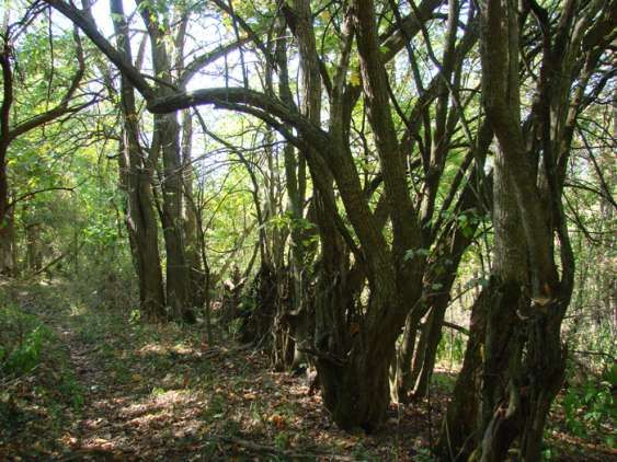
Wildflowers, “Blue eyed Marys” in bloom in April on Trail 1.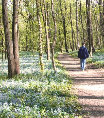
Before you get on the trail…
For your Safety:
  Do not hike alone.
  Let someone know you’re going to this
  park before you leave and a time you
  expect to be back.
  There is very poor cell phone coverage.
  In some areas of the park you get no
  signal at all.
  Stay on the trails. People DO get lost
  here! There are wild animals, insects,
  poison ivy, ticks and thorn bushes. Be
  careful and respect the wildlife. Also,
  do not eat any berries! Some of them
  are poisonous.
  For your safety, trails are closed during
  hunting season because there are
  hunters on land surrounding the park.
  The trails in this park are shared with
  horses, NOT paved, and sometimes very
  muddy, so it’s a good idea to wear
  appropriate hiking attire, especially
  closed walking shoes or boots.
  This hike will take approximately 3 to 4
  hours. Be sure to time it so you will exit
  the park at least an hour before sunset.
  Be advised that we have received
  reports of thieves that target vehicles
  parked at trail heads. Be sure not to
  leaves any valuables in your car (or
  trunk!) and keep it locked.
  And above all, do not litter!
                                                                   Trail Courtesy:
                                                                     HIKERS           HORSES

Suggestions to bring:                                                         YIELD
 Bottled water and bug spray (important!!).
 Walking stick - there is a lot of uphill hiking and also useful
                                                                              BIKES
 for spider webs that stretch across the trail!
 A camera and/or binoculars - for bird and animal watching.

                                               Page 2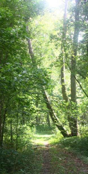
Middle Creek Park Unpaved Walking Trails
5501 Middle Creek Road, 8.49 miles (44,821.92 feet) of unpaved, moderate to very difficult trails
Burlington, KY 41005 with steep elevation changes. Trails have shared usage with horses.
This park is closed during hunting season.
Dinsmore Mi
dd
Homestead le
Cr
ee
kR
d.
P ike
n
gto Bridge
rlin Middle
Se
Bu Creek
rvi
18 Parking
te
ou
ce
R
KY Trail
1
Horse 1
Hikers entrance
Trail 2
Entrance
2 11
1
Tr
4
4 ail
Trail 4 3
2
4
3 1
B 1 6
Trail B
Tr
3
ai
l6
B
B 1
A Middle Creek Trails
6 1 Trail 1 - 2.937 miles
Trail 2 - .5 mile
D Tra
il D Trail 3 - .437 mile
Trail 4 - 1.25 miles
(Mud Road)
Tra
Trail 6 - .562 mile
A B
il A
(Trail 5 is no longer accessible)
A 1
Camargo Hunt Trails
C Trail A - 1.462 miles
Trail
C P ark Trail B - .867 mile
ek
A Cre Trail C - .332 mile
dle
Mid Trail D - .142 mile
C
Camargo Sample Trail
Hunt Park
A Directions: Go west on KY Route 18
▲
(Burlington Pike) approximately 6 miles from
the four-way stop in Burlington. Park entrance
North will be on the left, just past the Dinsmore
Homestead.
Page 3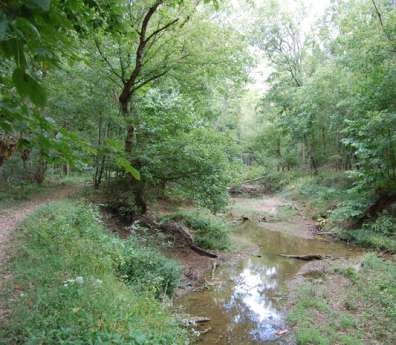
Sample trail…
   Start at the beginning of
   Trail 1 by the large sign
   next to the parking lot.
                                  Time to get
                                  your hands
                                  dirty! Pick
                                  up some of
                                  the soil you
                                  are standing
                                  on and
                                  notice how
                                  sandy it is.

  Glaciers receding north during the Ice Age
  (Pleistocene Epoch) created wind currents due to
  temperature differences between the cold ice and the
  warm land. These winds blew ice-eroded sand into
  piles. This eolian sand, “wind-blown sand” created
  sand dunes several feet deep. The parking lot is built
  on the remnants of one of these sand dunes.
                                                              Tuliptrees grow on the edge of the parking lot.

Spring Wildflowers
Middle Creek is an amazing place to visit in the spring. Starting in
early April, when we get a few warm days, wildflowers will begin to
break through the underbrush and start to bloom. Dutchman’s
Breeches (1), Sessile Trillium (2), Salt & Pepper (3) and Squirrel Corn
(4) are among the first to show. By late April, the Trout Lillies (5) are
in full bloom - the Wild Phlox (6) and the Blue-eyed Marys (7)
are everywhere! It is a beautiful show for you to enjoy.

                                                                                                       6

                                 3               4

               1      2                                               5                                7

                                                     Page 4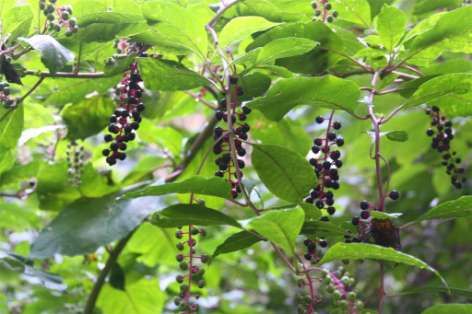
Walk down the
                                steps and take a
                                left onto Trail 1.
                                Follow the Creek
                                to the bridge.
                                Middle Creek, on your right,
                                flows peacefully through the
                                valley. Don’t be fooled!
                                The creek swells into a
                                raging river when heavy
                                rains fall. Water frequently
                                spills over the bank and
                                rushes madly across the
                                level land uprooting plants
                                and reshaping the
                                floodplain. Roots of trees
                                become submerged in
                                marshy pools when the
                                waters recede.

    Sugar Maple (1), Sycamore (2) and Box Elder (3) are the
    common trees adapted to thrive in these harsh conditions.
    Because the three are water-loving and fast-growing, they
    tolerate standing water and recover quickly after a wash-out.

1

2       3

            Page 5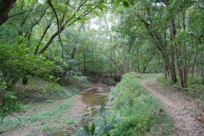
Sample trail…
 Cross Middle Creek using the large                               Take a moment to stand still and listen to the
 wooden footbridge.                                               forest. The animals that call this park home will
                                                                  show their presence in numerous ways.
 Take a left onto Trail 1.                                        Many species of birds inhabit the park, from the
                                                                  shrill call of the crow to the ever-changing
                                                                  songs of the mocking bird. Sometimes they will
                                                                  sing out warnings of your arrival as you pass
                                                                  underneath them. We have even had Squirrels
                                                                  drop nuts down
                                                                  onto us from the
                                                                  tree branches
                                                                  above!
                                                                  Whitetail deer,
                                                                  squirrels and rac-
                                                                  coons visit the
                                                                  floodplain for food
                                                                  and water and
                                                                  leave behind their
                                                                  tracks in the soft soil. Keep a sharp lookout for
                                                                  some of their tracks!

Leave Trail 1 & take a right onto Trail 2 at the 3-way intersection.
The Middle Creek Valley is a half-mile wide at this
point. How could small Middle Creek carve such a
wide valley? Before the glaciers of the Ice Age
(Pleistocene Epoch) rerouted many of the
waterways in this area, the ancestor of the
Kentucky river flowed where you now stand. This
large waterway carved most of the wide valley.
Glaciers moving southward dammed up the river
forcing it to reroute itself 30 miles south through
Carrollton, Kentucky, where it flows today.
This part of the hillside is composed of yellowish
clay that slides easily. The sliding soil limits the
height of the trees. The taller the trees become,
the more likely they will fall over from being top
heavy in the sliding soil. Early settlers realized how
easily the soil erodes, and determined the area was
better for pasture than for growing crops. Today,
new growth tries to reclaim the former pasture land.
These factors create thick undergrowth that
provides great cover that many animals depend on
for protection.

                                                         Page 6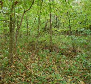
Just after crossing the in-
tersection with Trail, rocks
can now be seen on the trail.

 These large blocks of limestone, known as
bedrock, were formed on the bottom of an ocean
that covered the area 45 million years ago during
the Ordovician Age. As small ocean plants and
animals died, they accumulated on the bottom
and became fossilized to form part of the
bedrock. The fossils of these animals can be
seen in the rock today.

  If you are visiting in the summer, keep a look out for
  butterflies. They will land on muddy spots on the trail to
  drink the moisture and get minerals. This Red Spotted
  Purple butterfly (1) ( Limenitis arthemis astyanax) and
  Spicebush Swallowtail (2) (Papilio troilus) was seen in
  late August.
                                                                       1

                                                                   2
                                                               1

                                                      Page 7
Sample trail…
If you look down at the trail you
may find many species of leaves,
                       nuts and
                       acorns that
                       have been
                       dropped
                       from the
                       canopy of
                       trees
                       above.

                                     Large trees that have fallen in the forest serve as a place for lichen, moss
                                     and even young saplings to grow. This was photographed on Trail 2

Take a left onto Trail 3 towards Trail 1.
The small pond to the right of the trail was probably built years ago to provide water for livestock. Today it is
home to several species of woodland salamanders and frogs.

                                                   Take a right off of Trail 3 onto
                                                   Trail 1.
                                                   The trail winds through a large grove of Tulip Poplar, also
                                                   known as Tulip Tree and Yellow Poplar. This tree grows tall
                                                   and dominates the forest canopy. You may need to look up
                                                   to find them because the tulip poplar is the tallest hardwood
                                                   species in North America, oftentimes reaching a height of
                                                   200 feet! None in this grove are that tall since the area was
                                                   once clear cut for pasture. This tree is so impressive that it
                                                   became the state tree
                                                   for Kentucky, Indiana
                                                   and Tennessee.

                                                   The trail crosses a
                                                   running stream fed by
                                                   springs. This stream
                                                   flows most of the year
                                                   and provides a lush
                                                   environment for
                                                   several delicate
                                                   species of plants to grow. Be careful and try to stay on the
                                                   rocks to cross it!

                                                      Page 8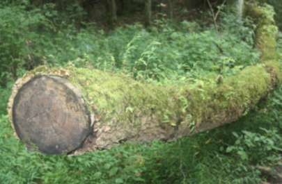
Bear left and stay on Trail 1
                                                                   where it intersects with
                                                                   Trail 6 .
                                                                  The soil in this region of the park is more stable
                                                                  and less likely to slide. Early settlers selectively
                                                                  cut trees here, but did not completely clear the
                                                                  land. Different soil and fewer disturbances have
                                                                  allowed large sugar maples to dominate the
                                                                  forest.
                                                                  Notice how
                                                                  the large
                                                                  trees provide
                                                                  shade from
                                                                  the sunlight
and prevent many plants from growing in the lower region of the forest.
Several species of fern, which are shade tolerant, thrive in the slightly acidic
soil and cooler temperatures.

                                                    Follow Trail 1 out the flat ridge.
                                                    Keep an eye out for a grove of Papaw trees. The Papaw
                                                    usually grows in stands of more than one and produces large
                                                    fruits. Indians and settlers often collected these custard-
                                                    tasting fruits after the first frost of the fall for food in winter. Its
                                                    leaves released a pungent odor when crushed.

                                                    Several trees and shrubs that were useful to early settlers
                                                    inhabit the ridge. Sassafras root bark was prized for the tea it
                                                    brewed and for its medicinal purposes. Sassafras was even
                                                    used as an ingredient in root beer.

Where Trail 1 splits, take the
left-hand fork of Trail 1
Approximately one hundred feet down the trail on the right
are the ruins of an old building. Keep a close eye out for
them. The tall rock structure is all that is left of the
chimney. Settlers relied on rock in the area to construct
any solid foundations they needed. These rock s are the
same type of flat bedrock you found earlier on the trail.
Most of these structures, like the one you see, were
constructed without any cement or mortar, only rock. This
chimney, which has stood for over a century, is a
testament to the settlers’ fine craftsmanship.

                                                       Page 9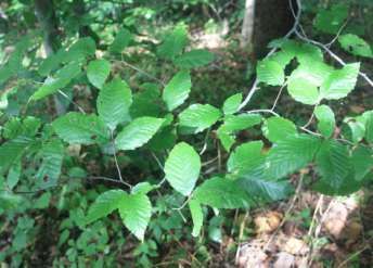
Sample trail…

Turn around and backtrack to the fork in Trail 1. Take trail 1
down over the hill, then turn right onto Trail 4 when you reach the
four-way intersection.
You are now following the main road used by early settlers. This old road connected ports on the Ohio River to
residents of Middle Creek Valley. The thick, close-growing, shrubby trees lining the left of the road are osage
orange trees. Sometimes used to form hedgerows and
producing a large, round fruit they are also called
hedgeapple. These trees, if planted closely together, are
nearly impenetrable and form the grain fields of the
floodplain.

                                                    Page 10
The summer
wildflowers are quite
different from what
blooms in the spring
There is
Late Thoroughwort
(1), and Yellow
Jewelweed (2).
Bushes are blooming
this time of year, too,
like Pokeweed (3). 3
Caution is advised
with Pokeweed
because the whole
plant, especially the 2
berries, is
poisonous.
1
Take a left at the four-way intersection and cross the large
wooden footbridge. Take a left and following Middle Creek.
Take a right onto the steps up to the parking lot.
We hope you enjoyed the
sampler Hike of Middle Creek
Park and that you will return to
explore the numerous other
trails.
Thank you!
Boone County Parks
P.O. Box 566
Burlington, KY 41005
859-334-2117
www.boonecountyky.org/parks
Page 11Other Boone County Parks and their amenities
Boone Woods Park Conservancy Park Giles Conrad Park Pete’s Park
6000 Veterans Way, 5820 Burlington Pike, 7500 River Road, Nicholson Avenue,
Burlington, KY 41005 Burlington, KY 41005 Hebron, KY 41048 Burlington, KY 41005
3 Large Shelters to 1 Large Shelter 1 Large Shelter to Park Benches
Reserve Fishing Reserve
Shor Lake Park
Basketball Courts Basketball Courts
505 Shoreland Drive
Bocce Ball Courts Dinsmore Woods Fitness Stations Walton, KY 41094
Disc Golf Course 5700 Burlington Pike, Playground Small Shelters
Horseshoe Pits Burlington, KY 41005 Walking/Hiking Trails Fishing
Unpaved Walking/
Picnic Tables
Hiking Trails Gunpowder Creek Union Pool
Playground
Nature Park 10165 Old Union Road
Soccer Fields England-Idlewild Union, KY 41091
6750 Sperti Lane,
Tennis Courts Park & Dog Park 1 Meter Diving Board
Burlington, KY 41005
Volleyball Courts 5550 Idlewild Road, Kiddie Pool
1 Large Shelter to
Burlington, KY 41005 Reserve 25 Meter Outdoor
Boone Cliffs Park 3 Large Shelters to Swimming Pool
Playground
4990 Middle Creek Road, Reserve
Walking/Hiking Trails Concession Stand
Burlington, KY 41005 Baseball/Softball Picnic Shelter
Unpaved Walking/ Field Lincoln Woods
Hiking Trails Basketball Courts 1 City Park Drive, Waller Stephenson Mill
Camp Ernst Lake Disc Golf Course Florence, KY 41042 Park
7615 Camp Ernst Road, 1 Large Shelter to Verona Mudlick Road,
Fishing
Burlington, KY 41005 Reserve Verona, KY 41092
Fitness Stations
Small Shelters Baseball/Softball Soccer Fields
Mountain Bike Trails
Fishing Fields Walking/Hiking Trails
Picnic Tables
Basketball Courts
Central Park & Playground Walton Community Park
Picnic Tables Old Stephenson Mill Road,
Arboretum Soccer Fields
Playground Walton, KY 41094
9190 Camp Ernst Road, Walking/Hiking Trails
Union, KY 41091 Tennis Courts 3 Large Shelters to Re-
2 Large Shelters to Re-
Florence Nature Oakbrook Park serve
serve Park 6605 Oakbrook Drive Baseball/Softball Field
Nature Park Drive, Florence, KY 41042 Basketball Courts
Baseball/Softball Field
Florence, KY 41042 Picnic Tables
Basketball Courts Small Shelter
Indoor Gathering Playground
Playground Sand Volleyball Court
House
Soccer Fields Playground Tennis Courts
Picnic Tables
Tennis Courts Volleyball Courts
Walking/Hiking Trail Petersburg
Walking/Hiking Trails Community Center Walking/Hiking Trails
Fox Run 6517 Market Street
1510 Woodside Drive,
Petersburg, KY 41080
Florence, KY 41042
Baseball/Softball
All Purpose Sport
Field
Field
Basketball Courts
Basketball Hoop
Playground
Playground
Community Center to
Reserve Revised 6-21-2012You can also read


