Southside Community Plan - Volume 2: Concept Plan Public Hearings Version - City of ...
←
→
Page content transcription
If your browser does not render page correctly, please read the page content below
Southside
Community Plan
 Volume 2: Concept Plan
  Public Hearings Version
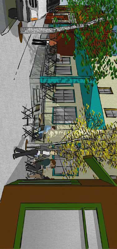
Table of
            Introduction4
            Development & Preservation Concept Plan                                                     6
            Live/Make Center Concepts                                                                    7
              Live/Make Center Concept Illustrations                                                    14

Contents
            Southside Main Streets Concepts                                                            17
              Southside Main Streets Concept Illustrations - Infill                                     18
              Southside Main Streets Concept Illustrations - Larger Lot 1                               21
              Southside Main Streets Concept Illustrations - Larger Lot 2                               24
            Live/Work Neighborhood Concepts                                                            27
              Live/Work Neighborhood Concept Illustrations                                              28
            Neighborhood Core Concepts                                                                 30
            Affordable Housing Concepts                                                                31

            Public Improvements Concept Plan                                                           32
            Parks Concept Plan                                                                         32
             Mikes Pike Pocket Park Concept Illustration                                                34
             Rio/Ellery Street Green Space Concept Illustration                                         36
             Lone Tree Overpass Larger Park Concept Overview                                            39
             Murdoch Center Concept Illustration                                                        44
            Transportation Concept Plan                                                                46
             Lone Tree Road Improvements                                                                46
             Milton Road Master Plan                                                                    46
             Enhanced Pedestrian/Bicycle Crossing Concept Illustration                                  48
             FUTS Connection Concept Illustration                                                       50
             Traffic Calming and Bike Boulevards Concept Illustration                                   52
             South O’Leary Street Traffic Calming Concept Illustration                                  53
             Curb, Gutter, and Sidewalk Concept Illustration                                            54
             Biking on Butler Avenue Concept Illustration                                               56
             Downtown Connection Center Concept Illustration                                            58

            Glossary60
            Bibliography63

                                                                             Southside Community Plan     3
Introduction
The Southside Community Specific Plan,                  address the goals, policies and ideas of the entire     be considered. If the public comments from the
Volume 2: Concept Plan (Concept Plan) provides          Southside Community Specific Plan, Volumes              Zoning Code update conflict with the goals and
supplemental information for the interpretation         1 and 2 (Southside Community Plan). In other            policies of this plan, the Planning and Zoning
of goals and policies found in the Southside            words, if a project achieves the desired outcome,       Commission and City Council should consider all
Community Specific Plan, Volume 1: Goals,               but does it in a different way that doesn’t look        information and potential options and provide
Policies and Strategies (Volume 1). The Concept         like the illustrations in this document, it can still   direction to staff. It is important to consider the
Plan is an illustration of how the goals, policies,     be in conformance with the goals and policies of        illustrations as a starting point for future code
and strategies of the Southside Community Plan          the Southside Community Plan. An analysis of all        work and projects and not a fully vetted design.
could generate private and public improvements          the goals and policies in the Flagstaff Regional
that move the community’s built environment             Plan 2030 (Regional Plan) and any applicable            No property owner is required to construct in the
towards the community vision. The concepts and          specific plan is the tool used to determine plan        way these illustrations present; all projects must
illustrations demonstrate what is possible but do       conformance for future proposals. Further               comply with underlying zoning requirements.
not compel conformance with the illustrations.          public engagement that builds on this Southside         Proposals for concept or direct-to-ordinance
They are intended to assist by creating a reference     Community Plan is encouraged for all projects           rezoning may vary from these illustrations if
point for future projects, both public and private.     that use public funding or for when the property        the proposals meet the goals and policies in
                                                        owner requests a Zoning Map Amendment to                the Regional Plan and applicable specific plans,
Each set of illustrations starts with an overview       change a property’s Zoning Code designation.            including this one. While, private development
map that shows the location and extent of all                                                                   proposals may vary from these illustrations, they
individual illustrations as well as concepts that       The first section, Development and Preservation         are encouraged to examine these illustrations
do not have their own illustration. The overview        Concept Plan, is focused on ways the Southside          to better understand compatible architectural
maps are followed by two- and three-dimensional         Community Plan’s goals and policies could               features and the community character.
illustrations of desired conditions in locations that   influence private development in each subarea.
correspond to the numbers on the overview map.          Each subarea, per the strategy in Volume 1, is          The second section, Public Improvements
In case of any conflict between the Concept Plan        proposed to be a new zoning category that               Concept Plan, looks at potential public
and Volume 1’s goals and policies, the goals and        replaces the current zoning in the Southside.           improvements to provide a starting point
policies shall prevail.                                 The illustrations and associated text, therefore,       for future capital projects that the City may
                                                        discuss some elements of a new zoning category,         undertake as funding becomes available and with
New information and changes in conditions,              such as building form, materials, height, parking,      the approval of the City Council. The concepts
objectives and technology may also lead project         and other site planning features. Also, they give       show the ideas that came from the public and
teams and the community to want different               a sense of the character and potential land uses.       project team about how infrastructure, and public
designs for these concepts. These concepts were         The new zoning proposed will have its own public        and community spaces could be improved. In
created with the idea that future teams working         participation and technical processes that build        some cases, multiple scenarios are considered
on real world projects, whether they be private         off this specific plan’s development. New public        because the future conditions that may determine
or public, can engage the community and use             comments and direction from the City Council            the technical constraints of designing the project
their up-to-date knowledge and creativity to            and the Planning and Zoning Commission will             have not yet been fully studied or confirmed.

4   Southside Community Plan
Traffic studies, stormwater studies, and other
technical examinations of the site conditions will
be considered along with the concepts in this
plan for future project designs. Public health and
safety requirements at the time the project is
implemented may also be different.

Appendix A of Volume 1 identifies which
Strategies that in turn create these concepts
the community would like to prioritize. This is
an initial list of priorities; Other concepts may
be implemented as opportunities arise. Every 5
years, the City may post updated implementation
priorities to the project website in consultation
with the community.

                                                     Scenes of vibrancy and community character in the Southside.

                                                                                                                    Southside Community Plan   5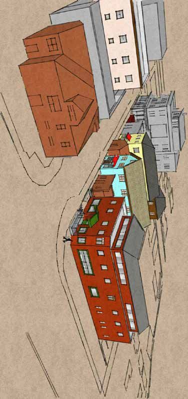
Development & Preservation Concept Plan
The objective of the Concept Plan               Development & Preservation - Concept Illustrations Overview
illustrations is to demonstrate a

                                                                                               o St
pattern of redevelopment and

                                                                                              cisc
historic preservation that will allow
the Southside to evolve as an urban

                                                                                              n
                                                                                          Fra
neighborhood without losing the

                                                   Rd
assets that give the Southside its

                                                                                         San
                                                                                                                       U1 (Urban, Historic Activity Center)
value as a historic, walkable, and

                                                 ton
diverse live/work neighborhood.

                                                 Mil
                                                                                                      Rou
Redevelopment occurs when new                                                                            te 6
                                                                                                                   6                        U2 (Urban, Regional
development replaces outdated                                                                                                               Activity Center)
and underutilized development.                                                   3
Preservation is an endeavor that
seeks to preserve, conserve, and                                                                                                   re)
                                                                                     2                                      utu
protect buildings, objects, landscapes,
                                                                                                                    e Rd (f
or other artifacts of historical                                                                                  e
                                                                             4                                 Tr
significance. The balance between

                                                                                                            Lone
                                                                                                                       1
these two community values is the
main focus of these illustrations and                                                                                                      Butler
is demonstrated in a variety of ways
                                                                  St                                                                                Ave
                                                             ver

in the context of each subarea. The
Concept Plan has two- and three-
                                                            Bea

                                                                                                                                             Legend
dimensional illustrations, descriptions,
                                                                                                                                     Live/Make Center
and photos to visually demonstrate                            U8 (Urban, Historic
the application of principles from                            Activity Center)                                                       Southside Main Streets

Volume 1. The text describing the                                                                                                    Live/Work Neighborhood
                                                            S7 (Suburban, Neighborhood
features of the illustrations will often                                                                                             Neighborhood Core
                                                            Activity Center)
reference goals, policies and strategies                                                                                             Historic Preservation focus area
from Volume 1.
                                                                                                                                     Northern Arizona University
Each subareas headings and outlines                                                                                                  Affordable Housing Opportunity
are color coded to the map to the
                                                                                                  d
                                                                                                                           1 - Live/Make Center
right.
                                                                                               eR

                                                                                                                           2 - Southside Main Streets - Infill
                                                                                              re

                                                   SCALE:    1"=800'                                                       3 - Southside Main Streets - Larger Lot
                                                                                            T

                                                                                                                           4 - Live/Work Neighborhood
                                                                                         ne

                                                  0         400        800
                                                                                         Lo

6   Development and Preservation Concept Plan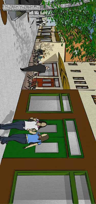
Live/Make Center Concepts
The Southside has always been the kind of neighborhood where a welding shop tucked into a pocket of single-family homes is a compatible set of uses. This
area could evolve into a craft and manufacturing area with a live/work environment that provides economic opportunities for the Southside neighborhood.
The employment activities within this area would be light industrial activities that do not directly conflict with residential activities. Modern employment
activities are often confined to industrial zones under this system of zoning, even if they do not create the public health issues or significant nuisances
that conflict with residential activities. This lack of conflict is especially true for small-scale, craft industries like microbreweries, coffee roasters, jewelry
manufacturing, and small batch goods in the back of a store. A large-scale manufacturing facility could be seen as a conflict with a residential setting, but
people are happy to live across the street from craft food production facilities, such as the Lumberyard Brewery operations. Some further examples of uses
that have been confined to mostly industrial zones but could work well with other commercial and residential uses include, cabinet shops, research offices,
prototype development, and small and medium scale light manufacturing.
The Euclidean separation of uses can disconnect people from employment opportunities. This subarea would reconnect the people of the neighborhood to
employment opportunities that take advantage of other community characteristics and make small-scale entrepreneurship more possible. An example could
be manufacturing small batch goods or metal items in the back of a store or in residences above or behind a commercial use. This mix of uses might not suit
everyone, but for individuals who want a live/work experience or want to lower their carbon footprint, it would be attractive if the scale of the operation is
small and the selected uses are appropriate.

Live/Make Design Examples
The following pages of photos and descriptions are intended to supplement
the concept illustrations. Some were inspirations for the illustrations, while
others were recommended because of their unique qualities that the
Southside could build upon. Materials and designs in this sub area should
encourage diversity. Designs can vary from classic lines to modernist curves.
Materials can vary from classic red brick to repurposed metal containers.
Because this concept is new to the Flagstaff community in the 21st Century,
the Plan highlights examples from other communities as illustrations of
how a new combination of form, fenestration, materials and style could
be achieved in this new urban environment. These are meant to provide
inspiration but are not intended to be mimicked exactly. The materials,
patterns and forms shown in these examples could be applied to new or
repurposed buildings in the Live/ Make Center.

                                                                                     Historic railroad buildings exemplify the Live/Make Center aesthetic
                                                                                                                                       Development and Preservation Concept Plan   7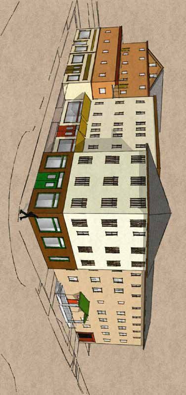
Internal Space
                                         The internal spaces of the Live/Make Center buildings should facilitate a wide variety
                                         of activities, often supported with large sunlit windows. Examples may include craft
                                           manufacturing, artistic creations, and markets that support the local craftsperson/artists.

                                                                                                           Students working on stained glass sash restoration

Flagstaff artist, Shonto Begay, at work in a Downtown Flagstaff studio
(photo credit: Flagstaff Arts Council)

                                                                         Market on Granville Island in Vancouver, British Columbia (photo credit: Tourism Vancouver)

8   Development and Preservation Concept Plan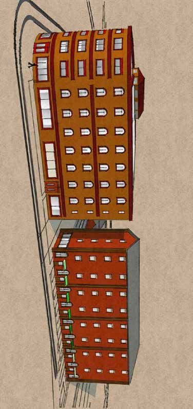
External Space: Classic Style
                                                                                           The following examples demonstrate some examples of classic and timeless
                                                                                           styles. These buildings were initially constructed to be used to make things,
                                                                                           or host activities more intense than a simple retail operation. The Old Ford
                                                                                           Motors factory in Detroit, MI was the location of the initial production of the
                                                                                           Model T. The Old Harmonie Club in Detroit, MI contains a music hall and large
                                                                                           stage on the bottom floor. Ponce City Market in Atlanta, GA was a distribution
                                                                                           center, now it contains a mix of shops, restaurants, food stalls and apartments.
                                                                                           Their ability to evolve over time is derived from open spans and abundant
                                                                                           window fenestration that lends itself to adaptive reuse within their urban
                                                                                           frameworks. The portions of the building facing the street define the urban
                                                                                           form of the entire neighborhood. The textures and patterns at the street level
                                                                                                      draw in the pedestrian and connect with the streetscape.

Old Ford Motors factory (photo credit: Jackdude101 via Creative Commons,
creativecommons.org/licenses/by-sa/4.0/deed.en, no alterations were made)

Ponce City Market in Atlanta (photo credit: Courtesy of the Georgia Department of   Old Harmonie Club in Detroit (photo credit: Historic Detroit)
Natural Resources)
                                                                                                                                                    Development and Preservation Concept Plan   9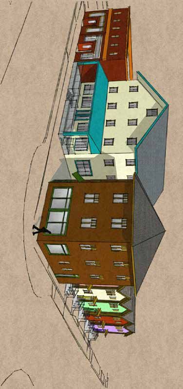
External Space: Alternative Style
The following examples demonstrate some examples of
alternative styles. Similar to the classical style, these buildings
have abundant window fenestration and engaging pedestrian
environments. However, their materials and forms draw on
later architectural periods. Many of these buildings were initially
constructed for uses with higher nuisance levels than are intended
for the Live/Make Center. Now, they have adapted to changing
conditions and facilitate a variety of more compatible activities.
Granville Island in Vancouver, British Columbia was originally
home to factories, plants and sawmills. Now it is a cultural district
with theaters, artisan workshops and craft studios. The Armory
in Phoenix, AZ is a re-purposing of an old armory that now
includes spaces for artists to create. The simpler materials have
lent themselves to art being incorporated into the interior and
exterior of these buildings and can allow for whimsical flourishes
 and incorporation of culturally relevant murals and civic spaces.

                                                               Granville Island in Vancouver, BC (photo credits: Tourism
                                                               Vancouver (bottom left) CMHC - Granville Island (rest))

Former Phoenix Armory Building (photo credit: Lynn Trimble/
Phoenix New Times)

10   Development and Preservation Concept Plan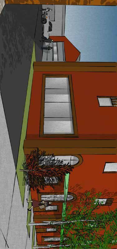
Live/Make Materials Examples                                                                                      General Design Details
Architects should look toward successful urban activity centers that have                              There is a lot of opportunity to create interesting forms
achieved vitality through urban site planning and mix of activities and                                with unique windows and mixes of materials while still
uses. An integral component of success is simple building forms with fitting                               following lessons of classic architectural form.
materials, and structure and refined detailing. Material can be human scale
and inviting or strange and unfamiliar. In general terms materials that are
modular, such as brick, block and stone that can be placed by craft persons
are human scale. Large monolithic surfaces or materials that require large
machines to install are not human scale. The Live/Make Center concept
envisions architectural forms that follow the function of the building. Many
current successful examples of Live/Make projects are with the adaptive
reuse of historic buildings. Large turn of last century manufacturing
buildings such as textile mills are conducive to the Live/Make concept. Brick
buildings with versatile open space and large windows lend themselves to
the endeavors of artist and artisans. Flagstaff does not have an inventory of
these buildings but does have the opportunity to look at these examples to
accomplish Live/Make projects with new construction and available current
materials.
Architectural Proportions: A building is often thought of as a classical
column, with a base, a column shaft and a capital that is its finishing top
detail. In order for a building to visually sit firmly on the ground, it deserves
a substantial base. The stories above are treated in a consistent material,
often of a somewhat less durable
and simpler material and these
floors are then capped by a roof
or the upper floor and roof form
that is the finishing capital with
some higher level of detailing.
Durable first floor materials add
textural interest to the street
level for pedestrians and drive-
by viewers. Substantial and
durable materials are resistant to
water splash and less suitable to
vandalism.
                                     Old Athletic Club in Detroit (photo credit: Historic   Examples of interesting design in Bozeman, MT, (photo credit: Gaylene Soper)
                                     Detroit)

                                                                                                                                           Development and Preservation Concept Plan   11
First Floor Materials
The selected material on the base of the building should remain consistent along the main face of the live-make building. It should be
noted that the base material is for the primary façade and the secondary façade may be simplified in a more cost-effective manner yet
still meet the general requirements of a durable first floor material (an example of this would be primary façade using split face CMU
and secondary faces with plane face). The material selected is also dependent upon the architectural style that has been selected for
inspiration. First floor materials that are not preferred unless appropriate to architectural style include: stucco and synthetic stucco (EFIS)
like materials, wood, metal, and corrugated “farm” metal. Materials should be durable and resistant to impact and abrasion.
Brick, a multitude of color and
textural qualities available, color
variation and architectural bond
variations and details encourage the
viewer reading the surface texture
and depth more easily
Cultured stone
Cut stone, smooth or tooled face, “classical style” or fake stone
(replicated stone
that simulates a
Rough face cut stone, red stone’s quality and
sandstone, limestone, durability)
granite or others with
mortar joints
Cement block (CMU) split
face or textured face, used
similar to rough cut stone,
encourage colored block
vs. plain cement, or utilize
“Romanesque Style” Rustic stone, Malpais basalt and stacked stone, “Flagstaff Vernacular” a combination of colored
and cement Tile or grid pattern
12 Development and Preservation Concept PlanUpper Floors Roof and Termination Details
The upper floor’s siding material should be durable but not necessarily impact resistant. The The roof and detailing at the eve line are essential in
façade material should be selected for compatibility of the design and the architectural style completing a building’s architectural look and style. The
initiated by the base floor treatment. termination of a building may also include the upper most
floor that may have a change in fenestration and/or a
horizontal line separation. Material should be selected that
is compatible with the architectural style and the other
materials that have been selected.
Brick may be carried up from the
base floor, and applied part way up
or full height as a vertical accent for
an area of the facade complimenting
adjacent materials. The brick may
also be the facade of the entire Shingles: roof covering such as asphalt shingles and
building, but the base first floor simulate shakes
Wood siding (or a wood should have some differentiation Stucco: the use of stucco or
composite pre-primed and and horizontal separation and/or synthetic stucco
painted siding) placed detailing
horizontally and lapped
vertically with batton
joints
Metal roofing, all types and all Classical projecting cornice
treatments including corrugated.
Metal shall be panels of 6” plus face with
folded or standing seams. Corrugated
galvanized metal is not allowed.
Stone: the use of stone or stone like materials and detailing may
be appropriate
Add (architectural) interest to large roof forms
Development and Preservation Concept Plan 13Live/Make Center Concept Illustrations
This illustration shows the redevelopment of the majority of a block. This block was selected because the Lone Tree Overpass will result in property acquisition
and relocation or demolition of some buildings which could catalyze redevelopment. These properties could be redeveloped all together or as two separate
projects.
Features:
A. The Lone Tree Overpass final design and construction plan may consider relocating existing houses that will be impacted by future development or
roadway construction, especially if they are historic and have integrity.
B. The design concept of the Craft Manufacturing/Residential mixed use building (pink) provides large ground floor workspaces for craft manufacturing
behind residential on Gabel Street and retail on Butler Avenue. (Policy S 5.1). These spaces could provide truck access from the alley and large doors
providing other access and community interaction on the street side.
C. Multiple small storefronts on the busier road could be used to directly sell goods manufactured on site, or from sites set back into the center (such as
properties facing Brannen Avenue), that may not have enough traffic to support commercial activity (Policy S 5.3).
D. Typical apartments could exist above the craft manufacturing ground floor.
E. More traditional mixed-use buildings could also exist in this subarea. These would contain more traditional commercial ground floors and apartments
above, and could provide housing while relieving redevelopment pressure from historic areas of the Southside (Policy SLM 1.2).
F. In order to meet required parking, the pink building would need to share or lease parking in the nearby parking garage.
G. Buildings should incorporate green building practices to ensure the sustainability and affordability of commercial, industrial and residential space.
14 Development and Preservation Concept PlanLive/Make Center Concept Illustration (Plan View)
Legend
Historic Building (at least 50 years old)
Colorado St (Existing)
Commercial/Residential mixed use
building (proposed concept)
Residential building (proposed concept)
e)
Craft Manufacturing/Residential mixed
ur
ut
use building (proposed concept)
(F
Bra
nne
Rd
nA
ve
ee
(Fu
Tr
ture
)
ne
Lo
A
Gabel St
B
F B
G
D
E G
C
SCALE: 1"=60'
Butler Ave
0 30 60
Development and Preservation Concept Plan 15Live/Make Center Concept Illustration (3D Views)
Buildings in this view show the maximum height (60 feet) and
bulk for the proposed Live/Make subarea.
16 Development and Preservation Concept PlanSouthside Main Streets Concepts
The ideal uses for this subarea would be similar to the Live/Work Center subarea but with fewer industrial uses and more commercial storefronts. Smaller scale
employment activities are expected in this zone more than the Live/Work Center subarea because its location is more conducive to traditional commercial
shopfronts, retail, offices, and restaurants.
Both the transect and conventional zoning currently allow height, bulk, mass, and scale that is not compatible with the existing character of the Southside
Main Streets. Chapter 3 in Volume 1 recommends that building heights in this subarea do not exceed 45 feet, which is approximately the height of the
climbing gym or the new mixed use building (see below right)., both at the corner of East Benton Avenue and South San Francisco Street.
While it is ideal for redevelopment to happen for a single parcel at a time, the history of developments like The Hub at 215 W. Phoenix Avenue shows that the
assembly of multiple parcels to develop larger and incompatible redevelopment is possible under the right economic conditions. The City has Policy HOH.1.5
in the High Occupancy Housing Plan that says it will not abandon alleys for the purpose of allowing more development or larger buildings to be constructed
in the Downtown or surrounding neighborhoods, which includes the Southside.
A vibrant main street character looking north along S San Francisco Street after a
Monsoon storm clears
Building elevation for Flag Town Lofts, a new mixed-use building under construction at E Benton
Avenue and S San Francisco Street (designed by Updesign Studio)
Development and Preservation Concept Plan 17Southside Main Streets Concept Illustrations - Infill
This illustration shows a variety of projects filling in a “main street” block and assumes that each project was done independently on existing lots. Setbacks
were determined by adjacent existing buildings, proposed frontage types, and the desire to create small café spaces. Each building shown as infill worked
within its existing small lot. The size of the lot and the usable space it creates determined some of the massing restrictions. Other massing decisions were
chosen based upon showing one increment larger than the existing context. Smaller lots often have inefficiencies of scale that limit building’s size before the
underlying zone’s codes would.
This block demonstrates an ability to increase intensity without completely losing the existing character. In 2019, before completion of The Lofts at the north
end of the block, the block as a whole had a Floor Area Ratio (FAR) of 0.31. The build-out of the block as shown accomplishes a FAR of 0.65. This block shows
that an area can more than double in intensity to respond to demand and keep a character popular with the community.
Features:
A. Infill should work around and preserve historic buildings.
B. This demonstrates compatible additions to existing buildings before scraping them and starting over. It may be difficult to add onto existing historic
buildings in a way that maintains their integrity. This addition was chosen as an example because the building is not historic. The step-back from the
street may help maintain the existing street-frontage feel.
C. This shows the approximate design of Flag Town Lofts, which is under construction at the time of this Plan. The scale and architecture of this infill
project demonstrates compatibility. It maximizes the site’s potential based on existing T5 zoning with three floors against the street and a small
portion with a fourth floor toward the back of the site. (Note that T5 currently allows up to five stories when the lot is large enough to accommodate
the site plan requirements.) On-site parking requirements limited the project’s square footage.
D. This building represents a conceptual redevelopment that maximizes a corner site using the Southside Community Plan goals and policies. It could
be a live/work building. It interacts with San Francisco Street (Policy S 4.3), not Butler Avenue, with a gabled entrance/frontage inspired by existing
buildings in the Southside. After the second floor, it has a step-back and a third floor in the style of a clear story with a pitched roof inspired by the old
Laundry (7 South Mikes Pike), and Lumberyard Brewing Company (5 South San Francisco Street).
E. The buildings illustrated represent smaller, potentially compatible infill buildings on narrow lots. Because of the traffic on South San Francisco Street,
both pedestrian and vehicle, these buildings would have a commercial component and would use a frontage type inspired by this plan for the
Southside Main Streets subarea to improve their compatibility.
F. Even though this building is not historic, it is a small flexible space that could be adaptively reused under Policy S 1.1.
G. New residential buildings as an accessory at the back of commercial lots is a historic pattern in the Southside that could increase live/work
opportunities.
H. One of the challenges to increasing intensity in the Southside Main Streets is trash pickup. As shown on feature C, dumpster enclosures can take up
a lot of space on a small lot. One solution could be to install dumpsters in the alley that are shared by multiple parcels. Increasing lot efficiency in this
way can help avoid lot consolidation and incompatible redevelopment.
18 Development and Preservation Concept PlanSouthside Main Streets Concept Illustration - Infill (Plan View)
Benton Ave
C
Legend
San Francisco St
Historic Building (at least 50 years old)
Commercial/Residential mixed use F G
building (proposed concept)
Residential building (proposed concept)
Craft Manufacturing/Residential mixed
use building (proposed concept)
E
A A
B E H
A
A
D
SCALE: 1"=40'
0 20 40
Butler Ave
Development and Preservation Concept Plan 19Southside Main Streets Concept Illustration - Infill (3D Views)
No conceptual buildings in this view show the maximum height
(45 feet) and bulk for the proposed Southside Main Streets
subarea. The existing “Flag Town Lofts” at the northeast end of
the illustration would max-out the proposed subarea’s height.
20 Development and Preservation Concept PlanSouthside Main Streets Concept Illustrations - Larger Lot 1
This illustration shows the redevelopment of a quarter-block. The design shows a representation of how a mixed-use building with structured parking could
meet the goals and policies of the Southside Community Plan in the Southside Main Streets subarea. This concept attempts to maximize its bulk and mass per
the proposed zoning. Horizontal articulation, and variation in setbacks, were designed with the existing Zoning Code’s design standards in mind.
Features:
A. A large building like the one shown can make its bulk and mass less apparent by appearing as multiple smaller buildings, each with their own style.
The preference for the interior is to have it laid out as multiple smaller buildings. Side streets can provide residential opportunities for apartments,
townhomes, and other high-density forms of housing.
B. Access to the structured parking garage is provided by both an alley and Benton Avenue. Corner lots can reduce their traffic impacts by providing
multiple access points and by taking advantage of the gridded streets of the Southside to disperse vehicles entering and exiting the parking structure.
C. Between the buildings and the curb, the new buildings should improve the pedestrian environment and provide informal civic space for outdoor
seating and public activities.
D. This building shows upper floors stepped back above the second floor to make the building appear smaller at the pedestrian level. Space could be
provided for commercial activities that service the community such as medical offices, childcare, and job training in larger developments (Policy S
6.5).
Development and Preservation Concept Plan 21Southside Main Streets Concept Illustration - Larger Lot 1 (Plan View)
Legend
Historic Building (at least 50 years old)
Commercial/Residential mixed use
building (proposed concept)
Residential building (proposed concept)
Craft Manufacturing/Residential mixed
use building (proposed concept)
D
Beaver St
A
C B
A
A
SCALE: 1"=30'
Benton Ave
0 15 30
22 Development and Preservation Concept PlanSouthside Main Streets Concept Illustration - Larger Lot 1 (3D Views)
Buildings in this view show the maximum height (45 feet) and
bulk for the proposed Southside Main Streets subarea.
Development and Preservation Concept Plan 23Southside Main Streets Concept Illustrations - Larger Lot 2
This illustration shows the redevelopment of the same quarter-block as Concept 1 This second concept uses surface parking and creates a more permeable
site with less intensity. Instead of trying to maximize the entire site, this concept attempts to show a greater mix of building heights and sizes, a concept more
popular with the community. Some buildings max-out the height of the proposed zone to accurately reflect the realm of possibilities.
Features:
A. This illustration shows multiple mixed use and residential buildings making up a site, each with their own style, in order to be more compatible
with their diverse community surroundings. Three different frontage types along South Beaver Street are used that mimic historic buildings in the
Southside Main Streets subarea in terms of architecture but with a slight increase in scale.
B. Parking is accessed off the alley. Some Commercial and all residential parking is available on the site. The illustration assumes that the future zone has
a low on-site parking requirement for the commercial buildings. In order to accomplish this desired building form, the commercial parking standard
would need to be look at the Southside Main Streets as a district with managed and metered parking nearby.
C. The site shows a civic space shared by adjacent buildings inspired by other locations in the Southside and is further activated by pedestrians who are
accessing the parking lot in the rear of the building.
D. A development like this could be subdivided by splitting the lot or creating condos in order to provide smaller-scale ownership opportunities for
the Southside. This is particularly relevant to new residential units. As the Southside has a very high percentage of rental units, increasing home
ownership can stabilize the residential character of the neighborhood.
E. Frontage types could be inspired by existing buildings throughout the Southside. For instance, the central mixed-use building facing South Beaver
Street is modeled after the historic dance hall at 113 South San Francisco Street.
F. Instead of developing new residential units, developers could also relocate historic buildings or residences that are at risk of demolition within their
project sites.
24 Development and Preservation Concept PlanSouthside Main Streets Concept Illustration - Larger Lot 2 (Plan View)
Legend
Historic Building (at least 50 years old)
Commercial/Residential mixed use
building (proposed concept)
Residential building (proposed concept)
Craft Manufacturing/Residential mixed
use building (proposed concept)
A
D
A
Beaver St
B
E
C
A D F
SCALE: 1"=30'
Benton Ave
0 15 30
Development and Preservation Concept Plan 25Southside Main Streets Concept Illustration - Larger Lot 2 (3D Views)
The yellow and teal buildings in this view shows the maximum height
(45 feet) and bulk for the proposed Southside Main Streets subarea.
26 Development and Preservation Concept PlanLive/Work Neighborhood Concepts
The area of the Southside between NAU and Downtown is envisioned as having the greatest commercial focus along South Beaver Street and South San
Francisco Street north of Butler Avenue (Southside Main Streets) and more residential focused between these streets and south of Butler Avenue. The Live/
Work Neighborhood would primarily be residential with small-scale commercial buildings and live/work opportunities throughout. This would create the
advantage of operating small commercial enterprises without having to invest in rent or purchasing property on a commercial corridor. This could also
advance entrepreneurship and workforce development in the Southside and throughout the City. In areas with single-family cottages, large development and
additional dwellings could be located at the rear of the property.
The photos of commercial and residential buildings from the Southside in this section illustrate the scale and appropriate use of materials in this subarea,
even though some of them are located elsewhere in the neighborhood.
Small-scale commercial and medium- to high-density housing appropriate to the Live/Work Neighborhood subarea
Development and Preservation Concept Plan 27Live/Work Neighborhood Concept Illustration
This illustration shows compatible infill and redevelopment working around historic and fully utilized buildings. It shows incremental increases in intensity on
existing lots. Smaller increases in intensity can be facilitated by flexibility in the lay out of multiple units on a lot without requiring a vertical arrangement (like
the stacked triplex). Property owners frequently request the ability to add a modest third unit to existing residential properties. Allowing incremental change
can allow existing property owners to stay in the neighborhood and increase their financial wellbeing without loss of historic cottages. It could slow or avoid
the creation uncharacteristically large units with 4 or more bedrooms. The objective is to allow additions within an existing property, in a pattern consistent
with Southside’s past, that will benefit the existing property owner. It becomes less appealing to sell individual parcels to an outside developer that will
consolidate lots, scrape the existing buildings, and rebuild to the maximum densities allowed that are often perceived to be incompatible with the existing
character.
In addition, small commercial uses on otherwise residential streets can fit the neighborhood pattern so long as they are not tied to the dining and
entertainment industries. Personal services are particularly appropriate to these settings because they do not need truck access and have hours that are often
compatible with the residential environment.
Features:
A. Site A shows a three-unit complex made up of a side-by-side duplex and smaller detached home. Currently, the HR zone limits lots like this to two
units. A third unit could be appropriate based on the historic pattern if the total number of bedrooms on the site is also limited. Alternatively, a similar
lot could have three smaller cottages on one lot at a scale that is more compatible with its surroundings.
B. Contributing historic buildings could also add new units to their lot. These intensity increases would allow for infill/new units without losing
neighborhood character.
C. A modified zone could better support redevelopment/development on narrow lots by managing the form, allowing smaller setbacks, and supporting
small-scale mixed-use opportunities.
D. Small-scale businesses, like barber shops, could be located in the front of a house with residents living behind and/or above to create a residential-
style live/work unit that is true to the historic pattern.
E. Portions of this Illustration’s area are within one of the proposed Historic Preservation focus areas. This illustration shows an area that still allows infill.
Preservation of historic buildings could be addressed by only putting the buildings themselves in a historic overlay or writing the overlay in a way that
allows compatible infill as defined by the overlay. The boundary of this and other Historic Preservation focus areas are not final.
28 Development and Preservation Concept PlanLive/Work Neighborhood Concept Illustration (Plan View)
Butler Ave
E
Beaver St
B
D
C
A
Leroux St
Legend
Historic Building (at least 50 years old)
Commercial/Residential mixed use
building (proposed concept)
Residential building (proposed concept)
SCALE: 1"=30' Craft Manufacturing/Residential mixed
use building (proposed concept)
0 15 30
Development and Preservation Concept Plan 29Neighborhood Core Concepts
Most of the Neighborhood Core subarea is currently zoned as High Density Residential (HR), and it is common for accessory dwelling units, duplexes,
and townhomes to be interspersed with single-family homes. This subarea would support the continuation of these patterns and would encourage the
preservation of existing single-family homes.
The Rio de Flag Flood Control project is being designed and constructed by the US Army Corps of Engineers and once the project is complete, most of the
Southside buildings currently located in the 100 year floodplain and subject to floodplain regulations could be remapped and removed from the floodplain.
However, there are still some areas of localized flooding that may not be resolved by the regional flood control project. Homes in these areas of the
neighborhood may benefit from floodproofing and may continue to see elevated building construction typical of conforming houses in the Southside.
In order to preserve the existing housing stock, dry floodproofing could be installed on most of the pre-1980s units located in the 100-year floodplain in order
to protect lives and property during a flood. Dry floodproofing does not lower flood insurance premiums, but it can be used to preserve property and prevent
loss.
When a nonconforming structure is demolished, the building that replaces it must be raised above the base flood elevation. These requirements change the
character of a residential area and diminish the connection between the front of the home and the streetscape. In the photo below, the home on the left is a
conforming structure which mitigated the elevation of the building by flattening the roof pitch.
Illustration of dry floodproofing techniques (source: FEMA 2007)
A conforming (left) and nonconforming structure (right) on South Humphreys Street
30 Development and Preservation Concept PlanAffordable Housing Concepts
Affordable housing should be considered in all subareas. Combined housing
and transportation costs are estimated to take up fifty-six percent of the
average household’s income in Flagstaff (CNT 2019). When affordable
housing is introduced in centrally located neighborhoods like the
Southside, it has twice the impact. The availability of walkable employment
opportunities and city-wide transit can lower a household’s transportation
costs.
Several City-owned properties in the Southside have been considered for
affordable housing development over the last few years. On the overview
map, and denoted by green stars, are City properties that can provide single
family and multifamily housing opportunities for families at various income
levels. The properties on the northwest corner of South O’Leary Street and
Butler Avenue are prime examples of small lots that with partnerships could
provide an opportunity for one or two units. A similar parcel was turned into
affordable housing through a partnership with Habitat for Humanity. Homes built by Habitat for Humanity in the Southside
Another small parcel that has been discussed for a small
affordable housing project is the property at the south end
of South O’Leary Street where it connects to South Lone Tree
Road. The property is currently a community garden and
that use could be maintained along with several affordable
units per a concept design prepared by the City. Neither
of these parcels on South O’Leary Street have immediate
plans for affordable housing development, but both have
been discussed as potential locations for partnerships and
affordable housing for several years. In fact, Housing funds
paid to upsize the waterline at 900 South O’Leary Street in
anticipation of future housing.
One Southside parcel committed to affordable housing is
the property at the southwest corner of South Lone Tree
Road and Butler Avenue. The City put out two Requests for
Proposals for this property in recent years, however, neither
of those plans were fully realized. As of Spring 2020 there are
no immediate plans for affordable housing on this parcel,
and the City is currently evaluating how to proceed with this
parcel.
Concept plan for affordable housing and community gardens at 900 South O’Leary Street
Development and Preservation Concept Plan 31Public Improvements Concept Plan
The Concept Plan is an illustration of how the
goals, policies, and strategies of the Southside
Parks Concept Plan
Community Plan could differently generate A recurring desire from public meetings and stakeholder conversations is to establish a park for the
private and public improvements. This section Southside neighborhood. Parks are culturally and socially important gathering places in an urban
is focused on public improvements that were neighborhood. Both the stakeholder group and City staff recommend evaluating other City-owned or
discussed with the public and have been listed as future City-owned parcels to create park space as the primary strategy for increasing the accessibility
potential strategies in Volume 1. of parks for this community. The illustrations in this section primarily demonstrate how the City and
community could take advantage of opportunities on City-owned parcels that are not set aside for
Each Concept Illustrations Overview map is another use. If purchasing a central parcel becomes feasible at some point in the future, the community
followed by illustrations of each design element would support that effort so long as it does not displace existing residents.
that corresponds with the number on the
overview map. One overview map is for parks The Parks Concept Plan shows six illustrations for potential parks that can meet the Parks and
improvements, the other is for transportation Recreation Master Plan’s criteria to provide a park within a 10-minute walk of the Southside residents.
improvements. All illustrations, diagrams, The Mikes Pike Pocket Park and the Rio/Ellery Street Green Space Concept Illustrations show properties
photographs, and depictions in this Plan are for currently owned by the City that could be reprogrammed for pocket park spaces.
illustrative purposes only. These do not constitute The Example Rio Green Space with Trail Concept Illustration is a conceptual drawing of Policy S 7.2,
a commitment by the City that the items depicted which supports strategic easements to allow for mid-block public access along the Little Rio de Flag
will be permitted or that such depictions comply alignment through the Southside. The City does not currently own enough of the Rio de Flag in most
with City Code. Any proposed projects, even blocks to provide this amenity nor does this illustration indicate that every block would have this
those depicted in this Plan, must go through connection.
the City’s review process before approval. The
projects depicted are not currently included in The Lone Tree Overpass Larger Park Concept Illustrations show properties that the City plans to acquire
any City capital plans, do not have identified as part of the Lone Tree Overpass project that was authorized and funded by voters in 2018. This could
funding, and the need for these improvements be the largest property the City owns in the Southside and could provide the greatest opportunity for a
may change over time, given that they are not neighborhood park. However, the site has many challenges including the Burlington Northern Santa Fe
immediately planned for implementation. (BNSF) spur and the location of pillars and features to support the overpass.
32 Public Improvement Concept PlanPublic Improvements - Park Concept Illustrations Overview
St
o
cisc
n
Fra
San
Rou
te 6
6
1
3
tu re)
e R d (fu
Rd Tre 4
on
ne
5
ilt
Lo
M
Butler Ave
2
St
ver
Bea
1
4 mile radius to show rough small-park
walk-sheds. The center of the 2 circles as
shown would maximize service area for the
neighborhood.
Existing Sawmill park
Legend
1 - Pocket Park
Rd
2 - Rio/Ellery Street Green Space
ee
3 - Example Rio Green Space with Trail
Tr
SCALE: 1"=680' 4 - Lone Tree Overpass Larger Park
ne
0 340 680 5 - Murdoch Center
Lo
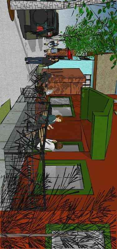
Public Improvement Concept Plan 33Mikes Pike Pocket Park Concept Illustration
This is a conceptual park that takes advantage of land the City of Flagstaff already owns and currently uses as right-of-way. The existing crisscrossing roadways
here are redundant and do not provide access to property on all sides. This illustration shows how the property could be re-allocated in a way that still allows
travel through this intersection while maximizing the remaining space for a pocket park. This concept may move forward more quickly than others because
beautification funding is currently programmed for improvements at this location.
Features:
A. Some structure may be needed in support of the Army Corps of Engineers’ Rio de Flag Flood Control Project. A manhole is shown for reference. The
current plan is for a sewer syphon in the vicinity of the Mikes Pike Pocket Park. Those plans may change as the project is being finalized. The location
of this necessary public facility should preferably attempt to save the mature tree on the site.
B. Mountain Line currently runs buses north from Butler Avenue to Phoenix Avenue along Kendrick Street. The smaller roadway width for Kendrick Street
still allows buses to move through the site based on model runs. A 60-foot articulated bus was tested through the shown design and worked. The
roadway widths should be minimized while allowing the chosen design vehicle to move through the area.
C. The angled parking with the hatch over it represents an optional parking concept. This park could be designed to have no net loss in public parking
managed by ParkFlag. The design as shown adds ten new parking spaces and loses eight others for a net gain of two. The number of spaces provided
for the public may vary based on final park design and how the City wants to balance the need for park space with parking. Eliminating the parking
shown in this area would add approximately 1,000 square feet of usable park space, a 15 percent increase.
D. The design shown shifts an existing driveway to still provide access to adjacent private property without interrupting the park. At the time of final
design or parcel redevelopment, the City should work with the property owner to determine the access needs of the parcels.
E. Final programming or landscape design of a park in this location is open to further technical review and public involvement. Active components,
while also creating a green space for respite, are desired. One possible theme idea is to celebrate Mikes Pike’s Route 66 heritage with amenities
replicating transportation of the early days of Route 66.
34 Public Improvement Concept PlanMikes Pike Pocket Park Concept Illustration
P ike
k es
Mi
C
E
A
D
C
Ben
ton
Ave
B
St
ck
dri
SCALE: 1"=30'
Ken
0 15 30
Public Improvement Concept Plan 35Rio/Ellery Street Green Space Concept Illustration
This park takes advantage of the widest piece of land along the Rio de Flag that the City of Flagstaff already owns. It is centrally located for access to the parts
of the neighborhood south of Butler Avenue. The land is currently used for parking access, stormwater conveyance, and roads,. The design as shown can only
happen after a flood control project is implemented because the entire park is within the floodway. The Rio de Flag channel through the Southside will no
longer be the main channel after a flood control project. In this document, this conveyance is referred to as the Little Rio de Flag or Little Rio. It will remain an
important feature for conveyance of local stormwater.
Features:
A. A wall is shown at the northern edge of the site to allow gradual grading south of the Little Rio, and to provide more usable space. Vertical faces could
evaluate permeable materials during final design.
B. The flowline of the Little Rio should incorporate native flora per Regional Plan policies and stormwater practices.
C. The hatched green area represents a landscaped area (not necessarily turf ). This area could include community gardens, native wash-inspired plants,
pollinator space and possibly some grass depending on the availability of supplemental water.
D. The park is designed to invite exploration and contemplation through unstructured use. Public art and interpretive panels could extend people’s stay
within the park, and could highlight the neighborhood’s history and historical figures. Paths away from the alley could evaluate aggregate surfaces
during final design.
E. Walls between the street and the park should remain short enough so that all areas of the park remain highly visible and therefore do not invite illicit
activity.
F. The City may be able to modify or replace the box culvert to the west to provide additional parking, if the creation of visual barriers between the park
and surrounding activity can be avoided.
G. Ellery Street could be converted to an alley for this block to provide more park space and manage parking. This would eliminate public on-street
parking. Other considerations may include fire access, parking management, and stormwater conveyance.
H. Continued use of private parking on City-owned land is shown. The design should evaluate the needs of property owners and the possibility of
bending the proposed alley into City parcel to expand park space.
I. Sidewalk shown along the park could eventually extend further. See the Curb, Gutter and Sidewalk Concept Illustration for more information.
J. The City could consider purchasing adjacent vacant parcels to expand the park or provide additional parking to this area.
K. Consider a sidewalk that is flush with the alley to help create adequate hardscape-width for fire code compliance. Final design could evaluate
permeable pavement and sidewalk options.
36 Public Improvement Concept PlanRio/Ellery Street Green Space Concept Illustration
I
El
le
ry
J
Av
e
B A
C
D
t
iz S
G
ass
E
Ag
St
H
de
F
Ver
K
SCALE: 1"=40'
0 20 40
Public Improvement Concept Plan 37Example Rio Green Space with Trail Concept Illustration
This is an example of an opportunistic linear park feature. An opportunistic
design like this is not a guarantee as no funding is currently available and
no agreement exists among property owners to give rights to the public for Ben
ton
access. However, public input was split between people who wanted to see Ave
a similar design along the entire path of the Little Rio de Flag and those who
did not want any design because of concerns about vagrancy, trash, safety,
and trespassing.
Re-grading and adding a path adjacent to the Rio de Flag anywhere along
its length is very challenging unless this area is no longer a FEMA floodway. A
Eliminating the floodway will require completion of a flood control project.
This illustration demonstrates how a redevelopment or group of willing
property owners in the block between Butler Avenue and Benton Avenue
could work with the City to incorporate this design. The concept could be
applied in numerous other blocks in the Southside.
In the case of this block, the City would need to obtain easements for all
four properties that face South San Francisco Street and the northernmost
property along Leroux Street. The design, as shown, would require moving
B
the current access, solid waste disposal and parking in the existing alley.
Other blocks in the neighborhood have more complexities such as the City
Flag
not owning an alley nearby or the Rio de Flag splitting properties in half.
Extensive legwork and property owner cooperation would be needed to
io de
create a green space with stable slopes and adequate space for a path.
le" R
Features:
"Litt
A. A multi-use path is located along one side of the green space to
allow maximum space for stable slopes and water conveyance.
B. The wash could be graded with stable slopes and native wash
vegetation could be added alongside some trees for shade.
C
C. This green space would invite more interaction and create larger,
St
sco
connected, public/green spaces if it is able to be connected to other
nci
public spaces. Consider design elements that celebrate the heritage
Fra
of Southside.
Butle
r Av
San
e
SCALE: 1"=50'
0 25 50
38 Public Improvement Concept PlanLone Tree Overpass Larger Park Concept Overview
The Lone Tree Overpass Project will require the City to purchase private properties and relocate businesses and residents for construction of the new road
alignment. Some businesses may be relocated outside of the neighborhood and some businesses may be relocated to adjacent available land along the
corridor if the size is suitable. After relocations are considered, land may be available for open space or a developed City park.
This park concept is the largest expected public space in the Southside neighborhood. However, it is also the most awkward to access. Careful design is
necessary to ensure this park stays active and comfortable and does not turn into an area that invites illicit activity. The community has expressed a desire for
landscaping that allows for active and passive recreation and creates “eyes on the park” as a form of passive surveillance. The community wants a design that
turns an overpass that could be a detraction into a community attraction.
The designs for the overpass are not complete and there are many factors that could influence how much land could be useable for a public park space. Two
scenarios are demonstrated in the plan based on a significant factor that may change. The railroad spur may move from its current location or may stay where
it is currently. This factor could affect the height of the bridge, the design of the structure and the location of any other aspect of the site. Scenario 1 assumes
the spur is moved north to align with the Rio de Flag flood control project and Scenario 2 assumes that the spur remains in its current location and that the
City must work with BNSF for safe access to the usable park space. There are tradeoffs between these two potential futures and these illustrations may help
anticipate those outcomes through the design process.
These illustrations are more conceptual than others. It intends to only give a feel for the potential space available and to ensure discussions on this amenity
continue. Few ideas are drawn because there is too little known.
An example of an active recreational activity located under a road. (photo credit: “Under the
An example of an “under-road” park in San Diego, CA (photo credit: Creative Commons Bridge” by wvs is licensed under CC BY-NC 2.0)
“Chicano Park Murals” by kellinahandbasket is licensed under CC BY 2.0)
Public Improvement Concept Plan 39You can also read