Spire for Third Party Mission Programme - Spire UNCLASSIFIED - COMMERCIAL IN CONFIDENCE - ESA Earth Online
←
→
Page content transcription
If your browser does not render page correctly, please read the page content below

Spire UNCLASSIFIED

       Spire for Third Party Mission Programme

Issue 1, Rev A     COMMERCIAL IN CONFIDENCE
Spire for TPM Programme 2019-2021

Revision History

Rev        Date      Description                              Written By        Approved By

 1A     2020-05-15   Initial Release to Customer              Dan Isaac              DI
                                                              Marcus Tallhamn

(c) 2020 SPIRE GLOBAL LUXEMBOURG; all rights reserved. This document may contain proprietary
       information and may only be released to third parties with the approval of management.

CONFIDENTIAL                                                                     May 15, 2020
                                                                                 Page 2 of 12
Spire for TPM Programme 2019-2021

Contents
1. Introduction                                                                  4

2. Mission Description                                                       5
   2.1. Spire Constellation                                                  5

3. Data Catalogue                                                            6

 CONFIDENTIAL                                                     May 15, 2020
                                                                  Page 3 of 12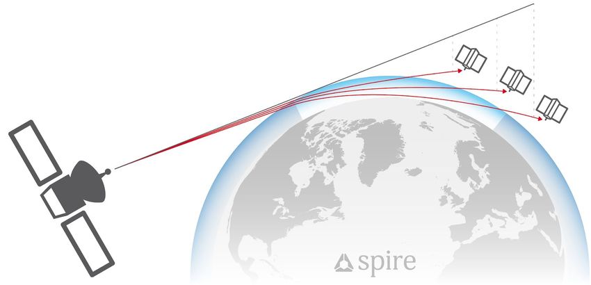
Spire for TPM Programme 2019-2021

1.     Introduction
This document is a guide to describe Spire's earth information mission, the data product catalogue and
data product information provided by Spire Global through the Earthnet programme.

 CONFIDENTIAL                                                                                May 15, 2020
                                                                                             Page 4 of 12
Spire for TPM Programme 2019-2021

2.       Mission Description
2.1. Spire Constellation
Spire Global is a satellite-powered data company that uses a large, distributed constellation of
multi-payload nanosatellites to persistently collect global radio frequency data in near-real-time. The
company leverages proprietary software-defined radio technology to both collect radio frequency signals
and extract information and intelligence from the RF spectrum.

                                             Figure 1 - View of Spire satellite

Spire’s constellation of over 90 satellites, currently in operation, operate in a variety of Low Earth Orbits:

     ●   Equatorial - 4 Satellites
     ●   SSO - 56 Satellites
     ●   51.6 degrees inclination - 33 Satellites
     ●   83/85 degrees inclination - 4 Satellites
     ●   37 degrees inclination - 4 Satellites

Spire satellites are equipped with the following sensors:

     ●   Automatic Identification System (AIS)
     ●   Automatic Dependent Surveillance-Broadcast (ADS-B)
     ●   Global Navigation Satellite System Earth Observation (GNSS-EO)

Data is downloaded from each spacecraft through Spire’s own global ground station network. Spire uses
this ‘raw data’ to produce high-value information products.

 CONFIDENTIAL                                                                                      May 15, 2020
                                                                                                   Page 5 of 12
Spire for TPM Programme 2019-2021
3. Data Catalogue
The following table provides a description of Spire’s data products as furnished for the EO TPM
programme:
Table 1 - Data Catalogue
AIS Data
The automatic identification system (AIS) is an automatic tracking system
that uses transponders on ships and is used by vessel traffic services. Spire
data includes satellite AIS (S-AIS) as observed by Spire satellites and
terrestrial AIS (T-AIS) from third party sensor stations.
High-level description
Spire AIS data can be served as a ‘live’ stream: Global AIS messages
(estimated today to be 40 million messages/day) pushed to the end-user. Or
as historic data, dating back to December 2018.
Spire has different AIS payload variants onboard the LEMUR2 satellites.
These are all SDRs capable of receiving AIS messages according to ITU-R
M.1371-5. They are fed by a near omni-directional dipole and support
operation on all four designated channels, one pair at a time depending on
satellite tasking:
Sensor technical details ● AIS 1 and AIS 2 channels at 161.975 MHz and 162.025 MHz), or
● long-range AIS channels at 156.775 MHz and 156.825 MHz.
Received messages are augmented with metadata, including a timestamp
and reception channel, and later downlinked to the ground segment in a
compressed format.
Near global
Coverage
[Currently circa]
Satellite-AIS: Up to 1 GB compressed
Terrestrial-AIS: Up to 10 GB compressed
Daily Data Size
As the Spire fleet of satellites grows, the volume of data will increase
accordingly.
.parquet.gz files
The AIS files contain both the raw NMEA message and added
Content post-processing data for each message. Data is presented in a
GZIP-compressed file - PARQUET format and contains time-series data on
received AIS messages.
See the following specifications on AIS messages format:
https://gpsd.gitlab.io/gpsd/AIVDM.html
Data Format
https://www.navcen.uscg.gov/?pageName=AISmain
CONFIDENTIAL May 15, 2020
Page 6 of 12Spire for TPM Programme 2019-2021
Information on field names and field types can be provided upon request.
Historic AIS: S3 API
Method of delivery to
Category-1 user Live AIS: Messages API
Graphic/Image
Important note to users: Data points in blue correspond to S-AIS. Data
points in white are T-AIS. Data in red corresponds to Dynamic AIS which is
not included in the catalogue (only available commercially).
Automatic Dependent Surveillance - Broadcast (ADS-B) Data
Automatic Dependent Surveillance-Broadcast (ADS–B) is a surveillance
technology in which an aircraft determines its position via satellite
navigation and periodically broadcasts it, enabling it to be tracked. Spire
data includes satellite ADS-B as observed by Spire satellites.
High-level description
Spire ADS-B data can be served as a ‘live’ stream, global ADS-B messages
pushed to the end-user, or as historical data, dating back to December
2018.
Spire ADS-B payload receives 1090 MHz Mode-S Extended Squitter
messages (DF17 and DF18) using SDR receiver on board of LEMUR2
satellites. The receiving antenna is a directional patch antenna with circular
Sensor technical details polarisation. The messages are received and stored in real time and time
stamped by a clock synchronised from ground.
Near global
Coverage
[Currently circa] 800MB
Daily Data Size As the Spire fleet of satellites grows, the volume of data will increase
accordingly.
CONFIDENTIAL May 15, 2020
Page 7 of 12Spire for TPM Programme 2019-2021
.csv.gz files
The decompressed csv file contains a list of hexadecimal representations of
Content ADS-B messages associated with the timestamp they were received on the
satellite.
Historical format: Target Update data is presented in GZIP-compressed
CSV files.
Live format: Target Update message
Data Format
Time: UTC timestamp of when the message was received (seconds from
epoch)
Method of delivery to Historical ADS-B: S3 API
Live ADS-B: Streaming API
Category-1 user
Graphic or image
GNSS-Radio Occultation (GNSS-RO) Data
Atmospheric radio occultation (RO) relies on the detection of a change in a
radio signal as it passes through a planet's atmosphere, i.e. as it is refracted
by the atmosphere. GNSS radio occultation (GNSS-RO) is a type of radio
occultation that harnesses the radio transmissions from Global Navigation
Satellite System satellites, such as GPS or Galileo.
High-level description
Spire satellites perform GNSS-RO measurements on a continuous basis,
globally, thus allowing researchers to have a global image of the Earth’s
atmospheric properties. Spire can provide RO data up to 30 days old or
greater than 30 days old.
Currently, the main Earth observation instrument is the Spire STRATOS
GNSS receiver instrument. It is an advanced, science-grade GNSS
receiver, leveraging previous GNSS-RO receiver designs worldwide. It is
Sensor technical details an open loop L1, L2 receiver, utilizing less than 4 watts, with three RF
inputs to allow both setting and rising occultation observations. This
state-of-the-art receiver collected the first GNSS-RO profile by a commercial
company, as well as the first open loop profile by a commercial company. It
CONFIDENTIAL May 15, 2020
Page 8 of 12Spire for TPM Programme 2019-2021
can collect from multiple GNSS constellations, including GPS, Galileo,
GLONASS, and QZSS. The receiver tracks, on average, five-six dual
frequency GPS signals for precision orbit determination (POD) at 1 Hz, as
well as multiple simultaneous GNSS satellites at 50 Hz (rising or setting) for
the GNSS-RO measurements.
Global
Coverage
A- POD Observation
podObs*.rnx files
This file contains raw pseudorange, carrier phase, Doppler frequency, and
signal-to-noise measurements for each observed GPS signal from a single
Spire satellite. Data is currently output every second in time. These
measurements are used to estimate the positions and velocities of each
Spire satellite and also used to derive ionospheric total electron content
data.
Content
leoOrb*.sp3 files
This file contains the estimated position, velocity and receiver clock error of
a given Spire satellite after processing of the POD observation file by the
precise orbit determination software. The length of the file is typically at
least 45 minutes long and thus, will overlap with multiple occultation events.
podObs*.rnx files
Data is presented in standard RINEX format (version 3.02). An example of
RINEX version 3.02 format is shown below. The header contains such
information as the satellite number, relevant antenna data, and GNSS
observation types. The observations corresponding to each GNSS
observational type for each time epoch are presented after the header.
More information on formatting can be found in the RINEX: The Receiver
Independent Exchange Format Version 3.02 document.
leoOrb*.sp3 files
Format The data are given in standard sp3 format
(ftp://igs.org/pub/data/format/sp3_docu.txt). Under each time epoch, there
are two lines beginning with ‘P’ and ‘V’. The first three values in the ‘P’ line
contain the XYZ position coordinates with units of kilometers in a given
orbital frame (‘IGS08’ as shown in the header in this example). The fourth
value in the ‘P’ line refers to the estimated receiver clock error from true
GPS time given in microseconds. The XYZ velocity coordinates are given in
the ‘V’ line in units of decimeters/sec. The final value of the ‘V’ line refers to
the estimated receiver clock error rate of change in units of 10-4
microseconds/sec, which is normally not estimated from the precise orbit
determination software and thus set to 999999.999999.
CONFIDENTIAL May 15, 2020
Page 9 of 12Spire for TPM Programme 2019-2021
[Currently circa] 300MB-1GB
Average Daily Data Size As the Spire fleet of satellites grows, the volume of data will increase
accordingly.
B- Satellite Attitude Information
leoAtt*.log files
File contains 1 Hz rate quaternion information measured from a single Spire
satellite. Quaternion information is necessary to convert between the
Content spacecraft-fixed body frame to the orbit local level frame defined in the
header. This essentially describes the orientation of the satellite. Each time
epoch contains one single quaternion.
Attitude data are presented in an ASCII format adopted by CDAAC for
COSMIC data.
Format http://cdaac-www.cosmic.ucar.edu/cdaac/cgi_bin/fileFormats.cgi?type=leoAtt
[Currently circa] 5MB - 100MB
Average Daily Data Size As the Spire fleet of satellites grows, the volume of data will increase
accordingly.
C- High-Rate Occultation Observation (RO)
opnGns*ro.bin, opnGns*rst.bin files
File contains raw carrier phase measurements and open-loop model
information obtained during an occultation event at 50 Hz sampling. This file
can either contain raw measurements from the occulting satellite signal or
the reference satellite signal, which is necessary to mitigate the effects of
receiver clock error (see “Excess Phase Processing”). Each file contains
Content measurements pertaining to only one signal frequency/type (i.e. GPS L1 vs.
GPS L2). In general, for a given successful occultation event observed on a
single Spire satellite, there should be two files containing raw
measurements from the occulting GNSS satellite (one for each signal
frequency) and two or more files containing raw phase data from one or
more reference GNSS satellites.
Data are presented in ‘opnGps’ format, which is a binary format created by
the CDAAC for processing COSMIC radio occultation data. More
Format information on this format can be found at:
http://cdaac-www.cosmic.ucar.edu/cdaac/cgi_bin/fileFormats.cgi?type=opnGps
[Currently circa] 50MB - 1GB
Average Daily Data Size
As the Spire fleet of satellites grows, the volume of data will increase
CONFIDENTIAL May 15, 2020
Page 10 of 12Spire for TPM Programme 2019-2021
accordingly.
D- Atmospheric Profiles
atmPrf*.nc files
The file contains profiles of atmospheric dry pressure, dry temperature and
neutral refractivity as a function of altitude produced from full processing of
one occultation event. In addition to that the NetCDF file aggregates almost
all outputs of RO processing: metadata, impact parameter, bending angle,
standard deviation of bending angle, perigee point geolocation, RO azimuth
Content angle, etc. atmPrf*.nc files can be considered as a replacement for BUFR
files because it contains all the data stored in BUFR files and more.
bfrPrf*.bufr files
Each BUFR file contains derived profiles of dry pressure, dry temperature,
refractivity and bending angle for each occultation.
atmPrf*.nc files
The data are presented in standard netCDF using the format defined for
COSMIC atmospheric profiles
(https://cdaac-www.cosmic.ucar.edu/cdaac/cgi_bin/fileFormats.cgi?type=at
mPrf).
Format bfrPrf*.bufr files
Each file is in standard BUFR format, which is used by almost all
operational meteorological services for assimilation of observational data
into weather models. More information on the BUFR file format can be
found in WMO FM94 (BUFR) Specification For Radio Occultation Data
Version 2.4.
[Currently circa] 5MB - 100MB
As the Spire fleet of satellites grows, the volume of data will increase
Average Daily Data Size accordingly.
Near global coverage.
Additional information
Method of delivery to
Up to 30 days RO and >30 days RO: S3 API
Category-1 user
CONFIDENTIAL May 15, 2020
Page 11 of 12Spire for TPM Programme 2019-2021
Graphic/Image
End of Document
CONFIDENTIAL May 15, 2020
Page 12 of 12You can also read