DOH 4 Restoration Status Update for Commission Mtg (Period Covered November 2018 to May 2019)
←
→
Page content transcription
If your browser does not render page correctly, please read the page content below
DOH 4 Restoration Status Update for Commission Mtg (Period Covered
November 2018 to May 2019)
The purpose of the Year 1 of this DOH Project is to reduce the Non-Point Source Pollutant
“Excessive Sedimentation” along with habitat restoration in Hakioawa Watershed. In August
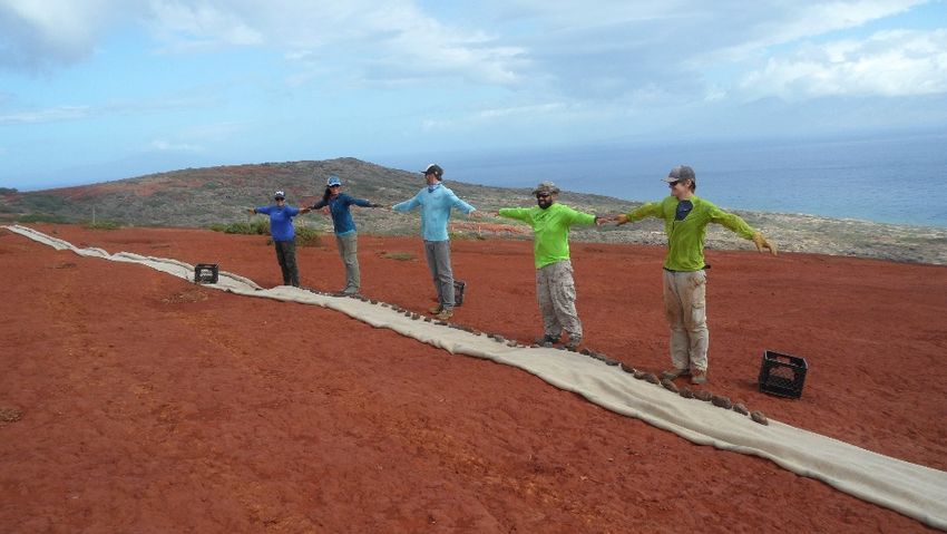
2018 work began in the 15ha (37A) Project Site. From November 2018, to May 2019, 161
volunteers have contributed 2450 hours of time to help with wattle construction and outplantings
of native grasses and shrubs. Located in Tier I (surface cleared) 6,782 plants (of 10,000 total)
have been placed in corridors built along the contours of the landscape. Burlap fabric is laid out
and rocks are placed into the wattle and then rolled up. A combination of native reclaimed soil,
Black Gold potting mix and Sunshine Mix #4, is spread above the wattle as a raised soil bed for
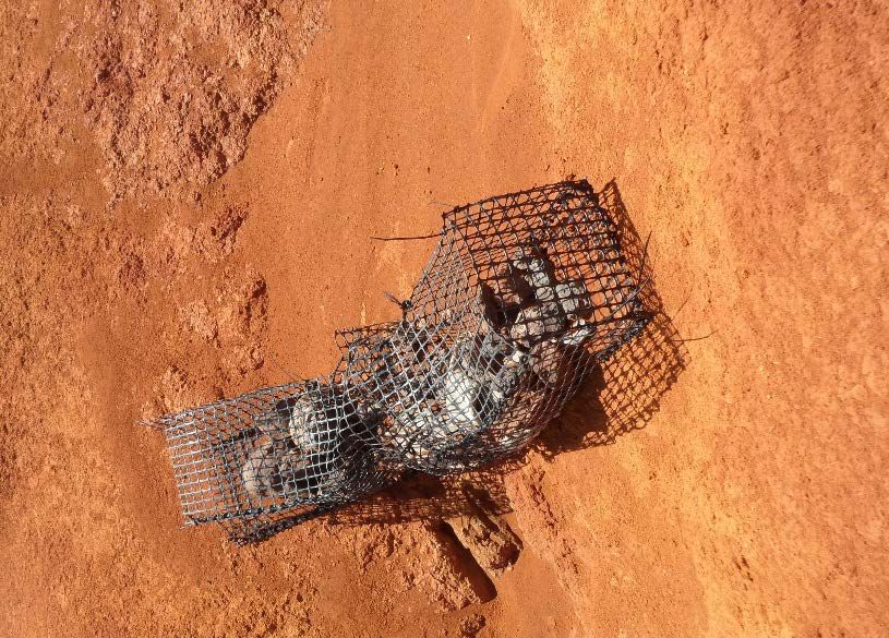
the plants, and irrigation lines are laid out for the delivery of water. Gabions (geotextile baskets
filled with rocks to act as check dams) have been constructed in the Project Site and have begun
to capture soil after rains.
A water level meter has been placed at the 75 foot elevation in Hakioawa Stream to record stage,
or height of the water when the stream flows during rain events. This measuring device recorded
between October 2018 and May 2019. The results will be correlated to the rainfall recorded
during this time period. Five vegetation plots will be read in June 2019 to determine plant
species presence and percentage of coverage after restoration. Eight soil erosion pin transects
were read once in November 2018 and will be re-measured in June 2019 to detect a difference in
erosion rates between bare hardpan soils with and without restoration.
Baseline photopoints and drone images were initially taken in September and October 2018 and
will be retaken in July 2019 to detect a difference in the vegetation. A Non-Point Source
Brochure describing the Best Management Practices used in the Project Site was developed (see
attached).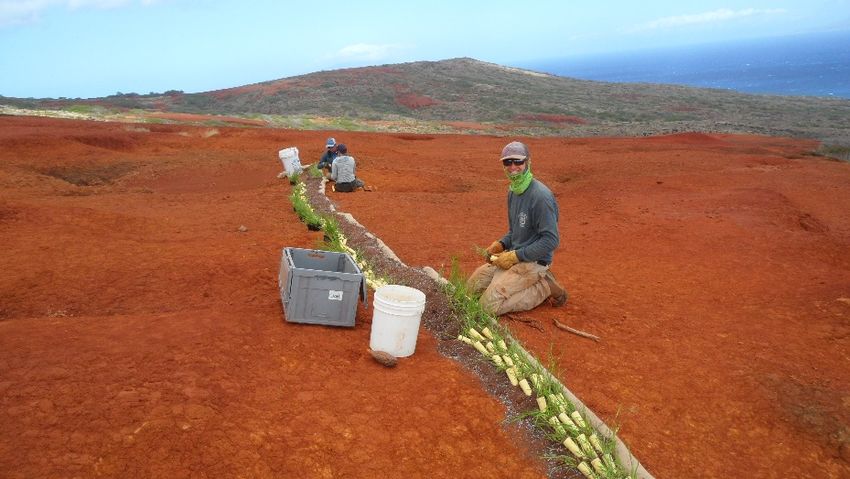
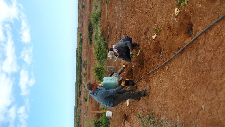
Volunteers rolling up a wattle with burlap fabric and rocks

Planting pili grass in the soil mixture in the wattle corridor
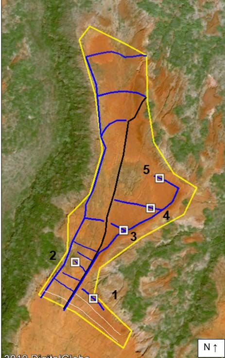
Gabion capturing sediment after a rain event

Map of Project Site wattles (blue) and planting corridors along contours and five vegetation plots
(white squares).
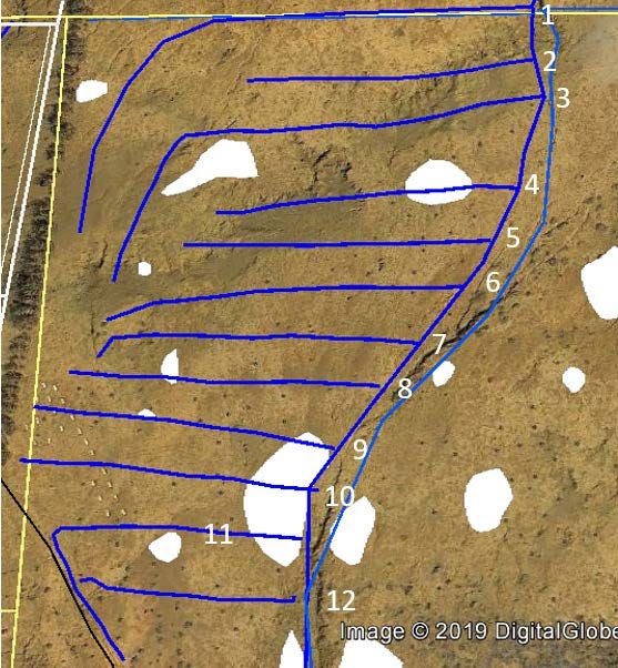
CIP Restoration Project Status Update

The CIP Dryland Forest Project was designed to outplant 14,800 native shrubs, trees, and grasses
in Kamōhio Watershed to establish native plants and help mitigate soil erosion. From November
2018 to May 2019 a total of 11,500 native plants have been placed along 12 irrigation lines in a
10ha (25A) Project Site. A 1.5” main line was brought 0.8 miles from Tanks 1 and 2, to feed the
irrigation lines totaling 2100m (6900 feet) in length. Plants were placed in holes dug with an
auger every 1m with fertilizer and kiawe mulch. Another 14,800 plants will be placed on
irrigation in a second 10ha (25A) section of the Dryland Forest Project Site beginning in Fall
2019.

Planting along Line 1 in the Project Site area
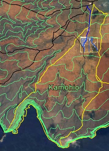
Map of Irrigation Lines (blue) in Zone A of the 25A Project Site

Area of Dryland Forest Project Site in Kamōhio Watershed on Kahoʻolawe
You can also read