INITIAL STUDY/ NEGATIVE DECLARATION - PUBLIC REVIEW DRAFT KENT PROPERTY GENERAL PLAN AMENDMENT AND REZONING 6207 SIERRA COURT, DUBLIN, CALIFORNIA ...
←
→
Page content transcription
If your browser does not render page correctly, please read the page content below
PUBLIC R E V I E W D R A F T

          I N I T I A L S T U DY/
    N E G AT I V E D E C L A R AT I O N

                  K E N T PR OPER TY
G E N E R A L PLAN A M E N D M E N T A N D R E Z O N I N G
 6207 S I E R R A C O U R T, D U B L I N , CALIF OR NIA

                      January 2021
This page intentionally left blank
PUBLIC R E V I E W D R A F T

          I N I T I A L S T U DY/
    N E G AT I V E D E C L A R AT I O N

                  K E N T PR OPER TY
G E N E R A L PLAN A M E N D M E N T A N D R E Z O N I N G
 6207 S I E R R A C O U R T, D U B L I N , CALIF OR NIA

                      Submitted to:

             Robert Smith, Associate Planner
                     City of Dublin
                     100 Civic Plaza
                Dublin, California 94568

                      Prepared by:

                            LSA
                      157 Park Place
              Pt. Richmond, California 94801
                       510.236.6810

               LSA Project No. DUB1601.01
          City Application No. PLPA‐2019‐00002

                      January 2021
This page intentionally left blank
PUBLIC REVIEW DRAFT
                                                                             KENT PROPERTY GENERAL PLAN AMENDMENT AND REZONING
INITIAL STUDY/NEGATIVE DECLARATION
                                                                                                             DUBLIN, CALIFORNIA
JANUARY 2021

                                                        TABLE OF CONTENTS

TABLE OF CONTENTS ............................................................................................................................... i
FIGURES AND TABLES ............................................................................................................................. ii
LIST OF ABBREVIATIONS AND ACRONYMS ............................................................................................ iii
1.0 PROJECT INFORMATION ................................................................................... 1‐1
2.0 ENVIRONMENTAL FACTORS POTENTIALLY AFFECTED ........................................ 2‐1
        2.1      Determination ................................................................................................................... 2‐1
3.0 CEQA ENVIRONMENTAL CHECKLIST .................................................................. 3‐1
        3.1      Aesthetics .......................................................................................................................... 3‐1
        3.2      Agriculture and Forestry Resources .................................................................................. 3‐3
        3.3      Air Quality ......................................................................................................................... 3‐6
        3.4      Biological Resources ........................................................................................................ 3‐13
        3.5      Cultural Resources .......................................................................................................... 3‐17
        3.6      Energy.............................................................................................................................. 3‐19
        3.7      Geology and Soils ............................................................................................................ 3‐22
        3.8      Greenhouse Gas Emissions ............................................................................................. 3‐27
        3.9      Hazards and Hazardous Materials .................................................................................. 3‐31
        3.10     Hydrology and Water Quality ......................................................................................... 3‐35
        3.11     Land Use and Planning .................................................................................................... 3‐39
        3.12     Mineral Resources........................................................................................................... 3‐42
        3.13     Noise................................................................................................................................ 3‐43
        3.14     Population and Housing .................................................................................................. 3‐46
        3.15     Public Services ................................................................................................................. 3‐48
        3.16     Recreation ....................................................................................................................... 3‐50
        3.17     Transportation ................................................................................................................ 3‐51
        3.18     Tribal Cultural Resources ................................................................................................ 3‐54
        3.19     Utilities and Service Systems........................................................................................... 3‐56
        3.20     Wildfire ............................................................................................................................ 3‐58
        3.21     Mandatory Findings of Significance ................................................................................ 3‐60
4.0 LIST OF PREPARERS .......................................................................................... 4‐1
5.0 REFERENCES ..................................................................................................... 5‐1

P:\DUB1601.01 Kent Property GPA\PRODUCTS\CEQA\Public Review Draft\KentGPA_Public Review Draft ISND.docx (01/04/21)                                        i
PUBLIC REVIEW DRAFT
KENT PROPERTY GENERAL PLAN AMENDMENT AND REZONING
INITIAL STUDY/NEGATIVE DECLARATION
DUBLIN, CALIFORNIA
JANUARY 2021
FIGURES AND TABLES
FIGURES
Figure 1: Regional Location ................................................................................................................. 1‐2
Figure 2: Aerial View of the Project Site and Surrounding Uses ......................................................... 1‐3
Figure 3: General Plan Land Use Designations ................................................................................... 1‐4
TABLES
Table A: Development Regulations ..................................................................................................... 1‐6
Table B: Adjacent Land Uses ............................................................................................................... 1‐7
Table C: Potential Change in Trip Generation................................................................................... 3‐52
ii P:\DUB1601.01 Kent Property GPA\PRODUCTS\CEQA\Public Review Draft\KentGPA_Public Review Draft ISND.docx (01/04/21)PUBLIC REVIEW DRAFT
KENT PROPERTY GENERAL PLAN AMENDMENT AND REZONING
INITIAL STUDY/NEGATIVE DECLARATION
DUBLIN, CALIFORNIA
JANUARY 2021
LIST OF ABBREVIATIONS AND ACRONYMS
AAQS Ambient Air Quality Standards
AB Assembly Bill
ABAG Association of Bay Area Governments
ACDEH Alameda County Department of Environmental Health
ACFD Alameda County Fire Department
APN Assessor’s Parcel Number
BAAQMD Bay Area Air Quality Management District
Basin Plan Water Quality Control Plan
CalFire California Department of Fire and Forestry Protection
CALGreen California Green Building Standards Code
C‐2 General Commercial
CAP 2030 City of Dublin Climate Action Plan 2030 and Beyond
CBC California Building Code
CDMG California Department of Mines and Geology
CEC California Energy Commission
CEQA California Environmental Quality Act
CH4 Methane
City City of Dublin
Clean Air Plan Bay Area Air Quality Management District 2017 Clean Air Plan
CNEL Community Noise Equivalent Level
CO carbon monoxide
CO2 Carbon dioxide
CO2e CO2 equivalents
P:\DUB1601.01 Kent Property GPA\PRODUCTS\CEQA\Public Review Draft\KentGPA_Public Review Draft ISND.docx (01/04/21) iiiPUBLIC REVIEW DRAFT
KENT PROPERTY GENERAL PLAN AMENDMENT AND REZONING
INITIAL STUDY/NEGATIVE DECLARATION
DUBLIN, CALIFORNIA
JANUARY 2021
CPUC California Public Utilities Commission
CUPA Certified Unified Program Agency
dB decibel
dBA A‐weighted (sound level) decibels
DMC Dublin Municipal Code
ECOS Environmental Conservation Online System
EFZs Earthquake Fault Zones
FAR Floor Area Ratio
FEMA Federal Emergency Management Agency
GHG Greenhouse gas
GPA General Plan Amendment
GWP Global Warming Potential
HFCs Hydrofluorocarbons
I‐680 Interstate 680
I‐580 Interstate 580
IS/ND Initial Study/ Negative Declaration
LID Low Impact Development
LUST Leaking Underground Storage Tank
M‐1 Light Industrial
MMI Modified Mercalli Index
MRP San Francisco Bay Regional Water Quality Control Board Municipal Regional Permit
N2O Nitrous oxide
NAHC California Native American Heritage Commission
NO2 nitrogen dioxide
iv P:\DUB1601.01 Kent Property GPA\PRODUCTS\CEQA\Public Review Draft\KentGPA_Public Review Draft ISND.docx (01/04/21)PUBLIC REVIEW DRAFT
KENT PROPERTY GENERAL PLAN AMENDMENT AND REZONING
INITIAL STUDY/NEGATIVE DECLARATION
DUBLIN, CALIFORNIA
JANUARY 2021
NOx Nitrogen oxide
NPDES National Pollutant Discharge Elimination System
O3 ozone
OPR Office of Planning and Research
Pb lead
PFCs Perfluorocarbons
PM particulate matter
PM10 respirable particulate matter
PM2.5 fine particulate matter
POTWs publicly owned treatment works
PPV peak particle velocity
ROG Reactive organic gases
SCP Stormwater Control Plan
SF6 Sulfur Hexafluoride
SLIC spills, leaks, investigations, and cleanups
SO2 sulfur dioxide
SRA State responsibility area
SWRCB State Water Resources Control Board
SWPPP Storm Water Pollution Prevention Plan
TACs toxic air contaminants
TCE trichloroethylene
USFWS United States Fish and Wildlife Service
VMT vehicle miles traveled
Water Board San Francisco Bay Regional Water Quality Control Board
P:\DUB1601.01 Kent Property GPA\PRODUCTS\CEQA\Public Review Draft\KentGPA_Public Review Draft ISND.docx (01/04/21) vPUBLIC REVIEW DRAFT
KENT PROPERTY GENERAL PLAN AMENDMENT AND REZONING
INITIAL STUDY/NEGATIVE DECLARATION
DUBLIN, CALIFORNIA
JANUARY 2021
This page intentionally left blank
vi P:\DUB1601.01 Kent Property GPA\PRODUCTS\CEQA\Public Review Draft\KentGPA_Public Review Draft ISND.docx (01/04/21)PUBLIC REVIEW DRAFT
KENT PROPERTY GENERAL PLAN AMENDMENT AND REZONING
INITIAL STUDY/NEGATIVE DECLARATION
DUBLIN, CALIFORNIA
JANUARY 2021
1.0 PROJECT INFORMATION
1. Project Title:
Kent Property General Plan Amendment and Rezoning (City Application No. PLPA‐2019‐00002)
2. Lead Agency Name and Address:
City of Dublin Community Development Department
100 Civic Plaza
Dublin, CA 94568
3. Contact Person and Phone Number:
Robert Smith, Associate Planner
(925) 833‐6610
Robert.Smith@dublin.ca.gov
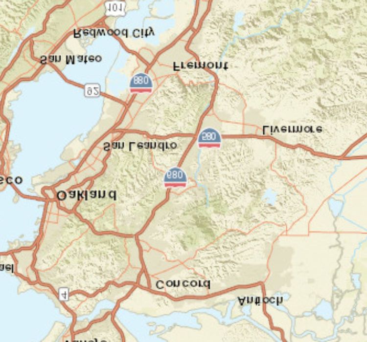
4. Project Location:
The project site is located at 6207 Sierra Court at the northeast corner of Dublin Boulevard and
Sierra Court in Dublin, Alameda County, California (Assessor’s Parcel Number [APN] 941‐0205‐
13‐4). Regional access to the project site is provided by Interstates 580 (I‐580) and 680 (I‐680),
which are located approximately 0.5‐mile south and west of the project site, respectively. Local
access to the project site is provided by Sierra Court. Figure 1, on Page 1‐2, depicts the regional
and local context of the project site. Figure 2, on Page 1‐3, is an aerial view of the project site
and its vicinity.
5. Project Sponsor’s Name and Address:
City of Dublin Community Development Department
100 Civic Plaza
Dublin, CA 94568
6. Existing General Plan Designation:
Business Park/Industrial
7. Existing Zoning:
M‐1 (Light Industrial)
8. Description of Project:
Existing Use. The project site consists of an approximately 1.5‐acre (66,122‐square‐foot)
property located at 6207 Sierra Court in the City of Dublin. The site is currently developed with
an existing 16,117‐square‐foot one‐story building that includes an existing commercial use. The
site is currently designated Business Park/Industrial in the City’s General Plan and is within the
M‐1 (Light Industrial) zoning district. The existing General Plan land use designations for the
project site and surrounding properties are shown on Figure 3, on Page 1‐4.
P:\DUB1601.01 Kent Property GPA\PRODUCTS\CEQA\Public Review Draft\KentGPA_Public Review Draft ISND.docx (01/04/21) 1‐1Project Site
Project Location
FIGURE 1
Kent Property General Plan Amendment
Dublin, Alameda County, California
0 500 1000
Regional Location
FEET
SOURCE: ESRI World Street Map (03/20).
I:\DUB1601\GIS\Maps\Figure 1_Regional Location.mxd (9/4/2020)lv
d
B
ley
Val
n Dr
ad or
Am
Pen
or
Y
kD VALLEY HIGH SCHOOL
r Trin
ity C
ourt
rt
Cou
Dougherty Rd
il
ra
n
l Tra
Sier
ce L
SINGLE-FAMILY MEDIUM-HIGH
Spru
C an a
Ma
RESIDENTIAL DENSITY RESIDENTIAL
ple D r
Ceda
r Ln
RETAIL
o
Alam
BUSINESS PARK/
Vil
Houston Pl
lag
Eben
sbur INDUSTRIAL
g Ln
eP
kw
y
Dublin Blv COMMERCIAL
d Dublin Blvd
S ie r r a L a n e
Ba
ntr
ee
Adar
COMMERCIAL
Ba
Dr
yS
680 ge
e Ln
lla
t
e
Vi
k Av
ee
al
BUSINESS PARK/ Tr
Clar
INDUSTRIAL DUBLIN Dubl
CIVIC in Bl BUSINESS PARK/
z vd
a
CENTER la INDUSTRIAL/STORAGE
ic P
Civ
DUBLIN SPORTS GROUNDS RETAIL
DUBLIN
LIBRARY
580
Do
ug
he
rty
il
Tra
Rd
ial
nn
nte
Ce
FIGURE 2
0 300 600 Project Site
FEET
Kent Property General Plan Amendment
SOURCES: Google Earth, 6/20/19; LSA, 2020 Aerial View of the Project Site and Surrounding Land Uses
P:\DUB1601.01 Kent Property GPA\PRODUCTS\Graphics\Figure 2.ai (9/1/2020)Legend
General Plan Land Use
Parks/ Public Recreation
Open Space
Stream Corridor
Public Lands
Public / Semi-Public
Semi-Public
Downtown Dublin - Village Parkway District
Downtown Dublin - Transit-Oriented District
Downtown Dublin - Retail District
Dublin Crossing
General Commercial
Retail/Office
Retail/Office and Automotive
Neighborhood Commercial
General Commercial/Campus Office
Campus Office
Industrial Park
Business Park/Industrial
Business Park/Industrial and Outdoor
Storage
Mixed Use
Mixed Use 2/Campus Office
Medical Campus
Medical Campus / Commercial
Rural Residential/Agriculture (1 Unit per 100
Gross Residential Acres)
Medium/High-Density Residential and Retail
Office
Estate Residential (0.01 - 0.8 du/ac)
Low-Density Single Family (0.5 - 3.8 du/ac)
Single Family Residential (0.9 - 6.0 du/ac)
Medium-Density Residential (6.1 - 14.0
du/ac)
Medium/High-Density Residential (14.1 -
25.0 du/ac)
High-Density Residential (25.1+ du/ac)
This map is based on City of Dublin GIS Informa on and reflects the most current
informa on at the me of this prin ng. The map is intended for reference purposes
only and the City and its staff is not responsible for errors.
2,460 0 1,230 2,460 Feet
FIGURE 3
0 1,230 2,460 Project Site
FEET
Kent Property General Plan Amendment
SOURCE: City of Dublin, 2020 General Plan Land Use DesignaƟons
P:\DUB1601.01 Kent Property GPA\PRODUCTS\Graphics\Figure 3.ai (9/2/2020)PUBLIC REVIEW DRAFT
KENT PROPERTY GENERAL PLAN AMENDMENT AND REZONING
INITIAL STUDY/NEGATIVE DECLARATION
DUBLIN, CALIFORNIA
JANUARY 2021
According to the City’s General Plan, the Business Park/Industrial land use designation allows for
non‐retail businesses (e.g., research, limited manufacturing and distribution activities, and
administrative offices) that do not involve heavy trucking, or generate nuisances due to
emissions, noise or open uses. Permitted floor area ratio (FAR) ranges from 0.30 to 0.40 and the
allowable employee density is 360 to 490 square feet per employee.
The M‐1 zoning district is intended to provide for the continued use, expansion and new
development of light industrial use types in proximity to major transportation corridors and to
ensure compatibility with adjacent residential and commercial uses. Permitted uses in the M‐1
zoning district include ambulance service, laboratory, office, parking lot/garage, light industrial,
printing and publishing, research and development, trucking terminal, warehousing and
distribution, and similar related uses.
Proposed Land Use. The City is initiating a General Plan Amendment (GPA) to change the land
use designation for the site from Business Park/Industrial to Retail/Office and Automotive
representing a natural evolution of land uses and land use changes over time, creating
continuity along Dublin Boulevard between the project site, and neighboring properties to the
east. The site would also be rezoned from M‐1 (Light Industrial) to C‐2 (General Commercial)
consistent with the amended General Plan land use designation. As described above, the project
site is already developed and no new development (i.e., demolition, construction, or change in
site access) is currently proposed.
The Retail/Office and Automotive designation allows general commercial, retail and service
uses and typically includes shopping centers, stores, restaurants, business and professional
offices, motels, service stations, and the sale of auto parts, as well as, automobile/vehicle
sales and service, auto body shops, and similar auto‐focused uses. Permitted FAR ranges from
0.25 to 0.50 and the allowable employee density is 220 to 490 square feet per employee.
The C‐2 zoning district is intended to provide for the continued use, expansion, and new
development of general commercial use types along major transportation corridors and
intersections, and to ensure compatibility with adjacent residential and commercial uses.
With implementation of the GPA and Rezoning, permitted uses for the project site that are not
currently allowed under the existing zoning, would include: adult business establishment (with
Conditional Use Permit [CUP]), banks and financial institutions, building material sales, car
wash/detailing (with CUP), copying and blueprinting, health services/clinics, hotel/motel (with
CUP), hospital/medical center (with CUP), massage establishment, personal services, plant
nursery (with CUP), repair shop, retail‐ general, retail – neighborhood, retail – outdoor storage
(with CUP), retail ‐ service, shopping center, tobacco retailer (with Zoning Clearance) and similar
related uses.
Maximum Development. Table A shows the development regulations that apply to the existing
(M‐1) and proposed (C‐2) zoning districts, as defined in Dublin Municipal Code (DMC) Chapter
8.36.030 Commercial and Industrial Development Regulations.
P:\DUB1601.01 Kent Property GPA\PRODUCTS\CEQA\Public Review Draft\KentGPA_Public Review Draft ISND.docx (01/04/21) 1‐5PUBLIC REVIEW DRAFT
KENT PROPERTY GENERAL PLAN AMENDMENT AND REZONING
INITIAL STUDY/NEGATIVE DECLARATION
DUBLIN, CALIFORNIA
JANUARY 2021
Under the current General Plan and Zoning regulations, the maximum development footprint on
the site could include a 26,448‐square foot, one‐story building, which would generate a
maximum of 73 employees at the maximum employment density (approximately 10,000 square
feet greater than the current use of the site). 1 A taller building would have a smaller
development footprint in accordance with FAR requirements; however, the number of
employees would be the same. Consistent with existing employee density requirements, the
existing building supports approximately 44 employees.2
Table A: Development Regulations
Existing Zoning District Proposed Zoning District
Standard
(M‐1) (C‐2)
Lot Area
Interior Lot 20,000 square feet 6,000 square feet
Corner Lot 20,000 square feet 7,000 square feet
Lot Width and Frontage
Interior Lot 100 feet 50 feet
Corner Lot 100 feet 60 feet
Lot Depth 100 feet 100 feet
Setbacks
Front 10 feet 0 feet
Side 10 feet 0 feet
Street Side 20 feet 0 feet
Rear 20 feet 0 feet
Height Limits 45 feet 45 feet
Source: City of Dublin Municipal Code (2020).
With implementation of the GPA and Rezoning, the maximum allowable development on the
site could include a 33,061‐square foot, one‐story building, which would generate approxim‐
ately 150 employees at the maximum employment density (approximately 16,944 square feet
greater than what currently exists and 6,613 square feet greater than what is currently allowed
on the site).3 A taller building would have a smaller development footprint in accordance with
FAR requirements; however, the number of employees would be the same. Based on the types
of allowable uses under the proposed land use designation, the most intensive uses of the site
may include a shopping center or restaurant. At the maximum employee density, the proposed
project could increase employment at the site by approximately 106 employees.
The analysis in Section 3.0, Environmental Checklist of this Initial Study considers the maximum
development potential that would be allowed under the proposed GPA and rezoning, compared
to existing conditions.
1
66,122 square feet x 0.4 = 26,448 square feet; 26,448/360 = 73 employees
2
16,117/360 = 44 employees
3
66,122 square feet x 0.5 = 33,061 square feet; 33,061/220 = 150 employees
1‐6 P:\DUB1601.01 Kent Property GPA\PRODUCTS\CEQA\Public Review Draft\KentGPA_Public Review Draft ISND.docx (01/04/21)PUBLIC REVIEW DRAFT
KENT PROPERTY GENERAL PLAN AMENDMENT AND REZONING
INITIAL STUDY/NEGATIVE DECLARATION
DUBLIN, CALIFORNIA
JANUARY 2021
Discretionary Approvals. As described above, the City has initiated a GPA to change the land use
designation for the site from Business Park/Industrial to Retail/Office and Automotive, and a
Rezoning of the site from an M‐1 to C‐2 zoning district.
9. Surrounding Land Uses and Setting:
As described above, the project site is currently developed with an existing 16,117‐square‐foot
building that includes an existing commercial use. The remainder of the site consists of paved
parking. Landscaping, including shrubs, turf, and several mature trees, are located along Sierra
Court.
The site is generally surrounded by industrial uses to the north, public/semi‐public uses to the
south, and retail, office, automotive uses to the east and west. Surrounding land uses are shown
in Table B below.
Table B: Adjacent Land Uses
Existing Use Land Use Designation
North Charmet Tile (flooring store Business Park/Industrial
McGoldrick Milling Company Inc. (building materials supplier)
South Dublin Sports Grounds, Dublin Civic Center Parks/Public Recreation
East Dublin City Shopping Center (Sahara Market, Sahara Kabob Grill, Funks Retail/Office and Automotive
Autoworks, Russian School of Mathematics, and Harvey’s Cleaners)
West NAPA Auto Parts (auto parts store) Retail/Office
California Custom Carpets, Inc. (carpet store)
Source: City of Dublin (2020).
10. Other Public Agencies Whose Approval is Required (e.g., permits, financial approval, or
participation agreements):
N/A
11. Have California Native American tribes traditionally and culturally affiliated with the project
area requested consultation pursuant to Public Resource Code section 21080.3.1? If so, is
there a plan for consultation that includes, for example, the determination of significance of
impacts to tribal cultural resources, procedures regarding confidentiality, etc.?
On April 20, 2020, the City provided formal notification to those California Native American
tribes that are traditionally and culturally affiliated with the geographic area within which the
proposed project is located pursuant to the consultation requirements of SB 18 and AB 52. To
date, no tribes have requested consultation pursuant to Public Resources Code section
21080.3.1.
P:\DUB1601.01 Kent Property GPA\PRODUCTS\CEQA\Public Review Draft\KentGPA_Public Review Draft ISND.docx (01/04/21) 1‐7PUBLIC REVIEW DRAFT
KENT PROPERTY GENERAL PLAN AMENDMENT AND REZONING
INITIAL STUDY/NEGATIVE DECLARATION
DUBLIN, CALIFORNIA
JANUARY 2021
This page intentionally left blank.
1‐8 P:\DUB1601.01 Kent Property GPA\PRODUCTS\CEQA\Public Review Draft\KentGPA_Public Review Draft ISND.docx (01/04/21)PUBLIC REVIEW DRAFT
KENT PROPERTY GENERAL PLAN AMENDMENT AND REZONING
INITIAL STUDY/NEGATIVE DECLARATION
DUBLIN, CALIFORNIA
JANUARY 2021
2.0 ENVIRONMENTAL FACTORS POTENTIALLY AFFECTED
The environmental factors checked below would be potentially affected by this project, involving at
least one impact that is a “Potentially Significant Impact” as indicated by the checklist in Section 3.0.
Aesthetics Agriculture and Forestry Resources Air Quality
Biological Resources Cultural Resources Energy
Geology/Soils Greenhouse Gas Emissions Hazards & Hazardous Materials
Hydrology/Water Quality Land Use/Planning Mineral Resources
Noise Population/Housing Public Services
Recreation Transportation Tribal Cultural Resources
Utilities/Service Systems Wildfire Mandatory Findings of Significance
2.1 DETERMINATION
On the basis of this initial evaluation:
I find that the proposed project COULD NOT have a significant effect on the environment, and a
NEGATIVE DECLARATION will be prepared.
I find that although the proposed project could have a significant effect on the environment,
there will not be a significant effect in this case because revisions in the project have been made
by or agreed to by the project proponent. A MITIGATED NEGATIVE DECLARATION will be
prepared.
I find that the proposed project MAY have a significant effect on the environment, and an
ENVIRONMENTAL IMPACT REPORT is required.
I find that the proposed project MAY have a “Potentially Significant Impact” or “Potentially
Significant Unless Mitigated” impact on the environment, but at least one effect (1) has been
adequately analyzed in an earlier document pursuant to applicable legal standards, and (2) has
been addressed by mitigation measures based on the earlier analysis as described on attached
sheets. An ENVIRONMENTAL IMPACT REPORT is required, but it must analyze only the effects
that remain to be addressed.
I find that although the proposed project could have a significant effect on the environment,
because all potentially significant effects (a) have been analyzed adequately in an earlier
ENVIRONMENTAL IMPACT REPORT or NEGATIVE DECLARATION pursuant to applicable
standards, and (b) have been avoided or mitigated pursuant to that earlier ENVIRONMENTAL
IMPACT REPORT or NEGATIVE DECLARATION, including revisions or mitigation measures that are
imposed upon the proposed project, nothing further is required.
12/29/2020
Signature Date
P:\DUB1601.01 Kent Property GPA\PRODUCTS\CEQA\Public Review Draft\KentGPA_Public Review Draft ISND.docx (01/04/21) 2‐1PUBLIC REVIEW DRAFT
KENT PROPERTY GENERAL PLAN AMENDMENT AND REZONING
INITIAL STUDY/NEGATIVE DECLARATION
DUBLIN, CALIFORNIA
JANUARY 2021
This page intentionally left blank
2‐2 P:\DUB1601.01 Kent Property GPA\PRODUCTS\CEQA\Public Review Draft\KentGPA_Public Review Draft ISND.docx (01/04/21)PUBLIC REVIEW DRAFT
KENT PROPERTY GENERAL PLAN AMENDMENT AND REZONING
INITIAL STUDY/NEGATIVE DECLARATION
DUBLIN, CALIFORNIA
JANUARY 2021
3.0 CEQA ENVIRONMENTAL CHECKLIST
3.1 AESTHETICS
Less Than
Potentially Significant with Less Than
Significant Mitigation Significant No
Impact Incorporated Impact Impact
Except as provided in Public Resources Code Section 21099,
would the project:
a. Have a substantial adverse effect on a scenic vista?
b. Substantially damage scenic resources, including, but not
limited to, trees, rock outcroppings, and historic buildings
within a state scenic highway
c. In non‐urbanized areas, substantially degrade the existing
visual character or quality of public views of the site and its
surroundings? (Public views are those that are experienced
from a publicly accessible vantage point.) If the project is in
an urbanized area, would the project conflict with applicable
zoning and other regulations governing scenic quality?
d. Create a new source of substantial light or glare which would
adversely affect day or nighttime views in the area?
a. Would the project have a substantial effect on a scenic vista? (No Impact)
Scenic vistas in Dublin consist of the ridgelines located in the open space area in the Western
Extended Planning Area of the City. This area is generally accessed by Interstate 580 (I‐580) and
Interstate 680 (I‐680), which are designated Alameda County scenic routes. In addition, San Ramon
Road, Dougherty Road, and Tassajara Road are designated scenic routes. Per the City of Dublin
General Plan policies, design review would be required for all project visible from a designated
scenic route in order to enhance a positive image of Dublin as seen by through travelers.
The project site is located in a generally level area, approximately two miles east of the open space
areas/ridgelines associated with the Western Extended Planning Area. The project site is not visible
from any of these County‐ or City‐designated scenic routes. The site is not located in an area
considered to be within a scenic vista. The project site is currently developed with a single‐story
16,117‐square‐foot building, associated surface parking lot, and landscaped areas. The proposed
GPA and Rezoning would allow general commercial, retail and service uses, as well as auto‐focused
uses in an already developed area and would not result in any physical changes to the project site.
Although potential future development on the project site may be visible from scenic viewpoints,
applicable height restrictions would apply, and new construction would be governed by existing
regulations that apply to development within this area. The proposed GPA and Rezoning would not
result in a substantial adverse effect on a scenic vista and no impact would occur.
P:\DUB1601.01 Kent Property GPA\PRODUCTS\CEQA\Public Review Draft\KentGPA_Public Review Draft ISND.docx (01/04/21) 3‐1PUBLIC REVIEW DRAFT
KENT PROPERTY GENERAL PLAN AMENDMENT AND REZONING
INITIAL STUDY/NEGATIVE DECLARATION
DUBLIN, CALIFORNIA
JANUARY 2021
b. Would the project substantially damage scenic resources, including, but not limited to, trees,
rock outcroppings, and historic buildings within a state scenic highway? (No Impact)
The closest officially designated State scenic highways to the project area and project site are I‐680
and I‐580, which are located approximately 0.4 mile west and 0.2 mile south of the project site,
respectively. Due to intervening development, the project area and project site are not visible from
these scenic roadways.
As described above, San Ramon Road, Dougherty Road, and Tassajara Road are designated scenic
routes. The project site is not located along any of these County‐ or City‐designated scenic routes. As
discussed above in Section 3.1.a, the proposed project would not result in any physical improve‐
ments to the site and future development projects on the project site would be governed by City
regulations for the amended land use designation and zoning district. Therefore, the proposed
project would not result in substantial changes to scenic resources within view of a State scenic
highway or scenic corridor and no impact would occur.
c. In non‐urbanized areas, would the project substantially degrade the existing visual character or
quality of public views of the site and its surroundings? (Public views are those that are
experienced from a publicly accessible vantage point.) If the project is in an urbanized area,
would the project conflict with applicable zoning and other regulations governing scenic quality?
(No Impact)
Implementation of the proposed project would allow general commercial, retail, and service uses, as
well as auto‐focused uses in an already developed area and no physical improvements to the project
site would occur. Any potential future development project proposed at the project site would be
reviewed based on, among other things, the effect on the visual character of the site and surroun‐
dings as a part of the City’s permit process. New structures would be evaluated for compliance with
the City’s Zoning Ordinance, including height and setback requirements and other design controls.
Compliance with the City’s applicable regulations would ensure that any future development of the
project site would not result in a substantial adverse effect on the visual character or quality of the
project site and no impact would occur.
d. Would the project create a new source of substantial light or glare which would adversely affect
day or nighttime views in the area? (No Impact)
The proposed project is located in an industrial area with existing lighting consisting of security and
streetlights. The proposed GPA and Rezoning would allow general commercial, retail and service
uses, as well as auto‐focused uses in an already developed area and no physical site improvements
to the project site would occur. Potential future development of the project site would be reviewed
based on, among other things, exterior lighting that could affect surrounding views, as part of the
City’s permit process. Any lighting associated with potential future development at the project site
would be consistent with City standard lighting requirements in the project area and no impact
would occur.
3‐2 P:\DUB1601.01 Kent Property GPA\PRODUCTS\CEQA\Public Review Draft\KentGPA_Public Review Draft ISND.docx (01/04/21)PUBLIC REVIEW DRAFT
KENT PROPERTY GENERAL PLAN AMENDMENT AND REZONING
INITIAL STUDY/NEGATIVE DECLARATION
DUBLIN, CALIFORNIA
JANUARY 2021
3.2 AGRICULTURE AND FORESTRY RESOURCES
In determining whether impacts to agricultural resources are significant environmental effects, lead
agencies may refer to the California Agricultural Land Evaluation and Site Assessment Model (1997)
prepared by the California Dept. of Conservation as an optional model to use in assessing impacts on
agriculture and farmland. In determining whether impacts to forest resources, including timberland,
are significant environmental effects, lead agencies may refer to information compiled by the
California Department of Forestry and Fire Protection regarding the state’s inventory of forest land,
including the Forest and Range Assessment Project and the Forest Legacy Assessment Project; and
the forest carbon measurement methodology provided in Forest Protocols adopted by the California
Air Resources Board.
Less Than
Potentially Significant with Less Than
Significant Mitigation Significant No
Impact Incorporated Impact Impact
Would the project:
a. Convert Prime Farmland, Unique Farmland, or Farmland of
Statewide Importance (Farmland), as shown on the maps
prepared pursuant to the Farmland Mapping and Monitoring
Program of the California Resources Agency, to non‐
agricultural use?
b. Conflict with existing zoning for agricultural use, or a
Williamson Act contract?
c. Conflict with existing zoning for, or cause rezoning of, forest
land (as defined in Public Resources Code Section 12220(g)),
timberland (as defined by Public Resources Code Section
4526), or timberland zoned Timberland Production (as
defined by Government Code Section 51104(g))?
d. Result in the loss of forest land or conversion of forest land
to non‐forest use?
e. Involve other changes in the existing environment which,
due to their location or nature, could result in conversion of
Farmland, to non‐agricultural use or conversion of forest
land to non‐forest use?
a. Would the project convert Prime Farmland, Unique Farmland, or Farmland of Statewide
Importance (Farmland) as shown on the maps prepared pursuant to the Farmland Mapping and
Monitoring Program of the California Resources Agency, to non‐agricultural use? (No Impact)
The project site is not used for agricultural production and is not designated Prime Farmland,
Unique Farmland, or Farmland of Statewide Importance on maps prepared pursuant to the
Farmland Mapping and Monitoring Program of the California Resources Agency. 4 The surrounding
area is characterized by industrial, public/semi‐public, retail, office, and automotive uses.
Furthermore, the Farmland Mapping and Monitoring Program categorizes the project site as Urban
and Built‐Up Land by, which is defined as land that is occupied by structures with a building density
of at least one unit to 1.5 acres, or approximately six structures to a 10‐acre parcel. Examples of
4
California Department of Conservation (DOC). California Farmland Conservancy. California Important
Farmland Finder. Website: maps.conservation.ca.gov/dlrp/ciff/ (accessed August 27, 2020).
P:\DUB1601.01 Kent Property GPA\PRODUCTS\CEQA\Public Review Draft\KentGPA_Public Review Draft ISND.docx (01/04/21) 3‐3PUBLIC REVIEW DRAFT
KENT PROPERTY GENERAL PLAN AMENDMENT AND REZONING
INITIAL STUDY/NEGATIVE DECLARATION
DUBLIN, CALIFORNIA
JANUARY 2021
Urban and Built‐Up Land include residential, industrial, commercial, institutional facilities,
cemeteries, airports, golf courses, sanitary landfills, sewage treatment, and water control
structures.5 Therefore, the proposed project would not convert Prime Farmland, Unique Farmland,
Farmland of Statewide Importance, or any other type of farmland to non‐agricultural uses. No
impacts to Prime Farmland, Unique Farmland, or Farmland of Statewide Importance would occur.
b. Would the project conflict with existing zoning for agricultural use, or a Williamson Act contract?
(No Impact)
The project site is currently classified as M‐1 on the City’s Zoning Map. With implementation of the
proposed project, the site zoning would change to C‐2. Neither of these zoning districts allow for
agricultural uses. The project site is not currently used for agricultural purposes, not zoned for
agricultural uses, and is not protected by, or eligible for, a Williamson Act contract. Therefore, the
proposed project would not conflict with existing zoning or Williamson Act contracts. No impacts
would occur.
c. Would the project conflict with existing zoning for, or cause rezoning of, forest land (as defined in
Public Resources Code Section 12220(g)), timberland (as defined by Public Resources Code
Section 4526), or timberland zoned Timberland Production (as defined by Government Code
Section 51104(g))? (No Impact)
As described above, the project site is zoned M‐1 and would be Rezoned to C‐2 with implementation
of the proposed project. The project site is currently developed with an existing 16,117‐square‐foot
building that includes an existing commercial use. Neither the project site nor the surrounding area
is zoned as forest land, timberland, or timberland production. No impacts would occur.
d. Would the project result in the loss of forest land or conversion of forestland to non‐forest use?
(No Impact)
The project site is located in an area of the City that is characterized by an urban setting. No forest
or timberland exists on the project site or in the surrounding area. Therefore, the proposed project
would not result in the loss of forest land or the conversion of forest land to non‐forest use. No
impacts would occur.
e. Would the project involve other changes in the existing environment, which, due to their location
or nature, could result in conversion of Farmland, to non‐agricultural use or conversion of forest
land to non‐forest use? (No Impact)
The project site is currently developed with an existing 16,117‐square‐foot building that includes an
existing commercial use. The proposed project would result in a change to the General Plan land use
designation and zoning classification of the site, to allow for uses such as retail, office and
automotive, similar to the neighboring properties to the east. The proposed project would not result
in the conversion of farmland on or off the project site to non‐agricultural uses because there are no
agricultural uses on or in the immediate vicinity of the project site. Likewise, the proposed project
5
Ibid.
3‐4 P:\DUB1601.01 Kent Property GPA\PRODUCTS\CEQA\Public Review Draft\KentGPA_Public Review Draft ISND.docx (01/04/21)PUBLIC REVIEW DRAFT
KENT PROPERTY GENERAL PLAN AMENDMENT AND REZONING
INITIAL STUDY/NEGATIVE DECLARATION
DUBLIN, CALIFORNIA
JANUARY 2021
would not result in impacts related to changes in the existing environment that could result in the
conversion of agricultural land to non‐agricultural uses. No impacts would occur.
P:\DUB1601.01 Kent Property GPA\PRODUCTS\CEQA\Public Review Draft\KentGPA_Public Review Draft ISND.docx (01/04/21) 3‐5PUBLIC REVIEW DRAFT
KENT PROPERTY GENERAL PLAN AMENDMENT AND REZONING
INITIAL STUDY/NEGATIVE DECLARATION
DUBLIN, CALIFORNIA
JANUARY 2021
3.3 AIR QUALITY
Where available, the significance criteria established by the applicable air quality management
district or air pollution control district may be relied upon to make the following determinations.
Less Than
Potentially Significant with Less Than
Significant Mitigation Significant No
Impact Incorporated Impact Impact
Would the project:
a. Conflict with or obstruct implementation of the applicable
air quality plan?
b. Result in a cumulatively considerable net increase of any
criteria pollutant for which the project region is non‐
attainment under an applicable federal or state ambient air
quality standard?
c. Expose sensitive receptors to substantial pollutant
concentrations?
d. Result in other emissions (such as those leading to odors)
adversely affecting a substantial number of people?
a. Would the project conflict with or obstruct implementation of the applicable air quality plan?
(Less‐Than‐Significant Impact)
The project site is located in the City of Dublin, which is located in the San Francisco Bay Area Air
Basin, a large shallow air basin ringed by hills that taper into a number of sheltered valleys around
the perimeter. The City of Dublin is within the jurisdiction of the Bay Area Air Quality Management
District (BAAQMD), which regulates air quality in the San Francisco Bay Area. Air quality conditions
in the San Francisco Bay Area have improved significantly since the BAAQMD was created in 1955.
Ambient concentrations of air pollutants and the number of days during which the region exceeds
air quality standards have fallen substantially. In Dublin, and the rest of the air basin, exceedances of
air quality standards occur primarily during meteorological conditions conducive to high pollution
levels, such as cold, windless winter nights or hot, sunny summer afternoons.
Within the San Francisco Bay Area Air Basin, ambient air quality standards for ozone, carbon
monoxide (CO), nitrogen dioxide (NO2), sulfur dioxide (SO2), particulate matter (PM10, PM2.5), and
lead (Pb) have been set by both the State of California and the federal government. The State has
also set standards for sulfate and visibility. The Air Basin is under State non‐attainment status for
ozone and particulate matter standards. The Air Basin is classified as non‐attainment for the federal
ozone 8‐hour standard and non‐attainment for the federal PM2.5 24‐hour standard.
The applicable air quality plan is the BAAQMD 2017 Clean Air Plan (Clean Air Plan),6 which was
adopted on April 19, 2017. The Clean Air Plan is a comprehensive plan to improve Bay Area air
quality and protect public health. The Clean Air Plan defines control strategies to reduce emissions
and ambient concentrations of air pollutants; safeguard public health by reducing exposure to air
pollutants that pose the greatest heath risk, with an emphasis on protecting the communities most
6
Bay Area Air Quality Management District (BAAQMD). 2017. Clean Air Plan. April 19.
3‐6 P:\DUB1601.01 Kent Property GPA\PRODUCTS\CEQA\Public Review Draft\KentGPA_Public Review Draft ISND.docx (01/04/21)PUBLIC REVIEW DRAFT
KENT PROPERTY GENERAL PLAN AMENDMENT AND REZONING
INITIAL STUDY/NEGATIVE DECLARATION
DUBLIN, CALIFORNIA
JANUARY 2021
heavily affected by air pollution; and reduce greenhouse gas (GHG) emissions to protect the climate.
Consistency with the Clean Air Plan can be determined if the project: 1) supports the goals of the
Clean Air Plan; 2) includes applicable control measures from the Clean Air Plan; and 3) would not
disrupt or hinder implementation of any control measures from the Clean Air Plan.
Clean Air Plan Goals. The primary goals of the Clean Air Plan are to attain air quality standards; reduce
population exposure and protect public health in the Bay Area; and reduce GHG emissions and protect
climate.
BAAQMD has established significance thresholds for project construction and operational impacts at
a level at which the cumulative impact of exceeding these thresholds would have an adverse impact
on the region’s attainment of air quality standards. The health and hazards thresholds were
established to help protect public health. As discussed below the proposed project would result in
less than significant construction‐ and operation‐period emissions. Therefore, the project would not
conflict with the Clean Air Plan goals.
Clean Air Plan Control Measures. The control strategies of the Clean Air Plan include measures in
the following categories: Stationary Source Measures, Transportation Measures, Energy Measures,
Building Measures, Agriculture Measures, Natural and Working Lands Measures, Waste
Management Measures, Water Measures, and Super‐GHG Pollutants Measures. The following
sections describe the Clean Air Plan control strategy measures:
Stationary Source Control Measures. The stationary source measures, which are designed to
reduce emissions from stationary sources such as metal melting facilities, cement kilns,
refineries, and glass furnaces, are incorporated into rules adopted by the BAAQMD and then
enforced by the BAAQMD’s Permit and Inspection programs. Since the project would not
include any stationary sources, the Stationary Source Control Measures of the Clean Air Plan are
not applicable to the project.
Transportation Control Measures. BAAQMD identifies transportation measures as part of the
Clean Air Plan to decrease emissions of criteria pollutants, toxic air contaminants (TACs), and
GHGs by reducing demand for motor vehicle travel, promoting efficient vehicles and transit
service, decarbonizing transportation fuels, and electrifying motor vehicles and equipment. The
proposed project includes a GPA to change the land use designation for the site from Business
Park/Industrial to Retail/Office and Automotive and Rezoning from M‐1 to C‐2 to be consistent
with the land use designation. No new development is proposed at this time. As discussed in
Section 3.17, Transportation, any future proposals to redevelop the site would require
discretionary review by the City and the land use proposed at that time would be subject to
review. If a specific proposed land use is found to have the potential to affect vehicle level of
service or vehicle miles traveled, project features such as travel demand management measures
could be implemented to preserve vehicle level of service. In addition, retail/commercial or
restaurant uses that would be allowed with the proposed GPA and Rezoning may attract many
of their trips from traffic already on the adjacent roadway. As such, the proposed project would
not hinder BAAQMD’s initiatives to reduce vehicle trips and vehicle miles traveled.
P:\DUB1601.01 Kent Property GPA\PRODUCTS\CEQA\Public Review Draft\KentGPA_Public Review Draft ISND.docx (01/04/21) 3‐7PUBLIC REVIEW DRAFT
KENT PROPERTY GENERAL PLAN AMENDMENT AND REZONING
INITIAL STUDY/NEGATIVE DECLARATION
DUBLIN, CALIFORNIA
JANUARY 2021
Energy Control Measures. The Clean Air Plan also includes Energy Control Measures, which are
designed to reduce emissions of criteria air pollutants, TACs, and GHGs by decreasing the
amount of electricity consumed in the Bay Area, as well as decreasing the carbon intensity of
the electricity used by switching to less GHG‐intensive fuel sources for electricity generation.
Since these measures apply to electrical utility providers and local government agencies (and
not individual projects), the energy control measures of the Clean Air Plan are not applicable to
the project.
Building Control Measures. BAAQMD has authority to regulate emissions from certain sources
in buildings such as boilers and water heaters but has limited authority to regulate buildings
themselves. Therefore, the strategies in the control measures for this sector focus on working
with local governments that do have authority over local building codes, to facilitate adoption of
best GHG control practices and policies. The proposed project would not include construction of
any new buildings. Therefore, the Building Control Measures of the Clean Air Plan are not
applicable to the project.
Agriculture Control Measures. The agriculture measures are designed primarily to reduce
emissions of methane. Since the project does not include any agricultural activities, the
Agriculture Control Measures of the Clean Air Plan are not applicable to the project.
Natural and Working Lands Control Measures. The natural and working lands measures focus
on increasing carbon sequestration on rangelands and wetlands, as well as encouraging local
governments to enact ordinances that promote urban‐tree plantings. Since the project does not
include the disturbance of any rangelands or wetlands, the Natural and Working Lands Control
Measures of the Clean Air Plan are not applicable to the project.
Waste Management Control Measures. The waste management measures focus on reducing or
capturing methane emissions from landfills and composting facilities, diverting organic materials
away from landfills, and increasing waste diversion rates through efforts to reduce, reuse, and
recycle. The project would comply with local requirements for waste management (e.g.,
recycling and composting services). Therefore, the project would be consistent with the Waste
Management Control Measures of the Clean Air Plan.
Water Control Measures. The water measures focus on reducing emissions of criteria
pollutants, TACs, and GHGs by encouraging water conservation, limiting GHG emissions from
publicly owned treatment works (POTWs), and promoting the use of biogas recovery systems.
Since these measures apply to POTWs and local government agencies (and not individual
projects), the Water Control Measures are not applicable to the project.
Super GHG Control Measures. The Super‐GHG measures are designed to facilitate the adoption
of best GHG control practices and policies through BAAQMD and local government agencies.
Since these measures do not apply to individual projects, the Super‐GHG Control Measures are
not applicable to the project.
3‐8 P:\DUB1601.01 Kent Property GPA\PRODUCTS\CEQA\Public Review Draft\KentGPA_Public Review Draft ISND.docx (01/04/21)PUBLIC REVIEW DRAFT
KENT PROPERTY GENERAL PLAN AMENDMENT AND REZONING
INITIAL STUDY/NEGATIVE DECLARATION
DUBLIN, CALIFORNIA
JANUARY 2021
Clean Air Plan Implementation. As discussed above, implementation of the proposed project would
not conflict with any of the measures outlined in the Clean Air Plan. Therefore, the project would not
disrupt or hinder implementation of a control measure from the Clean Air Plan.
In addition, as discussed below, implementation of the project would not result in the generation of
criteria air pollutants that would exceed BAAQMD thresholds of significance. Therefore, the project
would not conflict with or obstruct implementation of applicable air quality plans. This impact would
be less than significant.
b. Would the project result in a cumulatively considerable net increase of any criteria pollutant for
which the project region is non‐attainment under an applicable federal or state ambient air
quality standard? (Less‐Than‐Significant Impact)
Both State and federal governments have established health‐based Ambient Air Quality Standards
for six criteria air pollutants: CO, ozone (O3), NO2, SO2, Pb, and suspended particulate matter (PM).
These standards are designed to protect the health and welfare of the populace with a reasonable
margin of safety. As identified above, the Air Basin is under State non‐attainment status for ozone,
PM10, and PM2.5 standards. The Air Basin is also classified as non‐attainment for both the federal
ozone 8‐hour standard and the federal PM2.5 24‐hour standard.
Air quality standards for the proposed project are regulated by the BAAQMD CEQA Air Quality
Guidelines. According to the BAAQMD CEQA Air Quality Guidelines, to meet air quality standards for
operational‐related criteria air pollutant and air precursor impacts, the project must not:
Contribute to CO concentrations exceeding the State ambient air quality standards;
Generate average daily construction emissions of reactive organic gases (ROG), nitrogen oxides
(NOx) or PM2.5 greater than 54 pounds per day or PM10 exhaust emissions greater than 82
pounds per day; or
Generate average operational emissions of ROG, NOx or PM2.5 of greater than 10 tons per year
or 54 pounds per day or PM10 emissions greater than 15 tons per year or 82 pounds per day.
The following sections describe the proposed project’s construction‐ and operation‐related air
quality impacts and CO impacts.
Construction Emissions. The proposed project includes a GPA to change the land use designation for
the site from Business Park/Industrial to Retail/Office and Automotive and a Rezoning of the site
from M‐1 to C‐2. The project site is currently developed with a 16,117‐square‐foot building that
includes an existing commercial use. No new building is currently proposed to replace the existing
building.
Under current General Plan and Zoning regulations, the project site could be developed with a
maximum of a 26,448‐square‐foot building and up to 73 employees. The proposed GPA and
Rezoning would permit a maximum of 33,061 square feet of building area with up to 150
P:\DUB1601.01 Kent Property GPA\PRODUCTS\CEQA\Public Review Draft\KentGPA_Public Review Draft ISND.docx (01/04/21) 3‐9PUBLIC REVIEW DRAFT
KENT PROPERTY GENERAL PLAN AMENDMENT AND REZONING
INITIAL STUDY/NEGATIVE DECLARATION
DUBLIN, CALIFORNIA
JANUARY 2021
employees. This is an increase of approximately 6,600 square feet and 77 employees compared to
the maximum that is currently allowed on the site.
For regional shopping center and high turnover restaurant land uses (the most intensive use that
could be developed under the proposed GPA and Rezoning), BAAQMD’s screening size for
construction criteria pollutants is 277,000 square feet. Since the proposed project would allow for a
maximum of 33,061 square feet, based on BAAQMD’s screening criteria, the potential increase in
intensity of use on the site is not anticipated to exceed established thresholds. Therefore, any future
construction activities at the project site would not result in a cumulatively considerable net
increase of any criteria pollutant for which the project region is in nonattainment under an
applicable federal or State ambient air quality standards (AAQS).
Operational Emissions. Long‐term air pollutant emission impacts are those associated with mobile
sources (e.g., vehicle trips), energy sources (e.g., electricity and natural gas), and area sources (e.g.,
architectural coatings and the use of landscape maintenance equipment) related to the proposed
project.
PM10 emissions result from running exhaust, tire and brake wear, and the entrainment of dust into
the atmosphere from vehicles traveling on paved roadways. Entrainment of PM10 occurs when
vehicle tires pulverize small rocks and pavement, and the vehicle wakes generate airborne dust. The
contribution of tire and brake wear is small compared to the other PM emission processes.
Gasoline‐powered engines have small rates of particulate matter emissions compared with diesel‐
powered vehicles.
Energy source emissions result from activities in buildings for which electricity and natural gas are
used. The quantity of emissions is the product of usage intensity (i.e., the amount of electricity or
natural gas) and the emission factor of the fuel source. Major sources of energy demand include
building mechanical systems, such as heating and air conditioning, lighting, and plug‐in electronics,
such as refrigerators or computers. Greater building or appliance efficiency reduces the amount of
energy for a given activity and thus lowers the resultant emissions. The emission factor is
determined by the fuel source, with cleaner energy sources, like renewable energy, producing fewer
emissions than conventional sources.
Typically, area source emissions consist of direct sources of air emissions located at the project site,
including architectural coatings and the use of landscape maintenance equipment. Area source
emissions associated with the project would include emissions from the use of landscaping
equipment and the use of consumer products.
As discussed above, the proposed project includes a GPA to change the land use designation for the
site from Business Park/Industrial to Retail/Office and Automotive and a Rezoning of the site from
M‐1 to C‐2. The project site is currently developed with a 16,117‐square‐foot building that includes
an existing commercial use. No new building is currently proposed to replace the existing building.
Although no development is proposed at this time, under the current General Plan and Zoning
regulations, the project site could be developed with a maximum 26,448‐square‐foot building and
up to 73 employees. The proposed GPA and Rezoning would permit a maximum of 33,061 square
feet with up to 150 employees. This is an increase of approximately 6,600 square feet and 77
3‐10 P:\DUB1601.01 Kent Property GPA\PRODUCTS\CEQA\Public Review Draft\KentGPA_Public Review Draft ISND.docx (01/04/21)You can also read