Newmarket GO Station Mobility Hub Study - Town of Newmarket
←
→
Page content transcription
If your browser does not render page correctly, please read the page content below
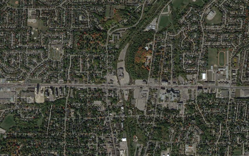
Newmarket
GO Station Mobility   Prepared for Metrolinx
                      by IBI Group

Hub Study             March 9, 2018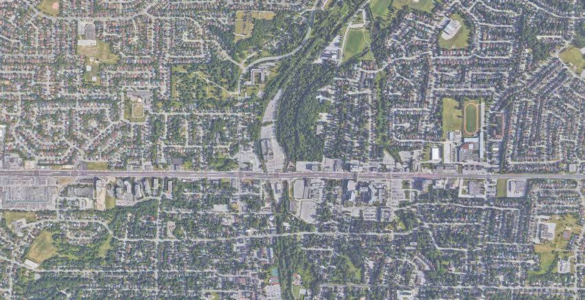
Table of Contents

Acknowledgements

List of Acronyms

Executive Summary����������������������������������������������������������������������������������������������������������������� i

1.	Introduction������������������������������������������������������������������������������������������������������������������1
          1.1 What is a Mobility Hub?                                                                                             1
          1.2 Newmarket GO Station Mobility Hub Study                                                                             3
          1.3 Report Structure                                                                                                    6
          1.4 Intended Use                                                                                                        6

2.	       Prevailing Planning Framework��������������������������������������������������������������������������������7
          2.1 Provincial                                                                                                          7
          2.2 Regional                                                                                                          10
          2.3 Municipal                                                                                                         11
          2.4 Lake Simcoe Region Conservation Authority (LSRCA)                                                                 14

3.	       Existing Conditions���������������������������������������������������������������������������������������������������15
          3.1 Transportation                                                                                                    15
          3.2 Land Use and Built Form                                                                                           21
          3.3 Summary of Strengths, Weaknesses, Opportunities and Threats
              within the Mobility Hub                                                                                           23

4.	       Transforming the Newmarket GO Station Mobility Hub������������������������������������ 25
          4.1 Vision                                                                                                            25
          4.2 Guiding Principles                                                                                                27
          4.3 Newmarket GO Station Mobility Hub Concept Plan                                                                    29
          4.4 TOD Demonstration Plan                                                                                            39

5.	Implementation�������������������������������������������������������������������������������������������������������� 44
          5.1 Short-Term (2018 – 2025)                                                                                          45
          5.2 Longer-Term (Beyond 2025)                                                                                         48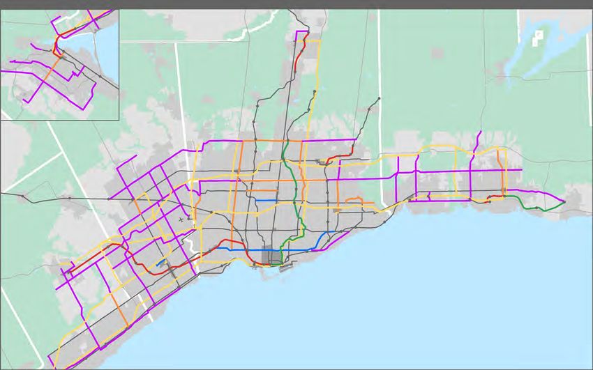
Table of Contents (con’t)
Glossary.................................................................................................................50

References.............................................................................................................56

Appendix A
Summary of Community Consultation.............................................................60
List of Figures
Figure 1. Location of the Newmarket GO Station Mobility Hub in the Context of the GTHA
Figure 2. Metrolinx Mobility Hub Objectives
Figure 3. Newmarket GO Station Mobility Hub Study Area
Figure 4. Overlay of Existing Municipal Land Use Designations
Figure 5. Existing Mobility Hub Conditions and Context
Figure 6. Existing Newmarket GO Station
Figure 7. Existing and Future GO Rail Service at the Newmarket GO Station
Figure 8. Examples of Existing Strengths, Weaknesses, Opportunities and
          Threats within the Mobility Hub
Figure 9. Illustrative Vision for the Newmarket GO Station Mobility Hub
Figure 10. Illustrative Examples of Proposed GO Station Improvements
Figure 11. Phase 1 Mobility Hub Concept Plan (Anticipated Timing 2018-2025)
Figure 12. Pedestrian Circulation - with Proposed Phase 1 Mobility Hub Improvements
Figure 13. Phase 2 Mobility Hub Concept Plan (Anticipated Timing Beyond 2025)
Figure 14. Transit-Oriented Development (TOD) Demonstration Plan (with Ultimate Mobility
           Hub Vision)
Figure 15. Pedestrian Circulation - with Proposed Phase 2 Mobility Hub Improvements and
           Demonstrative TOD

List of Tables

Table 1. Summary of Strengths, Weaknesses, Opportunities and Threats
Table 2. Proposed Amendments to the Town of Newmarket Official Plan and the Newmarket
Urban Centres Secondary Plan
NEWMARKET GO STATION MOBILIT Y HUB STUDY                       ACKNOWLEDGEMENTS

Acknowledgements

The Newmarket GO station mobility hub study was prepared by:
Metrolinx: Planning and Development, Project Planning and
Program Development
Consultant Team: IBI Group
Metrolinx and IBI Group would like to thank the Town of
Newmarket, the Region of York and the Lake Simcoe Region
Conservation Authority for their assistance and contributions to
the Newmarket GO station mobility hub study.
The study team would also like to acknowledge the time and
efforts of the various groups and individuals who participated
in landowner meetings, the visioning workshop and public
open houses. The local knowledge and insight helped
establish a vision, set of guiding principles and recommended
improvements to help this unique area of Newmarket realize its
full potential as a designated mobility hub.
NEWMARKET GO STATION MOBILIT Y HUB STUDY                  LIST OF ACRONYMS

List of Acronyms

AFP          Alternate Financing and Procurement
BRT          Bus Rapid Transit
CIP          Community Improvement Plan
DC           Development Charge
DRM          GO Design Requirements Manual
EA           Environmental Assessment
FSI          Floor Space Index
GFA          Gross Floor Area
GTHA         Greater Toronto and Hamilton Area
LEED         Leadership in Energy and Environmental Design
LID          Low Impact Development
LSRCA        Lake Simcoe Region Conservation Authority
PPS          Provincial Policy Statement
PPUDO        Passenger Pick-Up and Drop-Off
RER          Regional Express Rail
ROW          Right-of-Way
RTP          Regional Transportation Plan
SRHC         Southlake Regional Health Centre
SWOT         Strengths, Weaknesses, Opportunities and Threats
TDM          Transportation Demand Management
TOD          Transit-Oriented Development
TMP          Transportation Master Plan
YROP         York Region Official Plan
YRT          York Region Transit
NEWMARKET GO STATION MOBILIT Y HUB STUDY EXECUTIVE SUMMARY
Executive Summary
The Mobility Hub Context Mobility hubs are major
Given its location at the intersection of the Barrie GO rail line transit stations and
and the Viva Yellow Rapidway, the Newmarket GO station the surrounding area
is designated as a mobility hub. The mobility hub includes
where different modes
approximately 45 hectares of land that are within less than
of transportation come
800 metres, or a ten minute walk, of the GO station.
together seamlessly.
The Metrolinx GO expansion program (also known as
Regional Express Rail – RER) will bring two-way midday,
B ay v
Lundy’
evening and weekend service to the Newmarket GO station
iew P
s Lane
by 2025, with continued frequent one-way (peak direction)
ark w
Eas t
Ma
nue
Av e
ay
Penn
in S
service during the morning and evening rush hours. While
tre
et N
Prosp
transit ridership at the Newmarket GO station mobility hub
or t
t
tree
lia S
h
ec t S
A me rive
is D
is expected to remain low, there is an opportunity to expand D av
treet
the role and function of the GO station. With two-way rail
service, the station’s role as a destination and transfer point Onta
rio S
tree
t
Qu
een
St r e
et
Nia
Ma
will increase, providing access to the growing range of
gar
in
St
aS
re
tre
et
employment opportunities, services and amenities located
So
et
ut
h
within the Newmarket GO station mobility hub and beyond. LEGEND
Newmarket GO Station Mobility Hub
Many planning tools are in place to facilitate growth Existing Newmarket GO Station
and investment within the mobility hub, but the area is Primary Zone
constrained by a number of environmental, market and
infrastructure conditions, including the location of the GO
station within the floodplain of the East Holland River. More Mobility hubs generally
detailed study is necessary to build upon the strengths of the have the potential for high
mobility hub and address weaknesses and potential threats. concentrations of working,
living and other activities.
Purpose and Scope of Study Provincial, regional and
The Newmarket GO station mobility hub study is intended to: municipal policies do
• Establish a vision for the area and provide guidance on recognize that intensification
how it should look and function; and certain land uses
• Recommend improvements to the GO station; and, may not be possible in all
• Demonstrate the potential to integrate future transit- mobility hubs.
oriented development (TOD).
The findings and recommendations of the mobility hub
study will also help support the implementation of prevailing
policies, regulations and guidelines and inform on-going and
future transportation and planning initiatives.
iNEWMARKET GO STATION MOBILIT Y HUB STUDY EXECUTIVE SUMMARY
Study Process
The mobility hub study was prepared through a combination
of background research, technical analysis, design work and Vision for the Newmarket
consultation. The valuable input obtained from the study partners, GO Station Mobility Hub:
key stakeholders and the community helped to define the strengths,
weakness, opportunities and threats (SWOT) within the mobility hub A Vibrant and attractive
and to establish a vision statement and set of guiding principles. pedestrian-friendly area
Through an iterative design process, concept plans for the mobility where people living,
hub were created along with a TOD demonstration plan. working and visiting can
enjoy:
Findings and Recommendations
Drawing on the vision statement and guiding principles • Seamless integration
established for the Newmarket GO station mobility hub, as well between new and
as direction from the GO Rail Station Access Plan and other improved multiple
recent Metrolinx planning and policy initiatives, a number of modes of transit;
new and improved transit facilities, amenities and public realm
improvements are recommended. The following summarizes the • An intensified mix of
improvements, which are intended to be implemented in two uses and activities that
phases. are sensitive to, and
Phase 1 Mobility Hub Improvements (2018 - 2025) embrace, the natural and
• Improved GO signage and wayfinding; historic character of the
• Improved pedestrian and cyclist facilities; area; and,
• Pedestrian bridge over the rail tracks with a ticket kiosk;
• East and west passenger pick-up-drop-off areas (PPUDOs); • An engaging and
• Barrier free parking and Mobility Plus drop-off/lay-by space;
animated public realm
• Transit plazas with weather protection;
• Potential controlled intersection (Main Street North); and, that provides a strong
• Potential on-street bus lay-bys. sense of place.
Phase 2 Mobility Hub Improvements (Beyond 2025)
• Integration with redevelopment of the Tannery Mall;
• Reconfiguration of the east PPUDO and enlarged plaza;
• New station building;
• Additional pedestrian and cyclist facilities; and,
• Proposed municipal plaza.
No additional GO parking is proposed for the Newmarket GO station
and no changes to the existing road network are recommended.
Further technical analysis, including more detailed mapping and
modeling of the floodplain, and design work is required to determine
the final GO station layout and design. In addition, Metrolinx will
continue working with municipalities to evaluate level crossings
between the rail corridor and roadwork, including at Davis Drive. The
timing of each phase will need to be confirmed in coordination with
the GO expansion program, property acquisition, funding availability
and any private development plans within the Primary Zone of the
study area.
iiNEWMARKET GO STATION MOBILIT Y HUB STUDY EXECUTIVE SUMMARY
Transit-Oriented Development
Metrolinx will be responsible
A TOD demonstration plan was prepared to illustrate the how
the mobility hub may transform over time, with appropriate built for implementing the
form, and opportunities to integrate new development with the proposed improvements
GO station. All future development proposals must demonstrate to the GO station. Other
conformity with applicable policies and guidelines and will be public realm improvements
subject to approval by York Region, the Town of Newmarket are intended to be led
and the Lake Simcoe Region Conservation Authority (LSRCA). by the Region, Town or
The Phase 2 concept plan and TOD demonstration plan may be
LSRCA, either alone or in
revisited if Metrolinx’s ongoing system-wide analysis identifies
the need and opportunity to implement a grade separation at partnership.
Davis Drive, which is currently a level rail crossing. The full transformation of
Implementation the Newmarket GO station
mobility hub will occur
In conjunction with improvements to the GO station and the
adjacent public realm, the mobility hub study also recommends incrementally over many
amendments to the Town of Newmarket Official Plan and the years. Future development
Newmarket Urban Centres Secondary Plan, in order to incorporate will require approvals from
relevant findings and directions from the mobility hub study. Some York Region, the Town of
of the recommendations of the study can be classified as relatively Newmarket, and the LSRCA.
‘quick’ or ‘easy wins’ and be implemented within the next few years.
Other improvements or actions are expected to be undertaken over
the medium to long-term, and will be subject to funding, market
conditions, and overall development feasibility.
Metrolinx will be responsible for implementing the proposed
improvements to the GO station facilities. Other public realm
improvements involving sidewalks, streetscape, parks and trails
are intended to be led by York Region, the Town of Newmarket or
the LSRCA, either alone or in partnership between government
agencies or with the private sector. Where appropriate,
opportunities may be identified for Metrolinx to contribute to off-
site public realm improvements that facilitate active transportation
connections to the GO station. Such improvements will be
negotiated by the relevant partners on a case-by-case basis.
The Newmarket GO station mobility hub concept plans and
TOD demonstration plan are innovative and aspirational, yet
recognize the unique conditions and challenges within area. The
full transformation of the mobility hub will occur incrementally over
many years. It will require multiple levels of government and public
agencies, landowners, developers and the community to work
together, along with flexibility and forward thinking.
iiiNEWMARKET GO STATION MOBILIT Y HUB STUDY 1.0 INTRODUCTION
1. Introduction
Within the Town of Newmarket, the Davis Drive corridor is The Davis Drive corridor is
intended to transition from a low density, auto-oriented area into a intended to transition from
vibrant mixed-use, pedestrian friendly community. The Newmarket a low density, auto-oriented
GO station mobility hub is an important node within the corridor.
area into a vibrant mixed-
It is served by two rapid transit lines; the recently constructed
Viva Yellow Rapidway and the Barrie GO rail line, which is being use pedestrian friendly
enhanced as part of Metrolinx’s GO expansion program. community. The Newmarket
GO station mobility hub is
1.1 What is a Mobility Hub? an important node within
The 2008 Regional Transportation Plan (currently under review) the corridor.
identified 51 mobility hubs within the Greater Toronto and
Hamilton Area (GTHA). Two are located within the Town of
Newmarket:
• Newmarket Centre (Anchor Hub): Located at Davis Drive and
Yonge Street; and,
• Newmarket GO (Gateway Hub): Located at Davis Drive, east of
Main Street (see Figure 1).
Mobility hubs are major transit stations and the surrounding
area that have significant levels of planned transit service and
the potential for high concentrations of working, living and other
activities. They are places of connectivity where different modes of
transportation - from walking to transit - come together seamlessly.
Mobility hubs vary in terms of size, type and function, but they all
share the same broad objectives for achieving: Seamless Mobility,
Placemaking and Successful Implementation (see Figure 2).
Newmarket GO Station Mobility Hub
The Newmarket GO station mobility hub currently acts as a home
station for commuters travelling south towards Toronto. Its role and
function is expected to evolve. More frequent two-way service will
Mobility hubs are places
allow the Newmarket GO station to also serve as a destination and
transfer station, providing regional access to the broad and growing
of connectivity where
range of employment opportunities, service and amenities within different modes of
the mobility hub and beyond. transportation come
Many planning tools are in place to facilitate growth and investment
together seamlessly and
within Newmarket, but certain conditions will continue to impact where there is an intensive
the overall function of the Newmarket GO station mobility hub and concentration of working,
limit the amount of transit-oriented development (TOD) that can be living and other activities.
accommodated. These conditions include stable residential areas,
heritage resources, road network constraints and the floodplain
of the East Holland River. More detailed study and direction is
required to help the mobility hub achieve its full potential.
1NEWMARKET GO STATION MOBILIT Y HUB STUDY 1.0 INTRODUCTION
Newmarket GO
Anchor Hub
Major transit station areas
associated with an urban growth
centre (as defined in the Province’s
Growth Plan for the Greater
Golden Horseshoe)
Gateway Hub
Major transit station areas
located at the interchange of two
or more current or planned
regional rapid transit lines
with anticipated high levels
of ridership
N
Figure 1. Location of the Newmarket GO Station Mobility Hub in the Context of the GTHA
(Source: Metrolinx Newmarket GO Mobility Hub Profile)
SEAMLESS MOBILITY
1 Seamless
integration of
modes at the rapid
transit station.
2 Safe and efficient
movement of people
with high levels of
pedestrian priority.
3 A well-designed
transit station for
a high quality user
experience.
4 Strategic parking
management.
PLACEMAKING
5 A vibrant mixed-use
environment with
higher land use
intensity.
6 An attractive public
realm.
7 A minimized
ecological footprint.
SUCCESSFUL IMPLEMENTATION
8 Effective partnerships
and incentives for
increased public and
private investment.
9 Flexible planning
to accommodate
growth and change.
Figure 2. Metrolinx Mobility Hub Objectives
(Source: Metrolinx Mobility Hub Guidelines for the Greater Toronto and Hamilton Area, 2011)
2NEWMARKET GO STATION MOBILIT Y HUB STUDY 1.0 INTRODUCTION
1.2 Newmarket GO Station Mobility Hub Study
In December 2016, Metrolinx retained a multi-disciplinary
consulting team from IBI Group to undertake a study of the The Newmarket GO station
Newmarket GO station mobility hub. mobility hub study is
needed to ensure land use
Purpose and Scope of Study
and transportation plans are
A mobility hub study is required to ensure that land use and well-integrated and support
transportation plans for the area are well-integrated and support
appropriate future growth
appropriate future growth and multi-modal access.
and multi-modal access.
The Newmarket Urban Centres Secondary Plan encourages the
preparation of a mobility hub study that addresses:
a. the long-term role and function of the Newmarket GO station
within the broader GO rail network;
b. potential for grade separation of the rail line at Davis Drive;
c. potential re-location of the Newmarket GO rail station access
to Main Street to improve access and reduce traffic impacts on
Davis Drive;
d. integration between the GO rail station, the Rapidway, the
future GO bus services and the GO bus terminal;
e. pedestrian connections between the Rapidway station at Davis
Drive and Main Street and the GO rail platform;
f. pedestrian connections between the active transportation
network and the GO rail platform; The mobility hub study is
g. opportunities and constraints to development in the vicinity of intended to:
the station, including floodplain restrictions; and, • Establish a vision for the
h. accessibility and bicycle parking considerations (Policy 9.3.3 ii). area;
• Recommend
The Newmarket GO station mobility hub study is intended to:
improvements to the
• Establish a vision for the area and provide guidance on how it GO station; and,
should look and function;
• Demonstrate the
• Recommend improvements to the GO station; and,
potential to integrate
• Demonstrate the potential to integrate future TOD.
transit-oriented
Study Area development (TOD).
The geographic limits of a mobility hub are broadly defined as
the area within 800 metres, or a ten minute walk, of a Major Transit
Station. The boundaries for each mobility hub are intended to be
refined based on specific physical characteristics and barriers,
neighbourhood context and the local planning framework.
3NEWMARKET GO STATION MOBILIT Y HUB STUDY 1.0 INTRODUCTION
With input from the Town of Newmarket, a mobility hub study
The Newmarket GO station
area was established that is generally bounded by:
mobility hub study area
• Penn Avenue and the existing GO parking lot to the north;
covers approximately 45
• Ontario Street and Queen Street to the south; hectares and includes over
• Lundy’s Lane and Prospect Street to the east; and, 200 parcels of land that
• Vincent Street and Niagara Street to the west. are under both private and
The Newmarket GO station mobility hub covers approximately 45 public ownership.
hectares and includes over 200 parcels of land that are under both
private and public ownership. The study focused on those lands
immediately adjacent to the rail corridor, which are identified as
part of a ‘Primary Zone’ (see Figure 3). The Primary Zone includes
the existing GO station and associated facilities, as well as the
immediate surrounding lands that are, within approximately 250
metres or a 2.5 minute walk of the GO station. This area is most
influenced by the high level of accessibility offered by the transit
services at the station.
L es lie
LEGEND
ad
Str ee
Ro
don rive Newmarket GO Station Mobility Hub
Lon D av
is D
t
Highw
Existing Newmarket GO Station
St reet
Ma
ay 4 0
Go rham Primary Zone
Yong
in S
4
et
t re
e
St re
E agle
St ree
rive
et
ck D
M ulo
Bay v
t
L un d
iew P
y’s La
ar k w
ne
Ma
ay
in S
V in
e
t re
nu
Ave
ce n
n
et N
Pen
Prosp
t St
or t
ree
h
e
e t rive
c t Str
Stre is D
t
A me
lia Dav
ee t
Nia
gar
e t
Stre
a St
a r io t
Ont ree
n St
ree
Q uee
t
Ma
in
L or n
Str
e
e Av
et
So
enu
ut
h
e
Figure 3. Newmarket GO Station Mobility Hub Study Area
4NEWMARKET GO STATION MOBILIT Y HUB STUDY 1.0 INTRODUCTION
Study Process
The mobility hub study was prepared through a combination
of background research, technical analysis, design work and The valuable input obtained
consultation. The valuable input obtained from key stakeholders from key stakeholders and
and the community during the following meetings and events the community helped
helped shape the recommendations of the study: shape the recommendations
• Study Partner Meetings and Information Exchanges: of the Study.
held between December 2016 and November 2017, with
involvement of staff from York Region (including York Region
Transit and Viva), the Town of Newmarket, the Lake Simcoe
Region Conservation Authority (LSRCA), Metrolinx, and IBI
Group.
• Public Open House #1: held May 18, 2017 at the Newmarket
Senior’s Meeting Place. Information on the purpose and scope
of the study, initial findings from the site analysis and contextual
analysis and opportunities for further participation in the study
was provided through a series of display boards, a presentation
and an open question and answer period. The Open House
was attended by over 100 people.
• Visioning Session: held May 29, 2017 at the Newmarket
Senior’s Meeting Place. Following a short presentation by
Metrolinx and IBI Group, the 26 participants broke out into four
working groups and took pen to paper to provide input on two
preliminary draft mobility hub concepts and then reported
back to the larger group.
• Landowners Meetings: held in June 2017.
• Public Open House #2: held September 28, 2017 at the
Newmarket Senior’s Meeting Place. Information on the study
findings, and the draft recommendations was provided
through a series of display boards, a presentation and an open
question and answer period. The Open House was attended
by approximately 50 people.
Please refer to Appendix A for a more detailed summary of the
study consultation.
5NEWMARKET GO STATION MOBILIT Y HUB STUDY 1.0 INTRODUCTION
1.3 Report Structure
This mobility hub report is structured as follows: The mobility hub study
• Section One outlines the purpose and scope of the study, the is intended to support
format of the report and how it is intended to be used; prevailing policies,
• Section Two provides an overview of the prevailing policy and regulations and guidelines,
regulatory framework, as well as planning initiatives that are and inform on-going and
currently underway;
future initiatives.
• Section Three describes the existing conditions of the
Newmarket GO station and the larger mobility hub and
summarizes its strengths, weaknesses, opportunities and
threats;
• Section Four presents an approach to transforming the
mobility hub, with an illustrative vision, a set of guiding
principles, recommended GO station and mobility hub
improvements and a demonstrative TOD plan; and,
• Section Five outlines a phased approach to implementing the
study recommendations.
1.4 Intended Use
The Newmarket GO station mobility hub study is intended to
support the implementation of prevailing policies, regulations
and guidelines, inform on-going and future transportation and
planning initiatives and guide new development and investment. Metrolinx will be responsible
for implementing the
As detailed in sections 4 and 5 of this report, the mobility hub
study recommends: proposed improvements
to the GO station facilities.
• Improvements to the GO station and the adjacent public realm;
and, Other public realm
improvements are intended
• Amendments to the Town of Newmarket Official Plan and
the Newmarket Urban Centres Secondary Plan, in order to to be led by York Region,
incorporate relevant findings and directions from the mobility the Town of Newmarket
hub study. or the LSRCA, either alone
Future technical analysis and design work is required and will or in partnership between
build upon the concept plans, precedent images and guiding government agencies or with
principles contained within this report. Metrolinx will be the private sector.
responsible for implementing the proposed improvements to the
GO station facilities. Other public realm improvements involving
sidewalks, streetscape, parks and trails are intended to be led by
York Region, the Town of Newmarket or the LSRA, either alone or
in partnership between government agencies or with the private
sector. All of the proposed improvements are further described
in sections 4 and 5 of this report.
The Newmarket GO station mobility hub study should be read
in conjunction with the policies, regulations and guidelines of
other Metrolinx, York Region, Town of Newmarket and LSRCA
documents.
6NEWMARKET GO STATION MOBILIT Y HUB STUDY 2.0 PREVAILING PLANNING FRAMEWORK
2. Prevailing Planning Framework
The Newmarket GO station is a ‘Major Transit Station’ within a
While provincial, regional
designated mobility hub. Mobility hubs are intended to have high
residential and employment densities, to ensure the viability of and municipal policies
existing and planned transit service. While provincial, regional support the intensification
and municipal policies support the intensification of mobility of mobility hubs, they
hubs, they also direct development away from hazard lands also direct development
(such as lands at risk for flooding), and seek to protect heritage away from hazard lands
resources and established residential neighbourhoods. and seek to protect
As detailed below, over half of the Newmarket GO station heritage resources and
mobility hub falls within the designated floodplain of the East established residential
Holland River (see Figure 4). Prevailing policies encourage neighbourhoods.
intensification along Davis Drive and portions of Main Street, but
the remainder of the mobility hub is primarily designated for low- Over half of the Newmarket
density residential uses, parkland and natural open space. GO station mobility hub
falls within the designated
2.1 Provincial floodplain of the East
Provincial Policy Statement (2014) Holland River
The Provincial Policy Statement (PPS) provides direction on
land use planning and development matters that are of provincial Policies of the PPS allow
interest. Policies are grouped into three categories: limited development and
• Building Strong and Healthy Communities; site alternation within the
• Wise Use and Management of Resources; and, flood fringe, providing the
• Protecting Public Health and Safety. project can demonstrate
The PPS promotes efficient development patterns that have a adequate protection of
mix of housing, employment, recreation, parks / open spaces and health and safety.
transportation choices, with densities to support the incased
use of active transportation and transit. While the PPS intends
for the majority of future growth to be accommodated through
the intensification of existing urban areas, its policies direct new
development away from the floodplain. Limited development and
site alteration within the flood fringe may be permitted, providing
it can be demonstrated that:
• Development and site alteration meets floodproofing, access
and protection works standards;
• Vehicles and people can safely enter and exit the area during
flooding, erosion and other emergencies; and,
• New hazards are not created and existing hazards are not
aggravated.
7NEWMARKET GO STATION MOBILIT Y HUB STUDY 2.0 PREVAILING PLANNING FRAMEWORK
Be
xh
ill R
oa
d
Bolt
on A
ven
Lundy's La
ue
East Ho
ne
lland Riv
Bayview
er
nue
Parkwa
Mai
Ave
Penn
n Str
y
eet N
Vinc
orth
ent S
treet
t
tree
lia S
Ame
Prospec
ive
is Dr
Dav
Charles S
t Street
treet
t
tree
oe S
Niag
Simc
ara
t
tree
en S
Que
Stre
t
tree
et
tario S
On treet
lington S
Wel
Ma
in S
tre
et S
N
ou
th
LEGEND
Town of Newmarket Official Plan Urban Centres Secondary Plan Note:
Newmarket GO Station Aerial overlay prepared by IBI Group
Mobility Hub Stable Residential Secondary Plan Area for illustrative purposes only. Refer to
Schedule A of the Town of Newmarket
Official Plan and Schedule 3 of the
East Holland River Parks & Open Space Mixed Use
Urban Centres Secondary Plan
Newmarket.
The floodplain limits are shown for
Urban Centre Parks and Open Space screening purpose only and may not
reflect the most up-to-date data. The
LSRCA should be contacted to confirm
Commercial Priority Commercial Area the actual floodplain limits.
A topographical survey may be required
in order to determine the limit of
Floodplain Floodplain and Hazard Lands predicted flooding at a specific site.
Figure 4. Overlay of Existing Municipal Land Use Designations
8NEWMARKET GO STATION MOBILIT Y HUB STUDY 2.0 PREVAILING PLANNING FRAMEWORK
Places to Grow: The Growth Plan for the Greater Golden
Horseshoe (2017)
The Growth Plan for the Greater Golden Horseshoe is a framework
to implement the Province’s vision for building stronger and more The Growth Plan defines
prosperous communities by better managing growth and optimizing the Newmarket GO station
the use of existing and new infrastructure. It directs growth to strategic as a ‘Major Transit Station
areas such as designated ‘Urban Growth Centres’, ‘Priority Transit Areas’. These areas are to
Corridors’ and ‘Major Transit Station Areas’ and includes policies to achieve multi-modal access
improve integration between transportation and land use planning. and to provide, where
appropriate, infrastructure
The Newmarket GO station is defined as a ‘Major Transit Station to increase the modal
Areas’ given it is served by two higher-order rapid transit lines; share for transit and active
the Barrie GO rail line and the Viva Yellow Rapidway. Policies of transportation.
the Growth Plan intend for Major Transit Station Areas to achieve
multi-modal access and provide, where appropriate, the following
The Growth Plan recognizes
infrastructure to help increase the modal share for transit and
that high levels of
active transportation:
intensification may not be
possible in all Major Transit
• Connections to local and regional transit services; Station Areas.
• Sidewalks, bicycle lanes, and secure bicycle parking; and,
• Commuter pick-up/drop-off areas.
The Growth Plan does recognize that intensification and higher
densities may not be possible in all Major Transit Station Areas
and other strategic growth areas. Specifically, Policy 2.2.4 4. The Draft RTP recommends
d 2041 Frequent Rapid Transit Network
a) i allows for upper- and single-tier municipalities to request
alternative density targets through a comprehensive municipal
continued expansion and
optimization of the region’s
rapid transit network and
review where it is demonstrated that the target cannot be
achieved because development is prohibited by provincial policy places greater emphasis on
DRAFT or severely restricted on a significant portion of the lands within traveller needs at To
theAllandale
core
the delineated area. In accordance with policies of the PPS, the of planning and operations.
Waterfront
Growth Plan generally directs new development away from
hazardous areas such as the floodplain. 87
Draft 2041 Regional Transportation Plan for the Greater Davis Drive
Toronto and Hamilton Area (GTHA) (2017) Newmarket
The Draft Regional Transportation Plan (RTP) for the GTHA is a long- Centre
reet
range multi-modal transportation plan that takes into account all
Yonge St
modes of transportation. It builds on the success of the first RTP, 88
The Big Move (2008), which established the concept of mobility
hubs and identified the Viva Yellow Rapidway on Davis Drive as a Note: Draft RTP mapping and recommendations
may be subject to change
priority project. Urban Growth Centre
GGH Built Boundary
The Draft RTP recommends continued expansion and Greenbelt Designation
Existing or Future GO Station
optimization of the region’s rapid transit network and places
Existing, in Delivery & In Development
greater emphasis on traveller needs at the core of planning and Regional Rail and Rapid Transit
operations. As further described in section 3.1 of this report, by Proposed Frequent Rapid Transit by 2041
2025 the Newmarket GO station mobility hub will benefit from GO Rail - 15min
Priority Bus
more frequent service on the Barrie rail line, including new two- Frequent Regional Express Bus
way service during middays, evenings and weekends by 2025.
9
YORKNEWMARKET GO STATION MOBILIT Y HUB STUDY 2.0 PREVAILING PLANNING FRAMEWORK
Two-way service during the morning and afternoon peak hours is
proposed by 2041.
Metrolinx Mobility Hub Guidelines for the Greater Toronto The Metrolinx Mobility
and Hamilton Area (2011) Hub Guidelines provide a
The Metrolinx Mobility Hub Guidelines for the Greater Toronto framework for the successful
and Hamilton Area provide a framework for the successful planning and development
planning and development of mobility hubs. They address of mobility hubs that is
topics such as transit station design, circulation and access,
based on three objectives:
urban design and land use. Detailed strategies, best practices
and suggested resources are provided for the three broad • Seamless mobility;
objectives of: Seamless Mobility, Placemaking and Successful • Placemaking; and,
Implementation.
• Successful
Implementation.
2.2 Regional
York Region Official Plan (2010)
The York Region Official Plan (YROP) is intended to guide
economic, environmental and community building decisions and The York Region Official
manage growth. It contains broad policies, with allocations of Plan contains broad policies
population and employment growth, that set the stage for more that set the stage for more
detailed planning by local municipalities. detailed planning by local
While York Region is expected to grow by almost 300,000 people municipalities. It designates
and 40,000 jobs between 2016 and 2031, the Regional Official lands within the Newmarket
Plan allocates only a small portion of this growth to the Town of GO station mobility hub
Newmarket (i.e. 8,400 new people and 1,800 new jobs). Currently, study as ‘Urban Area’,
York Region is undertaking a review of its Official Plan as part of ‘Regional Greenlands System’
a broader Municipal Comprehensive Review. Growth forecasts
and ‘Regional Corridor’.
and municipal allocations will be reviewed as part of this process,
including the Town of Newmarket’s plan for the mobility hub,
which anticipates higher levels of growth (see section 2.3 of this
report). Within this context, the growth scenario for the Newmarket
GO station mobility hub remains uncertain at the time of this study.
In terms of land use, Map 1 of the Regional Official Plan designates
the lands which comprise the Newmarket GO station mobility
hub as ‘Urban Area’ and ‘Regional Greenland System’, with Davis
Drive designated as a ‘Regional Corridor’. Regional Corridors are
intended to be focal points of commerce, business and cultural
activities. Intensification areas along the Regional Corridors are
to be identified by local municipalities, but should include lands
within a reasonable and direct walking distance from major transit
station areas.
In terms of design, York Region requires that communities
provide an enhanced mobility system using a “people and transit
first approach”. This approach seeks to connect land use and
transportation by balancing pedestrians, cyclists, public transit and
automobile users.
10NEWMARKET GO STATION MOBILIT Y HUB STUDY 2.0 PREVAILING PLANNING FRAMEWORK
Finally, with regard to the floodplain, policies of the York Region
Official Plan generally prohibit development and site alteration
within the floodplain and seek to protect natural heritage features The York TMP is shaped
within the Regional Greenlands System. by provincial policy and is
aligned with existing regional
York Region Transportation Master Plan (2016)
and local policies. It proposes
The York Region Transportation Master Plan (TMP) is the Region’s
dedicated cycling facilities
long-term plan to build an interconnected system of mobility. It is
shaped by provincial policy, aligned with existing regional and local along Main Street South.
policies and informed by stakeholder input.
The TMP recommends a number of policies, actions and moves in
order to achieve the following objectives:
• Objective 1 – Create a World Class Transit System
• Objective 2 – Develop a Road Network Fit for the Future
2 and 28 Main• StObjective
N 3 – Integrate Active Transportation in Urban
InsetAreas
A: Complementary Use Area & Transitional Area
• Objective 4 – Maximize the Potential of Employment Areas Newmarket Urban Centres Secondary Plan Area
Complementary
Use Area
• Objective 5 – Make the Last Mile Work Flood Plain Open Space Transition Area
SIMON ST
In addition to more frequent service on the Barrie GO rail line, the
MAIN ST N
TMP identifies other potential transportation improvements that OPA # 3
E
ST
would benefit the Newmarket GO station mobility hub. These Roxboro
N
include dedicated cycling facilities along Main Street South,
0 25 50 OPA # 6 -
investment within
m the ‘Lake to Lake’ trail (one of the three conceptual
region-wide trail systems) and potential north/south and east/west 0 50 100
capacity and collector network improvements. Metres
ntary Use Area & Transitional Area
The Town of Newmarket
Official
Town of East Plan designates the
Gwillimbury
2.3 Municipal
condary Plan Area
Complementary
majority Schedule
of the Newmarket
Use Area
Open Space Transition Area Yonge
Street
A
Town
ntary Use Area of Newmarket
& Transitional Area Official Plan (2006) Regional GO station
Corridor
Land Use as
mobility hub
The Town of NewmarketOPA # 3 - Official Planof sets out a long-term vision for ‘Urban Centres & Corridors’
TownScheduleoflands
Newmarket
Complementary
condary Plan Area Northwest corner
Use Area
ntary Use Area
Open Space
& Transitional
Roxborough Rd and Queen St
Area
the municipality, and provides direction for existing and future land
Transition Area
with other A
designated
use and development.
condary Plan Area
Complementary
Use Area
Schedule
OPA # 6 A ofStthe Official Plan designates a
- 649, 693, 657 Queen
as ‘Stable Land Use and
Residential’
Stable Residential
large portion of theRoxborough
Newmarket GO station mobility hub as ‘Urban
Town & Schedule
ofResidential
NewmarketA
Open Space OPA # 3
Transition Area- Northwest corner of Emerging
0 50 100
Rd and Queen St
STUDY AREA ‘Parks Open Space’.
Centres & Corridors’. The remaining lands are designated as ‘Stable Land Use
Metres
Major Institutional
BOUNDARY
OPA # 6 - 649, 693, 657 Queen St
Residential’, ‘Parks &OPAOpen Space’ cornerand ‘Commercial’. Much of the
Town ofResidential
Newmarket
OPA # 9 - 17310 Leslie St Business
Stable Park - General Employment
Residential
arianneville # 3 - Northwest of
Gwillimbury Roxborough Rd and Queen St
s - former
dntary
mobility hub is subject
CourseUse Area & Transitional Area
to0 a 50‘Floodplain’
100 overlay designation. Emerging
Business Park - Mixed Employment
Metres
OPA # 6 - 649, 693, 657 Queen St Major Institutional
Commercial
Urban
Complementary
condary Plan Area
Use Area Centres & Corridors are intended to contain the broadest Stable Residential
Schedule A
OPA # 9 - 17310 Leslie St Business Park - General Employment
Regional Healthcare
Gwillimburydiversity of use, the greatest level of activity and theDavis Drive Regional
highest Emerging Residential
Open Space Transition Area 0 50 100 Urban Centres & Centre
Corridors
Corridor Business Park - Mixed Employment
Urban Gro Provincial
Land Use
of King
Metres
Major Institutional
(See Inset
CentreA)
e
quality of design. They will develop at differing scales and Historic Downtown
wth Centr
OPA # 9 - 17310 Leslie St Commercial
Town of Newmarket
Business Park - General Employment
Historic
Gwillimburydensities and further OPA #direction is provided
3 - Northwest corner
Roxborough Rd and Queen St
of in the Newmarket Newmarket Urban Centres Secondary Plan Area
Downtown
Business
Urban Park -&Mixed
Centres Employment
Corridors
Urban Centres Secondary Plan and the Town’s zoning by-laws. Centre&
is
Parks Open Space
ip
Yonge-Dav
OPA # 6 - 649, 693, 657 Queen St HistoricResidential
Downtown
Commercial Centre
Stable
Natural Heritage System
Townsh
Within the Stable Residential area, only single-detached and
OPA # 5 - Northeast Newmarket Urban Centres Secondary Plan Area
Emerging
Urban Residential
Centres & Corridors
0 50 100
Oak Ridges Moraine Area
semi-detached dwellings are permitted. New development
Metres Stackhouse Rd
must
corner of Leslie St and
The lands labelled Oak Ridges Moraine are
Major
Parks
Historic
subject
Institutional
to & Open
Downtown
policies Space
of Official Centre
Plan Amendment 28
respect the existing characterOPA
of# the area.
ville
Regional Healthcare 9 - 17310 Leslie St Flood Plain
Business
Natural Park - General
Heritage System Employment
Newmarket Urban Centres Secondary Plan Area
Gwillimbury
ea Referred to the Centre OPA # 5 - Northeast Floodplain limits are shown for screening purposes only and may not
h-Stouff
ntario Municipal (See
BoardInset A) corner of Leslie St and Business
reflect the mostPark
Oak
Parks Ridges
&actual
Open - Mixed
Moraine
up-to-date
Space Area
data. The Employment
LSRCA should be contacted to
11 confirm the floodplain limits & to obtain the most up-to-date data.
Stackhouse Rd The lands labelled
A topographic Oakmay
survey Ridges Moraineinare
be required order to determine the limit of
Historic
Commercial
subject to flooding
policies of
at Official
Natural Heritage System
predicted Plansite.
a specefic Amendment 28
Downtown
ille
Centre Regional Healthcare OPA # 5 - Northeast Flood Plain
WaterbodiesNEWMARKET GO STATION MOBILIT Y HUB STUDY 2.0 PREVAILING PLANNING FRAMEWORK
E DULE 3:
Policies of the Official Plan encourage the retention of listed heritage Much of the Newmarket
properties and Council approvals are required for any significant GO station mobility hub is
alterations or demolition. New development must be compatible
designated as ‘Floodplain’,
D USE with, and minimize the impact on, any designated heritage properties.
where the following uses
E DULE 3: Much of the Newmarket mobility hub is designated as floodplain.
Policies of the Official Plan direct new development generally to
are prohibited:
E DULE
USE 3:
areas outside of the Floodplain and Hazard Lands. Development or •E New residential uses;
D
LGIN
AY
STREET
re-development within these hazardous areas shall be regulated in • Most institutional uses;
W
RK
accordance with provincial policies and the regulations of the LSRCA.
PA
D USE
Essential emergency •
W
D
R OA
IE
New residential uses, most institutional uses, essential emergency
YV
TOL
I S
services; and,
BA
BR
services and many types of parking facilities are prohibited within ELGIN
AY
the floodplain. The Town encourages legal non-conforming uses to STUDY
• Most AREA STR ET
new or Eexpanded
W
E
IV
RK
relocate or redevelop in conformity with the Official Plan. Where a BOUNDARY
R
D
parking facilities.
PA
RIVE
N O R TH
ELGIN
HE IGHTS
W
AY
S TREET
request is made to develop lands Owithin
AD the floodplain, Council will
PATT E
IE
W
LR
YV
STO
RK
I
BA
consider a range of factors B including the nature, severity and potential
R
S1
PA
E
T
RSON ST ATT ERSON
RE
W
ST
ON
impact of the environmental hazards,
OAD the proposed methods, STUDY AREA
IE
D R
L UND
E
YV
OA TOL
HRUR
IN
IV
NR RIS by which potential impacts may be
including cost and benefits, BOUNDARY
BA
MA
D O B D
SC HE DULE 3:
LO N
REIVE
S2
N O R TH N O R TH
Y'S L A
HE IGH NSHE IGHTS
R EE
overcome and the recommendation of the LSRCA. STUDY AREA
P
E
IV
T
BOUNDARY
R
D
RIVE
S1 NE
E
T
LAN D USE
Newmarket Urban Centres Secondary Plan (2016) D UE RE
ST
AL EX
NR
ON UROT
PATT E
KIN G STO V EN
D NA
L UND L UND
OA More than half of the
IN
EN
Over half of theLOmobilityNR hub falls within the Newmarket Urban P
MA
NDO
ANDE
ST
H
S1
HILL E
S2 E
T
RSON ST
E RE
mobility hub area is
Y'S L A Y'S L A
R EE
Centres Secondary Plan.D The Secondary Plan provides ST more
DRIV
V IE W
GEOR
IV RD
R
A
HUR
IN
RO
T
detailed direction Drelated
ON to land use, built form, urban design, governed by the NewmarketELGIN
D R FO
MA
RO
NE
AY
E
LO N
S2 T
G
WES
AD
W
E
GE ST
R EE
transportation, RD community services andVEpublic spaces. E ETIts policies
LO N
NE NU E Urban Centres Secondary
AL EX
RK
N L A
KIN G STO EN A S TR
PA
GRE NN OE
T
encourage the redevelopment of Yonge Street PE
S and Davis Drive
MC
W
I D
Plan. Most ofEthese
ET lands
REE T
ANDE
NE
R OA
IE
HILL EHILL E
S TR
YV
TOL
into highlyTOwalkable,
D vibrant, transit-oriented E places. RIS L EY
AL EX
BA
DRIV
NR U T B I G
V EN EE are designated ‘Mixed
R
V IE W V IE W
S
GEOR GEOR
KIN G S
S TR
IV RD IV RD
NA
PAR IVE
R R NDER R
MA
PEN
PROSPECT STREET
EN STUDY AREA
D R FO D R FO
UE
DR
The Town anticipates at full build-out, the 2.2Qkilometre stretch
A
Use’ with a ‘Floodplain and
IN
E
OA
K SID
G
BOUNDARY
GE ST GE ST
WIL
ST
LO N
DRIV
D
E ET
along Davis Drive will be home IV
to 5,300 residentsE and 10,700 jobs.
N O R TH
DR RE
Hazard Lands’ overlay.
RE
OO D ST
E
STE
ENW
PATT E
SubjectIMto
CO
YONG
ASP
ET
A portion of this growth is expected to occur Swithin the Newmarket ET
REE T REE T
E
Section16.0 TREET
CHU
OA
AD
YSSTEREE
G
SO
S1 E
T
LO N
RSON ST
D
D
GO station mobilityR IVEhub. As noted, NUE Deferrals projectionsTT L
AVE these growthOE have
EE G M R
SRI HA ST
E STR
E
RRE
UT
STT
RM
GOR
PAR IVEPAR IVE
LOR
D S D
L UND
CH
PROSPEPRO
R OA
H
CN
IN
L LA YROP, which meansSIUMEE
AINS T MAIN
yet to be incorporated intoMIthe the NR
growth E ET
DR
MA
Q D O
LO N S TR
K SID
ENUE S2
NE A
EET
L EY
Y'S L A
WIL
SR
R
scenario for the mobility
BONSH hub remains uncertain at this
AW AV EE Ttime. I G
TR
EET
SR
EE
R
E
T
VEN
STE ILSTE
Subject EtoEN S
E
CT STR
YONG YONG
T
ET
NE
DR
AN QU
With regardGtoL ADland use, Schedule 3 of the Secondary
Section16.0 D Plan ET
CHU
K SID
M
AD
UE
E
S TR
SO
NR UE
I N G A VE NUE
SPEEET
W
ST
D
U E UE N G STO
Deferrals
KI V EN AM
AV EN NA
E STR E STR
R IVE EN ORH
UT
designates the majority of theARmobility hub as ‘Mixed Use’. This
R
PEN
RC HURC
V
E
A
LOR
D G
E
Subject to
CT STREET
H
Major Institutional
HILL E
L
ET
HS
MIL
designation permits a broad range of uses, such as but not limited
Section16.0 EET
C
DRIV
AD
N E A ORN E A
EET
R
SO
V IE W
STUse
GEOV
TR
IV RD
D E T UE Deferrals Mixed
R IVE
to, townhouses, apartments, T REAVE Nretail,
office, hotels, institutional, HAM
UT
D R FO
S GOR
EE
PR
E
E
L
L
D
R GN UE
EAGIL LA R
G
H
Parks and Open Space
LINE
E
T
DS
HS
LO N
community Guses, M
M urban squares and parking facilities. Schedule
N E ET
E ST R
A S TR
OO
EET
L AD E OE Heritage System
TR
Natural
IMC
W
U
V EN
SAN
4 delineates Aheight and density permissions. Within the mobility S
RRIE
E
EE
TE S TR
EE T
VEN
S1 Potential School Site EY
T PA DRIVE
Major Institutional
EE T GL
SRI
D FO
hub they range Mbetween
AN 2 and 8 storeys and 1.5 and 2.0 FSI (floor S TR
T BA
MA
UE
GL AD UE
PROSPECT STREET
EEN Use and Hazard Lands
Floodplain
RK S
T QUMixed
REE
IN
RD S
space index).AVSome
E N additional
LE S
Theight and density may be achieved
WIL
ST
I
The underlying land use in areas within the Floodplain and Hazard Lands
IDE
EAG
RAN S
Parks and Open Space
LINE LINE
Major Institutional
RE
through bonusing. Policies of the Secondary Plan stipulate that
overlay designation is subject to Policy 6.4.6 ii.
STE
TREE
Subject to
YONG
ET
Floodplain limits are shown for screening purposes only and may not
T reflectSection16.0Naturaldata. Heritage System
CHU
EEheight Mixed Use
AD
the most up-to-date The LSRCA should be contacted to
permitted land uses, density Tand provisions of Schedule 3 S TR
E
SO
SAN
R
ARRIE ARRIE
AD E S T
GO T
S D E confirm the actual floodplain limits & to obtain the most up-to-date data.
Deferrals may be required in order to determine the limit of
TE EW
RIVEAGL E AR D E NU A topographic survey HAM
T
E STR
R IVE
S1flooding at a specific site.
UT
V
RC
D E AV Potential
Parks and School
Open Site
Space GOR
O UL
LOR
and 4 do not applyDAwithin
VIS theOfloodplain, unless written approval LA R
D predicted
DFO ANDFO
H
EB
HS
MIL
ILLIAM R
NE A
EET
Floodplain
Natural Heritage and Hazard
GrowthLands
System
SI T RBAN SI T B
Provincial Urban Centre
for specific development W applications has been received from the
TR
RD S
S
VE
TE DR I
EE
S1
VEN
The underlying land use in areas within the Floodplain and Hazard Lands
CK Potential
Priority School
Commercial Site Area
LSRCA.
T
O
MUL DMAN
overlay designation is subject to Policy 6.4.6 ii.
TREED S TREE
UE
Floodplain limits are shown for screening purposes only and may not
GL A UE Floodplain Regional Shopping Centre Study Area
and HazardshouldLands
RD AV EN
reflect the most up-to-date data. The LSRCA be contacted to
VA
R
AD confirm the actual(Policy
floodplain 5.3.4) 12
G T
limits & to obtain the most up-to-date data.
LE RD
T
EVA
The underlyingsurvey
land use in be
areas withininthe Floodplain and Hazard Lands Major Inst
U A topographic may required order to determine the limit of
RANO
BO Subject to BO UL
overlay
predicteddesignation
flooding atisasubject
specifictosite.
Policy 6.4.6 ii.
OW OE Mobility Hub Station Area Plan Study Area
ET Mixed Use
ILLIAM R
Floodplain limits are shown for screening purposes only and may not
Section16.0 T RE (Conceptual)
reflect the most up-to-date data. The (Policy 9.3.3)
LSRCA should be contacted toNEWMARKET GO STATION MOBILIT Y HUB STUDY 2.0 PREVAILING PLANNING FRAMEWORK
Zoning By-laws
The Town of Newmarket Comprehensive Zoning By-law 2010-
40 zones the majority of lands within the Newmarket GO station The Town of Newmarket
mobility hub as ‘Downtown Urban Centres Zone’, ‘Service is preparing a new Urban
Commercial Zone’, ‘Residential Duplex Zone’, ‘Residential Centres Zoning By-law.
Detached Dwelling 15 m Zone‘, ‘or ‘Open Space Zone’. Much of It will include reduced
the mobility hub is subject to a floodplain zoning overlay. parking requirements
The Town of Newmarket is preparing a new Urban Centres to encourage transit use
Zoning By-law to create more precise development standards and to facilitate land
for areas within the Urban Centres. It is introducing including redevelopment.
reduced parking requirements to encourage transit use and to
facilitate land redevelopment.
Historic Downtown Community Improvement Plan (CIP)
Community Improvement Plans (CIPs) may be prepared for
lands that are covered by the Community Improvement Policy Properties within the
Area shown in Schedule F of the Town of Newmarket Official Historic Downtown CIP
Plan. Through a CIP, the Town may provide financial incentives area are eligible for a range
to facilitate the improvement or redevelopment of private of financial incentives, that
properties. Much of the Newmarket GO station mobility hub is are intended to promote
covered by the Historic Downtown CIP where property owners
upgrades to properties and
may be eligible for the following programs:
new development.
• Parkland Dedication Exemption (Full or Partial Waiver) Program:
To promote new construction, restoration and residential
intensification.
• Project Feasibility Study Matching Grant Program: To
help determine the feasibility of adaptive re-use or new
development projects.
• Façade Improvement and Restoration Matching Grant and
Loan Program: To promote and assist property owners with
upgrading, improving and restoring of exterior building
facades.
• Interior Renovation and Improvement Matching Grant and Loan
Program: To promote general upgrading and improvements to
the interior of deteriorated or functionally obsolete commercial,
industrial and mixed use properties.
• Business Sign Grant and Fee Waiving Program: To promote
unified updated signage within the Main Street retail area and
provide a sign presence elsewhere in the CIP area that require
signage.
• Development Charge (DC) Equivalent Rebate/Credit Program:
To promote the new construction, preservation and restoration
of heritage buildings and to stimulate residential intensification.
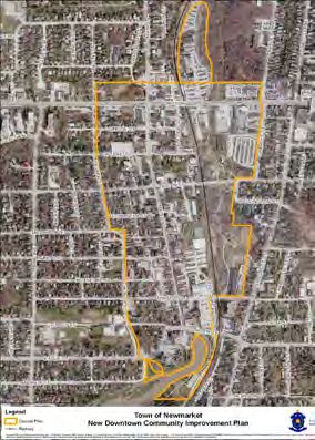
Town of Newmarket New Downtown
• Planning and Building Fees Equivalent Rebate/Credit Program: Community Improvement Plan
Incentives to create the desire to develop or redevelop.
13NEWMARKET GO STATION MOBILIT Y HUB STUDY 2.0 PREVAILING PLANNING FRAMEWORK
• Parking Requirement Relief or Reduction Program: To facilitate
development or redevelopment by providing relief or
assistance to properties that are unable to meet the Town’s
parking requirements.
The Newmarket GO station
2.4 Lake Simcoe Region Conservation Authority mobility hub is located
(LSRCA) within the jurisdiction of
the Lake Simcoe Region
The Newmarket GO station mobility hub is located within the
jurisdiction of the LSRCA. Conservation Authorities are mandated Conservation Authority
to ensure the conservation, restoration and responsible (LSRCA).
management of Ontario’s water, land and natural habitats
A topographic survey and
through programs that balance human, environmental and
economic needs. detailed floodplain analysis
will be required to confirm
The Lake Simcoe Region Conservation Authority Watershed
the limits of the flood fringe
Development Guidelines (2015) are intended to implement
provincial regulations pertaining to the development, and floodplain within the
interference with wetlands and alteration to shorelines and mobility hub.
watercourses. The Guidelines stipulate a preference for no new
development within the floodplain, but a Two-Zone approach
permits some limited new non-residential development within
the flood fringe. The limits of the floodplain shown within the
Town of Newmarket Official Plan, the Newmarket Urban Centres
Secondary Plan, and the LSRCA’s regulatory mapping is intended
for screening purposes only. Any application for development
within the floodplain or flood fringe will require a topographic
survey and detailed floodplain analysis to properly delineate
the floodplain limits and potential depths of flooding during a
flood event. Any site alteration or development within an area
governed by Ontario Regulation 179/06 under the Conservation
Authorities Act would require a permit from the LSRCA and
works would be required to be in accordance with the LSRCA
Watershed Development Guidelines.
A number of Tri-party agreements exist for properties within the
Newmarket GO station mobility hub that allow for some potential
redevelopment within the floodplain.
Future development proposals must demonstrate conformity
with applicable provincial, regional, municipal and LSRCA
policies and guidelines. All development applications will be
subject to approval by York Region, the Town of Newmarket
and the LSRCA, and must satisfy any identified conditions or
requirements.
14You can also read


