Strategic Governance Options for the Great Ocean Road Case studies - AWS
←
→
Page content transcription
If your browser does not render page correctly, please read the page content below
Strategic Governance Options for the Great Ocean Road

Strategic Governance Options for
the Great Ocean Road
Case studies
9 April 2018

    1
Strategic Governance Options Assessment for the Great Ocean Road: Case studies reference document

Contents
Introduction                                                                                        3

Learnings from others: Profiling governance arrangements of global tourism destinations             7

       Great Barrier Reef                                                                            9
       Milford Sound                                                                                20
       Big Sur                                                                                      28
       Cinque Terre                                                                                 34

               Strategic Management Structure                                                       41

References                                                                                          42

Limitation of our work                                                                              44

2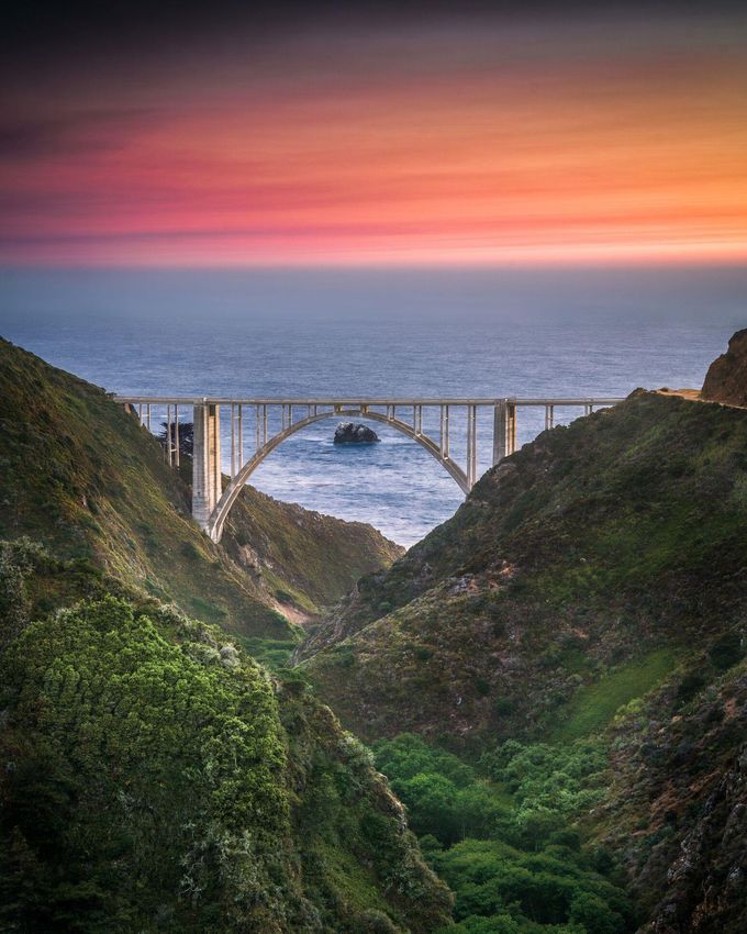
1 Introduction
This report explores four well-known tourism destinations as case studies. Each case study shares some
similarities with the Great Ocean Road as a destination. These case studies provide an opportunity for the
Great Ocean Road Taskforce to identify lessons learned and ideas that could help shape thinking around
potential governance arrangements. The structure of each case study purposefully sets out:
the features of the destination;
the drivers of the governance arrangements; and
a description of current governance arrangements and, in some cases, funding and revenue-
raising arrangements.
Background
On 14 September 2017, the Victorian Government announced the establishment of the Great Ocean Road
Taskforce. The Taskforce’s responsibilities include:
Review the effectiveness of the current governance arrangements for the Great Ocean Road and
its landscape;
Consult extensively with Traditional Owners of Country, Responsible Public Entities and local
communities; and
Make recommendations on governance reforms to protect the distinctive landscapes, improve the
visitor experience and attract investments that benefit both tourists and local communities.
To fulfil this remit, the Taskforce is undertaking several streams of work, including examining a range of
future potential governance options for the Great Ocean Road.
Deloitte Access Economics has been commissioned to support the Taskforce examine existing governance
arrangements and identify and consider potential future governance options for consideration.
This report is intended as a reference document as part of the Great Ocean Road Taskforce’s work
program. It presents a summary of select global tourism destinations and their corresponding governance
arrangements, enabling the Taskforce and stakeholders to consider how elements of these arrangements
could inform the development of future governance arrangements for the Great Ocean Road.
Victoria’s Great Ocean Road
The Great Ocean Road is a significant tourism, cultural and economic region of Victoria. Within a 90-
minute drive from Melbourne, the tourist route stretches 243km, encompassing the roads, coastal Crown
land and communities from Port Fairy to Torquay.
Each year, over five million visitors come to experience Victoria’s cultural, ecological and heritage-listed
attractions along the Great Ocean Road.
Visitors are drawn by incredible coastal views and cliff faces, intertwined with serene rainforest and
greenery. Whilst the rare landscape, flora and fauna is a marker of the high ecological and economic
value of this area, particularly to local indigenous communities.
Coupled with the region’s natural and cultural heritage, is the historical importance of this area to
Victoria. The Great Ocean Road was originally constructed by returned servicemen and has great
meaning to war veterans and their families. Today the road remains a memorial for the First World War.
The National heritage-listed tourist road is also an access route for the isolated local communities along
its length providing connection to the regional transport network and an emergency access route
These remarkable elements – the unique geography, cultural fabric and local history of the area combine
to make the Great Ocean Road a truly exceptional part of Victoria.
3
Strategic Governance Options Assessment for the Great Ocean Road: Case studies reference document
Challenges facing this globally significant destination
Despite its importance, the Great Ocean Road is encountering a number of economic, social and
environmental challenges, many of which are interconnected. There is a need for these to be addressed
to ensure the current and future prosperity of local communities, recognition of indigenous heritage and
protection of a unique natural environment, balanced with respectful development that positions the
region to release greater economic benefits from a thriving visitor economy.
These challenges are well understood by key stakeholders involved in the Great Ocean Road. These have
been identified in various consultations dating back to the 2004 Great Ocean Road Regional Strategy, as
well as recent consultations conducted on behalf of the Great Ocean Road Taskforce. These views are
supported by various planning work that has been completed including the 2015 Shipwreck Coast
Masterplan and 2015-2025 Strategic Master Plan for the Great Ocean Road Region Visitor Economy.
It is the general consensus that a number of challenges stem from and can be addressed by examining
the existing governance arrangements of the Great Ocean Road Region.
Presently there are a significant number of public entities with varying accountabilities ranging from
strategy development, land-use planning and development, infrastructure delivery, asset maintenance,
emergency management, investment facilitation, destination promotion as well as management of the
environment and local ecology. The scale and quantum of organisations involved in governance in the
region means there is a degree of duplication and inefficient allocation of resource spending across the
board – limiting the effectiveness of processes intended to realise key economic, environmental, cultural
and heritage outcomes for the region. It also means that it is difficult to progress solutions when the
challenges that straddle geographic boundaries or that relate to multiple entities. This includes the need
to enhance engagement and participation of Traditional Owner Communities (Wadawurrung and Eastern
Maar people).
Key notable challenges include:
Absence of complementary visitor experiences, to manage congestion bottleneck areas along the
Great Ocean Road;
Realise greater economic benefits for the region, particularly the 12 Apostles;
Inconsistent application of land-use planning approvals framework, constraining appropriate
private sector investment;
Limited systems view of the Great Ocean Road, resulting in decisions that effect, a specific local
perspective being prioritised over a holistic vision for the region;
Completion of numerous studies and strategies over a period of time, without a clear
implementation mandate for the length of the Great Ocean Road;
Limited availability of public funding, with no mechanism to target funds to efficiently address
regional priorities;
Limited use and application of revenue raising mechanisms, particularly for visitors to the region;
Limited holistic view regarding environmental and coastal management planning; and
Limited participation and resourcing for appropriate representation of Traditional Owners.
These challenges are not unique to the Great Ocean Road, and are experienced by similar destinations in
other jurisdictions.
Presentation and purpose of case studies
The destinations that have been profiled include:
Great Barrier Reef, Australia;
Milford Sound, New Zealand;
Cinque Terre, Italy; and
Big Sur, United States of America
These destinations were selected based on features that have some parallel with the Great Ocean Road.
Each destination draws visitors based on its unique natural environment and landscape. And importantly,
each has to carefully balance protecting its valuable environmental asset, with needs of local
communities (including in some cases indigenous communities) and the visitor economy. Notwithstanding
these areas of similarity, there are also some distinct differences driven by bespoke history and heritage.
A case study approach has enabled a close examination of each destination’s governance arrangements,
including (structure, legislative mechanisms and reporting relationships) to be understood within each
destination’s unique context and drivers (environmental degradation, visitor revenue yields, congestion,
private sector investment, multiplicity in entity structures etc.).
4
Table 1 below outlines some commonalities shared by each of the destinations profiled.

Table 1 Overview of case study commonalities

Commonalities                         Description

Environmental asset drives tourism    The attraction and popularity of each tourism destination is
                                      driven by its attraction as a natural, environmental asset.

Increased visitor numbers             Each destination is experiencing significant domestic and
                                      international visitor growth, which is projected to continue in line
                                      with global trends.

Visitor congestion                    The nature of the landscape and environment encompassing
                                      Milford Sound, Cinque Terre and Big Sur have historically limited
                                      the size of visitor routes. Consequently, visitor growth has and is
                                      continuing to result in visitor congestion in concentrated areas.

Public amenities                      Across all tourism destinations, increased pressure is being
                                      placed on public amenities and infrastructure (particularly public
                                      restrooms) due to the high visitor volume (with the exception of
                                      Great Barrier Reef).

Availability and quantum of funding   Each destination is increasingly facing funding pressures and are
                                      looking to optimise its governance and revenue raising
                                      arrangements to increase the availability and prioritisation of
                                      funding.

Continuous improvement approach to    Given the complexity of issues and challenges faced by each
governance arrangements               destination, each has recently instituted changes to its
                                      governance arrangements or has undergone reviews to look for
                                      opportunities for optimisation.

Table 2 below summaries some key differences between each of the tourism destinations that have been
profiled.

Table 2 Overview of case study differences

Differences                           Description

Limited private sector investment     The fragmented nature of the governance arrangements of Big
                                      Sur and Milford Sound, in addition to strategic planning
                                      accountability, is limiting the ability to attract private sector
                                      investment in product and experience development.
                                      Alternatively, Cinque Terre and Great Barrier Reef have
                                      embraced private sector investment, including collecting revenue
                                      from this market.

Low yield                             Unlike Great Barrier Reef and Cinque Terre, Milford Sound and
                                      Big Sur face the challenge of growing visitor expenditure and
                                      yields. There are a number of drivers for this, including the
                                      planning framework, local community interest as well as the
                                      quality and quantity of public amenities and supporting
                                      infrastructure.

5
Strategic Governance Options Assessment for the Great Ocean Road: Case studies reference document
Differences Description
Extent of fragmentation in governance The level of fragmentation across each destination’s governance
arrangements arrangements vary. Where the Great Barrier Reef has looked to
streamline governance through Great Barrier Reef Marine Park
Authority, Milford Sound and Big Sur have sought to retain
multi-entity participation. However, they have centralised
accountability around strategic planning.
Land ownership The mix of land ownership between public and private varies
across all destinations, which in turn has some influence on the
land use planning framework.
Statutory delegation All governance arrangements are enabled within a legislative
framework, however each provide varying levels of delegation
between local, state and federal government entities and special
purpose governance entities and groups.
Engagement with community There are varying levels of community engagement and
participation in governance arrangements across each
destination – including community representation on Advisory
Committees and Action Groups through to representation via
their local Council.
Environmental preservation Great Barrier Reef and Cinque Terre have experienced major
environmental damage, which is threatening the longevity of
these destinations.
Indigenous representation Indigenous representation in Milford Sound and Great Barrier
Reef is highly valued and important, with formal representation
in governance arrangements. It is unclear as to whether Big Sur
and Cinque Terre do the same or whether they are required to.
Detailed case studies are set out on the following pages. As mentioned above, the structure of each case
study purposefully sets out:
the features of the destination;
the drivers of the governance arrangements; and
a description of current governance arrangements and, in some cases, funding and revenue-
raising arrangements.
6Strategic Governance Options Assessment for the Great Ocean Road: Case studies reference document
2 Profiling governance
arrangements of global
tourism destinations
7Strategic Governance Options Assessment for the Great Ocean Road: Case studies reference document
Great Barrier Reef
8Strategic Governance Options Assessment for the Great Ocean Road: Case studies reference document
Great Barrier Reef
The Great Barrier Reef spans 2,300 kilometres of water off the east coast of
Queensland, Australia. The Reef stretches from the Southern Coastal town of Bundaberg
all the way to Cairns.
The Reef is the largest coral reef in the world and attracts over 2.6 million visitors
annually, contributing an estimated $6.4 billion in gross value added to the Australian
economy. Commercial fishing and aquaculture are also important drivers of the Reef
economy, with an estimated gross value added of $162 million in 2015-161.
Key threats to the health and long-term sustainability of the reef are environmental and
include climate change, crown of thorn starfish, illegal fishing, pollution, oil spills,
shipping accidents and tropical cyclones.
The Great Barrier Reef Marine Park Authority (GBRMPA) has managed the reef for over
forty years. The authority is responsibility for setting the strategic plan, managing
activity in the Marine Park, jointly making funding decisions with government and
working with the communities and industries that depend on a healthy reef for
recreation and their livelihoods2.
GBRMPA has strong connections and interactions with Reef stakeholders – tourism,
environment, citizen science groups and the public more broadly – while obviously not
formally part of its governance arrangements, it forms an important part of its operating
model as an organisation.
1
(Deloitte Access Economics, 2017) At What Price? The economic, social and icon value of the Great Barrier Reef
2
(Great Barrier Reef Marine Park Authority, 2018 b)
9Strategic Governance Options Assessment for the Great Ocean Road: Case studies reference document
Context and history
The Great Barrier Reef spans 2,300 kilometres of water off
the east coast of Queensland, Australia. It is the largest living
structure on Earth, comprising over 2,900 individual reefs and
900 islands over an area of approximately 344,400 square
kilometres.3
The Great Barrier Reef is one of the seven natural wonders of
the world, attracting more than 2.6 million visitors (including
standalone coral viewing activities and scenic flights).4 In
2017, Deloitte Access Economics valued the economic
contribution of the Great Barrier Reef to the Australian
economy at $6.4 billion, with 64,000 jobs supported.5 The
significant cultural heritage and spiritual value of the Great
Barrier Reef to Aboriginal and Torres Strait Islander peoples Figure 1 Map of the Great Barrier Reef
is widely recognised and is embedded in Indigenous culture
Source: (Great Barrier Reef Marine Park
and wisdom. Authority, 2018 c)
Challenges and opportunities faced by the Great
Barrier Reef
Increasing visitor numbers and ongoing environmental threats have created a number of challenges and
opportunities for the Great Barrier Reef.
Challenge / opportunity Description
Environmental preservation The major ongoing environmental threats to the health of the
reef are climate change, pollution, crown-of-thorns starfish and
fishing. Other threats include shipping accidents, oil spills, and
tropical cyclones.
Human use The Great Barrier Reef Marine Park and its Authority were set up
in 1975 to manage the effects of direct human use including
fishing, shipping and tourism. Maintaining the health of the Reef
is crucial not only for the thousands of marine species the Reef
supports, but also the economic value it generates from tourism
and the existence value many place on the Reef.
Increased tourism More than 2.6 million people visit the Great Barrier Reef each
year. Although most of these visits are managed in partnership
with the marine tourism industry, there is a concern that
increased tourism may be harmful to the Great Barrier Reef.
Management of tourism in the Great Barrier Reef is geared
towards making tourism ecologically sustainable.
3
(Great Barrier Reef Marine Park Authority, 2018 c)
4
In the year to June 2017: (Great Barrier Reef Marine Park Authority, 2018 a)
5
(Deloitte Access Economics, 2017) At What Price? The economic, social and icon value of the Great Barrier Reef
10Strategic Governance Options Assessment for the Great Ocean Road: Case studies reference document
Overview of governance arrangements
Great Barrier Reef Marine Park Authority
In 1975 the Australian Government created the Great Barrier Reef Marine Park (GBRMPA) to limit the
impact of human use including fishing, shipping and tourism on the reef. The complex and important
biodiversity of the reef was further recognised in 1981 when the site was listed as a World Heritage Site
and again in 2007 when the Reef was added to Australia’s National Heritage List. Existing statutes were
updated to ensure compliance with world heritage values. Similarly, non-statutory tools like site
management and Industry Codes of Practice contribute to the protection of World Heritage values. 6
The Great Barrier Reef is managed by GBRMPA, a Statutory Authority established when the Marine Park
was created by the Commonwealth Government. The Authority is responsible for setting the strategic
plan, managing activity in the Marine Park, jointly making funding decisions with the Queensland
Government and working with the communities and industries that depend on a healthy reef for
recreation and their livelihoods7.
GBRMPA reports to the Federal Minister for the Environment, having the key function of making
recommendations to the Minister in relation to the care and development of the Marine Park.
The roles and responsibilities of the Authority are set out in the Great Barrier Reef Marine Park Act 1975.
Some of these functions include:
Managing the Marine Park, including ensuring ecological sustainability and protecting heritage values
Receiving and disbursement of money relating to the Marine Park
Preparation and publication of plans about the way the Authority intends to manage the Park or
perform its other functions
Prepare zoning plans and management plans including a five yearly Outlook Report
Carry out and arrange research relevant to the Marine Park
Provide or arrange for the provision of education, advisory and informational services relating to the
Marine Park
GBRMPA also has the authority to fine park visitors for Commonwealth offenses such as removing
protected coral and marine life, and breaching zoning rules including illegal fishing8. Figure 2 provides an
overview of the organisational structure of GBRMPA.
6
The Great Barrier Reef Marine Park Act 1975 was amended in 2007 and 2008, and now provides for “the long term
protection and conservation ... of the Great Barrier Reef Region” with specific mention of meeting "... Australia's
responsibilities under the World Heritage Convention." (Department of Environment and Energy (C'Wlth), n.d.)
7
(Great Barrier Reef Marine Park Authority, 2018 b)
8
As with all Commonwealth and State criminal and civil offenses, penalty units are paid to the respective Treasury
11Strategic Governance Options Assessment for the Great Ocean Road: Case studies reference document Figure 2 Overview GBRMPA organisation structure 1. Role of General Manager: Three general managers are responsible for corporate services and the daily management function of the GBRMPA; policy and stewardship, Great Barrier Reef operations, Biodiversity conservation and sustainable use. 2. Role of staff units: Staff units support the operational function of the Great Barrier Reef Marine Park Authority. e.g. Legal Services. 12
Strategic Governance Options Assessment for the Great Ocean Road: Case studies reference document

Strategic Management of the Reef

GBRMPA has responsibility for setting strategic objectives relating to the Reef and its Marine Park, in
conjunction with the Australian and Queensland Governments. Members of the board are required to
have qualifications or extensive experience in a field related to the functions of the Authority, including
the tourism industry, and at least one member must be Indigenous with an understanding of Indigenous
issues in the Marine Park9. The strategic planning process is supported by a number of independent and
expert panels and committees. Figure 3 provides an overview of the strategic planning governance
arrangements.

Figure 3 Strategic management function of the Great Barrier Reef Marine Park Authority

Source: (Deloitte Access Economics, 2018); (Craik, July 2017)

1. Minister for Department of Environment and Energy (Australian Government): The Minister selects
   Chairman & board members (who are appointed by the governor-general).

2. Great Barrier Reef Marine Park Authority Board: The Board is responsible for the efficient and
   effective performance of the legislative functions of the Authority. Discussions by the board are
   focused on broad policy and legislative matters. The board meets four times each year.

3. Audit Committee: The GBRMPA is accountable to the Government and public through the same
   mechanisms that apply to other government bodies. The Audit committee ensures the Board and the
   Authority comply with all requirements.

9
    Great Barrier Reef Marine Park Act 1975 S10(6), S10(6A), S10(6B)

                                                                                                                              13
Strategic Governance Options Assessment for the Great Ocean Road: Case studies reference document
4. Advisory Committees: Advisory committees support the board
The marine committees involve local communities and stakeholders.
The two Reef 2050 committees advise the board on identified issues in the Great Barrier Reef
Region Strategic Assessment Report, Program Report and the Authority’s own Outlook
Report.
The current long term strategic planning and management of the reef is guided by the following major
documents:
Reef 2050 Long Term Sustainability Plan (Reef 2050 Plan)
Reef 2050 Water Quality Improvement Plan
2014 Strategic assessment
25 Year Management plan
Outlook Report
Figure 4 provides an overview including the main aim of each report and the body responsible for
producing the report.
14Strategic Governance Options Assessment for the Great Ocean Road: Case studies reference document
Figure 4 Strategic documents supporting the long-term health of the Reef
Source: (Deloitte Access Economics, 2018)
1. Great Barrier Reef Ministerial Forum: The Forum is responsible for the environment and marine
parks, science, tourism and/or natural resource management and implements the Intergovernmental
Agreement.
The Forum published the Reef 2050 and Reef 2050 Water Quality Improvement Plans (under the
2009 agreement).
15Strategic Governance Options Assessment for the Great Ocean Road: Case studies reference document Management of activities outside of the Marine Park Given the interconnectedness of the reef system with the coastal ecosystem and inland river systems, activities on upstream land and waterways that impact upon the reef often occur outside the Marine Park’s jurisdiction. These lands and waterways fall under the management of both the Federal and Queensland Government. Both tiers of government have a number of general acts that restrict land use to help protect the immediate effects on land from poor management or dangerous practices and to prevent the negative externalities caused downstream. In 2013 the Queensland Government developed its Water Quality Protection Plan to specifically prevent the negative externalities caused downstream in Reef Catchments. The plan set water quality improvement targets for 2025. Its scope was expanded in 2017 to addresses all land-based sources of water pollution to become the Reef 2050 Water Quality Improvement Plan. Funding and revenue generating arrangements Across governments, industry and the community, more than $1.2 billion has already been committed for the five years to 2021 for projects focused solely on delivering actions in the Reef 2050 Plan. The Reef 2050 Plan is supported by a robust investment framework that 10: 1. Establishes current investments in Reef protection 2. Determines investment priorities for the future 3. Sets out a strategy for boosting investment and diversifying its sources. The aim of the Framework is to channel new investment toward identified priorities and to inform the use of regulatory and policy levers that, along with investment, are critical tools to support the achievement of priority projects. One such lever is the Reef Trust, which was established in September 2014 by the Australian Government11 in conjunction with the Queensland Government and the Great Barrier Reef Marine Park Authority. The Trust was set up with an initial federal government contribution of $260 million. The Reef Trust The Trust funds priority projects on the Great Barrier Reef. The objective of the Trust is to deliver funding to projects focused on improving water quality, restoring coastal ecosystem health, address threats, and protect, repair and mitigate damage to the Great Barrier Reef World Heritage Area. To support the trust in its objective is a joint steering committee, the Reef 2050 Advisory Committee and the Reef 2050 Independent Expert Panel. The governance and administration structure of the trust is outlined in Figure 5. The selection of projects by the Trust is guided by the Reef 2050 Plan and the Reef 2050 Water Quality Improvement Plan and are delivered by experienced partners. Delivery partners must report to the Reef Trust on a project’s performance every six months and take an adaptive approach to managing the delivery of the project.12 The Reef Trust has strict financial accountability and reporting requirements. Investment is undertaken in accordance with the Public Governance, Performance and Accountability Act 2013, Commonwealth Grant Rules and Guidelines, Commonwealth Procurement Rules and Guidelines for the Management of Special Accounts. 10 (Department of Environment and Energy (Commonwealth), 2016) 11 Reef Trust Special Account 2014 Determination 01 under the section 78 of the Public Governance, Performance and Accountability Act 2013. 12 (Reef Trust Governance and Administration , September 2016) 16
Strategic Governance Options Assessment for the Great Ocean Road: Case studies reference document

Figure 5 Reef Trust - Governance and Administration

Source: (Reef Trust Governance and Administration , September 2016)

1. Joint Steering Committee: The Joint Steering Committee provides oversight and advice on the
   delivery of the Reef Trust, development of investment strategies and delivery and implementation of
   Reef Trust projects.

2. Reef 2025 Advisory Committee: The Reef 2050 Advisory Committee is also utilised by the Reef Trust
   to facilitate engagement with the broader community and industry and provide strategic advice on
   the implementation of the Reef 2050 Plan, including the Reef Trust.

3. Reef 2050 Independent expert panel: Provides independent expert advice on Reef Trust funding
   priorities and projects.

                                                                                                                             17
Strategic Governance Options Assessment for the Great Ocean Road: Case studies reference document
Table 3 provides a summary of the governance responsibilities for the Great Barrier Reef for each level of
government and the private sector.
Table 3 Overview of governance responsibilities
Strategy Regulation Coordination Strategy Funding
setting delivery
Overarching body ● ● ● ●
Federal Government ● ● ● ●
State Government ● ● ● ●
Local Government
Private Sector ● ●
Environmental Management Charge
GBRMPA levies an environmental management charge on most commercial activities within the reef to
support its operational duties. Tourism operators, non-tourist charter operations, and facilities operated
under a permit issued by the GBRMPA are liable for the charge. The charge for full day visitors is $6.50
and part day visitors $3.25. Semi-submersible and glass-bottomed boat excursions and scenic flights
collect a fee of 40 cents per visitor per excursion.13
Other operations within the Park including hire of equipment, installation and operation of tourist
facilities, underwater observatories, sewage outfalls and vending operations pay a fixed quarterly charge.
The charge varies for each activity and ranges from $12 for non-motorised beach equipment operators
with fewer than six pieces through to $500 for the first 10 hectares of mariculture operations, such as
pearl farms.
Private sector investment
Attracting private sector investment that responds to the Reef’s conservation concerns while addressing
the opportunity for economic growth is challenging. There are two main pathways for private investment
into the Reef and the undertaking of commercial operations:
1. Standard investment channels: While private investors may raise money, how they spend the money
in or around the Reef is subject to strict statutory planning controls. The Great Barrier Reef Marine
Park has seven planning zones that outline what activities are permitted and forbidden in each area of
the park, including activities that require a permit:
General use zone
Habitat protection zone
Conservation park zone
Buffer zone
Scientific research zone
Marine National Park Zone
Preservation Zone
Investment relating to coastal development (including buildings, vegetation alterations, other built
structures) is subject to local land use laws (statutory planning controls) but also planning overlays
implemented by the State Government including measures to protect wetlands that flow into the
Great Barrier Reef Catchment System.14
13
(Great Barrier Reef Marine Park Authority, 2016)
14
(Department of Environment and Protection (Qld), July 2017)
18Strategic Governance Options Assessment for the Great Ocean Road: Case studies reference document
2. Partnerships with the Reef Trust: The Reef Trust explores opportunities to partner with the private
sector to achieve its conservation goals. Proposals from both individuals and organisations from
industry and the finance, corporate, philanthropic, natural resource management, community and
environmental sectors for projects to enhance Reef conservation are welcomed. Ideally projects will
bring forward co-investment with a project value of $2 million or more.15 Other commercial ventures
are not considered.
Governance Review
An independent review examining the GBRMPA governance structure was announced by the Minister for
the Environment on 7 March 2017 with the final report published on 30 November 2017. A series of 24
recommendations were made with the Australian Government committing to implement the full suite of
recommendations. None of the recommendations suggested a dramatic change to the current governance
arrangements of the GBRMPA. Rather, the recommendations largely related to redefining and or
strengthening existing arrangements relating to:
The scope of the role of The Chairman / CEO of the Board (3, 4, 5, 22);
Selection process for new board members (6, 9, 10, 12, 13) and tenure for existing (11), including
appointing an additional two board members (10)
The structure of advisory committees. Existing committees should be updated regularly to ensure the
board receives the most up to date advice (23) while the board should consider developing a broad
based stakeholder committee to advise on matters relating to the management of the Marine Park (24)
Conflict of interest processes (13, 20).
Other recommendations included:
The board should consider meeting more frequently (15)
The board should implement a performance review process (16) that aligns with a new charter (18)
The governor general should have the power to terminate board members if they do not meet the
performance standards set (17)
Senior management capacity should be enhanced and clear responsibilities and reporting lines set
(19, 21, 22)
Induction processes for the board should be formalised (14).
Some of the recommendations (1, 7, 8, 10) also confirmed that the existing structure should be retained.
Recommendation 2 was for the Ministers and recommended joint statements from the Australian and
Queensland Government.
15
(Department of Environment and Energy (Commonwealth), n.d.)
19Strategic Governance Options Assessment for the Great Ocean Road: Case studies reference document
Milford Sound
20Strategic Governance Options Assessment for the Great Ocean Road: Case studies reference document
Milford Sound
Milford Sound is a destination 15 kilometres inland within the Southland region on the South island
of New Zealand. Notable attractions include:
o Peaks: the Elephant and the Lion
o Waterfalls: Lady Bowen Falls and Stirling Falls
Milford Sound attracts approximately 875,000 visitors per annum, making it one of New Zealand's
most-visited tourist spots. There is limited accommodation at Milford Sound, and only a very small
percentage of tourists stay more than the day.
While there are a number of travel options for getting to Milford Sound including boat, air or road,
the vast majority arrive by road and there is only one road providing access.
There is adbundant wildlife observation and conservation. Cruises and walking tracks allow visitors
to experience widlife in their natural habitat. However, the focus is on conservation of native
animals and plants. Many of the plant and animal species in Milford Sound can only be found in the
Fiordland region due to its remote location and the damp wet weather.
There are a number of travel options for getting to Milford Sound including boat, air or road;
however, the majority arrive by road and there is only one road providing access.
Milford Sound is a UNESCO World Heritage site.
In 2016, the Department of Conservation and Southland District Council jointly set out to oversee a
set of governance arrangements that would institute a process to manage the strategic planning of
the Southland region (including Milford Sound) as well as the ongoing management of key assets
and areas such as Milford Sound. The overseeing entity that was established to drive this was the
Southland Regional Development Strategy (SoRDS) Governance Group.
As Milford Sound was identified in the Action Plan as significant for the Southland region visitor
economy, the SoRDS Governance Group established the Milford Opportunities Governance Group to
specifically drive local visitor economy SoRDS actions. The two governance bodies now sit alongside
each other as complementary strategic planning entities.
21Strategic Governance Options Assessment for the Great Ocean Road: Case studies reference document
Context and history
Milford Sound is located 118 kilometres from the town of Te Anau on the
south west coast of New Zealand’s South Island. It runs 15 kilometres
inland from the Tasman Sea at Dale Point (the mouth of the fiord), and is
surrounded by sheer rock faces that rise 1,200 metres or more on either
side. Among the peaks are The Elephant at 1,517 metres and The Lion at
1,302 metres.
Milford Sound sits within Fiordland National Park. The park is part of Te
Wahipounamu, a UNESCO World Heritage site. Milford Sound is the key
attraction of Fiordland National Park, drawing over 875,000 tourists in the
year to June 2017. Visitor numbers to Milford Sound are predicted to
exceed 1 million by 2019 — more than double 2012 visitation levels of
457,00016.
Despite its name, Milford Sound is actually a fiord, not a sound. It is also the only fiord in New Zealand
that is accessible by road. However, its remote location, bounded by steep cliffs and dense rainforest,
means its special features remain unspoilt.
Milford Sound sports two permanent waterfalls, Lady Bowen Falls and Stirling Falls. After heavy rain,
temporary waterfalls run down the steep sided rock faces that line the fiord. Accumulated rainwater can
cause portions of the rainforest to lose their grip on the sheer cliff faces, resulting in tree avalanches into
Milford Sound.
Challenges and opportunities faced by Milford Sound
Increased visitor numbers to Milford Sound have created a number of challenges and opportunities that
the Sound needs to overcome.
Challenge / opportunity Description
Daily visitors only Despite its popularity, most of Milford Sound’s patronage
consists of daily visitors. Tourists visiting the Southland region of
New Zealand travel on average 156 kilometres per day17. Many
of these tourists travel from Queenstown (287 kilometres) or Te
Anau (118 kilometres). Milford Sound’s high visitation is a great
opportunity but low yield of daily visitors is a key challenge.
Traffic congestion and road safety Accompanying the rapid increase in patronage over the last five
years is a 30 per cent jump in traffic volumes18, leading to
congestion and other traffic problems along the Milford Road
(State Highway 94). This is the sole road in and out of the Sound
and is shared by cars, campervans, coaches and minibuses, with
variable speeds along the road common due to inexperienced
road users and changeable weather conditions. The long distance
to Milford Sound means that tourist operators and self-drivers
from Queenstown all depart very early in the day, arriving back
only late in the evening. This means that most tourists visit
Milford Sound within a few hours around midday, leading to
congestion on the roads and at the tourist facilities during the
main season.
The New Zealand Traffic Authority (NZTA) estimates that 85
percent of drivers on the Milford Sound Road are tourists —
16
(Harding, 2017)
17
(Venture Southland, 2018)
18
From 2015 to 2016: (Harding, 2017)
22Strategic Governance Options Assessment for the Great Ocean Road: Case studies reference document
Challenge / opportunity Description
either domestic or international. While the road is well
maintained, it is nevertheless a challenging and, in places,
narrow and winding drive.
Road conditions are monitored by the Department of
Conservation (DoC) with the road status listed on signage
throughout the National Park, the NZTA’s website and an
information kiosk 8 kilometres north of Te Anau19.
The journey can take far longer than the distance suggests which
can lead to fatigue and unsafe driving habits20. Other risks
include rain, snow, ice, flooding and avalanches and it is not
uncommon for the road to be closed at short notice due to
inclement weather or a traffic incident. While the Southland
Region does not record a higher number of road fatalities
relative to other regions in New Zealand21, the share of
international drivers involved in all crashes is higher in the
Southland district, at 23 percent compared to 4.1 per cent
nationwide between 2012-201622.
DoC advises an eight-hour day is needed from Te Anau, while
visitors should expect the trip from Queenstown to take 12 to 14
hours. Due to the long travel times, challenging road conditions
and variable weather, the DoC, NZTA, New Zealand Tourism and
Drive Safe New Zealand all recommend visitors take a coach to
the Sound rather than self-drive.
Despite this consistent message, traffic data from the Homer
Tunnel indicates that light vehicle volumes (associated with self-
drivers) are increasing. In 2013 124,000 vehicles passed
through the Homer Tunnel, with 23,560 (19%) of those heavy
vehicles or buses, while in 2016 this share had slipped to 18% or
29,520 out of a total 164,000 vehicles.23 With an increase in
self-drivers across the country, the Visiting Drivers Project was
launched — a collaboration between the NZTA and tourism
associations to ensure road safety for international drivers24.
Initiatives include online training for travel agents, road safety
pamphlets with visas, multilingual driver safety videos (played
on international flights) and a Drive Safe website.
Infrastructure and public amenities Increasing visitor numbers also presents challenges to the
existing infrastructure, including toilet facilities. Chinese New
Year is a notably busy period for the natural icon, with New
Zealand’s Department of Conservation having to operate
overflow carparks in recent years. Additionally, there are a
number of mobile coverage issues in the region. The Mobile
19
(New Zealand Transport Authority, 2018)
20
(Tourism New Zealand, n.d.); (Nicholl, 2017)
21
4.9% (16 deaths) of the 1500 national road fatalities occurred in the Southland region in 2016 compared to the top
three fatality regions Waikato (24.2%), Auckland (14.1%) and Canterbury (10.4%). Conversely, Gisborne and the
West Coast are the lowest at 1.2% (4 deaths). (New Zealand Transport Authority, 2018)
22
(New Zealand Ministry of Transport, September 2017)
23
(Nicholl, 2017)
24
The number of crashes involving international tourists across the country has remained steady over the last 10
years despite an increase in international tourism numbers of 45%. (New Zealand Ministry of Transport, September
2017)
23Strategic Governance Options Assessment for the Great Ocean Road: Case studies reference document
Challenge / opportunity Description
Black Spot Fund has been created to address this and expand
coverage to include Milford Sound25.
Multiple management entities There are several entities involved in the management of the
Southland region (and Milford Sound). Streamlining and
establishing a coherent strategic plan for the area has been
identified as an immediate challenge that is currently being
addressed through new governance arrangements.
Funding It is hoped these new governance arrangements will be
supported by government funding that will provide a project
manager and planning work for the next 15 to 20 years for
Milford Sound. It is expected that the Department of
Conservation will provide some funding; however, it also hopeful
that funding will come from the central government as the whole
of New Zealand will benefit from the business tourism brought to
the country. There is an opportunity for Southland, Central
Otago and the rest of the country to increase economic returns
from visitors to Milford Sound and Fiordland National Park.
Additionally, the majority of local council funding comes from
residential council rates. However, the large number of visitors
relative to local residents is putting pressure on the abilities of
the local councils to fund infrastructure maintenance required
due to increasing pressures from tourism.
Strong resource management Milford Sound has established very strong resource management
through the Resource Management Act. The Act ensures
mechanisms are in place to protect Milford Sound’s environment
and covers both publically owned and privately owned land.
Overview of governance arrangements
The visitor economy has been identified as a central pillar to the economic success of the broader
Southland region of New Zealand, including Milford Sound. Given the challenges and opportunities
mentioned above in the visitor economy surrounding Milford Sound, the region commenced a governance
reform process in 2017.
The National Parks Act 1980 is the key legislation that sets out the legal and regulatory management of
Fiordland National Park. Milford Sound sits within Fiordland National Park. The Minister of Conservation is
charged with responsibility for this Act and delegates its responsibility to The Department of
Conservation. This legislation is supported by the Fiordland National Park management plan and
Fiordland National Park bylaws. Additionally, the Conservation Act 1987 sets out responsibility to
formulate policy specific to Fiordland National Park. Responsibility under this Act has been delegated to
the Southland Conservation Board.26
25
(Pullar-Strecker, 2017)
26
(Department of Conservation, June 2007)
24Strategic Governance Options Assessment for the Great Ocean Road: Case studies reference document
Figure 6: Overview of Milford Sound legislation
In 2016, the Department of Conservation and Southland District Council jointly set out to oversee a new
governance arrangement for the Southland region (including Milford Sound). The overseeing entity that
was established to drive this was the Southland Regional Development Strategy (SoRDS) Governance Group.
Although the SoRDS Governance Group has overall responsibility for strategic planning, it commenced an
inclusive and consultative process, ensuring representation of community issues and priorities. The
Governance Group noted this structure was highly successful in delivering targeted and well-researched
inputs to the Action Plan.
As Milford Sound was identified in the Action Plan as significant for the Southland visitor economy, the
SoRDS Governance Group established the Milford Opportunities Governance Group to specifically drive
local visitor economy SoRDS actions. The two governance bodies now sit alongside each other as
complementary strategic planning entities.
Figure 7 provides an overview of these governance arrangements described above. A more specific
description of each governing entity involved is provided below.
Figure 7: Overview of Southland District governance arrangements (including Milford Sound)
25Strategic Governance Options Assessment for the Great Ocean Road: Case studies reference document
1. New Zealand’s Department of Conservation: The over-arching federal government agency charged
with conserving New Zealand’s natural and historic heritage.
The New Zealand Traffic Authority (NZTA) is an agency of the DoC and manages road surface
conditions and safety in the Sound in partnership with Downer NZ27. This includes avalanche control,
incident response, managing the Homer Tunnel, general maintenance of the route and managing the
road open status.
2. Southland District Council: Responsible for representing the Southland district, developing and
approving Council policy, deciding on expenditure and funding requirements, monitoring Council
performance and employing the chief executive.
3. Southland Conservation Board:Conservation boards are independent bodies, established by the
Conservation Act 1987. Each board represents the public interest in the work of the Department of
Conservation, and conservation in general, within the area of jurisdiction of that board. E.g.
Southland district.
4. Southland Regional Development Strategy (SoRDS) Governance Group: The SoRDS Governance
Group was established to develop the Southland Regional Development Strategy Action Plan as part
of a three-pronged approach to diversify the regional economy. The Plan focuses on driving
population growth, economic growth and greater social diversity within the three councils of the
Southland region.
5. Nine Action teams: Nine representative Action Teams were used for consultation and engagement.
Over 100 volunteers made up these action teams and provided an opportunity for the community to
participate and contribute to the future strategic planning of their region.
6. Milford Opportunities Governance Group: The Milford Opportunities Governance Group’s role is to
provide strategic direction and leadership around visitor economy opportunities for Milford, within the
principles set out in the SoRDS Action Plan. This includes managing growing visitation, maintaining a
quality experience for visitors, upholding conservation values and adding value to the Southland
region of New Zealand.
Figure 8: Milford Opportunities Governance Group
27
Downer NZ are a private company that maintain road surfaces in New Zealand and Australia.
26Strategic Governance Options Assessment for the Great Ocean Road: Case studies reference document
Strategic management overview of Milford Sound
Figure 9: Management and implementation of SoRDS Action Plan
Ongoing management and implementation of the recommended actions from the SoRDS Action Plan is
the responsibility of councils and existing delivery agencies (see Figure 9 above). These entities now have
greater clarity on the priorities of the region and their responsibility in delivering on these priorities.
Guidance is provided by the following principles28:
Whole of region focus
Simplicity, including “minimising the number of organisations involved so that accountabilities are
clear”29
Partnership between public and private entities
Clarity of purpose
Economic, social, cultural and environmental dimensions are all considered
Resilience is formed through enduring structures that will support the programme
Any implemented structures have stature locally and nationally
Lastly, Table 4 provides a summary of the governance responsibilities for the management of Milford
Sound including any role for private organisations.
Table 4 Overview of governance responsibilities
Strategy Regulation Coordination Strategy Funding
setting delivery
Overarching body ● ● ● ● ●
Central Government ● ● ● ● ●
Local Government ● ● ● ● ●
Private Sector ● ● ● ● ●
28
(SoRDS, 2015)
29
(SoRDS, 2015, p. 84)
27Strategic Governance Options Assessment for the Great Ocean Road: Case studies reference document
Big Sur
28Strategic Governance Options Assessment for the Great Ocean Road: Case studies reference document
Big Sur
Big Sur is a lightly populated, unincorporated region on California's Central Coast that is known
for its rugged coastline and mountain views.
The stunning views make Big Sur a popular global tourist destination, attracting between 4 to 5
million visitors each year.
Big Sur is traversed by a narrow, two lane state route, known as Highway 1, which is known for
its seaside cliff and coastline views.
Increased visitor numbers are putting pressure on the region’s amenities and services.
Additionally, the number of visitors coming to Big Sur on an annual basis has led to ongoing
traffic congestion and parking issues, especially during the summer months and American
holiday weekends.
Since the introduction of smart phones and social media, the popularity of Big Sur has
dramatically increased and there have been reports of tourists leaving their vehicle in the middle
of Highway 1 to take pictures.
Highway 1 has been closed more than 55 times by landslides.
The current governance arrangement in Big Sur is a very siloed approach between three levels;
federal, state and local agencies. Each level has their own individual responsibilities and manage
themselves. Strategic planning and service delivery do not overlap between the three levels of
governing agencies.
Broadly, the federal government is responsible for coastal management, forests and parks, the
state government is responsible for parks and road legislation, and the local government is
responsible for environmental preservation and base maintenance. There is some shared
responsibility between federal and state for park administration.
29Strategic Governance Options Assessment for the Great Ocean Road: Case studies reference document
Context and history
Big Sur is a lightly populated, unincorporated region on
California's Central Coast that is known for its rugged
coastline and mountain views, where the Santa Lucia
Mountains rise abruptly from the Pacific Ocean. The coast
is the longest and most scenic stretch of undeveloped
coastline in the United States.30 The stunning views make Big
Sur a popular global tourist destination, attracting between 4 to
5 million visitors each year.
Big Sur is not an incorporated town, but an area without formal
boundaries. Most current descriptions of the area refer to
Malpaso Creek in Monterey County as the northern border. The
southern border is recognised to be San Carpóforo Creek in San Luis
Obispo County
The inland region is uninhabited, while the coast remains relatively isolated and
sparsely populated with about 1,000 year-round residents and limited
accommodation between the four small settlements.
In the early twentieth century, visitors were largely attracted to Big Sur by the
adventure experiences that were on offer. However, the modern day visitor experience
is focused on travelling along Highway 1 coastal route. Big Sur has become a destination for
travellers both within the United States and internationally.
Challenges and opportunities faced by Big Sur
Increased awareness and popularity of Big Sur has created a number of challenges and opportunities for
the region.
Challenge / opportunity Description
Increased visitor numbers Most of the 4 to 5 million tourists who currently visit Big Sur
each year never explore beyond Highway 1. This is due to the
Santa Lucia Range, which is one of the largest roadless areas
near a coast in the entire United States. The Santa Lucia Range
lies adjacent to Highway 1 detracting from car travellers turning
off the coastal route. There are few parking spots along Highway
1 and there are no existing shuttle services that run along or
operate on Big Sur.
Traffic congestion The number of visitors coming to Big Sur on an annual basis has
led to ongoing traffic congestion and parking issues, especially
during the summer months and American holiday weekends. The
natural landscape and engineering of Highway 1 – narrow, steep,
and no shoulders, places a limitation on car turnouts and passing
spots.
Additionally, due to the introduction of smart phones and social
media, the popularity of certain Big Sur attractions like Bixby
Creek Bridge, Pfeiffer Beach, McWay Falls, and the Pine Ridge
Trail have dramatically increased and therefore traffic congestion
30
(Marvinney, 1984)
30Strategic Governance Options Assessment for the Great Ocean Road: Case studies reference document
Challenge / opportunity Description
around these sites has increased. As an example, in 2016, the
average daily vehicle count at the Big Sur River Bridge was
6,500, a 13% increase from 5,700 in 2011. An average daily
vehicle count of 6,500 translates to 2.3 million vehicles per
year.31
Parking is extremely difficult. Some locations have limited
parking, and visitors’ park on the shoulder of Highway 1,
sometimes leaving inadequate space for passing vehicles. There
have been reports of tourists leaving their vehicle in the middle
of Highway 1 to take pictures.
Limited public amenities There are very few public restrooms along the coastline of
Highway 1. Businesses report that the large number of visitors
using their bathroom has overwhelmed their septic systems.
Additionally, local residents complain that visitors regularly
defecate along Highway 1.
Limited mobile service Due to the remoteness of the Big Sur region, there is limited or
no mobile phone service along much of the highway.
Bushfires and climatic events In July 2016, the Soberanes bushfire forced residents east of
Highway 1 to evacuate. Highway 1 was shut down at intervals
over several days to allow firefighters to conduct backfire
operations. Visitors avoided the area and tourism revenue was
impacted for several weeks.
Coastal management Highway 1 has been closed more than 55 times by landslides. In
May 2017, a 2 million cubic foot landslide blocked the highway at
Mud Creek, north of Salmon Creek near the San Luis Obispo
border, to just south of Gorda. This section of the road is
expected to be reopened in June 2018.
Limited accommodation available The land use restrictions that preserve Big Sur's natural beauty
also mean visitor accommodation is limited, often expensive,
and places to stay fill up quickly during the busy summer
season.
Overview of governance arrangements
The ownership of the land encompassing Big Sur is a mixture of private land holdings and public land
(mix of state parks and federal land). Consequently, a number of entities play some role in managing the
region, including the California State Department of Parks and Recreation, City of Monterey, U.S. Forest
Service, U.S. Army, U.S. Coast Guard, the Big Sur Land Trust, and the University of California.
The surrounding roads, including Highway 1, are bound by State of California legislation. In 1976, the
state legislature limited the road along the Big Sur coast to two lanes. Federal legislation of Big Sur has
been proposed in the past to try to enable a bigger picture view of the region. However, all of these
proposals have been strongly opposed by county officials, local residents, and property owners. The
offshore region of the Big Sur coast is a marine protected area under the Monterey Bay National Marine
Sanctuary, a federal agency.
31
(Caltrans, 2016)
31You can also read