STRATEGY FOR A WATER SENSITIVE COMMUNITY 2012 - 2021 MARRICKVILLE COUNCIL
←
→
Page content transcription
If your browser does not render page correctly, please read the page content below
MARRICKVILLE COUNCIL
STRATEGY FOR
A WATER SENSITIVE COMMUNITY
2012 – 2021

             Marrickville Council: Water Sensitive Community 1
CONTENTS
                                                                                   1.   The Marrickville Strategy for a Water Sensitive Community                                              3
                                                                                        1.1   Four Strategies									                                                                          3
                                                                                        1.2   Objectives and Targets for 2021                                                                   3
                                                                                        1.3   Implementation								                                                                            7

                                                                                   2.   Marrickville Council and the Strategy						                                                            9
                                                                                        2.1   Why Marrickville has developed this strategy					                                                 9
                                                                                        2.2   Marrickville Community Strategic Plan 2021					                                                  10
                                                                                        2.3   The four strategies for a water sensitive community					                                         11

                                                                                   3.   What will a Water Sensitive Community look like?					                                                  14
                                                                                        3.1   A water sensitive community can supply water from within its catchment		                         14
                                                                                        3.2   A water sensitive community provides green infrastructure to support ecosystem services          15
                                                                                        3.3   A water sensitive community makes plans, decisions, and designs that are water sensitive         16

                                                                                   4.   Water Planning and Management							                                                                   18
                                                                                     4.1      Planning Approaches								                                                                      18
                                                                                   		          4.1.1 The Past									                                                                         18
                                                                                   		          4.1.2 The Present								                                                                       19
                                                                                     4.2      Council’s capacity for Sustainable Urban Water Management			                                     20
                                                                                   		          4.2.1 Council Organisational Survey						                                                       20
                                                                                     4.3      Current Planning									                                                                        21
                                                                                   		          4.3.1 Subcatchment Planning							                                                              21
    Acknowledgments                                                                		          4.3.2 Floodplain Management Planning						                                                      25
                                                                                   		          4.3.3 Stormwater Asset Management Planning					                                                 25
    Marrickville Council’s Environmental Services section has worked               5.   Marrickville’s current planning context for water management			                                        27
    across Council, particularly with Infrastructure Services, in the                5.1      The Social Context								                                                                       27
    development of this Strategy.                                                    5.2      The Physical Context								                                                                     30
                                                                                   		          5.2.1 The Water Cycle								                                                                   30
                                                                                   		          5.2.2 Marrickville’s Catchments							                                                          30
    Council acknowledges the contribution many people in the
                                                                                   		          5.2.3 Impervious Area								                                                                   31
    Marrickville community have made to sustainable urban water                    		          5.2.4 Water Quality – Stormwater Pollution					                                                 32
    management, particularly through subcatchment planning. Council                		          5.2.5 Water Quantity                    						                                                  34
    has also benefited greatly from its research partnership with                  		          5.2.6 Stormwater Infrastructure							                                                          36
    Monash University and now the CRC for Water Sensitive Cites. The               References 											                                                                                      37
    knowledge and ideas from the community and research partners
    have been included in this strategy and will continue to guide its
    implementation.

    Copyright © Marrickville Council 2012

    Cover photo – Joshua Merchant at Thornley Street rain garden in Warren Park,
    Marrickville South, September 2012. (Photo by Lisa Hogben.)

2                                                                                                                                          Marrickville Council: Water Sensitive Community 3
VISION OF A WATER
    SENSITIVE COMMUNITY

    Water sensitive communities create
    places that are “resilient, liveable,
    productive and sustainable. They
    efficiently use the diversity of water
    resources available within towns
    and cities; enhance and protect
    the health of urban waterways and
    wetlands; and mitigate against
    flood risk and damage. They also
    create public spaces that harvest,
    clean and recycle water, increase        Transformation of urban systems from a focus
    biodiversity and reduce urban heat       on water supply and wastewater disposal to more
                                             complex, flexible systems.
    island effects.”
    (CRC for Water Sensitive Cities, 2012)   A water sensitive community:
                                             >>supplies water from within its catchment;
                                             >>provides green infrastructure to support
                                               ecosystem services; and
                                             >>participates in making plans, designs,
                                               and decisions that are water sensitive.

1                                                                   Marrickville Council: Water Sensitive Community 2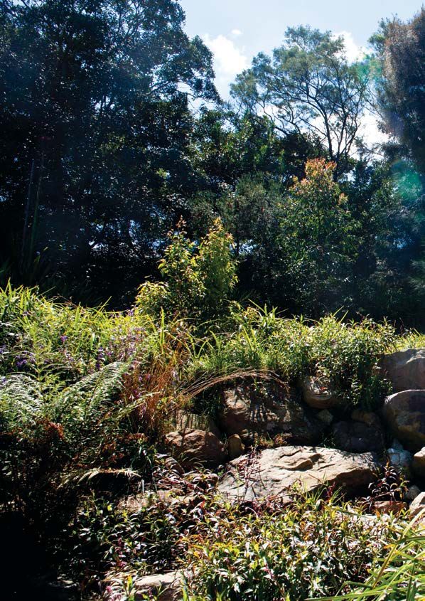
1. The Marrickville Strategy for a Water
          Sensitive Community
       The Strategy for a Water Sensitive Community aims to move current urban water management in
       Marrickville to a more sustainable and flexible approach that promotes liveable, productive, resilient and
       sustainable communities. The Strategy will be enabled through the initiative, support and actions of
       Council and a Water Sensitive Community.

       1.1. Four Strategies
       Four implementation strategies in the Strategy for       >> Reduce the use of potable mains water in
       a Water Sensitive Community will direct Marrickville        homes, businesses, Council facilities and public
       towards becoming a Water Sensitive Community.               spaces.
       Each strategy has an action plan as detailed in
                                                                >> Manage the stormwater system and its impacts
       the Marrickville Action Plan for a Water Sensitive
                                                                   on the urban environment.
       Community. Over the next ten years, the work
       under these strategies will address the many             >> Support regional projects to improve the
       complex issues relating to sustainable urban water          health of the Cooks River, Botany Bay, Lower
       management (SUWM) in Marrickville.                          Parramatta River, Sydney Harbour and their
                                                                   catchments.
       To become a water sensitive community, Council
       has developed the following strategies:                  >> Implement sustainable urban water
                                                                   management.

       1.2. Strategies, Objectives and Targets for 2021

       Strategy one:
       Reduce the use of potable mains water in homes, businesses, Council
       facilities and public spaces

    Objectives         >> Encourage private land managers to reduce water consumption.

                       >> Reduce Council’s use of potable mains water.

    2021 Targets       >> Marrickville LGA water consumption per household has decreased on 2010 levels.

                       >> Community knowledge of local water systems has increased on 2010 levels.

                       >> Council’s use of potable mains water has decreased by 30% on 2010 levels.

                       >> 2 in 5 sports fields are irrigated using non-potable water.

                       >> 15 of Council’s 30 highest water use facilities use harvested rainwater.

3                                                                                                                     Marrickville Council: Water Sensitive Community 4
Strategy two:
    Manage the stormwater system and its impacts on the urban environment

                    >> Improve stormwater runoff quality working towards NSW best practice targets.
    Objectives
                    >> Reduce the impacts of stormwater flows including flooding.

                    >> Increase flood preparedness.

                    >> Plan for integrated asset renewal and maintenance.

                    >> 30ha of the LGA is treated by vegetated stormwater treatment systems
    2021 Targets       constructed by Council.

                    >> The effective impervious area has decreased on 2010 levels.

                    >> Flood study and floodplain risk management plans are completed for all
                       subcatchments.

                    >> All flood prone properties in the Marrickville LGA have been tagged.
                                                                                                         Strategy three:
                    >> Five major flood mitigation projects with construction costs over $250,000 have
                       been completed.                                                                   Support regional projects to improve the health of the Cooks River, Lower
                    >> Stormwater asset information is integrated into capital works programs and
                                                                                                         Parramatta River, Sydney Harbour and their catchments
                       subcatchment plans.

                    >> A proactive stormwater maintenance regime has been successfully                   Objectives     >> Increase the area of riparian and aquatic habitat.
                       implemented.

                    >> Volunteer hours on Waterevolution programs are maintained at 2010 levels.         2021 Targets   >> The area of estuarine vegetation around the Cooks River has increased on

                    >> 20 vegetated stormwater treatment systems have been built on private                                2010 levels.

                       properties through the Waterevolution program.                                                   >> The diversity of macro-invertebrates in the Cooks River has increased on

                    >> 150 tanks have been installed on private properties through the Rainwater Tank                      2010 levels.

                       Incentive Scheme.

5                                                                                                                                                                   Marrickville Council: Water Sensitive Community 6
Strategy four:
    Implement sustainable urban water management (SUWM)

    Objectives          >> Increase Marrickville Council’s ability for SUWM.

                        >> Establish organisational direction and common understanding of SUWM.

                        >> Improve awareness and knowledge of SUWM.

                        >> Enable staff to work across different sections of Council on water-related
                           projects.

                        >> Implement SUWM planning.

    2021 Targets        >> Marrickville Council has a very high capacity for SUWM.

                        >> 90% of staff knows about the Strategy for a Water Sensitive Community 2012-
                           2021.

                        >> One Council-wide SUWM awareness campaign/event is held every two years.

                        >> All capital works projects use SUWM objectives (see 2.1).

                        >> All subcatchments have collaboratively developed management plans.

    1.3. Strategies, Objectives and Targets for 2021
    This Strategy will be implemented through the Marrickville Action Plan for a Water Sensitive Community
    2012 - 2016, with actions under each of the four strategic areas. Council will continue to fund its water
    programs from the Stormwater Charge and relevant capital works programs, and seek grant and other
    sources of funding where possible.

    Marrickville Council will monitor and evaluate the implementation of this Strategy and report on
    achievement of actions through the delivery and operational plans. The Strategy will be reviewed and
    updated in 2016 and 2020.

    Data management will include systematic and consistent collection and regular reporting. The targets are
    therefore quantifiable and measurable. Indicators will be used where numerical targets are not possible as
    they show trends and other useful information on progress.

    Progress with implementation of the Marrickville Action Plan for a Water Sensitive Community will be
    reported annually and a complete revision will occur with the Strategy review in 2016.

7                                                                                                                Marrickville Council: Water Sensitive Community 8
2. Marrickville Council and the Strategy                                                                                                            2.2. Marrickville Community Strategic Plan 2021
                                                                                                                                                        The Our Place, Our Vision - Marrickville Community Strategic Plan 2021
    2.1 Why Marrickville has developed this strategy
                                                                                                                                                        sets out the Marrickville Community Vision and defines the long-term aims
    Marrickville has been implementing projects for                 Section 4, p18). The aim of implementing the                                        and how to achieve them for the community.
    sustainable urban water management (SUWM) for                   Strategy for a Water Sensitive Community 2012-
    over 10 years. The projects have been influenced                2021 is to move Marrickville LGA to a Water Cycle                                   Marrickville’s Vision 2021
    by a combination of many years of research and                  City, and eventually to a Water Sensitive City.
                                                                                                                                                        In 2021, Marrickville still feels like home. It is a place of culturally diverse, forward thinking, inner city
    conversations with the Marrickville community
                                                                    This Strategy pulls together Council’s current water                                communities and neighbourhoods. It is the land of the Cadigal-Wangal people of the Eora Nation and
    that show that traditional water management
                                                                    related plans and programs, and includes new                                        continues to be enriched by generations of migrants from all parts of the world.
    is unsustainable and the community expects
    governments to adopt sustainable practices.                     programs that fill in the gaps. The Strategy aligns
                                                                                                                                                        In 2021, Marrickville remains a just and welcoming society with an eclectic mix of cultures and
    However, up until 2010, the various programs                    them directly with the Marrickville Community
                                                                                                                                                        communities. There is a common belief that the community should support, care for and empower its
    undertaken in Marrickville were not well integrated.            Vision, and the Council and community key result
                                                                                                                                                        members who are disadvantaged or marginalised. There is a common agreement that all citizens are able
    This strategy joins the wide range of programs                  areas (see Figure 1, p11), and key outcomes
                                                                                                                                                        to participate in the social, cultural and economic life of the community.
    under one common vision.                                        that together provide the long-term direction for
                                                                    Marrickville.                                                                       In 2021, Marrickville’s businesses are confident, thriving and responsive to the needs of the local
    Currently, Council’s general approach to water                                                                                                      community. Its industrial areas are revitalised and remain an important part of the local economy, while
    management is for a Drained City or Waterways                                                                                                       high-tech, creative and eco enterprises prevail.
    City as defined by Brown et al. (2008) (see
                                                                                                                                                        In 2021, Marrickville is a creative community. It values the people who celebrate, challenge and inspire local
                                                                                                                                                        identity and sense of place. It has innovative and responsible urban planning that protects the character
                                                                                                                                                        and heritage of the area. Public spaces are enticing, lively and accessible, with a street life that connects
    Sustainable urban water management (SUWM) in Marrickville.                                                                                          the community and welcomes visitors. As well as being clean and well maintained, these areas are

                                                                                                                        Understanding the Terminology
                                                                                                                                                        sustainable and are alive with trees and birds, grandparents and children, pedestrians and cyclists.
    Marrickville’s SUWM objectives are to:                          To achieve this, Council will:
    >> Reduce reliance on potable (drinking quality)                >> Develop and maintain Council’s ability for                                       In 2021, Marrickville’s environment is healthy. Children can swim in the river and play in the dirt, and native
       water brought in from outside the Marrickville local            SUWM through skill development, data                                             plants and animals, including frogs, bees and ants, are thriving. The community is resilient to climate
       government area.                                                collection and sharing, evaluation and
                                                                                                                                                        change and works together to minimise its ecological footprint and live sustainably. There are fewer cars,
                                                                       learning.
    >> Use water that is treated to a level suitable for its use;                                                                                       less congestion and a reduction in noise. Community members have their choice of well connected,
       e.g., use stormwater for irrigation.                         >> Integrate planning and projects.                                                 accessible and efficient public transport options, including light rail.
    >> Reduce the impact of stormwater on the Cooks River,          >> Identify and cost capital works needed
                                                                                                                                                        In 2021, local communities work closely with Council, which is ethical, effective and accountable. Council
       Botany Bay, Lower Parramatta River and Sydney                   to implement SUWM and include
       Harbour to:                                                     these in asset management plans and                                              provides supportive and cooperative leadership and is a strong advocate for community interests. It is
    •   improve the quality of stormwater runoff                       Council’s Long-Term Financial Plan.                                              a responsible partner and works together with community organisations, businesses and other levels of
    •   reduce the quantity of stormwater entering the waterways    >> Work in multidisciplinary teams.                                                 government to improve the quality of life for all residents of Marrickville.
    >> Reduce the amount of wastewater leaving Marrickville         >> Work with the people who live and work                                           (Marrickville Council, 2010a)
       LGA that may cause pollution in the Tasman Sea via              in the affected areas.
       Malabar Ocean Outfall.
                                                                    >> Communicate progress and results to all
                                                                       stakeholders.                                                                                                                       “ In 2021, children can
                                                                                                                                                                                                           swim in the river
        (Adapted from Brown, 2007)

                                                                                                                                                                                                           and play in the dirt”

9                                                                                                                                                                                                                         Marrickville Council: Water Sensitive Community 10
Marrickville Action Plan for a Water Sensitive Community
2.3. How this strategy fits with the Community Strategic Plan
Outcome 3.7 “Marrickville is a Water Sensitive City”
Alignment of water strategy with Community
KRA3: A well planned, sustainable and accessible
“We can swim in the river and play in the dirt.”
homes, businesses, Council facilities and public
>> Manage the stormwater system and its impacts
>> Support regional projects to improve the health
Strategic Plan and Delivery Program
Council has a number of targeted strategies and plans that will help deliver the many outcomes in the
of the Cooks River, Lower Parramatta River,
Community Strategic Plan. Figures 1 and 2 show how the Marrickville Strategy for a Water Sensitive
>> Reduce the use of potable mains water in
Community 2012 - 2021 fits with Council’s current planning framework.
Sydney Harbour and their catchments
>> Implement sustainable urban water
urban environment
>> Subcatchment management plans
This Strategy is designed to achieve one of the outcomes of the Our Place, Our Vision - Marrickville
Community Strategic Plan 2021, that “Marrickville is a water sensitive city” (Figure 2).
>> The Sustainable Irrigation Plan
To support the implementation of the Community Strategic Plan, Council has a ten-year Resourcing
on the urban environment
Strategy and a four-year Delivery Program (Figure 1).
management (SUWM)
>> Water savings plans
The Strategy for a Water Sensitive Community will contribute to Council’s overall direction for plans,
projects, operations and services as they relate to water. It will be reviewed in 2016 before the Delivery
Program review in 2017.
Resourcing Strategy
spaces
Long Term
Our Place, Our Vision 2021 Financial Plan
Marrickville Community Strategic Plan (10 years)
(10 years)
Asset
Management
Delivery Plans (10 years)
Strategy for a Water Sensitive
Program
Community 2012-2021
These are the big picture results which the community would like
These are detailed outcomes under each KRA. They are more
specific than the KRAs, but still focus on the end result, rather
(4 years)
help achieve the community vision are not contained in the
Workforce
Marrickville Commmunity Strategic Plan
The detailed set of actions which Council will undertake to
the Council and its many partners to focus on achieveing.
Community Strategic Plan, but are specified in its delivery
These guide the specific actions related to this plan and
community Marrickville aspires to be in the long term.
Plan (4 years)
This is a short statement about the sort of
Key Result Areas (KRAs)
Our Place, Our Vision 2021
define how to achieve the outcomes.
Operational
Outcome Statements
Related action plans:
programs and operational plans.
>> Subcatchment Management Plans Plan & Annual
than how to get there.
Budget
Strategies
>> Stormwater Asset Management Plan
Actions
Vision
>> Sustainable Irrigation plan (1 year)
>> Water Savings Plan
Figure 1. How the Marrickville Strategy for a Water Sensitive Community works with Council’s planning framework.
Figure 2. How the Marrickville Strategy for a Water Sensitive Community aligns with the Community Strategic Plan.
11 Marrickville Council: Water Sensitive Community 12
3. What will a Water Sensitive
                          Community look like?
                       A water sensitive community has a range of water sources to rely on. Its built environment benefits and
                       supports the functions of the natural environment and helps tackle the effects of climate change. People,
                       business, and governments work well together and support an ecologically sustainable lifestyle (adapted
                       from Wong and Brown, 2009).

                       A water sensitive community:

                       >> can supply water from within its catchment;
                       >> provides ecosystem services through green infrastructure; and
                       >> makes plans, decisions and designs that are water sensitive.

                       3.1. A water sensitive community can supply water from
                            within its catchment.
                       >> Infrastructure is a mix of centralised systems (potable mains water from outside the catchment), and
                          decentralised and distributed systems. Water quality matches the intended water use; e.g., rainwater is
                          used for flushing toilets, and stormwater for irrigating ovals.

                       >> Water sources include rainwater, stormwater, wastewater, desalinated water, and groundwater.


   Centralised, decentralised and distributed infrastructure systems
                                     Centralised, decentralised         and adistributed
                                                    Centralised systems provide                    infrastructure
                                                                                single service of one                       systems
                                                                                                      product (e.g. potable mains water supply, sewage),
                                                          and have one or more external systems accessing the service, for example, a water supply system
                                                          providing drinking quality water only to specific areas.
                                                          Decentralised
                                     Centralised systems provide           systems
                                                                     a single      are made
                                                                                service      up ofproduct
                                                                                         of one    many
                                                          independent systems and products that can link with
                                     (e.g. potable mains water   supply,
                                                          each other        sewage),
                                                                       if necessary as aand  have one or
                                                                                         network.
                                                          Distributed systems have no centre and do not have
                                     more external systems accessing the service, for example, a
                                                          to depend on a centre for the functioning. All nodes
                                     water supply system providing      drinking
                                                          in a distributed  system quality water only to
                                                                                   are networked.
                                     specific areas.     Centralised systems have a greater risk of one

     Understanding the Terminology
                                                         event breaking the entire system. However, if one of
                                                         the systems in a decentralised or distributed system
                                     Decentralised systems  are made up of many independent
                                                         breaks, it is more likely that only one element is lost,
                                     systems and productsnotthat  can link
                                                              the whole     with each other if necessary
                                                                        system.
                                                                                                                     Centralised,  decentralised
                                                                                                                    Centralised, decentralised andand  distributed
                                                                                                                                                   distributed systems
                                     as a network.                                                                  (Baran,
                                                                                                                     systems1964).
                                                                                                                             (Baran, 1964).

                                     Distributed systems have no centre and do not have to depend on a centre for their functioning.
                                     All nodes in a distributed system are networked.

                                     Centralised systems have a greater risk of one event breaking the entire system. However, if
                                     one of the systems in a decentralised or distributed system breaks, it is more likely that only one
                                     element is lost, not the whole system.

13                                                                                                      Marrickville Council: Water Sensitive Community 14
3.2. A water sensitive community provides green 3.3. A water sensitive community makes plans, decisions,
infrastructure to support ecosystem services. and designs that are water sensitive.
>> Stormwater is harvested, treated for use, and cleaned before entering waterways, e.g. by rain >> Citizens, businesses, community and government organisations promote and maintain an ecologically
gardens and wetlands. sustainable lifestyle.
>> Infrastructure is designed for more infiltration and evaporation, improving microclimates, helping >> Water planners and managers of public and private land are skilled at managing urban water sustainably.
reduce effects of local flooding, e.g. vegetated roofs and permeable paving. >> Local, state and national government policies strengthen inter-government collaboration and public/
>> The movement, distribution, and quality of water are managed so that it is more like the natural private engagement.
water cycle.
>> Urban waterways are rehabilitated to support local biodiversity and influence microclimate.
Ecological Sustainability (Council of Australian Governments, 1992)
Goal:
Terminology
Understanding the
Ecosystem Services are the things that plants, Microclimate is the climate of a
animals, water, soil, and air provide. Examples small specific place in contrast with Development that improves the total quality of life, both now and in the future, in a way that
include: the local larger area. Differences maintains the ecological processes on which life depends.
• trees acting as carbon sinks and providing oxygen; in rainfall, wind, temperature and
humidity can be affected by trees, Core Objectives:
• trees and water cooling the nearby area;
buildings, water bodies, aspect and >> to enhance individual and community well-being and welfare by following a path of economic
• fungi and insects breaking down waste; and even the colour of the ground which development that safeguards the welfare of future generations
• bees pollinating plants. can create a local microclimate.
>> to provide for equity within and between generations
>> to protect biological diversity and maintain essential ecological processes and life-support
systems
Guiding Principles:
>> decision making processes should effectively integrate both long and short-term economic,
environmental, social and equity considerations
>> where there are threats of serious or irreversible environmental damage, lack of full scientific
certainty should not be used as a reason for postponing measures to prevent environmental
degradation
>> the global dimension of environmental impacts of actions and policies should be recognised and
considered
>> the need to develop a strong, growing and diversified economy which can enhance the capacity
Understanding the Terminology
for environmental protection should be recognised
>> the need to maintain and enhance international competitiveness in an environmentally sound
manner should be recognised
>> cost effective and flexible policy instruments should be adopted, such as improved valuation,
pricing and incentive mechanisms
>> decisions and actions should provide for broad community involvement on issues which affect them
These guiding principles and core objectives need to be considered as a package. No objective
or principle should predominate over the others. A balanced approach is required that takes into
account all these objectives and principles to pursue the goal of ESD.
15 Marrickville Council: Water Sensitive Community 164. Water Planning and Management
4.1. Planning Approaches
4.1.1. The Past
Since colonisation, water management in Australia has developed through a number of phases, each
generated by different urban development priorities for that period (Figure 3).
The service focus of earlier periods (i.e. the supply of clean water, removal of sewage, and large-scale
drainage schemes) have served Marrickville well for 150 years by significantly reducing the incidence
of disease, personal injury and property damage. However, Marrickville now needs to manage water
sustainably as traditional approaches have resulted in over extraction of water and high levels of pollution
in waterways with little or no accounting for the ecological services provided by the environment (Brown,
2008).
Water supply Public health Flood Social amenity, Limits on natural Intergenerational equity,
access & security protection protection environmental protection resources resiliance to climate change
Water Supply City Sewered Drained Waterway Water Cycle Water Sensitive
City City City City City
Supply Separate Drainage, Point & diffuse Diverse, fit-for-purpose Adaptive, multi-functional
hydraulics sewerage channellisation source pollution sources & conservation, infrastructure & urban design
schemes management promoting waterway reinforcing water sensitive
protection behaviours
Figure 3. The Urban Water Management Transitions Framework (Brown et al, 2008).
The six historical periods with different drivers of service and water management are:
1. The Water Supply City – from early colonisation in late 1700s
>> access to clean water for the survival of the colony
>> building water supply infrastructure
2. The Sewered City – from mid- late 1800s
>> construction of sewerage systems in response to public health problems
3. The Drained City – throughout the 1900s to the present
>> efficient stormwater drainage for protection of property from flooding
17 Marrickville Council: Water Sensitive Community 184. The Waterways City thinking and some practice - from 1970s 4.2. Council’s capacity for Sustainable Urban
>> increased focus on environment and increasing concern about the state of local waterways as visible
Water Management
pollution, degradation and algal blooms became headline news
>> environmental regulation and enforcement through a central body e.g. EPA
4.2.1. Council Organisational Survey
5. The Water Cycle City thinking and some practice – from 1990s For Marrickville Council to be able to work towards becoming a water sensitive community, Council needs
>> a variety of water sources that are appropriate to the intended use to determine where its strengths and weaknesses are for implementing SUWM and how to overcome
>> water saving initiatives problem areas.
>> measures to protect waterway health
In 2009/10, Monash University assessed Marrickville Council’s capacity to carry out SUWM and found
that it had moderate ability for SUWM (Figure 5 below). Council was in the growth phase in 2010, having a
6. The Water Sensitive City thinking - from 2000s:
moderate level of SUWM ability, with some areas close to the insider phase (high SUWM ability). Therefore,
>> a mix of centralised and decentralised water supply and reuse systems Council has some good capacity for SUWM.
>> urban design and infrastructure that supports human and ecosystem wellbeing
>> a community active in sustainable water planning and management
4.1.2. The Present
The current approach to water management in Marrickville spans three of these recognised phases:
Project Outsider Growth Insider Integrated
>> Road and stormwater asset management still holds with the drivers of the Drained City; Very basic Basic capacity Moderate capacity High capacity Very high
capacity capacity
>> The introduction of water sensitive urban design (WSUD) works through subcatchment planning since
2005/06 and programs such as verge gardens has adopted the Waterways City and Water Cycle City; Aspirations
>> This Strategy together with integrated SUWM planning (being achieved through asset plans Strategy
incorporating subcatchment planning, which focuses on the community as a key player in planning and
Organisational Capabilties
decision making) are pushing Marrickville towards a Water Sensitive City (Figure 4).
Human Resources
Systems & Infrastructure
Drivers Organisational Structure
Water supply Public health Flood Social amenity, Limits on natural Intergenerational equity,
Culture
access & security protection protection environmental protection resources resiliance to climate change
Figure 4:
Marrickville Figure 5. Areas of Council’s ability shown according to organisational development phases (A. Bos, 2010).
Council’s current
water management
Water Supply City Sewered Drained Waterway Water Cycle Water Sensitive practice ( )
City City City City City within the Urban >> Organisational systems are the formal and informal processes that make SUWM work
Understanding the
Water Management
Transitions
within Council.
Framework Terminology >> Infrastructure refers to the actual SUWM physical and non-physical infrastructure and
(adapted from
Brown et al, 2008). assets that contribute to SUWM within Council.
Supply Separate Drainage, Point & diffuse Diverse, fit-for-purpose Adaptive, multi-functional
>> Organisational culture is the connective tissue that binds Council together to work
hydraulics sewerage channellisation source pollution sources & conservation, infrastructure & urban design
schemes management promoting waterway reinforcing water sensitive
towards SUWM.
protection behaviours
Technical Solutions
19 Marrickville Council: Water Sensitive Community 20Subcatchment planning addresses the identified flaws in previous approaches to urban water management by:
Growth phase
Understanding the Terminology
>> reducing the planning unit to the local level;
This means that Council has a moderate level of capacity for SUWM >> integrating all elements of water management (water quality, water use and reuse, stormwater and
>> Growing commitment for SUWM at political, managerial and community level;
flooding);
>> SUWM driven by consistent formal/informal network; >> integrating the many disciplines (e.g. sociology, ecology and engineering); and
>> Dedicated staff hours solely to SUWM activities; >> involving the community of interest in the decision making and implementation.
>> Still highly dependent on external skills;
>> Some internal conflict regarding roles and responsibilities persists; A key part of understanding the subcatchment planning context is through researching the physical, social
>> Proficient in obtaining external grants for projects; and organisational characteristics of the subcatchment (Figure 6).
>> Increasing internal funding for SUWM;
>> Champions with moderate influence are becoming apparent; Social Organisational Physical
>> Extended stakeholder network established, but tensions between the organisations; and >> Population density and >> Stakeholder activities and >> Stormwater management
>> Increasingly extended community engagement. groupings priorities infrastructure and capacity
>> Demographics >> Current policies >> Ecosystem health of
>> Socio-economic factors >> Regulatory administration receiving waters
Council’s strengths are in its organisational structure, human resources, aspirations and strategy (Figure
>> Land use >> Cross-council and sectoral >> Drainage capacity
5). However, considerable improvement is needed for Council to reach its full SUWM potential. In addition,
>> Social transience relationships >> Pollution sources and
its systems and infrastructure, and culture for SUWM inhibited Council’s SUWM practice in 2010. The
>> Awareness, knowledge, >> Organisational culture pathways
study also shows that outside influences (government legislation and policies) provide very limited direct
incentives for developing and implementing SUWM within Council. behaviours and aspirations >> Knowledge and skills for >> Retrofit opportunities
>> Community organisations SUWM >> Thermal mapping
To achieve SUWM, the assessment (Bos, 2010) recommends that Council firstly needs to: >> Biodiversity / vegetation /
fauna mapping
>> develop organisational direction and a common understanding of SUWM
>> gain a Council-wide commitment to SUWM
>> define explicit cross-Council goals and targets for SUWM, including performance targets with attached
measurable criteria
>> improve organisational awareness and internal education for SUWM Collaborative planning forums
>> develop supporting organisational systems including measures that lead to SUWM from planning to
operation and maintenance
This Strategy goes towards addressing these recommendations. Subcatchment Management Plans
with actions implemented by:
4.3. Current Planning
• Integrating into Capital Program and asset planning processes
4.3.1. Subcatchment Planning • Council and community working group projects
Between 2002 and 2006, Marrickville Council trialled and developed the subcatchment planning process
Figure 6. Subcatchment planning maps the local context and uses this information to inform
in partnership with leading researchers at Monash University through the Urban Stormwater Integrated participation and final subcatchment management plans.
Management (USWIM) project. In 2005/2006, Council adopted the collaborative and locally focused
subcatchment planning as its strategic approach to carry out the objectives of sustainable urban water
management.
21 Marrickville Council: Water Sensitive Community 22Understanding the social and organisational influences in the subcatchment facilitates collective decision >> Flood management now being integrated
making on the best management approaches to consider water quality and use together. This has resulted with subcatchment plans – Eastern Channel
in numerous locally appropriate stormwater treatment works and plans for harvesting, and community East Subcatchment being first to include flood
partnership activities. However, integrating flood management into the SUWM program is in its infancy. management in its 2011 subcatchment plan;
>> The Stormwater Asset Management Plan
The flood studies and management plans analyse flood risks and recommend actions. Council is now
adopted in 2010;
focused on how best to integrate the recommendations into subcatchment planning so that analysis is of
>> A wide range of subcatchment specific actions
the subcatchment’s full water cycle, as well as wastewater reuse, stormwater quality, flooding, including
and works that help build community capital, and
tagging of flood prone properties, and development controls.
are appropriate for the subcatchment community,
landscape, land use and infrastructure;
>> A selection of on-ground projects that can be
Figure 7. The Eastern Channel East Subcatchment Plan in 2011
funded from the Stormwater Management
was the first subcatchment plan to include flood management.
Service Charge or government grants;
>> Construction of seven rain gardens across the
LGA and permeable paving at Tom Foster car
What is subcatchment planning about? park (Figure 8);
>> Planning at a manageable neighbourhood scale (e.g. subcatchment)
Understanding the Terminology
>> Involving people who live and work in the subcatchment in planning and implementation
>> Including people with different professions, knowledge and skills in the planning and
decision making
>> Tailoring plans to the area’s social, cultural, biophysical and planning contexts
>> Designing neighbourhoods to reduce pollution of local waterways - the Cooks River,
Botany Bay, Lower Parramatta River and Sydney Harbour
>> Reducing dependence on potable mains water brought in from outside the catchment Figure 7. L-R – Hill Street and Thornley Street rain gardens, Marrickville South, 2010; Permeable paving
Figure
at Tom8.Foster
L-R- HillCommunity
Street and Thornley
Care Street rain gardens,
car park, 2010 Marrickville South, 2010; Permeable paving at Tom Foster Community
by using water that is fit for its purpose i.e. the quality of water is safe for its intended use Care car park, 2010.
(e.g. stormwater harvesting and wastewater recycling);
>> Providing green infrastructure for healthier communities and liveable neighbourhoods >> The subcatchment planning approach being used by
7 other Cooks River councils through the Cooks River
>> Partnering with leading SUWM research - currently the CRC for Water Sensitive Cities
Sustainability Initiative;
>> The Sustainable Water Ambassadors volunteer peer
Major achievements education program;
>> The Rainwater Tank Incentive Scheme, including over
Since Council adopted the USWIM project’s subcatchment planning approach as its major water
100 rebates for rainwater tanks based on their capacity
planning process in 2006, there have been numerous advances in SUWM in Marrickville LGA:
(at December 2011), and 460 participants at over 35
>> The creation of specific staff roles within Council to support the Waterevolution SUWM program; rainwater harvesting technical workshops to support
>> A commitment from the organisation to have no more ‘single issue’ planning for water management; implementation and maintenance;
>> The introduction of the Stormwater Management Service Charge from July 2007, which raises >> The Marrickville Sustainable Irrigation Plan to introduce
around $830,000 per year and funds the 10-year Waterevolution SUWM program. alternative water supplies; and
>> Four community neighbourhood (subcatchment) visions to the year 2050 with subcatchment >> A cross-Council SUWM water team.
management plans representing the ideas, knowledge and values of those living and working in the
subcatchments (Marrickville Council, 2005, 2009a, 2009b, 2010b, 2012);
>> The Water Sensitive Urban Design Development Control Plan 2011;
23 Marrickville Council: Water Sensitive Community 244.3.2. Floodplain Management Planning Figure 9. NSW Floodplain The asset management planning process provides an opportunity to consider biotic and non-structural
Management Process.
assets together with the built assets. It is a key step in the implementation of this Strategy for a Water
Marrickville Council has been planning and managing flooding in line with Floodplain Management Sensitive Community and in moving Marrickville LGA from a Drained City to a Water Sensitive City. The
Committee
the approach set out in the NSW Government’s Floodplain Development sustainable urban water management objectives form part of the level of service that Council provides the
Manual (Figure 9) ( NSW Department of Infrastructure, Planning and Natural Community. The asset management plans need to translate the objectives into costs and actions relating
Data Collection
to managing stormwater assets.
FLOOD PLAIN MANAGEMENT PROCESS
Resources, 2005). The main aim of this approach is to reduce the impact of
flooding and flood liability on owners and occupiers of flood prone property
and to reduce private and public losses resulting from floods. By applying this
process, the NSW Government and Council are providing a risk management Flood Study
approach to flooding, reflecting the drivers of a Drained City (Figure 3).
The primary tools used by Council to manage flooding are the Local Floodplain Risk
Environment Plan 2011 and flood risk management plans. The Marrickville Management
study
Floodplain Management Advisory Committee oversees the floodplain
management process and makes recommendations.
Floodplain Risk
Management
Plan
Figure 10. Flooding in Illawarra Road – Implementation of
circa late 1960s (Reproduced with the kind Plan
permission of Leslie Isted. Copy held in
Marrickville Council’s History Collection).
4.3.3. Stormwater Asset Management Planning
Integrated Planning and Reporting Framework
Marrickville Council recently implemented an asset management policy, strategy and plan completed in 2010
as part of the new Integrated Planning and Reporting Framework (IPR). The IPR resulted from the Department
of Local Government recognising the need for improved asset management for councils’ infrastructure assets,
and includes statutory planning and reporting processes required by the Local Government Act 1993 and the
Environmental Planning and Assessment Act 1979.
Integrated planning and reporting enables a more defined strategic force behind asset management. The
asset management plan ensures the financially sustainable delivery of services from councils’ infrastructure.
The plan defines the services provided, how the services are provided and what funds are required, including
actions for agreed levels of service in the most economical manner.
As part of Marrickville Council’s resourcing strategy, the new Infrastructure Planning section was created in
2010/11 to improve Council’s long-term strategic planning and management of community assets.
The profile of stormwater has steadily increased in recent years. Industry and government are now more
than ever looking for opportunities to effectively manage stormwater as a resource and create more liveable
environments. The asset management plans strategically introduce changes to existing service levels,
construction techniques, and the design and maintenance of councils’ assets. Council’s first Stormwater
Asset Management Plan 2010 is currently under review with a focus on improving its integration with the
Community Strategic Plan.
25 Marrickville Council: Water Sensitive Community 265. Marrickville’s current planning context Major environmental improvements wanted in Marrickville in the next 20 years.
for water management Green spaces 24%
22%
5.1 The Social Context
Reduced pollution
Water management - Water saving initiatives 21%
Marrickville Community Snapshot (ABS 2011) Water management - Cleaner waterways 16%
>> Population - 77,700 >> Own/purchasing homes - 50% Reduced car usage/More bike paths 15%
>> Area – 17 sq km >> Average household water use 2010/11
Rainwater tanks 8%
>> Private dwellings – 32,920 - 185kL/year
Renewable energy 6%
Environmental education 5%
Figure 12. The 8 most mentioned environmental improvements wanted in Marrickville LGA in the next 20 years according to
the survey of Marrickville Valley citizens (Ruby Cha Cha, 2011).
Council has been engaging local communities on SUWM
since 2005. It has documented the vision and goals of WHITES CREEK JOHNSTONS CREEK NORTH
communities through four subcatchment management plans.
JOHNSTONS CREEK WEST
WEST STREET
JOHNSTONS CREEK SOUTH
These aspirations are reflected in this Strategy along with the
HAWTHORNE CANAL
following social factors that impact water management:
DRAFT
LGA CATCHMENTS
MALAKOFF STREET
The community is changing its relationship with
the environment (Marrickville Council, 2010) TENNYSON STREET
0
Metres
500 1,000
MALAKOFF TUNNEL
Scale 1:20000
>> 87 species of native wildlife live in the Marrickville area. Projection: Map Grid of Australia
Datum: GDA 94
RIVERSIDE CRESCENT
PRODUCTION DATE
2009/06/09
>> 94% of residents believe it is important to provide natural © COPYRIGHT Land and Property Information NSW
Marrickville Council
All Rights Reserved.
Plan Produced by Information Systems of Marrickville Council. This
Map Remains the Property of Marrickville Council. Reproduction of
ILLAWARRA ROAD any part of this map without approval is prohibited.
areas and green spaces.
DISCLAIMER
This map has been compiled from various sources and the publisher
and/or contributors accept no responsibility for any injury, loss or
damage arising from its use or errors or omissions therein.
MAHONEY RESERVE
LEGEND
>> 73% of Marrickville residents believe it is important to
STREET 2
THORNLEY
CATCHMENT BOUNDARY
ALEXANDRA CANAL MARRICKVILLE LGA BOUNDARY
restore the Cooks River and its foreshores.
>> 45% of responses to the recent water survey of residents
property owners and businesses in the Marrickville Valley Figure 11. The Marrickville
P:\GIS_Maps\TechnicalServices\Engineers\CATCHMENTS\LGA_SUB_CATCHMENTS_A3L20-K_LGA.wor
(figures 11, 12 and 13) prioritised water saving and Valley subcatchment.
managing water pollution.
(Ruby Cha Cha, 2011)
“Maintain lovely
green space” Figure 13. Clustering of the most commonly used phrases when describing improvements to Marrickville’s environment
wanted in the next 20 years (Ruby Cha Cha, 2011).
27 Marrickville Council: Water Sensitive Community 28The community expects Marrickville Council to take the lead in partnership building and 5.2. The Physical Context
engagement (Marrickville Council, 2010):
>> Marrickville Council has 13 Advisory and Consultative Committees, 3 specific to water management 5.2.1. The Water Cycle
- the Marrickville Environment Committee, Marrickville Cooks River Committee, and the Marrickville
Floodplain Management Advisory Committee. Marrickville’s water cycle (Figure 14) clearly shows the current way water is used in Marrickville LGA is
>> In 2011, four subcatchment community working groups work on programs related to their local unsustainable.
areas, including the Illawarra Road, Tennyson Street, Riverside Crescent and Eastern Channel East
>> Much more rain falls in Marrickville LGA than is brought in via Sydney Water’s mains to supply the LGA.
subcatchment working groups.
>> Most mains water leaves the catchment as sewage via the sewerage system. The treated wastewater
>> 56% of residents are satisfied that Marrickville Council informs them about its activities and services.
is discharged into the Tasman Sea via the Malabar Ocean Outfall.
>> 38% of residents are satisfied that Marrickville Council carries out good community consultation.
>> A significant amount of Marrickville’s rainfall runs off hard surfaces and into drains, picking up pollution
that ends up in the Cooks River, Botany Bay, the lower Parramatta River and Sydney Harbour.
Land use planning is becoming more challenging (Marrickville Council, 2010):
>> 45% of residents were satisfied that new developments protect and preserve heritage
Rainfall
>> Over 4,150 new dwellings will need to be built in Marrickville to 2031
18,750
>> By 2036, the impervious area of the Inner West is estimated to increase by 2% (SMCMA, 2012) ML/yr
Drinking quality 100% Wastewater discharge
water imported to Malabar Ocean Outfall
6,860 ML/yr 100% 5,150 ML/yr 75%
1% 19
%
Drinking quality
water consumed
Sewer overflows
45 ML/yr
5 1,300 ML/yr
%
Storm-
water
Garden & open Infiltration/Evaporation &
space watering
runoff 27 transpiration 5,050 ML/yr
13,240 %
ML/yr
71%
Figure 14. The water cycle in Marrickville (Equatica, 2010).
5.2.2. Marrickville’s Catchments
Marrickville LGA has 21 subcatchments (see Figure 15). The six subcatchments north of Stanmore Road
and New Canterbury Road flow to the Lower Parramatta River before entering Sydney Harbour. The 15
subcatchments to the south flow via stormwater channels to the Cooks River or Alexandra Canal and then to
Botany Bay.
29 Marrickville Council: Water Sensitive Community 30Subcatchments WHITES CREEK JOHNSTONS CREEK NORTH
flow north to Lower
JOHNSTONS CREEK WEST
Parramatta River and
WEST STREET
Sydney Harbour.
JOHNSTONS CREEK SOUTH
HAWTHORNE CANAL
DRAFT
EASTERN CHANNEL NORTH
LGA CATCHMENTS
MALAKOFF STREET
EASTERN CHANNEL EAST
5.2.4. Water Quality - Stormwater Pollution
0 500 1,000
TENNYSON STREET
MALAKOFF TUNNEL EASTERN CHANNEL WEST Metres
Scale 1:20000 The stormwater drainage network combines runoff from roads with runoff from properties, including roofs.
Projection: Map Grid of Australia The combined runoff from roads and roofs is the largest source of stormwater pollution in Marrickville LGA
Datum: GDA 94
RIVERSIDE CRESCENT
WESTERN CHANNEL
(see Figure 17).
EASTERN CHANNEL SOUTH PRODUCTION DATE
2009/06/09
© COPYRIGHT Land and Property Information NSW
Marrickville Council
All Rights Reserved.
Pollutant Loads - Sources
Plan Produced by Information Systems of Marrickville Council. This
Map Remains the Property of Marrickville Council. Reproduction of
ILLAWARRA ROAD CENTRAL CHANNEL any part of this map without approval is prohibited.
DISCLAIMER
This map has been compiled from various sources and the publisher
Public roads Rail corridor Roofs Pavings, driveways
and/or contributors accept no responsibility for any injury, loss or
damage arising from its use or errors or omissions therein.
MAHONEY RESERVE
THORNLEY STREET
EASTERN CHANNEL 2 LEGEND Total Suspended
Subcatchments flow south to Cooks CATCHMENT BOUNDARY
Solids
ALEXANDRA CANAL
River, Alexandra Canal and then to MARRICKVILLE LGA BOUNDARY
Botany Bay.
Total Phosphorus
P:\GIS_Maps\TechnicalServices\Engineers\CATCHMENTS\LGA_SUB_CATCHMENTS_A3L20-K_LGA.wor
Figure 15. The 21 subcatchment in the Marrickville local government area (Marrickville Council).
Total Nitrogen
5.2.3. Impervious Area
Hard impervious surfaces (mainly public roads, roofs, driveways and car parks) cover around 76% of Gross Pollutants
Marrickville LGA (see Figure 16).
0% 10% 20% 30% 40% 50% 60% 70% 80% 90% 100%
Impervious Area Figure 17. Proportion of common pollution types in runoff (Equatica, 2010).
Public roads Rail corridor Roofs Pavings, driveways Other (e.g. parks, schools)
% of total
>> Suspended solids are small solid particles that stay in suspension in water.
impervious
>> Gross pollutants include litter, coarse sediments and organic matter.
0% 10% 20% 30% 40% 50% 60% 70% 80% 90% 100%
Water quality modelling identifies the degree of pollution coming from each source by looking at the
Figure 16. Relative proportion of different impervious surface areas (Equatica, 2010).
different types of impervious areas. As seen in Figure 17, public roads contribute the largest amount of
suspended solids and phosphorous, while roofs collect nitrogen and gross pollutants, including leaf litter,
other organic matter and sediment.
Impervious surfaces stop water from soaking into the ground. Examples
Understanding
include roofs, driveways, carparks, swimming pools, patios, paved areas,
the Terminology Stormwater also collects sewer overflows containing pathogens and heavy metals from vehicles and
tanks, and other features that are waterproof to rainfall.
roads.
31 Marrickville Council: Water Sensitive Community 32Pollutants What are they? What are their impacts?
>> Leaves Organic matter can impact on: 5.2.5 Water Quantity
>> Grass clippings >> Biogeochemical processes (cycling of substances)
Organic Matter >> Human and animal faeces >> Nutrient cycling
>> Ability of organisms to use or degrade materials Flooding
>> Chemical transport and interactions In Marrickville LGA, the source of flooding is either mainstream flooding from the Cooks River or flooding
>> Litter >> Reduce stormwater drainage capacity resulting from overland flow from stormwater runoff. Serious flooding in Marrickville usually occurs when
>> Coarse sediments >> Impact on visual amenity
there is a combination of heavy rainfall and high tides in the Cooks River.
Gross Pollutants >> Organic matter >> Impact on aquatic habitats
>> Impact on water quality indicators such as oxygen Major floods in Marrickville
demand, hydrocarbons and heavy metal levels
Records of past floods across the Marrickville LGA are limited; however, the following are some of the
Nutrients from natural and non-natural >> Nutrients promote growth of aquatic plant life. In
sources including: large concentrations they can produce algal blooms widely reported events since the second half of the Nineteenth Century:
>> Atmospheric deposition on the water surface
>> 25-27 May 1889 – the highest flood on record. Seventeen inches of rain in Sydney; flooding from
Total Nitrogen >> Soil particles >> Algae are microscopic plants which occur naturally
Victoria Road to Unwins Bridge Road. Tuesday 28 May 1889, 3m deep floodwaters along Victoria
Total Phosphorus >> Human and animal faeces in water bodies. Increased nutrients promote algal
>> Plant matter growth resulting in a build up of toxins. Toxic algal Road after four days of rain (SMH, 28 May, 1889).
>> Fertilisers blooms cause the closure of fisheries, water farming >> 1 June 1897 – Heavy downpours and high tide led to closing of the Cook’s River floodgates.
>> Vehicle exhaust industries and public beaches
‘Tramvale’ area of Marrickville converted into a lake (SMH, 2 June 1897). Cottage on corner of Meeks
>> Soil particles >> Reduce the penetration of light through water
Road (now Carrington Road) and Renwick Street reported to be “4ft deep” (1.2m).
>> Airborne particles impacting on the respiration of aquatic plants
>> 17 January 1911 – Width of Cook’s River near Tempe reportedly increased from 20 yards (18m) to
Suspended
>> Sediment from erosion and land >> Phosphorus, heavy metals and organic chemicals
Solids quarter of a mile (400m); residents from this part of Tempe complained the floods “create swarms of
degradation utilise sediment as the medium for transportation in
mosquitoes, and outbreaks of fever.” The SMH reporter noted, “the overflow from the stormwater
urban runoff
sewer must bring unpleasant consequences.” (SMH, 19 January, 1911).
Trace amounts derived from:
>> 25 January 1937 - thunderstorm tore through Marrickville, Mascot, Botany and Matraville. Five people
>> Petrol additives >> Impact of metals on water bodies can vary widely.
died and many injured as buildings collapsed and heavy rain generated flash floods.
>> Hydrocarbons Impacts are affected by complex interactions with
>> November 1961- second highest known flood.
Lead >> Old paint (prior to 1970) biophysical parameters such as pH, dissolved
oxygen and temperature >> 8 March 2012 - Residents from 20 homes in three Marrickville streets evacuated due to severe flash
>> Lead acid batteries
>> Lead can be harmful or deadly to aquatic and flooding; the Cooks River flooded, reaching over 1.5 metres at Tempe Bridge.
human life.
Trace amounts derived from: >> Low levels of zinc can be deadly to aquatic life
>> Vehicle wear (tyres)
ZInc >> Herbicides
>> Galvanised roofs
>> Mineral oils >> Impact on visual amenity
>> Automotive oils >> Lowers water quality
Hydrocarbons >> Diesel fuel >> Increases chemical oxygen demand
>> Can be highly toxic to aquatic life in low to moderate
concentrations
Pathogens are the viruses and microorganisms that can cause illness. Major Understanding
sources in stormwater are sewage overflows and animal droppings. Pathogens
the Terminology
are a major concern when they are in streams, rivers, lakes, seas and oceans.
33 Marrickville Council: Water Sensitive Community 34Cooks River
The last large flood on the Cooks River was the event in November 1961. However, small events occur
every few years with the last being on 8 March 2012.
Years the Cooks River is recorded as flooding (Webb McKeown and
Associates, 1994, and Marrickville Library History Services):
1887 1925 1938 1950 1963 1978
1889 1926 1942 1952 1964 1983
1897 1927 1946 1953 1969 1993 5.2.6 Stormwater Infrastructure
1911 1931 1947 1956 1971 2008
1913 1933 1948 1957 1974 2011 The stormwater infrastructure in the Marrickville LGA is one of the oldest in Sydney, dating back over 100
1920 1937 1949 1961 1975 2012 years. Stormwater assets can be difficult to manage with the limited information on location and condition
of the pipe network. Over the past 20 years, engineers have mapped the extent of the underground pipe
network. Council commenced a closed circuit television investigation in 2011 to verify the underground
Whenever the drainage system is overloaded from heavy or lengthy rainfall or because parts of the
network.
engineered system fail, such as pumps, flooding occurs at various scales. The drainage system also
transports stormwater runoff that picks up pollutants into local waterways, including the Cooks River and
Council’s stormwater assets include:
Lower Parramatta River.
>> 70 km of stormwater pipes (ranging from 225 mm to 1200mm diameter)
The flood engineering practice in Marrickville LGA is now moving towards the Waterways City as designs
>> 4,600 stormwater pits
include a combination of constructed pipelines, channels and designed floodways, typically incorporating
>> 22 gross pollutant traps
green space. Although it is still a centralised drainage system, this type of stormwater system allows for
flooding of the constructed stormwater system without endangering property. While this approach has >> 1 pump station at Camdenville Basin
become mainstream since the 1970s, it is more challenging to implement in the Marrickville LGA as the >> 5 detention basins (Marrickville Basin 10,000m3, Camdenville Basin 7,900m3, Tempe Reserve -
area was already developed prior to this practice becoming established, and property acquisition is very 3 basins)
expensive.
>> 16 water sensitive urban design devices for stormwater storage and treatment inlcuding porous paving,
wetlands, bioretention swales, bioretention basins (rain gardens)
As shown in Figure 18 (next page) the stormwater network includes pipes and other infrastructure owned
and managed by Sydney Water Corporation (18km of pipes and the 100ML Sydenham detention basin),
Roads and Maritime Services (ex RTA) (11km pipes), and RailCorp NSW (3.5km pipes).
The gradual development and urbanisation of the Marrickville LGA has meant that stormwater
infrastructure has been built and modified over time, responding to the community’s need for flood
mitigation. The works were generally not sufficient for future development and did not plan for water quality
improvements. Consequently, the stormwater system in Marrickville LGA performs to a number of different
design standards.
A recent assessment of the condition of a small number of Council’s stormwater pipelines showed
that the pipe network requires significant renewal and upgrade. Stormwater infrastructure renewal and
upgrade programs will use sustainable water management objectives and include water sensitive design
technologies where possible. Council is working to integrate water sensitive design into its capital works
program; however, the costs and processes associated with the transition to any new techniques and
technologies require analysis and definition before including them in Council’s Resourcing Strategy.
35 Marrickville Council: Water Sensitive Community 36You can also read