SUMAS MOUNTAIN STUDY - S'ólh Téméxw Stewardship Alliance
←
→
Page content transcription
If your browser does not render page correctly, please read the page content below
SUMAS
MOUNTAIN
STUDY

       March 2021
PREPARED BY:
   URBAN SYSTEMS LTD.
   #550–1090 Homer St.
   Vancouver
   BC V6B 2W9

This report is prepared for the sole use of the Collaborative Stewardship Forum and Recreation Sites and
Trails BC. No representations of any kind are made by Urban Systems Ltd. or its employees to any party
with whom Urban Systems Ltd. does not have a contract. © URBAN SYSTEMS® 2021
Acknowledgements
We gratefully acknowledge the Stó:lō First Nations for initiating this project within S’ólh
Téméxw, their traditional territory.

We thank members of the Sumas First Nation who attended tours of the mountain and
shared stories and information about their traditional uses, past and present. We are also
grateful to the Sumas Longhouse Committee for inviting us to their meeting and sharing
their insights on Sumas Mountain.

Thank you to many residents of the surrounding areas who completed the
community survey.

We appreciate the participation of the Fraser Valley Regional District and the City of
Abbotsford. The City was invited to attend meetings partway through the process and to
share technical information.

We hope to reconnect again soon for the next stages of this work.

      From the Project Team

               Collaborative Stewardship Forum (project leader)

               Recreation Sites and Trails BC (project partner)

Project Participants
Collaborative Stewardship Forum – Carrielynn Victor, Ayelstexw Consulting LP, Project
Coordinator/Co-Lead CSF

Recreation Sites and Trails BC – Tom Blackbird

Fraser Valley Regional District – Technical Support - David Urban, Meghan Jackson

City of Abbotsford – Technical Support – Mitchell Comb

SRRMC – GIS data – Colin Green

Urban Systems – Catherine Berris, Project Consulting Lead, Dave Flanders, Andrew Cuthbert,
Rhonda Maskiewich, Alisa Khliestkova, Clare Dolan, Alex Miller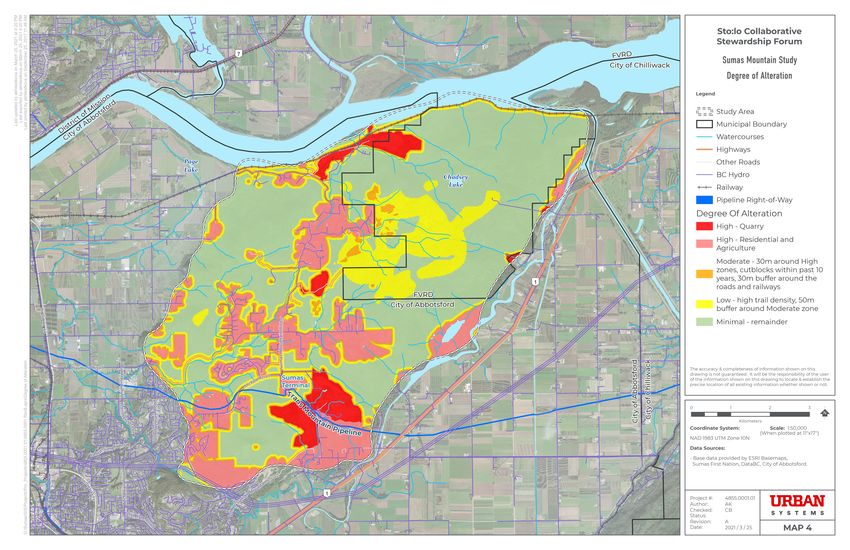
Sumas Mountain Study

           TABLE
           OF CONTENTS

           1 INTRODUCTION                                                                                                                                        1
              1.1 Origin of the Project ..................................................................................1

              1.2 The Study Area .............................................................................................2

              1.3 Purpose of the study ..............................................................................3

              1.4 CSF Guiding Framework..................................................................... 4

              1.5 Planning Process ...................................................................................... 6

              1.6 Crossover with other Initiatives ......................................................7

           2 WHAT WE HEARD                                                                                                                                     9
              2.1 Input from Sumas First Nation ...................................................... 9

              2.2 Community Survey ................................................................................11

           3 RESOURCES AND USE                                                                                                                              14
              3.1 Introduction................................................................................................. 14

              3.2 Physical Characteristics..................................................................... 14
                    3.2.1 Slope....................................................................................................................................14

                    3.2.2 Elevation .........................................................................................................................14

                    3.2.3 Biogeoclimatic Zones...........................................................................................14

                    3.2.4 Degree of Alteration .............................................................................................. 15

                    3.2.5 Environmental Overview .................................................................................. 16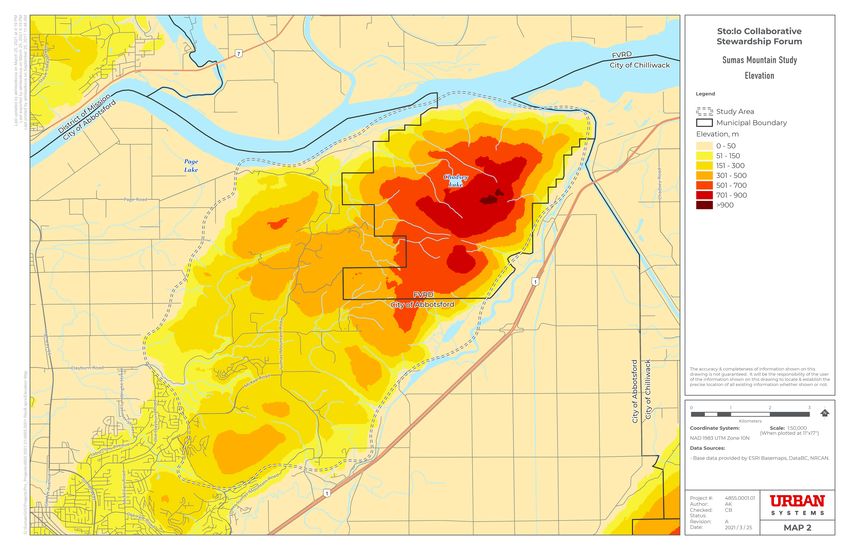
Sumas Mountain Study

  3.3 Jurisdiction and Regulatory Conditions ............................. 20
        3.3.1 Land Use Designations .......................................................................................20

        3.3.2 Jurisdiction and Ownership ........................................................................... 22

        3.3.3 Land Tenures ..............................................................................................................24

  3.4 Mountain Use ...........................................................................................25
        3.4.1 Cultural Use ................................................................................................................ 25

        3.4.2 Trail Use .......................................................................................................................... 31

        3.4.3 Recreation Use ......................................................................................................... 33

4 FUTURE DIRECTIONS                                                                                                                        34
  4.1 Vision and Values ................................................................................... 34

  4.2 Challenges and Opportunities ..................................................36

  4.3 Goals and Objectives ..........................................................................38

  4.4 Strategies ....................................................................................................40

5 NEXT STEPS                                                                                                                               42
Sumas Mountain Study

                                                         Photography © Robyn Bessenger
F

                    MAPS
                    Map 1 – Slope

                    Map 2 – Elevation

                    Map 3 – Biogeoclimatic Zones

                    Map 4 – Degree of Alteration

                    Map 5 – Species and Ecosystems

                    Map 6 – Habitat

                    Map 7 – Land Use Designations

                    Map 8 – Jurisdiction and Ownership

                    Map 9 – Land Tenures

                    Map 10 – Cultural Use

                    Map 11 – Trail Use

                    Map 12 – Recreation Use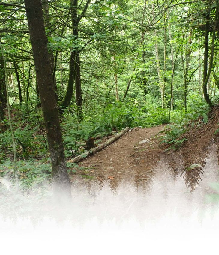
Sumas Mountain Study

Executive Summary
This project arose out of the S’ólh Téméxw Stewardship Alliance (STSA). Rooted in the
recognition of the importance of Kw'ekw'e'i:qw (Sumas Mountain) within S’ólh Téméxw,
the Sumas Mountain Study was initiated in 2019. The Collaborative Stewardship Forum and
the Province - Recreation Sites and Trails BC, with technical support from the Fraser Valley
Regional District (FVRD) and City of Abbotsford, are excited to be working together towards a
strategy for Sumas Mountain.

The purpose of this project is to better understand recreation and culture activities on Sumas
Mountain so that a new management framework can be implemented to protect and
manage the multiple uses and values. A key goal is to integrate a cultural lens throughout
the project. This study is the first step towards achieving a plan for Sumas Mountain.

The process involved compilation of map information from multiple sources, small group
meetings and tours with Sumas First Nation members, a public online survey for the broader
community, and a report that describes guiding principles, existing resources and use, and
future directions. The latter includes vision and values, challenges and opportunities, and
goals, objectives and strategies.

The following is the proposed vision for Sumas Mountain, describing how participants hope it
                                                                                                 i
will be considered in the future:

Kw'ekw'e'i:qw (Kw-ewkweeuwkw) (Sumas Mountain) is a place where
recreation, cultural practices, and all other activities occur with respect
for and stewardship of environmental and cultural values.

The following key values for Sumas Mountain were generated from the community survey
and endorsed by the Project Team:

  • Peaceful enjoyment

  • Recreation

  • Biodiversity, wildlife, and environmental protection

  • Cultural practices and information

  • Scenic views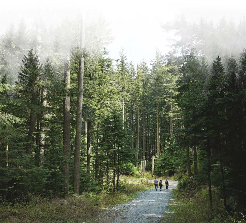
Sumas Mountain Study

     The following are the goals generated through the community survey:

       1. Protect and enhance the environmental resources

       2. Limit the impacts of other land uses on environmental, cultural, and
          recreation resources

       3. Protect the cultural resources

       4. Establish an overall plan for recreation use

       5. Improve infrastructure to support recreation use with an increase in safety and
          reduction in environmental impacts

       6. Coordinate and increase management and monitoring of recreation activities

       7. Increase operations and maintenance to support gradual and respectful
          increases in use

     One of the greatest challenges to management is the complexity of jurisdictions. Options
     are provided for a new integrated management regime for Sumas Mountain (potentially
     excluding the residential areas) as a way to coordinate management.

     A plan for the mountain is needed to achieve the objectives identified.
ii   The S’ólh Téméxw Stewardship Alliance has started a guardians program, which will in
     time include a role in monitoring and managing areas for cultural use. This program aims
     to gather and share information to improve stewardship of the collective territories of the
     Stó:lō people.

     The next steps will require collaboration of the same groups involved in this study. The steps
     fall within the following categories:

       • Take actions that can be considered “quick wins”

       • Explore options for the management regime

       • Pursue funding and proceed with the preparation of a Sumas Mountain Plan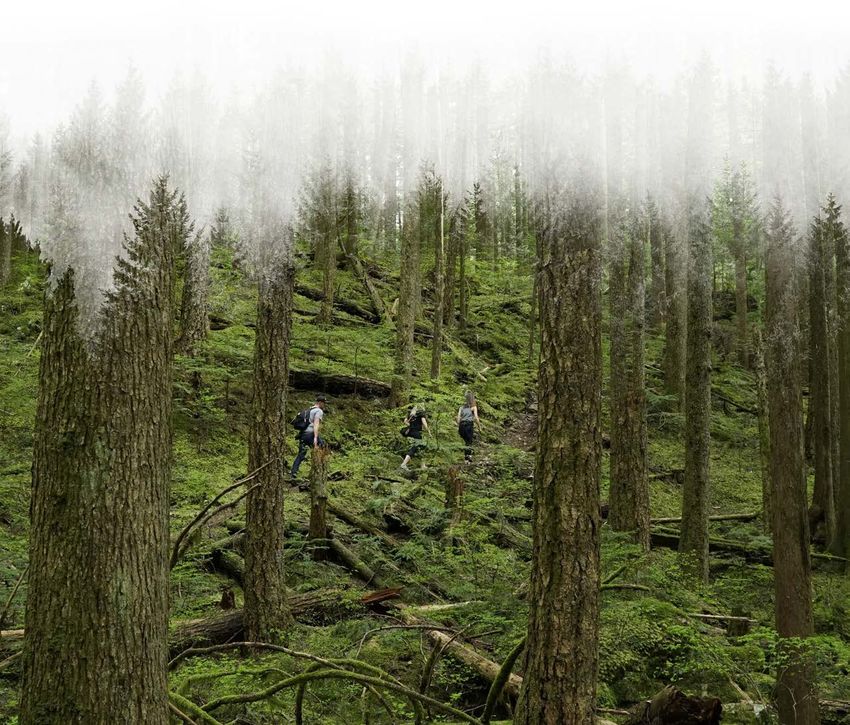
Sumas Mountain Study

1 Introduction
1.1 ORIGIN OF THE PROJECT
This project arose out of the S’ólh Téméxw Stewardship Alliance (STSA). The vision of the
STSA is as follows:

           STSA supports Stó:lō in making strong collective stewardship
           decisions as title holders that honour and maintain the
           integrity of our relationship with S’ólh Téméxw."

                  S'ólh Téméxw is the halq'eméylem name for the shared asserted
                  territory of the Stó:lō. In English, it can be translated as 'our world'
                  or 'our land'.

                                                                                               1

            In 2012, the STSA and the Province of BC entered into a Strategic Engagement
            Agreement (updated in 2016) that establishes a government-to-government
            (G2G) relationship and an engagement process for land and resource use
            decisions within S’ólh Téméxw.

            The Stó:lō Collaborative Stewardship Forum (CSF) (a partnership of 15 Stó:lō
            First Nations) has emerged from STSA-BC dialogues as a central element of
            those relations. The STSA and BC are exploring collaborative stewardship and
            shared decision-making principles, plans, processes, and mechanisms serving
            to inform provincial policy and legislative reform guiding steps toward desired
            futures in S’ólh Téméxw.

                   The idea is to change how governments work together and how
                                          decisions are made.

            Because of the importance of Kw'ekw'e'i:qw (Sumas Mountain) within S’ólh
            Téméxw, the Sumas Mountain Study was initiated in 2019. The CSF and the
            Province - Recreation Sites and Trails BC are excited to be working together
            towards a strategy for Sumas Mountain. We refer to that group of two
            organizations as the Project Team.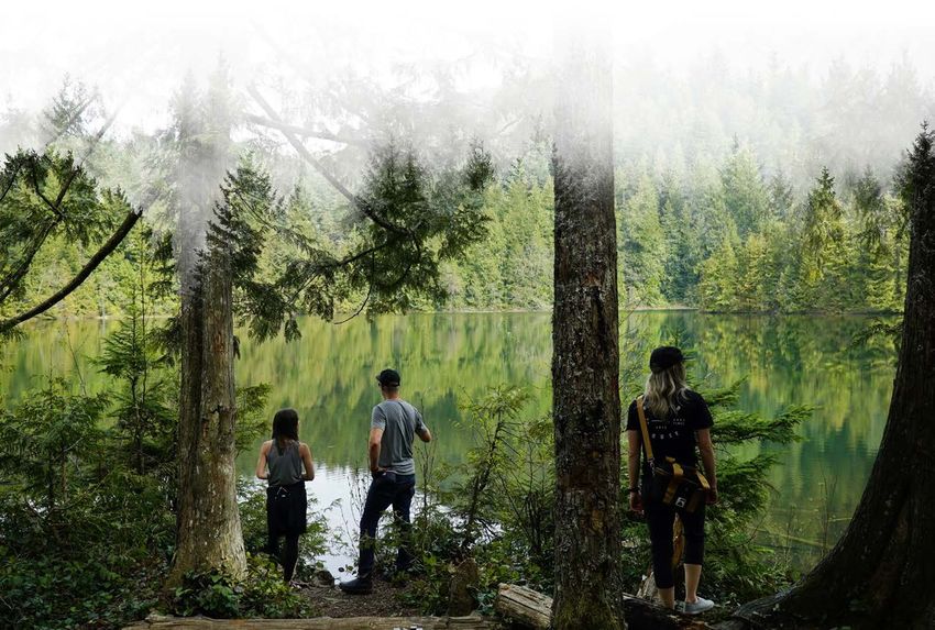
Sumas Mountain Study

                                         PROJECT TEAM

                                      TECHNICAL SUPPORT

    1.2 THE STUDY AREA
    Sumas Mountain is a unique feature in the heart of the Fraser Valley. It rises out of the
    floodplain and appears unconnected to other topography in the area. It stands proudly on
    its own. For that reason, the study area was defined as the base of the slopes, where the
    mountain meets the flat land of the Sumas Prairie.

2
                               Kw'ekw'e'i:qw (Kw-ewkweeuwkw) is the
                               mountain's name, and can be used multiple ways,
                               as it means "sticking up" like sticks in the mud, or
                               the way the mountain sticks up over the prairie.

    The mountain is in the heart of Stó:lō
    First Nations’ traditional territory and
    sits at a complex jurisdictional nexus
    of Indigenous, provincial, regional,
    and municipal lands. A significant
    portion of the mountain is in the City
    of Abbotsford, and within that portion,
    much of the land is in private ownership.
    Stó:lō people continue to assert that
    federal, provincial, municipal and
    private properties rest on top of the
    unextinguished title of the Stó:lō.
Sumas Mountain Study
1.3 PURPOSE OF THE STUDY
The purpose of this study is to better understand recreation and culture activities on Sumas
Mountain so that a new management framework can be implemented to protect and
manage the multiple uses and values. A key goal is to integrate a First Nations cultural lens
throughout the project.
This study is the first step towards achieving a plan for Sumas Mountain
A Terms of Reference for the study identified the following key tasks to be undertaken
through collaboration among the organizations and the support of consultants:
• Data collection and review – literature, trail counters, base maps
• Analysis of opportunities and challenges
• Community input on values, concerns, and ideas
• Proposed designation map (was not part of final study)
• Strategic recommendations for recreation, culture, environment
• Tracking and monitoring, including S’ólh Téméxw Stewardship Alliance guardians 3
programmingSumas Mountain Study
1.4 CSF GUIDING FRAMEWORK
The CSF has a framework agreement summary that is relevant to this project, as follows:
a. The Stó:lō First Nations maintain a shared language, title and rights, traditions,
customary laws, history, and relationships to the land. The maintenance of these
connections is essential to their culture and the maintenance of their community, and
desire to safeguard the health and wellbeing of their communities now and for future
generations, in accordance with their system of values, through respectful land and
resource use and stewardship.
b. The Collaborative Stewardship Framework seeks to enable the Province and
Indigenous groups to collaboratively explore shared responsibility for stewardship of
the environment in the Province of British Columbia through regional collaborative
stewardship forums.
c. The Parties are committed to moving forward together through their participation in
the S’ólh Téméxw Stewardship Alliance Collaborative Resource Stewardship Forum
within the Collaborative Stewardship Framework to further strengthen relationships on
a Government-to-Government basis in the spirit of reconciliation.
d. The Parties acknowledge their desire that their participation in the S’ólh Téméxw
4 Stewardship Alliance Collaborative Resource Stewardship Forum (Forum) will be guided
by the Stó:lō First Nations perspective of “Lets’emó:t – one mind” as it relates to seeking
consensus and collaboration.
The purpose of the forum is to identify the process for the Parties to collaboratively:
a. develop and implement agreed upon joint stewardship plans, projects, mechanisms,
and / or activities through the Forum in keeping with the goals and objectives
identified;
b. evaluate the performance of any joint stewardship plans, projects, mechanisms, or
activities that the Parties have developed and implemented through the Forum; and
c. develop joint recommendations for long-term, province-wide Collaborative Stewardship
Frameworks based on the evaluation of, and adapted learnings from, joint stewardship
plans, projects, mechanisms, or activities that the Parties have developed and
implemented through the Forum.Sumas Mountain Study
The Parties’ shared vision of collaborative resource stewardship under this Agreement is one
that embodies a government-to-government relationship, which will be developed within
the Forum.
The Parties share an interest in having the collaborative stewardship and shared decision-
making relationships developed under the Forum serve to advance reconciliation based
on the United Nations Declaration on the Rights of Indigenous Peoples, the Calls to Action
of the Truth and Reconciliation Commission, and the work that evolves from engagement
on the Draft Principles that guide the Province of British Columbia’s Relationship with
Indigenous Peoples.
The following cultural filters guide the development and execution of projects and initiatives
(Appendix A contains more detailed information on each theme):
THEME I: HOLISM
Principle: Mekw stam ilileq’tol (everything is connected). The environment is holistic and
interconnected in nature both in terms of time and space.
THEME II: TRUST AND DECOLONIZATION
Principle: Óyeqelhtel (reciprocity).
5
THEME III: RESEARCH PROTOCOLS, INDIGENOUS INTELLECTUAL PROPERTY
RIGHTS AND RESEARCH OUTCOMES
Principle: Xa:xa (knowledge that is secret or sacred).
THEME IV: INDIGENOUS EXPERTISE, PRACTICES OF STEWARDSHIP AND
RELATIONS OF AUTHORITY AND JURISDICTION
Principle: S’ólh Téméxw teít’kwelat. Xolhmet te mekw’stam ít’kwelo’. (This is our land. We
have to take care of everything that is ours.)
THEME V: MEASURES OF COMMUNITY WELLBEING
Principle: Tomíyeqw (connecting seven generations past and future to today).
THEME VI: SUSTAINABILITY AND TEACHINGS
Principle: Kw’ókw’estswítsem tl’ós lexw kw’ets kw’e ts (looking back is looking forward).Sumas Mountain Study
1.5 PLANNING PROCESS
This project was guided by an interjurisdictional group, including the two lead agencies -
Collaborative Stewardship Forum (CSF) and Recreation Sites and Trails BC – with technical
support from the Fraser Valley Regional District (FVRD) and the City of Abbotsford. The City
joined the group at the end of the analysis stage.
A consultant to the CSF, Ayelstexw Consulting LP, served as the project coordinator and co-
lead, and Urban Systems was contracted to co-lead and assist with the technical work and
community engagement. The Stó:lō Research and Resource Management Centre (SRRMC)
provided some of the GIS data.
The original work plan included the following engagement methods:
• Sumas First Nation family meetings on the mountain
• A public community survey
• Meetings with the Sumas First Nation leadership and staff
• Two public community open houses
6
Because the COVID-19 pandemic affected the entire study period, the methods were
modified to the following:
• Sumas First Nation family meetings on the mountain were replaced with walks with
one or two SFN members at a time
• Meetings with the Sumas First Nation community members were replaced with a youth
workshop indoors and on the land, ceremonial longhouse engagement, and review by
staff and elected leadership
• Communications with Sumas FN elected leadership and staff was through email
• The public community open houses were replaced with online engagement
An intent of the project was to weave Indigenous and western science where possible. Some
of the technical tasks included the following:
• Review of StoloConnect web portal and existing Stó:lō policy as a basis for
recommendations for cultural sites on Sumas Mountain
• Collaboration, team meetings, site visits, video-conferencing, and collaborative report
preparation among members of the Project Team
• Collaboratively prepared an interactive public survey with a summary of input
distributed to the publicSumas Mountain Study
• Project contributed six new infrared trail counters to add to the five already placed by
FVRD, installed and connected to existing FVRD monitoring software
• Literature review of relevant Stó:lō, FVRD, City of Abbotsford, provincial, and
other documents
• Open ended discussions with Stó:lō community members
1.6 CROSSOVER WITH OTHER INITIATIVES
There are various past, current, and planned projects and initiatives that interrelate with the
Sumas Mountain Study. The following is a summary list.
S’ólh Téméxw Stewardship Alliance
• STSA Implementation of Bill 41 - 2019 Declaration on the Rights of Indigenous Peoples
Act will change the landscape of management and governance on Sumas Mountain
• Guardians program established by CSF will be able to integrate monitoring and
reporting in relation to uses and impacts on Sumas Mountain
7
• The S’ólh Téméxw Use Plan Policy (STUP, April 18, 2018) and the Stó:lō Heritage Policy
(SHP, May 5, 2003) provide policies related to cultural sites (Section 3.4.1)
Recreation Sites and Trails BC (RSTBC)
• RSTBC exists to provide safe, quality recreation opportunities for the public by
developing, maintaining and managing a network of sites and trails and RSTBC
manages much of the northeast portion of Sumas Mountain, including the mountain-
biking area
• RSTBC is working on a new guide to the development and use of mountain-biking trails
Photography © Robyn BessengerSumas Mountain Study
Fraser Valley Regional District
• Most of the northeast portion of Sumas Mountain is within the FVRD, and the
Official Community Plan designates most of the mountain as Forest or Park and
Conservation Area
• The FVRD manages trail counters at trailheads in Sumas Mountain Regional Park, and
two vehicle counters on road
• The FVRD’s Regional Parks Strategic Plan 2014 – 2024 has the following vision:
“The Fraser Valley Regional Parks system will provide diverse opportunities for
outdoor recreation, protect and steward areas of cultural and ecological significance,
and promote a stronger connection between people and nature in a way that is
responsive to and enhances the quality of life of the region’s changing population.”
Sumas Mountain Interregional Park is classified as a Natural Area park.
• The FVRD is conducting an outdoor recreation study that will guide the growth and
expansion of outdoor recreation in our region. The study has two phases:
Phase One: Outdoor Recreation Economic Impact Analysis, which quantified the
value of outdoor recreation in the FVRD, was released in November 2020
Phase Two: Outdoor Recreation Management Plan will separate the FVRD into 17
recreation management units (RMUs), and identify the specific activities, challenges,
8 opportunities, and management recommendations for each RMU
• The FVRD is participating in Experience the Fraser (ETF), a recreational, cultural and
heritage project that extends along the Lower Fraser River Corridor connecting Hope to
the Salish Sea.
City of Abbotsford
• The City of Abbotsford (City) is working on the McKee Neighbourhood Plan, which
is located on Sumas Mountain. The City has completed the first of four stages. It is a
report that compiles background data and reviews senior government legislation to
determine what should be protected vs developable. The work involved mapping of
sensitive ecosystems and engagement with First Nations.
• The City is now working on Stage 2, exploring options and preparing a preferred
concept. Stage 3 is a draft plan and Stage 4 will be a final plan.Sumas Mountain Study
2 What We Heard
2.1 INPUT FROM SUMAS FIRST NATION
A full report on engagement with the Sumas First Nation is in Appendix B. The following is a
summary of the input received:
Field Surveys
Due to COVID-19 social distancing and gathering limitations, individuals who are known
cultural practitioners were contacted directly by the Project Lead to participate in field
surveys. Observations were shared and documented on the following:
• Culturally modified trees
• Artifacts
• Regalia materials gathered or stored
• Hunting or trapping occurrences
9
• Cultural sites, past or present
• Water accessed for cultural purposes
• Plants of known use or value for food, ceremonial, medicinal or day to day use
Ceremonial Community Engagement
The Project Lead made a special request and was granted permission to meet with
Ceremonial Longhouse community members during one of their regularly scheduled
gathering nights. The community members place sanitized coloured dots on maps to
indicate the following:
• Habitation and Aquatic Harvesting
• Hunting, Deer, Duck and Bear
• Xá:Xá, Sxwōxwíyám, Spiritual Practice, Metaphysical Being, and Material Culture
• Travel, Terrestrial Harvesting, TrappingSumas Mountain Study
Youth Engagement Workshop
Sumas First Nation teens (14 to 17 years of age) who were participating in a workshop on local
plant harvesting and medicine making were asked to provide a “youth voice” in relation to
Sumas Mountain:
Emily Silver says:
Our mountain is important to me because it holds all of our
medicine, it is also home to my family and the animals. The
mountain carries teachings from our ancestors."
Dezirae Ned-Nash says:
My hope for the future of our mountain is that it is big,
beautiful and unpolluted."
Clayton Ritchie says:
10
I am connected to the land and the mountain by ties to the
ancestors."
Ian Rose Silver says:
It is a gift for us to even live on this land, we do not own
this land."
STSA Leadership Table, and Sumas First Nation Engagement
The STSA Board and Sumas First Nation administration were provided updates throughout
the project. A Semá:th Councillor provided input that was integrated into the sections on
resources and use, goals, objectives, and strategies.Sumas Mountain Study
2.2 COMMUNITY SURVEY
An early step in the process was to find out how people use Sumas Mountain and what
they care about. An online survey was open from September 1 to October 7, 2020 and it was
promoted through multiple social media channels. The survey received 486 responses, which
are summarized below.
• Most respondents (77%) live within a 30-minute drive of Sumas Mountain
• Most associations with Sumas Mountain are for hiking (68%) and mountain biking (51%),
and there are diverse activities and interests
The following is a summary of the key findings of the survey. A full survey summary is available
on the STSA website in the CSF Reports section: (https://thestsa.ca/stsa-operations/csf/). Mapped
input from the survey is in Appendix D.
What is your association with Sumas Mountain?
Hiking 68%
Mountain Biking 51%
Nature/Wildlife Viewing 32%
Trail Running 24%
Dog Walking 22% 11
Live on the Mountain 19%
Own Property on the Mountain 12%
Participants in Events, e.g., Runs 11%
Swimming 10%
Winter Activities, e.g., Snowshoeing,
Cross-Country skiing, Snowmobiling 10%
Picnicking 10%
Outdoor Education 9%
Off Roading, e.g., Quads,
Dirt Bikes, ATVs, ORVs
8%
Camping 6%
Other 4%
Equestrian Use 4%
Spiritual Bathing 4%
Harvesting Food or Medicinal Plants 4%
Rock Climbing 4%
Work on the Mountain 2%
Hunting 1%
Stó:lō Community Member 1%
Spiritual Regalia, e.g., Gathering
Materials or Storing Practices 1%
Fire Pit Gathering
(”Bush Parties”)
0 50 100 150 200 250 300 350 400Sumas Mountain Study
• Respondents most commonly visit Sumas Mountain a few times per month (36%) or a
few times per year (36%), though 23% visit multiple times a week
• The typical length of visit is a half day for most respondents (64%)
• The most important values are peaceful enjoyment (96%), recreation (95%), and
biodiversity and wildlife (96%), and other values are also important
What values are important to you?
Score Not Important Somewhat Important Very Important
Peaceful enjoyment 3% 13% 83%
Recreation 2% 14% 81%
Biodiversity and wildlife 2% 20% 76%
Views 6% 37% 55%
Great place to live 34% 26% 31%
12
History 23% 40% 29%
Cultural practices 34% 35% 21%
Forestry industry 62% 21% 8%
Quarries / aggregate
industry 75% 12% 3%
Less Important More Important
• The values rated lowest in importance are the quarries / aggregate industry (75%) and
the forest industry (62%), with the numbers in brackets being the respondents rating
these values not important
• The greatest concerns are illegal dumping (54%) and matters related to environmental
protection (40%), with multiple other concerns expressedSumas Mountain Study
Do you have any concerns about Sumas Mountain?
Illegal dumping 54%
More environmental protection 40%
Aggregate / quarry activities 37%
Needs more trails 36%
Partying 29%
Trails need improvement 27%
Human waste management 26%
More protection of cultural
resources and activities 26%
Need more parking 25%
Forestry activities 25%
Roads need improvement 22%
More trail management to reduce conflicts 20%
Gate management needs improvement 19%
Lack of information, e.g., signs, apps 18%
Approval process to build trails 17%
Unsanctioned trail building 12%
Social media increasing inappropriate use
11%
Dog management
11%
Noise and parking impacts near
8% 13
residential areas
Other 4%
Too many trails 3%
0 50 100 150 200 250 300 350 400
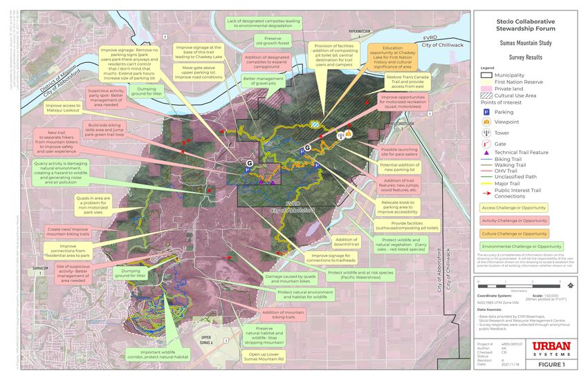
Survey respondents were invited to place a point on an interactive map and to provide a
comment on that location (Appendix D). Points could be selected from the following list:
• Access challenge or opportunity
• Activity challenge or opportunity
• Culture challenge or opportunity
• Environmental challenge or opportunitySumas Mountain Study
3 Resources and Use
3.1 INTRODUCTION
This section provides an overview of the characteristics of Sumas Mountain. The maps are
appended to the back of this report.
3.2 PHYSICAL CHARACTERISTICS
3.2.1 Slope
The mountain is known for its steep slopes, but there is significant variation (Map 1):
• Northeast part of the mountain has extensive steep slopes facing north and southeast
• Northwest part of the mountain has a major steep gully and other steep slopes at the
14 base of the mountain
• Southwest portion has limited steep slopes except for a bluff facing southeast
• Central portion of mountain has more moderate slopes
3.2.2 Elevation
There is a wide range of elevation, especially on the east (Map 2):
• Elevations range from 50 to over 900 metres
• Elevations on the west side, within the City of Abbotsford, are mostly under 500 metres
• Elevation on the east side, within the FVRD, climb prominently to the peak
3.2.3 Biogeoclimatic Zones
A biogeoclimatic zone is a geographical area (large ecosystem) with a relatively uniform
macroclimate, characterized by a mosaic of vegetation, soils and, to a lesser extent, animal life
reflecting that climate (Map 3):
• Sumas Mountain is in the Coastal Western Hemlock zone
• Three subzones occur within the study area – Very Dry Maritime, Dry Maritime, and Very
Wet Maritime – therefore supporting a wide range of habitatsSumas Mountain Study
3.2.4 Degree of Alteration
Degree of alteration measures the degree to which the natural environment has been
changed by human activities. Sumas Mountain has been irreversibly affected by major
industries such as quarries and the Trans Mountain tank farm. Residential uses also have
permanent impacts on the environment that are unlikely to be reversed. Linear features such
as the railway, roads, power lines, and the Trans Mountain Pipeline can affect habitats and
the movements of wildlife. Agriculture impacts are variable depending on the land cover.
Recreation uses such as hiking and mountain biking have relatively low impacts, though
motorized trail uses can have more significant effects when vegetation is removed and
erosion causes sediment runoff.
The table below shows the levels and types of alteration on Sumas Mountain. Because the
mountain naturally supported such rich habitats, low and minimal alteration areas generally
have the highest environmental and cultural values and have the greatest importance for
protection (Map 4).
Rating of Alteration Description and Comments
Quarries
Very High
All quarries must have a reclamation plan
Residential and Agriculture 15
Residential areas are unlikely to convert to a more natural state
High Range of alteration (and presence of vegetation) based on
varying densities of development
Some of the agriculture areas are natural
30 metre setback around High areas due to their influence
Moderate Cutblocks within last 10 years
30 m buffer around roads and railway due to their influence
High trail density (mountain biking area)
Low
50 m buffer around Moderate areas
Mostly natural except for trails, signs, and day use features such
Minimal
as picnic tablesSumas Mountain Study
3.2.5 Environmental Overview
Sumas Mountain has a high level of biodiversity due to its extensive elevation range and
varied aspects facing all four cardinal directions. All undeveloped portions of the mountain
support critical and important species and habitats. The southern slopes of Sumas Mountain
host a rare stand of Garry Oak trees. These trees are very rare in the Fraser Valley and are
often found in warmer more Mediterranean climates such as those found on Vancouver
Island. Oral history states that the stand on Sumas Mountain was intentionally planted or
came in on a flood many generations ago.
CSF is looking at plant indicators of Stó:lō. That information was not available for this project
but could be added to the data for future Sumas Mountain studies.
The Stó:lō People refer to the mountain as a
“bread basket”. Sumas Mountain is unique in that
the mountain faces all four directions allowing
varying moisture conditions on each side, so Stó:lō
People can access foods, medicines, and cultural
use areas in one place!
16
Maps 5 and 6 display available environmental information. Because there has been no
comprehensive environmental study of Sumas Mountain, a lack of identification on these
maps does not mean that all habitats and species are identified or that those mapped do not
exist elsewhere on the mountain.
The points on Map 5 show the locations of critical and important species based on
observations and studies; this data covers Crown and municipal lands only and it was
compiled and provided by the Fraser Valley Conservancy (FVC). FVC also indicated that
there may be Screech Owls on the mountain as a rehabilitation society had one from there
and released it back. Some of the species, such as Great Blue Heron, frogs, and the water
shrew, play a key role in oral histories. The polygons on this map also identify the locations of
critical and important species and habitats from iMap (DataBC); this data covers locations
where environmental studies have been conducted, which is mostly where development is
proposed. The following species list is in approximate order of occurrence per Map 5.Sumas Mountain Study
Species Description and Preferred Habitat
Open areas within early-seral forests with friable soils that allow for
burrow construction usually near stream or seepages. Subsurface
Mountain
drainages that keep tunnels wet are ideal, but dens must be dry. Den
Beaver
sites are usually near preferred foods, i.e., herbaceous plants, ferns, young
shrubs and trees.
FVC did some habitat suitability mapping for this species, which is mostly
in second growth forests.
Deciduous and mixed deciduous/coniferous forest, typically dominated
Oregon by bigleaf maple, balsam poplar, and scattered western redcedar. Many
Forestsnail records are from riparian habitats and forest edges, where dense cover
of low herbaceous native vegetation is typically present. Stinging nettle
is often present. All known Canadian Oregon forestsnail populations are
from habitats less than 360 m above sea level.
Terrestrial stages live below 200 m in elevation, and are associated with
Northern Red streams, ponds or marshes. Can also be found far from water, living in
Legged Frog moist forests. Breeding habitat includes permanent and ephemeral
bodies of water.
Snail generally found in forested areas. Adults are often encountered in
Pacific 17
spring when crawling in the open off the ground or climbing trunks of
Sideband
shrubs and trees.
Herbaceous perennial plant that occurs in moist woodlands and stream
Pacific
banks in the lowland zone. Rare in the Fraser Valley, limited to the
Waterleaf
Abbotsford and Chilliwack areas.
Semiaquatic riparian habitat specialist found in riparian habitat
associated with wet coniferous or deciduous forests with downed
Pacific Water
logs that maintain a moist microenvironment, dense marsh/ wetland
Shrew
vegetation, areas adjacent to water including natural stream, wetland or
channelized watercourse with permanent, ephemeral or intermittent flow.
Nests on rock cliff ledges or crevices above lakes or river valleys, will also
use tall buildings. Nests where abundant prey is nearby. Will occasionally
Peregrine
use abandoned nest of bald eagle or cormorant or natural tree cavity. Prey
Falcon
primarily on birds ranging in size from hummingbirds to geese that are
caught in flight. Usually nests near a seabird colony.
Nests colonially in tall, undisturbed forests. Nest tree species include red
Great Blue alder, black cottonwood, bigleaf maple, Sitka spruce, and Douglas-fir.
Heron Foraging habitat includes aquatic areas up to 0.5 m in depth. Require
forage within 3-10 km of nest.Sumas Mountain Study
Species Description and Preferred Habitat
Every type of forest is different and there is no commonly accepted
definition of an old-growth forest. Characteristics of old growth can
include tree species, tree age, tree size, surrounding forest structure,
ecological function, and historical disturbance. While these characteristics
Old Growth vary according to location and species, old-growth forests tend to have
Forest more diversity of plant and animal life (including standing dead trees, or
snags, and fallen trees) than younger forests. Generally speaking, most of
B.C.’s coastal forests are considered to be old growth if they contain trees
that are more than 250 years old.
(From: Definition of “Old Growth” | Old Growth Forests (gov.bc.ca))
Garry oaks form ecosystems that are open parkland and meadows with
Garry Oak Douglas-fir and arbutus and a lush spring display of herbs - camas, Easter
lilies, western buttercups, and shootingstars.
Includes American Pika, Band-Tailed Pigeon, Black Bear, Cotton Grass,
Other – very Johnson’s Hairstreak (Butterfly), Giant Pacific Salamander, Phantom
few locations Orchid, Red-Tailed Hawk, Rubber Boa, Snowshoe Hare, Spotted Owl,
identified for Tailed Frog, Townbridge’s Shrew, Turkey Vulture, Western Screech Owl
each
18
Douglas-fir A BC red-listed1 ecological community that occurs in the Coastal Western
/ Western Hemlock biogeoclimatic zone. This ecological community occurs on dry
Hemlock sites that are often on steep upper slopes, ridges, or crests with warm
/ Salal Dry aspects. Soils are shallow or coarse over bedrock.
Maritime
A highly aquatic turtle found in shallow waters of ponds, lakes, oxbows,
and marshes, in slow-moving stream reaches, and in quiet backwater
Painted Turtle sloughs of rivers. Usually, their habitat contains muddy substrates with
– Pacific Coast emergent aquatic vegetation, exposed vegetation root mats, floating logs,
Population and open banks. Nesting habitats are on land usually within 200 m of
aquatic habitat, on gentle south-facing slopes with well-drained soil, sand,
or gravel substrate with minimal or no plant cover.
Grows in relatively undisturbed old growth, mature, and occasionally
older second growth forests. Typically found in coniferous or mixed forests
and requires an intact below-ground (ectomycorrhizal) fungal network.
Phantom Usually grows in sites with sparse ground cover and thick leaf litter
Orchid although it is also occasionally found in areas with a high cover of forbs
and shrubs. Majority of sites are south to southwest-facing. Litter from
Bigleaf Maple or other trees may play a role in making the soil pH more
alkaline than in other sites.
1 A red-listed species or ecosystem is one that is at risk of being lost (extirpated, endangered or
threatened). - BC Conservation Data CentreSumas Mountain Study
Species Description and Preferred Habitat
Moss that grows in cool, humid, mixed deciduous and coniferous, second
Roell’s growth forests on stream terraces, swampy floodplains, and occasionally
Brotherella in ravines and creeks. The primary substratums include alder, big leaf
maple, dogwood trees, rotten logs, and stumps.
Grows on semi-exposed rock or the surface of tree bark. Both of the
Silver Hair known sites in British Columbia have hot summers and cool to cold
Moss winters. At the Sumas Mountain site, it was found in a cranny on a dry
vertical sandstone cliff, and on a damp, shaded sandstone cliff face.
Flowering perennial that grows in shady, moist, mixed, mature western
redcedar-hemlock and Douglas-fir forest and also in predominantly
Tall Bugbane deciduous stands. Common associated species include bigleaf maple, red
alder, thimbleberry, Devil’s club, vine maple, red elderberry, and western
wild ginger.
Generally found in pastures, prairies, and shrub habitats in lowlands
Townsend’s and floodplains. Inhabits heavier soils with higher water content. Prefers
Mole medium-textured silt, loam soils with good humous content, also found in
open forest and light sandy soils.
Small mammal found mostly in conifer forests with dry, loose soil and
19
deep litter, however deciduous and mixed forests are also utilized. Prefers
Trowbridge’s upland areas away from water where litter and soils are drier. May
Shrew frequent disturbed areas. Critical features are well-developed litter layer
and ground cover of shrubs and herbaceous plants. Nests are typically in
cavities of downed wood, under logs, or in shallow holes.
Plant in the aster family found on narrow alluvial shoreline margins of
Vancouver
lakes, ponds, wetland, creeks, bogs, tidal estuaries, and in ditches and
Island
other wet areas that undergo annually fluctuating water levels, summer
Beggarticks
drawdown, and siltation. Is shade-intolerant.
There are six known spawning sites in the lower Fraser River between
Hope and Chilliwack. Five of the spawning sites are along side channels
White and one is in the main channel in a confined reach of the river. Substrate
Sturgeon at side channel spawning sites is mainly cobbles, gravel, and sand, with
the highest percentage of sand at the farthest downstream site, and
predominantly cobbles and boulders at the single mainstem site.Sumas Mountain Study
Map 6 shows sensitive ecosystems, riparian areas, older forests, and critical habitat for
federally listed Species at Risk. The latter data is historic and the species may no longer
be present.
Feature Description and Comments
Sensitive Ecosystems From City of Abbotsford mapping, limited to City lands
Riparian Area Lakes, ponds, and 30 metres either side of watercourses
Forest Cover over 150 From provincial forest cover data, represents higher habitat/
years old biodiversity value forest habitats
Critical habitat is mapped based on species-specific criteria
Critical Habitat for
and may not have been ground-truthed – includes Oregon
Federally-listed
Forestsnail, Pacific Water Shrew, Phantom Orchid, Townsend’s
Species at Risk
Mole, Western Painted Turtle
3.3 JURISDICTION AND REGULATORY
CONDITIONS
20 3.3.1 Land Use Designations
Map 7 shows the land use designations within the Official Community Plans (OCPs) of the
FVRD and City of Abbotsford. OCP designations identify the uses envisioned for the future by
municipalities and not necessarily existing use.
The S'ólh Téméxw Use Plan identifies one polygon encompassing the whole mountain. It is
designated a Cultural Landscape Feature. These sites, described in Stó:lō narratives in relation
to Transformation Stories and the Flood Story, comprise individual rocks and features, such as
mountains, that are viewed as living parts of the landscape that must be treated with respect.
2
This is explained in more detail in section 3.4.1.
Hatzic
Lake
r Ri v er
Fr a se
ke
La
s
ltu
Cu
Map of Sumas Mountain (red area) in the S'ólh Téméxw Use Plan
2 Cultural Landscape Feature, Section 8.1, Sto:lo Land Use Policy V.1.1 April 2018Sumas Mountain Study
OCP Designation Description
FVRD OCP – Forest Undeveloped Crown Land
FVRD OCP – Limited Use Quarry
FVRD OCP – Park and
Undeveloped Crown Land with Park tenure
Conservation Area
Abbotsford OCP – Agriculture Part of agriculture area on east side of mountain
Abbotsford OCP – Country Most of the existing rural residential area, part of which is
Rural undeveloped
One quarry
Abbotsford OCP – High Impact
Industrial Additional quarries that exist are not included in this
designation
Abbotsford OCP – Institutional Existing and future schools
Abbotsford OCP –
Future core of new neighbourhood
Neighbourhood Centre
Land acquired as parks and open space within and
Abbotsford OCP – Open Space
outside developed areas
21
Abbotsford OCP – Suburban
Existing and future residential areas
and UrbanSumas Mountain Study
3.3.2 Jurisdiction and Ownership
There is a complexity of jurisdictions with responsibilities and rights to Sumas Mountain
(Map 8). This map identifies the primary ones, and there are many others, as shown here.
Indigenous
Sumas First Nation
Stó:lō Nations
Federal Jurisdictions
Department of Fisheries and Oceans (watercourses)
Department of National Defence
Transport Canada (river navigation)
Provincial Jurisdictions
Ministry of Forests, Lands, Natural Resource Operations and
Rural Development (FLNRORD)
• Recreation Sites and Trails BC (RSTBC) (trails and lower
parking lot)
22
• Engineering (road)
• Forestry
Ministry of Energy, Mines and Low Carbon Innovation (mining)
Ministry of Environment and Climate Change Strategy
(environment)
Local Governments
City of Abbotsford
Fraser Valley Regional District
Photography © Tourism AbbotsfordSumas Mountain Study There are also multiple Acts that are relevant to managing recreation uses on Sumas Mountain as follows: Federal • Aviation Act • Canada Shipping Act - Vessel Operation Restriction Regulations • Fisheries Act Provincial • Declaration on the Rights of Indigenous Peoples Act • Forest and Range Practices Act • Forest Service Road Use Regulation and Natural Resource Road Act • Heritage Conservation Act • Land Act • Off Road Vehicle Act • Wildlife Act 23 Sumas Mountain is within the shared asserted territory of the Stó:lō. The S’ólh Téméxw Use Plan Policy establishes the guiding principles and planning direction for this territory. The FVRD portion of the mountain is mostly available and protected for recreation and cultural uses, except for one quarry. The City of Abbotsford portion of the mountain is largely under private ownership and it contains some areas that are designated as future neighbourhoods in the OCP. The City is working through planning processes for these areas with work that involves identification of environmentally and culturally sensitive and important areas, and establishing a network of parks and protected areas within future developments to protect these resources. There are four active quarries on Sumas Mountain, which generate a significant amount of truck traffic. There are also multiple inactive quarries. The Sumas First Nation has received many referral requests for quarry projects on Sumas Mountain and has issued a moratorium on new quarries. A common response to requests for new quarry activity among jurisdictions is lacking. There is also a proposal to twin the Trans Mountain Pipeline on the mountain. Mining has taken place on Sumas Mountain since the 1900s. There has not been an assessment of the cumulative effects of the mining activity.
Sumas Mountain Study

     The following is a summary of the mapped information:

      Label                      Description

                                Upper Sumas 6 extends into the study area

                                Six other Reserves in area: Sahhacum 1 – Matsqui, Aylechootlook
      First Nation Reserve      5 – Leq'á:mel First Nation, Sumas Cemetery 12 – Leq'á:mel First
                                Nation, Lakway Cemetery 3 – Leq'á:mel First Nation, Lackaway 2 –
                                Leq'á:mel First Nation

                                Planning areas within City of Abbotsford
      New Neighbourhoods        There will be more parks within the McKee planning area (yellow)
                                for neighbourhood and community parks in the future

      Ownership – Private       Most of the land in Abbotsford is privately owned

                                Majority of the study area in FVRD is Crown land
      Ownership – Crown
      Provincial                Crown land is managed by FLNRORD (Recreation Sites and
                                Trails BC)

      Ownership – Federal       One parcel on west side of mountain

24    Ownership – Municipal     Properties owned or purchased as future parkland

     3.3.3 Land Tenures
     In addition to land owners, there are other types of land tenures, such as leases, licences, and
     mining claims, that grant the tenure holders rights to Sumas Mountain (Map 9). This map
     identifies the land tenures and claims:

      Label                      Description

      Park Tenure               Crown tenures held by FVRD and City of Abbotsford

      Recreation Tenure         Crown tenures for trails and camps

      Rural Residential         Crown tenures for residential use

      Utility Tenure            Small tenures for infrastructure

                                Mineral, placer claims and leases, and coal applications, licences
      Mineral, Placer and
                                and leases with the Ministry of Energy, Mines and Low Carbon
      Coal Tenure
                                Innovation

      Forest Harvest            Operational activities for harvesting authorities, harvesting
      Authorization             authority is a legal area cleared for harvesting purposes

      Forest Tenure             Ministry of Forests Managed Licences including Community
      Managed Licence           Forests and Woodlots
Sumas Mountain Study
3.4 MOUNTAIN USE
3.4.1 Cultural Use
S’ólh Téméxw Use Plan Policy (STUP, April 18, 2018)
Kwe’Kwe’Ikw (Sumas Mountain) is a recognized Cultural Landscape Feature by the Coast
Salish People, and in the S’ólh Téméxw Use Plan Policy3. The Cultural Landscape Feature
Zone represents terrestrial sites on the landscape that are integral to Stó:lō worldview and
establish their unique relationship with the land and resources of their traditional territory.
These sites, described in Stó:lō narratives in relation to Transformation and Flood stories,
comprise individual rocks and features, such as mountains, that are viewed as living parts of
the landscape that must be treated with respect.
According to the STUP zone conditions, activities proposed within the Cultural Landscape
Feature Zone must be assessed for their potential impacts on:
• Surface integrity, with an understanding that surface activities that cause superficial
damage may be permissible whereas subsurface activities that cause internal damage
to these sites will not be tolerated
• Appearance, in relation to sites on the landscape that are identifiable from a distance
making their form a crucial aspect of their cultural significance
25
Story of the Flood
by Sloh-Kwilh-LAM-loh – July 1964
Well, when the time came the floods started; they began to follow that Sumas
Mountain the Natives call Tuhk-KAY-uhq; that was the name of the mountain that
didn't go out of sight during the flood. Well, they got up to the top and they had a long
rope that was the Native's work, braided of some kind of skin and trees, and they tie
themselves up there.
The story says there were three canoes; one was the lost from there, one that broke
away and nobody knows where they went. For so many days they were up there and
then the water begun to come down. They got down to about half way to the lower
land, and they stopped in place, there was a cave in a mountain, so they stay right
there to be dried, and they had a long rope coiled up inside the cave and they stayed
there those people - stayed right there until they could see the low land was dry. The
grass began to get green. Then they began to come down. And that long rope and
other stuff that they had were left up there. It appears you know anybody can see that
coil of rope inside the cave – whoever will see it. And it will either be good luck or bad
(for) whoever will see it – that coil of rope that's left up there.
3 S’ólh Téméxw Use Plan Policy V1.1, Section 8, Table 1Sumas Mountain Study
StÓ:lō Heritage Policy (SHP, May 5, 2003)
The purpose of the SHP is to allow the Stó:lō to:
• protect, preserve and manage Stó:lō heritage - in all its forms – in a manner consistent
with Stó:lō values, beliefs and traditions
• cooperate with other organizations - both Stó:lō and non-Stó:lō - in the protection,
preservation and management of Stó:lō heritage
• protect and preserve Stó:lō religious freedom in all its expressions
• maintain the integrity of the Stó:lō spiritual world
• maintain healthy relations between the contemporary Stó:lō community and Stó:lō
ancestors – past, present and future
• maintain the integrity of Stó:lō history and heritage through the respectful treatment of
Stó:lō knowledge, heritage objects and sites
• advance knowledge and understanding of Stó:lō heritage
• maintain continuity in Stó:lō heritage and the practice of cultural traditions in forms
both old and new
26 • advance Stó:lō cultural revival
We, the Stó:lō, make public our Stó:lō Heritage Policy Manual.
We do this with the intent that all who live here and care
about the future of S'ólh T'éméxw will come to understand
and respect us – our concerns, our heritage, our land and its
treatment. We are determined to promote the integrity and
well being of our Stó:lō heritage in all its forms. We wish to
share our heritage with our neighbours. We promote better
understanding between peoples in order to create a better
and healthier way of life for all living within S'ólh T'éméxw.
We believe this policy manual will aid us in these endeavours." 4
4 Sto:lo Heritage Policy Manual, Section 1.2, VisionSumas Mountain Study
It is the intent of the CSF to promote and advocate for enhanced protection of the places
and stories connecting the Stó:lō people to Sumas Mountain. The policies and practices
of the Stó:lō people are rooted in agreements stemming from the occupation and
relationship of Stó:lō ancestors for millennia. The modernizing of these agreements, in the
form of policy, allows for alignment and interpretation alongside provincial, regional, and
municipal government policy. This document, and the tables within it, provide specific site
policy references for use in the collaborative decision-making necessary for the future of
Kw’ekw’e’í:qw, Sumas Mountain.
The SHP table below provides a framework for the management of Stó:lō heritage sites:
Preferred
Site Type Management Secondary Option(s) Comments
Measure
sxwôxwiyám;
Avoidance /
Xá:Xa; n/a
no impact
sxwó:yxwey
Refer to environmental
Minimize impact &
Avoidance / assessment process; enhance
stl’áleqem mitigate impact
no impact the natural qualities of the area
(to area)
if possible / applicable
27
Options potentially
available per Exception - spirit poles are not
Ceremonial Avoidance /
consultation with and to be disturbed or moved as a
regalia no impact
approval of the Stó:lō means of avoiding impact
Nation / Tribal Council
Options potentially
available per Burials may be recovered
Burial / Avoidance /
consultation with and and reburied under some
cemetery no impact
approval of the Stó:lō circumstances
Nation / Tribal Council
Minimize impact &
Material Avoidance /
mitigate impact
culture no impact
(to area)
Enhancement Minimize impact & Maintain or enhance the
Traditional
/ avoidance / mitigate impact traditional use activity potential
activities
no impact (to area) of the area
Refer to environmental
Minimize impact &
Avoidance / assessment process; enhance
Named place mitigate impact
no impact the natural qualities of the area
(to area)
if possible / applicableSumas Mountain Study
The following table describes the Sumas Mountain site types and management measures in
keeping with the framework from the SHP:
Ancestral Management English Name/
Site Type Definition
Name Measures Description
Sticks up, like 1. Avoidance,
how Sumas No
Wōqw’
Mountain sticks Impact
Places tied to Kw’ekw’e’í:qw Sumas Mountain
up over the river, 2. Minimize,
flood stories and the valley Mitigate
bottom impact
Sxwōxwiyám 'come/go/get
The confluence
T'ex̠ qé:yl fork/branch in
Sxwôxwiyám oral of Sumas River
the head' A long
histories that and what is now
standing warrior
describe the distant Vedder river
village
past "when the
world was out ‘Sticking up’, in
of balance, and reference to how
not quite right." the Mountain
28
Sxwôxwiyám sticks up over
account for the Kw'ekw'e'í:qw the prairie and
origins and the river valley, Sumas Mountain
connections of the associated
Stó:lō, their land, with local and
resources and broader Coast
sxoxomes ('gifts Salish Flood Avoidance,
of the creator'). stories No impact
There are many
‘Thunderbird Bluffs and Caves
heritage sites Xwexwó:sáwtxw
house’ at McKee Peak
throughout Stó:lō
Territory that relate
to sxwôxwiyám.
These sites are
among the most
Bedrock, canoes
culturally important
were tied here Now Lafarge
Stó:lō heritage Teq'qéyex
during a great Quarry site
sites and continue
flood
to function as
essential parts of
the contemporary
Stó:lō world.You can also read