Summary Report GHG Inventory for Forests and Trees Outside Forests, 2008 to 2016 Custom uploaded polygon County, N/A - Albemarle County
←
→
Page content transcription
If your browser does not render page correctly, please read the page content below

Summary Report
            GHG Inventory for Forests and Trees Outside Forests, 2008 to 2016
                         Custom uploaded polygon County, N/A
Summary
Forests and trees play a key role in mitigating climate change, yet they are often not included in local greenhouse gas (GHG)
inventories or climate action plans. Custom uploaded polygon County, N/A has taken the first step towards understanding
how local changes in land use and tree canopy have contributed to the county’s net greenhouse gas profile. Unlike other
sectors, land use (in this case, forests and trees) not only emit GHGs, they also remove CO2 from the atmosphere through
photosynthesis, and play a critical role in regulating the planet’s climate. The information contained in this summary report
can be useful when designing climate actions that reduce GHG emissions and/or increase removals of GHGs from the
atmosphere.

Key :ndingsb
- Over the period 2008 to 2016, emissions from forests and trees were 157,739 t CO2e per year.
- Over the period 2008 to 2016, the Net GHG balance of forests and trees was -920,304 t CO2e per year.
- Roughly 68% of Custom uploaded polygon County’s total land base of 178,009 hectares (439,870 acres) is forest. Many
areas outside of forests are also covered by trees, including an average of nearly 21.8 percent tree canopy on lands outside
of forest areas
- Over the same period, annual CO2 removals from forests and trees were -1,024,305 t CO2e per year. (Carbon removals
are represented by negative values.)
- Total GHG emissions for Custom uploaded polygon County across all sectors could be reduced if additional forests/trees
were added to its land base, and/or if losses of trees were reduced further.
     Ta.le 1c Custom uploaded polygon 'ountyxs GHG –uDes from forests and trees for inventory period 2008 L 2016, all values reported in t CO2e per year

                                                                           1/8
                                                                                                           Report generated on 2021-03-16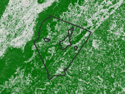
hata Inputs
Data used as inputs into the GHG emission and removal calculations are described below.

3and and Forest Cover
GHG inventories for lands are reported in six “land use” categories which were defined by data on land cover—forest land,
grassland, cropland, wetland, settlement and other land (barren, snow, ice). Custom uploaded polygon County’s total land
base is approximately 178,009 hectares (439,870 acres), with nearly 5.5% Settlement (i.e. developed areas of varying
intensity), around 68.2% forest, 24.5% Grassland (which includes hay/pasture, shrub/scrub and other herbaceous cover),
1% cropland, 0.6% wetland and 0.1% other land.

                         Figure 1c 3and 'over in Custom uploaded polygon from twe National 3and Cover hata.ase, 2016

                         Figure 2c 3and 'over in Custom uploaded polygon from twe National 3and Cover hata.ase, 2016

                                                                                              Open Water
                                                                                              Perennial Ice and Snow
                                                                                              Developed, Open Space
                                                                                              Developed, Low Intensity
                                                                                              Developed, Medium Intensity
                                                                                              Developed, High Intensity
                                                                                              Barren Land
                                                                                              Deciduous Forest
                                                                                              Evergreen Forest
                                                                                              Mixed Forest
                                                                                              Shrub/Scrub
                                                                                              Grassland/Herbaceous
                                                                                              Pasture/Hay
                                                                                              Cultivated Crops
                                                                                              Woody Wetlands
                                                                                              Emergent Herbaceous Wetlands

                                                                   2/8
                                                                                                   Report generated on 2021-03-16
Forest Cover Cwange
Generating GHG estimates requires data not just on areas of land use, but also data on how land use has changed over
time. Between 2008 and 2016, the county lost around 4,589 hectares (11,339 acres) of forest land, largely conversion
to Grassland. Over the same period, the county gained around 2,562 hectares (6,330 acres) of forest land, largely from
Grassland.
Figure (c 3oss of forest to otwer land use types .et)een 2008 and 2016 4wa5
Figure %c Gain of forest from otwer land use types .et)een 2008 and 2016 4wa5
Forest histur.an'es
Over the inventory period 2008 to 2016, forest disturbance from harvests/other disturbance was the most significant in
Custom uploaded polygon County, affecting 2525.2 hectares (6,240 acres), followed by fires, which affected 15.8 hectares
(39 acres) and insects, which affected 0.6 hectares (1 acres).
3/8
Report generated on 2021-03-16Trees Outside Forests
Figure 5 shows tree canopy captured by the NLCD tree canopy data. (Note that some areas with high tree canopy in Figure
5 overlap with the NLCD forest class shown in Figure 2.)
This data are available only for the years 2011 and 2016. Over this time period, Custom uploaded polygon County had an
average of 11,367 hectares (28,088 acres) of tree canopy outside forests. Between 2011 and 2016, 25 hectares per year
of tree canopy were lost, for a total of 127 hectares (315 acres) of tree canopy loss over the 5 year period. Most of this loss
occurred within the Grassland class.
Figure -c Tree 'anopy 2016 4Sour'eb National 3and Cover hata.ase5
0% 100%
Figure 6b Average tree 'anopy 4in we'tares5 and “ tree 'anopy in di”erent non7forest land use 'ategories in Custom uploaded polygon County for twe period 201172016c
Noteb .ars relate to tree 'anopy area 4left verti'al7aDis, we'tares5 and dots are twe “ tree 'over per land use 'ategory 4rigwt verti'al7aDis5c MOtwerE 'ategory not swo)n
due to very lo) areac
4/8
Report generated on 2021-03-16Figure Wb Average area of tree 'anopy loss in di”erent non7forest land use 'ategories in Custom uploaded polygon County over twe period 2011 to 2016 4we'tares per
year5c Noteb otwer 'ategory not swo)n due to very lo) areac
5/8
Report generated on 2021-03-163and Cover Cwange PatriD Ta.le 2c Full N3Ch land 'over 'wange matriD for 2008 to 2016c All areas are in we'taresc
Ta.le (c Simpli:ed land 'over 'wange matriD for 2008 to 2016cAll areas are in we'taresc

 mission and Removal Fa'tors
A summary of the emission and removal factors used in the calculations is provided in Table 4.

Harvested ood rodu'ts
Harvested wood products (HWP) temporarily store carbon from the forest ecosystem as the wood goes through a series
of production processes and end-uses, with eventual disposal (and emission to the atmosphere). The delay represents a
net benefit to the atmosphere. The period of storage varies from long-lived solid wood products that remain in use for long
periods of time to products that are quickly disposed of in landfills.

In the web tool, the HWP Calculator tracks carbon in harvested wood through four different “fates,” from harvest to timber
products to primary wood products to end-use to disposal, applying best estimates for product ratios and half-lives at each
stage. Based on user inputs entered about annual harvest volumes in Custom uploaded polygon County, the change in the
harvested wood pool over the inventory period 2008 to 2016 is estimated as 53738 t CO2e per year.

                                                                   7/8
                                                                                                     Report generated on 2021-03-16
Caveats
Information presented here represents a snapshot in time of the net GHG balance and many of the factors contributing to
that balance. The estimates can help identify where policies may be designed to reduce net GHG emissions. This inventory
currently uses a simplifying assumption that a loss of forest or trees results in immediate emissions to the atmosphere
(rather than delayed emissions in the case of various use cases from long-term storage to shorter decay timelines if sent
to landfills). In general, it is important to consider that these estimates represent a relatively short period of time compared
with the long-term consequences of policy decisions and land management actions. For example, a forest converted to
settlement represents a permanent loss of removal capacity. Over the long term, maintaining forests will sustain a higher
rate of carbon removal, depending on age-related growth rates and occurrence of disturbances.
There are significant uncertainties in the estimates. Although not quantified here, typical greenhouse gas inventories of
forests using similar approaches, including the national GHG inventory, report uncertainties in the net GHG balance that
can be as high as ±45% (with 95% confidence). In the results presented here, the most uncertain estimates involve
emissions from land-use change which are based on well-documented remote-sensing products, but relatively few field
observations from a statistical sampling of county forests. While uncertainties can be high, the estimates can still provide
useful information on the relative magnitude and importance of such GHGs; subsequent analyses can also provide
information on the directionality of emissions and removals from land management.
Finally, it is recommended that additional analyses be done using models that project impacts of alternatives over coming
decades. Such models are available and have been used in other studies at county scale. The GHG inventory presented
here is only the first step to providing science-based information to support policy decisions. To more fully explore the
potential impacts of alternate policies, projection models can be used to compare long-term results among the alternatives
which typically include a “business as usual” (i.e. no change in policy) alternative. This feature may be added into the web
tool in the future.
8/8
Report generated on 2021-03-16You can also read