Summary State of the Waitākere Ranges Heritage Area 2018 - Whakarāpopoto: Te āhua o te Rohe o Te Ika Whenua o Waitākere 2018
←
→
Page content transcription
If your browser does not render page correctly, please read the page content below
18-PRO-3160
   Whakarāpopoto: Te āhua o te Rohe
   o Te Ika Whenua o Waitākere 2018

   Summary
   State of the Waitākere
   Ranges Heritage Area 2018

Find out more: visit aucklandcouncil.govt.nz
or phone 09 301 0101
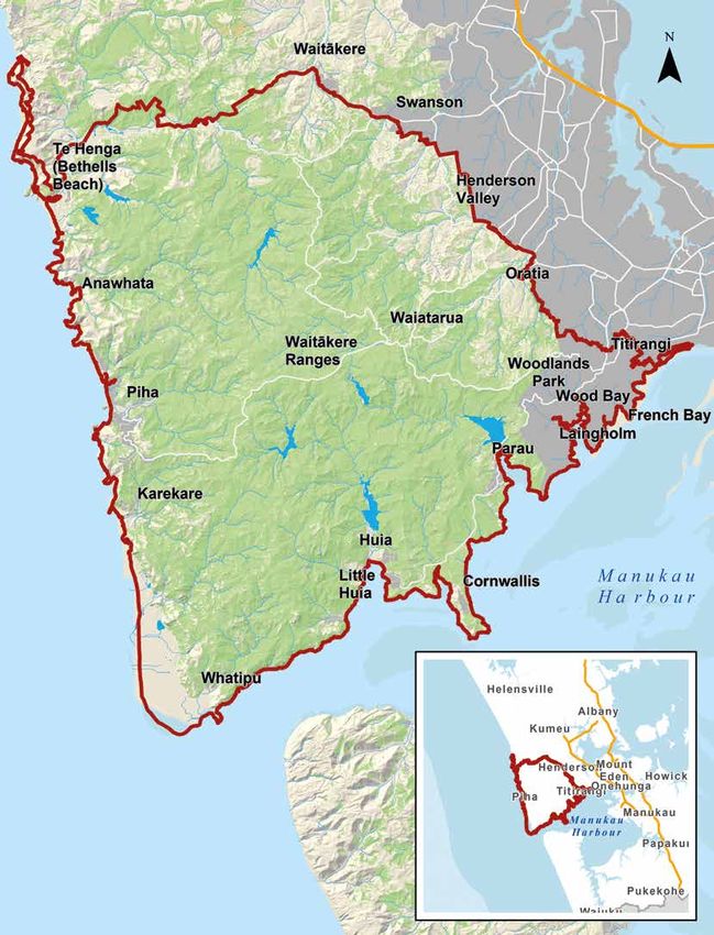
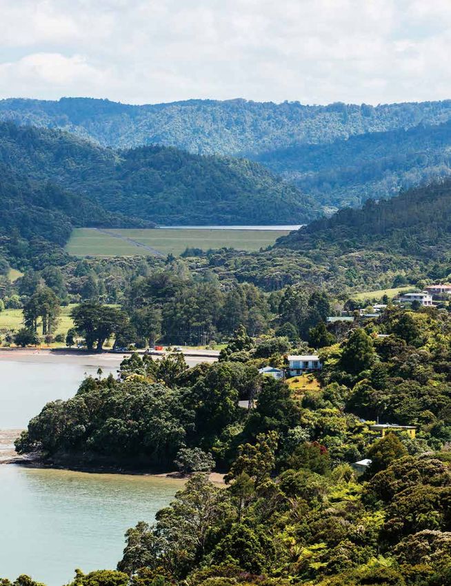
Map of
Waitākere
Ranges
Heritage Area

2   |   SUMMARY
Monitoring the state of the heritage area
Why we monitor the state of the Waitākere Ranges Heritage Area
The Waitākere Ranges heritage area is of national,      This is the second report to be prepared under the
regional, and local significance and the heritage       Act. Changes over the last five years have been
features described in section 7 of the Waitākere        measured against the data used for the Waitākere
Ranges Heritage Area Act 2008 (the Act) individually    Ranges Heritage Area Monitoring Report (Volumes 1
and collectively contribute to its significance.        and 2) June 2013. Statutory changes and some new
                                                        topics have been included in the 2018 report.
Section 34 of the Act requires the council to monitor
at five yearly intervals:                               The results of the latest monitoring are discussed in
                                                        detail in the State of the Waitākere Ranges Heritage
• the state of the environment of the heritage area
                                                        Area 2018 report.
• the progress made towards achieving the
                                                        This pamphlet provides a summary of the overall
  objectives of the Act
                                                        findings across the topics of the report.
• the funding impact from activities to be undertaken
                                                        The full report is available from the council website:
  to give effect to the Act.
                                                        aucklandcouncil.govt.nz

                               STATE OF THE WAITĀKERE RANGES HERITAGE AREA 2018                                  |   3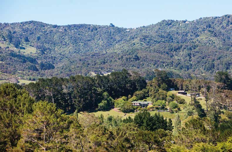
Mana whenua response
                      Te Kawerau ā Maki and Ngāti Whātua are mana
                      whenua of the heritage area and played an integral
                      role in the creation of the Act.
                      The issues they identified from reviewing the
                      State of the Waitākere Ranges Heritage Area 2018
                      report are that progress had been made towards
                      achieving the objectives of the Act in some areas,
                      but that a number of other areas need improvement,
                      particularly in respect of:
                      • addressing the spread of kauri dieback disease
                      • managing the spread of pest plants and animals
                      • addressing the ecological quality of lakes
                      • allocating funding proportionate to the national
                        significance of the area
                      • managing the uncontrolled growth of tourism and
                        recreation activity in sensitive areas.
                      To address their concerns Te Kawerau ā Maki and
                      Ngāti Whātua have recommended to Auckland
                      Council and its council-controlled organisations:
                      • that a co-governance and co-management steering
                        group be established for the heritage area
                      • that a strategic plan be developed for the heritage
                        area to integrate and co-ordinate activities
                      • that baseline information gaps be identified and
                        that measurement and monitoring processes be
                        re-designed to align with both western science and
                        tikanga Māori
                      • that progress be made to complete Deeds of
                        Acknowledgement with Te Kawerau ā Maki and
                        Ngāti Whātua (as enabled by the Act).

4   |   SUMMARY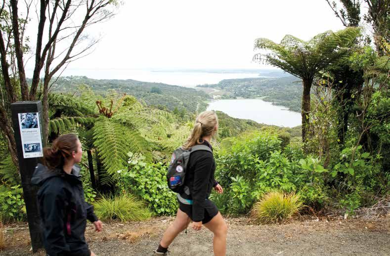
Overall findings

Achievements between 2013 and 2018
       Indigenous terrestrial and aquatic ecosystems
The heritage area contains approximately 21,200 hectares of
indigenous forest, of which approximately 9,500 hectares
(45 per cent) is kauri-podocarp forest. This is one of the
largest blocks of continuous indigenous vegetation
remaining in Auckland. Two of the most significant
wetlands in Auckland are also located within the heritage
area; at Te Henga / Bethells Beach and at Whatipu.
The indigenous terrestrial and aquatic ecosystems in
the heritage area are heritage features.

Over the last five years
The indigenous terrestrial and aquatic ecosystems of the
heritage area have been enhanced through:
• the addition of 98 hectares of land as either regional
  park land, local reserve, or as covenanted land (eighty seven
  hectares of this land contains predominantly indigenous vegetation
  and 34 hectares contains ecologically significant habitat)
• a likely increase in the proportion of threatened species
  with stable or increasing population sizes
• key roosting sites of the long-tailed bat within the
  heritage area being identified
• identifying of a diverse range of ecosystems
  (Biodiversity Focus Areas) to ensure their long-
  term retention and as a focus for protection and
  restoration activities
• the on-going council and the Waitākere Ranges
  Local Board pest plant and animal control activities
  undertaken in the heritage area                                         Photo: Jacqui Geux

• the significant effort that community groups and
  landowners have made in on-going pest plant and animal
  control, restoration activities and programmes to manage and stop
  the spread of kauri dieback disease.

                                STATE OF THE WAITĀKERE RANGES HERITAGE AREA 2018           |   5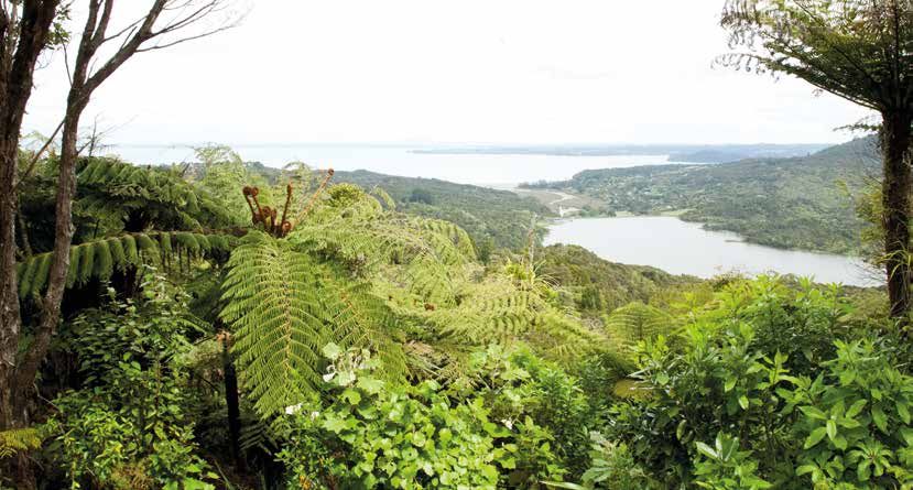
Natural landscapes and character
    The natural landforms and landscapes, rural character       Over the last five years
    of the foothills, urban and residential areas within the
                                                                There has been a substantial and continuing decline
    forest settings and the coastal villages are all heritage
                                                                in the number of resource consent applications for
    features. An objective of the Act is that the character,
                                                                subdivision and development. The planning provisions
    scale and intensity of subdivision and development
                                                                that applied over this period have met the objectives
    does not adversely affect the heritage features.
                                                                of retaining:
                                                                • the natural landforms and landscapes which give
                                                                  the heritage area its distinctive character
                                                                • the subservience of the built environment to the
                                                                  heritage area’s natural and rural landscape
                                                                • the identity, scale and character of the
                                                                  coastal villages
                                                                • the low-density residential and urban areas in
                                                                  forest settings
                                                                • the rural character of the foothills.
                                                                The darkness of the Waitākere Ranges and coastal
                                                                areas are a heritage feature. During this monitoring
                                                                period measurements of the night sky were taken and
                                                                were found to correspond to the International Dark
    Photo: Sean Shadbolt
                                                                Sky Association’s Bronze Standard.

6   |   SUMMARY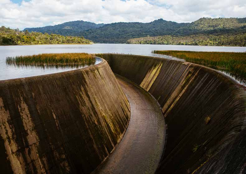
Photo: Gail Allende
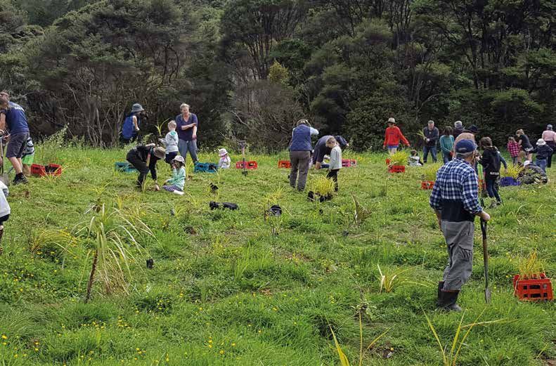
People and communities
The local communities, volunteer groups and land Over the last five years
owners play a significant and valuable role in actively
The community organisations and volunteer groups
maintaining the natural, historical, cultural and
within the heritage area have thrived and they
recreational features of the heritage area.
continue to make a vital and significant contribution
The relationship of the people, communities and to maintaining the natural, historical, cultural and
mana whenua with the heritage area and their recreational values of the heritage area.
exercise of kaitiakitanga and stewardship is a
heritage feature.
Photo: DPA Architects
STATE OF THE WAITĀKERE RANGES HERITAGE AREA 2018 | 7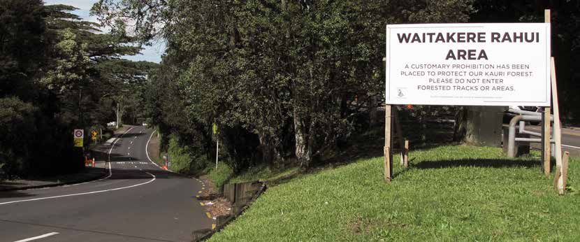
Historic heritage
    The Act refers to the heritage features including      Over the last five years:
    evidence of past human activities such as timber
                                                           The knowledge and understanding of historic
    extraction, gum-digging, flax milling, mineral
                                                           heritage has been improved by:
    extraction, quarrying, extensive farming, and water
    impoundment and supply. Other past human               • Survey and research work being underway, or
    activities such as Māori settlement and use are also     completed, for over 250 historic heritage places.
    historic heritage features.

8   |   SUMMARY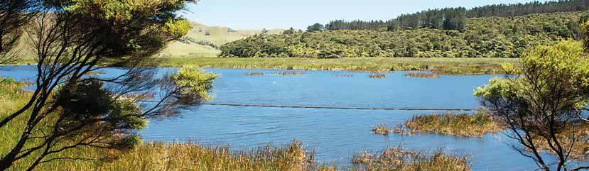
Recreational use and wilderness experiences
The heritage area is located in close proximity to       • the addition of park land at Piha; Taitomo (a 78
the city and is highly valued and used for a range         hectare addition to the regional park), at Seaview
of recreation activities and wilderness experiences.       Road, Piha (a two hectare local reserve) and at
The Waitākere Ranges Regional Park and west                Karekare; property next to McCreadies Paddock (a
coast beaches are major visitor destinations and           1.2 hectare local reserve)
the recreation and wilderness opportunities of the
                                                         • the provision of new public infrastructure such as
heritage area are a heritage feature.
                                                           the Piha public toilets and sections of the Little
Over the last five years                                   Muddy Creek walkway (link between Tangiwai
                                                           Reserve and Grendon Road) and walkway between
The opportunities for recreational use have been
                                                           Rimutaka Place and Huia Road.
further enhanced by:

       Water catchment and supply
The water catchment and supply system and its            Over the last five years:
operation, maintenance, and development to serve
                                                         The operation, maintenance and development of
the people of Auckland are a heritage feature. An
                                                         the water catchment and supply system remains an
objective of the Act is to protect the features of the
                                                         important feature of the heritage area and presently
heritage area that relate to its water catchment and
                                                         provides 19 per cent of Auckland’s water supply.
supply functions.

                                STATE OF THE WAITĀKERE RANGES HERITAGE AREA 2018                                |   9
Overall findings

     Key threats and pressures
             Kauri dieback disease                              • there is a close relationship between kauri dieback
                                                                  zones and their proximity to the track network,
     The forest of the heritage area (Te Wao Nui ā Tiriwa         with 71 per cent of kauri dieback zones within 50
     – the great forest of Tiriwa) is a taonga (treasure)         metres of a track
     that has significant cultural and spiritual values for
                                                                • all of the kauri forest within the heritage area
     mana whenua. For Te Kawerau ā Maki the death of
                                                                  is at very high risk of being infected by kauri
     the forest is an existential threat. Kauri are tupuna
                                                                  dieback disease.
     (ancestors) and the rangatira (chiefs) of the forest.
     Their health is linked to the health of numerous other     Response
     plants and animals within the ecosystem, and to the
                                                                The recent (up to December 2017) response to the
     health of the iwi.
                                                                spread of kauri dieback disease has been:
     The heritage area contains approximately
                                                                • monitoring through aerial and extensive ground
     2571 hectares of kauri forest as well as many
                                                                  survey with the results reported in the Auckland
     individual trees. Kauri dieback disease is a major
                                                                  Council report; ‘Kauri Dieback Report 2017: An
     threat to the kauri forest ecosystem of the heritage
                                                                  investigation into the distribution of kauri dieback,
     area and all kauri is considered to be at very high
                                                                  and implications for its future management, within
     risk of infection.
                                                                  the Waitakere Ranges Regional Park Version 2:
     Over the last five years                                     Update June 2017’

     Monitoring of kauri within the heritage area               • to minimise the risk of spreading kauri dieback
     shows that:                                                  disease through the movement of soil (on
                                                                  footwear, vehicles, machinery, equipment & tools)
     • the number of trees infected by kauri disease has
                                                                  by applying ‘Standard Operating Procedures for
       more than doubled from eight per cent in 2013 to
                                                                  Kauri Dieback’ to apply to all council staff, Auckland
       19 per cent in 2016 (with a further five per cent
                                                                  Council Controlled Organisation staff, contractors,
       showing signs of infection)
                                                                  permit holders and concessionaries working in
     • of the 91 distinct areas of kauri forest greater           areas that kauri are present
       than five hectares in size (ecologically significant),
       53 areas are exhibiting symptoms of kauri
       dieback disease

10   |   SUMMARY
• on-going community group and landowners initiatives, often
in collaboration with the Ministry for Primary Industries,
mana whenua and council (e.g. Keep Kauri Standing
kauridieback.co.nz), trialling possible treatment
(phosphite injections), providing public information
and acting as ambassadors at tracks to ensure
people use the phytosanitary stations
• in response to the spread of kauri dieback Te Kawerau
ā Maki placed a rāhui (customary prohibition) over
the Waitākere forest restricting use of, and access
to the forest to safeguard it both physically and
spiritually (the rāhui took effect on 2 December 2017)
• Te Kawerau ā Maki also sought that a Controlled Area
Notice under the Biosecurity Act 1993 be implemented by
the Ministry of Primary Industries to provide specific control
and management methods to support the rāhui and help stop
the spread of kauri dieback
• at its Environment and Community Committee meeting
on 5 December 2017 the council supported the rāhui in
principle and implemented a programme of high and
medium risk track closures, and upgrading open tracks
and cleaning stations (the success of this approach
was to be reported back in February 2018).
The response to kauri dieback disease is on-going and
subject to assessment and review by both the council
and the Ministry of Primary Industries. The state
of the environment reporting period for this report
covers the period up to December 2017. Responses and
changes after this period will be reported in the State of
the Waitākere Ranges Heritage Area 2023 report.
STATE OF THE WAITĀKERE RANGES HERITAGE AREA 2018 | 11Pest plants and animals
Pest plants and animals are a major on-going
threat to the terrestrial and aquatic ecosystems of
the heritage area. Pest plant and animal control is
required at a level that (at a minimum) retains the
ecosystem values of the heritage area.
Over the last five years
A considerable number of council (including
the Waitākere Ranges Local Board), community
and landowner pest plant and animal control
programmes have been undertaken and are vital to
maintaining the ecosystems of the heritage area.
The on-going challenge is to fund programmes at
a level that will improve and restore the health
of ecosystems.
Response to date
A number of pest plant and animal control
programmes continue to be undertaken in the
heritage area.
A substantial increase in funding through a natural
environment targeted rate is being sought for
biosecurity management in the council’s Long Term
Plan 2018-2028. This will determine the extent of
pest plant and animal control programmes that can
be undertaken within the heritage area over the
next ten years.
Additional monitoring sites are needed in the eastern
foothills (which act as buffer areas to the forest)
and road corridors to enable accurate reporting and
to measure the effectiveness of pest plant control
programmes in these areas.
12 | SUMMARYPressures of use
– managing use to maintain heritage features
There has been a significant increase in the level of Mana whenua have identified the uncontrolled
recreational use of the heritage area between 2013 growth of tourism and recreation activity in sensitive
and 2017. There is a growing concern that the level areas as a matter that needs to be addressed.
of use, unless appropriately managed, may be to The challenge associated with managing kauri
the detriment of other heritage features, such as dieback disease has highlighted the need to better
ecosystems, wilderness and historic heritage values. monitor and manage all uses of the heritage area.
STATE OF THE WAITĀKERE RANGES HERITAGE AREA 2018 | 13Water quality of lagoons and beaches
Coastal lagoons form part of the dune systems and aquatic
ecosystems that are heritage features under the Act.
The adjoining beaches contribute to the recreational
opportunities of the heritage area.
Water quality at five coastal lagoons and 12 beaches
within, or adjoining the heritage area, are tested
weekly over summer (from November to March) to
determine if they are safe for swimming.
Five lagoons and seven beaches adjoining the
heritage area were found to be unsafe for swimming.
In most cases the source of contamination is from
failing on-site septic tank systems.
The challenge for council is to work with the local
communities to improve water quality at coastal lagoons and
beaches through:
• upgrading septic tank systems
• ensuring proper septic tank maintenance
• riparian planting and stock exclusion fencing in the Te Henga / Bethells
Beach catchment.
Emerging threat – Myrtle rust
An emerging biosecurity threat with potentially
devastating effects is myrtle rust. Myrtle rust affects
pōhutukawa and other myrtle tree species. Myrtle
rust can easily be spread by the wind.
In December 2017 myrtle rust was discovered in west
Auckland. It has not yet been found in the heritage
area, but this needs to be closely monitored. An
on-going seed collection programme (led by the
Department of Conservation) is underway to ensure
preservation of vulnerable species.
14 | SUMMARYPhoto: Sean Shadbolt
Overall findings
Matters raised
Adequate data to Integrated management
monitor changes A number of council, council-controlled organisations
and community programmes are undertaken within
Robust data on the use of the heritage area is needed
the heritage area, particularly relating to pest plant
to measure changes and assess the impacts of
and animal control. These could be undertaken in
activities on heritage features for the State of the
a more integrated way and greater alignment of
Waitākere Ranges Heritage Area 2023 report.
activities is likely to be beneficial.
An archaeological and built heritage survey and
Mana whenua have identified the integrated
research programme has been initiated but significant
and strategic management of the heritage area
work is still needed to establish the baseline state
as an issue that needs to be addressed and they
of the historic heritage environment and enable a
recommend that an across-party management group
comprehensive on-going monitoring programme.
and strategic plan be developed to better co-ordinate
Additional data is needed in some locations (areas activities within the heritage area.
adjoining the regional park and road corridors) to
monitor changes in pest plant and animals and the
success of control programmes. Implementation of the
Mana whenua seek that future data collection and Auckland Unitary Plan
monitoring programmes be designed to incorporate
both western science and tikanga Māori in measuring provisions
and assessing changes to the heritage area. This will Over the 2018 to 2023 monitoring period the
involve across topic consultation with mana whenua. Auckland Unitary Plan provisions will apply. While
these are intended to maintain the heritage features,
the achievement of this outcome needs to be
monitored, particularly in the foothills and coastal
villages (where most changes were noted).
STATE OF THE WAITĀKERE RANGES HERITAGE AREA 2018 | 15Auckland Council disclaims any liability whatsoever in connection with any action taken in reliance of this document for any error, deficiency, flaw or omission contained in it. ISBN 978-1-98-855576-8 (Print) ISBN 978-1-98-855577-5 (PDF)
You can also read