Survey Tie Guidelines - North Carolina Board of Examiners for ...
←
→
Page content transcription
If your browser does not render page correctly, please read the page content below
Survey Tie Guidelines

                        1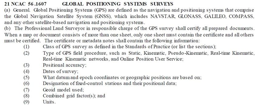
Purpose of guidelines
Interpretative guide for proper ties to
comply with Board Rule 21.56-1602(g)
Is not a finite list of proper ties
Variations of the examples are
acceptable, if the intent of the rule is
met
The purpose of a tie is to reproduce a boundary when all or
most of the property corners have been destroyed, or to
verify the position of any given corner without the necessity
or resurveying the entire tract of land.
2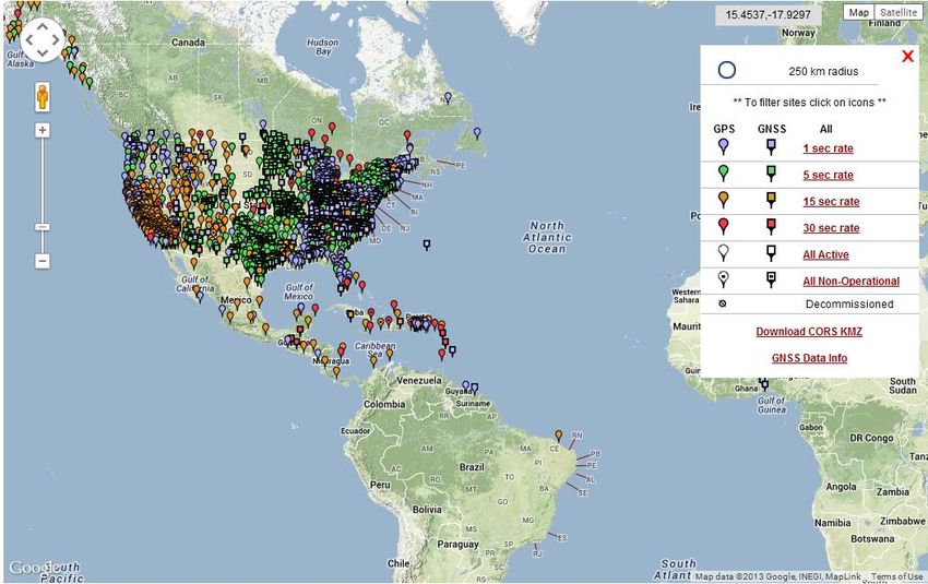
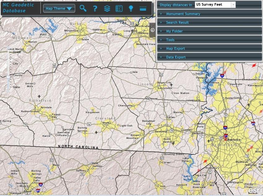
Grid tie
Required when property is within
2000’ of a geodetic monument
Recommended
when possible
Available Tools
OPUS-S/OPUS-RS
Real Time Kinematic Network (RTKN)
Traverse connection
3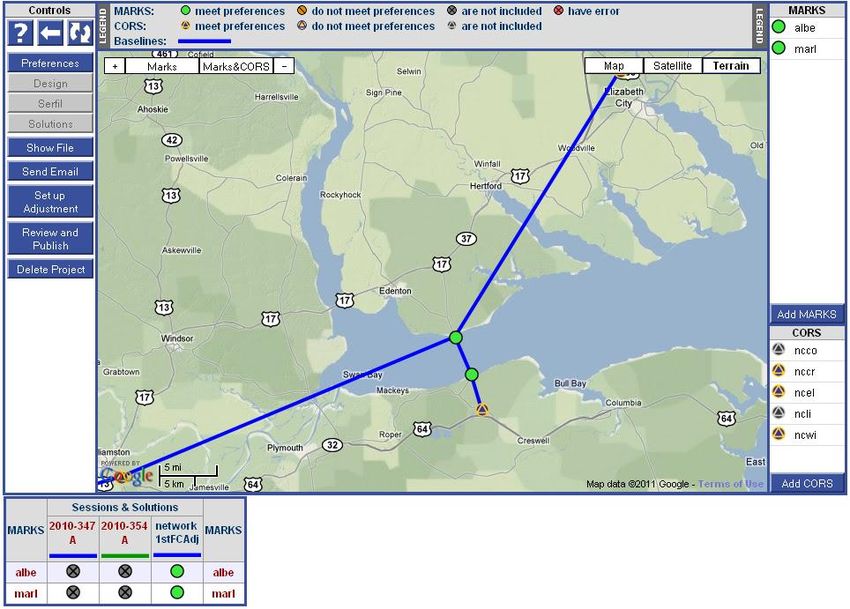
OPUS-S/OPUS-RS
Acceptable methods for a grid tie
Provide summary of results
4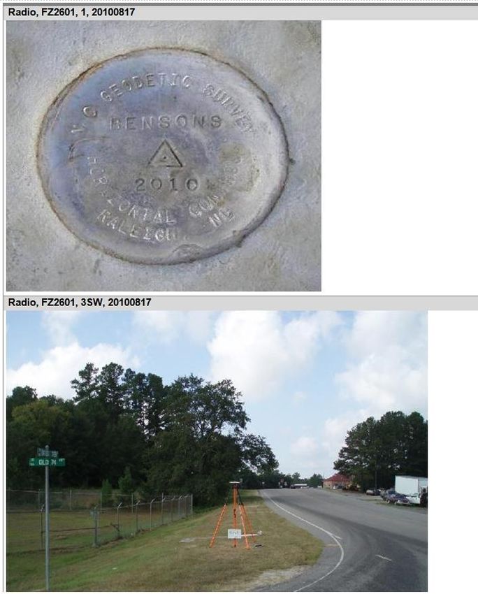
What is OPUS?
On-line Positioning User Service
Fast & easy access to the National Spatial
Reference System (NSRS) for GPS users
5
How does OPUS compute positions?

                   1. OPUS chooses the 3 best
                      nearby CORS
                   2. Computes 3 baselines
                   3. Determines 3 positions
                   4. Averages the 3 positions
                      by a simple mean (equal
                      weights) to a single
                      position

Note: Differences between positions include any
      errors in CORS coordinates                  6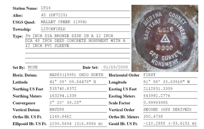
Peak to Peak Errors
OPUS Peak to Peak Errors
Separation of the maximum and minimum
component values from the 3 separate CORS
solutions.
LEGEND:
CORS
Northing max
Baseline
0.005 m
Northing
P to P
Solution from a
Error CORS
Northing min
Easting P to P Error
0.007 m
Easting min
Easting max
Easting Northing P to P Error
P to P
Error 7
OPUS Static solution report

                                    Metadata
Metadata
                                    stats
stats

NAD83                               ITRF

                               UTM and SPC

                                       8
Extended Output
Peak to Peaks Errors
are relatively large:
• Horz: 14 cm
• Vert: 23 cm
9
OPUS-RS search algorithm
1. Sort stations in CORS
network by distance from
rover.
2. Select up to 9 CORS that are
< 250 km
< 250 km from rover and that
have suitable data.
No solution is computed
if < 3 CORS are selected.
No solution computed
if distance from rover to
< 50 km polygon enclosing selected
CORS is > 50 km.
10OPUS-RS solution report
11OPUS Projects
Real Time Network (RTN)
Acceptable methods for a grid tie
Proper field procedures should be used
to insure the quality of the data
collected
Redundant observations when possible
14Grid ties
Other methods of grid ties:
Static GPS RTK GPS Traverse
F. SAMPLE CERTIFICATE Combining a boundary survey, GPS certificate
I, ________________________ certify that this plat was drawn under my supervision from an actual survey performed under my
supervision (deed description recorded in Book ____, page ____, etc.) (other); that the boundaries not surveyed are clearly
indicated as drawn from information found in Book ____, page ____; that the ratio of precision as calculated is 1: ____; that the
Global Positioning System (GPS) survey and the following information was used to perform the GPS (GNSS if dual constellations
are used) survey:
Class of survey _________
Positional accuracy______
Type of GPS field procedure: ________
Dates of survey:____________
Datum/Epoch: ________________
Published/Fixed-control use: ________
Geoid model: ________________
Combined grid factor(s): __________
Units: _____________
That this plat was prepared in accordance with G.S. 47-30 as amended (if the survey is not a G.S. 47-30, remove this sentence).
That this plat meets the requirement of G.S. 47-30 section F-11-___ (insert the section in F-11 that matches this survey if it is a 47-
30 survey)
Witness my original signature and seal this the __________ day of ____________. 15Positional Tie Reporting Policy BP-1012-02 Rev 1
When tools such as Online Positioning User Service (OPUS)
or a Real Time Network (RTN) are used to position a
property corner, in lieu of reporting the Continuous
Operating Reference Station(s) (CORS) positions (State
Plane Coordinates or geographic position) as required by 21
NCAC 56.1602 (g) and .1607(b)(6) & (e), a statement by the
PLS indicating that OPUS or a RTN was used to determine
the position(s) of a property corner(s) or control
monument(s) and report of the positional information
provided by the tool, such as OPUS or RTN will meet the
requirement of reporting the positional information of the
published control as required in 21 NCAC 56.1602(g) and
.1607(b)(6) & (e).
17Tie to control corners
Control monuments within a
previously recorded subdivision
may be used in lieu of grid control
NC General Statute 39-32.1
One or more corners of such development to be
designated as “control corner “
And two or more street center lines or offset lines
within or on the street right-of-way lines to be
permanently monumented at intersecting center
lines or offset lines, points of curvature or such
other control points, which monuments shall also
be designated as “control corners” 21Article 5A.: Control corners in real estate developments § 39-32.1. Requirement of permanent markers as "control corners." Whenever any person, firm or corporation shall hereafter divide any parcel of real estate into lots and lay off streets through such real estate development and sell or offer for sale any lot or lots in such real estate development, it shall be the duty of such person, firm or corporation to cause one or more corners of such development to be designated as "control corner" and shall cause two or more street center lines or offset lines within or on the street right-of-way lines to be permanently monumented at intersecting center lines or offset lines, points of curvature or such other control points, which monuments shall also be designated as control corners and to affix or place at such control corner or corners permanent markers which shall be of such material and affixed to the earth in such a manner as to insure as great a degree of permanence as is reasonably practical. (1947, c. 816, s. 1; 1959, c. 1159.) 22
Tie to natural or artificial mons
Massive objects
Natural or man-made objects that are easy
to identify and have, or can accept, finite
points that can be measured to with
certainty
Other artificial monuments
Use property corners of the highest
permanent quality
Include corner metadata
The use of adjoining property corners requires
the use of:
At least two (2) adjoining record corners
~ or ~
One (1) record corner and one (1) other point
that is visible from the referenced adjoining 23
cornerArtificial monuments
PK nails and spikes
Tend to be less permanent and more
likely to be destroyed
Artificial points should be used when
no other alternative is available
Artificial points in road intersections
are acceptable, but they are
considered to be the lowest preference
24Example of reference points on line
Define
orientation Trees mostly on line
used on
subject
parcel
Set and reference
PK nail on line
Ridge as described by
deed or new survey
Pipe or rock with ½ inch pipe or rock
chiseled cross with chiseled cross
Set as many points as would be necessary on ridge lines (that represent existing
or proposed boundary line) that would be needed to re-establish or retrace
boundary line with minimal work.Reference monuments
Board Rule 21-56.1602(e) states:
Where a corner falls in a right-of-way, in a
tree, in a stream, or on a fence post, boulder,
stone, or similar object, one or more
monuments or metal stakes shall be placed in
the boundary line so that the inaccessible point
may be located accurately on the ground and
the map.
26Legend
All symbols, acronyms, and line types
used on a plat should be clearly defined
in the legend per Board Rule 21-
56.1604(d)(11)
Note: Other Professional Land Surveyors may
be familiar with the symbol or acronym,
but the public in most cases will not
understand the meaning of the symbols
or acronyms.
27Metadata
Data about data
Metadata provides a description of the
data included in the plat or report
Examples
Horizontal/vertical datums
Units
Property corner description
Material
Found or set
Above, below, or flush with ground level
28METADATA: Data about data
Datums:
Horizontal: NAD 27, NAD 83(1986),
NAD83 (199X), etc.
Vertical: NGVD29, NAVD88, MLLW, MSL,
MHW, etc.
Units:
Meters, U.S. survey feet, international feet,
chains, rods, poles, links, smoots, etc.
Accuracy:
A, B, 1st, 2nd, 3rd, 3 cm, scaled, etc.
29Vertical control datums
A set of fundamental elevations to which
other elevations are referred.
Datum types:
Geodetic:
Directly or loosely based on Mean Sea Level at
one or more points at some epoch
Examples: NGVD 29, NAVD 88, IGLD85, etc.
Tidal:
Defined by observation of tidal variations over
some epoch of time
Examples: MSL, MLLW, MLW, MHW, MHHW, etc.
30Where’s the METADATA??
• Horizontal &
vertical datums ??
• Plane
Coordinate
System ??
• Units of
measure ??
• Accuracy ??
31Good METADATA
32Changes to NAD83
(using North Carolina as an example)
NAD83(1986)-Started as Classic horizontal network
NAD83(1995)-High Accuracy Reference Network (HARN)
Observed with GPS using some CORS as control
NAD83(2001)–Federal Base Network (FBN) and
Cooperative Base Networks (CBN)
Observed with GPS with Tight CORS control. Also aimed
at increasing ellipsoid height accuracy
NAD83(NSRS2007)
CORS system primary control, used only quality GPS
projects. CORS system well developed.
NAD83(2011) - Current AdjustmentReport of Survey
The map or report of survey is required
for property boundaries, easements
authoritative encumbrances of property
boundaries and to wetland boundaries.
It is not required for construction
staking.
34Report of Survey
In lieu of preparing a plat for the client a
“Report of Survey” can be provided to
the client that includes the following
information:
Outline of Report of Survey:
General description of survey
Who performed the survey
Recipient of survey
General description of what was surveyed and
purpose of survey
35Report of Survey
Provide information concerning deeds
and plats that were examined for the
survey
Report the evidence that was
recovered
Provide a description of corners that
were set
36Report of Survey
General metadata of survey
Bearing reference
Horizontal/Vertical datums
Certification Statement to Standards
of Practice
37Report of Survey: Sample
I certify that this survey was done under my responsible charge in compliance with the
Standards of Practice for Land Surveying (21-56.1600) for (name of recipient of
survey) for the purpose of locating the boundaries and corners of Lot #6 and #7 of the
Acme Subdivision recorded on plat book B-214 in Waldon County North Carolina
Register of Deeds.
That before I performed the survey I examined the following deeds and plats recorded
in the Waldon County Register of Deeds:
Plat recorded in B-214 Plat recorded in Plat Book 8-95
Deed Book 216-192 Deed Book 218-200
That after examining the deeds and plats, I examined the property and found:
1/2” iron pipe flush with the ground at the southeast corner of Lot #6
1/2” iron pipe flush with the ground at the southwest corner of Lot #6
No other corners were found.
Upon completion of the survey, I set new ½” iron rods flush to the ground at remaining
corners of Lot #6 and #7. No visible encroachments were observed.
All bearings are referenced to the North Carolina State Plane Coordinate System
(NAD(NSRS2007)), and all distances are horizontal distances.
This ______ day of _______________, 20____.
Seal _______________________________ 38
Professional Land SurveyorQuestions?
39You can also read