T M - Tauranga City Council
←
→
Page content transcription
If your browser does not render page correctly, please read the page content below
new store

  ������
                                    coming soon

T ��
 �
 M��

     Te Papa Spatial Plan
     Te Mahere ā-Takiwā o Te Papa
     2020 – 2050
     September 2020
He kupu whakamānawa
              Whakarongo ki te papaki o ngā ngaru
              E whawhati mai ki ngā toka tu moana
              Kia rongo te kiri ki te kīkini o te rehutai
              Ko taipari ko taitimu ao po
              E kawe o tātou tini mate ki te wāhi ngaro
              Ki te huihuinga o te Kahurangi oti atu ai
              Titiro ki Mauao e tū Tūtei ana
              Huri ō kanohi ki uta ki Pūwhenua
              Mai uta ki tai, mai whitinga ki urunga
              Ko Tauranga Moana Ko Tauranga Tangata
              Ko Ngāti Ranginui Ngāi Te Rangi Ngāti Pukenga
              Me mahi tahi te hapori whānui kia ora
              Ā iwi whenua ā tinitini kainga rua i raro I te mana ōrite
              Kua hua mai ai ko Te Tiriti o Waitangi
              Tēnei te matatau kia eke, whakatū tārewa ki te rangi
              Haumi ē - hui ē - tāiki ē

              Word of encouragement
              Hearken to the reverberation of the waves
              Smashing themselves relentlessly on immovable rocks
              Allow your skin to feel the salty tang of far-flung sea spray
              Gaze upon the timeless flooding and ebbing of tides
              Which carry our dearly departed to those gathered in the hidden realm
              Our treasured ones they shall remain
              Salute Mauao, our sentinel guardian ever alert
              Cast your eyes inland to the beautiful Pūwhenua
              From the mountains to breaking waves
              From where the sun rises to its entry into the night
              We stand proudly as one Tauranga Moana Tauranga Tangata
              Ngāti Ranginui, Ngāi Te Rangi and Ngāti Pukenga
              Let us unite as one in all we do
              For the wellbeing of our wider community
              As people of the land and the multitude
              Who have made this community their second home
              Under the authority, leadership and partnership
              Proclaimed in the Treaty of Waitangi
              Let us attain the sacred knowledge from the highest heavens
              Hold fast, hold strong, and let it be done

    Huikākahu Kawe
    Ngāi Te Ahi, Ngāi Tamarāwaho, Ngāti Tapu

2
Mauao

                                                                                                MOUNT
                                                                                              MAUNGANUI

                                                                                                                  OMANU
                                                   Otumoetai Pa
                              MATUA                                              SULPHUR
                                                                                  POINT

                                                      OTUMOETAI                                         Whareroa Marae

                                   BELLEVUE                                             Otamataha Pa
                                                                                      The Elms and Mission Cemetery
                                                BROOKFIELD                           Monmouth Redoubt
                          Peterehema Marae                                           Te Awanui Waka
                                                                         TAURANGA
     BETHLEHEM                                                            CENTRAL
                                        Huria Marae
           Wairoa Marae
                                                  JUDEA                                                          MATAPIHI
                                                                                  Hungahungatoroa Marae

                                                                                                       Waikari Marae

                                                       The Historic Village
                                             TAURANGA SOUTH
                                              (HOSPITAL AREA)
                                                      AVENUES                                          Maungatapu Marae
                                                  TAURANGA SOUTH

                                                                                      MAUNGATAPU
                                      GATE PĀ        Gate Pā (Pukehinahina)

                                                PARKVALE/
                                                MERIVALE                          Hairini Marae

                                    GREERTON               POIKE                             WELCOME BAY
 TAURIKO
                                                                       HAIRINI

                      PYES PA

                                                      OROPI        Waimapu Marae

                   Te Ranga

OMANAWA

                                                          WESTERN BAY OF PLENTY
He kōrero nā te koromatua
    Mayor’s Foreword
    The Te Papa peninsula sits at the heart               This spatial plan sets out how we support the
                                                          growth of unique, liveable, connected and
    of our city. Well-considered planning
                                                          healthy communities within Te Papa. It provides
    for this area must encompass more                     a framework for working together to unlock
    than just building much-needed                        opportunities in a way that will accommodate and
    homes to accommodate growth; it is                    manage growth over time. The plan provides for
    about shaping our city and building                   greater housing choice, safe and efficient transport
                                                          options and the local amenities and infrastructure
    better communities.                                   needed to support our communities.

                                                          Achieving the change envisaged by this plan will
    Tauranga and the western Bay of Plenty will
                                                          take time, resources, effort and commitment.
    continue to experience rapid growth. While this
                                                          If we do not act now, we are likely to face a
    brings significant challenges, it also provides us
                                                          growing housing shortage and higher housing
    with unique opportunities. The Te Papa peninsula
                                                          and infrastructure costs. That is why it’s important
    is well placed to support us in managing some
                                                          that we take this journey together by taking action
    of this growth within our city. It is home to 14%
                                                          now. Continuing to engage with the community
    of Tauranga’s population and a destination for
                                                          when implementing the projects and initiatives
    employment, education, health services and
                                                          of this spatial plan will help us achieve a unique,
    hospitality. Providing greater housing choice and
                                                          livable, connected and healthy Te Papa.
    better ways to move around the city, will support
    the continued prosperity of the entire sub-region.    I am looking forward to seeing the work unfold that
                                                          will shape better Te Papa communities – together,
    Together with the community, mana whenua and
                                                          for today’s residents and our future generations.
    key stakeholders, we have developed this plan
    to manage growth in the area from Greerton to
    the city centre. Feedback from all groups has
    provided us with an understanding of community
    values and allowed us to proactively plan for
    a sustainable future. We’ve incorporated what
    we’ve heard in this plan, which provides a
    roadmap to support the forecast growth – and
    highlights how important it will be to work
    together to get there.

    Taking a collaborative approach now, and as
    we move forward, gives us a greater ability to
    harness the opportunities of growth rather than
    succumbing to its negative impacts. We have
    an opportunity to create a place that reflects our
    cultural heritage and welcomes all communities,
    protects the things we love about Te Papa and
    improves the way we move around the city. Over
    the next 30 years and beyond, it will allow us to
    create a place for people from all walks of life to   Tenby Powell
    call home.                                            Tauranga Mayor

4
Rārangi upoko
Contents
1.    Te Tiro Whānui – Te Papa Spatial Plan Overview                                      6
1.1   Te aronga matua – Purpose of the Te Papa Spatial Plan                               7

1.2   Ngā āhuatanga o te takiwā – Understanding Te Papa                                   8

1.3   Te Mana Ōrite i Te Papa – Te Papa and Mana Whenua Partnership                      16

1.4   Tō tātou haerenga – Our Journey Together                                           20

1.5   Ngā tūāpapa korero me ngā kaupapa here – Strategic Context                         22

1.6   Ngā painga o Te Mahere ā-Takiwā o Te Papa – Benefits of the Te Papa Spatial Plan   24

2.    Ngā Putanga Nui – Te Papa Spatial Plan Outcomes                                    26
2.1   Te tāera whakawhanake i Te Papa – Growth Approach to Te Papa                       27

2.2   Te rongomaiwhiti o ngā hapori – Unique Neighbourhoods                              31

2.3   Te mataora o ngā hapori – Liveable Neighbourhoods                                  32

2.4   Te piringa o ngā hapori – Connected Neighbourhoods                                 34

2.5   Te hauora o ngā hapori – Healthy Neighbourhoods                                    38

3.    Ngā Pūmanawa o Te Papa – Key Centre Plans                                          40
3.1   Te Papa – City Centre                                                              41

3.2   Pukehinahina – Gate Pā/Pukehinahina                                                44

3.3   Tutara Wānanga – Merivale                                                          48

3.4   Maarawaewae – Greerton                                                             52

4.    Te Mahere Whakahaere – Implementation Plan                                         56

                                                                                              5
1.
    Te Tiro Whānui
    Te Papa Spatial Plan Overview

6
1.1         Te aronga matua
            Purpose of the Te Papa Spatial Plan
The spatial plan sets the strategic direction to how we manage growth to meet future needs, opportunities
and challenges in Te Papa over the next 30 years. It provides a coordinated and integrated approach to:

•   the way we move around (transport)
•   where we live (urban form)
•   where we work (economy)
•   where we play (open space, community facilities)
•   how we are supported (health, social services, commercial activity)
•   where we learn (education, culture, identity).

The plan will assist in more efficient use of resources, including infrastructure, the way we move around,
and how we live. In turn, this will reduce costs to the community and individuals, as well as providing
potential for better use of time and healthier living.

As non-statutory documents, spatial plans help to inform council planning processes such as city plans,
social infrastructure planning, transport planning, local plans, and the annual plan and long term plan.
They do this by identifying actions and projects that are needed to achieve the outcomes, in this case
for Te Papa. A spatial plan generally provides a high level of detail and indicates areas where this detail
should be investigated further.

There are four sections in this spatial plan:

              Overview
    1         Identifies the background and strategic context to the spatial plan, the overall approach to
              enabling growth in Te Papa, priority areas of focus and anticipated benefits.

              Outcomes

    2         Identifies the outcomes we expect to see as we grow, and actions required to achieve these;
              these are focused on supporting the growth of unique, liveable, connected and healthy
              neighbourhoods within Te Papa.

              Key centre plans
    3         Provide an overview of expectations for local planning and improvement of key centres
              identified as priority areas of focus in Te Papa.

              Implementation plan
    4         Sets out actions in the form of projects and further planning work required over a 10 to 30-
              year period to deliver the spatial plan outcomes.

                                                                                                              7
1.2         Ngā āhuatanga o te takiwā
            Understanding Te Papa
Within the context of this spatial plan, Te Papa peninsula refers to the area of land from Greerton to the
city centre. The name Te Papa was originally used by local iwi to describe the central/northern part of the
peninsula, with other historical Māori names also applying to the wider area (refer to section 1.3).

Since the 19th century and more recently, references to the name Te Papa can be found on websites such
as nzhistory.govt.nz and tauranga.kete.net.nz that identify the historic attributes of the area. Te Papa is
also the ward name for the group of suburbs (City Centre, The Avenues, Gate Pā/Pukehinahina, Merivale
and Greerton) within the area that this spatial plan focuses on.

Having experienced significant growth through the latter part of the 20th century, Te Papa is now home to
20,000 people, approximately 14% of the city’s total population. Over the next 30 years, this population is
expected to grow by another 72%.

The Te Papa community is considerably more diverse than Tauranga on average. There are less people who
identify as European and more people who identify as Māori, Asian or Pacifika. In addition, like Tauranga, Te
Papa’s population is aging, with a significantly higher than average elderly population when compared to the
national average. Te Papa also has a significant proportion of social, elderly and community housing, and
the number of people in the community with disabilities is also likely to be higher. This includes all types of
disabilities such as hearing, vision, psychological and physical disabilities.

While Te Papa’s growing population and diversity will continue to enrich its culture and identity, it will also
need to be supported by resources, effort and commitment to providing for existing and future needs of
the community.
Te Papa is growing
                                                               Proportion of Tauranga’s
                                                               population living in Te Papa:
Te Papa
2018
20,200                                                                             14%
                                                                                   in 2018
2050*                                                                              +3.3%
35,200
                                                                                   2050 projection*

Tauranga                                                                *Tauranga City Population and
                                                                       Dwelling Projection Review 2020
2018
140,800

2050*                                                                                5000
                                                                                   = people
204,000
                                                                                     (rounded)

Western Bay of Plenty sub-region                                                     20,000
                                                                                   = people
                                                                                     (rounded)
2018
193,700

2050*
271,000

Te Papa community

Are more diverse than
the people of Tauranga,                                                          Speak more
                                                     Live in
on average                                                                          than 12
                                                      7600                        languages
100%                                                 homes

                            People of Te Papa                             Are mostly between
                            People of Tauranga                             15-29 years of age

  0%                                                                      7000               29,920
           European     Maori    Asian &     Other
                                                                       study in              work in
                                 Pasifika
                                                                       Te Papa               Te Papa

       Love how handy Te Papa is to:                 Believe future possibilities include:
       •   amenities                                 •   better road infrastructure for Te Papa
       •   education                                 •   less congestion in Te Papa
       •   employment                                •   better housing
       •   commercial areas                          •   safer open spaces
                                                                                                         9
Existing amenities
     Te Papa is centrally located in
     the sub-region and provides a
     range of opportunities to build
     upon, including:

                     Access to
                     community
                     amenities

                     Open space
                     and recreation
                     (including water)

                     Education

                                                                 TAURANGA
                                                                  CENTRAL

                                                    Te Papa
                     Business

                                              TAURANGA SOUTH
                     Movement
                                               (HOSPITAL AREA)
                     networks
                                                        AVENUES
                                                    TAURANGA SOUTH

                                          GATE PĀ
                     Three waters
                                                MERIVALE
                     infrastructure

                                         GREERTON

                     Retail

                                                    Tauranga

                     Dining

                     Health
                                           Western Bay of Plenty

10
Place
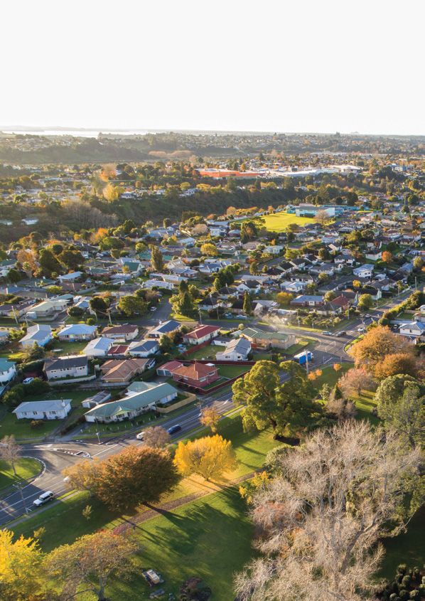
Covering 1070 hectares, Te Papa runs from Barkes Corner through the city centre to the harbourside
bridge. Te Papa is bound by the Tauranga Harbour and the Waikareao Estuary, with Kopurererua Valley
providing a 1300-hectare reserve along the south-western boundary. State highways 2, 29 and 29A are
located along the west and southern side of the peninsula. Te Papa has several distinct communities
located throughout, starting with the city centre to the north and then moving south to include the
Avenues, Gate Pā/Pukehinahina, Merivale and Greerton.
The peninsula is well placed to support the growth of our city. It has existing infrastructure, a range of
services and activities, significant employment hubs and schools, a mix of housing and is relatively
resilient to natural hazards. Te Papa includes the Central Business District (CBD) for the sub-region and is
the location of our major hospital along with a range of medical, health and social service providers. We
want to make good use of these existing assets and investments by enabling more people to live, work,
learn and play in Te Papa, while ensuring that the values present in the community today are protected
and enhanced for future generations.
The key challenges within Te Papa that the spatial plan responds to include:
• a lack of good quality public realm and built form, combined with a need to enhance local culture and
identity, that is not attracting more people to live, work and play in the Te Papa peninsula
• a lack of good quality intensive housing that is not meeting the needs of current and future residents
• the current urban form and density, travel options and transport that do not support safe, accessible
multimodal transport options for all.
With regard to water supply and wastewater infrastructure capacity, studies show that further growth in
Te Papa is supported by already planned trunk network upgrades. Potential stormwater implications of
future development will be responded to by a proposed change to the Tauranga City Plan, addressing the
impact of flooding from intense rainfall.
There is scope to strengthen identity, liveability, sustainability and prosperity of the wider region through
this spatial plan. Te Papa plays a key role in delivering and enabling better transport choice for wider
growth areas through its key transport corridors, particularly those areas to the south such at Tauriko.
Future public transport, walking and cycling improvements will link into the Te Papa area to support mode
shift and provide an efficient public transport service city wide.
11A growing part of the city
1915 1930s
Cameron Road Widening of Cameron Road
Corner of Spring Street
Looking towards Mauao
1924
The Strand
First train to go over the rail bridge
121960s 1960s
Greerton shopping area Tauranga Hospital
Cameron Road corner Looking over Cameron Road
Chadwick Road
1960s
Merivale subdivision Historic images: Tauranga City Library
Between Fraser Street and Waimapu Stream Ref. 99-1185, 11-107, 99-724, 00-238, 99-275, 00-199
1360 years on Te Papa peninsula seen from Yatton Park
1.3         Te Mana Ōrite i Te Papa
                 Te Papa and Mana Whenua Partnership
     Tauranga City Council works in partnership with tangata whenua to build, protect and celebrate our city,
     our environment and our people. To assist in this, through the preparation of this spatial plan council has
     worked in partnership with the mana whenua of Te Papa including representatives of Ngāi Tamarāwaho,
     Ngāti Tapu, Ngāi Te Ahi, Ngāti Ruahine and Ngāti Pūkenga, as well as wider engagement with iwi and
     hapū through the Te Rangapū Mana Whenua o Tauranga Moana Partnership.

     A key focus of the mahi and wānanga undertaken throughout the project with mana whenua has been
     developing the plan’s cultural principles to support future projects. Mana whenua input into the process
     has also assisted to identify specific cultural projects for Te Papa as well as providing input into the wider
     outcomes and projects.

     The Tauranga Moana Design Principles (adopted by Te Rangapū Mana Whenua o Tauranga Moana
     Partnership and Tauranga City Council in 2017) provide the overarching framework and starting point for
     the Te Papa cultural principles and projects:

       Tauranga Moana Design Principles                       Outcomes sought

       Mana Rangatiratanga/Ahikāroa: Authority                The status of iwi and hapū as mana whenua is
                                                              recognised and respected.

       Whakapapa: Names and naming                            Māori names are celebrated and reinstall pride.

       Taiao: The natural environment                         The natural environment is protected, restored
                                                              and/or enhanced.

       Mauri Tū Mauri Ora: Environmental health               Environmental health is protected, maintained
                                                              and/or enhanced.

       Tohu: The wider cultural landscape                     Acknowledgement of sites significant to mana
                                                              whenua and cultural landmarks.

       Mahi Toi: Creative expression                          Iwi/hapū kōrero are captured and expressed
                                                              creatively, celebrating the knowledge and
                                                              identity, through a co-creation process.

       Ahi Kā: The living presence                            Iwi/hapū have a living and enduring presence
                                                              and are secure and valued within their rohe.

     The Te Papa cultural principles for partnership and engagement are outlined as follows. Other Te Papa
     cultural principles are integrated into the Outcomes section of this document and specific projects are
     identified within the Key Centres Plans and Implementation Plan sections.

16
Partnership and engagement – recognising rangatiratanga
Integral to achieving the Tauranga Moana Design Principles and the cultural principles in this spatial
plan is recognising mana whenua status as a partner on relevant council projects and ensuring ongoing
engagement by project partners is reflective of this partnership. This begins with recognising the mana
whenua of hapū within Te Papa, applying the following principles.
• Authority/mana whenua is recognised as ‘hapū centric’ as determined by the agreed hapū rohe, Treaty
of Waitangi and Resource Management Act.
• Hapū authority is recognised and enabled through appropriate engagement, collaboration and co-
creation of outcomes, from beginning to end of the project process.
• Draw design inspiration from Mātauranga ā hapū (hapū knowledge systems) and wairuatanga.
• Through engagement and partnership, provide meaningful opportunity for mana whenua to exercise
their kaitiakitanga in accordance with Part 2, Sections 6e, 7a and 8 of the Resource Management Act.
• Whakamanahia – acknowledge that all sites are of importance to mana whenua and that it is
necessary to engage to further understand the value of those sites.
• Provide opportunity for active mana whenua project involvement through partnership including, where
possible and appropriate, project implementation.
Partnership and engagement – how we do this effectively
Strong partnership and engagement with mana whenua will be facilitated through:
• empowering partnerships by creating and committing to an enduring relationship with integrity, from
the beginning to the end of the project
• recognising principles of IAP2, international guidelines on engagement, in engagement and collaboration
• recognising the need for kanohi kitea (face-to-face) engagement
• empowering mana whenua by allowing them the opportunity and time to wānanga amongst themselves
• assisting mana whenua to resource themselves with technical/research expertise where appropriate
• keeping hapū management plans up to date and educating partners on their content
• assisting in coordination of cultural issues across councils (i.e. Western Bay of Plenty District Council,
Tauranga City Council, Bay of Plenty Regional Council).
17Te Papa takiwā and waahi map
The combination of engagement and the cultural principles outlined within this spatial plan seek to assist
in restoring the mana rangatiratanga of Te Papa, through protecting, enhancing, commemorating and
celebrating those areas of significance to mana whenua. In doing so, it also aims to enrich the culture and
identity for the wider community and future generations to come.
The following takiwā and waahi map identifies areas of importance to mana whenua, including original
takiwā (territory) names, pā and kāinga sites, and other waahi (areas of interest). It provides an insight into
the cultural narrative that forms part of the spatial plan area, which will require further investigation and
input from mana whenua at a project delivery level.
Legend
Takiwā: Historic Māori district/territory within the study area, including the historic name
Pā: Location of a historic Māori fortified village or settlement area
Kainga: Location of a historic Māori village or settlement area
Maara: Location of a historic garden or cultivation area
Waahi: A notable historic location, known by a particular name or significance
Puna: Location of a historic spring or well where water was sourced, with associated cultural
significance
Redoubt (Pā maioro): Location of a historic European fort
Existing commercial and industrial zones
Existing schools
Existing open space zones
All boundaries shown on the map are indicative only. Further information on each of the areas, including
location and names, will be provided by mana whenua as part of ongoing engagement.
It is also noted that the takiwā and waahi map is not intended to signify iwi and hapū rohe boundaries,
which are identified within the relevant iwi and hapū management plans. Further, the takiwā and waahi
map is not intended to identify ‘Significant Māori Areas’ (SMAs). SMAs are identified and registered in the
Tauranga City Plan.
18 Map – Te Papa Takiwā and WaahiOtamataha
Wharepai
Domain
Waikareao
Estuary
Elizabe
th St
Te Papa
Huria Marae
Tauranga
Harbour
Memorial
Park
Dr 15
itimu th
Tak Av
e
Rd
on
er
m
Ca
Kopurererua
St
er
as
Fr
Kopurererua
Kopurererua
Valley
Valley
Ch Tutara Wānanga
ad Waimapu Estuary
wi
ck
Rd
Hairini
Marae
Maarawaewae
Greerton
Park
Waimapu
Marae
Map – Te Papa Takiwā and Waahi 191.4 Tō tātou haerenga
Our Journey Together
We have been engaging with the community, stakeholders and mana whenua around growth for some
time now and will continue to do so as we progress implementation of this spatial plan. In August 2019,
people have shared with us about what they value about living in Te Papa, what they don’t like, what they
would like to see in the future and what their priorities are for growth within their own neighbourhoods.
Here is what you told us
What people value now
Sports facilities Mature trees
Access to open space Coastal location
Diverse communities Access to local amenities
What people don’t like now
Crime Lack of safety Homelessness
Traffic congestion Unsafe roads Unclean environment
Poor recognition of history Not enough to do Empty parks
Lack of transport choices Busy residential streets
What people would like to see in a future Te Papa
Better homes Safe communities
Tree-lined streets Transport choices Places to meet
Greater access to water Walkable neighbourhoods
Safe open spaces Healthy communities More housing choice
Pedestrian friendly Open space Better parks
Cleaner streets Community-centred
Source: Community engagement, August 2019
20A consistent message we heard is support for better connections, and easier access to work, live, learn,
and play opportunities. Transport has been continuously identified as a key issue with support for a
comprehensive and ambitious, integrated, multimodal transport plan with a 30 to 50-year horizon.
The environment has also been a consistent theme from community engagement and includes climate
change responsiveness, protection of environmental values and improving the quality of the environment
– air, land and water.
The feedback we received through the March 2020 community engagement further reinforced these
issues, and is incorporated into the outcomes, key actions and implementation plan.
We have worked closely with partners including mana whenua, Waka Kotahi NZ Transport Agency and
Bay of Plenty Regional Council, central government agencies such as Ministry of Education, the BOP
District Health Board, and key stakeholders such as Kāinga Ora and Accessible Properties Limited.
Planning for the future of Te Papa requires ongoing engagement with partners, key stakeholders and
the community, acknowledging the different meaning and values placed on Te Papa by all involved
parties. Other engagement processes such as the Vital Update 2020 also help us to better understand
the needs, wants and aspirations of the people of Tauranga and will be valuable in supporting project
delivery of this spatial plan.
By continuing to work together, we can collectively deliver better outcomes on this growth journey.
2013 2018 2020 2021 2022
SmartGrowth Tauranga Urban Urban Form and Long Term Plan Project
Strategy Strategy and Transport Initiative, engagement delivery
Future Te Papa Plan and
Development Housing Choice
Strategy Plan Change
Community engagement
211.5 Ngā tūāpapa korero me ngā kaupapa here
Strategic Context
The spatial plan responds to central and local government strategic direction, which sets out expectations
for integrated land use and transport, in order to achieve wellbeing and sustainability outcomes. The
following policies and programmes are the primary documents this plan refers to and delivers on.
National Policy Statement on Urban Development (NPS-UD)
The NPS-UD seeks to ensure development of well-functioning, inclusive and better connected cities that
reflect the diversity of their current and future communities. It requires that Tauranga City Council enables
higher-density residential development in proximity to employment opportunities (including the city centre
and neighbourhood centres) and existing and planned rapid transit bus stops and where commercial
activities and services are easily accessible by active or public transport networks. The spatial plan
responds to the proposed central government direction by focusing on development of centres and
surrounding areas supported by public transport, active modes and improved amenities.
Waka Kotahi NZ Transport Agency’s Arataki
Arataki provides national guidance with a 10-year view of the step changes needed to deliver on the
Government’s current priorities and long-term objectives for the land transport system. The spatial plan
and associated projects incorporate an integrated land use transport strategy to give specific regard to
the Arataki key steps changes, including improving urban form, transforming urban mobility, improving
public health, tackling climate change and supporting regional development.
Regional initiatives
At a sub-regional level in the Western Bay of Plenty, the Urban Form and Transport Initiative programme
business case (UFTI) identifies Te Papa as a critical area to provide for residential and commercial growth
and improved local and sub-regional transport networks.
The Urban Form and Transport Initiative (UFTI)
UFTI is a collaborative project led by SmartGrowth and Waka Kotahi NZ Transport Agency and involves
Western Bay of Plenty District Council, Tauranga City Council, Bay of Plenty Regional Council, tangata
whenua, Ministry of Housing and Urban Development and community leaders. Together, the parties have
developed a refreshed, coordinated and aligned approach to key issues across the sub-region such as
housing, transport and urban development that is fully aligned with the Government’s new transport
policy statement and urban growth agenda.
The endorsed UFTI programme is the Connected Centres programme which the partners agreed as
the best programme to cater to the expected growth in the western Bay of Plenty sub-region over the
next 30 to 70 years, and address challenges related to housing, transport, and access. There are two
core concepts critical to the programme. The first is increasing the number of houses in existing urban
and new growth areas, to maximise available land and support a well-functioning transport system.
The second core concept is the idea that we should all be able to access local social and economic
opportunities within a 15-minute journey time, and sub-regional social and economic opportunities within
30 to 45 minutes. These concepts encourage strong local centres and connected neighbourhoods.
By enabling more residential development within a short distance of employment, social, educational and
other opportunities, the Te Papa Spatial Plan’s recommended centres-based approach responds directly
to the two concepts of UFTI’s Connected Centres programme.
22Tauranga Urban Strategy
At a city level, the Tauranga Urban Strategy (TUS) places greater focus on planning for growth in our
existing urban area. It emphasises placemaking in and around our town centres (including local shopping
centres) to support more compact forms of housing, with community spaces, retail and other businesses.
A key action of the TUS is to progress with future planning for Te Papa to achieve these outcomes.
The spatial plan recognises Te Papa as a part of the wider Tauranga and the Western Bay of Plenty urban
system. Te Papa provides opportunities for more housing choice, which in turn can help with wider city
affordability. UFTI proposes that the Western Corridor provides a substantial proportion of the greenfield
growth capacity for the long term. Improvements to movement within Te Papa will also support growth
of the Western Corridor of Tauranga which includes Tauriko West. Tauriko West has the potential to
deliver over 3000 new dwellings and multimodal transport upgrades within Te Papa will play a key role in
delivering and enabling better transport choice for wider growth areas through its key transport corridors.
The Te Papa Indicative Business Case
The Te Papa Spatial Plan is, in part, underpinned by the technical studies undertaken as part of the
Te Papa Indicative Business Case (IBC). The IBC, endorsed by project partners Waka Kotahi, Bay of
Plenty Regional Council and Tauranga City Council, provides decision-makers with a clear indication
of the preferred way forward for an integrated land use transport programme of initiatives, intended
to support a connected and liveable city, both locally and sub-regionally. The project focuses on
investments within the Te Papa peninsula as part of the Western Bay of Plenty sub-region, over the next
30 years. The transport investments are a sub-set of the overall integrated land use transport strategy
prepared as part of the project.
Developed through assessment of a range of integrated land use transport strategy options, the IBC sets
out a full programme of investment to be delivered by the programme partners (Tauranga City Council,
Bay of Plenty Regional Council, Waka Kotahi and other government agencies). Investments are across
urban development, provision of green networks, community facilities, walking, cycling, micro-mobility,
public transport, three waters, and essential supporting social infrastructure improvements. Initiatives
include encouragement of behaviour change and demand management through use of pricing tools.
The integrated land use transport programme will result in significant changes to the way people will
move around in the future, reducing reliance on motor vehicles sub-regionally and locally, and with
on-flow benefits for safety and environmental outcomes. Moreover, the combined approach is critical to
maximise efficiency of the transport system, drawing more people into the city centre to work, live and
visit, and increasing modal share opportunities. Evidence also indicates that the integrated investment
programme proposed will increase the urban development value proposition for the area and
encourage investment, resulting in faster growth over time. This will bring with it associated transport
benefits related to transforming the way people move around the city. In addition, the wider economic
benefits of the integrated approach are substantial – indicatively estimated with a present value of
$1.4b, arising within a context of $11b+ of new urban development envisaged in the Te Papa peninsula
over the next three decades.
231.6 Ngā painga o Te Mahere ā-Takiwā o Te Papa
Benefits of the Te Papa Spatial Plan
More liveable neighbourhoods with stronger culture and identity
Local neighbourhoods and centres in Te Papa will be able to better meet the expectations of our
communities and support a thriving live, work, learn and play lifestyle. They provide a sense of place
that reflects the identity of the area and the cultural values of the community, including mana whenua.
Improved environmental quality
Future developments in Te Papa will assist in greening the peninsula, reducing carbon emissions,
using resources efficiently and sustainably, protecting our cultural heritage and contributing to
ecosystem health and biodiversity.
Housing meets current and future needs
Te Papa will offer more housing and more housing options to meet current and future community
needs. Increasing housing choice means providing increased height and density which can be
achieved by increasing the provision of duplexes, terraced housing and apartments, providing for a
range of dwelling sizes and more social, affordable and market housing options.
Strengthened economic growth and employment
Te Papa will accommodate a significant proportion of the projected employment growth for Tauranga
in strong, well-performing local centres and the city centre as well as other business locations that
are efficiently accessed across the transport system. This will result in increased and sustained
economic productivity and prosperity.
Better access to social and economic opportunities
Te Papa will provide the community with greater multimodal transport choices through an effective,
safe and efficient transport system. Residents will become less reliant on private car trips. They will
easily and safely be able to walk and cycle around the peninsula or use public transport.r cu l ture
Stro nge
d e n tity Improved
i
and environmen
quality
tal
in g that
o us
H ets our n ee d s
me Economic growth
and employment
Social and economic
oppor tunities
new store
������
coming soon
T ��
�
M��2.
Ngā Putanga Nui
Te Papa Spatial Plan Outcomes
We’ve identified the approach we are taking to manage growth in Te Papa, the outcomes we expect to
see as we grow, and the actions required to achieve these. The plan is focused on supporting growth by
creating unique, liveable, connected and healthy neighbourhoods within Te Papa. These outcomes will
allow us facilitate growth and deliver a range of benefits that respond to the needs and desires of the
local and wider community.
262.1 Te tāera whakawhanake i Te Papa
Growth Approach to Te Papa
The spatial plan provides opportunity for increasing housing choice throughout the Te Papa peninsula,
with a focus on increased height and higher densities close to key centres, public transport and amenities.
This will enable people to choose from more housing types and encourage more people to walk, cycle and
take public transport to get to where they need to go. In Te Papa, key centres are categorised by a mix of
commercial, residential and community activities that provide focal points for the surrounding community
and enhance the ability to live, work and play within each neighbourhood. The spatial plan priorities are
to initially focus on higher density development and supporting investment in and around key centres and
corridors, acknowledging the benefits that this approach will provide for the wider community and the
alignment with the NPS–UD requirements. The key centres map identifies the location of the Te Papa key
centres and the programme to develop these centres over time.
The focus of future growth will be on providing higher residential densities in proximity to centres and public
transport. This includes up to six-storey heights close to the city centre, town centres and planned rapid
transit bus stops; and four-storey heights within walking distance to other centres and amenities. Housing
types will include duplexes, terraced housing and apartments, providing for individuals through to extended
families. There will be less change to housing density towards the outer edges of the peninsula.
The growth approach has been developed through an assessment of a range of integrated land use
and transport strategy options, by the Te Papa Integrated Land Use Transport Indicative Business Case
programme partners being Tauranga City Council, Bay of Plenty Regional Council, Waka Kotahi and other
government agencies. The findings support the opportunity for higher-density living in close proximity to
centres, public transport and other amenities along the Te Papa peninsula through a sustained, balanced
investment programme in active modes and public transport infrastructure.
Other areas in Te Papa will continue to develop over the next 30 years. There is flexibility within the spatial
plan to respond to changes in demand and opportunities that arise, which may require a change of focus
and investment priorities in the future.
Growth and change will be incremental, generally occurring at a rate of about 10% every 10 years. Market
responses and supporting investment in movement and community infrastructure are significant factors in
changing the value proposition for investment in areas such as Te Papa and influencing the growth rate.
1
The Tauranga City Plan identifies a Commercial Centres Network hierarchy. Some of these commercial centres are
included in Te Papa priority centres (e.g. city centre, large format centre in Gate Pā, local centre at Merivale and Greerton
town centre). Other commercial centres such as the Eleventh Avenue sub-regional retail centre will continue to provide
commercial services and employment opportunities for the increasing population within Te Papa.
27The following ‘key centres’ are the areas of focus for Tauranga City Council and programme partners over
the next 20+ years:
A City centre: Immediate focus on ongoing city centre regeneration. The city centre has the greatest
ability to achieve higher densities and increased activity.
B Gate Pā/Pukehinahina (and hospital precinct): Commence a residential community regeneration
project in collaboration with central government agencies, key stakeholders and the community in
2021. This area provides the greatest opportunity in the short to medium term due to current land
ownership and ability to achieve positive change for this community (e.g. public realm improvements,
greater housing choice, increased accessibility).
C Merivale: Commence residential community regeneration project planning in collaboration with
central government agencies, key stakeholders, mana whenua and the community over the 2021-
2024 period.
D Greerton: Engage with existing users, community, stakeholders and mana whenua on the future use
of crown-owned lands (Tauranga Racecourse and Golf Course) to support community wellbeing and
growth over the long term.
Legend
Existing commercial zone
Existing open space zones
Existing industrial zones
Increased housing heights area (indicative boundaries)
Existing schools
University precinct
Hospital precinct
Areas of focus/key centres
Potential for increased height to be further investigated alongside public transport and community
amenities investment
28 Map – Key centresTauranga
Domain
City
centre
A
Waikareao
Estuary
Elizabe
th St
Rd
Huria Marae
ron
me
Ca
Tauranga
Harbour
Ele
ven Memorial
th Park
Av
e
Dr
iti mu 15
Tak th
Gate Pā Av
e
Pukehinahina
Rd
on
er
m
Ca
St
B
r
se
a
Fr
Gate Pā -
Pukehinahina
Reserve
C
Merivale
Kopurererua
Valley
Hairini
Marae
Yatton Park
St
ser
D
Fra
Ch
ad
wi
ck
Tauranga Golf Club Rd
and Racecourse Greerton
Rd
Reserve
on
er
m
Ca
Greerton
Park
Waimapu
Marae
Map – Key centres 29Mai ngā ngārehū o
Whakapaukarakia -
Kei te ka tonu te ahi
From the embers of Whakapaukarakia -
The fire still burns
Ngāi Te Ahi
302.2 Te rongomaiwhiti o ngā hapori
Unique Neighbourhoods
A unique neighbourhood tells the story of our people, culture and history every day. Living in a unique
neighbourhood creates ownership and pride in the areas that we live in and contributes to greater
community connections between people and places. In a unique neighbourhood, we acknowledge and
facilitate diversity and inclusiveness, protect the things that we value, and enhance character through
well-designed places and spaces within our community. Unique neighbourhoods also help us to
understand and learn about our past and help shape our future.
What a unique neighbourhood will look like
• Reflects our city’s unique culture and history.
• Places and buildings that identify our heritage are protected.
• A city and neighbourhoods that we are proud of.
• Enhanced identity, sense of place and cultural values are protected as they grow.
How we will get there
• Continue to work with mana whenua to acknowledge the cultural history of Te Papa in delivering the
spatial plan and related projects, including:
– Where appropriate, work with hapū to (re)establish original place names drawn from Mātauranga ā
hapū (hapū knowledge systems).
– Provide resourcing to educate the wider community in regard to ingoa Māori/ā hapū/ā iwi to avoid
miseducation, misappropriation and mispronunciation.
– Restore the mana rangatiratanga of areas of cultural significance through appropriate signage
including original place names and descriptions, while also providing opportunity to contribute to
education and local identity.
– Provide opportunity for use of enduring tohu/taonga (e.g. materials used for pou/taonga) and
potential for co-maintenance of current and future taonga between mana whenua and council.
– Identify potential sites and activities that can restore mana whenua ahi kā (living presence) to the
area, such as maara kai, well/spring access, tuahu, whare tāpere, whare waka, whare hangarau,
whare toi, whare wānanga.
• Continue to work with the community to understand local values and needs that respond to and
enhance identity, culture, diversity and inclusiveness in these communities.
• Identify opportunities to provide greater awareness of culture and heritage throughout Te Papa, either
through project delivery and/or support of community-based initiatives.
• Utilise planning processes such as the Tauranga City Plan review to identify heritage attributes within
Te Papa and where appropriate, seek to provide protection and recognition of these in the future.
• Encourage creative and innovative approaches that support dynamic communities and foster strong
urban identities.
• Explore the feasibility of developing arts, culture and heritage spaces that tell the story of our people,
culture and history, and that enhance creativity in our communities.
312.3 Te mataora o ngā hapori
Liveable Neighbourhoods
A liveable neighbourhood allows us to choose to live close to places where we work, learn, play and meet
our daily needs, providing greater equality within our communities. Creating walkable neighbourhoods
means reducing reliance on travel to get to the places we need to go, such as shops, schools and
work places. This gives us more time to do other things. It also promotes a greater connection with the
outdoors and other people in our neighbourhood. Enabling more people of all ages and abilities to live
closer to our centres also facilitates greater local employment and learning opportunities for all.
What a liveable neighbourhood will look like
• More housing choice that meets the diverse needs of Tauranga now and in the future and in close
vicinity to amenities such as shops, parks, public transport and schools.
• Healthier and safer neighbourhoods as well as vibrant and accessible centres, that are great places to
live, work, play, learn and visit.
• Thriving centres at the heart of each neighbourhood that connect people with what they like to do
and with others.
Three-storey apartment building
32Three-storey townhouse
How we will get there
• Review the Tauranga City Plan provisions to enable opportunities for more housing choice throughout
Te Papa by providing a variety of housing types, including increased height and density close to
centres, community amenities and public transport.
• Work with the private sector and government agencies to facilitate more residential living
opportunities, supported by appropriate public spaces, community facilities and infrastructure.
• Promote greater diversity of housing supply that supports people remaining in their community
regardless of changing needs related to ageing and/or disability.
• Undertake a strategic approach to revitalise the city centre by working with others to provide
opportunities for residential living, economic growth, education, community facilities, connection to
water and quality public realm, building on strategies and frameworks already in place.
• Support the regeneration of Gate Pā/Pukehinahina and Merivale through community planning to
improve the quality of life and encourage development that reflects cultural history and responds to
community needs.
• Support growth of the hospital precinct as a local and city-wide health hub, providing opportunity for
growth of community health services and related employment, and affordable residential choices for
essential workers and the ageing population.
• Encourage and facilitate high quality community and residential development in and around Greerton
that meets the needs of the community and helps businesses to thrive.
• Engage with existing users, community, stakeholders and mana whenua on the future use of crown-
owned lands (Tauranga Racecourse and Golf Course) to support community wellbeing and growth
over the long term, recognising the value of existing green space within the city.
Increased housing choices are proposed throughout the Te Papa peninsula. The key centres map
identifies the areas where increasing housing height is being considered along with the key centres where
higher densities, growth and investment is proposed.
332.4 Te piringa o ngā hapori
Connected Neighbourhoods
A connected neighbourhood means that we can move around and get to the places where we need to
go easily by using a range of transport options. With a strong focus on public transport, walking and
cycling, people are encouraged to choose active ways to move around, providing health benefits and
opportunities for social interaction. A connected neighbourhood is accessible to all and responds to the
needs of all users. This means that people can safely access employment, schools, public transport,
community facilities, parks and other centres and neighbourhoods. In a connected neighbourhood we live
where we have everything close by.
What a connected neighbourhood will look like
• People of all ages and abilities, including people with reduced mobility levels, can go about their daily
lives and get from one place to another easily, affordably and safely.
• Enhanced choice of local and sub-regional transport modes.
• Neighbourhoods are connected to each other, and to centres, employment, schools, community
facilities, public transport and parks.
• Centres are highly walkable, pedestrian-friendly and safe.
• Safe and inclusive cycling and walking connections in and between neighbourhoods.
• Accessibility of the city centre to the Te Papa community is improved.
3435
How we will get there:

                Provide and encourage more choice of different transport options including cycling, walking,
     A
                public transport and ride share options, locally and sub-regionally.

                Encourage more people to use active modes of transport by providing safe and direct walking
     B
                and cycling connections with equitable access for all users.

                Create a sense of arrival through well-designed gateways into Te Papa that create a sense of
     C
                identity, assist with slowing traffic and provide wayfinding opportunities.

                Create new transport hubs in the city centre and within key centres, that are well connected
     D
                and provide access for different modes of transport.

     E          Support higher frequency public transport that is safe, efficient and convenient, including
                providing for a high-frequency, multimodal corridor along Cameron Road.

     The connected neighbourhoods map references the areas of focus.

     Legend
          Existing commercial zone

          Exisiting open space zones

          Existing industrial zone

          Increased housing heights area (indicative boundaries)

          Existing schools

          University precinct

          Hospital precinct

          Existing railway

          Cameron Road Multimodal Project

          Possible ferry

          Potential pedestrian bridge

          Major entrance to Kopurererua Valley

          Green necklace

36   Map – Connected neighbourhoods
C
Tauranga
Domain
City centre
Waikareao
Estuary D
C Elizabe
th St
Rd
Huria
ron
Marae
me
Ca
Tauranga
Harbour
Ele
ven Memorial
th Park
Av
e
A
u Dr
itim C 15
Tak th
Av
e
B
E
Rd
on
er
m
Gate Pā Ca
Pukehinahina
r St
se
a
Fr
Gate Pā - C
Pukehinahina
Reserve
Kopurererua Merivale
Valley
Greerton Yatton Park Hairini
St
Marae
ser
Fra
Ch
ad
wi
ck
Tauranga Golf Club Rd
and Racecourse
Rd
Reserve
on
er
m
Ca
Greerton
C Park
Waimapu
Marae
Map – Connected neighbourhoods 372.5 Te hauora o ngā hapori
Healthy Neighbourhoods
A healthy neighbourhood is supported by an environment that encourages us to be healthy and active
in our day to day lives, and to interact with other people and the space around us. Public spaces and
community facilities provide opportunities for inclusiveness, social interaction, learning and recreation,
and contribute to the overall health and wellbeing of our community. These spaces are safe and
accessible so that they can attract the widest possible use. A healthy community also requires a healthy
environment that is cared for by all, designed in a way that maximises access to the natural environment,
and increases biodiversity, water and air quality.
What a healthy neighbourhood will look like
• Accessibility to vibrant, diverse and distinctive places and spaces is enhanced for everyone.
• Quality spaces, where people can meet and gather are well used, safe and valued.
• Communities are encouraged to care for the environment that they live in.
• A healthy environment and healthy living choices are supported.
How we will get there
• Provide for modal shift towards more sustainable movement patterns, by creating more connected
neighbourhoods.
• Identify development of a green corridor across the peninsula that supports recreation, movement,
biodiversity and ecological corridors, and improves water quality and amenity.
• Develop public spaces and places with the community to enhance safety and accessibility for all
users and provide for different experiences, needs and opportunities.
• Provide a network of community facilities that encourages the community to be active, connect with
others and creates a variety of activity within the community.
• Develop an environmental programme to reintroduce native species back to the peninsula. Use native
planting and vegetation as a catalyst to regenerate and repair coastal ecology and biodiversity.
• Encourage use of the WELL Building Standards2 framework in building and development, including
provision of quality shared spaces in comprehensively designed developments, to enhance amenity
and wellbeing for residents.
• Enhance and restore the natural environment, including utilisation of natural resources (e.g. rain water)
and original native flora.
• Undertake active monitoring (haepapa) of environmental quality within the peninsula, including
emissions, air and water quality, biodiversity and mātauranga ā hapū ie māramataka.
• Provide resourcing to educate the wider community in regard to kaitiaki initiatives to avoid
miseducation and miscommunication.
2
The WELL Building Standard is a performance-based system for measuring, certifying, and monitoring features of the
built environment that impact the health and wellbeing of people, through air, water, nourishment, light, fitness, comfort and
mind.
38He peka titoki e
kore e whati
A steady branch that will not break
Ngāti He
393.
Ngā Pūmanawa o Te Papa
Key Centre Plans
This section provides guidance to assist with local planning and improvement of key centres identified:
the city centre, Gate Pā/Pukehinahina, Merivale and Greerton. It also provides a starting point to
coordinate and integrate the various planning and delivery projects. Work undertaken in centres will be
carried out in collaboration with local communities, mana whenua, partners and key stakeholders, and
incorporates local aspirations along with the outcomes or core elements identified for each of the centres.
403.1 Te Papa
City Centre
The city centre plays a strategic role as the commercial, cultural and civic heart of the sub-region. The
long-term development of the city centre is supported by the City Centre Strategy and the City Centre
Spatial Framework (which focuses on improving the look and feel of the city centre streetscape, open
spaces and waterfront).
These documents are under review in 2020 to ensure they align with current and future thinking, and to
provide a robust framework for prioritising future investment in the city centre. It is important that this
work takes place to articulate a clear vision for the city centre and that is has buy-in from mana whenua,
the community, residents, businesses and key stakeholders. This will seek to support achieving increased
investment in the city centre from both the public and private sector.
This spatial plan supports the direction provided by the City Centre Strategy, the City Centre Spatial
Framework and the continued implementation of this direction in the reviewed strategy, in particular:
• revitalise commercial, retail and hospitality activity, develop residential living opportunities and
improve the public realm
• recognise the sub-regional role of the city centre as a destination for locals and visitors, and provide
community facilities and public realm that further supports this
• work in partnership with mana whenua to enhance the intrinsic cultural values of the city centre while
also recognising mana whenua rangatiratanga within their rohe
• continue to implement improvements to public places that provide for a greater focus on pedestrian
movement and safety, amenity and recreational opportunities.
41The Te Papa planning process has specifically identified:
1 Provide for a transport hub, including opportunity for interconnection with key city centre attractors
and other modes of transport, e.g. walking, cycling, ferry and, in the longer term, rail.
2 Support University of Waikato and Toi Ohomai to expand their campus and develop student
accommodation.
3 Develop a continuous 7km walking and cycling circuit around the peninsula, creating a distinctive,
legible and accessible water’s edge experience and reconnect the city centre to its waterfront
heritage and landscape context.
4 Continue to develop the waterfront area to improve connection of the city centre to the water, and
provide for a diversity of cultural, community and commercial activity opportunities.
5 Continue to explore opportunities to provide greater recognition of our culture and history.
6 Development of destination facilities that attract people to the city centre and provide a range of
experiences that contribute to the community’s health and wellbeing.
7 Investigate development of a multi-purpose community centre hub that provides for multi-
generational activity. Consider rationalisation of sites to achieve this and how this could be
incorporated into the central library development.
8 Work with mana whenua to establish a wharewaka and associated interpretive cultural resource centre.
9 Implement the Cameron Road Multimodal Project to provide clearways/dedicated bus lanes,
segregated cycleways and walking facilities and other improvements.
Legend
Existing commercial zone Create a sense of arrival through
well-designed gateways
Existing open space zones
Public transport improvement
Increased housing heights area
(indicative boundaries) Multimodal improvement
Existing schools Active mode improvement
Cameron Road Multimodal Project Visual and physical access to water
improvement
Potential pedestrian bridge
Possible ferry
Regeneration area
Existing railway
New transport hub (indicative location)
Green necklace
42 Map – City centre5
Tauranga and 8
Wharepai
Domains
4
6
Willow St
Durham St
7
ad
1
ron Ro
Came
2
Elizab
eth St
t Rd
npor
Devo
9
Huria
Marae Four
th Av
e
3
d
Roa
ron
me
Ca
Rd
ort
np
vo
De
Ele
ve Memorial Park
nth
ad
Av
Ro
e
on
er
m
Ca
Fi
fte
en
th
Av
e Tauranga Boys
College
Historic
Village
ad
Ro
on
d
tR
er
m
or
Map – City centre 43
Ca
np
vo
DeYou can also read