Working together for a navigable and living river - masterplan ems 2050 - masterplan ems 2050
←
→
Page content transcription
If your browser does not render page correctly, please read the page content below
masterplan
      ems 2050

masterplan ems 2050
Working together
for a navigable and
living river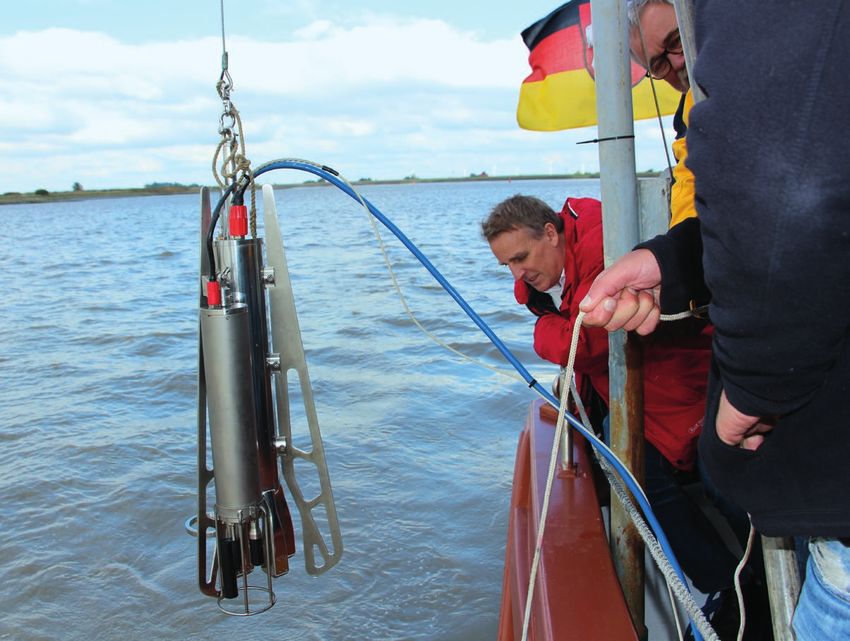
masterplan ems 2050 | Content
Content
Introduction . . . . . . . . . . . . . . . . . . . . . . . . . . . . . . . . . 3
Objectives . . . . . . . . . . . . . . . . . . . . . . . . . . . . . . . . . 6
Measures . . . . . . . . . . . . . . . . . . . . . . . . . . . . . . . . . . 12
FAQ . . . . . . . . . . . . . . . . . . . . . . . . . . . . . . . . . . . . . . . . . 25
Glossary . . . . . . . . . . . . . . . . . . . . . . . . . . . . . . . . . . . . . 31
Contract . . . . . . . . . . . . . . . . . . . . . . . . . . . . . . . . . . . . 34
masterplan ems 2050 | Introduction
Ecology and economy – A massive undertaking –
working together for the a large alliance
Ems region
Working together for a navigable and living river. A comprehensive and long-term undertaking like the
Commerce and nature are given equal priority on the Master Plan Ems 2050 requires support from a wide
Ems – the contract partners of the Master Plan Ems variety of interest groups. A large, cooperative alli-
2050 are bound by these principles. The federal and ance stands behind the plans, and ensures the
state governments, the Emsland and Leer districts, fine-tuning of the measures and the security of the
the city of Emden, Meyer Werft, and the environmen- interests of all involved over the span of 35 years.
tal associations BUND, NABU, and WWF have agreed
to realise these goals by the year 2050. This placat-
ed a conflict smouldering for decades. In other words:
EU directives on nature, water and sea conservation
will be fulfilled, and jobs will be secured and created.
3
masterplan ems 2050 | Introduction
The Ecological Goals of the Ems Region
The contract partners have thus defined concrete
measures that aim to improve water quality and
habitats in the Master Plan Ems 2050. As a result,
the European Commission has initially suspended
the pilot procedure, but would like to be informed
semiannually of progress in the Ems. The threatened
contract violation proceedings before the European
Court of Justice, with potentially high penalties, is
thus not completely off the table.
The quality of the water is most troubling. A cloud of
loose silt washes to and fro with every flow into the
river, and when combined with the lack of oxygen
and rising salt levels this makes life difficult or im-
possible for a lot of aquatic wildlife and plants, espe-
cially in the summer. Microscopic creatures that
primarily consume the organic components of the
silt need the oxygen released into the water to do so.
A number of solutions to this problem are considered
in the assessment. A tidal control system is to be
installed in the Ems barrage that would use a bearing
threshold or technical regulation of flow conditions
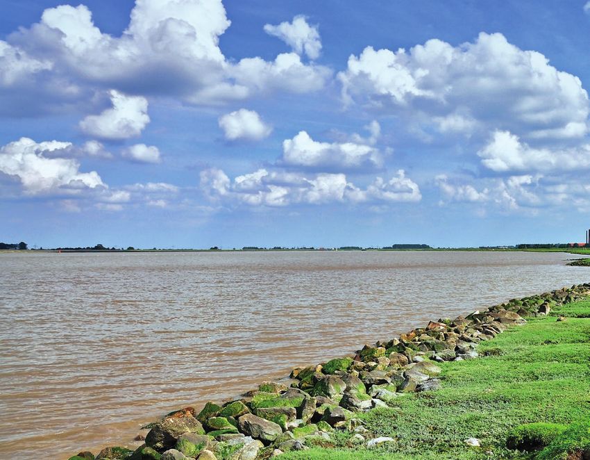
The Ems is in poor ecological condition. The water to halt the incoming silt. So-called tidal polders –
contains little oxygen, a lot of suspended matter, and newly dredged basins along the edge of the river –
too much salt. This state is a consequence of, among will gather water and silt. The outflow from the pol-
other things, the increasing deepening of the river ders should strengthen the ebb current over time,
since the ‘80s that has disorganised the tidal balance thereby helping to wash out the silt.
so much that the Ems can no longer independently
carry out with the ebb all of the silt that washes in But that is not the only solution. The objective
with the flow. Typical riverbank habitats like riparian “Giving the River More Room” foresees the forma-
forests, reeds, and tidelands with tidal creeks have tion of “typical estuary habitats” like tidal riparian
vanished in many areas, and elsewhere they are in forests, reeds, and tidelands with tidal creeks along
danger of vanishing as the Ems was straightened and the banks of the Ems through the targeted acquisi-
fortified, thereby destroying nearly natural riverbank tion of space and the installation of polders. The new
zones. system of such tide-dependent areas along the river
should compensate for the loss of such habitats,
It is thus necessary to act, especially as the Europe- giving flora and fauna the chance to recover or re-
an Commission has made it clear with a so-called settle. The Master Plan Ems foresees the acquisition
“pilot procedure” that it will not continue to tolerate of 500 hectares by the year 2050. An additional 200
violations of numerous European environmental hectares of meadow bird habitat will be created in-
standards in the long term, thereby obligating the land by 2050 to replace the grassland areas claimed
state of Lower Saxony to improve the situation. in the foreland.
Structures that currently prevent fish and other
animals from straying into bodies of water adjacent
to the Ems shall be made more traversable through-
out the duration of the Master Plan Ems 2050.
4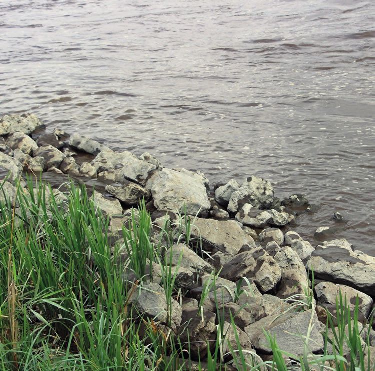
masterplan ems 2050 | Introduction
The Economic Goals of the Ems Region
Along with agriculture and tourism, ship transporta-
tion shapes the Ems region. While the shipping in-
dustry, as a sub-sector of the maritime economy, is
largely concentrated in Haren and Leer, shipbuilding
and port logistics are based in Papenburg and Em-
den. Bulk goods like salts, fertiliser, construction
materials, and agricultural products are largely
processed at the inland harbours of the Ems. Large
industrial locations for the automotive industry,
paper manufacturing, and wind energy plants,
among others, have developed near these harbours,
serving the Ems region and the global market.
Along the Ems federal waterway, nearly 15,000 em-
ployees work in this economic sector in the drainage
basin of the Ems thoroughfare. According to an as-
sessment released by the Lower Saxony Institute for
Economic Research in 2014, Meyer Werft currently
employs around 3100, half of whom come from the
Emsland and Leer districts, plus more than 2200
full-time positions with direct vendors and more than
200 with indirect vendors. An employment effect of
about 20,000 full-time positions in Germany is ex-
pected by 2017. One-fifth of vendors from the region A sufficiently navigable, year-round federal water-
benefit from technological advances and innova- way – the Ems – is crucial for shipbuilding, port
tions, according to the report. With its strong devel- logistics, and all other harbour-related sectors.
opment and engineering divisions, Meyer Werft is a However, the heavy sedimentary contamination of
crucial driving force for the development of this the Ems necessitates extensive dredging to keep the
economic region with relatively few epicentres of fairways at the necessary draught. The harbours
innovation. along the Ems are also suffering from the massive
silt contamination. The silt reduction measures
In addition to this are another estimated 20,000 suggested by the Master Plan Ems 2050 could thus
positions with companies from sectors that directly lead to visible economic relief.
depend on the harbours (e.g. VW, ENERCON, Nord-
land-Papier), vendors and companies working for
corporations that depend on the harbours, and the
expanded commerce and service sectors.
This immense employment volume with a strong
regional base ensures a special degree of regional
added value through its dynamic nature and innova-
tion. Families, retail, and service providers thus
benefit as much as the municipalities and districts
of the Ems region who receive considerable fiscal
revenue from the regional economic effects – and
with it the creation and maintenance of local infra-
structure and quality of living.
5
masterplan ems 2050 | Objectives
Objectives Less silt,
more oxygen
The objectives defined in the Master Resolving the silt problem and
restoring water quality
Plan Ems 2050 should achieve three
Through changes in the river’s course – straightening
things: and deepening – as well as the disappearance of
natural silt accumulation areas, the ratio of ebb and
flow duration in the Ems has shifted considerably,
Secure the economic infrastructure greatly increasing silt contamination. Because the
river became deeper and straighter, the incoming
of the Ems region. flow has become faster and heavier, running up to
the edge of the tidal inflow in Herbrum in an ever
shorter amount of time. The ebb current, on the
other hand, has become slower and more consistent.
Create a vibrant Ems that offers Because of this asymmetry, current speeds during
the flow are much greater than those during the ebb.
plants and animals significantly This means that the flow current carries far more
sediment into the tide than the ebb can carry back
better water quality and revitalised out. Silt from the harbour in Ems – where the state
habitats along its banks. of Lower Saxony dredges – is no longer removed from
the river system, and is thus no longer stored on land.
The Ems is much more heavily contaminated with silt
Avoid contract violation proceed- than other rivers. This not only means that a lot of
sediment accumulates on the river bed and along the
ings by the EU with unforeseeable banks, but also that there is a very high amount of
dissolved silt in the river’s water itself. According to
financial consequences. The time measurements by the coastal research station of the
Lower Saxony State Organisation for Water Manage-
frame for implementing the meas- ment, Coast and Nature Conservation (NLWKN), the
ures by 2050 is considered realistic, concentration of sediment in the water of the Ems is
100- to 1000-times that in the Elbe and Weser.
as the contract’s demands entail Primarily in the summer, when little water flows from
a number of tasks that, due to geo- the headwaters and the ebb is further weakened as
a result, an actual layer of fluid mud forms on the
graphic extensiveness and labour- river bed and only moves slightly up- and down-
stream with the tide. Despite the very high sediment
intensiveness, are highly challenging. content, this mixture remains fluid but behaves dif-
ferently than water, and is not habitable for wildlife.
This “system state” of the river is very rare, accord-
ing to the coastal research station, and international
knowledge of this topic remains “highly incomplete”.
That is why the NLWKN and the coastal research
station, among others, are taking extensive samples
and sets of measurements of specific parameters of
the Ems water. These measurements also serve to
improve the existing calculation models for planning
the measures to resolve the silt problem.
One initial measure for resolving the silt problem was
commenced by the Steering Committee in January:
6
masterplan ems 2050 | Objectives

                                                                                                                      Stefan Wenzel,
“flexible tidal control” with the gates of the Ems         the tidal reservoirs prove to be feasible and effective,   Minister for Environ-
                                                                                                                      ment, Energy and
barrier. Before the Federal Waterway and Shipping          they can be combined with the flexible tidal control.      Climate Protection
Administration (WSV) and the NLWKN had consoli-            In addition, the expected minimisation of silt in the      of Lower Saxony,
dated their very different approaches of a weir and        Ems is expected to have a positive effect on the           during a sample taking
tidal control at the Ems Barrier in a feasibility study.   planned state of habitats in tidal polders along the
The effectiveness and technical feasibility of flexible    Ems. They should not silt up as quickly as they do
tidal control with elements from both approaches was       under the current conditions.
verified. It was also determined that there are cur-
rently no exclusion criteria for implementation from       The heavy turbidity of the Ems and contamination
an environmental and shipping perspective. Because         with suspended sediment often leads to a very low
of this, the Steering Committee commissioned the           oxygen content in the water. No oxygen is present is
NLWKN and WSV to compile the basis for a planning          some parts of the river during the summer months.
process. This is expected to commence in 2020.             A certain increase in oxygen is always apparent in
                                                           the winter. By resolving the silt problem, the oxygen
The WSV and Lower Saxony Department of Com-                content is expected to increase and the Ems should
merce have already entered talks with harbour op-          become a year-round habitat for fish once more.
erators, shipping companies, and harbour-related
businesses to cooperate with their representatives         Another consequence of past river enlargements is
in finding ways to minimise shipping restrictions by       the threat of saltwater flowing further into the Ems
blockages of the Barrier during tidal control. The         system with the flow tide than before. The brackish
basis for working out the specific operation plans for     water zone (the zone where freshwater and saltwater
tidal control is a balance between effectiveness of        meet) has thus shifted further upriver.
silt reduction in the Ems and compatibility with
maritime commerce.

In order to achieve the desired results as quickly as
possible, the contract partners agreed in the Master
Plan Ems 2050 to commence planning for flexible
tidal control before the feasibility study for the tidal
reservoirs on the Ems – the third improvement
measure – is ready, presumably by late 2018. Should

                                                                                                                                                7
masterplan ems 2050 | Objectives
Life between More protection
two worlds for birds
What makes the Lower Ems so special Safe breeding, nutritious resting grounds
The Lower Ems downriver from Herbrum is influ- The protection of breeding and passage migrant
enced by the ebb and flow, has freshwater/saltwater/ birds is a component of the Master Plan Ems 2050.
brackish water zones, and is thus one of the “expand- Some measures of the Master Plan Ems 2050 in the
ed mouths” that experts refer to as an estuary. Be- dyke foreland could potentially jeopardise the habi-
fore human encroachment such landscapes between tat of some of the birds currently living there. The
the river and sea – such as the Elbe, Weser, and Eider re-waterlogging of old Ems loops, which should
– were shaped by distributaries and tidal inlets, create estuary habitats with riparian forest and reed
marshlands and ponds, still bodies of water and zones, would deteriorate the quality of meadow bird
shallow water zones, riparian forest and reeds. Now habitats near the river. This is also why the Master
many of the habitats typical of an estuary are threat- Plan Ems 2050 stipulates the acquisition of 200 in-
ened, or have vanished, as a result of straightening, land hectares for bird conservation by the year 2050.
deepening, reinforcement, and embankments. The breeding birds in question are primarily lap-
wings, black-tailed godwits, redshanks, large curlews,
The Master Plan Ems 2050 intends to recreate typ- and common snipes. Passage migrant birds would
ical estuary habitats while maintaining the Ems’s also find refuge in the bird conservation areas. The
function as a shipping waterway. river course, forelands between the dykes, and adja-
cent inland areas have also been reported as bird
Estuaries are the point of transfer and contact be- conservation and FFH areas.
tween marshland, river, and sea wildlife. Migrating
fish species that return to their spawning grounds Before finalising the Master Plan the environmental
as adults use the estuary as a passageway. Only when associations and Meyer Werft, in conjunction with
this is possible is the animals’ offspring secure. the ship crossovers, agreed on bird conservation
Shallow water zones play a crucial role as “nurseries” measures. This agreement is one of the foundations
for the young fish. These habitats are necessary for for the future securing of a location for the shipyard.
the survival of migrating species of fish like salmon, In the agreement from 2009 the shipyard obligated
houting, sturgeon, lampreys, eels, and shads, as well itself not to convey any large ships during the birds’
as many non-migrating fish and large mussels. One breeding period – specifically from 1 April to 15 July
future objective is for bearded tits, among others, to The Master Plan – for 30 years. This will protect egg clutches in the
breed in expanded reed belts. Large riparian forests Ems 2050 stipulates foreland from flooding via Ems damming.
are also a habitat for penduline tits, orioles, and ot- the acquisition of
200 inland hectares
ters, among others. for bird conservation
by the year 2050
Furthermore, brackish water marshes produce a lot
of biomass and are home to a multitude of inverte-
brate species – a crucial source of sustenance for
many breeding birds and passage migrants.
In order to improve and expand these habitats and
their biodiversity, the Master Plan Ems 2050 stipu-
lates the creation of more estuary habitats along the
banks of the river. The Master Plan foresees the ac-
quisition of 500 hectares near the river by 2050 for
this purpose. New inland bird conservation areas are
planned for the potential deterioration of meadow
bird habitats (e.g. through the formation of riparian
forest and reed zones).
8
masterplan ems 2050 | Objectives
Green light for ships
The Ems as a federal waterway
The contract partners of the Master Plan Ems 2050
have committed themselves to reconcile the equal
ecological and economic interests. This is why the
Ems’s efficiency as a federal waterway must be
maintained by all measures for improving the river’s
ecological condition. In concrete terms, this means
that both the security and ease of ship traffic are
guaranteed and the availability of all ports is en-
sured. The Ems and Ems-Dortmund canal are part of
the central network of federal waterways in Germany,
meaning they are significant in terms of traffic. The
Federal Waterway and Shipping Administration, a
division of the Federal Department of Transportation,
is responsible for this. Ships can reach the entire
European waterway network through the Ems and
the channels and rivers connected to it. The region’s
economy is heavily dependent on the maritime in-
dustry. Cruise ship from
also located in Leer. The main transshipment goods the Meyer Werft in
Papenburg
A year-round, navigable Ems as a federal waterway of the port in Leer are construction materials and
is significant for all maritime sectors. The high sedi- agricultural goods. The tideless port of Leer can be
ment contamination of the Ems is currently resulting reached from the Ems federal waterway via a sea
in extensive dredging with the objective of keeping lock (192 metres long, 26 metres wide, 7 metres
the fairways at the required target depth. The ports deep).
on the Ems are also suffering from the high sediment
contamination. A reduction in silt contamination via The Papenburg sea port and inland port can be
the measures in the Master Plan Ems 2050 could reached by sea ships despite its distance of about 60
thus also result in visible economic relief. nautical miles from the North Sea, making the im-
portance of the federal waterway quite clear –
The following ports can be reached via three-quarters of its total transshipment comes from
the Ems federal waterway: sea traffic alone. Papenburg is Number 1 in Lower
Saxony for peat transshipment, and construction
The Emden sea port is a base harbour for automobile materials, agricultural goods, iron and steel, wood,
transshipment for Volkswagen. The Volkswagen and project loads also pass through the port. The
Group shipped 1.31 million cars in 2014. Furthermore, transshipment and commercial spaces at the port
renowned paper corporations have conducted trans- are currently being expanded. The port is also be-
shipment of forestry products like cellulose, paper, coming more active as a service provider for the
and wood here for decades. The wind energy indus- offshore wind energy sector.
try ships components for onshore and offshore fa-
cilities here. Package freight, construction materials, The Emsland freight village (FV) in Dörpen. The
project loads, and solid/liquid bulk goods are also northwestern-most FV in Germany began operating
cleared and loaded in Emden. There are specially in 1996, and in 2015 it transshipped about 5.5 million
secured areas for hazardous and military goods. tons of goods. A total of 450 people are employed
here. Ships with triple-layered containers reach the
The Leer sea port and inland port is one of the most wharfs via the Ems federal waterway. The goods are
important municipal ports in Lower Saxony, and is transported further via railways and roads. One of
the lifeblood for more than 20 directly port-related the main users of the FV is the forwarding company
business. With about 20 shipping companies, the city UPM Nortrans, who regulates the transportation of
is the second-largest shipping location in Germany. goods and raw materials for the UPM Nordland
Numerous companies that depend on the port are Papier factory in Dörpen.
9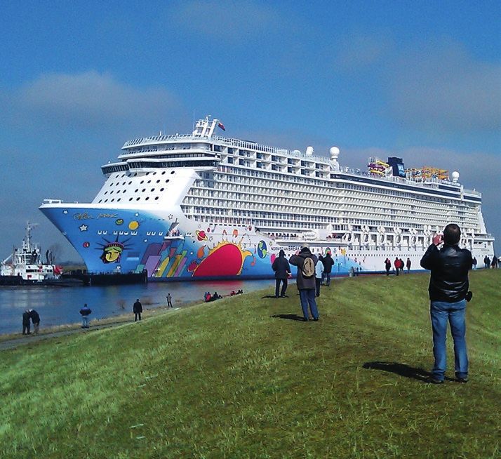
masterplan ems 2050 | Objectives
A lot of work on the river
Securing economic growth in the region
The primary objective of all partners who signed the assessment released by the Lower Saxony Institute
Master Plan Ems 2050 is to reconcile the equal for Economic Research in 2014, the Meyer Werft
ecological and economic interests of the region. In shipyard alone hires around 3,100 employees, half of
concrete terms, this means considering and ensuring whom come from the Emsland and Leer districts. In
the economic strength and infrastructure of the re- addition to these are more than 2,400 full-time
gion in all plans and measures for the mutually workers at direct and indirect suppliers. One-fifth of
agreed ecological restoration of the Ems and the the suppliers from the region benefit from the
neighbouring habitats, and thus the opportunities shipyard’s technical advances and innovations.
for local companies and their employees to thrive.
Industry, shipbuilding and shipping, agriculture, and Another estimated 20,000 employees work at
tourism make up the backbone of the regional companies in sectors that directly depend on the
economy, and the Master Plan ensures that all indus- ports (e.g. VW, ENERCON, Nordland-Papier), suppli-
tries will be able to further develop and grow. ers, and firms who work for these port-dependent
companies, as well as the wider commercial and
The relationship between the Ems and regional service sectors.
economic strength is clear. Large companies from
the automotive, wind energy, and paper industries In order to not excessively strain the agricultural
have settled here because they are able to utilise the sector with the need for land for the Master Plan, the
Ems and its harbours, as well as the many local process for acquiring land for bird conservation and
shipping companies, to connect to international typical estuary habitats is being jointly coordinated
markets. Nearly 15,000 employees work in this in- with this sector’s representatives. The tourism indus-
dustry along the Ems federal waterway and the try is expected to benefit from the improved attrac-
catchment area of the Ems axis. According to the tiveness of the region.
10masterplan ems 2050 | Objectives
Another economic aspect of the contract is securing
the future of the location of the Meyer Werft ship-
yard. In 2009 the shipyard and the environmental
associations agreed on bird conservation in accord-
ance with clear regulations. This agreement is still in
effect, and a number of aspects are included in the
Master Plan Ems 2050. The winter passages of ships
into the yard is legally assured until 2019. Recom-
mendations for the summer of 2019 and the period
after 2020 are currently being discussed and worked
out.
Furthermore, the Master Plan Ems 2050 is linked to
the location assurance contract that the state of
Lower Saxony, the shipyard, and IG Metall Küste
concluded in early 2015 in order to secure the long-
term location in Papenburg – at least until the year
2030. The contract guarantees that personnel,
training, and research and development in Papen-
burg and the region as a whole will be retained.
11 masterplan ems 2050 | Measures
Measures
In order to realise the objectives
defined in the Master Plan Ems 2050,
the contract partners have established
testing projects for specific measures
as part of the agreement. A number of
feasibility studies are already being
conducted. Once the results are avail-
able, they will first be discussed in
the respective task forces and then
submitted to the Steering Committee.
The Committee’s decision marks the
beginning of the concrete planning for
all necessary permits before imple-
mentation can begin.
Should individual measures prove
to be infeasible, they will be replaced
with new, similar recommendations.
For example, measures for improving
water quality cannot be replaced with
measures pertaining to bird conser-
vation.
12masterplan ems 2050 | Measures
Working together
against silt
Country and state develop
“flexible tidal control”
The country and state have agreed on a joint tech-
nical model for declaring war on silt contamination
in the Ems: the gates of the Ems Barrier should
control the tide in such a way that the ebb current
carries more sediment out of the Ems than the cur-
rent prevailing flow current carries into the river. The
fundamental feasibility of the “flexible tidal control”
was verified in two feasibility studies conducted by
the Federal Waterways and Shipping Administration
(WSV) and the Lower Saxony State Organisation for
Water Management, Coast and Nature Conservation
(NLWKN) with support from renowned technical
assessors. Based on this, on 25 January 2017 the
Steering Committee of the Master Plan Ems 2050
assigned the preliminary work for a permit process
that should result in an approvable, detailed plan.
The contract partners expect the tidal control to
begin in 2020.
Minimisation of silt in
The federal and state governments had previously storm flood structure for the planned and permanent the Ems by regulation
of tidal
followed different models. The federal weir aimed to control of the tide in a river course. The Barrier need
raise low tide levels, and the NLWKN wanted to halt not be structurally altered for this purpose, but the
the flow current. Both sides now favour a concept riverbed above and below the structure must be
that primarily affects flow current because the reinforced with stone bed protection in order to
greatest possible effects can be achieved this way. prevent erosion. An administrative agreement con-
However, a method for lifting low tide levels is also cerning the distribution of the foreseeable overall
still in place. This concept includes many control expenses of about 30 to 40 million euros is being
methods for being able to respond flexibly to all negotiated between the state and federal govern-
Ems-related situations – including the demands of ments.
interior draining and ship transit. An operating plan
is to be developed during the public law permit The decision that has now been made consolidates
process in which all affected parties are involved. two of the three measures for improving water
quality, for which the contract partners commis-
Leading up to the process, the Federal Waterways sioned feasibility studies in March 2015: a weir adja-
and Shipping Administration held discussions with cent to, and tidal control with, the Ems Barrier. In
representatives from shipping, port administration, order to reach the desired results as quickly as
and port-related companies. The closing times of the possible, the contract partners of the Master Plan
Barrier will impair ship traffic along the Ems. These Ems 2050 agreed to implement the scheduling
exchanges aim to determine ways of minimising process before the feasibility study for the tidal
these restrictions while simultaneously ensuring the reservoirs on the Ems – the third improvement
effectiveness of the silt retardant. measure, expected by late 2018 – is available. Should
the tidal reservoirs prove feasible and effective, they
The model calculations from the Federal Waterways can be combined with the flexible tidal control. Fur-
Engineering and Research Institute predict that the thermore, the expected minimisation of silt in the
spatial impact of the flexible weir on the silt will reach Ems should have a positive effect on the planned
as far as Knock, beyond Emden. If the plans are fi- establishment of habitats in tidal polders along the
nalised successfully, current information from the Ems. They would not be contaminated by silt as
Federal Waterways Engineering and Research Insti- quickly as current conditions allow.
tute (BAW) foresees the construction of the first
13 masterplan ems 2050 | Measures
Test-run for the reservoir idea
Offshore land surface
potential for the tidal
reservoir
The Vellage tidal reservoir accommodated more easily. The soil samples had
revealed that the soil in the oxbow lake of the Ems
The planned tidal reservoir in Vellage is fundamen- in Vellage consists of material similar to the silt
tally different from the polders that will potentially commonly found in the Ems. This preferred location
be installed to improve the estuary habitats along could be realised within a territory of ten hectares in
the river: it is a “pilot reservoir”, meaning that it will the existing oxbow lake. This minimises encroach-
be used to test whether and how tidal reservoirs ment in the surrounding environment. The initial
influence the desired improvement of water quality estimation amounted to 20 hectares.
– and it is not installed permanently.
By validating the hydromorphological modelling re-
The testing phase has been given a temporary term sults the pilot polder should provide realistic infor-
of about two years before the tidal reservoir in Vel- mation about the challenges of such construction
lage will be relinquished, as per the current planning, measures, e.g. how to handle the soil excavated
and left to natural succession. During the flow tide a during construction of the polder – and how quickly
part of the incoming tide will be provisionally stored such polders will be re-contaminated with silt. This
in the reservoir in order to support the outflowing information will be incorporated into the feasibility
water during the ebb. This, along with any potential investigation for “tidal reservoirs”.
measures with the Ems Barrier, aims to counteract
any further silt contamination of the river. The Vel- Current state
lage tidal reservoir shall test the mathematical
models underlying this hypothesis under real condi- The soil samples in the oxbow lake required for fur-
tions. ther planning were examined for a third time in
September. Because of these delays, it currently
Two types of location were initially investigated for appears that construction will not commence by the
the construction of the tidal reservoir in the vicinity end of the 2017 bird breeding season (mid-/late July).
of the Vellage oxbow lake. The planning both within The Master Plan schedule for the Vellage tidal res-
the levees on the former peninsula and the offshore ervoir is thus delayed by one year. The feasibility
land surface (a larger basin with afflux and influx of study of silt reduction by the tidal reservoir would
parts of the oxbow lake) was discarded in the mean- then be complete by late 2019.
time. After the results of the soil samples taken in
September during the Ems damming for the assess-
ment of the “Genting Dream”, the planning is now
concentrated on the oxbow lake, as this location
requires less soil transportation and it is expected
that the sediment stored in the oxbow lake can be
14masterplan ems 2050 | Measures
New life on the river
A manmade biotope
One priority of the ecological measures of the Master
Plan Ems 2050 is recreating lost habitats along the
river. These biotopes are special because they are
influenced by the ebb and flow, meaning they are dry
at times and submerged at others. Ideally, shallow
water zones, brackish and freshwater reeds, sand and
silt flats, and tidal riparian forest would form.
One of the attempts at creating such a biotope
should be realised in the municipality of Westoverl-
edingen, close to the former bend in the Ems near
Coldemüntje. The area located behind the Ems dyke
consists of the remains of a former Ems loop that
was cut off in the first half of the 20th century. The
Grotegaste oxbow that formed here was filled with
dredged materials from maintenance of the fairway
and was later completely separated from the Ems by Bird’s eye view of the
the construction of the new main dyke line. A silted planned area. The municipality of Westoverledingen biotope area
lake and few biodiverse biotopes are now located will constantly be kept up to date. The state will bear
here. the expenses of around seven million euros.
Tidal inlet structures will be created in the tidal Under the current circumstances, it is assumed that
polder during construction, and a freshwater pond the measure is feasible and can be realised according
will be formed at the higher altitude of the planned to schedule (2020).
area. Because it is expected that no water will be able
to flow out of the Ems for a number of days during Current state
the summer because of greater sediment loads,
additional irrigation via the Coldemüntje sluice will Based on the feasibility study, in January 2017 the
be considered. Along with the tidal polder that is Steering Committee recommended implementation
expected to form tidal inlets, a freshwater pond is of the Coldemüntje measure. The NLWKN is current-
also expected to be created at the higher altitude of ly preparing the proposal paperwork for the permit
the planned area. A structure installed in the dyke to proceedings, with the Leer district as the permit
allow the influx of water should ensure that the up- authority.
permost layers of the water column around the flood
waters can flow into the polder from the body of Coldemüntje feasibility study
water. This will ensure that only the surface water of
the Ems that it less heavily contaminated with sedi- The document now publicly available here is a feasi-
ment will enter the polder. The dyke line remains bility study. It not only contains plans that will be
untouched. Furthermore, a settling basin should realised, but also verification of the fundamental
prevent excessively rapid silt buildup. The structures technical feasibility and effectiveness. Documents
will be designed in such a way that fish can also pass are currently being compiled for the permit proceed-
through them. ings, during which a permissible, detailed plan will be
drafted by the public and all parties involved as part
Based on the NLWKN feasibility study submitted late of a constitutional process.
last year, the Steering Committee for the Master Plan
Ems 2050 decided in January to commence permit
proceedings in the Leer district to realise the Cold-
emüntje tidal polder. Around 340,000 cubic metres
of dredged materials must be removed to construct
the polder. Plans are currently being discussed to
determine how to disturb the residents as little as
possible – including by leaving more material in the
15 masterplan ems 2050 | Measures
Everything in the river
Open for tides in The Ems nature
Stapelmoor conservation station
South of Weener, near Stapelmoor, a river loop was
penetrated and separated from the river in the first
half of the twentieth century, and nearly completely
filled with silt like many other places along the Ems.
This land is now heavily used for agriculture, and
there are only a few protected biotopes there. A
polder could also be installed here, where the tide The Ems nature
can flow in and create typical estuary habitats. The conservation station
possible effects of the respective plans on the exist-
ing water conservation area will be determined. As part of the Master Plan Ems 2050, the state of
Lower Saxony is obligated to establish an Ems nature
Current state conservation station – and this has happened in the
meantime. Two employees from the Lower Saxony
The feasibility study is underway. It concerns, among State Organisation for Water Management, Coast
other things, the potential impact on the water and Nature Conservation (NLWKN), Peter Pauschert
conservation area located within the planned area. and Heinrich Pegel, have been working at the nature
The Steering Committee will decide on implementa- conservation station since May 2015. It is currently
tion, and then the plans would commence in close housed in the state land registry building in Leer, but
cooperation with the Leer district. The goal is then will move to a property directly next to the Ems in
to activate the polder by late 2020. The acquisition July 2017. Only there, in direct proximity to the river,
of the required land will depend on the results of the will the nature conservation station be able to
feasibility study and detailed plans. Land along the Ems completely and adequately fulfil its intended tasks,
used for agriculture such as the arbitration of nature conservation and
technical public relations work in the nature learning
centres.
The physical emphasis of the nature conservation
station’s work is in the Natura 2000 areas in and
along the tidal Ems. The field of activity here is
concentrated on the areas outside of the dyke be-
tween Herbrum and the outer Ems. The emphasis
lies on documenting species and habitats, planning/
executing/monitoring care and development meas-
ures on state land, economic management of state
land, general nature conservation consultation, and
cooperation during the implementation of Master
Plan Ems 2050 projects.
The Aurich, Emsland, and Leer districts, the city of
Emden, and – along certain parts of the coastal wa-
ters – the NLWKN are distinctly responsible for the
official nature conservation as subordinate nature
conservation authorities. The nature conservation
station works in close cooperation with them. The
two employees are involved in the implementation
of Master Plan Ems 2050 projects, as well as other
Ems projects in which the NLWKN is involved. They
are currently involved in the technical preparatory
planning for the Vellage tidal reservoir, the Cold-
emüntje and Stapelmoor tidal polder, and are coop-
erating in the economic management of state nature
conservation areas (outer dyke).
16masterplan ems 2050 | Measures
A large-scale search
Acquiring space for the
Master Plan
700 hectares of land will be required by the year
2050 to implement the Master Plan Ems 2050. A
total of 500 hectares is to serve for developing
typical estuary habitats, and 200 hectares shall be
provided for meadow bird conservation.
Currently this land is primarily being used for agri-
cultural purposes. To this day the announcement of
the wish to purchase this much land has caused great
uproar and protest from farmers and farmers’ asso-
ciations, especially in the Leer district, even before
conclusion of the contract. They fear scarcity of land
and higher leasing expenses. A very large, overriding
target area for the space was thus determined in the
Master Plan Ems 2050, largely as a reaction to this
criticism. This target area includes parts of the The land for the Master
Emsland, Leer, and Aurich districts, and the city of The land for meadow bird conservation will be leased Plan is currently being
used for agricultural
Emden. All sales or land exchanges only occur with out to local farmers after being acquired by the state purposes
the landowners’ consent – no land will be confiscated. of Lower Saxony. This lease will be subject to condi-
The Office for Regional State Development Wes- tions that grant meadow breeders like black-tailed
er-Ems is responsible for this. godwit, lapwing, curlew, redshank, and common
snipes, among others, suitable breeding and feeding
In order to achieve equal distribution of land through- grounds. The land will be arranged in such a way that
out the entire target area, and to consider agricul- it will provide attractive nesting grounds for the
tural and water management aspects during the birds. Very high water levels in the spring before
acquisition of land, the Steering Board for Land mating season, for example, are very favourable.
Management – chaired by the Office for Regional
State Development Weser-Ems – was established in No land has yet been acquired for the arrangement
April 2015. This Steering Board consists of the three of typical estuary habitats, as these measures are
affected districts (Emsland, Leer and Aurich) and the largely dependent on the results of further planning
city of Emden, the representatives of the three envi- and feasibility studies.
ronmental associations involved in the Master Plan
Ems 2050 (BUND, NABU, and WWF), the Lower
Saxony State Chamber of Commerce, the NLWKN
(Lower Saxony Water Management, Coastal Defence
and Nature Conservation Agency), two representa-
tives of regional water and soil associations or dyke
associations (Rheider Embankment Committee,
Oldersum Drainage Association), and five regional
representatives of agricultural interest groups (Chief
Agricultural Society of Eastern Friesland, Society of
Rural Residents of Emsland, Association of Rural
Agriculture AbL Lower Saxony/Bremen, Federal As-
sociation of German Dairy Farmers, and Lower Sax-
ony Rural Youth), as well as the Office for Regional
State Development Weser-Ems (chair).
In 2016, 52 hectares of land were acquired for
meadow bird conservation. They are located in the
northern district of Emsland and the district of Au-
rich.
17 masterplan ems 2050 | Measures
Step by step Free movement for aquatic wildlife
Improved fish ladder Traversability of sluices
at the Herbrum weir
The Federal Waterways and Shipping Administration The Ems is connected to many inland bodies of water
declared in the Master Plan Ems 2050 its willingness via a system of sluices and pumping stations. These
to improve ecological traversability at the Herbrum structures, which separate the river from neighbour-
weir by 2021. The fish ladder erected with the weir in ing bodies of water, are often impossible or difficult
1959 no longer completely meets modern traversa- for fish and other animals to traverse. In order for
bility requirements, thereby making it an impediment these animals to be able to regain their original
to the migration of sea fish and cyclostomes (lam- habitats, the Master Plan Ems 2050 plans to work
preys). It should thus either be expanded or replaced with dyke and drain associations to find solutions for
with a new fish ladder. making these structures more traversable for ani-
mals, significantly expanding the species’ habitats.
The EU also feels that this would considerably im-
prove the quality of the Ems estuary, taking consid-
eration of the European Water Framework Directive
and its call to improve water quality.
Based on the positive results of a feasibility study, a
preferred method for improving traversability at the
Knock sluice has been selected: among other things,
reprogramming the gate controls will foreseeably
improve conditions for migrating species by spring
of 2017, in time for spawning season.
Examinations conducted at the Oldersum sluice have
revealed that better traversability will be possible
with specific fish locking at the Oldersum sluice. This
is also expected to begin in 2017.
Further examinations for improvements are also
planned for the following sluices:
Sautel sluice
Pogum sluice
Ditzum sluice
Coldeborg sluice
Jemgum sluice
Soltburg sluice
Stapelmoor sluice
18masterplan ems 2050 | Measures
Open borders Room for ebb and flow
No barriers for fish Internal tidal polders
and backward
relocation of dykes
With its tributaries and sluices, the Ems is actually Along with the tidal polders in Coldemüntje and near
one cohesive habitat. However, the drain and irriga- Stapelmoor, the Master Plan Ems 2050 also foresees
tion systems have increasingly blocked the paths of about 450 to 500 hectares of land for additional
migrating species. The Master Plan Ems 2050 thus polders, which shall be installed behind the main dyke
stipulates that, in the interest of the ecological im- or formed through backward relocation of dykes.
provement of the Ems and its neighbouring bodies Their location depends on the availability of land and
of water, structures in the river or confluent bodies the results of the feasibility study on the tidal reser-
of water be made more traversable for fish and voirs, as well as their effectiveness with regard to
other animals. improving water quality. A tidal polder on the Leda
is also included in the measures. No land has yet been
Currently these plans are primarily concentrated in acquired for the establishment of such typical estu-
Knock and Oldersum. The Lower Saxony State Or- ary habitats, as these measures largely depend on
ganisation for Water Management, Coast and Nature the results of further planning and feasibility studies.
Conservation (NLWKN) is cooperating with the Furthermore, Article 13 (2) of the Master Plan Ems
draining associations and, in the case of Oldersum, 2050 states that the development of tidal riparian
with the Federal Waterway and Shipping Administra- forest, reeds, and marshland is the priority, followed
tion. by the formation of estuary habitats after consider-
able reduction of silt in the Ems.
The Knock sluice will be separated from the river by
a sluice and pumping station at the confluence with Internal tidal
the Ems at the southwestern point of the East Frisian polders
peninsula. The sluice itself is about 35 kilometres in
length and, with the adjacent bodies of water, drains
broad expanses of western Eastern Friesland. Eco-
logically optimal sluice management is currently
being worked on to acquire this broad aquatic habi-
tat for fish and other creatures from the Ems and
other bodies of water.
In Oldersum, the Oldersum sluice and the Ems
by-channel are jointly considered in the interest of
improving traversability. The two bodies of water are
connected, but enter the Ems separately – the
channel via the Oldersum lock, the sluice via the
pumping station. The NLWKN currently favours the
lock. Under the current conditions, additional fish
locks can be used to improve access for fish and
other animals. The NLWKN and WSA Emden are
currently working closely together to resolve the
matter.
Current state
All authorities, draining associations, and dyke asso-
ciations involved are jointly examining ways to make
the sluices more traversable. Operations at the
Knock sluice will commence this spring.
19 masterplan ems 2050 | Measures
Water creates life Anything but monotonous
More room for Hidden life in
the river the reeds
The Master Plan Ems 2050 foresees the opening or Many reeds have disappeared along the Ems as a
demolition of overflow dams and levees to create result of digging, straightening, and bank reinforce-
typical estuary habitats. These measures shall allow ment. These reed belts, which appear plain at first
the tide to flow into the land in front of the dyke, glance because of the lack of plant variety, are actu-
thereby creating habitats. ally a diverse habitat and also contribute to the
self-cleaning processes of bodies of water. The
Overflow dams protect agricultural land from light Master Plan Ems 2050’s list of measures includes a
storm tides, wind floods, and summer floods, as well number of measures for reestablishing reed zones.
as damming during ship crossovers. Levees, on the They are expected to be established in the planned
other hand, are low earth walls on the banks of tidal polders and the river neck in Rysum, where
bodies of water that generally don’t offer any pro- existing reed belts should also be preserved.
tection against flooding. Neither overflow dams nor
levees are covered by the Lower Saxony Dyke Act Reed zones are especially crucial to bird species who
(NDG) or have any significance for the calculation of specialise in living and breeding in this habitat, in-
the height of the main dykes. They are not significant cluding reed warblers, rails, and reed buntings. Many
for coastal protection. fish and amphibians also spawn here, and their off-
spring have enough room to grow. Many inverte-
Before the Steering Committee decides where such brates also call this habitat home.
a demolition could be feasible, the Lower Saxony
State Organisation for Water Management, Coast
and Nature Conservation (NLWKN) will assess the
seven suggestions made by the Master Plan Ems
2050:
Levee at Bingum
Levee at Coldam
Kirchbogum
Coldemüntje
Tunxdorf/Vellage
Nüttermoor
South of Leer
Existing reed
belts should
be preserved
20masterplan ems 2050 | Measures
Banks will be reshaped Connection to the current
Reinforcements may Revitalising meanders
change and runnels
Over time the banks of the Lower Ems were protect- Distributaries and old river loops of the Ems are now
ed by massive stone embankments in order to pro- separated from the river and current, and some have
tect the coast from breaks in the shoreline. The silted up. Reconnection to the ebb and flow by pen-
Master Plan Ems 2050 aims to determine in certain etrating barriers not only facilitates the recreation
increments whether it is possible to reshape the of habitats, but also a weakening of the flow current.
banks through biological engineering without jeop- Opening and revitalisation could thus contribute to
ardising coastal protection and the function of the improved water quality, but primarily to the develop-
federal waterway. ment of typical habitats of the Ems estuary. Such
measures will be tested in Coldam and north of
The Federal Waterway and Shipping Administration Tunxdorf.
(WSV) is thus taking a closer look at specific sections
of the shore along the Lower Ems and the Dort-
mund-Ems canal. As the topic of biological-engineer-
ing bank reinforcement in the tidal range with ship
traffic is unique in Germany in this particular form,
it has commissioned the Federal Waterways Engi-
neering and Research Institute and the Federal Hy-
drology Institute to draft corresponding assess-
ments, concepts and plans.
In accordance with the cooperative approach of the
Master Plan Ems 2050, the WSV will involve the af-
fected districts, dyke associations, municipalities,
water and soil associations, the Lower Saxony State
Organisation for Water Management, Coast and
Nature Conservation, and the three environmental
associations in the project. Should such measures
prove unfeasible, the Master Plan Ems 2050 is obli-
gated to search for feasible alternatives.
Wherever the bank reinforcement can be reshaped,
sand and silt may build up and (nearly) natural bank
zoning with shallow water areas, broken shorelines,
reeds, and riparian woodland may form on top of it.
The suitability of multiple target areas along the
river is being examined.
The banks of the Ems
were protected
by massive stone
embankments
21 masterplan ems 2050 | Measures
Life with tides and salt Under control
Salt marsh habitats Monitoring for the
Master Plan Ems 2050
measures
The effectiveness of recently implemented measures
and the state of the Ems are ensured through mon-
itoring. An existing, intensive water management
measurement system that has already been used by
the state (NLWKN) and the federal government
(WSV) on the Ems for many years will be used for
this purpose. This system includes, among other
things, ten measuring stations that continuously
record water quality parameters (salt content, tem-
perature, oxygen content, liquid-silt ratio, depth
profile, currents), numerous long-term measurement
devices, and measurement campaigns.
Salt marshes are a highly specialised ecosystem The effects of damming for ship crossovers by
whose plants have adjusted to the harsh living con- Meyer Werft on the Ems is accompanied and docu-
ditions of high salt levels and mechanical strain from mented via monitoring.
wind and currents, as well as tide-induced flooding.
Salt marshes are home to about 2,000 species of Current state
animal. About 50 per cent of these species can only
be found in the salt marsh. The monitoring is constantly updated with current
measures and requirements.
In order to protect and develop these salt marsh
habitats, the Master Plan Ems 2050 foresees special
measures in the Manslagt neck at the Wadden Sea
National Park.
One of ten
measuring
stations
22masterplan ems 2050 | Measures
Committees for Cooperation
The Master Plan Ems 2050 designates various ronment, Energy, and Climate Protection. All con-
committees and task forces, as well as a branch of- tract partners are represented in the Task Force. The
fice, that aim to prepare and ensure technical respective professionals from the contract partners’
measures that equally consider the interests of the operational level work together on the Task Force to
contract partners and regional players. develop and discuss the measures stipulated in the
Master Plan Ems 2050, and to prepare these meas-
1. Ems Steering Committee ures for a decision by the Steering Committee.
The Ems Steering Committee is the central body for The Task Force meets on a regular basis every 3
the implementation of the Master Plan Ems 2050. months or so.
All contract partners are high-priority. It convenes at
least once per year and is chaired by the State 4. Task Force “Prospective Process
Chancellery of Lower Saxony. The Ems Steering for Ship Crossovers”
Committee:
is responsible for achieving the goals of the con- This Task Force was appointed by the Steering
tract and regularly assesses the achievement of Committee and has been meeting regularly at
these goals 6-week intervals since 18.5.2015. It is chiefly respon-
makes decisions concerning the implementation sible for the preliminary development of suitable
of measures minimisation, compensation, and consistency meas-
appoints task forces ures of prospective necessary, additional permit
makes public relations decisions. processes for Meyer Werft ship crossovers for the
sufficient consideration of the requirements of envi-
The Ems Steering Committee makes all decisions ronmental conservation. Special attention shall be
unanimously. paid to bird conservation (cf. Article 18 of the Master
Plan Ems 2050). The results shall serve to swiftly
2. Ems Branch Office achieve mutual solutions in any permit processes.
However, the results may not forestall or even re-
The Ems Branch Office is located at the Federal place the required formal permit process. The prima-
Commissioner’s Office for Regional State Develop- ry objective is to make ecological and economic in-
ment Weser-Ems. It supports the Ems Steering terests in the Ems region compliant with the contract
Committee, prepares the meetings of the Steering goals.
Committee, ensures an exchange of information
between the various task forces of the Master Plan The State of Lower Saxony Ministry for the Economy,
Ems 2050, and compiles progress reports on the Labour, and Transportation chairs this Task Force. All
implementation of the Master Plan Ems 2050 for the contract partners are represented in the Task Force.
Steering Committee. The Steering Committee may
also assign it additional tasks as needed. 5. Steering Board for Land Management
One of the Ems Branch Office’s special roles is The Steering Board for Land Management, chaired
tending to press and public relations work for the by the Office for Regional State Development Wes-
Master Plan Ems 2050. er-Ems, was established to consider regional inter-
ests during the acquisition of land for the implemen-
3. Task Force “Hydraulic Engineering tation of the Master Plan.
Measures/Other Measures and Concepts”
This Steering Board consists of:
This Task Force was appointed by the Steering the three affected state districts (Emsland, Leer,
Committee to develop and accompany the measures Aurich) and the city of Emden,
defined by the Master Plan Ems 2050, and to submit the representatives of the three environmental
these to the Steering Committee for a decision (as associations involved in the Master Plan (NABU,
per Article 10 paragraph 9 and Article 13 paragraph BUND, WWF),
5, Master Plan Ems 2050). The Task Force is chaired the State of Lower Saxony Chamber of Agricul-
by the State of Lower Saxony Ministry for the Envi- ture,
23 masterplan ems 2050 | Measures
the Lower Saxony State Organisation for Water 6. Public Relations Task Force
Management, Coast and Nature Conservation
(NLWKN), A Public Relations Task Force was formed and is
two representatives of regional water and land chaired by the Office for Regional State Development
associations and embankment groups (Rheider Weser-Ems. Given the number of equally authorised
Embankment Committee, Oldersum Drainage contract partners representing various economic,
Association), and ecological, and regional interests in the area, it is
five regional representatives of agricultural inter- necessary to ensure coordinated public relations for
est groups (Chief Agricultural Society of Eastern the Master Plan Ems 2050 that considers all interests
Friesland, Society of Rural Residents of Emsland, equally. The Task Force thereby supports the Ems
Association of Rural Agriculture AbL Lower Sax- Branch Office at the Office for Regional State Devel-
ony/Bremen, Federal Association of German Dairy opment, itself responsible for public relations for the
Farmers, and Lower Saxony Rural Youth), as well Master Plan Ems 2050, and also drafts all conceptu-
as the Office for Regional State Development al public relations decisions for the Steering Com-
Weser-Ems (chair). mittee. The operational level of all contract partners
is represented in the Task Force, which meets on a
One of the Board’s chief objectives is maintaining a regular basis.
balanced distribution of land throughout the entire
overriding survey area. The Steering Board meets on
a regular basis.
24You can also read