A DECADE OF SCIENCE SUPPORT IN THE SAGEBRUSH BIOME - WORKING LANDS FOR WILDLIFE NATURAL RESOURCES CONSERVATION SERVICE
←
→
Page content transcription
If your browser does not render page correctly, please read the page content below

NATURAL RESOURCES CONSERVATION SERVICE
    WORKING LANDS FOR WILDLIFE

A DECADE OF SCIENCE
SUPPORT IN THE
SAGEBRUSH BIOME

                          2011–2021
USDA NATURAL RESOURCES CONSERVATION SERVICE

     A Decade of Science Support in the Sagebrush Biome

    Natural Resources Conservation Service. 2021. A decade of science support in the
    sagebrush biome. United States Department of Agriculture. Washington, D.C. 32 pp.
    https://doi.org/10.32747/2021.7488985

Photo: Jeremy Roberts/Conservation Media                                 Cover photo: Jeremy Roberts/Conservation Media
WORKING LANDS FOR WILDLIFE

Photo: Jeremy Roberts/Conservation Media

Table of Contents
Introduction..........................................................................................................................................1
Rangeland Analysis Platform (RAP)....................................................................................................3
Land–Use Conversion..........................................................................................................................7
Woodland Expansion.........................................................................................................................11
Livestock Grazing................................................................................................................................15
Riparian and Wet Meadow Degradation..........................................................................................19
Exotic Annual Grass Invasion............................................................................................................23
Rangeland Connectivity.....................................................................................................................27
Conclusion.....….......................................................................................................................…….…...29
USDA NATURAL RESOURCES CONSERVATION SERVICE
A Decade of Science Support in the Sagebrush Biome
Introduction
Photo: Jeremy Roberts/Conservation Media
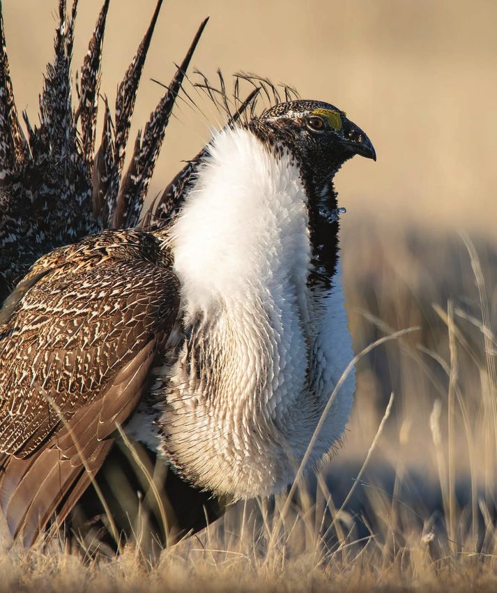
S eventy percent of the western United
States is rangeland where rural
communities maintain large intact grass
and shrublands through domestic livestock
grazing. More than 350 plant and animal
voluntary conservation of sagebrush country with
the people who live and work in this biome.
COPRODUCTION OF SCIENCE:
species call this land home, notably sage grouse,
LINKING PEOPLE TO
sagebrush songbirds, and migratory big game CONSERVATION
populations. These important rangelands
are under threat from land–use conversion, Coproduction is the joint creation of new
woodland expansion, invasive annual grasses, and knowledge based on interactions between
dewatering of wet meadows and riparian sites. scientists and affected stakeholders.
Coproduction in rangeland conservation makes
Starting in 2010, the USDA’s Natural Resources science more actionable by engaging stakeholders
Conservation Service (NRCS)—through its to share in both design and implementation,
Working Lands for Wildlife (WLFW) Sage Grouse striving to achieve better outcomes for ranching
Initiative (SGI)—accelerated efforts to help and wildlife.1 Along with the rise of coproduction
combat these threats to the sagebrush biome is a renewed interest in working lands as stewards
through WLFW’s vision of wildlife conservation of some of the most productive lands in the
through sustainable ranching. To date, the West. A focus on working lands also helps actively
NRCS has invested $536.2 million into SGI with manage persistent threats for conservation–
2,366 participating landowners in the sagebrush reliant species like sage grouse.
biome, resulting in the conservation of 8.58
million acres of working lands. A decade later WLFW scientists engage with practitioners to
and WLFW’s new five–year Framework for proactively target conservation and assess
Conservation Action (https://wlfw.rangelands. resulting outcomes, focusing efforts on threats
app) is the agency’s continuing contribution to that can be addressed through voluntary
“Outcomes provide the backbone for effective communications
with producers.” —Julia Debes, WLFW Director of Agricultural Communications
1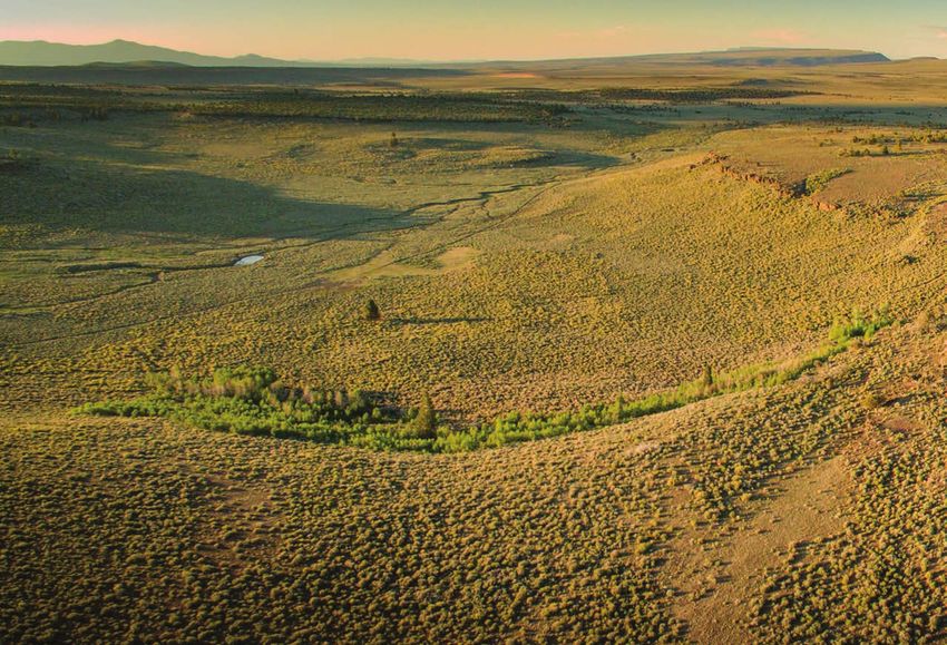
WORKING LANDS FOR WILDLIFE

Science investment is an integral part of WLFW because outcomes
don’t measure themselves.

conservation on private working lands. The                           PURPOSE
uptake of science is rapid because findings are
directly relevant to conservation actions.                           This report summarizes—in one place—more
                                                                     than a decade of WLFW science support that
QUANTIFYING OUTCOMES IN                                              NRCS staff and partners can incorporate into their
CONSERVATION                                                         future work. Rather than list citations, this report
                                                                     summarizes science’s current understanding of
WLFW recognized early that limited resources                         identified threats and how best to address them
necessitate a strategic, landscape approach to                       through voluntary conservation actions.
succeed. Outcomes are defined as the impact
of conservation actions. Outputs, on the other                       At the time of this report, WLFW scientists have
hand, are defined as the amount of something                         authored 61 peer–reviewed publications that help
produced. In conservation, outputs typically are                     target conservation and quantify outcomes for
tallied as acres enrolled, dollars allocated, or miles               threats that can be reduced with voluntary actions.
restored. Outputs are an integral, yet interim, step                 These papers have been cited 1,264 times thus
in quantifying outcomes, allowing conservationists                   far by other researchers in the scientific literature
to track progress towards implementation goals.                      and another 43 times in the Federal Register to
                                                                     articulate the outcomes of voluntary conservation
Tracking outputs electronically is vital as it enables               (SGI Outcomes in Conservation Report 2015) in
scientists to evaluate the effectiveness of resulting                Endangered Species Act determinations.
outcomes. For example, practitioners that maintain
GIS shapefiles showing locations and timing of                       This accumulation of findings quantifies outcomes
pinyon–juniper cuts enables scientists to assess                     and sparks new ways of thinking about how to
the restorative outcomes of these actions on deep–                   address threats facing rangelands and wildlife.
rooted forage plants or nest survival of radio–                      The report also details WLFW’s advanced spatial
tagged grouse.                                                       technologies that help practitioners best identify
                                                                     where conservation work will yield the greatest
Outcomes answer the “so what?” question in                           outcomes. WLFW thanks the NRCS’ Conservation
strategic conservation. WLFW invests in science                      Effects Assessment Project–Wildlife Component
support and provides the capacity to proactively                     as an early adopter and continued partner in the
target investments and quantify outcomes.                            coproduction of science on western rangelands.2
Knowing outcomes provides the mechanism for                          Please explore this report and learn what we
sustained investment because stakeholders can                        have learned over more than a decade of putting
communicate their return on investment.                              science into action.

1. Naugle, D.E., B.W. Allred, M.O. Jones, D. Twidwell, and J.D. Maestas. 2020. Coproducing science to inform working lands:
   The next frontier in nature conservation. BioScience 70:90–96.
2. Naugle, D.E., J.D. Maestas, B.W. Allred, C.A. Hagen, M.O. Jones, M.J. Falkowski, B. Randall, and C.A. Rewa. 2019. CEAP quantifies
   conservation outcomes for wildlife and people on western grazing lands. Rangelands 41:211–217.
                                                                                                                                       2
USDA NATURAL RESOURCES CONSERVATION SERVICE

    A Decade of
    Rangeland   SciencePlatform
              Analysis  Support(RAP)
                                in the Sagebrush Biome

    Advances in
    Rangeland
    Mapping
    Technology
    Photo: Jeremy Roberts/Conservation Media

    S       trategic early investments by WLFW
            in remote sensing and mapping
            technologies continue to bolster
    conservation across western rangelands and have
    spurred the creation of cutting–edge geospatial
    data and tools that make conservation efforts        application that provides an unprecedented ability
    more efficient and effective. Innovations in early   to monitor rangelands across space and time
    online mapping tools spurred the creation of the     and serves as a primary mechanism to deliver
    Rangeland Analysis Platform (RAP)—a free online      rangeland conservation at landscape scales.

    In Brief: Early WLFW investments in mapping technologies via
    the Rangeland Analysis Platform (RAP) provide spatial context
    for conservation actions and usher in a new era in rangeland
    monitoring and evaluation.
3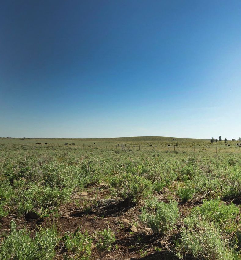
WORKING LANDS FOR WILDLIFE

        RAP–based estimates of herbaceous production put change–detection tools at the fingertips of land
        managers and other decision–makers.

WLFW developed annual, 30–meter, percent cover                     Using these data, WLFW and partners developed
maps for U.S. rangeland vegetation from 1984 to                    the Rangeland Analysis Platform (RAP). This web
the present.1 Plant types mapped are those                         application allows anyone to view and analyze
used for rangeland monitoring and evaluation                       land cover and vegetation production through
including annual forbs and grasses, perennial                      time—from ranch to watershed scales.8 The RAP
forbs and grasses, shrubs, trees, and bare                         and its data serve as a primary component in
ground. These land cover data were improved                        WLFW’s strategic spatial approach to address
using fresh field plot data and the latest machine                 rangeland threats across the West, embedded
learning techniques.2                                              in the Sagebrush Biome Framework for
                                                                   Conservation Action.
In parallel, cutting–edge vegetation productivity
maps that quantified plant carbon uptake                           RAP data are also a critical component in Idaho’s
were being produced at ever finer spatial and                      Cheatgrass Challenge, where NRCS leaders and
temporal resolutions;3,4 providing a detailed                      partners launched a statewide effort to fight
view of vegetation productivity with cascading                     invasive annual grasses. This effort highlights
implications for conservation and management.5                     the role of the RAP in WLFW’s spatial–based
WLFW then combined the land cover data with                        conservation strategy—Defend the Core, Grow
productivity computations to create first–ever                     the Core, Mitigate Impact—which focuses
rangeland herbaceous production data that                          proactive conservation efforts where they are
has been split into separate estimates for                         most likely to be successful and cost–effective.
perennials and annuals.6,7 Together, these                         The Cheatgrass Challenge is using RAP to
cutting–edge data provide views of cover,                          identify core intact areas, defending and growing
carbon, and production at temporal and spatial                     those cores through conservation actions and
resolutions never seen before.

                                                                                                                       4
USDA NATURAL RESOURCES CONSERVATION SERVICE

    Rangeland Analysis Platform (RAP)

    partnerships, and mitigating impacts in areas         Rangeland monitoring is quickly evolving—with
    where annual grasses have a strong foothold.          the RAP at the forefront—as WLFW is pioneering
                                                          new approaches to rangeland conservation.
    The RAP has also provided critical data to identify   WLFW has added the capacity to help train
    the severity and extent of woodland expansion         more ranchers and practitioners to apply this
    into sagebrush rangelands. This threat has            technology while continuing to innovate through
    detrimental effects on rangeland resiliency,          new data and web applications to assist in
    hydrology, productivity, and wildlife. The RAP is     managing and monitoring America’s rangelands.
    being used to prioritize areas for conservation
    action and assess outcomes of past and future         WLFW–SUPPORTED SCIENCE
    conservation efforts. Recent studies demonstrate
    the use of RAP data to assess outcomes of
                                                          PUBLICATIONS:
    targeted conifer removal which increased sage
                                                          1. Jones, M.O., B.W. Allred, D.E. Naugle, J.D.
    grouse habitat,9 resulting in a +12% increase in
                                                             Maestas, P. Donnelly, L.J. Metz, J. Karl, R.
    population growth rate.10 Invasive annual grasses
                                                             Smith, B. Bestelmeyer, C. Boyd, J.D. Kerby,
    and expanding woodlands are pervasive across
                                                             and J.D. McIver. 2018. Innovation in rangeland
    the West, and RAP data helps detect early warning
                                                             monitoring: Annual, 30 m, plant functional type
    signals before these threats result in irreversible
                                                             percent cover maps for U.S. rangelands, 1984–
    shifts in vegetation assemblages.11
                                                             2017. Ecosphere 9:e02430.

                                                                                                                      RAP provides
                                                                                                                      spatial context to
                                                                                                                      conservation strategies
                                                                                                                      and makes it easy to
                                                                                                                      quantify outcomes of
                                                                      Credit: USDA-NRCS, Working Lands for Wildlife

                                                                                                                      management actions.

5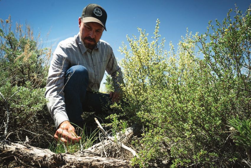
WORKING LANDS FOR WILDLIFE

2. Allred, B.W., B.T. Bestelmeyer, C.S. Boyd, C.        8. Jones, M.O., D.E. Naugle, D. Twidwell, D.R.
   Brown, K.W. Davies, M.C. Duniway, L.M.                 Uden, J.D. Maestas and B.W. Allred. 2020. Beyond
   Ellsworth, T.A. Erickson, S.D. Fuhlendorf, S.D.,       inventories: Emergence of a new era in rangeland
   T.V. Griffiths, V. Jansen, M.O. Jones, J. Karl, A.     monitoring. Rangeland Ecology and Management
   Knight, J.D. Maestas, J.J. Maynard, S.E. McCord,       73:577–583.
   D.E. Naugle, H.D. Starns, D. Twidwell, and D.R.
   Uden. 2021. Improving Landsat predictions            9. Olsen, A.C., J.P. Severson, B.W. Allred, M.O.
   of rangeland fractional cover with multitask           Jones, J.D. Maestas, D.E. Naugle, K.H. Yates and
   learning and uncertainty. Methods in Ecology           C.A. Hagen. 2021. Reversing tree encroachment
   and Evolution 12:841–849.                              increases usable space for sage–grouse during
                                                          the breeding season. Wildlife Society Bulletin:
3. Robinson, N.P., B.W. Allred, M.O. Jones, A.            In Press.
   Moreno, J.S. Kimball, D.E. Naugle, T.A. Erickson,
   and A.D. Richardson. 2017. A dynamic Landsat         10. Olsen, A.C., J.P. Severson, J.D. Maestas,
   derived normalized difference vegetation index           D.E. Naugle, J. Smith, J.D. Tack, K.H. Yates,
   (NDVI) product for the conterminous United               and C.A. Hagen. 2021. Reversing tree
   States. Remote Sensing 9:863.                            expansion in sagebrush steppe yields
                                                            population level benefit for imperiled grouse.
4. Robinson, N.P., B.W. Allred, W.K. Smith, M.O.            Ecosphere 12:e03551.
   Jones, A. Moreno, T.A. Erickson, D.E. Naugle,
   and S.W. Running. 2018. Terrestrial primary          11. Roberts, C.P., D. Twidwell, J.L. Burnett, V.M.
   production for the conterminous United States            Donovan, C.L. Wonkka, C.L. Bielski, A.S.
   derived from Landsat 30 m and MODIS 250 m.               Garmestani, D.G. Angeler, T. Eason, B.W. Allred,
   Remote Sensing in Ecology and Conservation               M.O. Jones, D.E. Naugle, S.M. Sundstrom,
   4:264–280.                                               and C.R. Allen. 2018. Early warnings for
                                                            state transitions. Rangeland Ecology and
5. Robinson, N.P., B.W. Allred, D.E. Naugle,                Management 71:659–670.
   and M.O. Jones. 2019. Patterns of rangeland
   productivity and land ownership: Implications        ADDITIONAL READINGS:
   for conservation and management. Ecological
   Applications 29:e01862.                              Uden, D.R., D. Twidwell, C.R. Allen, M.O. Jones, D.E.
                                                        Naugle, J.D. Maestas, and B.W. Allred. 2019. Spatial
6. Robinson, N.P., M.O. Jones, A. Moreno, T.A.          imaging and screening and regime shifts. Frontiers
   Erickson, D.E. Naugle, and B.W. Allred. 2019.        Ecology and Evolution 7:e407.
   Rangeland productivity partitioned to sub–pixel
   plant functional types. Remote Sensing 11:1427.

7. Jones, M.O., N.P. Robinson, D.E. Naugle, J.D.
   Maestas, M.C. Reeves, R.W. Lankston, and B.W.
   Allred. 2021. Annual and 16–day rangeland
   production estimates for the western United
   States. Rangeland Ecology and Management
   77:112–117.

                                                                                                                6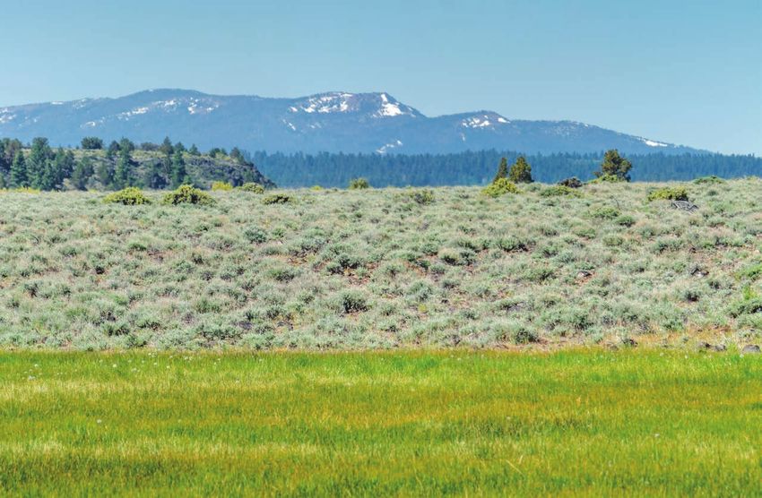
USDA NATURAL RESOURCES CONSERVATION SERVICE

     Land–Use Conversion

     Protecting
     Rangelands
     from Land–Use
     Conversion
     Photo: Jeremy Roberts/Conservation Media

     W            orking Lands for Wildlife (WLFW)
                  uses Farm Bill resources like
                  conservation easements to
     proactively remove the risk of cultivation and
     new housing developments to maintain the
                                                         Conservation easements are one tool provided
                                                         by the USDA’s Natural Resources Conservation
                                                         Service (NRCS) and partners to help reduce
                                                         these threats with producers who voluntarily
                                                         agree to keep working lands undeveloped. Pace
     open space, habitat, water quality, and soil        and extent of easement acquisition accelerated
     health required for ranching and wildlife. While    in the sagebrush biome since WLFW became
     the impacts from constructing homes or other        an NRCS national priority. From 2010–2013,
     buildings are more localized, habitat destruction   for example, easements increased more than
     is severe and virtually impossible to reverse.      1,800 percent, providing certainty for current
     Both forms of development can sever big game        and future generations that sagebrush grazing
     migration routes and reduce habitat below levels    lands will remain as large and intact watersheds.
     needed to support sage grouse movements.            Since 2013, SGI has published five outcome–

     In Brief: WLFW is keeping grazing lands connected with
     conservation easements before crops and houses creep in, and
     using science to inform the landscape context of these actions.
78
WORKING LANDS FOR WILDLIFE
based evaluations to help target conservation In eastern Montana, the western Dakotas, and
easements and evaluate their effectiveness in northeast Wyoming, 70 percent of sagebrush
maintaining intact rangelands. habitats are privately owned and under the
primary threat of cultivation. An NRCS–sponsored
In Wyoming, NRCS and partners place easements assessment published in 2016 found that 96
to remove the threat of housing developments percent of active leks are surrounded by less than
inside sage grouse strongholds. Easements 15 percent cropland and that additional cultivation
complement the Wyoming governor’s approach would decrease the regional populations by five to
to managing oil and gas development. SGI’s seven percent.3 The reach of impact is striking—a
assessment back in 2013 predicted that $250 single square mile of new cropland negatively
million in targeted easements can cut sage grouse impacts sage grouse in a landscape 12 times that
losses by roughly half statewide and nearly two– size. Findings also indicate that optimal placement
thirds within core areas.1 To date, NRCS and of a $100 million easement investment would
matching partners in Wyoming have invested prevent most losses, and that clumped easements
$131 million towards meeting the conservation rather than scattered ones yield higher returns on
easement goal and keeping 192,565 acres of biological investment.3
intact habitat on working lands. Easements taken
for sage grouse also have conserved 75% of Fast–forward to 2021, and Montana now leads
priority habitats for two populations of migratory the nation in using easements to perpetually
mule deer.2 conserve working rangelands. Over the past
Science–based targeting predicts that targeted easements in Wyoming can cut sage grouse
losses by roughly half statewide and nearly two–thirds within core areas (1).
8USDA NATURAL RESOURCES CONSERVATION SERVICE
Land–Use Conversion
revenues from livestock grazing. WLFW science
showed a doubling of grassland retention when
these efforts are targeted to poor–performing
croplands.6 The likelihood of retaining these
grasslands is high because of their proximity
to existing rangelands that support a grazing
culture. Producers revert to cropping their most
productive CRP fields once payments end but
are open to keeping in grass their less productive
fields (Barnes et al. 2020). Landowners interested
in keeping their expired CRP fields in grassland
can get the help they need from NRCS to
design sustainable grazing systems, such as the
installation of water for domestic livestock.
Science showing the rapid decline in sage grouse lek density
associated with new cultivation of sagebrush rangelands (3).
decade, NRCS and partners here have invested
$78 million to conserve a quarter–million acres of
intact sagebrush grazing lands. To deliver these
tools at scale, NRCS and its partners built their
easement culture from the ground up, including
early dialogue with communities, additional
investment in people to complete the complex
transactions, and the ingenuity to combine
diverse funding sources.
Montana’s effort is conserving—in perpetuity—
the largest sage grouse and pronghorn migrations
in the West.4 Easements were strategically placed
within the longest known sage grouse migratory Migratory pathways for sage grouse and pronghorn in the
northern Great Plains, Montana, USA, and Saskatchewan,
pathway—the birds here travel more than 100
Canada (4).
miles each way annually. And these grouse are
international travelers, crossing the border
WLFW–SUPPORTED SCIENCE
where they comprise Canada’s last sage grouse
population in Saskatchewan.5 PUBLICATIONS:
The NRCS is adding to the mix a novel approach 1. Copeland, H.E., A. Pocewicz, D.E. Naugle, T.
for retaining grassland that is exiting the Griffiths, D. Keinath, J.S. Evans, and J. Platt.
Conservation Reserve Program (CRP) by replacing 2013. Measuring the effectiveness of
landowners’ lost annual CRP payments with conservation: a novel framework to quantify
9WORKING LANDS FOR WILDLIFE
Photo: Jeremy Roberts/Conservation Media
the benefits of sage–grouse conservation 6. Sullins, D.S., M. Bogaerts, B.H.F. Verheijen,
policy and easements in Wyoming. PLoS One D.E. Naugle, T. Griffiths, and C.A. Hagen. 2021.
8:e67261. Increasing durability of voluntary conservation
through strategic implementation of the
2. Copeland, H.E., H. Sawyer, K.L. Monteith, D.E. Conservation Reserve Program. Biological
Naugle, A. Pocewicz, N. Graf, and M.J. Kauffman. Conservation 259:109177.
2014. Conserving mule deer through the
umbrella of sage–grouse. Ecosphere 5:art117. ADDITIONAL READINGS:
3. Smith J.T., J.S. Evans, B.H. Martin, S. Baruch– Barnes, J.C., M. Sketch, A.R. Gramza, M.G. Sorice,
Mordo, J.M. Kiesecker and D.E. Naugle. R. Iovanna, A.A. Dayer. 2020. Land use decisions
2016. Reducing cultivation risk for at–risk after the Conservation Reserve Program: Re–
species: Predicting outcomes of conservation enrollment, reversion, and persistence in the
easements for sage–grouse. Biological southern Great Plains. Conservation Science and
Conservation 201:10–19. Practice 2:e254.
4. Tack, J.D., A.F. Jakes, P.F. Jones, J.T. Smith, R.E. Lipsey, M.K., K.E. Doherty, D.E. Naugle, S. Fields,
Newton, B.H. Martin, M. Hebblewhite, and D.E. J.S. Evans, S.K. Davis, and N. Koper. 2015. One step
Naugle. 2019. Beyond protected areas: Private ahead of the plow: Using cropland conversion
lands and public policy anchor intact pathways risk to guide Sprague’s Pipit conservation in the
for multi–species wildlife migration. Biological northern Great Plains. Biological Conservation
Conservation 234:18–27. 191:739–749.
5. Newton, R.E., J.D. Tack, J.C. Carlson, M.R. Sawyer, H., F. Lindzey, and D. McWhirter. 2005.
Matchett, P.J. Fargey, and D.E. Naugle. 2017. Mule deer and pronghorn migration in western
Longest sage–grouse migratory behavior Wyoming. Wildlife Society Bulletin 33:1266–1273.
sustained by intact pathways. Journal of Wildlife
Management 81:962–972.
10USDA NATURAL RESOURCES CONSERVATION SERVICE
Woodland Expansion
Strategically Tackling
Woodland Expansion
Photo: Jeremy Roberts/Conservation Media
3
W oodland expansion into grasslands
and shrublands is a global
problem as trees displace wildlife
and reduce the productivity of grazing lands
(Nackley et al. 2017). Scattered trees across
science showed sage grouse are particularly
sensitive to trees, abandoning otherwise suitable
breeding habitat with just a few trees per acre
(i.e., 4 percent canopy cover) thereby elevating
awareness of this threat to grouse.2 To help
the sagebrush biome may look harmless to a practitioners better target tree removal, WLFW
casual observer, but science shows woodland coproduced the first high–resolution mapping of
expansion erodes rangeland resilience when left tall woody plant cover across sagebrush habitats3
unchecked. In the Intermountain West, conifer and made this tool freely available via the SGI
trees—including juniper, pine, and fir—have interactive web application for partners to identify
increased up to 600 percent since the 1800s, with areas of early tree invasion and visualize potential
90 percent of expansion occurring at the expense areas in need of treatment. Today, this tool has
of sagebrush rangelands (Miller et al. 2011). been replaced by newer tree mapping technology
Woodland expansion results in sagebrush wildlife available through the Rangeland Analysis
habitat loss and fragmentation, reduced forage Platform (see Sagebrush Conservation Tab;
production, decreased resilience to fire, and less http://rangelands.app). Under WLFW’s proactive
resistance to cheatgrass invasion.1 “‘Protect the Core, Grow the Core” strategy,
participants focus on conserving core areas of key
The extent and severity of woodland expansion sage grouse habitat with little or no tree cover and
as a primary threat to sage grouse was poorly then expanding into areas where woody species
understood a decade ago. WLFW–sponsored are present but not dominant.
In Brief: Targeted removal of expanding conifers improves
ecosystem resilience and benefits sage grouse and other
sagebrush–dependent wildlife.
11WORKING LANDS FOR WILDLIFE
Woodland expansion also reduces available
forage for wildlife and livestock across U.S.
rangelands. West–wide, livestock producers lose
more than $300 million annually in revenue
as a result of lost production from woodland
expansion.4 In the western Dakotas, Montana,
and Wyoming, woodland expansion and cropland
conversion threaten biome connectivity and
biodiversity. As these lands are critical habitat
for grassland birds and home to some of the last
remaining big game migrations in the contiguous
U.S., halting woodland expansion and conserving Restoring sagebrush communities with conifer manage-
ment increased understory vegetation critical for sage
intact shrublands is crucial. To support outreach grouse nesting habitat three years post–treatment (8).
and project targeting WLFW scientists developed Square symbol on the left represents the average cover
found at radio–marked bird nest sites.
a web application (https://rangelands.app/
yield–gap). This free online app helps producers
Nesting hens were quick to use restored habitats
estimate the productivity and forage gains that
made available by conifer removal. Within three
accompany the restoration of grazing lands
years of initiating treatments, a third of marked
through woodland management.
females were nesting near or within restored
habitats; no such response was apparent in the
WLFW scientists also quantified wildlife outcomes
nearby control landscape where conifers were
in a decade–long evaluation of juniper removal in
not removed. The relative probability of nesting
Oregon. Findings show that restored rangelands
in newly restored sites increased by 22 percent
are rapidly recolonized by sage grouse5 with
annually, and females were 43 percent more likely
higher survival rates inside than outside of
to nest near treatments. Herbaceous vegetation
treatments,6 resulting in a +12% increase in
responded favorably when nutrient–robbing trees
population growth rate.7
were removed from sagebrush rangelands.8
From 2011 to 2017, the amount of newly available
open space used by marked grouse increased
six–fold (from five to 31 percent) with no change
in probability of use in the untreated control
landscape.9
These outcomes demonstrate that targeted
conifer removal works and is one of the few
management actions available to increase sage
grouse population growth rates. Next–generation
modeling continues to explore how to enhance
Sage grouse population growth rates increased +12% as
conifer trees were removed from the landscape (7). No such targeting of restoration cuts to improve seasonal
response occurred in the nearby control landscape where habitats for sage grouse, facilitate their movement
conifers were left unmanaged.
between seasonal habitats, and maintain
connectivity among sage grouse strongholds.10
12USDA NATURAL RESOURCES CONSERVATION SERVICE
Woodland Expansion
Targeted removal should be scaled up further 1125, 327 pages. https://doi.org/10.3133/
as conifer expansion continues in unmanaged ofr20201125.
landscapes in the sagebrush biome.11,12
2. Baruch–Mordo, S., J.S. Evans, J.P. Severson,
Additional outcomes from southern Oregon show D.E. Naugle, J.D. Maestas, J.M. Kiesecker, M.J.
that abundances of Brewer’s sparrow, green– Falkowski, C.A. Hagen, and K.P. Reese. 2013.
tailed towhee, and vesper sparrow more than Saving sage–grouse from the trees: A proactive
doubled following mechanical conifer removal.13 solution to reducing a key threat to a candidate
Annual increases each year post tree removal species. Biological Conservation 167:233–241.
suggest that Brewer’s sparrow use may increase
even more with time. Findings illustrate that 3. Falkowski M.J., J.S. Evans, D.E. Naugle, C.A.
conifer removal conducted for sage grouse that Hagen, S.A. Carleton, J.D. Maestas, A.H.
retained shrub cover can result in immediate Khalyani, A.J. Poznanovic, and A.J. Lawrence.
benefits for other sagebrush songbirds of high 2017. Mapping tree canopy cover in support
conservation concern. of proactive prairie grouse conservation in
western North America. Rangeland Ecology and
Management 70:15–24.
4. Morford, S.L., B.W. Allred, D. Twidwell, M.O.
Jones, J.D. Maestas, and D.E. Naugle. 2021.
Biome–scale woody encroachment threatens
conservation potential and sustainability
of U.S. rangelands. bioRxiv https://doi.
org/10.1101/2021.04.02.438282
5. Severson J.P., C.A. Hagen, J.D. Maestas, D.E.
Naugle, J.T. Forbes and K.P. Reese. 2017.
Short–term response of sage–grouse nesting
to conifer removal in the northern Great Basin.
Rangeland Ecology and Management 70:50–58.
Songbird abundance increased after sagebrush communities
were restored through conifer management (13). 6. Severson J.P., C.A. Hagen, J.D. Maestas, D.E.
Naugle, J.T. Forbes and K.P. Reese. 2017. Better
WLFW–SUPPORTED living through conifer removal: A demographic
SCIENCE PUBLICATIONS: analysis of sage–grouse vital rates. PloS One
12:e0174347.
1. Maestas, J.D., D.E. Naugle, J.C. Chambers,
J.D. Tack, C.S. Boyd, J.M. Tague. 2021. Conifer 7. Olsen, A.C. Olsen, J.P. Severson, J.D. Maestas,
expansion. In T.E. Remington, P.A. Deibert, S.E. D.E. Naugle, J. Smith, J.D. Tack, K.H. Yates, and
Hanser, D.M. Davis, L.A. Robb, and J.L. Welty C.A. Hagen. 2021. Reversing tree expansion
(editors). Sagebrush conservation strategy— in sagebrush steppe yields population level
Challenges to sagebrush conservation. U.S. benefit for imperiled grouse. Ecosphere
Geological Survey Open–File Report 2020– 12:e03551.
13WORKING LANDS FOR WILDLIFE
8. Severson J.P., C.A. Hagen, J.D. Maestas, D.E. Beck. 2018. Understanding biological effectiveness
Naugle, J.T. Forbes and K.P. Reese. 2017. before scaling up range–wide restoration
Restoring sage–grouse nesting habitat investments for Gunnison sage–grouse. Ecosphere
through removal of early successional conifer. 9:e02144.
Restoration Ecology 25:1026–1034.
Donnelly J.P., J.D. Tack, K.E. Doherty, D.E. Naugle,
9. Olsen, A.C., J.P. Severson, B.W. Allred, M.O. B.W. Allred and V.J. Dreitz. 2017. Extending conifer
Jones, J.D. Maestas, D.E. Naugle, K.H. Yates and removal and landscape protection strategies from
C.A. Hagen. 2021. Reversing tree encroachment sage–grouse to songbirds, a range–wide assessment.
increases usable space for sage–grouse during Rangeland Ecology and Management 70:95–105.
the breeding season. Wildlife Society Bulletin:
In Press. Nackley, L.L., A.G. West, A.L. Skowno, and W.J.
Bond. 2017. The nebulous ecology of native
10. Reinhardt J.R., D.E. Naugle, J.D. Maestas, B. invasions. Trends in Ecology and Evolution
Allred, J. Evans, and M. Falkowski. 2017. 32:814–824.
Next–generation restoration for sage–grouse:
A framework for visualizing local conifer Maestas, J.D., C.A. Hagen, J.T. Smith, J.D. Tack,
cuts within a landscape context. Ecosphere B.W. Allred, T. Griffiths, C.J. Bishop, K.M. Stewart,
8:e01888. and D.E. Naugle. 2019. Mule deer juniper use
is an unreliable indicator of habitat quality:
11. Reinhardt, J.R., S. Filippelli, M. Falkowski, B. Comments on Coe et al. (2018). Journal of Wildlife
Allred, J.D. Maestas, J.C. Carlson, and Management 83:755–762.
D.E. Naugle. 2020. Quantifying pinyon
juniper reduction within North America’s Miller, R.F., S.T. Knick, D.A. Pyke, C.W. Meinke,
sagebrush ecosystem. Rangeland Ecology and S.E. Hanser, M.J. Wisdom, A.L. Hild. 2011.
Management 73:420–432. Characteristics of sagebrush habitats and
limitations to long–term conservation. Pages 145–
12. Filippelli, S.K., M.J. Falkowski, A.T. Hudak, P.A. 185 In S.T. Knick and J.W. Connelly, Editors. Greater
Fekety, J.C. Vogeler, A H. Khalyani, B.M. Rau, sage–grouse: Ecology and conservation of a
and E.K. Strand. 2020. Monitoring pinyon– landscape species and its habitats. Studies in Avian
juniper cover and aboveground biomass Biology Volume 38. Berkeley, California, University
across the Great Basin. Environmental of California Press.
Research Letters 15:1–15.
Miller R.F., D.E. Naugle, J.D. Maestas, C.A. Hagen
13. Holmes A.L., J.D. Maestas and D.E. Naugle. and G. Hall. 2017. Targeted woodland removal to
2017. Bird responses to removal of western recover at–risk grouse and their sagebrush–steppe
juniper in sagebrush–steppe. Rangeland and prairie ecosystems. Rangeland Ecology and
Ecology and Management 70:87–94. Management 70:1–8.
RELATED READINGS: Severson J.P., C.A. Hagen, J.D. Maestas, D.E. Naugle,
J.T. Forbes and K.P. Reese. 2017. Effects of conifer
Doherty, K.E., J.D. Hennig, J.B. Dinkins, K.A. Griffin, expansion on greater sage–grouse nesting habitat
A.A. Cook, J.D. Maestas, D.E. Naugle, and J.L. selection. Journal of Wildlife Management 81:86–95.
14USDA NATURAL RESOURCES CONSERVATION SERVICE
Livestock Grazing
Grazing by
Domestic
Livestock
Photo: Jeremy Roberts/Conservation Media
W orking Lands for Wildlife’s (WLFW)
shared vision of wildlife conservation
through sustainable ranching
includes producers as part of the solution for
implementing conservation to reduce persistent,
values and leverages the Farm Bill’s 80–year
history of voluntary conservation to put that
vision into practice.
WLFW use of coproduced science does not
non–regulatory threats. This vision rallies and always yield anticipated outcomes, but forces
sustains partnerships from the very start and conservationists to think differently about
sustains landowner enrollment. Landowners perceived threats. Such was the case when
are not forced to enroll. Instead, the WLFW pastures rested from domestic grazing did not
shared vision is congruent with ranchers’ benefit sage grouse populations as originally
In Brief: WLFW science has raised the collective understanding of
the importance of ranching to wildlife conservation across western
public–private land ownerships.
15WORKING LANDS FOR WILDLIFE
concealing cover for nests is unlikely to be limiting
population growth regardless of grazing strategy.
In response, the USDA’s Natural Resources
Conservation Service (NRCS) adjusted the delivery
of conservation practices to de–emphasize financial
incentives for extended rest within rotational
grazing systems.
Additional science revealed maximization of
hiding cover may be overemphasized in grazing
management guidelines and policies.1 Findings
suggested females instead select nest sites based
on relatively static features such as sagebrush
Nesting success was similar among different grazing man- cover and distance from roads, whereas nest
agement systems (non–SGI), and rotational grazing, which failure was driven primarily by extended periods of
kept livestock off of designated areas to allow vegetation
to recover (SGI–RGS bar) had no effect on nest survival (1).
heavy precipitation. As a result, the management
of sage grouse nesting habitat should focus on
hypothesized.1,2 Outcome assessments found conserving areas of adequate shrub cover and
no evidence that rest from grazing (≥12 months) preventing fragmentation of intact grazing lands.
increased daily nest survival rates. Rotational
grazing systems and rest had negligible effects on Entomological study in the same landscapes
herbaceous vegetation height and cover relative showed arthropods consumed by sage grouse
to other grazing strategies.1 Nest survival was were twice as prevalent in grazed shrublands than
comparable to range–wide averages, suggesting in nearby pastures that had been idled without
Activity–density of grouse–food arthropods in grazed, rested and idled pastures in central Mon-
tana. Bars represent average weekly catch and standard errors. Grazed rangelands produced more
sage grouse food compared to idled pastures where predatory spiders were most abundant (3).
16USDA NATURAL RESOURCES CONSERVATION SERVICE
Livestock Grazing
Photo: Jeremy Roberts/Conservation Media
domestic grazing for more than a decade.3 Lands nesting habitat–fitness relationships have been
managed with grazing supported a more diverse inappropriately extrapolated in developing range–
assemblage of ground–dwelling arthropods, wide habitat management objectives.5
which may be particularly beneficial as food
resources for birds. Outcomes suggested that Management of public lands, and who should
periodic disturbance may enhance arthropod have access to them, remains contentious in
diversity and that sage grouse may benefit from the West. Most private ranching enterprises rely
livestock grazing with periodic rest or deferment. upon seasonal grazing access to public lands,
and ongoing wildlife conflicts result in continual
Findings spawned additional inquiry challenging calls to restrict grazing on public lands. In a final
the long–held belief that grazing restrictions line of questioning, WLFW found restricting
inevitably benefit sage grouse populations. grazing on public lands can increase habitat
A follow–up study revealed commonly loss on private lands and reduce community
used methodologies are inherently biased, support for conservation.6 A preferred approach
misrepresenting the relationships between for maintaining habitat is a policy that facilitates
habitat structure and sage grouse nest success.4 management on public lands while also
A range–wide meta–analysis reveals weak supporting sustainable, economically viable
effects of grass height on nest–site selection ranching operations on private lands.
with no relationship to nest success, suggesting
Sage grouse selected slightly denser shrub cover at nest sites but used herbaceous grass cover based on its availability.
Deviation above the diagonal line represents selection by nesting sage grouse. Circles represent individual studies (5).
17WORKING LANDS FOR WILDLIFE
WLFW–SUPPORTED SCIENCE 6. Runge, C.A., A.J. Plantinga, A.E. Larsen, D.E.
Naugle, K.J. Helmstedt, S. Plasky. J.P. Donnelly,
PUBLICATIONS:
J.T. Smith, T.J. Lark, J.J. Lawler, S.M. Martinuzzi,
and J. Fargoine. 2019. Unintended habitat loss
1. Smith, J.T., J.D. Tack, L.I. Berkeley, M.
on private land from grazing restrictions on
Szczypinski, and D.E. Naugle. 2018. Effects of
public rangelands. Journal of Applied Ecology
rotational grazing management on nesting
56:52–62.
greater sage–grouse. Journal of Wildlife
Management 82:103–112.
RELATED READINGS:
2. Smith, J.T., J.D. Tack, L.I. Berkeley, M.
Szczypinski, and D.E. Naugle. Effects of livestock Runge, C.A., J.C. Withey, D.E. Naugle, J.E. Fargione,
grazing on nesting sage grouse in central K.J. Helmstedt, A.E. Larsen, S. Martinuzzi, and J.D.
Montana. 2018. Journal of Wildlife Management Tack. 2019. Single species conservation as an
82:1503–1515. umbrella for management of landscape threats.
PLoS One 14:e0209619.
3. Goosey, H.B., J.T. Smith, K.M. O’Neill and
D.E. Naugle. 2019. Ground–dwelling Dahlgren, D.K., R.T. Larsen, R. Danvir, G. Wilson,
arthropod community response to livestock E.T. Thacker, T.A. Black, D.E. Naugle, J.W. Connelly,
grazing: Implications for avian conservation. and T.A. Messmer. 2015. Greater sage–grouse and
Environmental Entomology 48:856–866. range management: Insights from a 25–year case
study in Utah and Wyoming. Rangeland Ecology
4. Smith, J.T., J.D. Tack, K.E. Doherty, B.W. Allred, and Management 68:375–382.
J.D. Maestas, L.I. Berkeley, S.J. Dettenmaier, T.A.
Messmer, and D.E. Naugle. 2018. Phenology Stevens, B.S., D.E. Naugle, B. Dennis, J.W. Connelly,
largely explains taller grass at successful nests T. Griffiths, and K.P. Reese. 2013. Mapping sage
in greater sage–grouse. Ecology and Evolution grouse collision risk: Spatially explicit models for
8:356–364. targeting conservation implementation. Wildlife
Society Bulletin 37:409–415.
5. Smith, J.T., B.W. Allred, C.S. Boyd, J.C. Carlson,
K.W. Davies, C.A Hagen, D.E. Naugle, A.C. Olsen, Stevens, B.S., K.P. Reese, and J.W. Connelly. 2011.
and J.D. Tack. 2020. Are sage–grouse fine–scale Survival and detectability bias of avian fence
specialists or shrub–steppe generalists? Journal collision surveys in sagebrush steppe. Journal of
of Wildlife Management 84:759–774. Wildlife Management 75:437–449.
Photo: Jeremy Roberts/Conservation Media 18USDA NATURAL RESOURCES CONSERVATION SERVICE
Riparian and Wet Meadow Degradation
Restoring Riparian
and Wet Meadow
Resilience
Photo: Jeremy Roberts/Conservation Media
O n the range, water is life. Riparian,
wet meadow, and other mesic areas
—places where land meets water—are
rare but disproportionately important to wildlife
and working lands. These areas are reservoirs
improving overall rangeland resilience to drought,
fire, watershed scale, and flooding. From a wildlife
standpoint, targeting conservation actions close
to sage grouse breeding and nesting habitats
helps ensure a reliable source of insects and forbs
of late–season productivity that provide reliable to feed growing chicks as uplands dry out in the
water and food for livestock and wildlife during summer sun.
the dry summer and fall.
Anchored in Working Lands for Wildlife
Past degradation and dewatering have reduced (WLFW) science, the USDA’s Natural Resources
the size and function of these mesic areas. Conservation Service (NRCS) has created a
Protecting and restoring these sites is essential to cooperative venue for ranchers to restore and
In Brief: Restoration of riparian areas and wet meadows realize
quantifiable gains in productivity and drought resiliency.
19WORKING LANDS FOR WILDLIFE
enhance water resources. Working lands science application (https://map.sagegrouseinitiative.
shows private grazing lands are central to water com/). Follow–up science extends the importance
conservation in the sagebrush biome. Although of privately stewarded wet meadows to other
wet summer habitats cover less than 2 percent species, including continental waterbird
of the landscape, 50–90 percent are located on migrations.3,4
privately managed ranchlands.1,2 Availability of
nesting habitat was previously thought to be the In addition to these insights, WLFW science
primary determinant of grouse distributions. documented the efficacy of various mesic
WLFW science shows that sage grouse also place restoration techniques. In a retrospective study
their breeding grounds near water where hens of three watershed–scale restoration projects
go to raise their chicks—with 85 percent of leks across the West, scientists found that Zeedyk
within six miles of these wet habitats.1 Drought structures, beaver dam analogues, and grazing
sensitivity also structured grouse populations management increased riparian and wet meadow
wherein landscapes with the greatest uncertainty vegetation productivity by 25 percent and kept
in mesic abundance and distribution supported plants greener longer throughout the growing
the fewest grouse.2 season.5 Restoration efforts also exhibited
reduced sensitivity to precipitation over time,
To better target management opportunities, resulting in greater resiliency against the stresses
WLFW scientists mapped these wet resources of drought and climate variability. Findings
over time across the West and provided these exemplify the dual benefits of restoration to
data through a free and publicly available web ranching and wildlife.
Mesic productivity maps enable managers to visualize the changing productivity of wet their resources
during drought and deluge.
20USDA NATURAL RESOURCES CONSERVATION SERVICE
Riparian and Wet Meadow Degradation
WLFW is putting this science into practice
through technology transfer and training led by
the NRCS’ West National Technology Support
Center in partnership with Utah State University’s
Restoration Consortium, private consultants,
and other agencies. Together, these groups have
hosted dozens of field and virtual workshops
(http://lowtechpbr.restoration.usu.edu/) and
webinars reaching nearly 2,000 practitioners.
WLFW also sponsored the publication of technical
restoration design manuals and pocket guides
detailing how to implement this low–tech
restoration work. These efforts have enabled
more landowners and partners to participate
in scaling up mesic restoration to improve the
resiliency of water resources in the region for the
benefit of people, wildlife, and livestock.
21WORKING LANDS FOR WILDLIFE
WLFW–SUPPORTED SCIENCE reveals benefits of natural and simulated beaver
dams to a threatened population of steelhead
PUBLICATIONS:
(Oncorhynchus mykiss): Scientific Reports
6:28581.
1. Donnelly J.P., D.E. Naugle, C.A. Hagen, and J.D.
Maestas. 2016. Public lands and private waters:
Fairfax E., and A. Whittle. 2020. Smokey the
Scarce mesic resources structure land tenure
beaver: Beaver–dammed riparian corridors stay
and sage–grouse distributions. Ecosphere
green during wildfire throughout the western
7:e01208.
USA. Ecological Applications 30:e02225.
2. Donnelly, J.P., B.W. Allred, D. Perret, N.L.
Fesenmyer, K.A., D.C. Dauwalter, C. Evans, and T.
Silverman, J.D. Tack, V.J. Dreitz, J.D. Maestas,
Allai. 2018. Livestock management, beaver, and
and D.E. Naugle. 2018. Seasonal drought in
climate influences on riparian vegetation in a
North America’s sagebrush biome structures
semi–arid landscape. PLoS ONE 13:e0208928.
dynamic mesic resources for sage–grouse.
Ecology and Evolution 8:12492–12505.
Maestas J.D., S. Conner, B. Zeedyk, N.M.
Sapello, B. Neely, R. Rondeau, N. Seward, T.
3. Donnelly, J.P., S.L. King, N.L. Silverman, D.P.
Chapman, L. With, R. Murph. 2018. Hand–built
Collins, E.M. Carrera–Gonzalez, A. Lafón–
structures for restoring degraded meadows in
Terrazas, and J. N. Moore. 2020. Climate and
sagebrush rangelands: Examples and lessons
human water use diminish wetland networks
learned from the Upper Gunnison River Basin,
supporting continental waterbird migration.
Colorado. Range Technical Note Number 40.
Global Change Biology 26:2042–2059.
USDA–Natural Resources Conservation Service,
Denver, Colorado.
4. Donnelly, J.P., D.E. Naugle, D.P. Collins, B.D.
Dugger, B.W. Allred, J.D. Tack, and V.J. Dreitz.
Swanson S., S. Wyman, and C. Evans. 2015.
2019. Synchronizing conservation to seasonal
Practical grazing management to maintain or
wetland hydrology and waterbird migration in
restore riparian functions and values. Journal of
semi–arid landscapes. Ecosphere 10:e02758.
Range Applications 2:1–28.
5. Silverman, N.L., B.W. Allred, J.P. Donnelly, T.B.
Wheaton, J.M., S.N. Bennett, N. Bouwes, (editors).
Chapman, J.D. Maestas, J.M. Wheaton, J. White,
2019. Low–tech process–based restoration of
and D.E. Naugle. 2019. Low–tech riparian and
riverscapes: design manual Version 1.0.
wet meadow restoration increases vegetation
Utah State University Restoration Consortium.
productivity and resilience across semiarid
Logan, Utah.
rangelands. Restoration Ecology 27:269–278.
Wheaton, J.M., A. Wheaton, J. Maestas, S. Bennett,
RELATED READINGS: N. Bouwes, S. Shahveridan, R. Camp, C. Jordan, W.
Macfarlane, E. Portugal, and N. Weber. 2019. Low–
Bouwes, N., N. Weber, C.E. Jordan, W.C. tech process–based restoration of riverscapes:
Saunders, I.A. Tattam, C. Volk, J.M. Wheaton, Pocket field guide. Utah State University
M.M. Pollock. 2016. Ecosystem experiment Restoration Consortium. Logan, Utah.
22USDA NATURAL RESOURCES CONSERVATION SERVICE
Exotic Annual Grass Invasion
Defending Core
Rangelands Against
Invading Annual Grasses
Photo: Jeremy Roberts/Conservation Media
I nvasive annual grasses represent one of the
largest threats to the health and resilience of
western rangelands.1 Invading annual grasses
increase wildfire risk and shorten return intervals,
exacerbate drought, reduce forage for wildlife
context, ultimately hindering long–term success.
Working Lands for Wildlife (WLFW) has developed
spatial tools to help conservation planners better
mitigate risks using soil data.2 WLFW science
has also quantified the elevational ascent and
and livestock, and have long–term negative spread of annual grassland transitions, showing
implications for carbon and climate. movement upslope at 200 to 330 feet per
decade.3 This ascent and spread contribute to an
Past efforts to control invasive annual grasses alarming six–fold increase in annual grassland
were often done reactively, at small scales, in area from 1986–2019 in the U.S. Great Basin.
areas of intense infestation, and void of regional
In Brief: WLFW science has spurred biome–wide application of
geospatial data to proactively address the conversion of native
rangelands to annual grasslands.
23WORKING LANDS FOR WILDLIFE
Fire probability maps built on data from the Great Basin is largely predictable based on
Rangeland Analysis Platform (RAP) demonstrate accumulating fuel conditions and drought.4
fine fuels like annual grasses are a primary Over the last three decades, about 80 percent
predictor of large fires. Fire activity in the of burned area has occurred on a quarter of the
Basin and the annual burned area is increasing
in some areas. This science supports a call to
action where accelerated intervention is critically
needed to conserve rangelands in the face of
an ever–growing distribution of annual grasses
fueling megafires.5 WLFW, with public and private
partners, has introduced an innovative approach
to tackle this problem and address the conversion
of sagebrush rangelands to annual grasslands.
Invasive species control is more effective and
cost–efficient when done early, before infestations
become widespread, and when management
is informed by the surrounding landscape. This
science spurred WLFW’s new spatial targeting
strategy for tackling this threat; a proactive
management approach—Defend the Core, Grow
the Core, Mitigate Impacts—that is embedded
in WLFW’s Sagebrush Biome Framework for
Conservation Action.
The Rangeland Analysis Platform has mapped invasive annual
grasses across western grazing lands (1,3).
Fire probability in 2017 for the Great Basin. These largely RAP– Invasive species control is more effective and cost–efficient when
based seasonal fire probability maps help managers prepare done early and at biologically large scales. Mapping of invasive
for where and when ignitions are likely to result in large and grasses in the Rangeland Analysis Platform spurred a new spatial
damaging wildfires. Insets depict in purple the perimeters of targeting strategy of ‘Defend the Core, Grow the Core’.
wildfires >1,000 acres that burned in 2017 (4).
24USDA NATURAL RESOURCES CONSERVATION SERVICE
Exotic Annual Grass Invasion
Core areas with minimal annual grass invasion closely with ranchers and partners to launch the
serve as anchors for conservation where efforts Cheatgrass Challenge, a proactive strategy for
are most likely to be successful and cost– tackling exotic annual grasses. Using RAP data and
effective. Defending and growing those cores considering assessments of sagebrush ecosystem
through conservation actions and partnerships resilience and resistance,2 the strategy identified
is prioritized and invasion impacts are mitigated relatively uninvaded areas in Idaho and guided
in areas where annual grasses have a strong conservation efforts. Following Idaho’s lead,
foothold. This spatial strategy relies on the Western Governors’ Association–appointed
comprehensive geographic data of annual grass Western Invasive Species Council convened a
cover and interannual variability, and WLFW’s cheatgrass committee. The committee stretched
early investment in remote sensing and mapping across agencies, created an integrated annual
technologies is paying dividends. herbaceous cover map,6 and developed a new
toolkit for invasive annual grass management
No state has been hit harder by cheatgrass than across the West that incorporated WLFW’s spatial
Idaho, which is why USDA’s Natural Resources targeting strategy and RAP data.
Conservation Service (NRCS) in Idaho worked
Photo: Jeremy Roberts/Conservation Media
25WORKING LANDS FOR WILDLIFE
Capitalizing on a network of partners, new 6. Maestas, J., M. Jones, N.J. Pastick, M.B. Rigge,
geospatial data from RAP, and insights from B.K. Wylie, L. Garner, M. Crist, C. Homer, S. Boyte,
cutting–edge science NRCS and WLFW have and B. Whitacre. 2020. Annual herbaceous cover
spurred uptake and application of this new across rangelands of the sagebrush biome:
innovative strategy to address the deterioration U.S. Geological Survey data release https://doi.
of sagebrush rangelands. org/10.5066/P9VL3LD5
WLFW–SUPPORTED SCIENCE RECOMMENDED READINGS:
PUBLICATIONS:
Chambers, J.C., J.L. Beck,; J.B. Bradford, J. Bybee,
1. Jones, M.O., D.E. Naugle, D. Twidwell, D.R. S. Campbel,; J. Carlson, T.J. Christiansen, K.J.
Uden, J.D. Maestas, and B.W. Allred. 2020. Clause, G. Collins, M.R. Crist, J.B. Dinkins, K.E.
Beyond inventories: Emergence of a new era in Doherty, F. Edwards, S. Espinosa, K.A. Griffin, P.
rangeland monitoring. Rangeland Ecology and Griffin, J.R. Haas, S.E. Hanser, D.W. Havlina, K.F.
Management 73:577–583. Henke, J.D. Hennig, L.A. Joyce, F.M. Kilkenny, S.M.
Kulpa, L.L. Kurth, J.D. Maestas, M. Manning, K.E.
2. Maestas, J.D., Campbell, S.B., Chambers, J.C., Mayer, B.A. Mealor, C. McCarthy, M. Pellant, M.A.
Pellant, M., Miller, R.F., 2016. Tapping soil Perea, K.L. Prentice, D.A. Pyke, L.A. Wiechman,
survey information for rapid assessment of and A. Wuenschel. 2017. Science framework for
sagebrush ecosystem resilience and resistance. conservation and restoration of the sagebrush
Rangelands 38:120–128. biome: Linking the Department of the Interior’s
integrated rangeland fire management strategy
3. Smith, J.T., B.W. Allred, C.S. Boyd, K.W. to long–term strategic conservation actions.
Davies, M.O. Jones, J.D. Maestas, S.L. Morford, Part 1. Science basis and applications. General
and D.E. Naugle. 2021. The elevational ascent Technical Report RMRS–GTR–360. Fort Collins,
and spread of exotic annual grasslands in Colorado. U.S. Department of Agriculture, United
the Great Basin, USA. bioRxiv https://doi. States Forest Service, Rocky Mountain Research
org/10.1101/2021.01.05.425458 Station. 213 pages. https://www.fs.usda.gov/
treesearch/pubs/53983
4. Smith, J.T., B.W. Allred, C.S. Boyd, K.W.
Davies, M.O. Jones, A.R. Kleinhesselink, Chambers, J.C., J.D. Maestas, D.A. Pyke, C.S.
and D.E. Naugle. 2021. Where there’s Boyd, M. Pellant, and A. Wuenschel. 2017. Using
smoke, there’s fuel: Predicting Great Basin resilience and resistance concepts to manage
rangeland wildfire. bioRxiv https://doi. persistent threats to sagebrush ecosystems and
org/10.1101/2021.06.25.449963 Greater sage–grouse. Rangeland Ecology and
Management 70:149–164.
5. Murphy, T., D.E. Naugle, R. Eardley, J.D.
Maestas, T. Griffiths, M. Pellant, and S.J. Stiver.
2013. Trial by fire: Improving our ability to
reduce wildfire impacts to sage–grouse and
sagebrush ecosystems through accelerated
partner collaboration. Rangelands 35:2–10.
26You can also read