2004 INDIAN OCEAN TSUNAMI ON THE MALDIVES ISLANDS
←
→
Page content transcription
If your browser does not render page correctly, please read the page content below
2004 INDIAN OCEAN TSUNAMI ON THE MALDIVES ISLANDS:
                INITIAL OBSERVATIONS

                     Barbara H. Keating and Charles Helsley,
     University of Hawaii, HIGP/SOEST, 2525 Correa Rd. Honolulu, HI 96822
       Zaha Waheed, Marine Resources Research Center, Maldives Islands
  Dale Dominey-Howes, Risk Frontiers, Macquarie University, Sydney, NSW 2109
                                   Australia

                                       ABSTRACT

         Post-tsunami field surveys of the Maldives Islands where carried out to document
the effects of the tsunami inundation. The study area was situated in the islands of South
Male Atoll that were some of the most heavily damaged islands of the Maldive Islands.
The tsunami damaged the natural environment, vegetation, man-made structures, and
residents. The maximum tsunami wave height was 3-4 m. This level of inundation
exceeded the height of most residents. The wave height was greatest on the eastern rim
of the South Male Atoll (closest to the tsunami source) and these islands were completely
flooded. The islands within the interior of the atoll saw the lowest wave heights, and
these were only marginally flooded.
         Surveys of flood lines left on the exterior and interior of structures were measured
but proved to be substantially less than that reported by survivors. It appears that the
highest inundation was not preserved as flood lines. We suggest that the turbulence
associated with the tsunami inundation erased the highest lines or that they did not form
due to an absence of debris and organic compounds that acted as adhesion during the
initial flooding.
         Significant erosion was documented. Deposition took place in the form of sand
sheets while only desultory deposition of coral clasts in marginal areas was found.
Seasonal erosion, and storms are likely to remove most or all of the traces of the tsunami
within these islands.

              Science of Tsunami Hazards, Vol. 23, No. 2, Page 19 (2005)
INTRODUCTION

       The December 26, 2004 Indian Ocean Tsunami produced considerable damage
within the Maldive Islands in the Central Indian Ocean (Figure 1; location map). The
maximum tsunami wave heights reached 3 to 4 m and the impacts to these low lying
islands in the far-field of the tsunami were considerably less than that observed in the
Eastern Indian Ocean, closer to the source region. Nevertheless, the tsunami impact was
both widespread and destructive to: the natural environment (rocks, beaches, etc),
vegetation, man-made structures, and the island residents. In addition, the location of
garbage dumps on the seaward side of the island resulted in the spread of debris that
polluted the ground surface and ground water as a direct result of the tsunami.
       The nature and scope of the tsunami impact is described here in a general fashion
and more details will be the subject of future papers. The narrative of eyewitness reports
along with our own observations is intended to give the reader an added dimension and
perspective to the impact of the disaster. The tsunami survivors indicated that the flood
waters were significantly higher than the flood lines we surveyed.

              Science of Tsunami Hazards, Vol. 23, No. 2, Page 20 (2005)
Figure 1. Map of the Indian Ocean (upper left) shows the location of
the Maldive Islands relative to Sri Lanka and India, with the location
of the South Maldive Islands shown as a bold black dot. The map at
lower right shows the location of the islands of South Male Atoll
visited during these studies. A small color inset back (bottom) shows
the location of the reefs (turquoise color) and the islands (green
color). The map is based upon the map of Godfrey (1999).

LOCATION - MALDIVE ISLANDS

       The Maldive Islands are situated in the Western Indian Ocean, 2500 km west of
the tsunami source area (Figure 1). The island groups lie southwest of India and Sri
Lanka along two parallel North-South lines, and form an island archipelago with a total
length of a little more than 800 km. Male Atoll, the capital of the Maldives, is situated
centrally on the eastern line of atolls. Our observations are restricted to seven low-lying
islands of South Male Atoll (both resort islands and residential islands). The islands
surveyed are situated on the eastern barrier ring-reef or within the atoll where local
pinnacles and micro-atoll are topped with sandy islands only 1.5 m (or less) above sea
level (see Figure 2). The islands are composed entirely of reef-derived sediments.
       We chose this study area since some of the heaviest tsunami damage was reported
in this area. We did not include the island of Male in this investigation although that was
our base of operations. Male is a densely populated urban city with high-rise buildings
and armored coasts. It was inundated to a depth of about 0.5 m above street level in many
places but repairs had been completed prior to our visit and little first hand information
was volunteered.

              Science of Tsunami Hazards, Vol. 23, No. 2, Page 21 (2005)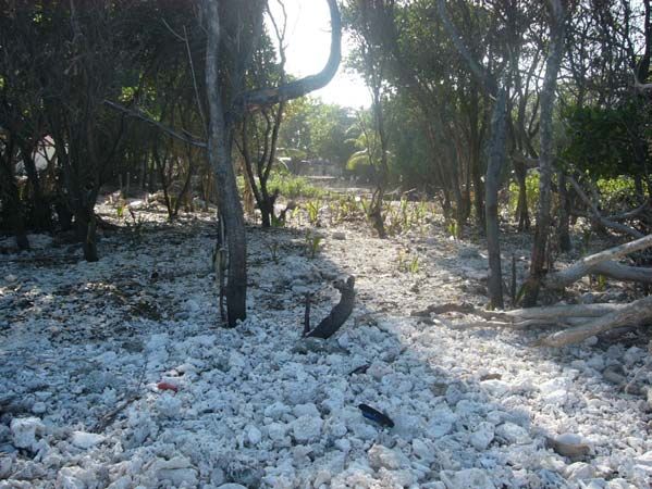
Figure 2. Photograph of Villivaru. These resort room units were flooded due to
their proximity to the coast and the fact that this is a very low-lying islands (roughly
0.5 m above sea level).

POST TSUNAMI FIELD SURVEY OBSERVATIONS

        Signs of tsunami inundation were numerous (see Table 1). The damage
identified falls into five categories including: vegetation, building structures, outdoor
structures, people, and natural environment. The damage ranged from severe to light,
and reflects proximity to the eastern atoll barrier (ring) reef of the atoll.

              Science of Tsunami Hazards, Vol. 23, No. 2, Page 22 (2005)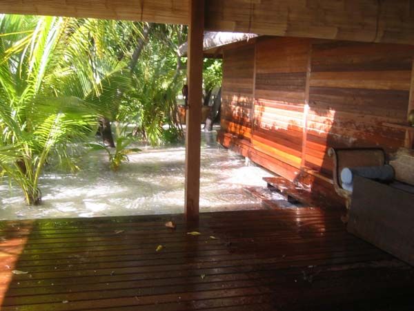
Table 1
                           Tsunami Impacts on Maldives Islands

Impacts on Vegetation

Severe:                                          Moderate to Light:
Trees up-rooted                                  Salt burnt vegetation
Trees undermined and roots exposed               Bark abraded from tree trunk
Trees killed by inundation                       Debris left in branches, roots, and fork of
Roots buried by sand                             trees
Trees and low vegetation killed                  Leaves stripped
                                                 Sand-covered leaves
                                                 Burial of grass in sand
Impacts on Building Structures

Buildings Interior:                              Buildings Exterior:
Flood lines on walls, doors, and mirrors         Flood lines on walls
Changes in finish on furniture                   Scratches on exterior walls
Electrical fixtures damaged                      Doors and locks ripped off
Fixtures corroded                                Breaks in walls
Fine sand deposited                              Effervescence in lime mortar
Bathrooms: black mud                             Windows blown inwards
Paint sand blasted                               Air vents blown outward
Paint peeling from walls                         Changes in paint/finish (blue)

Impacts on Outdoor Structures
Heavy-duty Structures:                           Light Weight Structures:
Piers- broken                                    Boats moved inland
Jetty structures- broken                         Jet Ski washed away
Ramps- broken                                    Signs and light poles-
Sea Walls damaged                                Sand adheres
Heavy objects moved                              Paint striped
                                                 Signboards gone
                                                 Soccer goals sand blasted
Impact on People

Impact injuries (Based on first-hand
accounts)
                                                 Deaths- 80 initial numbers
Drowning
                                                 Cemetery- more newly dug graves
Illness, e.g. Pneumonia
                                                 Trauma, flashbacks, loss of sleep
Phobias

               Science of Tsunami Hazards, Vol. 23, No. 2, Page 23 (2005)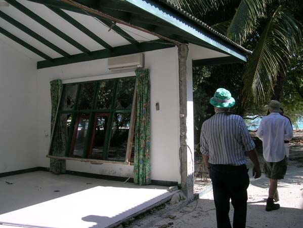
Impact on Distribution of Rocks
Deposition:
Sand sheet
Coral splay deposit
Coral berm formed
Sand Shallowed harbors

Erosion:
Scarp at back of beach
Erosion roots and structures
Sand bar or cays removed (North & South of islets)
Reef coral moved inland (East)
Beaches incised with gullies (West side)
Subsidence of island by sand compaction/redistribution

Flood lines were measured when encountered on the interior and exterior of buildings.

The lines often had small fragments of vegetation (e.g. dry leaves) adhering to the wall

probably by organic compounds or oils spread by the flooding. In all cases, the surveyed

elevations of flood lines were less than flood elevations described by survivors. The

reported “wave height” is summarized in Table 2 (column 3) and compared to the

measured flood line elevation (columns 10 and 11) listed as the “Interior” flood height

(measured within damaged interiors of homes) and the “Exterior” flood heights

(measured on walls and various other exterior surfaces). There are significant disparities

between the two levels.

              Science of Tsunami Hazards, Vol. 23, No. 2, Page 24 (2005)
Table 2 Summary of Eye-witness Reports from all islands surveyed
          Damage           Structural   Locations Erosion Type of Vegetation Damage
Environment        Wave Ht.    Damage                          Inundation Waves Int. Ext.
Island on     HD 71-          Extensive     Guraidhoo      H    Flood        3 H      190 218
barrier              152                                                              cm    cm
reef                 cm
Island on     H      122      Extensive     Maafushi       H    Flood        3 H      102 244
barrier              cm
reef
Back          H      61       Very light    Cocoa          H    Flood**      2 L      15    61
from                 cm                     Island
Reef                                        Resort
Lagoon        L-     99       Dive Shop     Biyaadhoo      M Marginal        2 H            122
              M      cm       Flooded       Resort              Flood **
Lagoon        M      102      Room Unit     Villivaru      H    Marginal         H
                     cm       Damaged       Resort              Flood
Island on     D      249      No            Lhosfushi      H    Flooded          M
barrier              cm       Structures    Isle
reef
Island on     H      152      Extensive     Kandooma       H    Flooded      3 H      102 244
barrier              cm                     Resort              **
reef
Lagoon        M      122      Rooms         Boduhithi           Flood **     2              122
                     cm       Flooded       ***Resort
Notes:
 ** Wave from west side of island, probably due to wrap-around.
Damage: HD- Heavy Damage, D- Damaged, M-Moderately Damaged, L- Light Damage
Run-up measured in cm based upon eyewitness reports. Erosion: H - Heavy Erosion, M -
Moderate Erosion. Number of Waves. Vegetation Damage: H - Heavy, M – Moderate, L
–Light.
Run-up depth from survey leveling measurements: Int.- Interior Rooms, Ext. Exterior
walls of structures. *** These eyewitness reports are from employees on Biyaadhoo
Island Resort who were at Boduhithi Resort during the tsunami.

               Science of Tsunami Hazards, Vol. 23, No. 2, Page 25 (2005)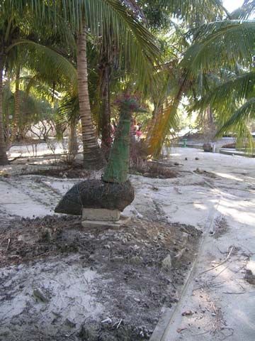
Paint on structures provided important evidence of inundation heights. The paint
on the buildings was often abraded from the walls by the sand-lain tsunami waters. The
paints on exterior walls (particularly the favored blue color) that remained in contact with
seawater for some time appeared to be chemically altered and had changed colors. On
interior walls the paints were either abraded or had peeled away from the walls. The
paint on the exterior walls often showed scrapes and scratches substantially above the
flood lines.

Vegetation
        The atolls of the Maldives Islands experienced inundation associated with
maximum tsunami wave-heights of 3-4 m. Since the islands of South Male only stand
0.6-1.5 m above sea level (asl), the tsunami flooded all of the land area for the islands
nearest the barrier reef and, either totally or marginally, flooded those more removed
from the atoll ring reef.
        The most obvious tsunami damage was to the vegetation (Figure 3). At the
margin of the islands trees were uprooted and laid backwards by the tsunami waters
flooding across the island. Corals were found, still held in the roots and branches of the
upturned trees. Along the eastern coastlines scrubs, trees, and grasses were killed by the
inundation of salt water leaving the leaves and the stalks brown. Broken branches of
other plants were found mixed in the branches of still standing trees. Corals were found
in the forks of standing trees and in hollows of the trunks.

               Science of Tsunami Hazards, Vol. 23, No. 2, Page 26 (2005)
Figure 3. Photograph of the vegetation that was laid back onto Guraidhoo Island by
the tsunami inundation. This shoreline is situated between Guraidhoo and
Lhosfusfi Islands. A log (at right) and corals (5-8 cm across) have been thrown up
on the island surface.

       Within the back-beach area, the bark on some tree trunks had been partially
removed by abrasion. On the eastern (barrier reef) sides of the islands, the shrubs were
stripped of leaves. Further inland, fine sand covered leaves remaining on plants.
Occasionally we observed small areas in the lee of trees that had been shielded from
damage, leaving a small patch of green grass in the lee of a tree trunk (a few 10’s of cms
in area). Generally, the grass was buried by a thin layer of sand with strands of seaweed
mixed in. The grass was brown from salt damage. The broad ranging roots of coconut
trees were exposed in erosional scarps at the back of many beaches. Up to one half of the
root mat of the trees could be exposed to the air, without apparent damage to the living
palm tree.
       Whilst the roots of palm trees along the beach were very efficient at holding sand
in place during the inundation, the palm trees inland provided a minimum barrier to
             Science of Tsunami Hazards, Vol. 23, No. 2, Page 27 (2005)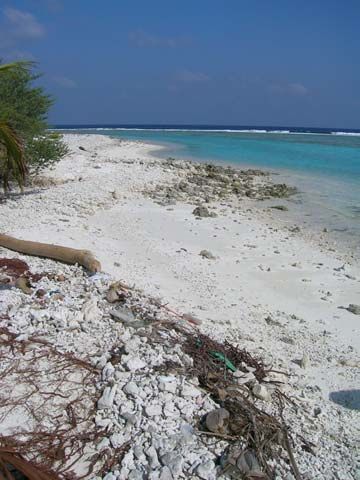
waves, having small cross-sections. Some of the coconut trees were toppled and can be
seen lying on the ground in the photographs taken immediately after the tsunami.
Pandanas trees that have a network of supporting trunks protected the coast well (Figure
4). (In the Pacific Ocean atolls these trees are called upside-down trees because the
structure at the base of the tree, mirrors the branch structure above ground).
Additionally, in the Maldive Islands, a bushy coastal shrub, 1 to 2 m high, provided
excellent protection for the islands. Where present, the vegetation caught coral
fragments, sand, and debris and provided substantial protection against the forces of
flowing water.

Figure 4. This tree is the Pandanus tree. Because the tree proves a broad cross-
section to the sea, it stopped corals from being transported onto the surface of the
island. These trees were buried in several cms of coral clasts.

              Science of Tsunami Hazards, Vol. 23, No. 2, Page 28 (2005)
Coconuts washed from the islands were observed floating in the sea. Also, more
than a month after the event, trees up to 30 m long were floating in the lagoon and proved
to be a significant obstacle to navigation. These trees are not native to the Maldive
Islands and have floated from Asia. An islander who had worked in Sumatra reported
that these types of tree were native to that area.
Buildings and other man-made structures
The tsunami produced the most extensive damage to concrete block structures on
the eastern ocean-side of the islands on the atoll ring reef (Figure 5). Structures on
islands in the lagoon away from the barrier reef experienced reduced tsunami flooding
from 3 m to 2m and thenFigure 5. The interior of this resort room unit on Kandooma was destroyed by the tsunami.
The building lost the sidewall; and the window units were forced in by the force of the
tsunami. The air conditioning units above the windows, and the lighting and electrical
fixtures were filled with seawater. The contents of the room were spread over the island.
The exterior doors (front and back) on many units were torn away or damaged.
On Biyadoo Island, the sand walkways between buildings had been lined with
narrow concrete blocks and concrete block walls. The concrete block edging along the
paths restricted the flood inundation. These low obstacles to the tsunami flooding
restricted the water damage to the outer margins of the island, seemingly preventing
damage to the vegetation and buildings in the interior of the islands.
Substantial scouring was found around the corners of many building structures.
The scour pits conformed to the walls, and were 0.6-1.5 m deep and the walls above were
generally abraded by sand.
Science of Tsunami Hazards, Vol. 23, No. 2, Page 30 (2005)Sea Walls
As is typical on any island, different types of sea walls were built over a long span
of time. Sea walls come in all sizes and types. Some do not protect, e.g. concrete ramps
at Biyadoo allowed the water to run up the ramp and onto the island surface thereby
endangering buildings and people. Other sea walls, e.g. vertical poured concrete walls,
provided amazing protection, where adjacent land without any protection was deeply
eroded. There were breaks in some seawalls that were probably decades old. While
reinforcing bars (rebar) are generally absent in locally constructed buildings in the low-
islands of the Maldives, many of the sea walls have been there a long time and served the
purpose of protecting people and property.
One of the frequent observations was heavy erosion on the land side of harbor sea
walls. Typically the area behind and adjacent to the concrete sea wall was heavily eroded
from behind. Some, walls remained in place while others were excavated and toppled
seaward. The concrete seawall protected the island but the tsunami waters inundated the
inland and erosion became focused behind the harbor seawalls, probably during the
drain-back phase of the wave.
Erosion due to the tsunami in the Maldive Islands was very heavy. Coastline
retreat of 15 m or more occurred is some areas that were not protected by sea walls
(Kandooma). The islanders reported that the tsunami came from the east, and then came
from the western (lagoon) side of the island. Often the lagoon-side of the island was the
most heavily eroded.
Piers
Like the sea wall, the boat piers throughout the low islands vary in age. Most
were completely inundated by the tsunami. Occasionally the support structures were
removed and the concrete slab surface fell into the sea. But, it was more common to see
the piers that were little affected, in this portion of South Male Atoll (Figure 6).
Elsewhere in the Maldives, photographs show wooden pier supports in the water with the
wooden planking missing.
Science of Tsunami Hazards, Vol. 23, No. 2, Page 31 (2005)Figure 6. It was common to see piers like this one damaged or toppled by the drawdown.
The waters draining from the islands eroded behind the piers and the concrete structures
were heavily damaged or destroyed. This photograph shows the damaged pier at Maafushi.
Science of Tsunami Hazards, Vol. 23, No. 2, Page 32 (2005)IMPACT ON THE NATURAL ENVIRONMENT
Sand sheet
The tsunami in general left a thin sand sheet on the surface of the flooded islands.
Sometimes individual corals lay on the ground on the sand sheet; generally this was
restricted to the several meters adjacent to the margins of the islands. Typically the
greatest sand movement was associated with harbors, shallow lagoon areas, sand bars,
and reclaimed beaches. Resort managers (at Biyadhoo and Kandooma) reported that a
great deal of sand was lost from shoal areas around these islands and into the deep
waters.
Corals
The transport and deposition of coral clasts (blocks) was generally limited to the
margins of the islands. We sporadically saw evidence of movement of corals (0.2 m in
diameter) in the surf zone on the side of the islands closest to the tsunami source. Within
the inter-tidal zone we frequently saw evidence of the movement of small corals (up to
0.1 m in diameter). And, individual corals of this size were strewn (10 m) inland but in a
very desultory fashion (Figure 7). No large boulders of coral or cemented beach rock
were found displaced onto the reefs or islands by the tsunami.
Science of Tsunami Hazards, Vol. 23, No. 2, Page 33 (2005)Figure 7. The vegetation was heavily damaged by the tsunami. At right a shrub has
been toppled and laid back onto the surface of the island. The thick root mat of the
trees has been undermined by sand erosion and blocks of coral were caught in the
vegetation. In the background is one of the room units on Kandooma Island, where
doors and windows were removed by the tsunami flooding.
On Guraidhoo Island, the residents reported that the boat harbor was shallower
after the tsunami, than before. The sands and other debris that washed across the island
filled in the harbor to some degree. An image from a cellular telephone showed a boat
sitting on the harbor floor when waters withdrew during the tsunami.
On the east side of Kandooma Island, corals were carried by the tsunami onto and
over the beach berm (Figure 8). Behind the berm, a low wetland was found with three
scour pits. The back beach appears to have experienced erosion as the waters drained
from the island, and deposition of coral clasts occurred on and over the berm and pits.
Inland of this low-lying back beach area there was a broad sheet of sand with isolated
coral clasts on the sand-covered grass.
Science of Tsunami Hazards, Vol. 23, No. 2, Page 34 (2005)Figure 8. On the east side of Kandooma Island, coral clasts were washed over a
berm and onto the surface of the island. The trees are buried in corals about 20 cm
in depth. The coral rubble extends about 20 m inland from the sea. Broken trees
can be seen to the right.
Beach erosion
While the deposition of sediments was limited on these islands, there were
abundant erosional features including: scarps cut at the back of the beaches, undermining
of vegetation and structures, and incised gullies cutting through the back beach and the
shore face.
Erosional scarps cut into the sands at the back of the beach that extended 0.25 to
0.5 m vertically were common, on all islands. Many of the scarps expose the roots of
coconut trees or other vegetation (Figure 9). On Cocoa Island where the beaches are
raked daily we know that these features were formed by the tsunami. Employees of the
Cocoa Island resort reported that the sand under the vegetation was undermined. On the
seaward side of Lhosfushi Isle, trees were toppled and undermined and several dead trees
remained offshore, partially buried by sand.
Science of Tsunami Hazards, Vol. 23, No. 2, Page 35 (2005)Figure 9. The most obvious tsunami damage was to the vegetation. This
photograph demonstrates the extent of erosion and under-mining of the vegetation.
The tree in the photograph is now standing in the sea. The roots of the trees are
now exposed above sea level. Many trees were killed, undermined, damaged by salt,
and their leaves stripped.
On Guraidhoo Island we were informed that some of the erosional scarps existed
prior to the tsunami. And, on Biyadhoo Island we saw a similar scarp formed between
our first survey at low tide and our second survey at high tide. Clearly, normal current
induced erosion events can produce scarps just like those reported by local residents as
being due to a tsunami origin and observations even a month after the event cannot
distinguish between the two origins. Photographs taken of the islands prior to the tsunami
indicate that many of the erosions scarps were present prior to the tsunami and thus
seasonal erosional processes must have formed some of them.
Science of Tsunami Hazards, Vol. 23, No. 2, Page 36 (2005)Scouring
Residents of the islands reported that numerous scour pits were left after the
tsunami flood waters drained. The pits were large, 2.5-4m in diameter and 0.5 to a meter
or more in depth. Some scour pits occurred around the periphery of the island, e.g. on
Kandomma, others formed in the midst of residential areas (on Maafushi and Guraidhoo)
perhaps due to subsidence or perhaps due to focused erosion during either flooding or
drain-back. On Cocoa Island, a large cay (sand bar) that extended to the north of the
island was largely removed and or moved 150 m during the tsunami with the sand being
lost into the deep water, thus removing a significant volume of sand from the local beach
environment.
Incised gullies
Kandooma Island was one of the worst damaged islands that we visited. It was
completely inundated by waters that flooded higher than the height of the residents (160
to 180 cm). The flood waters from the eastern and the western sides of the island met
near the center of the island. This compounded flooding led to significant erosion
particularly on the west side of the island. The flood waters sculpted a broad area of
reclaimed beach, leaving it scoured and incised into hummocks. The draining waters
incised gullies, 30 m long and up to 1 m deep across the beach. The draining waters also
undermined the beach sand from two jetties extending offshore into the surf and a plastic
lawn chair was found wedged under the remains of one of the two damaged jetties
(Figure 10). On the north side of the island in a reclamation area, a pre-existing channel
that had been filled with dredged material was heavily eroded.
Science of Tsunami Hazards, Vol. 23, No. 2, Page 37 (2005)Figure 10. The reclaimed beach on the east side of Kandooma Island was heavily
eroded, with incised gullies (shown at center of the photograph) removing a meter of
sediments. The erosion undermined the two concrete jetties so that the inland
portions of the structures are entirely missing. A plastic lawn chair was wedged
underneath the closer jetty. A great deal of beach and lawn furniture was
permanently lost during the tsunami.
Subsidence
On Guraidhoo Island, residents reported that the island has subsided. Since the
island is only slightly above sea level (roughly 1-1.5 m elevation) this is an important
observation. The walls of the buildings on the island were cracking weeks after the
tsunami. The flooding of the island followed by the draining is likely to have caused
rearrangement and repacking of sand resulting in subsidence.
Science of Tsunami Hazards, Vol. 23, No. 2, Page 38 (2005)Ground Water
Impact of the tsunami on the island groundwater supply was variable. Those
resort islands that utilized reverse osmosis to generate drinking water, recharged the
ground water to some degree and thus the existing fresh ground water lens was full and
close to the surface, and these islands displayed little impact to the ground water supply.
In contrast, on the residential islands, where the water lens was depleted from use, the
islanders reported substantial salt-water contamination of the ground water.
IMPACT ON PEOPLE
The 2004 Indian Ocean tsunami reached the Maldives Islands shortly after a low
tide but not the lowest tide of the day and during day light hours. The coincidences of the
low tide, the low tsunami wave height, and the time of day were fortunate. Many
Maldive islanders are short in stature and, on the islands that were fully inundated
everyone faced drowning (Figure 11). The survivors suggested that if the tsunami
inundation had been just a meter greater, or if it had occurred at night it is likely that
many more people would have drowned.
Science of Tsunami Hazards, Vol. 23, No. 2, Page 39 (2005)Figure 11. This photograph illustrates the flood lines preserved on the interior walls
of a partially destroyed residence on Maafushi. The waters flooded this home to
roughly 1.5 m. The occupants were forced to swim in order to survive the tsunami.
While we were conducting leveling surveys to determine the elevation of tsunami
flooding, members of the communities often came up to us and related their experiences.
Clearly the residents were traumatically affected by their experiences. They volunteered
their observations and when their comments were unclear only limited questioning asked
for clarifications. During these conversations, notes were taken (Appendix 1) and
occasionally pictures were taken. But we did not try to take formal interviews for we
decided that it was unnecessary to have the residents relive the trauma of the tsunami
unless they chose to do so by volunteering to talk with us.
Science of Tsunami Hazards, Vol. 23, No. 2, Page 40 (2005)Eyewitness Reports
Throughout the islands we visited we were told that the tsunami inundation was
greater than the elevation of the flood lines we measured. The absence of flood lines or
other evidence on walls at the height of the maximum water level as reported by
eyewitnesses is somewhat puzzling. It was very common for residents to report
inundation at levels up to a half-meter or meter higher than the flood lines. Occasionally,
we could verify this greater inundation by the presence of a residual dusting of very fine
sand with an abrupt upper boundary. But the general absence of evidence of this higher
flooding level possibly could be explained in various ways. It might reflect: great
turbulence in the waters associated with the highest waves scrubbing surfaces at the same
time they were being wet by the wave; temporary short duration superposition of waves
approaching from different directions, splashing associated with the inundation being
capable of erasing the trace; or the absence of compounds in the water which allow debris
to adhere to surfaces and structures.
An example of a splash level without an associated flood line can be seen on the
walls of the reception building on Cocoa Island resort (Figure 12). Video footage of the
tsunami inundation is available from the Maldives Disaster Center Web Site
(http://www.tsunamimaldives.mv). The footage shows very clear seawater inundating
the island. (The seawater is free of debris and the clays that make the tsunami waters
appear brown at other Indian Ocean inundation zones.) The flood waters can be observed
to splash along and wet the walls, but they left no obvious high flood lines. It would
appear the combination of the splashing of the water and the absence of debris and oils
for adhesion may explain this discrepancy between the measured flood lines and the
reported flood levels.
Science of Tsunami Hazards, Vol. 23, No. 2, Page 41 (2005)Figure 12. Employees of the Cocoa Island Resort, in the Maldive Islands, took this
photograph of the tsunami flooding. The tsunami flooding at the time of this
photograph is roughly 20 cm deep. The seawater is laden with sand, resulting in a
milky appearance. The wall at right has been wet by the tsunami inundation. The
splashy or turbulent nature of the inundation is evident from the uneven splash lines
on the wall. The splash is roughly 1 m above the island surface. The buildings on
the island were inundated by water. The flooding damaged computer equipment,
bedding, and furnishing but very little structural damage occurred.
DISCUSSIONS
Discrepancies between leveling results and eyewitness reports
The most significant reports the residents made was that flooding had been
significantly higher than the elevation of the flood lines we were measuring on the walls.
They reported the water was generally 0.25 to 1 m higher. They also reported that the
tsunami flood waters drained episodically, with noticeable standstills. They reported that
the flood lines represented various standstills. In retrospect, observations of the
elevations of scrapes on the exterior walls might have provided us with more
Science of Tsunami Hazards, Vol. 23, No. 2, Page 42 (2005)representative inundation measurements. These marks were excluded, since they could
have been made during the clean up after the tsunami.
The tsunami behaved as an extreme flood event. Two young men reported that
they saw the sea boiling (our interpretation of this statement was that it became very
turbulent offshore due to flow between and around coral heads and other bottom
features), then the water withdrew, and then the tsunami came ashore (Appendix 1,
conversion 11). No crashing waves were reported although several people noted that the
splash of the flooding wave as it hit the shore sent water up to palm frond levels. Instead
the tsunami catastrophically flooded the islands, either completely or marginally. The
flooding seawater rose quickly and in most places the flooding was strong enough to
knock people off their feet. The survivors reported that the flood waters seemed to pause
before receding and that the drain-down was episodic and strong. The survivors report
that the flood lines were left by standstills of the retreating flood waters. Depending on
the location of the eyewitnesses, the water came from different directions. Residents
generally report that the flooding came from the east (side nearest to the tsunami source)
then from the west (far side). These reports are consistent with the tsunami wrapping
around the islands or spreading out after going through passes and channels between the
islands and in the barrier reef.
Draw-down of flood waters
Drawdown of waters was severe, between 5-7 m in the reef channels. One
tsunami survivor was washed down into a reef channel and had to climb out. Thus, these
reports are reliable. During the maximum drawdown the reefs were bare and sharks, fish
and manta ray were left marooned on the top of the reef. Scuba divers from two resorts
reported being forced down to 30 ft (9m) by the strong currents during the tsunami.
Currents were so strong that a return trip to the island that normally took 15 minutes
instead took one hour.
The protection provided by vegetation
In the Maldive Islands, the coastal vegetation provided important protection to the
residents of the islands. Where the vegetation was thick, it provided significant protection
Science of Tsunami Hazards, Vol. 23, No. 2, Page 43 (2005)to the buildings, and limited the damage by tsunami impact (Figure 13). Where
vegetation was missing the tsunami flood inundated the buildings, breaking down
concrete block walls, breaking in windows, tearing off front and back doors, etcetera as
well as flooding the buildings.
Figure 13. The thick vegetation along the shore at Lhosfushi Islet trapped much of the
coral at the back of the beach and in around brush. Much of the brush on the island was
killed by salt water or torn away by the tsunami. The shallows bank east of the island was
stripped of coral and sand, and exposed well-cemented beach rock in the surf.
Many people have recommended that mangrove vegetation is useful for coastal
protection in similar disasters. Conceptually that is a valid suggestion, but in practice it
has proved problematic. Mangroves are extremely invasive plants. Furthermore, the
plant is a nuisance plant, since it becomes so thick that it often becomes a barrier that
makes it impossible to reach to the ocean. Although it might protect portions of the
coastline, it would virtually consume all of the land area on these small islands if left
unchecked. During our surveys, we did not note any mangroves on the islands we visited.
Science of Tsunami Hazards, Vol. 23, No. 2, Page 44 (2005)Mangroves were introduced to Hawaii and they have become a real nuisance,
because the plant is so invasive, it greatly reduces access to the water in many beach
parks. The mangrove plants are detrimental to many local indigenous species, and when
the plants have been removed from beach parks, the environmental damage done by
siltation along the shoreline is very heavy.
Protection provided by walls and seawalls
During the passage of tsunami waves over the coral reef and beach the tsunami
can dissipate a great deal of energy. After the 1946 Tsunami in Hawaii, scientific papers
of the time, favored the use of sea walls for protection from tsunami. Considering the
amplitude of wave and tsunami experienced by the Maldives, seawalls in most cases
provided a means of reducing the wave energy before it reached residents. The concrete
structures in places dissipated energy at the coast rather than allowing the energy to be
dissipated in areas where people live in the interior of these very low-lying islands.
In addition, in the Maldive Islands, where there are no highlands and no continent
to back up to, the sand islands tends to move with time and seawalls are a necessity to
assure the island remains in one place for the lifetime of a structure. In some places
within the Maldives, barriers have been placed under the sea to restrict sand from
migrating into deep waters and this may be an effective means of minimizing sand loss as
well as tsunami and storm damage. Although these barriers were installed to control
strong seasonal sand movement, they also reduce the strength of waves reaching the
shore and they deflect currents away from the soft sandy coastline. Clearly, armored
coastlines provided protection to the island communities. Even the low edging along
walkways saved a vast amount of resort landscaping and allowed the resorts to get back
to business quickly after the tsunami. Furthermore the lined walkways restricted the
flooding, and reduced salt water mixing with the ground water and thus preserved a
portion of the freshwater lens.
Damage to man-made structures
The hollow blocks walls with poor footings or without foundations were toppled
by the tsunami flooding on Guraidhoo and Maafushi Islands. In part the walls were
Science of Tsunami Hazards, Vol. 23, No. 2, Page 45 (2005)undermined and in part the walls were simply pushed over by the force of the water since
they lacked reinforcing rods and interior cement. Both metal roofs and glass windows
dislodged by the tsunami inundation became hazards to the general population, causing
injuries during and after the tsunami flooding. Guidelines for safe foundations and
construction techniques need to be adopted, but must be appropriate for construction on
limestone and sandy coastal soils.
Garbage dumps
The residential islands use the eastern coasts of the islands as open garbage
dumps. The tsunami emptied these coastal dumping grounds onto the surface of the
islands and dumped the garbage as well as the flood debris from the tsunami into the
lagoon on the other side of the island. The unfortunate location of the dumps contributed
to the contamination of the island surface and the water supply.
SUMMARY
The 2004 Indian Ocean tsunami was a very significant geologic event that
generated devastating tsunami near the source region (near-field) and on distant shores
(far-field). Eyewitness accounts indicate maximum wave heights reached 3-4 m
throughout the Maldive Islands. The wave heights varied significantly through the
islands, often having sufficient wave height to drown all of the residents. The
coincidence of the tsunami arriving at the Maldive Islands at low tide, during daylight
hours, the variability of the wave height, and the resourcefulness of the local people
contributed to the low numbers of fatalities.
The tsunami impact to the vegetation on the islands was significant. The salt
water flooding killed the fruit trees and the tsunami inundation tore out coastal trees.
Inland vegetation was stripped of leaves and killed or damaged by the salt water.
Coconuts washed off the islands and floating trees from elsewhere that washed into the
lagoon have proven to be hazards to navigation, particularly to the high-speed boats used
to deliver guests to resort islands.
Science of Tsunami Hazards, Vol. 23, No. 2, Page 46 (2005)The tsunami damage to buildings varied according to location of the island
relative to the exterior atoll ring reef and according to the location on the island. The
tsunami totally destroyed concrete block buildings adjacent to the coast of the eastern
side of Guraidhoo and Maafushi Islands. It also destroyed buildings built using the older
style of construction without regard to location. Building debris (concrete blocks,
sections of wall, coral clasts from older buildings, metal roofs, glass from windows) and
the contents of the homes (televisions, furniture, books, etc.) were spread across the
surface of the most-damaged islands. Residents have gradually removed the debris,
reestablishing the dump on the eastern sides of the islands. Current plans are to remove
contaminated soils and ship them to Male, and eventually to an uninhabited island.
Several islands within the Maldive nation were so heavily damaged that the residents
have been relocated to other islands.
The resort islands experienced less damage in term of structures being destroyed
by the collapse of walls and total destruction of structures. This is probably due to the use
of different construction techniques. The resort designs generally were formulated by
architects and engineers from abroad rather than individual local builders as are most
residences. But on Kandooma Island, the room units were so damaged by flooding, and
in some cases by wave impact, that they may be destroyed rather than rebuilt. The two
story room units on the resort islands faired well. While they had flooding on the ground
floor that destroyed the contents of the rooms, the structures themselves were not heavily
damaged.
Both residential and resort islands have extended the islands by reclaiming land
from the sea. While the islands have been exposed to natural weathering, compaction
and cementation, the fill material has not undergone this natural compaction. We
observed more erosional damage to the reclaimed land than to the natural landscape. The
fill material is loose, mostly transported from other islands or from the surrounding
seafloor. Seasonal changes naturally move the sand around the islands and even during
storms little is permanently lost for a subsequent episode brings it back again.
Unfortunately the residents reported that much sand from shallow waters was moved to
the deep waters by the tsunami. These sands are permanently removed from the normal
littoral cells, decreasing the overall sand budget to beaches.
Science of Tsunami Hazards, Vol. 23, No. 2, Page 47 (2005)In some areas, the tsunami deposited sand on the surface of the islands. Since the
grass was still visible through the sand sheet, the thickness of sand was not great. Coral
clasts were also deposited on the surface of the islands, particularly along the eastern
coastlines. These were individual coral clasts, most of pebble to cobble size. On
Kandooma Island, cobble size corals were thrown up on to one beach berm. Scouring of
the littoral zone and the islands was common and gullies were incised into the reclaimed
beaches. Much more erosion occurred on the islands than deposition. Normal beach
processes are likely to obliterate the traces of the tsunami so that little or no geologic
record of the tsunami will be left on the islands, but a significant depositional event
should be preserved in the offshore sedimentary record.
ACKNOWLEDGEMENTS
The 2004 Indian Ocean Tsunami produced catastrophic effects on the residents of
these low-lying atolls. Most residents faced drowning. Many residents were washed from
the islands and fortunately rescued at sea. Friends and family were lost and injured. The
homes and businesses of many islanders were destroyed, as well as their jobs. In many
cases all their belongs were destroyed.
Many survivors are now afraid to go to the beach. After six weeks, the residential
islands still look like ghost towns with residents clustered together in tent camps. Many
residents reported that they experience trauma, flashbacks, and nightmares of the tsunami
returning. Many resorts were able to make quick repairs and return to business. A few
resorts were damaged to the point that they remain closed.
In order to assist the government of the Maldive Islands we shared our
observations and recommendations with them in written reports and oral presentations
(Keating et al., 2005) in the hope that they can use the information to make their
community more tsunami resistant. We thank the residents and officials of the Maldive
Islands for their hospitality and assistance in this work.
Dale Dominey-Howes would like to thank Aon Re Australia for their financial
support to be able to participate in the post-tsunami surveys. Travel support for Dr.
Science of Tsunami Hazards, Vol. 23, No. 2, Page 48 (2005)Keating and Dr. Helsley was provided through the University of Hawaii Vice Chancellor
for Research. Aloha.
REFERENCES:
Godfrey, T. (1999). Maldives Travellers and Divers Map, 3rd Edition, Atoll Editions,
Apollo Bay, Australia.
Keating, B., Helsley, C. E., Dominey-Howes, D., and Waheed, Z. (2005) Preliminary
Report of the US-AUS International Field Team “Post-Tsunami Field Survey in Kaafu
South Male Atoll, The Republic of Maldives,” pp. 1-9.
Video footage of the tsunami inundation is available from the Maldives Disaster Center
Web Site (http://www.tsunamimaldives.mv).
Appendix 1
Narrative of Eyewitness Reports from the Post-tsunami Field Survey South
Malé Atoll, Republic of Maldives
Dr. Barbara Keating, SOEST, University of Hawaii, Hawai’i, USA
Zaha Waheed, Marine Research Center, Maldives Islands
Dr. Charles Helsley, SOEST, University of Hawaii, Hawai’i, USA
Dr. Dale Dominey-Howes, Risk Frontiers, Macquarie University, Australia
Unless otherwise noted the conversations were conducted by B. Keating and Z. Waheed.
The dimensions cited in the conversations were in feet, with the metric equivalents added for
clarity. The locations of the islands can be found in Figure 1 of the text.
Science of Tsunami Hazards, Vol. 23, No. 2, Page 49 (2005)Figure 1. Upper left- Map showing the location of the Maldive Islands relative to India and
Sri Lanka. The South Male Atoll is shown by a bold black circle. Lower right- map
showing the distribution of the islands of the study area of South Male Atoll.
INTERVIEWS: BIYADOO ISLAND
Conversation 1 with WOOD WORKER on Biyadoo Island
The resort employee stated that the first inundation was about 4 ft. or 1.2 m deep and the
other inundations were about 2 ft or 0.6 m deep. When the water receded the reef was exposed
and bare. The water came in slowly and smoothly but it went out very quickly and powerfully.
He said that when the flooding began, he fled inland. He said all the children were crying and
screaming. After the flooding, everyone on the island was upset for a long time.
Conversation 2 with young Resort Employee (a girl from the Philippines) on wharf on Biyadoo
Island
The young lady told us she had been on Buduhiti (another island where there is a sister
resort owned by the same operator). She was working in the Reception Center, when two
inundations took place. The first wave reached chest high (about 4 feet) and the second wave was
Science of Tsunami Hazards, Vol. 23, No. 2, Page 50 (2005)about 2 ft. deep or 0.6 m. The water receded rapidly, “at a run.” The draw down of water left the
reef dry, stranding fish and manta rays on the surface and the water deep within the channels.
When the sea began flooding on to the island, the flooding only lasted a short time but
reached chest high. The resort had a swimming area of the lagoon that was used by children
since it was very shallow. When the flood inundated the lagoon, that was full of children, they
became frightened because they were drowning by the flooding waters.
She and all the adults on the island ran to rescue the screaming children. Afterwards, the
employees ran to the individual rooms and then to the shore to see if they needed to rescue
anyone. The rooms were flooded and the bedding was all wet.
When asked if the flooding frightened her, she said, “no” that she interpreted the flooding
as some kind of extreme high tide. Others were panicked, but she said she was very impressed by
the people on the island helping each other. Everyone immediately ran to the aid of the
screaming children and then ran to help with any rescues. People were working together and
helping one another.
Conversation 3. Dale Dominey-Howes’ conversation with the clerk at the Biyadoo Resort
Reception Desk
There were 2 inundations that took place a little after 9:00 a.m. Both waves completely
submerged the jetty. The first wave went up to the first building [the Dive Shop] (about 25 m
inland, horizontally). It was a rapidly rising surge not a wall-of-water. The first flood lasted
about 2 minutes and then receded and the second flood began about 2 minutes later. The next
inundation flooded inland further, reaching the reception building, [the reception area was raised
two steps above ground level] without entering the building.
MAAFUSHI ISLAND
Conversation 4:
Conversation with a young woman (and her husband) who owned a home and shop on
the atoll barrier reef side of the island (eastern side). She was inside her home and heard a very
loud noise. She tried to leave the room to check out the noise but the flooding outside the home
was so strong that she could not push open the exterior door. The water quickly rose to her neck
(4 feet or 1.2 m). The interior of the room was full of water so she held on to the bed. She and
the bed were carried around the room by the turbulent waters, repeatedly colliding, and leaving
many bruises. [With the rapidly rising flood, the windows and window frames of many homes
Science of Tsunami Hazards, Vol. 23, No. 2, Page 51 (2005)were pushed out of the walls by the force of the water and destroyed.] She was able to climb out
of the window (because the doors would not open). When she got outside she saw that everyone
was hanging on to things (trees, yard walls, etc.) trying to keep from being washed away. When
the water receded to ankle depth, everyone went to the mosque at the center of the island. Even
the mosque had flooded so they immediately cleaned it up, despite the on-going disaster.
The young mother reported that she did not see the first inundation. Her small child
came to her, warning the waves were coming in. The mom was inside the house working on the
sewing machine and told her child, “don’t go too close to the water, that it was normal.” But, by
then her older 13 year-old daughter was crying so she realized something was wrong. Her
husband tried to get out of the house but could not. She was in shock when she saw the water.
A wall collapsed, then the water tower in her yard was toppled. The mother and
grandmother went back into the house. Her little girl was hanging onto the bed screaming “Save,
me! Save me!” Both her grandmother and daughter were drowning. She desperately tried to pull
her mother and her daughter up to get their heads above the water. They tried to swim. The bed
was floating around the room, with the little girl hanging on to it (a bunk bed).
When they could get out of the room they ended up on top of an outside masonry yard
wall that did not fall down. Water from the flooding was strong and high because it funneled
between her home and the adjacent buildings. The water in this passageway reached the roof
eaves.
Marks on the wall in the front room of the house/shop were shoulder- high about 5 ft. 6
inches or 1.5 m. The buildings outside (adjacent to the sea, in the atoll reef direction) were
completely gone! The floor tiles within their home came up off the floor and the walls cracked.
She reported that many people were cut by the sheet metal that came off the homes when
the walls collapsed. One man cut his foot on glass from the tsunami damage as he rescued a boy
being washed out to sea. [They could not see the glass in the water, because it appears
transparent in the sea water.]
5. Conversation with woman:
She felt the earthquake. She reported that the flooding was about 40 inches (100 cm)
deep and it left a mark on the wall of her home. But, she reported that the first wave reached 12
inches (30 cm) higher than the mark left on the wall. During the flooding water was coming over
the walls that were about 5 feet high (1.5 m) and that there was no warning. Two later waves
flood the island and left marks at 30 and 18 inches (75- 45 cm). She reported the seawater came
over the beach at palm tree height [somewhere on the trunk of the palm trees.] And the waters
Science of Tsunami Hazards, Vol. 23, No. 2, Page 52 (2005)were splashing as they came. She reported the second wave was even higher. It went up to the
palm fronds of the coconut tree [it splashed up into the fronds].
The inundation level at her house was reached about 4 ft. (1.2 m) deep but she reported
that the flooding was even higher (up to 5 ft. (1.5 m) deep) further down the beach. The second
wave was bigger. The second wave splashed onto the island.
6. Conversation with Island Chief
The community leader reported that the tsunami inundation was all flooding, with “no
breaking wave”. The seawater went completely over the island and then the waters washes back\
on to the island from the lagoon side and was about 2 ft (0.6 m) deep. There was scouring of the
land that left big pits. The reclaimed land around the prison was heavily damaged, scoured, and
eroded. In large part, the erosion resulted because the retaining wall (on the barrier reef side of
the island) was damaged.
The floodwaters moved away in ripples. Waters came straight over the island and
through the buildings. When the floodwaters moved down the streets, the flood knocked people
down. They could not walk in the rising water. The flood swept everything out of the houses
including refrigerators, television sets, and everything.
The garbage in the landfill was removed by the tsunami, and left dump empty. Garbage
was washed over the island and into the lagoon. The ground has now settled (6 weeks after the
tsunami). The residents think the island has subsided. Cracking of building walls is ingoing and
probably is the result of the ground settling.
The water supply was contaminated by the seawater that flooded over the island and also
by the landfill, leaving the fresh water lens contaminated. The chief concluded that even with
rain, the water lens was ruined.
On the seaward side of the island, the chief reported that there is a lot of offshore reef
damage. Lots of the corals are washed upon the island. The reef is wide; comparable is size to
the island. After the water receded the reef was completely exposed. A person on a boat at sea,
said they could see the exposed reef.
On the opposite side of the island, the entrance to the harbor was exposed completely. [A
picture we viewed on a camera cell phone showed a boat sitting on the harbor bottom.] A boat
anchored in the harbor was loose and the ships moved out of the harbor and then back into the
harbor. All the other boats on land that were being repaired were moved 300 ft. inland from the
boat yard at the shore.
Science of Tsunami Hazards, Vol. 23, No. 2, Page 53 (2005)Interview on VilliVaru (off Biyadoo Island)
7. Conversation with repairman on beach.
He reported that he experienced two waves, each lasting only a couple minutes. The
seawater reached a maximum of 1.5 ft deep or 0.4 m deep on the leeward side of the island and it
flooded the room units, destroying bedding while none of the room units of the windward side
were significantly damaged.
Interview on Kandooma Resort Island
8. Conversation with Resort Manager Mohammed
Note- The resort on Kandooma was visited on two occasions in order to document the
damage and then to carry out a leveling survey that documented the height of tsunami flood lines.
The tsunami occurred as a series of three flood inundations at this location. The Resort Manager
Mohammed, who provided us with a tour of the resort, made these comments. The employees
also used paint to mark flood levels on trees.
At the time of the tsunami there were 210 guests and 180 employees on the island. The
staff is now down to 30. The manager was in his room in the staff quarters (Figure 2) when an
employee came to his door and told him to leave. He grabbed his shirt and turned to leave but
found he couldn’t open the door so he broke the window out and climbed out of the window
(cutting his hand in the process). Then the door burst inward from the force of the tsunami waters
within the building. The water was up to eye level (about 5 feet, 1.5 m) everywhere on the island
for about 5 minutes. He said he would have drowned inside the building if he hadn’t gotten out
when he did.
Figure 2. The interior of the employee quarters is shown in this photograph taken
after the 2004 tsunami. The building was flooded to about 3 m depth and the
Science of Tsunami Hazards, Vol. 23, No. 2, Page 54 (2005)manager escaped through a window. The sand in the tsunami wave abraded the
white paint on the interior wall.
Outdoors, the ground was cluttered with white coral everywhere. Even the dark corals
carried up onto the beaches turned white the next day. On the east side of the island, vegetation
had been overturned (Figure 3) despite having roots of several meters wide and the shrubs and
trees were rolled backward onto the island. A beach berm (or ridge, Figure 4) of as much as 3.28
ft or 1 m high was present on the east side of the island (Figure 5), with broken corals and whole
coral heads mantling the berm. Sand was in large part absent from eastern side of Kandooma
Resort Island, having been redistributed over the island and into the lagoon. Coral clasts (blocks)
were strewed inland on east side (Figure 6) inland of the storm berm, in a very spotty fashion.
Figure 3. The vegetation on the east side of Kandooma was crushed by the tsunami
and laid backyards toward the center of the island. The leaves were stripped from
the trees. The roots of the vegetation were undermined and the coral from the
littoral zone was trapped within the vegetation. But, the vegetation provided
important protection to the buildings nearby.
Science of Tsunami Hazards, Vol. 23, No. 2, Page 55 (2005)Figure 4. The manager of the resort reported that 15 m of sand (horizontally) was
stripped from this beach. A beach ridge or berm can be seen at the back of the
beach, where the vegetation is seen.
Figure 5. On the eastern side of Kandooma Island, coral clasts were left along the
back of the beach by the tsunami. The maximum coral clast size is roughly 10 cm
across. The clasts bury the roots of some trees along the coast. These trees are
roughly 5 m inland from the ocean.
Science of Tsunami Hazards, Vol. 23, No. 2, Page 56 (2005)Figure 6. On the eastern side of the Kandooma Island, coral clasts were carried up
onto the island surface in one area, by the tsunami. The typical coral clast size was
roughly 10 cm across. The clasts bury the base of the trees along the coast up to
roughly 20 cm.
A row of palm trees planted on a reclaimed beach on the lagoon side was heavily
damaged and many were lost. Along this part of the island, in places, the beach sand was
completely washed away. The leeward beaches experienced severe erosion, retreating as much as
5 m (Figure 6). The resort jet-ski was washed into the channel and observed traveling at full
speed, and rider-less after the tsunami. Two hours later, the jet-ski was seen again in the channel,
going the opposite direction (toward the lagoon). Two days later, the jet-ski was found on the
next island (Guraidhoo).
The ground water was still fresh on the Kandooma Resort Island after the tsunami. The
leaves on trees and brushes show salt burn. A luxuriant garden featuring topiary was completely
stripped of leaves (Figure 7).
Science of Tsunami Hazards, Vol. 23, No. 2, Page 57 (2005)Figure 7. The leeward side of the Kandooma resort island experienced significant
erosion. The roots of coconut trees are exposed to the air. A comparison of satellite
pictures taken before and after the tsunami shows that a large number of coconut
trees were missing after the tsunami and 5-15 m of beach sand had been removed.
Scuba divers on resort excursions, diving in the water at 16 ft depth, were pushed down
to 30 ft. both on the lagoon side and in the seaward side of the resort island. The clarity of the
seawater increased after the tsunami. The particulate matter in the water column seemed to be
gone.
Interviews: GURAIDHOO Island (Note- this flood level survey was made at low tide)
9. Interview with the Chief of Guraidhoo Island
Science of Tsunami Hazards, Vol. 23, No. 2, Page 58 (2005)You can also read