ALMELEY PARISH - January 2019 - Neighbourhood Development Plan 2011-2031 - Almeley Parish Council
←
→
Page content transcription
If your browser does not render page correctly, please read the page content below

ALMELEY PARISH
Neighbourhood Development Plan
          2011-2031

                January 2019

    Almeley Parish Neighbourhood Development Plan 2011-2031 January 2019
                                1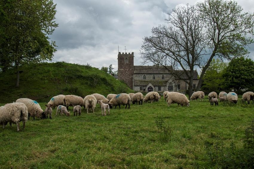
Contents
1.      Introduction                                                              3

2.      Background to the Plan Area                                               5

3.      Issues for the Plan                                                       11

4.      Development Options                                                       17

5.      Vision, Objectives and Strategic Policies                                 19

6.      Environmental Policies                                                    23

7.      Economic Development Policies                                             31

8.      Housing Policies                                                          35

9.      Parish Infrastructure                                                     42

10.     Implementing the Plan                                                     46

Almeley Village Policies Map                                                      48
Woonton Village Policies Map                                                      49
Appendix 1: Almeley Conservation Area –
        Assessment of Character and Appearance                                    50
Appendix 2: Other Locally Important Buildings                                     56

Acknowledgements
Thanks go to Almeley Parish Council NDP Group, previous NDP Groups, Bill Bloxsome, Data
Orchard and Herefordshire Council's Neighbourhood Planning Team.

Photographs courtesy of Paul Charles and Barry Hall
Front cover – The two features that epitomise the character of Almeley village and parish - cricket on
Spearmarsh Common with uninterrupted views across to the Black Mountains

                      Almeley Parish Neighbourhood Development Plan 2011-2031 January 2019
                                                  2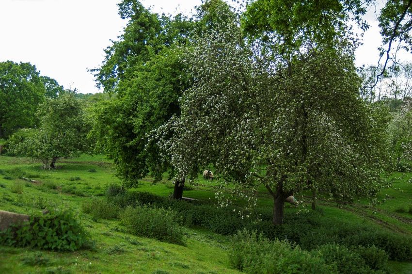
1. Introduction

1.1   Almeley Parish Neighbourhood Development Plan (the NDP) is a new type of planning
      document introduced by the Localism Act of 2011. It enables local communities to
      make a major contribution to planning decisions that will be needed in order to meet
      the requirements for development.

1.2   Almeley Parish Council has agreed to prepare a Neighbourhood Development Plan. It
      made a formal submission to Herefordshire Council to designate the Parish as a
      Neighbourhood Plan Area under the Localism Act 2011 on 17th May 2012, with the
      intention of preparing this NDP. Following a consultation period this was designated
      on 6th July 2012 by Herefordshire Council. A Steering Group was established to
      prepare the plan. This draft NDP has been prepared following the adoption of
      Herefordshire Local Plan Core Strategy by Herefordshire Council on 16th October
      2015.

1.3   Herefordshire Local Plan Core Strategy sets a range of strategic policies for
      development of the County up to 2031. It aims to balance environmental issues with
      economic and social needs of communities to ensure that development is sustainable
      and does not cause harm to residents. This NDP must conform to these requirements
      and ensure that where necessary it does so positively in order to contribute to the
      aims of the Core Strategy document.

              Map 1 –Almeley Neighbourhood Plan Area

                                                        © Crown copyright and database rights Ordnance Survey (10003431)

1.4   This draft NDP has been prepared on the basis of the evidence gathered from surveys
      undertaken in respect of residents' views on future housing needs and quality of life
      issues, the Parish Plans, parish consultation events held between 2015-2017 and
      where issues and opinions were gathered, and a parish questionnaire survey
                 Almeley Parish Neighbourhood Development Plan 2011-2031 January 2019
                                             3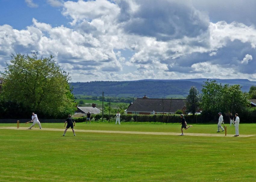
undertaken during 2014. In addition, other evidence including that used as the basis
      for Herefordshire Local Plan Core Strategy and other information arising from issues
      raised through consultation with the local community and by the Steering Group. The
      NDP is considered to comply with the broad criteria for sustainable development
      within Government’s National Planning Policy Framework (NPPF) and with
      Herefordshire Local Plan Core Strategy.

1.5   Policies and proposals are set out in this document prefixed by ‘ALM’ (i.e. Almeley).
      These will become part of the development plan guiding what might receive planning
      permission as well as indicating what measures are to be promoted to guide new
      development.

1.6   This draft NDP was approved by Almeley Parish Council as the basis for consultation
      with residents and other stakeholders in November 2017.

Community Involvement

1.7   Almeley Parish Council established a Steering Group to prepare the NDP which
      included members from the community involved in addition to parish councillors.
      Local neighbourhood plan consultation events were held during 2015-2017 in order to
      identify issues of concern to residents and other interested parties. A general
      household questionnaire was circulated in the parish during 2014. The response to
      the general questionnaire was 46%.

                                  Figure 1: NDP Presentation Event

1.8   The Steering Group consists of 2 members from the Parish Council and 9 members
      from the wider community.

1.9   The Steering Group has written these policies with professional support from Bill
      Bloxsome MRTPI of Data Orchard and Herefordshire Council’s Neighbourhood
      Planning Team.
                 Almeley Parish Neighbourhood Development Plan 2011-2031 January 2019
                                             4
2. Background to the Plan Area

2.1   Almeley Parish covers a large rural area of some 1,400 hectares within north
      Herefordshire some 18 miles to the north-west of Hereford, 13 miles south-west of
      Leominster and 7 miles south-east of Kington. It is bounded by the A4111 Road that
      runs through Eardisley just to the west of the Parish, and the A4112 that runs just
      beyond its southern edge. The A480 runs through the east of the parish and the
      hamlet of Woonton. The Parish’s principal settlement is Almeley village which sits
      approximately within its centre. Woonton is the next sizeable settlement around 1
      mile to the south-east of Almeley. A number of small hamlets are located throughout
      the Parish.

      Its People

2.2   The Parish’s population was 601 in 2011, having been a small increase in population
      of 4% upon the 579 present in 2001. The Parish sits in Castle ward and the 2011
      Census shows the age structure for this ward has a higher proportion of elderly
      present compared to the County as a whole. In turn Herefordshire has a higher
      proportion of elderly compared to England and Wales. Herefordshire Council has
      recognised this to be a significant issue in terms of the long-term health and well-
      being of County residents. Around half of Parish residents live in the central village of
      Almeley, with the majority of the rest living in hamlets across the Parish.

2.3   There is a primary school in Almeley serving a wide area. Most secondary age
      children travel to Kington and some travel to Weobley. The village also has a village
      hall, local shop within a public house, one church, a Quaker meeting house and a
      substantial area of local green space at its core that comprises Spearmarsh Common,
      which is used as public open space, cricket pitch and school sports field. There are no
      facilities at Woonton, except for a post-box and hourly bus service. Residents of the
      Parish can choose to travel to Hereford or either of the nearby market towns for
      weekly shopping. Hereford offers major shopping outlets.

2.4   There is no large employer within the Parish although agriculture is an important
      sector in terms of land use. The recent sale of Council smallholdings may alter the
      current balance within this sector as the Castle ward contains a high number of such
      farms. Residents must travel to the nearby towns for work although there are also
      notable employment areas in the nearby villages of Eardisley and Lyonshall. Working
      from home presents an alternative for some, and the range includes self-employed
      craftsmen, agricultural sub-contracting, technical and professional services.

      History and Settlements

      Almeley Parish

2.5   There is evidence of continuous occupation within the parish for more than 4,000
      years through archaeological finds. Historically Almeley parish had a number of
                  Almeley Parish Neighbourhood Development Plan 2011-2031 January 2019
                                              5
notable settlements, and in addition to Almeley village there is physical evidence of
      shrunken settlements at Woonton, Almeley Wootton, Hopley's Green, Upcott and
      Logaston, numbering more than 100 buildings. Nieuport House, located just to the
      north-west of Almeley village, was originally the location for a medieval house
      demolished sometime after 1712 when its estate was bought by Lord Foley of Great
      Witley. By 1718 it had been replaced by a grand Georgian house and a walled garden
      added later in that century. Substantial extensions were added in the 19th century. In
      1919 it was converted into a TB hospital and remained so until 1953 when it became
      a Latvian Home. It is now back in private hands and has been extensively renovated,
      its gardens re-designed and a woodland returned to the estate, having been bought
      back from Herefordshire. The gardens are now included in the English Heritage’s
      Register of Parks and Gardens.

      Almeley village

2.6   Almeley is recorded in the Doomsday Book as a manor. Much of the present village is
      built around a triangle of roads, with St Mary's parish church to the south, and on the
      edge of the built area. The Oldcastle, on the north-west side of the village and
      Almeley Castle just south of the church are of historical interest and a brook ran past
      both castles providing them with a reliable water supply. The parish church of St
      Mary is largely 14-century and is a Grade I Listed Building. Almeley is notable as the
      birthplace of Sir John Oldcastle, a Lollard sympathizer who was eventually executed
      for treason in 1417; he is presumed to be the basis for Shakespeare's character of
      Falstaff. Almeley railway station, just to the west of the village, was opened in 1874
      and worked by the Great Western Railway. The GWR closed the station in 1917,
      reopened it in 1922 and closed it again in 1940. The railway line has since been
      dismantled.

      Woonton hamlet

2.7   Woonton is the largest of the shrunken settlements within the Parish and contains its
      third castle, near The Mere at a place called Hall Mote. The conjectural line of Offa's
      Dyke cuts across the north east of Woonton crossing Mere Lane and Camp Lane.
      There are four listed timber-framed houses in Woonton and many of the other
      dwellings are conversions including a Quaker Meeting House, Church Mission Hall, a
      forge, a stone pub and timber and stone barns. Woonton is bisected by the A480.

      Other Hamlets

2.8   Other hamlets include Almeley Wootton, Logaston, Upcott and Hopley's Green in
      addition to a number of smaller concentrations.

2.9   Almeley Wootton is centred on the junction of lanes from Almeley, Woonton, Lyonshall
      and other Woottons. It is at the head of the batch dingle which contains a handful of
      dwellings and was once a very active area with a brickworks and mill. It falls within
      Almeley Conservation Area. One of the early Quaker meeting houses is in Almeley
      Wootton. It was given to the Quakers in 1672 by its owner, Roger Prichard, and is still
      in use by Quakers today. Two of the Quakers who worshipped there, Edward Prichard,
      and Edward's brother-in-law, John Eckley, were involved with William Penn in setting
      up the colony of Pennsylvania in 1682. The Meeting House together with Summer
                 Almeley Parish Neighbourhood Development Plan 2011-2031 January 2019
                                             6
House Farmhouse, a cottage on the Green and the Malthouse all fall within the central
       triangle of the hamlet and are Listed Buildings. There are also a number of other
       houses, several barns and a disused chapel within the hamlet although it is more
       widely spaced than Woonton and interspersed with trees. The central triangle of lanes
       reinforces its sense of place as does its sense of isolation amid the wide sweep of
       open fields to the north, east and south. Being near the top of the Parish, the distant
       views to the south are spectacular.

                    Figure 2: Quaker 17th Century Meeting House, Almeley Wootton

2.10   Logaston is an isolated hamlet spread over half a mile, off the lane from Woonton to
       Sallys on the A4112. It contains around 10 buildings and a few barns. Logaston
       Common Farmhouse and barn, Little Logaston Cottage and Rosemary Cottage are
       Listed Buildings. A number of dwellings are dotted around Logaston Common. Other
       buildings straddle the road towards Woonton and are too scattered to form a coherent
       group. Distant views are limited through the hamlet being at the bottom of a slope
       although you soon emerge from the hamlet for longer distant views towards Upcott.

2.11   Upcott is located where Cokes Yeld Dingle crosses the road from Almeley to Eardisley.
       It is an ancient settlement which the Domesday Book records as supplying labour to
       Almeley. It consists of a farm and a limited number of other dwellings sitting on high
       land above the road. They are constructed with a range of materials comprising
       timber frame, red brick, grey stone, metal and timber cladding. Little Upcott Cottage
       and Lower Upcott farmhouse are Listed Buildings. The group of buildings sits on the
       line of an old green lane from Logaston to Eardisley running diagonally across the line
       of the current road.

2.12   Hopley's Green comprises around half a dozen houses and farms along a rural lane
       with a concentration around a common.

2.13   Still smaller groups of houses are located at The Stocks, Upper and Lower Wootton,
       Oldcastle and New House.

                  Almeley Parish Neighbourhood Development Plan 2011-2031 January 2019
                                              7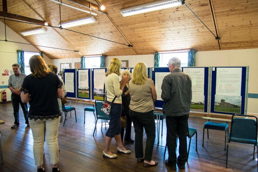
The Environment within the Parish

2.14    The underlying bedrock of the area consists of the Raglan Mudstone Formation of the
        Lower Old Red Sandstone. This material has long been used in the construction of a
        wide range of buildings and boundary walls throughout the area. The bedrock is
        overlain by deep, coarse loamy soils, typical argillic brown earths, that support cereals
        and short-term pasture, and some fruit and potatoes. In ‘The Batch’, superficial
        geological deposits include sand and clay suitable for brick and tile making.

2.15    Agricultural land within the parish falls within the very good quality classification.
        Despite small scale historical use, there is no indication of any present day workable
        minerals reserves within the Parish. The Parish possesses a number of small streams,
        mainly flowing southwards to the River Wye. A notable area within the south of the
        parish is shown to be prone to flooding although this is some distance from either of
        the two main settlements. No notable areas of brownfield land are apparent.

2.16    The landscape of most of the Parish is described as Principal Timbered Farmlands1.
        Both the parish’s settlements fall within this landscape, together with most of its
        hamlets. Its characteristics are rolling lowland landscapes with occasional steep sided
        hills and low escarpments. They have a small scale, wooded, agricultural appearance
        characterised by filtered views through densely scattered hedgerow trees. It has a
        mosaic of small to medium sized fields, irregularly shaped woodlands and winding
        lanes. There is strong tree cover through woodlands, hedgerow trees, and linear tree
        cover associated with streams and watercourses which create its scale and enclosure.
        Woodlands are usually species rich, complex habitats supporting a wide range of flora
        and fauna as well as the numerous hedgerow trees. The scale and shape of the
        woodlands is also important, ranging in size from small field corner copses to those of
        a size exceeding that of the surrounding fields. The irregular outline of many of the
        woodlands, together with the pattern of hedgerows and winding lanes, contributes to
        the overall organic character of this landscape. A densely-dispersed pattern of
        farmsteads and wayside cottages is typical with a notable number of buildings
        constructed out of brick and timber. A dispersed settlement pattern would be most
        appropriate.

2.17 Two other landscape types are present, both within the southern portion of the Parish
     and only to a small extent. Wet Pasture Meadows2 lie to the south of Almeley village.
     These are flat, low lying and largely uninhabited landscapes previously protected from
     change by the difficulty of cultivating soils with such poor drainage. Further to their
     east are Wooded Estate Lands3. These are wooded agricultural landscapes of isolated
     farmsteads, clusters of wayside dwellings and occasional small estate villages. Its
     woodland component is the critical element in defining its character together with
     prominent hedgerows. Ornamental grounds and parkland associated with large
     estates can be a noticeable feature in these landscapes. It is not an intimate
     landscape and, due to its fairly-large scale, can sometimes appear rather functional.

1         See Herefordshire Landscape Character Assessment
(https://www.herefordshire.gov.uk/media/268536/landscape_character_assessment.pdf)
2                Ibid
3                Ibid
                      Almeley Parish Neighbourhood Development Plan 2011-2031 January 2019
                                                  8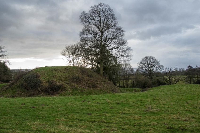
2.18   Although there are many and changing attractive views throughout the Parish, most
       are local or of medium distance, filtered through the irregular woodland and
       hedgerows. There are nevertheless a number of striking long-distance views,
       especially southwards across the broad Wye floodplain to the Brecon Beacons and
       Black Mountains beyond. The landscape views from the southern edge of Almeley
       village are particularly striking, not just because of the mountains in the distance, but
       also the generally uncluttered pastoral qualities of their foreground with its organic
       hedgerow pattern.

2.19   A number of other important landscape features are identified within the Parish.
       Three streams cut deeply through its western portion in the form of dingles. Holywell
       dingle, along its western boundary, is managed by Herefordshire Wildlife Trust as one
       of its reserves. Cokes Yeld dingle runs just to the south of Newport House and
       connects with Holywell dingle right on the edge of the southern Parish boundary. The
       Batch dingle just to the west of Almeley village contains a much-used footpath. All
       three are considered important landscape features that need to be protected and
       sensitively managed. Three other streams run through the Parish at a shallower
       depth. These are important in terms of land drainage.

2.20   There is one large wood within the Parish, Highmoor, which forms part of a Registered
       Historic Park and Garden. There are three smaller woods at Roughmoor, Cockshute
       and Kymin together with a number of coppices, all of which add to the local
       landscape. These are added to by hedgerows, which provide the vast majority of field
       boundaries, and hedgerow trees.

2.21   Commons are another important feature. The Parish also contains an unusual amount
       of commons and these are listed in Appendix 2 as heritage assets. In addition to
       Spearmarsh Common in the centre of Almeley village there are seven smaller
       commons – Meer Common, Tan House Common, Hopley's Green Common, Logaston
       Common, The Green at Almeley Wootton, Pool Common at Woonton and Tomkins
       Green. The last three comprise very small areas.

2.22   There are no nationally or internationally designated habitats within the Parish
       although eight locally important sites were identified in surveys undertaken in the
       1970s and updated during the 1990s. Of particular note is The Batch which runs
       north-south along the western edge of Almeley village and has been included within
       its Conservation Area. The Batch is identified as a core area corridor upon
       Herefordshire Council’s Ecological Network diagram. A number of other small core
       areas and wildlife ‘stepping stones’ are also identified.

2.23   A range of heritage records are available for locations across the parish, although they
       are more extensive at Almeley village and Woonton. Notable references are also
       shown at Almeley Wootton. A concentration of Listed Buildings is found in Almeley
       village, and again some further small concentrations in Woonton and Almeley
       Wootton. Some 23 historic farmsteads are revealed within the Parish as a
       consequence of work undertaken by the Herefordshire Historic Farmstead Project.
       This rich assemblage of identified heritage assets suggests further may exist in
       unexplored locations.

                   Almeley Parish Neighbourhood Development Plan 2011-2031 January 2019
                                               9
Figure 3: Almeley Church

2.24   Almeley Conservation Area was designated in 1987. It includes not only the historic
       portion of Almeley village but also The Batch and Almeley Wootton. Herefordshire
       Council prepared a draft appraisal for this area in 2006 although did not adopt this.

                   Almeley Parish Neighbourhood Development Plan 2011-2031 January 2019
                                              10
3. Issues for the Plan
3.1 The background information above provides an initial basis to inform the plan.
Herefordshire Local Plan Core Strategy, prepared by Herefordshire Council, has an
extensive evidence base which has also been used. Parts of this evidence base will be
referred to where necessary and relevant to issues which this plan seeks to address.
3.2 In addition the residents’ survey has provided valuable information and views, for
example upon what the communities consider the approach to addressing housing
provision should be.
3.3 Issues have been drawn substantially from those raised within the Parish survey,
community consultation and matters identified as relevant to the parish within
Herefordshire Local Plan Core Strategy.
Local Environment
3.4 The need to accommodate development sensitively within environmental constraints
is given a high priority. There are a range of such constraints and they vary across the
plan area. The majority of new developments will occur within or adjacent to the two
plan area settlements identified within Herefordshire Local Plan Core Strategy –
Almeley and Woonton.
3.5 The character of Woonton is very much that of small scale, with individually designed,
mostly traditional buildings, including a number converted from redundant rural
buildings. Originally a small hamlet based upon farmsteads, it has received some
limited development but generally on a small scale through individual buildings. The
hamlet sits mainly within an enclosed setting although there are impressive far-
reaching views from Pool Common towards Ladylift and the Black Mountains. There is
one notable industrial building on its west side, accommodating a general industry
workshop. The hamlet does not have mains drainage and local knowledge suggests
soil structure may not readily accommodate notable amounts of new development.
Evidence to show waste water from any new housing can be successfully
accommodated will need to be provided. The issue is compounded by localised
flooding within parts of the hamlet and the ability to cope with storm water needs to
be determined. An integrated approach to addressing both foul and storm water from
any development should be promoted. Highway safety is a concern given the
alignment of the A480 and the speed of traffic through the hamlet. There are two
Listed Buildings within the core of the hamlet with three further on its periphery. The
original Little Woonton Farm, whose outbuildings were converted to two residential
properties in 2002, falls within its core area and is included within the Herefordshire
Historic Farmstead Characterisation Project. Woonton Farm, with its Grade II listed
farmhouse, is similarly included.
3.6 Almeley, by contrast is a larger village with a number of distinct parts. On the western
side of the village sits its historic core, around the cross roads beside St Mary Parish
Church and the earthworks marking the location of Almeley Castle, a Scheduled
Ancient Monument. The high architectural and historic quality of this area is reflected
by the fact that it forms the eastern part of an extensive Conservation Area that
extends to the south, west and, more especially northwards to include The Whittern
Almeley Parish Neighbourhood Development Plan 2011-2031 January 2019
11Farm, The Batch and Almeley Wootton. Appendix 1 sets out a more detailed appraisal
of the Conservation Area.
Figure 4: Rural setting of Woonton hamlet
3.7 Preserving the rural character of and historic environment within the wider Parish is
also considered extremely important. The approach to accommodating all new
development across the Parish should retain local character and distinctiveness;
ensure the level of new development is in keeping with these; and promote high
quality design in particular in terms of scale, appearance and quality of materials.
3.8 Protection of heritage sites and buildings should be supported, as should efforts to
increase public accessibility and provision of information in relation to the
environment.
3.9 All five notable hamlets within the Parish have historic farmsteads associated with
them that have been identified within Herefordshire Historic Farmstead
Characterisation Project (See Appendix 2). The need to retain the particular
characteristics and beauty of each of the hamlets will require any new development to
be located and designed with extreme care, especially any large farm buildings, and
the present relationship with its surrounding open fields preserved.
Economic Development
3.10 Although welcoming new business enterprises there is concern that these should
generally be small scale to reflect the nature and character of the rural area. There is
support for the conversion of rural buildings to accommodate small businesses.
Almeley Parish Neighbourhood Development Plan 2011-2031 January 2019
123.11 The need to protect good quality agricultural land is recognised as important for the
retention of the existing pattern of land-use and to support farming and other
associated agricultural enterprises. Similarly support for agriculture is strong.
Nevertheless, there is also a strong commitment to ensuring the scale of any
buildings and infrastructure should respect the landscape and settlement pattern.
The quality of the landscape is considered to be high, especially within that part of
the Parish that provides generally undisturbed and extensive panoramic views across
to the Black Mountains and Brecon Beacons National Park. Its protection will support
local tourism enterprises and diversification of the local economy. Public consultations,
including in relation to the NDP, revealed considerable community concern over the
potential harmful effects of intensive livestock operations to public health and the
environment. Support for traditional farming is, however, strong.
3.12 Facilitating improved and faster broadband services outside Almeley village including
Woonton is considered a priority.
Figure 5: The Bells, Almeley
Housing Need
3.13 A number of questions about housing were asked in a Residents Survey undertaken in
2014. This identified that residents saw the greatest need to be for private 2 and 3
bedroomed houses. There was generally greater support for than opposition to most
housing forms although there appeared to be mixed views upon the need for social
housing and semi-detached bungalows. A preference was also shown for single plot
and small-scale developments of up to five houses. The most appropriate approach
was considered to be to seek sites outside of the previously defined settlement
boundary. Only Almeley village had previously had such a boundary.
3.14 Herefordshire Council has set a minimum target of 33 houses to be built over the
period 2011 to 2031. The Council also advised that between 2011 and April 2017
some 18 houses had been built or had planning permission. The minimum
Almeley Parish Neighbourhood Development Plan 2011-2031 January 2019
13outstanding requirement to be met through this plan therefore amounted to 15
dwellings.
3.15 Most of the new dwellings are to be located within or adjacent to the built-up areas of
the two settlements within the parish, i.e. Almeley village and Woonton hamlet.
However, an allowance can be made for dwellings built away from these settlements
such as dwellings needed for agriculture, converted rural buildings, dwellings needed
to support rural enterprises and affordable housing on exception sites. Any allowance
needs to be based on past trends and in relation to Almeley Parish such trends
indicate a modest total of around 12 dwellings might be expected. Of the dwellings
receiving planning permission since 2011, four were outside the two settlements and
hence a further 8 might come forward if the expected rural windfall allowance were to
materialise. Given the extent of farmsteads, with associated rural buildings, this figure
is considered realistic although it is recognised that this assessment may not provide
the level of certainty required by Herefordshire Council. However, it should be taken
into account as part of the strategy for the Parish to show that a positive approach to
planning for housing has been adopted.
3.16 Taking the above information into account a minimum 7 new dwellings would need to
be provided for through this NDP to meet Herefordshire Local Plan Core Strategy’s
minimum housing requirement. Two sites, each of 5 houses, have been identified
through the NDP process, leaving only 5 to accrue by windfall. This windfall target is
considered to be highly likely to materialise during the period up to 2031.
3.17 Although housing is recognised as an important issue, the outstanding target
requirement to be met is relatively small. There is currently, however, no detailed
analysis of local housing need, although it is recognised that the sale of Council
smallholdings, of which a number are located within the Parish, may result in the
need for a form of housing to accommodate residents who may wish to continue to
live and work locally within the industry through contracting. The provision of rural
enterprise live/work units may provide for such a need.
3.18 In terms of providing housing for local needs, the approach that is most likely to be
favoured is considered to be those providing for local workers such as agricultural
dwellings, and opportunities for self-build.
3.19 There is concern that new dwellings should be well designed, reflect local character,
and achieve high levels of sustainability especially through energy conservation.
Although the preference is for small developments, the opportunities for this at
Almeley village is limited while Woonton has recently experienced a relatively
significant expansion of more than 50% the size of the hamlet, and to the extent that
any further growth in this location would amount to development at a scale that
would significantly harm the form, layout, character and setting of the settlement.
3.20 Almeley village possesses all the community facilities and services within the Parish
although it has seen very little growth with only 6 dwellings being built within it since
2001. Herefordshire Core Strategy indicates that it is the location where the majority
of development should be focused.
3.21 Residents have expressed support for limited development within its smaller hamlets.
This would not generally be permitted unless one or more of a limited range of
Almeley Parish Neighbourhood Development Plan 2011-2031 January 2019
14exceptions is met.
Highways and Transport
3.22 There are localised areas where there are potential dangers from traffic, such as
through high speed and inappropriate size of vehicles along narrow lanes. Increased
traffic due to additional housing will exacerbate this problem. Addressing these issues
where possible would be welcome. New development should be accommodated
safely. Locations where improvements may be needed should be monitored with the
intention that should the need arise Herefordshire Council might be pressed to
address these.
3.23 Both settlements suffer from the absence of pedestrian footpaths although this is
most acute in Woonton hamlet where the danger to pedestrians appears to be
greater due to the A480 running through Woonton.
Community, Social and Health Needs
3.24 There is a village hall in Almeley and this is well used although offers further
potential. Access to a range of high quality recreational facilities is limited although
there is a cricket pitch on Spearmarsh Common. There is no local surgery within the
Parish. Almeley Primary School, which also contains a nursery, is located in the south
of the village on the edge of Spearmarsh Common. There is no public footpath linking
the school to residential parts of the village.
3.25 The Parish has an extensive public rights of way network with many footpaths
radiating from Almeley village and Woonton. They also have the potential to provide
circular walks around the two settlements, although there are gaps that might
usefully be filled.
Other Infrastructure
3.26 No areas within the two principal settlements are shown to be within Flood Risk Zones
2 and 3. There are, nevertheless, areas in Woonton that have been affected by storm
water flooding and any new development should not exacerbate flood risk from this
source. There is evidence that the water table is high within the hamlet. Should
opportunities arise that would reduce such flooding then this would be a benefit.
3.27 Almeley village has a mains sewer although sewerage is pumped to the Waste Water
Treatment Works (WwTWs) at Eardisley. Welsh Water has indicated there is sufficient
headroom to accommodate development limits set within Herefordshire Local Plan
Core Strategy although it may need to consider including works to achieve Best
Available Technology within its investment programme for 2020 to 2025 because
flows will be within 10% of its consent limit. Herefordshire Council has allowed
development in excess of the required proportion growth within Eardisley so it may be
necessary to allow for further development that would utilise that WwTWs to be
deferred until any necessary improvement works take place. There is no public sewer
within Woonton. New development would need to ensure that foul drainage can be
accommodated without causing pollution and any measures required might usefully
be undertaken through a co-ordinated approach taking into account drainage from
other properties where necessary.
Almeley Parish Neighbourhood Development Plan 2011-2031 January 2019
153.28 There is no street lighting within either settlement and no desire for its provision.
Almeley Parish Neighbourhood Development Plan 2011-2031 January 2019
164. Development Options
4.1 An option not to prepare a Neighbourhood Plan but rely upon Herefordshire Core
Strategy, developer pressures and any subsequent Rural Areas Local Plan that
Herefordshire Council might produce, was rejected at an early stage as not being in
the community’s best interests. It was decided to prepare a Neighbourhood Plan on
the basis that the community wished to contribute more fully to determining how the
required level of proportional housing growth should be accommodated within the
Parish.
4.2 The choice of options has been influenced by:
• The small number of dwellings required to meet the required housing target;
• The potentially conflicting desire by the community to seek small scale
developments while also supporting the need for a range of housing types,
especially 2 and 3-bedroom family housing; and
• The nature of sites that are available as indicated through Herefordshire’s
Strategic Housing Land Availability Assessment and the local ‘Call for Sites’.
• The contribution that the Parish might make towards improving the age-profile
within the County.
4.3 The options considered for development concentrated upon where new housing might
be located. The following options were considered:
Option 1 – small amount of new housing development in Almeley, with no
more development in Woonton.
Option 2 – retain current settlement boundary for Almeley village, restrict
development in Woonton and rely on Parish windfall.
Option 3 – extend Almeley settlement boundary to incorporate a site large
enough for affordable housing, with no more development in Woonton.
Option 4 – extend Almeley settlement boundary to incorporate a site large
enough for affordable housing and limited further development in Woonton.
Option 5 – retain current settlement boundary for Almeley village, while
allowing limited development in Woonton.
Option 6 – small extension to Almeley village settlement boundary with limited
further development in Woonton.
Option 7 – not to prepare a NDP.
4.4 At the time of the survey complete reliance on windfall development Option 2 was
thought to be a viable option. Subsequently it became clear that it was not, as it
entailed more expectation than firm proposal and would be unacceptable to the
Planning Authority and the Independent Examiner, causing rejection of the Plan.
Although a small majority of residents expressed a preference for Option 2, in order
to meet the level of certainty required that the necessary growth would be met, the
parishioners second choice of Option 6 was considered the most practicable while
respecting community wishes. In this regard, the combination of the community's
expressed wish for no new development to exceed 5 houses, Herefordshire Council's
Policy that Almeley village and Woonton were identified as locations for development,
and the Government's indication that Neighbourhood Plans would be stronger if they
Almeley Parish Neighbourhood Development Plan 2011-2031 January 2019
17contained housing land allocations, it was considered that the identification of two
small sites would meet these aims. The balance of no less than 5 additional houses
from windfall was considered to be wholly realistic hence the proposal enshrined in
this NDP. Options 3 and 4 received the least community support. Not to prepare an
NDP would allow developers to bring forward sites in both settlements as they see fit
which might exceed significantly the target for new housing set for the Parish.
Alternatively, it would rely upon Herefordshire Council including the two settlements
within its Rural Areas Sites Allocation DPD upon which the community would have less
influence.
4.5 There is no strategic requirement to allocate land for employment and no expressed
local need for any such sites. Consequently, a flexible approach supporting
Herefordshire Local Plan Core Strategy policies RA5, E3 and E4 has been adopted and
no options considered.
Almeley Parish Neighbourhood Development Plan 2011-2031 January 2019
185. Vision, Objectives and Strategic Policy
5.1 In preparing Almeley NDP the following vision sets the basis for what it is hoped to
achieve through the planning system by the end of the plan period:
" In 2031, Almeley Parish will remain an unspoilt, rural and scenic part of
Herefordshire, providing homes for its families and elderly residents,
supporting local businesses, such as small family farms, and an increase in
home working through a fast-broadband network.”
5.2 To achieve this vision the following objectives have been set:
Objective 1: To maintain the rural character of the Parish, its village and
hamlets. This means:
a) Landscape character, views and features of the Parish have been preserved,
especially the views southwards across to the Brecon Beacons National Park.
b) The historic aspect of the village, especially its Conservation Area, and
hamlets have been preserved or enhanced.
c) The Parish’s commons and open spaces have been protected, conserved and
maintained.
d) The contribution made by agriculture to the community and local
environment has been recognised and is supported.
Objective 2: To minimise the effect of further developments on the
countryside and landscapes. This means:
a) There has been no net-loss in biodiversity and the opportunities to enhance
wildlife have been taken.
b) The rural nature of the parish has been maintained.
c) Any new development has been sensitively integrated to blend with existing
buildings, settings and the landscape.
d) Land has been used efficiently.
e) High quality agricultural land has been protected.
Objective 3: To support the rural economy within the Parish through:
a) Enabling diversification of businesses where this is in scale with the
character of the area;
b) Supporting home-working;
c) Encouraging live-work units;
d) Protecting high quality agricultural land.
Objective 4: To provide housing opportunities for existing and future
residents of the parish, including affordable, private and self-build homes.
This means:
a) The amount of new housing meets the strategic requirements of
Herefordshire Local Plan Core Strategy.
Almeley Parish Neighbourhood Development Plan 2011-2031 January 2019
19b) A mix of housing, including housing for older people, has been provided;
c) Affordable and self-build homes are available to meet local needs,
particularly those with a local connection.
d) New development is of a scale that fits sensitively into the relevant
settlement.
e) New housing has been designed to a high standard in terms of appearance
and sustainability.
Objective 5: To accommodate future development within the capacity of
local infrastructure. This means:
a) Local services such as the village school, village hall, shop and church have
been supported where possible through any new development.
b) New development has not resulted in on-street parking or road congestion
and road safety problems have been improved where possible.
c) The capacity of utility services, local drainage and the highway network
has not been exceeded.
d) Residential and local amenity has not been adversely affected by new
development.
e) Alternative means of transport to cars, in particular local bus services and
shared transport have been encouraged.
5.3 The community expressed overwhelming support for these objectives4.
Strategy for Sustainable Development
5.4 Sustainable development seeks to ensure proposals are advanced that will “meet the
needs of the present without compromising the ability of future generations to meet
their own needs”5. It covers social and economic factors as well as the environment so
that the community is provided with sufficient and appropriate housing, jobs,
opportunities for enterprise, and access to community facilities which will help to
maintain healthy and thriving communities as well as protecting our natural and
historic environment, all of which contribute to our quality of life.
5.5 Although based upon policies for the environment and housing, this plan brings
forward measures intended indirectly to benefit suitable economic activity and
community infrastructure. The following policy forms the basis for the overall approach
being pursued.
Policy ALM1: Promoting Sustainable Development
Positive measures that promote sustainable development within Almeley
Parish will be supported where they meet the principles and policies set out
in this Neighbourhood Plan. Where development proposals are advanced,
they should, in particular, address the following high-level priorities that are
considered essential by the local community for maintaining sustainable
development within Almeley Parish:
a) The highest priority will be given to retaining the rural character of the
4 See evidence base at http://almeleypc.org/council-business/neighbourhood-development-plan/
5 National Planning Policy Framework, page 2.
Almeley Parish Neighbourhood Development Plan 2011-2031 January 2019
20Parish and its settlement pattern through requiring development to:
• Fit sensitively into the landscape;
• Maintain the dispersed settlement pattern of frequent roadside dwellings
and farmsteads that avoid clusters of modern houses;
• Protect views across the River Wye Flood Plain to the Brecon Beacons
National Park and Black Mountains;
• Protect and enhance landscape features such as broadleaved tree cover
and mixed species hedgerows;
• Conserve the organic pattern and character of the local lane network;
• Strengthen the ecological network of wildlife corridors and patchwork of
small wildlife habitats;
• Maintain or restore the character of the Parish’s historic farmsteads,
through innovative approaches.
b) Preserve or enhance the character and appearance of Almeley
Conservation Area.
c) Support local economic development appropriate to the capacity of the
highway network, the local landscape and the existing settlement
pattern.
d) Meet the specific local housing needs in terms of house types and
tenures.
e) Be capable of being accommodated within the capacity of local
infrastructure, while supporting the retention of existing services and
facilities.
Development proposals must comply with the policies in this Neighbourhood
Plan and any decisions should reflect the community’s sustainable
development priorities set out in this policy. Where there are overriding
material considerations that indicate these policies should not be followed
then compensatory or mitigation measures will be sought as part of the
development proposal to ensure the priorities set out in this policy are still
met.
5.6 The high-level criteria within this policy reflect the overall objectives set out above.
They represent the community’s aspirations for development within the Parish yet
comply with national and Core Strategy policies. They are also based upon an
assessment of local distinctiveness and pertinent issues described in sections 2 and 3 of
this NDP.
5.7 Section 38(6) of the Planning and Compulsory Purchase Act 2004 requires all planning
applications to be determined in accordance with the adopted Development Plan
unless material considerations indicate otherwise. This overarching strategic policy sets
out the essential sustainable development requirements which the local community
considers important to achieve its vision. In particular, the provisions within this
Almeley Parish Neighbourhood Development Plan 2011-2031 January 2019
21Neighbourhood Plan will be measured against this policy. Where exceptional reasons
are such that the community’s expression of priorities might be overridden then the
effects upon the principles that this policy sets out should be mitigated or compensated
for.
5.8 Herefordshire Local Plan Core Strategy indicates a preference for settlement
boundaries to be defined within which development might take place. This might
incorporate any site allocations as well as individual sites or small plots that could be
accommodated satisfactorily as infilling. The approach to the location of development
to meet the community’s aspirations for and contribution to sustainable development
while complying with the provisions of Herefordshire Local Plan Core Strategy will be in
accordance with the following policies.
Almeley Parish Neighbourhood Development Plan 2011-2031 January 2019
226. Environmental Policies
6.1 Protecting and enhancing the landscape, natural environment and local heritage, is
given a high priority by the local community. There are specific environmental features
within the Parish that the community values and which it acknowledges as contributing
to its sense of ‘place’. The community is fully aware of those parts of its surroundings
that should be preserved or enhanced. In addition, the need for high quality design is
strongly supported by the community and it is considered that this would include
sustainability elements that would help mitigate the effects of climate change. The
following policies seek to address the environmental objectives set out in this NDP.
Policy ALM2: Maintaining and Protecting the Landscape and its
Features
Measures to maintain, restore and enhance the natural environment and
landscape character and features within Almeley Parish will be promoted
wherever possible.
To ensure development contributes positively to the area’s rural character
and does not adversely affect it, proposals should:
a) Retain the landscape character of the areas within the Parish, in
particular ensuring the features contributing to their identification as
Principal Timbered Farmlands, Wet Pasture Meadows or Wooded Estate
Lands6 as appropriate, are conserved, restored or enhanced through
measures consistent with their particular characterisation.
b) Maintain and preferably extend tree cover, adding to the natural assets of
the Parish where opportunities are available.
c) Include appropriately detailed landscape schemes to enhance landscape
character that should be carried out in association with development
proposals.
d) Protect landscape views across to the Black Mountains area of the Brecon
Beacons National Park.
e) Contribute towards the wider ecological network with measures, in
particular, to maintain and enhance the ecological corridors formed by
watercourse habitats and small woodland habitats throughout the Parish,
utilising development where appropriate to improve their ecological
value.
f) Protect the biodiversity value of local sites and green infrastructure
within the Parish, in particular, around its settlements.
g) Retain important natural habitats and landscape features such as ponds,
orchards and hedgerows, while ensuring there is no net loss of
biodiversity through providing offsetting for any loss and adding to the
6 See Herefordshire Landscape Character Assessment
(https://www.herefordshire.gov.uk/media/268536/landscape_character_assessment.pdf)
Almeley Parish Neighbourhood Development Plan 2011-2031 January 2019
23natural assets of the parish where opportunities are available.
Figure 6: Traditional Orchards add significantly to local biodiversity
6.2 The landscape and wider natural environment of the Parish should be given a high
priority, not just in terms of its protection, but its restoration and enhancement.
Paragraphs 2.9 to 2.17 describe those characteristics, features and other elements
that combine to create an extremely high-quality local environment. This policy, and a
number that follow, address those environmental issues identified within paragraphs
Section 3.5 to 3.8. The basis for this policy is to maintain and reinforce the Parish’s
natural areas, features and landscape. Although there are no nationally or
internationally designated landscape or nature conservation sites within the Parish, it
does make a valuable contribution to such features just to the south of its boundary,
i.e. the River Wye Special Area of Conservation and the Brecon Beacons National
Park. There is a range of locally important habitats and features which are
fundamental to the Parish’s environment, especially traditional orchards; these are
described and mapped in the Almeley Parish Biodiversity Conservation and
Enhancement Plan: June 2018. The need for positive works is also a significant
concern which developers and others should address. There should certainly be no
net loss in biodiversity and landscape character and where features must be removed
full compensatory measures must be proposed within any planning application and
preferably additional measures included where either or both landscape character and
biodiversity need to be restored. In addition to this policy and Herefordshire Local
Plan Core Strategy policies LD1 and LD2, there is guidance included in Herefordshire
Landscape Character Assessment Supplementary Planning Document7 that needs to
be considered and the Council’s Biodiversity Supplementary Planning Guidance8. The
use of landscape impact assessment techniques to show how developments will fit
into the landscape and reflect local landscape character may be required. Statements
providing supporting ecological information and analysis should indicate the
7 Ibid
8 See https://www.herefordshire.gov.uk/media/268309/biodiversity_spg.pdf
Almeley Parish Neighbourhood Development Plan 2011-2031 January 2019
24importance of an area and what measures are necessary to enhance the local
ecological network. This should be informed by the biodiversity audit and associated
recommendations for conservation, restoration and recreation of habitats; the
protection and recovery of important species; and the enhancement of the ecological
network of sites, wildlife corridors and stepping stones for the Parish current at the
time9.
Figure 7: Unspoilt view across to the Brecon Beacons National Park from Almeley Primary School
Policy ALM3: Protecting Heritage Assets
The significance of heritage assets and their settings within the Parish will be
conserved and enhanced through:
a) Not permitting development that would adversely affect Almeley Castle
and Oldcastle Twt Scheduled Ancient Monuments and their settings.
b) Requiring appropriate development proposals affecting heritage assets to
be accompanied by a Heritage Impact Statement or full archaeological
investigations, and in the event of significant and/or extensive remains
being found they should be preserved in-situ wherever possible.
c) Ensuring all development within Almeley Conservation Area preserves or
enhances its character and appearance, paying particular regard to the
analysis set out in Appendix 1.
d) Not permitting development that adversely affects features and settings of
Listed Buildings and other similar heritage assets.
e) Ensuring every effort is made to retain and conserve buildings and heritage
assets of local importance, including traditional rural buildings, and groups
of buildings that contribute to the character and appearance of Almeley
9 See http://almeleypc.org/wp-content/uploads/2018/07/Almeley-Parish-Council-Nature-Conservation-Plan-June-
2018.pdf
Almeley Parish Neighbourhood Development Plan 2011-2031 January 2019
25Conservation Area.
f) Resisting development that would adversely affect the significance of
Nieuport and Broxwood Court Registered Park and Gardens.
g) Only allowing development within Lemore unregistered park and garden to
proceed if an assessment has shown the effects of works will fit sensitively
into the garden design. The contribution that this park and garden makes
to the wider landscape will be relevant to this consideration.
h) Preserving the network of commons through only allowing development
that might affect them where this fits sensitively into their character and
appearance and protects their biodiversity value.
6.3 The area’s heritage is reflected in the presence of a number of Scheduled Monuments,
Listed Buildings, Almeley Conservation Area and other locally important monuments,
buildings and other heritage assets. It is difficult to foresee that any significant
development within the Conservation area can be accommodated while ensuring its
character and appearance is maintained. There are also historic landscapes that
contribute to the area’s character and may also be archaeological remains. These
assets and, where appropriate, their settings10 are important and need to be preserved.
Listed buildings, especially those within Almeley Conservation Area, often form groups
with other buildings of local interest and these latter buildings are also important to the
Parish’s local distinctiveness, as well as contributing to local economy and cultural
heritage. The contribution of locally important buildings, archaeology, parks and
gardens and other assets are recognised for their contribution to the Parish’s landscape
character and Almeley Conservation Area. This policy may restrict development and
influence the approach taken and may, where possible, stimulate development, for
example where re-use and regeneration brings benefits. Where a proposal is likely to
affect a heritage asset, developers will be required to demonstrate what these effects
might be and how they will be mitigated. It will be a requirement that, in appropriate
instances, a Heritage Impact Statement be prepared to support planning and related
applications.
Figure 8: Almeley 15th Century Manor House
10 NPPF paragraph 128
Almeley Parish Neighbourhood Development Plan 2011-2031 January 2019
266.4 To preserve or enhance Almeley Conservation Area, the analysis set out in Appendix 1
must be taken into account.
Figure 9: Remains of Almeley Motte and Bailey – Scheduled Ancient Monument
Policy ALM4: Protection of Local Green Space
The following areas are designated Local Green Space. Development that
would result in the loss of these sites will not be permitted. Proposals for
any development on these sites will be resisted unless they are related to
their retention, management or enhancement of the green space and there
is no significant adverse effect on residential amenity:
a) Land at Spearmarsh Common.
b) Pool Common.
6.5 The Steering Group carried out an assessment of potential areas for inclusion as Local
Green Space in the NDP and this is set out in http://almeleypc.org/local-green-space-
assessments. The areas identified in this policy are considered important green space
and special to the whole community. Development is not totally restricted within these,
but any proposals should be for the benefit of the site’s current use. Designation as
Local Green Space does not indicate a right of public access if it is not already public
space, neither does it change the current use. The reasons advanced for the
designation of each site are as follows:
i) Spearmarsh Common: This designation continues protection afforded in the former
Herefordshire Unitary Development Plan and previous planning policy documents. The
common serves not only as an informal green space of considerable amenity and
informal recreation value at the heart of Almeley village but also as formal recreation
area, containing the village cricket pitch, and also as the playing field for Almeley
Almeley Parish Neighbourhood Development Plan 2011-2031 January 2019
27Primary School.
ii) Pool Common, Woonton: This is an area that presents itself as a small village green
in front of Pool House and Pool Cottage. Pool House is a Grade II Listed Building and
the common is important to its setting. Woonton Farmhouse, just to its south-west,
and separated from the common by the Almeley Road is also a Listed Building and their
interrelationship is important. Consequently, Pool Common is special to the community
as a heritage asset and visual amenity which also allows far-reaching panoramic views
stretching from Yazor Woods in the south-east to the Brecon Beacons in the south-
west.
Figure 10: Pool Common, Woonton
Policy ALM5: Design
New development will be required to achieve good standards of design and
architecture throughout the Parish but especially where there is a need to
respect local distinctiveness and the traditional qualities of its rural
settlements and buildings. This will be achieved by requiring development
to:
a) Respect the traditional character, where appropriate, by adopting a
design approach utilising a range of materials and architectural styles
that are sympathetic to the development’s surroundings, and
incorporating appropriate locally distinctive features;
b) New innovative design or features should be of high quality and fit
sensitively within the street scene, village setting or rural location;
c) Respect the scale, massing, density and character of existing
properties in the vicinity;
d) Be similar to established building heights, frontages, massing and plot
Almeley Parish Neighbourhood Development Plan 2011-2031 January 2019
28You can also read