And - SOUTH MOUNTAIN RECREATION AREA - FORT FREDERICK STATE PARK COMPLEX - Maryland ...
←
→
Page content transcription
If your browser does not render page correctly, please read the page content below

Ex pl or
    2021
         e   SOUTH MOUNTAIN
             RECREATION AREA

                        and
                 FORT FREDERICK
             STATE PARK COMPLEX

                  Unofficial Guide to State Park Facilities and Programs
Family Fun!
   epic       In hagerstown & washington county

Visit our 8 State Parks for Family Fun, Living History, Wildlife and More!

                               #MasksUpMaryland / #RecreateResponsibly

                               301-791-3246
                               VISITHAGERSTOWN.COM
Voted Maryland
       Gin Distillery
        of the Year
             &
      Best Frederick
      Wedding Venue

                                        Award Winning Wines
                                          Tasty Food Menu

                    Overnight
          Luxurious odations
           Accomm                                                      Indoor
                                                                              Eve
                                                                          For 300 nt Seating
                                                                                  Guests

                             Maryland
                                      ’s
                              Farm & H Largest Lavende
                                        ome            r
                                 Lavende of Maryland
                                          r Festiva
                                                    l

     We Farm Whiskey                                               Craft Beer On Tap
                   illed Spirits
Farm To Glass Dist                                                 Live Music & Even
                                                                                    ts
                                                                                                             HM-944718-1

                       EXPLORE 2021 SOUTH MOUNTAIN RECREATION AREA AND FORT FREDERICK STATE PARK COMPLEX |        3
The South Mountain Recreation Area is
                                                                                                       open for adventure year-round.


                                                                                            Climb, swing,and ZIP
                                                                                            through the trees on
                                                                                             14 different courses
                                                                                           with 7 difficulty levels.


                                                                                          DO YOU
                                                                                          KNOW ..
                                                                                           LEDO    ?                       F y
                                                                                                                           Family
                                                                                                                            Style
                                                                                                                              y
                                                                                                                          DDinning
                                                                                                                            inning
                                       Cut out or bring in for
 Fun For the Entire Family                $
                                             3off purchase
                                                   25.00  $

 • Hagerstown’s only paint your
                                                     OR
   own pottery/ceramics studio!                                                                                     Foxshire
                                                                                                                    Fox
                                                                                                                      xshiree Pla
                                                                                                                              Plaza
                                                                                                                                aza
                                         $
                                           5off             30.00
                                                           $
 • No appointment necessary!
                                                                         Experience
                                                          purchase
 • Girls Night Out!                      cannot be combined with other
                                               discounts/promos                                                          Foxshire Plaza
                                                                                                    Private Banquet     1423 Dual Hwy.,
   1201 E Dual Highway, Hagerstown, MD 21740 • 301-797-3100              theDifference             Room for Groups      Hagerstown, MD
           See website for hours • www.potterybyme.net                   HM-946568-1                                     301-766-4900
4 | EXPLORE 2021 SOUTH MOUNTAIN RECREATION AREA AND FORT FREDERICK STATE PARK COMPLEX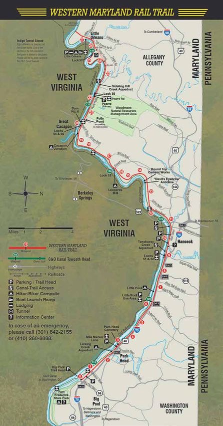
Welcome to Maryland State Parks! South Mountain
Recreation Area
21843 National Pike, Boonsboro, MD
South Mountain Recreation Area 301-791-4767
Interim Park Manager Mark Spurrier
With five state parks in the midst of a 13,000-acre forest, the South Mountain Recreation
Area is open for adventure year-round! Featuring boating, swimming, fishing, hiking, mountain Asst. Park Manager Michael Burditt
biking, camping, and picnicking, Greenbrier State Park is the perfect place to get your blood Park Maintenance Program Supervisor
pumping or just relax and unwind. Maryland's approximately 40 miles of the Appalachian Timothy Trembly
National Scenic Trail follows the length of the South Mountain ridgeline, beckoning hikers Lead Ranger Chris Todd
for a day trip or an overnight excursion. Gathland State Park presents the unique history of Office Supervisor Philip Hurline
Civil War correspondent George Alfred Townsend, whose estate now houses two museums,
South Mountain Cover Photo by Tammy McCorkle
and you can walk in the footsteps of soldiers who fought in the first major Civil War battle
in Maryland at South Mountain State Battlefield. At Washington Monument State Park,
climb to the top of the first monument honoring George Washington for unrivaled views of
the mountain and valley. Be sure you have the necessary skills, knowledge and equipment Fort Frederick
for a safe, environmentally respectful visit, and enjoy your time in the great outdoors at the
South Mountain Recreation Area!
State Park Complex
11100 Fort Frederick Road, Big Pool, MD
301-842-2155
Fort Frederick State Park Complex
Park Manager Ranger Jacob Doyle
We are very pleased to have you as our guest within the three parks that comprise this
Asst. Park Manager Ranger Bob Study
Potomac River heritage corridor. The park complex consists of Fort Frederick State Park, the
Western Maryland Rail Trail (WMRT), and Woodmont Natural Resources Management Area Maryland Park Service Ranger Robert Ambrose
(NRMA). The park complex headquarters is at Fort Frederick. Please join us for an historical Maryland Park Service Ranger Jeremiah Corbin
interpretive program at the fort, a bike ride along the paved WMRT, and hunting and hiking Administrative Specialist Betsy Mellott
at Woodmont Natural Resources Management Area (NRMA). At Fort Frederick State Park
Fort Frederick Cover Photo by Frank Ceravalo
Complex, we hope that you will come for the history and stay for the day!
Park Watch 800-825-PARK
TABLE OF CONTENTS Central Reservation 888-432-CAMP
Leave No Trace.......................................................6 Hunting Policy and Land Maps.............................17 parkreservations.maryland.gov
Appalachian Trail....................................................7 Fort Frederick State Park......................................18 General Information 800-830-3974
Greenbrier State Park.............................................8 Fort Frederick State Park Map..............................19
TTY users call via the MD Relay
Greenbrier State Park Trail System Map..................9 Fort Frederick Walking Tour...................................20 866-804-7846
Greenbrier Campgrounds and Map.......................10 Williams Family - African-American
Call Center International 410-500-9901
South Mountain State Heritage Walking Tour...........................................21
Battlefield and Map.............................................11 dnr.maryland.gov
Friends of Fort Frederick.......................................22
Gathland State Park.............................................12 Western Maryland Rail Trail..................................23
Washington Monument State Park........................13 Woodmont Natural Resources Published by
Herald-Mail Media
South Mountain Recreation Area Map............ 14-15 Management Area................................................24
South Mountain State Park..................................16 Wildlife and Fishing, Pets Policy...........................25 Lisa Tedrick Prejean Editor
Jessica Strope Graphic Artist
Colleen McGrath Chief Photographer
EMERGENCY AND 24-HOUR CONTACT INFORMATION Additional photography courtesy
of park staff members
Emergency Assistance Call 911
For Park Ranger Information or Assistance, Call the Park Ranger For advertising information,
contact your Herald-Mail Media
South Mountain Fort Frederick sales representative or
call 301-791-7177.
Recreation Area State Park Complex
Park Office 301-791-4767 Duty Ranger 443-805-1759 © 2021 Herald-Mail Media
All rights reserved by copyright. This book or parts
For 24-Hour Assistance or to Report a Violation, thereof may not be reproduced in whole or in part
without the express written consent of the publisher.
Call the Natural Resources Police The cover, design, format and layout of this publication
410-260-8888 OR 1-800-825-7275 are trademarks of Herald-Mail Media.
For additional copies, call 301-791-4767.
THE NATURAL RESOURCES POLICE IS THE PRIMARY LAW ENFORCEMENT AGENCY FOR MARYLAND STATE PARKS.
EXPLORE 2021 SOUTH MOUNTAIN RECREATION AREA AND FORT FREDERICK STATE PARK COMPLEX | 5
EXPLORE LEAVE NO TRACE
LEAVE NO TRACE
Enjoy the outdoors and Maryland State Parks responsibly
PLAN AHEAD AND PREPARE MINIMIZE CAMPFIRE IMPACTS
• Prepare for extreme weather, hazards and emergencies. • Campfires are prohibited at Annapolis Rock. At all other
Call 800-825-PARK or 911 if you have an emergency. designated campsites, use established fire rings.
• Schedule your trip to avoid times of high use. • Keep fires small.
• Be aware of hunters. Hunting is heaviest from • Use only timber found on the ground;
late September through January, and April through May. do not cut live vegetation.
Wear bright-colored clothing during hunting seasons. • Burn all wood or coals to ash, put out campfires completely,
TRAVEL AND CAMP ON DURABLE SURFACES then scatter cool ashes.
• Stay on designated trails and camp only on RESPECT WILDLIFE
designated campsites. • Observe wildlife from a distance. Do not follow,
DISPOSE OF WASTE PROPERLY approach or feed.
• Pack-it-in, pack-it-out. There are no trash cans • Store food and trash securely. Black bears frequent
in Maryland State Parks. South Mountain. Hang food in bear bags.
• Deposit solid human waste at campground privies, • Control your pets. Dogs must be leashed.
or in 8-inch deep cat holes.
BE CONSIDERATE OF OTHER VISITORS
• Dispense liquid waste (urine, dishwater) at least
• Respect other visitors and protect the quality of their experience.
200 feet away from springs and streams.
Avoid raising your voice and (making) loud noises.
• Trash should not be placed in privies.
• Be courteous. Yield to other trail users.
• Pack out toilet paper and hygiene products.
• Repackage food to minimize waste.
APPALACHIAN TRAIL SPECIFICS
• Travel in small groups. Avoid groups larger than
LEAVE WHAT YOU FIND 10 participants for overnight trips, and groups larger than
• Preserve the past. Examine—but do not touch—cultural 25 participants for day trips.
or historic structures or artifacts. • Use a map. The Potomac Appalachian Trail Club’s Maps 5 and
• Leave rocks, plants and other natural objects as you find them. 6 are ideal for traveling the Maryland portion of the A.T. Copies
• Avoid introducing and/or transporting non-native species. can be purchased at Greenbrier and Washington Monument
• Avoid building structures, furniture or state parks.
digging trenches. • Camping is allowed only at designated trail shelters
and campgrounds.
• The Appalachian Trail is for foot traffic only.
• Follow official blazes. The A.T. is marked by white blazes,
side trails by blue. Avoid bushwhacking your own trail or
following abandoned roads.
• Shelters and campsites are intended for backpackers
or hikers.
• Maximum of six people per regular campsite.
• Maximum of 10 people per group campsite.
• Overnight hikers will be limited to a maximum two-night stay at
any shelter/campsite area.
Learn more at lnt.org.
6 | EXPLORE 2021 SOUTH MOUNTAIN RECREATION AREA AND FORT FREDERICK STATE PARK COMPLEX
EXPLORE APPALACHIAN TRAIL
DON’T MISS THESE A.T.
POINTS OF INTEREST
(Distances in miles between features)
Mason-Dixon Line
0.2
Pen-Mar Park
2.9
High Rock
1.8
*Raven Rock Shelter
1.0
MD Route 491
(Raven Rock Hollow)
0.8
Warner Hollow Road
1.5
MD Route 77
1.2
POPULAR A.T. DAY HIKES *Ensign Cowall Shelter
0.2
Amazing Views and Historic Sites Provide MD Route 17
Great Destinations for a Day Hike 4.7
*Pogo Memorial Campground
Washington Monument Return Options: Return by same trail or leave a 1.3
(elevation 1,500 feet) second car at Weverton Road (one mile south of Black Rock
Access Point: U.S. 40 parking lot, 1/4 mile east Weverton Cliffs on A.T.). 1.0
of Greenbrier. Follow blue-blazed trail from parking Highlights: Weverton Cliffs offers a view of the *Annapolis Rock Campground
lot to white-blazed A.T. Turn left to go south Potomac Valley near Harpers Ferry, WV. 1.6
(cross I-70 foot bridge). *Pine Knob Shelter
Annapolis Rock (elevation 1,700 feet)
Difficulty: Moderate • Distance: 3 miles (one way) 0.6
Access Point: U.S. 40 parking lot, 1/4 mile east of
Return Options: Return by same trail to U.S. 40 I-70 Footbridge/Route 40
Greenbrier. Follow blue-blazed trail from parking lot
or leave a second car at Washington Monument 2.9
to white-blazed A.T. Turn right to go north.
State Park. Washington Monument
Difficulty: Moderate • Distance: 4.4 miles
Highlights: The first monument to George Washing- 2.0
(round trip)
ton offers views to the east and west. U.S. Route Alternate 40
Return: Return by same trail to U.S. 40. (Turners Gap)
Weverton Cliffs (elevation 750 feet) Highlights: Annapolis Rock offers a view of Green- 0.2
Access Point: Gathland State Park brier Lake and the Cumberland Valley. *Dahlgren Backpackers
Difficulty: Strenuous • Distance: 6 miles (one way) Campground
0.8
Reno Monument Road
APPALACHIAN NATIONAL SCENIC TRAIL (Fox’s Gap)
1.0
Explore the Mountain’s Challenging, Scenic Terrain *Rocky Run Shelter
1.8
on this National Treasure of a Trail Lambs Knoll/White Rock
3.2
THE APPALACHIAN TRAIL — a 2,190-mile strength. *Crampton’s Gap Shelter
footpath across Appalachian Mountain ridge- Maryland’s 40 miles are considered easy by A.T. 0.4
lines from Georgia to Maine — was envisioned standards, with only a 1,650-foot change in ele- Gathland State Park
in 1921 by Benton MacKaye, a forester and vation from the low point at the Potomac River to (Crampton’s Gap)
self-styled philosopher. Thousands of volunteers, the high point at High Rock. Following the South 3.7
many legislators and the Civilian Conservation Mountain ridgeline, it offers plenty of challenges *Ed Garvey Shelter
Corps made the trail a reality by 1937. Many and impressive scenery. For beginning back- 2.1
hikers use the trail today for short day hikes or packers or those getting in shape, the entire A.T. Weverton Cliffs
overnight backpacking adventures, and hundreds in Maryland can be hiked in three or four days, 0.9
tackle the entire journey, which requires exten- with trail shelters and backpacker campgrounds Weverton Road
sive planning and incredible physical and mental spaced about a day’s hike apart. 0.5
C&O Canal Towpath
HELP FOR THE HIKE To learn more about the A.T. and plan your trek, visit: (east end)
2.6
Appalachian Trail Conservancy
appalachiantrail.org C&O Canal Towpath
National Park Service (west end) and Footbridge
nps.gov/appa to Harpers Ferry
Potomac Appalachian Trail Club
patc.net *Designated Campsites
EXPLORE 2021 SOUTH MOUNTAIN RECREATION AREA AND FORT FREDERICK STATE PARK COMPLEX | 7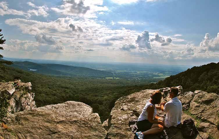
EXPLORE GREENBRIER STATE PARK

GREENBRIER STATE PARK
Discover the Full Range of Fun,
All In One Great Park
Located in the Appalachian Mountains,         PETS: Pets on leashes are allowed
with a portion of the Appalachian Trail       in Greenbrier State Park in the
passing through the park’s eastern edge,      following areas:
Greenbrier is a multi-use park offering a     • Pets on leashes are allowed in the day-
range of recreational opportunities. The        use and lake area from the day after
manmade freshwater lake offers swim-            Labor Day to the day before Memorial
ming, sunbathing, boating and fishing           Day Weekend.
opportunities, and hiking trails meander      • Pets on leashes are allowed in the
through a variety of wildlife habitats and      Cedar and Dogwood camp loops.
spectacular views. Picnic tables, grills      • Pets on leashes are allowed on
and playgrounds are available in the            trails outside the day-use and
day-use area.                                   lake area (access from outlying parking
                                                areas).
SWIMMING: A 1,000-foot beach and
swim area that gradually reaches a            WILDLIFE: The park is home to abun-
depth of six feet leaves plenty of shallow
                                              dant wildlife. Bring your camera and        DAY USE SERVICE CHARGES
                                              guide books, but please respect the                                                                          WEEKEND & HOLIDAY
water for children to play in Greenbrier’s                                                         DATE                   WEEKDAY MARYLAND
                                              animals. Do not disturb!                                                                                         MARYLAND
44-acre fresh water lake. Lifeguards
monitor the beach and swim area daily         HUNTING: Greenbrier has a 500-acre              October – April                   $3/vehicle                       $3/vehicle
from Memorial Day through Labor Day.          hunting area. A Maryland hunting license
                                              and knowledge of the Maryland hunting         May & September                     $3/vehicle                       $3/person
Restrooms, showers and changing rooms
                                              seasons are required. There is no hunting       Memorial Day –
are available.                                                                                                          $3/person                 $5/person
                                              on Sundays. The Natural Resources Po-         Labor Day Weekend
PICNICKING: Greenbrier features               lice monitor hunters closely, so be sure                    Additional $2 for out-of-state residents
hundreds of picnic sites with tables and      your weapon is unloaded in the safety       • Maryland State Park Passport (good at any Maryland State Park):
grills. Sites overlook the lake and are       zones and near your vehicle. Remember
                                                                                            $75*/$100
convenient to restrooms. Rent one of our      that hikers may be unaware of hunting
                                              seasons.                                    • Gazebos: $106.25 per day, including non-refundable $6.25
four lake-front gazebos for group picnics
                                                                                            reservation fee. Gazebos can be reserved by calling
— they seat up to                             ACCESSIBILITY: The Visitor Center             1-888-432-2267 or online at parkreservations.maryland.gov
32 people.                                    and all restrooms in the beach area at
                                              Greenbrier State Park are accessible to                For Maryland State Park Passport information visit
BOATING: Bring your own boat (electric                                                                        dnr.maryland.gov/publiclands
trolling motors only) or rent paddleboats     the mobility impaired. The beach plaza
                                                                                                    *Maryland resident discount; additional fees for out-of-state residents
                                              allows easy access to the beach and
by the hour during the summer.
                                              shower house. Beach wheelchairs are
FISHING: With an appropriate Maryland         available at no charge on a first-come,
fishing license in possession, you can
fish for trout, bass or blue gill. Children
                                              first-served basis.                         PLAN YOUR VISIT
                                              VISITOR CENTER: Explore exhibits on
15 or younger do not need a fishing                                                       • Alcohol is prohibited in the entire park
                                              South Mountain’s wildlife, history and
license. Free Fishing Days: first two         the Appalachian Trail. Park staff will be   • Greenbrier is a “Trash-Free Park.” Take your trash home
Saturdays in June and July 4. No license      happy to answer your questions. The Vis-      with you; bring bags and plan accordingly to reduce waste.
is required to fish in any of Maryland’s      itor Center is open weekdays year round     • Bus groups must make prior reservations. Buses are not permitted on
fresh waters on                               and weekends in the spring                    summer weekends and holidays.
these days.                                   and summer.                                 • Greenbrier often fills to capacity on summer weekends and holidays.
                                                                                            If the park fills, all additional visitors will be turned away (no
                                                                                            exceptions). To ensure entry, all party members are encouraged to
                                                                                            arrive at the park early.
                                                                                          • Baptisms at Greenbrier Lake are strictly prohibited between
                                                                                            10 a.m. and 6 p.m. every day from Memorial Day weekend through
                                                                                            Labor Day. Prior written approval is needed for
                                                                                            baptisms at all other times.
                                                                                          • Metal detectors are permitted on the sandy beach and in the
                                                                                            swimming area only. From the Friday of Memorial Day weekend
     • Sales • Service/Repairs • Shuttle Service                                            through Labor Day, metal detectors are prohibited from 9 a.m. to
                                                                                            dusk. Metal detectors may not be used elsewhere in the park.
     • Rentals: Bicycles, Canoes & Kayaks                                                                                                         Greenbrier State Park
     • Pedal & Paddle Day Trips                                                                                                    c/o South Mountain Recreation Area
                                                                                                    21843 National Pike, Boonsboro, MD 21713 | 301-791-4767
     • Experience riding a FAT BIKE or ELECTRIC                                                   dnr.maryland.gov/publiclands/Pages/western/greenbrier.aspx
       BIKE on the historic C&O Canal trail.
8 | EXPLORE 2021 SOUTH MOUNTAIN RECREATION AREA AND FORT FREDERICK STATE PARK COMPLEX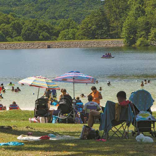
EXPLORE GREENBRIER STATE PARK TRAIL SYSTEM MAP
BARTMAN HILL TRAIL
Blaze Color: Light Blue          HIT THE TRAILS
Distance: 0.6 mile               Mountain bikes are welcome on all Greenbrier
Difficulty: Strenuous. Steep     State Park trails except on the face of the dam,
trail connects Visitor Center
                                 on a section of un-blazed trail between the
to Appalachian Trail (A.T.).
Turn left on the A.T. to go      Rock Oak Fire Trail (blue) and the dam, and the
north or right to go south.      Bartman Hill Trail. Bikes are NOT permitted on
                                 the Appalachian Trail.
BIG RED TRAIL
Blaze Color: Red                 Pets are not allowed within the developed
Distance: 4.5 miles              areas the day before Memorial Day weekend
Difficulty: Strenuous. The       through Labor Day. Pets on leashes are
longest trail in the park, Big   welcome on the trails and on the A.T. Hikers
Red is a complete circle with    with pets must use Mountain Laurel Road
many access points.              and Greenbrier Road parking lots May–Sept.
CAMP LOOP TRAIL                  Several Greenbrier trails are in public
Blaze Color: Orange              hunting lands. The most popular hunting
Distance: 1 mile
                                 seasons are Sept.–Jan. and April–May. Wear
Difficulty: Moderate.
Adding a short section of
                                 bright colors during these times.
the Big Red Trail makes
this a 1.5 mile loop.
Hilly by the lake.
COPPERHEAD TRAIL
Blaze Color: Green
Distance: 0.4 mile
Difficulty: Moderate.
Parallels a section of
the Big Red Trail.
GREEN TRAIL
Blaze Color: Green
Distance: 0.8 mile
Difficulty: Moderate.
Loop trail starting at the
Visitor Center. Good for
beginning hikers.
MARKED MILE
Blaze Color: White Arrows
Distance: 1 mile
Difficulty: Easy. Follow white
arrows on paved surfaces in
the day use area for exactly
a mile walk. Starts at the
“X” near the Visitor Center.                                                                                     Tollbooth

ROCK OAK FIRE TRAIL
Blaze Color: Blue
Distance: 1.5 miles
Difficulty: Moderate.
Parallels Snelling Fire Trail.
Includes one steep section.
SNELLING FIRE TRAIL
Blaze Color: Silver
Distance: 1 mile
Difficulty: Moderate.
Fairly flat; steep section
in the middle.
WATER TANK TRAIL
Blaze Color: Yellow                                                                  Ev
                                                                                    Yo ergr
Distance: 2.5 miles                                                                   uth ee
                                                                                         Ca n
                                                                                            mp
Difficulty: Moderate. Runs
from Camper Registration
Office to the Green Trail.

                                        EXPLORE 2021 SOUTH MOUNTAIN RECREATION AREA AND FORT FREDERICK STATE PARK COMPLEX |                       9
EXPLORE GREENBRIER CAMPGROUNDS AND MAP

GREENBRIER CAMPGROUND                                                                                                      CAMP HOSTS
Connect with Family and Nature Camping
Under the South Mountain Stars
                                                                                                                   WANTED
                                                                                                                            • Help maintain the park
                                                                                                                            • Make campers feel at home
                                                                                                                            • Help with special events
                                                                                                                              and programs
                                                                                                                            • Have a good time!
                                                                                                                           In exchange for 20 hours of
                                                                                                                           volunteer work per week,
                                                                                                                           camp hosts receive a free
                                                                                                                           campsite with full hook-ups
                                                                                                                           and a sense of community
                                                                                                                           with Greenbrier State Park.

                                                                                                                           Call 301-791-4767
                                                                                                                                to apply.

                                                                                                                maryland.gov. Campsite costs range
                                                                                                                between $26 and $40 per night;
Greenbrier features 165 developed                               dumpsters. Camping is open from early           weekend, holiday, non-resident and
campsites in a mountain forest setting.                         April through late October. Pets on leashes     electric premiums apply. Alcohol is
The campground includes four loops,                             are permitted in the Cedar and Dogwood          prohibited in the campground and
each with its own central shower building.                      loops only.                                     throughout the park. Quiet hours start
Each campsite has a driveway, a space                           Campsites allow for a maximum combined          at 10 p.m.; check out is 1 p.m.
for trailers or tents, a picnic table, lantern
                                                                trailer and vehicle length of 30 feet.          During the week (Sunday after 1 p.m.
holder, and a fire ring. Each campsite
can accommodate up to six people. Ash                           CAMPSITE RESERVATION                            through Friday before 3 p.m.) visitors are
Loop is closest to the lake. Cedar Loop                         Call 888-432-CAMP between 8 a.m.                welcome to tour/preview the Greenbrier
includes electric hook-ups. The camp                            and 8 p.m. Monday–Friday, or reserve a          campground after registering their vehicles
area has a central dump station and                             site online anytime at parkreservations.        with the Camp Office staff.

                                                                                                     To Lake
                                                                                                                                       il
                                                                                                                                 Tra
                                                                                                                          side
                                                                                                                   Lake

                                                       r a il
         N                                  Lo o p T
                                     Camp
                                                                                                                             Gate
  W             E
                                                                                                           ASH
         S
                                                                                            BIRCH
                                                                                                                 Speed Limit is 10 MPH in Camp Areas

                                                                            CEDAR                              Dogwood Campground           Restroom
                                                                                                               Cedar Campground             Water
                                                                                                               Birch Campground             Ampitheater
                                                                             Pet-Friendly
                                                                                                               Ash Campground               Parking
                                                                                                               Camp Host                    Visitor Center
                                                                                                               Amphitheater Parking         Dump Station
                                                                                                               Evergreen Youth Camping

                                   DOGWOOD
                                       Pet-Friendly

10 | EXPLORE 2021 SOUTH MOUNTAIN RECREATION AREA AND FORT FREDERICK STATE PARK COMPLEX
EXPLORE SOUTH MOUNTAIN STATE BATTLEFIELD AND MAP
SOUTH MOUNTAIN
STATE BATTLEFIELD
A Crucial Battle Echoed Through the
Mountain Gaps in the Lead-Up to Antietam
The Battle of South Mountain was perhaps the most decisive part of Gen. William B. Franklin did not begin an attack by his Union VI Corps until late
Confederate Gen. Robert E. Lee’s failed first attempt to invade the Union afternoon — a delay that cost the Union a chance at dividing the Confederate
— and perhaps one of the most decisive events in the American Civil War. forces.
A Confederate victory on northern soil might have compelled Great Britain By nightfall on Sept. 14, 1862, the Maryland Campaign changed for Lee
and France to intervene on the South’s behalf, and persuade a war-weary and the Army of Northern Virginia from an offensive incursion to a defensive
North to negotiate a peace settlement. A Southern victory might have secured withdrawal. Although the Battle of South Mountain was a Confederate tactical
Confederate independence. defeat, the Union’s failure to lead a full-scale attack early in the day allowed
Following his victory at 2nd Manassas, Lee’s invasion of the Union (also known Lee to summon reinforcements. On Sept. 15, Lee fell back to Sharpsburg to set
as the Maryland Campaign) began Sept. 4, 1862, when a portion of the up a defensive position along Antietam Creek.
Army of Northern Virginia crossed the Potomac River near Leesburg, Va., and The first major Civil War battle in Maryland, the Battle of South Mountain,
advanced toward Frederick, Md. As the Confederates moved westward across shaped events that resulted in the bloodiest one-day battle in American history
South Mountain toward Hagerstown, the Army of the Potomac under Union Gen. when, three days later, on Sept. 17, the armies clashed during the Battle of
George B. McClellan left Washington, D.C., in pursuit of the invaders. Antietam.
Everything went according to Lee’s plan until Sept. 13, when the Federals Send mail c/o South Mountain Recreation Area
reached Frederick and Union soldiers found a copy of Lee’s Special Order No. 21843 National Pike | Boonsboro, MD 21713
191. The famous “Lost Order” revealed that Lee’s army was divided, with only a 301-791-4767
few regiments in Boonsboro watching the mountain gaps. dnr.maryland.gov/publiclands/Pages/western/southmountainbattlefield.aspx
Fought Sept. 14, 1862, the Battle of South Mountain broke out in the Fox’s
Gap and Turner’s Gap areas after Confederate gunners opened fire on Federal
forces moving toward the base of the mountain. Charges and counter-charges
continued here throughout most of the day. Further south at Crampton’s Gap,
ORO
Visiting Hallowed Ground BO O NSB Washington 1 ael Rd
Monument 1 Mich
State Park
The South Mountain battlefield is a remarkable historic, natural, Frostown Gap
Monumen
King Rd
Fros
tow
and recreational resource. In addition to being the site of the nR
d
Milt ers Rd
m
t Rd
Sum
first major Civil War battle in Maryland, it includes valuable farm 2 Turner’s Gap
2
Rd
and forestland and is home to diverse wildlife. Only here does
r
abo
M
the Appalachian National Scenic Trail intersect a major Civil War
ye
Reno Monume Mt T
rsv
nt Rd
Old Hager
ille
battlefield. The battlefield also serves as a shrine to the memory
Fox
Rd
d
G
of the approximately 6,100 soldiers who were killed, wounded and 3
ll R
3
ap R
17
Kno
Fox’s Gap
s town
missing that day.
d
r Rd
b’s
va
ol i
Lam
B
A large portion of the battlefield is privately owned. Please respect 67
ALT
40
Rd
the property rights and privacy of our friends and neighbors when Marker Rd
touring the battlefield. OWN
MIDDLET
Battlefield preservation is an ongoing, expensive process. untain Churc
Mo h Rd
Two-thirds of the battlefield remains unprotected. Assistance is Ho
lte
needed to prevent encroaching development from forever snuffing rR
d
Old Middletown
out this unique landscape. To learn more about how to help save the 17
battlefield, call the South Mountain State Battlefield office at 301-
Rd
432-8065 or visit the Maryland Department of Natural Resources’ Townsend Rd
Arnoldstown
Rd vil
le
tts
website. ki
Mtn Church Rd
Rd
Gathland r
State Park Bu
4
4
Crampton’s Gap
Gapland Rd Gap
SOUTH MOUNTAIN STATE BATTLEFIELD
lan
Old Middl
dR State Parks U.S. Highway
d
Bro State Highway
ad R South Mountain
VILLE
BURKIT TS
un State Park
POINTS OF INTEREST
Cities/Towns State Road
etown Rd
Rd
Appalachian Trail Parking
351
383
Miles
17 0 1.25 2.5 5
2 Turner’s Gap
1 Washington Monument State Park A major thoroughfare in the area during the 4 Crampton’s Gap
The Washington Monument Visitors Center Civil War, the National Road crosses the 3 Fox’s Gap (Gathland State Park)
features exhibits covering the history of the mountain here, at one of the three major Wayside exhibits discuss the battle in this Two museums explore the literary
nation’s first completed monument to honor gaps involved in the battle. The Mountain area. Monuments dedicated to the men who career of George Alfred Townsend, War
George Washington, a summary of the 1862 House hugs the road and was a focal fought here include two devoted to generals Correspondents, and the Battle of South
Maryland Campaign, and a fiber-optic map point during the battle. It still operates as killed during the battle: Union Major General Mountain. Interpretive wayside exhibits
presenting an overview of the Battle of a restaurant today (South Mountain Inn). Jesse Reno, commander of the Ninth Army highlight points of interest from the
South Mountain. Visit the monument itself, Wayside exhibits explain the battle around Corps, and Confederate Brigadier General battle. The War Correspondents Memorial,
which was used as a Union signal station the gap, where the famous Iron Brigade Samuel Garland, commander of a North constructed by Townsend after the war,
during the Civil War. earned its name. Carolinian brigade. stands at the park entrance.
EXPLORE 2021 SOUTH MOUNTAIN RECREATION AREA AND FORT FREDERICK STATE PARK COMPLEX | 11EXPLORE GATHLAND STATE PARK
GATHLAND STATE PARK
Nature and Architecture Combine
in Mountain Estate Honoring
Civil War Correspondents
While researching his novel, Katy of Catoctin, George Alfred
Townsend — the Civil War’s youngest field correspondent and one
of late-19th century America’s most important journalists and
novelists — became captivated by beautiful Crampton’s Gap, site
of a September 1862 Civil War battle. He purchased 100 acres
on the ridge of South Mountain and built his estate. Townsend
often wrote under the pen name “GATH,” which he derived from
adding an “H” to his initials “G.A.T.,” and the estate is now Gathland’s pavilion is available for reservation by calling 888-432-
Gathland State Park. CAMP or visiting parkreservations.maryland.gov. Reservation cost
During the Civil War, Townsend reported on the events from the is $76.36 per day. Alcohol permits are available for this pavilion
Union side. He covered the Peninsular Campaign in 1862, then and are available through the reservation service for $35.
lectured in Europe before returning to report on the war’s end.
A popular syndicated columnist and novelist, Townsend fashioned The Appalachian National Scenic Trail passes through
himself as a Renaissance man and was an unabashed self- Gathland State Park. You can hike the A.T. from Maine to Georgia
promoter. Race horses, pocket knives, a line of cigars as well as a or for just a few miles. If you are planning an overnight backpack
post office all bore his pseudonym. outing, you can park at Gathland State Park for a few days.
In establishing his estate, he included a monument to honor
war correspondents, artists and photographers. The War
Gathland State Park Send mail
Correspondents Arch — a monument 50 feet high and 40 c/o South Mountain
The museums are open in spring,
feet across built in 1896 — is a national historic monument summer and fall, and by request. Recreation Area
administered and maintained by the National Park Service. Two 900 Arnoldstown Road 21843 National Pike
buildings from Townsend’s estate survive and now serve as Jefferson, MD 21755 Boonsboro, MD 21713
Gathland State Park’s museum. The museum features many 301-791-4767
artifacts from Townsend’s life, career and estate, as well as dnr.maryland.gov/publiclands/
artifacts from the Battle of South Mountain. Pages/western/gathland.aspx
12 | EXPLORE 2021 SOUTH MOUNTAIN RECREATION AREA AND FORT FREDERICK STATE PARK COMPLEXEXPLORE WASHINGTON MONUMENT STATE PARK
WASHINGTON MONUMENT STATE PARK
A Monument to Our First President Provides
Stunning Views and an Activity-Packed Park
In 1827, the citizens of Boonsboro became the first to complete
a monument in honor of George Washington. According to a
period newspaper account, on July 4, 1827, at 7 a.m., most of
PHOTO BY: SCOTT CANTNER
Boonsboro's 500 inhabitants assembled at the public square.
Behind the Stars and Stripes and stepping spiritedly to the music
of a fife and drum corps, they marched two miles up the mountain
to the monument site. The citizens worked until noon and then held
a dedication ceremony and lunch. They resumed work and by 4
p.m. the monument stood 15 feet high on a 54-foot circular base.
The day ended with the reading of the Declaration of Independence
and a three-round salute fired by three Revolutionary War veterans.
The workers returned that September to complete the monument,
at a finished height of 30 feet. During the Civil War, the Union
Army pressed the monument into service as a signal tower. The
monument fell into disrepair, and the Civilian Conservation Corps
(CCC) restored it in 1936. FEES AND RESERVATIONS
Visitors today can take in panoramic views of four states from Entrance Fee: $2* Maryland Park Passport: $75*
the top of Washington Monument, which anchors a park featuring *Maryland Resident Discount • Additional fees for
hiking, picnicking, camping, bird watching, and a museum. Most of out-of-state residents
the Washington Monument's hiking trail is part of the Appalachian Fort Necessity Picnic Shelter $61.36/day (Shelter capacity: 55)
National Scenic Trail. Hikers planning an overnight backpack outing Youth Group Camping Areas: No charge with MPS Youth Group Pass
can park at Washington Monument State Park for a few days
To reserve campsites or shelters, call 888-432-CAMP or visit
(park in the lower lot only and sign the hiker log book). Day-hikers
parkreservations.maryland.gov. Alcoholic permits are available for this
can trek north for 3 miles to Greenbrier State Park or go south to
shelter and are available through the reservation service for $35.
South Mountain State Battlefield and Gathland State Park. Pets on
Call the park office at 301-791-4767 for help planning your visit.
leashes are welcome on the Appalachian Trail and in Washington
Monument State Park. Washington Monument State Park
Picnic sites with tables and grills are available, and families or The museum is open in spring, summer and fall, and by request
groups can rent one of the two pavilions. The park includes a 6620 Zittlestown Road | Middletown, MD 21769
multi-purpose field for pick-up games and playground for children. 301-791-4767
The monument is an ideal site for spotting migratory birds like dnr.maryland.gov/publiclands/Pages/western/washington.aspx
hawks, eagles and falcons; peak time is mid-September. The
monument museum features historical artifacts related to the Send mail c/o South Mountain Recreation Area
history of Washington Monument and the Battle of South Mountain. 21843 National Pike | Boonsboro, MD 21713
Washington
Monument
PHOTO BY: BILL WANTZ
ad
Museum Park
ent Ro
Road
Monum
Park Wash
ingto
Office n Mo
nume
nt Ro a
d
d
own Roa
Private
Residence
Zittlest
Overnight N
Hiker’s
Parking
W E
S
Path to Playground/Field Trail
Monument
Picnic Area Appalachian Trail Youth Group Site 1
Parking Parking Lot Paved Youth Group Site 2
Picnic Pavilion Building Youth Group Site 3
Restroom Road Youth Group Site 4
EXPLORE 2021 SOUTH MOUNTAIN RECREATION AREA AND FORT FREDERICK STATE PARK COMPLEX | 13Pennsylvania
Pe
418
n
64 M
60
ar
Rd
418 High Rock
Rd
d
ck
Ro
e
11
gh
Pik
Rock R
Hi
550
ar
rsh
M
60
n
Ma
Raven
Pe
81
Raven Rock
Le Shelter
ite 64
rsb
ur Raven Rock
Pennsylvania Av
g
e
Sm
i th
491
60 sb
62 ur
g
Rd
e
58
Av
BUURRGG Catoctin
ac
l Rd
m
MITHSSB
SSM Mountain
to
oo
40
Po
Park
Sch
144
uk
TOWN 66
64
H AG ERS 64
uira
Jefferson Blvd
Q
77
11 Ensign Cowall Shelter
Wolfsville Rd
Ave
inia
Virg
Dr
Rd
65
lls
r
ALT
Fa
40 Cunningham
ye
t al
632 40
me
Falls State Park
rys
Pogo
C
ttle
66
Backpacker
Sto
70 camp 17
White O
ak Rd
Wolfsv
ille
Black Rock
Rd
d eR
lk Rd
Wolf
Frederick
Annapolis Rock
Loy
65 40 Municipal
nt Wa
a
Forest
68 na
Le
Pleas
Mt
Mt Len
San M a Rd
ar Rd
Pine Knob 17
Harp
66 Greenbrier Shelter
d
State Park
H i ll
eR
Rd
Mountain Laurel Rd
vill
lfs
68
ALT
Wo
Ke
40
ad
le
Rd
65 Rd
Rd
n 70
ai
nt Ca
na
ou d
M
dstone
aH
roHi
o
i
ll D
nsb d
Gr
Boo r
tR Mo
num
en ent
Rd
Ha
u m
rm
ORO on VILLE
B O O NSB M
ony
M YERS
Rd
Washington
Monument
34 State Park
n
40
to
M
King Rd
ing
ye
Antietam
sh
rsv
National Dahlgren
Wa
ille
Backpacker
Camp
Rd
Battlefield
Reno Monument Rd
Fox
Ga
17
Po
Rocky Run Gambrill
p Rd
rte
Shelter d State Park
d rR
r st
oa va
URG ll R
K no B o li
b’s
ow
SH A RPSB 67 Lam
n
ALT
Marker Rd
Rd
40
Bu
rn
sid
White Rocks
eB
ri
d TOWN
Mt.
MID DLE
ge
Br
70
Bidle Rd
Rd
untain Churc
Mo h Rd RICK
iar R
d
Ho
lte
FR EDE
h Rd
Rd rR
Marker
Tr
Qu d
eb
eg
Rd
Rd
o
ec
n
S ch
Rd
ove
tai
17
oo
d
in Churc
un
R lR
d
ut Gr
ds
o Mo
oo
Arnoldstown cW
Chestn
Treg
ni
Mounta
Rd c
Crampton’s Gap Pi
Shelter
Rd
Gathland
r r y Rd
ove
State Park
rs Fe
t Gr
stnu
Harpe
Che
180
Bro
ILLE ad R
un
Old Middl
C&O Canal BURKITTSV 15
Rd i ke
nP
Historical rso
Ga
383
ffe
Je
etown Rd
National pla
n dR
Park d
Rd
y
17
rr
351
Fe
67
Bro
ers
ad R
un Rd
arp
H
180 15
Ed Garvey
Shelter
Rd
340 Maryland Parking
rton
Harpers Ferry Rd
ne
ri
National N State Parks State Highway
Ho
Weve
Historical Park
Weverton Cliffs South Mountain AT Points of
State Park Interest
Weverton Rd W E
464 Cities/Towns State Road
180
s Rd 464 Appalachian Trail Interstate Highway
ock
t of R
West Poin S Shelters U.S. Highway
351
17
85
Virginia Miles
Virginia 0 1.25 2.5 5
C&O
C ANALEXPLORE SOUTH MOUNTAIN STATE PARK
SOUTH MOUNTAIN STATE PARK
Explore a Landscape Teeming with Wildlife,
Scenic Vistas and History
South Mountain State Park is a 40-mile-long multi-use state park disturb! South Mountain is also along the Eastern Flyway, a
weaving along the South Mountain ridge from the Pennsylvania migration route for hawks, eagles and owls.
line to the Potomac River. The park has no distinguishable Maryland’s portion of the Appalachian National Scenic Trail is
situated along the ridge top of South Mountain State Park. The
boundary or entrance facility but is accessible at a number of A.T. is perfect for a variety of hikes and experience levels: You
locations. Most of the park is only accessible by foot. can make a simple day hike, an overnight backpack trip or a
South Mountain State Park’s 13,000-acre forest is home to a multi-night excursion part of your South Mountain adventure. Use
a detailed Appalachian Trail map to plan your outing, available
wide variety of wildlife, including black bears, meadow voles, for purchase at Greenbrier State Park. South Mountain features
whitetail deer, raccoons, rat snakes and opossums. Please be several impressive scenic vistas, including High Rock, Black
respectful to the wildlife; keep your distance and do not Rock, Annapolis Rock, White Rock and Weverton Cliffs, which are
all accessible from the A.T.
WE RENT SOLUTIONS In addition to its natural significance, South Mountain has been
influenced by several historic figures, including
General Edward Braddock, George Washington, William McKinley,
RU $2 OFF
20 lb. Refill PROPANE
Rutherford B. Hayes, Robert E. Lee, George B. McClellan, and
George Alfred Townsend.
READY! Exp. 9/30/21
South Mountain State Park
Home • Industrial • Contractors PROPANE REFILLS The South Mountain State Park Office
Mon-Sat 7AM-5:30PM is located at Greenbrier State Park.
• Motor Homes
5 Locations
HAGERSTOWN FREDERICK Send mail c/o South Mountain Recreation Area
• Gas Grill Tanks
Sharpsburg Pike 36 Thomas Johnson Dr. 21843 National Pike | Boonsboro, MD 21713
240-420-0200 301-663-9200 • Heater Tanks 301-791-4767
dnr.maryland.gov/publiclands/Pages/
877-RU-RENTS (787-3687) rentalsunlimited.com western/southmountain.aspx
16 | EXPLORE 2021 SOUTH MOUNTAIN RECREATION AREA AND FORT FREDERICK STATE PARK COMPLEXEXPLORE HUNTING AND HUNTING LANDS MAPS
HUNTING Observe Safety Zones and
Respect Private Property
South Mountain State Park includes Black Rock Hunting Lands, Gathland
Hunting Lands and Lambs Knoll Hunting Lands. A Maryland hunting license and
knowledge of the Maryland hunting seasons are required. THERE IS NO HUNT-
ING ON SUNDAYS. Access is limited, so be prepared to hike long distances. To
improve your hunting experience, scout out the areas prior to hunting season.
You may use the Appalachian Trail to access the hunting areas, but the Appa-
lachian Trail Corridor is a non-hunting area. You cannot hunt until you are 150
yards away from the Trail in either direction. Hunting is not permitted on Federal
land.
Make sure your weapon is unloaded in the safety zones and also while hiking to
your destination through non-hunting areas. Respect private property. Off-road
motorized vehicle use is strictly prohibited.
Remember that many hikers using the A.T. may be unaware of hunting sea-
sons. Boundaries are marked with yellow paint. A yellow line indicates you are
looking into state property; a yellow dot indicates you are looking into private
property.
To learn more about hunting on public lands, hunting licenses and education
programs, visit dnr.maryland.gov/huntersguide/Pages/default.aspx
For hunting maps of South Mountain Recreation Area, call 301-791-4767
RD
OWN
N AVE
66
®
17
APPLET
RD
PADE
ER
R
KING RD
LS D
MOS
L FAL
STA
E
AV
CRY
AN
IC BUCK
66 BL SKIN
PU CT
RE
REP
UB
L ICA
N AVE
WN RD
DR
CLEVELANDTO
LS
BLOSORAN
FAL
SO GE
TAL
MOSER RD
M CT P RD
YS
X GA
CR
FO
SAFETY RENO MONUMENT RD
ROYS LN
ZONE RENO MONUM MO R
RENO
ENT RD NU ENO
LT
MEN
PO TR
N DS D
VVIL
LE R
E Y RD
D
D
V A LL
R RD
FE R
BLACK ROCK
SP COLD
REEDE
WOL
ANT
RING
PLEAS
RD
L OY
AMOS
TROY
LAMBS KNOLL
LN
REN
FOX
G A RF
OM
GAP
ON
IE L
UM
RD
RD
D
HUNTING
EN
66
DR
GA
TR
LLS
D
L FA
RF
E LD
RD
I
STA
HUNTING
CRY
JUG
TOW
D
ER
NR D
LIN
BOLIVAR
CT
NK
AREA
JOH
AR RD
AREA
BOLIV
RD
LFE
66
WO
D
CARTER
WAY
LO Y
reek
R
NE
MT
aC
S LN
SAFETY
KLI
AE
Aetn
TN DR RT
JOHN
AR BE
ZONE
Mt
RO
LE
D 17
OO
OT
OT
VIEW
Harman Branch
OO
TER
L
Dry R un
WAL
ED
RD
R
Mt Ae
17
LL
tna C
HA
reek
a Creek
Aetn
RD
RK
Mt
MT AE EY
PA
CRYSTAL FALLS DR
T
BAIL
RD
NA
66 MT AET
DR
NA
RD
RD
OINT
SMITH
C
RD
A
HIGHP
BOLIV
PARK HALL
ADEMY DR
AR RD
LN
AC A DEMY LN
GE
IE
OG
AS
BO
LIN
DR
ek
Cre
er
av
Be
Y RD
RR
LOY W OL F E RD
BE
SP
reek
MART
RA
IN R
rC
LOCUST
SAFETY ZONE
D
ve
a
Be 66
GROVE RD
DR
Safety
Sa fe ty Zone
Zone
LS
FAL
SI
NES
TAL
HANNAH
LN
YS
LN
CR
ES
BIDL
LN
W
Dry R un
HIT
RD
VIOLET RD
CK BL EO
AC AK
N RD
RO
KR RD
RTI
OW
OC MA
BLA
MEAD
CK R O
KL
BLACK R "
N
OCK RD
K RD BAGTOWN KR
D
C
E RD
ENBURG HOLLOW RD
C
K RO
HA
W OLF
BLAC
YES
BLAC
KR
RD
MAR
L OY
WO
BL
KER
OC
AC
BRAND
KR
LF
K RO VI
RD
LL
S
CK
D
70 RD
D
ER
TTL EMEYER RD
RIDEN STOTTLEMYER RD
OUR R
D MOUNTAIN
ySAFETY Zone
RD
R CHURCH
TD Safety
Safettty Zo ne
ZONE 17
S
STO
RE
W OL LE RD
AC
F S V IL
ILD
RD
CH
VE
RO
CRYSTAL FALLS
G
LK RD
W IN
ST
LL RD
DR
WA
DO NTA
CU
SAN T
RD
W ILD CAT RD
LO
MEA OU
PLEA
HARP HI
M
YER
D OG RD
ME
TLE
DR
OT
ST
FE RD
67
L
Y WO
40
LO
MAIN
RUBLE RD
D
ST
MARKER RD
ER
QUEBEC
D
BL
SCHOOL
R
RD
RU
EA
WILDCAT
eek
RD
Little Catoctin Cr
RD
STAL FALLS DR
ST
ALK
AY
TW
P HILL RD
DW
AN
ER D
EW
MT AS
MOUNTAIN CHURCH
PLE
LAN
IN
AY R
LE
GC
NA
D
HAR
WOO
T
CRY
RD
D
OLD
TR
D
YR
OL
LEY
D
RD
AR R
A
RD
RD
LN
NM
RKER
SA S
TE
MT EA
RD
MA
LENA
T WALK
RD
PLEASAN
SAN MA
RIER RD
R RD 40
GR
EEN
BENT WILLO
W RD
GREENB
EL RD
BRIE
RD
LAUR
R
70
TAIN
MOUN
! 67 STONE
ROW LN
Annapolis
RU EAR
N PL
Rock
CL
SAFETY OO
DS
RD
SAFETY ZONE NIC
W
PIC
Safety
S
ZONEZone
affe tty
y Zo n
ARNOLDTOWN RD
SC
VE
RA
LR ARNO
D LDTOW
D N RD
KR
LAUREL RD
" TW
AL TOWNSEND RD
CHUR TAIN
CH RD
AN
AS
P LE
MOUN
MOUNTAIN
TO
W
NS
EN
D
40 RD
RD
K EA
DLE R
DAY
D
EAST ER
KE
AD 70
RD
LE
RD
DSTONE RUN
CA
NA
DA
17 P
HIL
GA
LR
CT
IN
D
RD
GR
IN
GREENBRIER SP TA GUARD CT
UN 40
MO
RO USGS TNM - National Structures Dataset; USGS TNM - National Transportation Dataset; TomTom Commercial Roads; U.S. Census Bureau - TI GER/Line; USGS TNM - National Boundaries Dataset; USGS TNM - Geographic Names Information System;
BO
NS USGS TNM - National Hydrography Dataset
O
BO
EXPLORE 2021 SOUTH MOUNTAIN RECREATION AREA AND FORT FREDERICK STATE PARK COMPLEX | 17EXPLORE FORT FREDERICK STATE PARK
FORT FREDERICK STATE PARK
The centerpiece of Fort Frederick State Park is a unique stone fort that Historical Interpretation and Reenactor Events are all
served as Maryland’s frontier defense during the French and Indian tentative as of the date of this publication. Please see our
War. Built in 1756, the Fort’s stone wall and two barracks have been website for an up-to-date Calendar of Events.
restored to their 1758 appearance. Historic exhibits are in the Fort,
barracks, Civilian Conservation Corps (CCC) Museum, and Visitor
Center. The fort barracks are open seven days a week from Memorial
Day to Labor Day and on the weekends in the spring and fall, when
staff and volunteers dress in period clothing and occupy the fort,
demonstrating daily life in the 18th century. The 585-acre park borders
the Potomac River and The Chesapeake and Ohio Canal passes
through the park. The park also features a boat launch, campsites,
camp store, fishing, flat water canoeing, hiking trails, a playground, a
picnic area and small pavilion. Group tours are available seasonally.
Facility Service Charge: $3 per vehicle for MD residents. $5 per
vehicle for out-of-state visitors. Please pay at one of the honor boxes
located in the picnic area or the store parking lot near the fort. You
may also pay at the Visitor Center or Captain Wort’s Store.
General Park Hours: April 1-October 31 (8 a.m.-Sunset)
November 1-March 31 (10 a.m.-Sunset) • Closed: Christmas Day
Camping: Family camping at Fort Frederick State Park is available
on 29 sites. Sites include: a picnic pad with stone dust surface; a
picnic table; a fire ring with grilling grate attached; a lantern post with
small wooden countertop area. There are no electric sites, and the
restrooms in the vicinity are portable toilets. Flush toilets are located
near Capt. Wort’s Sutlery and are available throughout your stay.
Tent camping is available April through October. Camping is available
year round for self-contained units. Family campsites may be reserved
through the reservation system, however walk-ins are also welcome
on a first-come first-served basis. ALL CAMPING EQUIPMENT
MUST BE PLACED ON THE STONE DUST PAD.
Four youth group campsites are available for organized youth groups
aged 16 and younger. These sites must be reserved either online or
through the park office. To obtain a two-year youth group pass, please
apply online at: dnr.maryland.gov and search “youth group pass.”
To make pavilion or youth group camping reservations, call Park
Reservations at 1-888-432-2267. Or make your reservation on the
internet: parkreservations.maryland.gov
Fort Frederick State Park
Potomac River Family Camping Potomac River
Steps to River located behind Sites # 2 & 8 Steps to River for Youth Groups
Site # 1 2 3 4 5 6 7 8 9 10 11 12 13 14 15 16 17
Youth Group
Camping Area
Campground Road to Youth Group Camping Area
Site # 29 28 27 26 25 24 23 22 21 20 19 18 Y1
Y2
Woods
Campground Road
Woods
Woods
Y4 Y3
Beaver
Pond
Area reserved for Youth Groups Only
Canal
Bridge Williamsport, MD C & O Canal Towpath Trail Hancock, MD
Map Not to Scale
- Denotes Handicapped Site
Big Pool Lake
- Porta Pots (April - October)
18 | EXPLORE 2021 SOUTH MOUNTAIN RECREATION AREA AND FORT FREDERICK STATE PARK COMPLEXEXPLORE FORT FREDERICK STATE PARK EXPLORE 2021 SOUTH MOUNTAIN RECREATION AREA AND FORT FREDERICK STATE PARK COMPLEX | 19
EXPLORE FORT FREDERICK WALKING TOUR

FORT FREDERICK WALKING TOUR
1. Stone Wall ~ This wall is the fort’s main defense. It is built
   of local rock and is three layers thick. The outside layer is
   mainly limestone with a rubble layer between. It measures
   four feet thick at the bottom and tapers to two feet thick at
   the top. At its highest point, the wall measures roughly 22
   feet high. British engineers designed the fort for the Colony of
   Maryland. As a guide, the engineers used the design of French
   engineer Sebastian de Vauban. His design was very popular in
   European forts and was modified for different environments in
   the colonies. Many American- and English-built forts followed a
   similar design but were built of logs and earth. Fort Frederick is
   designed as a large square with four diamond-shaped bastions
   used for defensive purposes. The wall is made of stone, rather
   than wood, which allows the fort to be very secure.
2. Fort Gate ~ Large wooden doors are the only entrance to
   the fort and were closed except when a supply wagon came
   through. Individuals were allowed to enter through a smaller
   door known as a wicket gate. This gate allowed the guard to
   watch people entering the fort. If an enemy was trying to get in,
   he could be pushed back, the door closed, and block anyone
   else from entering. The main gate had a row of spikes to
   discourage anyone from climbing over.
3. West Barracks ~ This building shows the life of the common
   soldier. Governor Sharpe set up the fort to house 200 men              8. Bastion and Catwalk ~ The catwalk in the fort was built by the
   easily and 400 if needed. The barracks are large for the 18th             Civilian Conservation Corps in the 1930s. It is not known what
   century. Typically, frontier forts did not have two-story buildings,      kind of defenses were inside Fort Frederick. There is no proof
   white clapboard siding, double porches and glass windows. The             that there were ever catwalks inside the fort. There is evidence
   floor plan was open except for a sectioned-off area on each               that two of the bastions had earth ramps. The bastion
   end for camp followers’ living space. The camp followers were             defenses allowed soldiers to fire over the wall at attackers.
   women hired by the army to cook for the officers, do laundry,             Each bastion had one six-pound cannon. Bastions improved the
   sew, clean and do nursing duties. The enlisted men would have             fort’s defenses by allowing the artillery to have a broad range
   done their own cooking in groups of 6-8 men. The Barracks                 of fire and by putting crossfire on attackers who might attempt
   were rebuilt in 1975 for the bicentennial. The barracks are               to attack the wall. There is some evidence that the northeast
   open when staff in 18th-century clothes are present.                      bastion had an earth-covered powder magazine.
4. Governor’s House ~ This building, represented by the stone             9. CCC Museum ~ The Civilian Conservation Corps (CCC) built
   outline, was the officers’ quarters. Governor Horatio Sharpe              this building in the 1930s for the park store and museum. The
   stayed in this building several times as he supervised the                building does not look like any building from the 18th century.
   construction of Fort Frederick and commanded the fort in                  Today, it houses exhibits about the CCC.
   the summer and fall of 1758. The large diamond shape in                10.Captain Wort’s Store and Outbuildings ~ The Civilian
   the middle of the east wing shows a central chimney with a                Conservation Corps (CCC) built these buildings in the 1930s
   fireplace in each room. It appears there were no fireplaces               as the Park Superintendent’s Residence, which now serves
   in the west wing and could indicate this side was used for                as the park store. The outbuildings included a barn, carriage
   storage. The middle rooms were used as the fort’s office and              house and blacksmith shop.
   officers’ dining area. In May 1757, Wahachey of Keowee (near
   Clemson, S.C.) and 62 Cherokee Warriors came to the fort. In
   a meeting held in the Governor’s House, the Cherokee agreed
   to help Maryland in the fight against the French and their
   American Indian allies.
5. Parade Ground ~ The parade ground between the fort’s
   buildings was used for troop inspection, drill and review. The
   area inside the fort encloses about two acres, a large size for a
   frontier fort.
6. East Barracks ~ This building and the one across the parade
   ground were the enlisted men’s quarters. This building now
   shows officers’ quarters, grand hall, armory, store house,
   laundry and kitchen on the first floor, which would have been in
   the Governor’s House historically. The second floor shows other
   areas, including a hospital and doctor’s quarters, Indian trade
   good storehouse and timeline museum.
7. Well ~ By building the well inside the fort, the garrison’s water
   supply could be protected. Since the Potomac River was a half-
   mile south of the fort, a well supplied the men with water for
   drinking, cooking and laundry.

20 | EXPLORE 2021 SOUTH MOUNTAIN RECREATION AREA AND FORT FREDERICK STATE PARK COMPLEX
EXPLORE WILLIAMS FAMILY - AFRICAN-AMERICAN HERITAGE WALKING TOUR

WILLIAMS FAMILY - AFRICAN-AMERICAN
           HERITAGE WALKING TOUR
From 1860 until 1911, the fort was owned by the Nathan Williams           8. Other Points of interest:
family. The Williamses were free African-Americans. The family            Western Maryland Railroad ~ This railroad crossing is part of the
had been held as slaves until Nathan’s father, Samuel, purchased          former Western Maryland Railroad, and is an active spur line for
the family’s freedom in 1826. By 1847, Nathan would purchase              CSX today. The Western Maryland Railroad began construction in
his wife, Ammy from bondage. The Williamses made a prosperous             1852 but did not reach Big Pool until 1882. It offered passenger
farm on the site. In 1876, Nathan was named trustee of “Fort              and freight service and was an economic catalyst for local farmers.
Frederick Colored School,” which operated off and on until 1909.          C&O Canal ~ Construction began in 1828. By 1852, it was
Two of Nathan’s children served as teachers for the school.               completed from Georgetown to Cumberland, Md. Some of the
1. Visitors’ Center and Kiosk ~ At the visitors’ center, watch an         laborers used to build the canal were enslaved people. Tradition
   orientation movie about the fort‘s history and view an exhibit         states it was part of the Underground Railroad. The canal opened
   about the Williams family. The kiosk located in the parking lot        up commerce, trade and travel both east and west. This was
   features historical information on the fort and the Williams family.   accomplished by overcoming the mountains with a series of locks
   The visitors’ center is near the site of the Charles Williams farm.    which raised and lowered canal boats. The Williams’ family would
   Charles was Nathan William’s son and a school teacher.                 have been intimately familiar with the canal workers and using the
                                                                          canal as a source of trade.
2. First House Site & Civil War Trails Markers ~ From about
   1857 to 1909, the Williams family resided on this site. The            Potomac River ~ The river was the original source of trade and
   restored foundation might be from the kitchen of the house.            travel for early settlers. By the 1800s, it was an obstacle to be
   According to period sources, the house was considered a                overcome for north/south trade. Ferries were established along
   “mansion.” A period image of the house contradicts that                the river; the closest being at McCoy’s Ferry and Cherry Run.
   sentiment as the house appears to have had two stories, no             During the Civil War, the river would be the dividing line between
   porch, and no more than six rooms. The house was destroyed             two nations and the front line of that war. Nathan Williams, a
   by fire in 1909. During the Civil War, Union officers occupied the     Virginian by birth, knew and traded with people who lived in
   house for their quarters, and Ammy Williams cooked for them.           Virginia. He did not let the war stop him. He would take goods and
                                                                          cross the river with his wagon and trade with soldiers and civilians
3. Second House Site ~ On this site stood the second home built           in the Confederacy. Upon his return to Maryland, he would give
   by the Williams family. It was built in 1909 and was raised            information to Union soldiers stationed around Fort Frederick.
   by the Civilian Conservation Corp in 1934. It was a two-story
   frame house with a wrap-around porch and had four to eight
   rooms.
4. Cannon Hole ~ According to Nathan Williams, Union soldiers
   knocked a hole in the wall in 1861, to fire a cannon through at
   Confederates across the Potomac River in Virginia. Historical
   documentation places Union artillery at the fort in 1861 and
   1862. In 1931, the Daughters of the American Revolution
   placed a Confederate Civil War cannon at the hole, it is
   currently displayed in the Visitors’ Center.
5. Fort Interior ~ Williams took advantage of the ruined walls of
   the fort and used the area inside for many purposes, including
   a pig sty, orchard and vineyard.
6. Northwest Bastion / Bank Barn ~ Around 1860, Nathan
   Williams dismantled the northwest bastion and built a bank
   barn here, recycling a lot of the wall’s stone in its construction.
7. “Fort Frederick School for Colored’s” ~ In 1876, Nathan
   Williams was named trustee of the “Fort Frederick School
   for Colored’s.” This school was the second school built in
   Washington County for the education of African-American
   children. The school appears to have been in several buildings
   and locations, including Charles Williams’ house before the
   current building was built. The school consisted of three rooms,
   one classroom and two offices or closets. It has been altered
   several times during its life span. This building was built about
   1899 and used as a school periodically until 1909. Two of
   Nathan Williams’ children, Charles and Betty, were teachers at
   this school. The school building was sold by the county in 1914
   and became a private residence.

                                  EXPLORE 2021 SOUTH MOUNTAIN RECREATION AREA AND FORT FREDERICK STATE PARK COMPLEX |                            21
You can also read


