3THAMES CHASE, BEAM & INGREBOURNE - ALL LONDON GREEN GRID
←
→
Page content transcription
If your browser does not render page correctly, please read the page content below
All      Thames Chase, Beam & Ingrebourne

                3
London   Area framework
Green
Grid
Contents
1       Foreword and Introduction
2       All London Green Grid Vision and Methodology
3       ALGG Framework Plan
4       ALGG Area Frameworks
5       ALGG Governance

6       Area Strategy
8       Area Description
9       Strategic Context
12      Vision
14      Objectives
18      Opportunities

20      Project Identification
22      Project update
24      Clusters
26      Projects Map
28      Rolling Projects List

32 Phase Two Delivery
34 Project Details

50 Forward Strategy
52 Gap Analysis
53 Recommendations

55      Appendices
56      Baseline Description
58      ALGG SPG Chapter 5 GG03 Links
60      Group Membership

Note:
This area framework should be read in tandem with
All London Green Grid SPG Chapter 5 for GGA03 which
contains statements in respect of Area Description,
Strategic Corridors, Links and Opportunities.
The ALGG SPG document is guidance that is
supplementary to London Plan policies. While it does
not have the same formal development plan status as
these policies, it has been formally adopted by the Mayor
as supplementary guidance under his powers under
the Greater London Authority Act 1999 (as amended).
Adoption followed a period of public consultation, and a
summary of the comments received and the responses of
the Mayor to those comments is available on the Greater
London Authority website. It will therefore be a material
consideration in drawing up development plan documents
and in taking planning decisions.
The All London Green Grid SPG was developed in parallel
with the area frameworks it can be found at the following
link: http://www.london.gov.uk/publication/all-london-
green-grid-spg .

Cover Image: The river Rom near Collier Row
Foreword
           As a key partner, the Thames Chase Trust welcomes
           the opportunity to continue working with the All
           London Green Grid through the Area 3 Framework.

           The previous framework can be credited with enabling
           the delivery of a significant number of projects,
           regenerating local landscapes to enhance the
           quality of life of local people. These projects include
           Dagenham Washlands with it’s environmental and
           access improvements; Ingrebourne Hill, a restored
           landfill providing access and recreational facilities
           for local communities; the wider Ingrebourne Valley
           Project, linking community engagement, with             Ann Bartleet
           conservation and enhancement of this unique natural Chair
           landscape; Wildspace, the major new Thames-side         Thames Chase Trust
           park including public access and restoration of
           Rainham, Wennington and Aveley marshes; and
           Connect 2 linking Harold Hill to the River Thames with
           a continuous pedestrian and cycle path forming part
           of the National Cycle Network.

           There are also many projects for which design and       The Trust believes that the Green Grid can engage a
           feasibility stages have been completed and where        wide range of partners using the common vocabulary
           delivery funding is now being sought: Bretons Bridge,   of Sustainable Development. By bringing planners,
           Hornchurch Country Park to Belhus Woods Country         developers, government, industry and communities
           Park Greenway and the A1306 to Hornchurch Country       together, we can deliver mutual benefit and added
           Park Link.                                              value to our projects. By adopting these principles,
                                                                   we believe we can do more for our landscape, our
           The Trust recognises that there are great challenges    environment and our communities.
           ahead, particularly with funding constraints on both
           the development and management of green spaces.
           There is now clear evidence that an enhanced natural
           and built environment can generate benefit to the
           local economy. We must use this argument to support
           the case for continued investment in green space
           projects.

           We also need to find ways of building financial
           sustainability into projects, such as has been
           achieved by the Land Trust at Dagenham Washlands,
           where an endowment structure guarantees the
           future management costs of the park. The concept
           of productive landscapes also offers the potential
           for new financial models for investment and
           management of green spaces.

           To realise these aspirations we must build on our
           partnership approach. The work already delivered
           within the Thames Chase Community Forest has
           demonstrated the effectiveness of partnership
           working, in particular in delivering benefits across
           local authority boundaries.
                                                                                                                      1
Introduction – All London Green Grid Vision and Methodology
Introduction                                            Area Frameworks                                            Partnership - Working
The various and unique landscapes of London are         Area Frameworks help to support the delivery of            Strong and open working relationships with many
recognised as an asset that can reinforce character,    the All London Green Grid objectives. By identifying       partners are key to delivering the All London Green
identity and environmental resilience. Delivered        how the All London Green Grid can be delivered at          Grid. By setting out strategic objectives and
alongside existing infrastructure such as transport,    the landscape scale and across administrative              opportunities at the sub-regional level, the Area
utilities and schools an enhanced network of open       boundaries. To achieve this they;                          Frameworks help to encourage and facilitate existing
spaces and green infrastructure can serve to            − establish a comprehensive baseline understanding         and new partnerships that involve regional and local
shape and support new and existing communities,            of each area                                            government; government agencies; regeneration and
respond to the challenges of climate change, support    − define a vision, area objectives and strategic           environmental organisations; private green space
economic development and deliver an improved               opportunities for each area                             managers; and the green space jobs and skills sector.
quality of life.                                        − ensure that sub-regional and strategic projects
                                                           interface with Borough level planning, regeneration,    The Green Grid process includes the formation of
The All London Green Grid ihas been developed to           transport and open space strategies and                 Area groups, to implement the Green Grid vision,
provide a strategic interlinked network of high quality    processes                                               objectives and projects, at the landscape scale.
green infrastructure and open spaces that connect       − identify the resources required and form bidding         By utilising and expanding existing structures and
with town centre’s, public transport nodes, the            strategies to deliver the funding for strategic         forming new groups where they do not exist already,
countryside in the urban fringe, the Thames and major      projects                                                11 ALGG area groups have been established across
employment and residential areas. This approach has − consolidate resources, coordinate efforts and                London. A London-wide Project Board and a Working
been extremely successful in accelerating delivery of      facilitate partnership working                          Group provides the strategic management structure
green infrastructure in East London through the East − support the preparation of Delivery Strategies              for the ALGG project.
London Green Grid (ELGG).                               − address the recommendations of the Drain London
                                                           research project and ensure that the possible flood
Policy 2.18 of the London Plan (July 2011), promotes       and surface water management opportunities are
the provision of an integrated green infrastructure        incorporated within the ALGG.
network and supports the extension of the Green Grid
to the whole of London.                                 ALGG Area Frameworks expand on the implementation
                                                        points and strategic opportunities identified in the All
The ALGG objectives are to:                             London Green Grid Supplementary Planning Guidance
− adapt to climate change and promote urban             to the London Plan. Subject to boroughs agreement
   greening                                             ALGG Area Frameworks can also form part of Local
− increase access to open space                         Development Plans, Development Plan Documents
− increase access to nature, and to conserve and        and or Joint Area Action Plans.
   enhance biodiversity
− improve sustainable travel connections
− promote healthy living
− conserve and enhance heritage features and
   landscape character
− enhance distinctive destinations and boost the
   visitor economy
− promote sustainable design, management and
   maintenance
− enhance green space and green infrastructure
   sector skills
− promote sustainable food production
− improve air quality and soundscapes
− improve the quality of and access to the Greenbelt
   and the urban fringe
− conserve and enhance the Thames and its
   tributaries riverside spaces

2
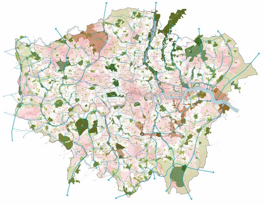
Introduction – ALGG Framework Plan

The map above illustrates the strategic Framework                                                         Strategic Corridors               District Parks
Plan for the All London Green Grid SPG to the
London Plan. The composite drawing illustrates                                                            Strategic Links                   Local Park and Open Spaces
open space typologies, open space deficiency and                                                          Metropolitan Park Opportunities   Small Open Spaces - Pocket Parks
primary transport corridors. It identifies strategic                                                      Regional Park Opportunities       Other / Private Open Spaces
opportunities for the Green Grid area.
                                                                                                          Regional Parks                    Strategic Walking Routes
Map derived from GiGL data 2011 - © Crown Copyright and database right 2011. Ordnance Survey 100032216.   Metropolitan Parks                Strategic Cycling Routes
                                                                                                                                                                               3
Introduction – ALGG Area Frameworks
London Plan
Policy 2.18
All London Green Grid Companion Document
Supplementary Planning Guidance Delivery Plan
ALGG vision, Strategic objectives,
Rationale, Recommendations
Thames Chase Beam and Ingerbourne
South East London Green Chain Plus
River Cray and Southern Marshes
Epping Forest and Roding Valley
Brent Valley and Barnet Plateau
Now absorbed in Areas 2 and 3
ALGG Area Frameworks
Lea Valley and Finchley Ridge
Development Frameworks
River Colne and Crane
London’s Downlands
London Plan OAPFs
Arcadian Thames
Central London
Wandle Valley
Borough LDF / AAPs
Infrastructure Plans
Open Space Strategies
investment frameworks
Major capital programmes
1 2 3 4 5 6 7 8 9 10 11 12
Major funding bids
update and extend new Area Frameworks
Area Frameworks have 4 Sections
Section 1 Section 2 Section 3 Section 4
Area Strategy Project Identification Phase Two Delivery Forward Strategy
This section examines the context A schedule of project suggestions for The results of the area’s project The area chair and design advisor
and baseline conditions, to propose consideration by the area group, design review and assessment, identifying summarise a particular delivery and
a vision, area objectives and a set of advisor and working group. Including the projects which best deliver the funding strategy to take forward the
area strategic opportunities in line with interventions to be delivered through strategic objectives, as well as those first phase of delivery.
the ALGG SPG. Together these form a development, and those requiring site which are feasible and deliverable.
framework for future change, project acquisition. Each project is mapped Thereby constituting a next phase of
development and evaluation. and described in a rolling project list. delivery.
4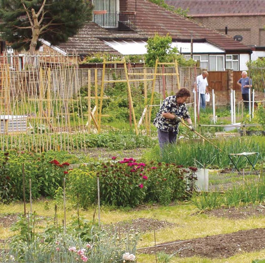
Introduction – ALGG Governance

The ALGG SPG proposes that London be divided
into eleven Green Grid Areas as illustrated above.
The formation of ALGG Area steering groups bring                                                          1   Lea Valley and Finchley Ridge        7    London’s Downlands
together the London boroughs, representatives of                                                          2   Epping Forest and River Roding       8    Wandle Valley
partner agencies and other stakeholders to develop                                                        3   Thames Chase, Beam and Ingrebourne   9    Arcadian Thames
and implement the Green Grid vision, objectives and
projects, area by area.
                                                                                                          4   Is now absorbed in Area 2 and 3      10   River Colne and Crane
                                                                                                          5   River Cray and Southern Marshes      11   Brent Valley and Barnet Plateau
Map derived from GiGL data 2011 - © Crown Copyright and database right 2011. Ordnance Survey 100032216.   6   South East London Green Chain Plus   12   Central London
                                                                                                                                                                                          5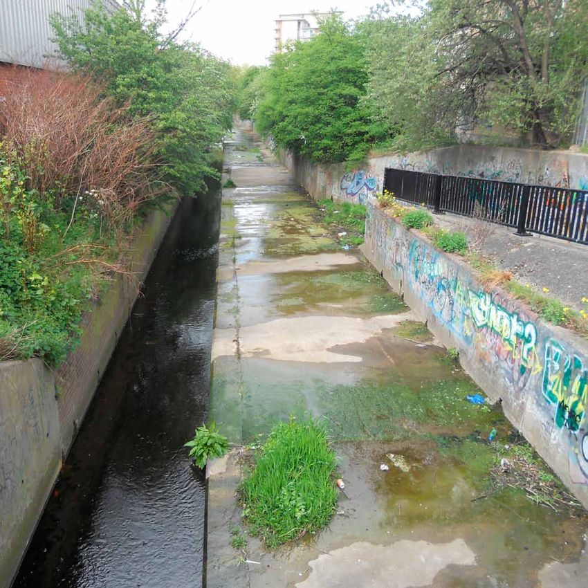
Looking across Havering and Dagenham to the Thames and beyond

6
Area Strategy

This section examines the local and
strategic context to establish a distinct
vision and set of objectives for the
area. These have been developed to
establish a framework for future change,
project development, evaluation and
prioritisation.
                                        7
Area Strategy – Area Description
Area Description                                          The Plain also contains country parks and areas of        Open Space Links
The Fairlop, Beam and Ingrebourne Green Grid Area         gravel extraction and landfill. The Seven Kings water     The Ravensbourne River Link follows the
includes the boroughs of Barking and Dagenham,            runs through the plain but is largely culverted and is    Ravensbourne River through the residential area of
Redbridge and Havering. The area includes three of        hidden from view.                                         Emerson Park north of Hornchurch, past Hornchurch
the landscape character zones identified by Natural                                                                 Sport Centre and through Harrow Lodge Park. There
England. The Natural Signatures of each of the relevant  Open space in and around Dagenham is a mosiac of           is currently no public access to the river where it
landscape zones are as follows:                          large scale parks set in urban residential mass. There runs through the residential area. The river is heavily
                                                         are significant barriers to north / south and east / west engineered and for the most part lacks any green
Essex Plateau                                            connectivity including road and rail infrastructure and corridor.
Mosaics of ancient woodland, wood pasture and acid       ‘lost’ river corridors. The urban areas present relatively
grassland within the former royal hunting ‘forests’ at   few opportunities to plant trees.                          The London Riverside Link includes the Barking Reach
Epping Forest and Havering.                                                                                         development site and the Dagenham Docks Industrial
                                                         Thames Chase Community Forest covers part of the           Estate. A number of ditches and small water courses
North Thames Terraces                                    area. The Beam River valley is predominantly flat, open run through the area which provide an important
Flat, open grassland, stepping up from the Thames,       flood plain with sparse tree cover, although there are     habitat for water voles, birds and vegetation. The
with narrow sinuous strips of woodland marking the       pockets of woodland and scattered trees in the parks. Thames itself is an important east-west linkage for
alignment of tributary creeks.                           Lack of access to the watercourses is a key issue as       wildlife with London’s widest mudflats, a UK priority
                                                         well as degradation of existing watercourses.              habitat which supports important numbers of
Lower Thames Floodplain                                                                                             overwintering birds.
A vast, flat riverside zone of grazing marsh grading to The Ingrebourne valley is a gently sloping landscape
reedswamp, mudflats and the wide tidal Thames – the at the eastern edge of Hornchurch and Romford with              The Goresbrook Link follows the Goresbrook River
most striking and immediately visible natural element a predominantly rural/urban fringe character. Access from Parsloes Park in Barking and Dagenham, through
in London.                                               along the edge of the Ingrebourne River is good, with      Goresbrook Park, the industrial and commercial
                                                         the London Outer Orbital Path running almost along         development between the A13 and the railway line,
Up until the early twentieth century the area was        its full course. The wetland valley through Hornchurch and along the eastern boundary of the Barking Reach
strongly rural with small village communities whose      Country Park is spectacular and regionally important       development site before reaching the River Thames.
livelihood was based on market gardening and             for wildlife. North of Upminster, the Ingrebourne has      There are only two sections of this link where there
livestock farming. From the 1920’s onwards major         steeper valley sides, the river meanders more and land is public access to the river: Goresbrook Park and
housing and industrial developments completely           use consists mainly of pasture and arable fields. The the southern end of the link adjacent to the River
changed this pattern.                                    land is relatively unspoilt, unlike the lower river valley Thames and Horse Shoe Corner. The river is buried
                                                         which has been affected by gravel extraction and           underground in a culvert through Parlsoes Park, is
The area to the north of the A13 is now characterised    landfill.                                                  more natural through Goresbrook Park but is artificially
by clusters of post-war housing often in surprising                                                                 straight and is poor to the south of the A13, suffering
proximity to landfill sites, many of which are now       Rainham, Wennington and Aveley Marshes in the south from its post industrial setting.
disused and in various stages of re-naturalisation.      east of the Green Grid Area form the Inner Thames
One example of this is Eastbrookend Country Park and Marshes SSSI. This area comprises flat grazing
the surrounding housing clusters at Dagenham and         marshes of grassland and reed beds, intersected by
Elm Park. Significant housing areas where economic       a network of ditches and provide an important wildlife
investment is being targeted by the Borough’s include habitatfor many species of animals and plants. The
Harold Hill, and the Mardyke Estate. In general, access central part of the SSSI is a raised area of salt water
to green space is good although the quality and level of dredging beds that are now declining in use. The
management within these spaces is very varied.           London Riverside Conservation Park (Wildspace)
                                                         will comprise the marshes and the adjacent restored
South of the A13 has a more industrial character         landfill. Wildspace will be a regional visitor destination
interspersed with areas of marsh land while the outer promoting access to nature and to open space and
fringes to the east and north, include open countryside contribute to the regeneration of London Riverside.
where farming and rural industries take the place of     The park will be the culmination of the work of a
urban industry and post-war housing. There are major partnership that includes public and private sector
opportunities for job creation in existing and new       organisations.
enterprises within the London Riverside area.
The land north of the A118 is mainly flat arable land,
with large open fields, such as Fairlop Plain.
8
Area Strategy – Strategic Context
Strategic Context
This map illustrates the development context for Area
3 ALGG network. Information has been collected from
the Unitary Development Plans of
Havering and Redbridge, the Open Space Strategy and
landscape framework of Barking and Dagenham.
The Environment Agency’s recommendations for river
restoration are also mapped.
Within the Thames Chase, Beam and Ingrebourne
area the direct relationship with the Green Arc Study
area, the South Essex Green Grid and the extension
of the Thames Chase Community Forest into Essex
to the north and east reveals the potential to merge
the All London Green Grid projects with other ongoing
initiatives.
The map also identifies strategic and local connections
across the framework area that will create new links
between existing and proposed open spaces.
Green Open Spaces
Town Centres
Strategic Employment Land
Strategic Housing Land Availability
Strategic (Regional) Walking Routes
London Cycle Network - Existing
London Cycle Network - Proposed
Map derived from GiGL data 2011 - © Crown Copyright and database right 2011. Ordnance Survey 100032216.
9Area Strategy – Strategic Context London Borough of Havering Havering is the third largest borough in London, to the north east of London, the borough sits on the rural Essex fringe. The borough has a large proportion of elderly residents over 65, this is expected to decrease in the next ten years due to the increase in new households. However this will be counterbalanced by an increase in the very elderly, those over 85. The Core Strategy identifies the need to provide environments accessible for both the elderly and those with young children. Much of the borough is bordered by Green Belt and there are three SSSI’s within the borough boundary including the Inner Thames Marshes which the Core Strategy has identified as of importance for improving informal recreation opportunities in open space and countryside. London Borough of Barking and Dagenham Historically the population of Barking and Dagenham has been fairly stable and predominantly white however predictions indicate the population will rapidly increase by around 60,000 and become more ethnically diverse in the next 15 years. The borough is the 9th most deprived in London. The principal areas of growth are identified as Barking Riverside, Dagenham South and Barking Town Centre. The Joint Strategic Needs assessment identified improving health as a significant challenge in the area. The Core Strategy identifies improvements to existing open spaces to enhance user satisfaction through environmental enhancement, water management and flood protection, connectivity between parks via tree lined streets, wildlife corridors, cycle routes and enhanced biodiversity particularly along the banks of the River Roding and River Thames. Redbridge The population of Redbridge is expect to grow by around 13% in the next 10 years. The Borough is relatively diverse with some of the most ethnically diverse wards in London. The population density is slightly lower than the London average. The Core Strategy identifies a Green Environment as strategic policy setting out an approach to protecting open spaces and promoting nature conservation and providing recreational areas for residents and visitors. This has informed an approach to urban development that is intensified in centres such as Ilford and Gants Hill thus preserving Green Belt land. A third of the Borough is designated as Green Belt. 10
River Rom, Romford Town Centre
Area Strategy – Vision

12
Area Strategy – Vision

 Vision                                                                                                              Future Change
The area has a high level of productive landscape           Increased linkage creates the possibility of several     There are currently several complete or nascent
located on the rural Greater London fringes. Green          circular routes beginning or including the London        projects within the area that were identified within
space development within the urban and riverside            Riverside Conservation Park and with the possibility     the ELGG phase one. The future of some significant
regions will provide increased opportunity to extend        of arriving at several transport interchanges such as    green spaces have been agreed and are in the
productivity towards the river. Present and proposed        Upminster or Romford. These connections open the         process of taking shape but many others have
strategies include re use of municipal green houses,        area to the wider region and London, offering visitors   not been agreed and are in need of investment.
reintroduction of grazing cattle and extension of           a chance to access the Thames frontage via foot or       Further work on linkages and green corridors within
productive woodlands throughout the Thames Chase.           cycle. Work to the National Cycle Network route 13       urban areas is also needed if these projects are to
                                                            makes long distance cycle journeys into and out of       become embedded. So far, of the spaces that have
Much of the landscape within Area 3 is at some stage        London possible from the area.                           been invested in, the work has been largely capital,
in a cycle of industrial use and remediation / re use.                                                               phase two also seeks to begin more investment in
As these landscapes become redundant / available for        Perhaps most importantly the increased access            community based engagement and green skills and
use then chances to extend green space and activity         to and quality of green infrastructure in the area       education. Not only could these living landscapes
will be taken. Landfill sites such as those within the      will be enhanced by new need for and visibility          be important habitats but also important places for
Inner Thames Marshes SSSI and those in and around           of green skills. Professionals in the field such as      activity and learning within the communities of Area 3
the Ingrebourne Valley offer opportunities for new          graziers, forestry management teams and wild life        and the region.
green infrastructure. Other landscapes such as the          conservation workers will be needed within the area
PLA silt lagoons that are now declining in their value to   and current skills should be extended and passed on.
wildlife should be seen as important moments within         It is possible that these people might become part
which the ALGG objectives could be fulfilled.               of the education network available in connection to
                                                            the areas green space available to local schools and
Many chances exist to create long distance green-           community groups.
routes through and around the area with the London
Riverside Conservation Park and the rural fringes as
anchors. Routes such as Romford to Havering Atte
Bower, link this rural villages to the Thames through
the urban centre of Romford. Use of the river corridors
and their naturalisation is an efficient and achievable
means to facilitate these linkages. Circular routes at
new various scales will be achieved through east /
west connectivity for instance through
the Mardyke, Ingrebourne Valley, Bretons and to the
Goresbrook.

                                                                                                                                                                        13
Area Strategy – Objectives
Increase access to open space, the Green Belt and Conserve landscape and the natural environment Adapting to climate change
the urban fringe and increase access to nature
To improve the quantity and quality of accessible To improve visual and physical access to nature, To utilise the open space networkto help minimise
open space and to enable people to access it more especially in areas of deficiency, through; flood risk and reduce the impact of the ‘heat island
easily, especially in areas of deficiency, through; effect’, through;
- Encouraging connectivity of habitats along the
-Overcoming physical barriers (i.e. rivers and streams, Ingrebourne and its tributaries to encourage - Increasing flood storage capacity through increased
railways, roads) to existing and new open spaces biodiversity open space provision within the flood zone, and where
- Negotiating and enabling access to open space - Strategic improvements to river courses including appropriate the de-canalisation of watercourses such
where access to the land is currently restricted by the naturalisation, de-canalisation, habitat creation, as the Goresbrook within Parsloes Park
landowner (e.g. utility companies) species re-introduction, and improved management - Reducing rates of water run-off by promoting the
- Completing the north south recreational route down regimes of the water network and surrounding installation of green roofs and sustainable urban
the Ingrebourne valley, connecting Harold Hill to the landscapes drainage through development policies
Thames - Identification and protection of natural resources - Changing management regimes of amenity open
- Developing interconnected and linear parks along and the habitats of protected species, and, where space to cope with increased areas of street tree
other existing watercourses such as the Beam, non-disruptive, enabling access to currently cover and natural plantscapes to provide shade and
Goresbrook, Rom, Seven King’s Water and Carter’s inaccessible sites counteract the ‘urban heat island’ effect
Brook - Optimising the ecological value of sites of nature - Utilising the potential of flood defence structures
- Ensuring all opportunities offered through conservation importance, especially in Sites of to create paths and improve access to currently
redevelopment of the urban fabric, particularly Special Scientific Interest such as the Ingrebourne inaccessible open space
existing industrial areas (e.g. London Riverside) Valley and Inner Thames Marshes - Coordinating project investment with the emerging
optimise the access to and the interface with the - Developing public facilities and activities which Drain London strategy to optimise opportunities for
open space network encourage public understanding and engagement flood mitigation
- Developing a network of routes that offers users a with their local natural landscapes
range of recreational opportunities and experiences - Enhancing physical access in and around Rainham
- Improving access to and through current parks and Marsh to improve access to nature for residential and
open spaces such as Bretons and East Brookend business communities in the south
Country Park to give benefit to neighbouring urban
areas
- Improving routes within existing parks to the north
to enhance access to surrounding countryside
14Area Strategy – Objectives
Making sustainable travel connections Enhancing distinctive visitor destinations and Promote healthy living
boosting the visitor economy
To improve connections to and between open spaces, To improve the quality and range of visitor To ensure that the green space network within
to create an integrated network of green space. This destinations to attract visitors from near and far the area supports the development of healthy
can be implemented through; through; communities through;
- Completing the strategic north south cycle and - Improving and publicising existing visitor attractions, - Improving existing and creating new play-spaces
pedestrian routes down the Ingrebourne and Beam facilities, and amenities including nature reserves, and sports facilities within the open space network
Valleys golf courses, equestrian center, football and athletics - Improving the access to the open spaces of the
- Extending and enhancing cycle routes (e.g. Sustrans pitches, scenic walking routes, heritage features area for healthy recreational opportunities, including
Greenways) through the open space network - Promoting the inherent characteristics of the walking, gardening, cycling and horse riding
- Developing pedestrian and cycle routes through the Thames Chase, Beam and Ingrebourne, with its - Maximising the opportunity for the Thames Chase,
Green Belt as a major sustainable transport route varied natural and man-made landscapes as a visitor Beam and Ingrebourne areas to become a focal point
- Improving routes from urban centres and transport destination for sustainable urban neighbourhoods
hubs to the open space network - Encouraging local organisations to maximise the - Encouraging the use of sustainable travel
- Capitalising on the routes of watercourses to create potential of current facilities and introduce new connections
characterful pedestrian and cycle routes activities within the existing open space network - Identifying areas of health inequality and obesity
- Delivering new pedestrian and cycle routes across - Encouraging the coordination of diverse and in relation to the open space network, and improving
existing infrastructural barriers complementary programmes and facilities by various access to open space for those in most need
- Developing routes linking the Beam and Ingrebourne authorities, landowners, and organisations - Providing suitable facilities and activities for the
Valleys and beyond for neighbouring communities - Encouraging and facilitating the organisation of local demographic such as sports facilities for young
- Negotiating access to strategic routes that are events by local communities and offering open days people and easily negotiable routes for the elderly
currently inaccessible to encourage a sense of place, ownership and shared
- Building upon existing walking and cycling routes local identity
such as the Capital Ring, the London Loop, the - Developing and supporting new visitor destinations
Thames Path, and Sustrans National Routes 13 and such as Rainham Hall and its gardens, Rainham
Connect 2 Marsh, the Three Crowns Café, Bretons Hall and a new
riverside space at Dagenham Dock
15Area Strategy – Objectives
Promote sustainable food production Promote green skills and sustainable design,
management and maintenance
To build upon the presence of existing productive To develop green space and green infrastructure
landscapes within the Thames Chase, Beam and sector skills in order to maintain a high quality green
Ingrebourne area through; space network and support London’s transition to the
low carbon economy through;
- Improving the quality and facilities of existing
allotment sites - Engaging the public with open days, short courses,
- Creating new food growing opportunities, allotment and opportunities for voluntary work
sites and community gardens within the open space - Integrating climate change mitigation and adaptation
network into all areas of green skills education and training
- Encouraging and enabling social enterprise schemes - Providing coordination, access to expert advice,
- Looking for opportunities to extend the provision by training and knowledge transfer across various green
exploring possibilities for creating other productive space organisations
landscapes including coppicing, fish ponds, - Providing instructional signage and interpretation
watercress beds throughout the green space network
- Supporting the re-use of public greenhouses such
as Central Park to provide new food sources and local
employment
- Develop the Railway Allotments project to provide
new growing space
- Upgrade and extend existing bee keeping facilities
(e.g. under the Ingrebourne Catchment Engagement
Programme)
- Support proposals for the introduction of short
rotation forestry by the Forestry Commission
16Alotments in Barking
Area Strategy – Opportunities

                                                                                                          1
                                                                                                          Fairlop & Seven Kings
                                                                                                          Access
                                                                                                          Improve the access to
                                                                                                          and the landscape quality
                                                                                                          of Fairlop Plain as part of
                                                                                                          the Redbridge Link and
                                                                                                          open up the Seven Kings
                                                                                                          water running through the
                                                                                                          site to add to the diversity
                                                                                                          of the landscape.

Map derived from GiGL data 2011 - © Crown Copyright and database right 2011. Ordnance Survey 100032216.

18
Area Strategy – Opportunities
2 3 4 5 6 7
Ingrebourne Fairlop to the Thames River Corridor Links East - West Borough Romford Park Thames Chase Mosaic
Improvement Create an accessible Improving links, north Links Provide a new public park, Create a mosaic of open
Improve and protect open space network to south along river Improve and strengthen civic square and tree lined spaces and woodland in
the landscape value of through the Dagenham corridors such as Gores, east/west links across streets within Romford Thames Chase, that might
the Ingrebourne valley, corridor, linking Hainault Wantz, Ravensbourne, nieghbouring boroughs Town Centre and enhance be used for biomass,
providing for informal and Fairlop with the Mardyke and Beam by increasing access and pedestrian and cycle orchards for food
recreation, reinforcing Thames, providing long by upgrading access connectivity along major routes to surrounding production, allotments,
woodland planting, distance paths and infrastructure and east/west infrastructure green spaces as well as wet woodlands and
conserving and re- strengthening east-west transforming parks en corridors such as the A13, restore and enhance screening and improved
creating habitats. connections. route. A1306 and railway lines access to the River Rom access to the open
and by opening new cycle in Romford town centre countryside.
corridors and tree lined through opening up of
streets. culverts, naturalising over
channels and enhancing
the recreational potential
of the river.
8 9 10 11 12 13
Landfill & Quarry London Riverside Ingrebourne Education London Riverside Link Natural Goresbrook London Outer Orbital
Remediation Conservation Park and Engagement Create a linked network of Open up the culverted Path
Restore previous mineral Create the London Promote community accessible open spaces sections of the Improve the London Loop
extractions and landfill Riverside Conservation engagement, teaching with a strong wetland Goresbrook restoring long distance footpath
sites with an accessible Park as an exemplar and events within character, along the naturalised river banks linking Rainham village
landscape structure of sustainable regional park open spaces along the London Riverside Link. and floodplains, providing and the Thames and
woods and hedgerows for for the 21st century, Ingrebourne catchment. access along the integrating other foot
instance Pinch Mountain restoring and enhancing Provide educational Goresbrook Link from and cycle routes and
and the landfill site at biodiversity and access to professionals Parsloes Park through destination points within
Rainham when this floodplains and providing working within the natural Goresbrook Park and the Green Grid Area
becomes inactive. informal opportunities landscape. the Barking Riverside
for recreation in the development site to the
countryside Thames.
19Dagenham Dock 20
Project
Identification

This section details all Thames
Chase, Beam and Ingrebourne project
suggestions: public authority
projects, interventions delivered through
development, and site acquisitions. Each
project is mapped, described within a
rolling project list and assessed against
this area’s strategic opportunities.
There is also an update on progress of
key projects within the previous Area
Framework.                                21
Project Identification – Project Update

Rainham to Purfleet Path                                  Washlands Bridge                                          Three Crowns Link Path
The new path, part of the Rainham to the River and        Strategically important new bridge link on Dagenham       Important link connecting Rainham with the Thames
National Cycle Network Route 13 projects, connects        Washlands across the Beam. The project, opened in         and forming part of the Rainham to the River project.
Rainham to Purfleet via Rainham Marshes and the           2010 was delivered with the help of the Environment       The path runs across Rainham Marsh Local Nature
Thames riverside. The path requires several bridges       Agency and the Veolia Landfill Trust as part of the       Reserve which will be leased and managed by the
on the Rainham Marsh section as well as new               Dagenham Washlands project (3.1.01).                      RSPB.
pedestrian crossing structures beneath the A13 fly-
over.

Three Crowns Riverside Space                              Marshland Discovery Zone                                  Mardyke Bridge
A new riverside space forming the final moment in         Located at Wennington Marsh, a classroom and              A strategically important new bridge link across the
the Rainham to the River Cluster. New landscaping         learning area for the RSPB as part of the Wildspace       Mardyke River linking Wennington / Aveley Marshes to
and provision for a cafe facility in the future enhance   project. This project facilitates educational visits to   Purfleet. The bridge provides improved access to the
a space that offers extraordinary views across the        the RSPB run marshes by school groups from London         marshes and the RSPB centre from Purfleet.
Thames and on the Dartford.                               and other parts of the country.

22
Project Identification – Project Update

Rainham Marsh Local Nature Reserve                     Chequers Lane                                         Rainham Hall Gardens
Two parcels of marsh land have now been formally       Public realm and highways work along Chequers Lane,   Renovation of the gardens at Rainham Hall for the
declared a local nature reserve and have had a         Dagenham. The work creates new linkages to the        national trust. The work will offer visitor access for
significant capital project of landscape work and      Thames waterfront from Dagenham Dock rail station.    the first time.
visitor / farm infrastructure undertaken.

Rainham Trackway Bridge                                Rainham Transport Interchange                         Rainham Village Walkway
Replacement of a concrete CTRL rail ramp with a new    New public realm work associated with a new           Public realm upgrade, new public space and walkway
pedestrian footbridge that lands directly on Rainham   transport interchange and site of future library.     between Rainham village and the neighbouring
Marsh. Work began on site in January 2011.                                                                   supermarket.

                                                                                                                                                                      23
Project Identification – Clusters
Clusters
The projects identified
for the Area 3 Framework
have been arranged
into clusters that are
either related in terms
of geographic proximity,
landscape character
or where one cluster
becomes the parent
project of a number of
smaller projects that
can be implemented
independently but have
an over arching strategy
that will deliver an
interconnected project of
strategic significance. The
clusters are summarised
on the opposite page.
Map derived from GiGL data 2011 - © Crown Copyright and database right 2011. Ordnance Survey 100032216.
24Project Identification – Clusters
3.1 Lower Beam Valley Plus 3.2 Ingrebourne Valley and Quarry Landscapes 3.3 The Heart of Barking & Dagenham
At the lower reaches of the River Beam just prior to These landscapes are the product of gravel The projects identified within this cluster are primarily
meeting the River Thames there lies a patchwork of extraction, landfill and land reclamation process. related to existing public parks. In parallel there are a
project opportunities clustered around the Dagenham Many of these landscapes have already been number greenway projects that will provide greater
Washland project. Largely characterised by landfill remediated but this process occurs in isolation, connectivity between these parks. The existing parks
landscapes the projects seek to address access creating a fragmented landscape. Projects in this are a rich historic and cultural asset that require a
across borough boundaries and the river itself cluster seek to redress disconnection through the review of programme and a redefined approach to
through the creation of greenways and the design of creation of Greenways, opening up access points biodiversity, management and maintenance.
bridges. to the sites, to create landscape strategies and
environmental designs for those areas that have not
been remediated.
3.4 Barking & Dagenham to Fairlop 3.5 Havering & Essex Fringe 3.6 Tree Lined Streets
In the north of Barking and Dagenham there are a This cluster is encapsulated by the M25 and is the The tree lined streets will create verdant boulevards
number of projects that respond to the infrastructural boundary landscape between Greater London and throughout the borough of Barking and Dagenham,
division that is created by the A12. The projects that south Essex. The projects in this cluster primarily providing a hierarchy of playful and safe route
flank the northern edge of the arterial road seek to concern connectivity between disparate local open opportunities between parks, schools, hospitals,
create a landscape that is of use to local communities spaces with the strategic intention of creating a shops and places of work, rest and play. These
and an environmental buffer between the road and continuous green corridor along the length of the River streets reinforce the green infrastructure that links
the adjacent housing. Ingrebourne. There are also a number of Victorian key Green Grid projects within the borough.
Parks that are in need of enhancement and improved
access.
3.7 Heathway to the Thames 3.8 Green Spine 3.9 Beam Valley to the Thames
A phased programme of works to improve the quality A range of projects forming the core of London A strategic north-south axis of new and enhanced
of the public realm between the Heathway District Riverside between the A1306 and the north bank of public realm and foot and cycle linkages connecting
Centre and the River Thames at Dagenham Dock. the Thames. This includes new public parks, enhanced Dagenham Washlands with the Thames.
river corridors and east-west foot and cycle linkages.
3.10 Rainham to the River 3.11 London Riverside Conservation Park - Wildspace 3.12 A1306 Corridor
Enhanced public realm and foot and cycle linkages The public and wild spaces of Rainham Wennington Enhancement of road corridor and new public realm
connecting the Ingrebourne Valley and Rainham and Aveley Marshes are a high priority project and projects associated with major development sites of
Village centre to the Thames frontage at Three as such is one of the most strategically significant Castle Green, Chequer’s Corner, South Dagenham, and
Crowns. projects in the East London section of the All London Rainham Village Extension.
Green Grid.
25Project Identification – Projects Map
Identified projects
The Area 3 Framework is composed of a
number of projects of various types including:
open space improvements, open space creation,
new access points to open spaces, habitat or
riverine improvements, community engagement,
feasibility studies and promotion projects.
The following map illustrates the disposition of
the projects in the framework area. This is followed by
the rolling projects list, which provides a description
of each project alongside delivery arrangements.
Project Mapping
Open space projects
Phase two project
Completed project
Linking projects
Phase two link
Buildings and structures
Regional park study
3.1.03 Project code
Related open space
26Project Identification – Projects Map
Map derived from GiGL data 2011 - © Crown Copyright and database right 2011. Ordnance Survey 100032216.
27Project Identification – Rolling Projects List Complete Phase two
Project Project Name Project Description Next Steps Project Size Project Owner Estimated Funding in Funding
Stage *
Number (Ha/Km) Cost Place Required
3.1 Lower Beam Valley Plus
3.1.01 Dagenham Washlands The Dagenham Washlands is a partnership project between the Environment Agency, the Land Restoration Trust and the LB 125.3 ha Land Trust £3,400,000 complete complete 7
Barking & Dagenham, including access and habitat enhancements to a 53 Hectare area of open space. Dagenham Washlands
functions as a flood storage area (FSA). The EA is investing over £12.5m to further reduce flood risk to the South Dagenham area
by increasing the capacity and integrity of the FSA. The works to the washlands and its margins are being designed and
implemented to provide a substantial new parkland for existing and future communities, accommodating not just flood water but
also people and wildlife. Outcomes will include: improving and formalising public access; providing a strong greenspace identity
and routeways; delivering and sustaining significant habitat enhancements; engaging local communities to maximise participation;
establishing a single management regime.
3.1.02 Mardyke Farm Greenway Safeguard the extension of a greenway from South Dagenham Road to A1306, pending closure of landfill 694 m LB Havering 0
3.1.03 Mardyke Farm Land restoration scheme currently being implemented on privately owned land. The agreed restoration scheme has been 47.7 ha LB Havering 2
designed to create opportunities for both public access and nature conservation in this part of the Dagenham Corridor. A long
term development and management plan are required which could include further restoration and habitat creation. Uncertainty of
landfill restoration programme.
3.1.04 Mardyke Farm Bridge New bridge between LB Barking and Dagenham and LB Havering across the Beam River adjacent to Mardyke farm restoration 0.5 ha LB Havering £80,000 complete complete 7
site.
3.1.05 Bretons Greenway North - South Greenway 1178 m LB Havering £376,000 £0 £376,000 3
Consultation, Detailed Designs
New Bridge, New Greenways, New signage showing connections between Bretons and Ingrebourne Valley Forestry Commission
land, New surfaced path, Improvement to crossings on Rainham Road and South End Road, Marketing.
3.1.06 Bretons Bridge A new foot or equestrian bridge across the River Beam to connect Beam Country Park to LB Havering's Bretons complex. This is Review existing feasibility and prepare RIBA stage C/D design for planning 0.6 ha Thames Chase Trust/LB Barking and £150,000 £0 £150,000 2
a vital link for the Thames Chase Forest circle. Feasibility/scoping complete. submission Dagenham/LB Havering
3.1.07 Dagenham Green Corridor Programme of improvements throughout the Beam valley focusing on the signage, paths, entrance ways and lakes. Secure funding and begin work. 111.7 ha LB Barking and Dagenham £450,000 £0 £450,000 3
3.1.08 Central Park Existing District Park requires a landscape masterplan consultation and implementation programme. £50k has been spent but further work is needed and would have to begin 80.7 ha LB Barking and Dagenham £1,000,000 £0 £1,000,000 1
with feasibility/ consultation and a masterplanning exercise. This project is
a priority for LBBED.
3.1.09 Beam River to Hainault Forest Link To create a Greenway (cycle/bridge/footpath) link throughout the length of the Beam Dagenham Corridor to Hainault Forest. 3675 m LB Barking and Dagenham £142,000 £0 £142,000 2
3.1.9.a Central Park Greenway (Timberland Trail) 1300mx2m tarmac repair £40,000
3.1.9.b Crowland Golf Course Greenway 1750mx2m tarmac repair £52,000
3.1.9.c Dagenham Corridor (Beam and Rom) Interpretation and signage throughout £50,000
3.1.10 Westlands to Bridport Avenue Uncertainty of Westlands Playing fields and lack of permission. 519 m LB Havering 0
Greenway
3.1.11 Footbridge at District Line New footbridge over the District Line connecting the Beam Valley and Chase Local Nature Reserve. The existing bridge is an LB Barking and Dagenham £1,020,000 £20,000 £1,000,000 0
eyesore and an unpleasant and unsafe environment. It should be upgraded or ideally replaced with a green cycle bridge or
underpass which could cost millions and take years due to London Underground. The £20k allocated would only fund an initial
study into feasibility.
3.1.12 Ingrebourne Valley to Bretons Bridge Creation of an east to west Greenway to connect, via the Bretons Bridge, open spaces within LB Barking and Dagenham and Thames Chase Trust/Forestry 1
Green Link Havering. These open spaces include: Beam Valley Country Park, Eastbrookend Country Park, The Chase, Bretons Complex, Commission/LB Havering
Brittons Playing Fields, Ingrebourne Hill, Hornchurch Country Park and the Ingrebourne Valley.
3.1.13 Chase Nature Reserve Physical improvements to the river and floodplain to create wetland features Works will be carried out in phases. One backwater on right bank of Rom YMCA/ Environment Agency £50,000 - £20,000 £30,000 - 1
will be carried out 2011. For YMCA land a planning process will be £100,000 £80,000
followed.
3.1.14 Central Park Greenhouses Re-use of existing greenhouses in central park, possibly for production of food by a local social enterprise. The borough has applied for £30k to pay for works required to separate LB Barking and Dagenham £30,000 £0 £30,000 2
the greenhouses from the other council facilities. This includes gas, water,
electric supply and boundary / security treatments. Once this work has
been done expressions of interest will be invited from potential occupants.
3.1.15 Bretons Manor – Walled Garden Restoration of historic walled garden and out buildings in terrible disrepair. The garden is part of an historic manor house grounds LB Havering 0
that are currently under used and in need of investment. The garden could be an attractive and significant visitor attraction with
the possibility of restoring it to a kitchen garden with bee keeping and fruit growing.
Ingrebourne Valley and Quarry
3.2
Landscapes
3.2.01 Ingrebourne Valley Wayfinding New signage, motorbike barriers and interpretation at several entrances.
3.2.02 Ingrebourne Valley Greenway - This path connects Harold Hill in the north and the River Thames in the south. It is divided into 3 elements. 1 M25 to Hall Lane, 2 21km LB Havering/Sustrans £1,558,000 £1,558,000 £0 3
Connect 2 Hacton Lane to Thames, 3 Hall Lane to Upminster Road. Element 1 will be delivered by March 2011 and the entire scheme by
31st March 2013.
3.2.03 Ingrebourne Valley Enhancement The Ingrebourne Valley is the most significant geographical feature in Havering, extending 15km between Harold Hill and the River
The partnership has secured funding from HLF and others. Delivery 76 ha Environment Agency/Essex Wildlife £1,500,000 £100,000 £1,400,000 4
Thames. A funding application is being submitted to the Heritage Lottery Fund towards the costs of a £700,000 project to anticipated by March 2012 Trust/LB Havering
increase access to and understanding of the Ingrebourne Marshes, LB Havering and Essex Wildlife Trust are seeking additional
funds to improve physical and intellectual access to the Ingrebourne Valley north of the Marshes.
3.2.04 Hornchurch Country Park Supporting future developments within the Ingrebourne Valley, primarily proposals to develop a “Heritage Centre” in Hornchurch Tender brief to be sent out by Essex Wildlife Trust to prospective Essex Wildlife Trust/LB Havering £1,048,000 £648,000 £400,000 5
Country Park adjacent to the nationally important Ingrebourne Marshes. companies to provide a build for the budget required. Planning application
It is envisaged that this centre will provide much needed visitor facilities including toilets, a café and play equipment. to be submitted. Planning surveys are complete.
The main purpose of the centre will be to promote the importance and increase understanding of the diverse heritage of the area.
Not only is the site adjacent to a nationally important SSSI, but HCP was the base for RAF Hornchurch during the 1st and 2nd
World Wars.
Next Steps: design work and plans for proposed “Heritage Centre” landscaping, improved access including car park, signage and
publicity.
3.2.05 Ingrebourne Hill Ingrebourne Hill was recently opened to public access by the Forestry Commission as part of the Thames Chase Community
Forest. The remaining operational landfill area is to be restored and incorporated into public open space.
3.2.06 Berwick Woods To improve access, and undertake improvements to the footpath system following completed landfill restoration. 25.1 ha Thames Chase Trust £65,000 £0 £65,000 3
3.2.06.a New gateway from Rainham village £10,000
3.2.06.b Footpath enhancement surfacing 5000mx2m granite surface dressing £55,000
3.2.07 Restoration of Lanes and verges Transport feasibility study assessing the ability to create a greenway and quiet roads in Rainham and Upminster with 1.5 ha LB Havering £60,000 £0 £60,000 2
consideration of the legacy of heavy vehicles damage caused, associated with mineral extraction and landfill.
3.2.08 Berwick Pond Road A new greenway from Berwick Woods and Little Gerpins Lane. Creation of footpath and crossings. 1617 m Forestry Commission £85,000 £0 £85,000 3
3.2.08.a Creation of a surfaced pathway (400x3m granite) £30,000
3.2.08.b Design of a crossing of Berwick Pond Road in Little Gerpins Lane £55,000
3.2.09 Hornchurch to Belhus Greenway Part of the Thames Chase Forest Circle. Development of this route towards Belhus Woods Country Park began in 1997. Relies 1617 m Thames Chase Trust/Forestry £395,000 £0 £395,000 3
on two completed landfills. Link could be completed through two sub-projects. Link should terminate in Hornchurch CP Commission/LB Havering
3.2.09.a Design of a crossing into and signage for use of Little Gerpins Lane and Gerpins Lane £55,000.
3.2.09.b Design of a crossing of Warwick Lane Landfill to Rainham quarry, with associated pathway works and crossing controls
£105,000.
3.2.10 Pinch Mountain Long term environmental and public access improvements to landfill site. Plans include aforestation, habitat improvement and 17.3ha Thames Chase Trust/Forestry £325,000 £0 £325,000 2
amenity. Subject to planning application. The Forestry Commission are exploring opportunities to develop a project in partnership Commission/LB Havering
with the Thames Chase Community Forest and land owner. Development of this project will be subject to securing necessary
funding, due diligence and an acceptable partnership agreement.
3.2.11 Gerpins Waste Tip Restoration of the former landfill site to a publically accessible green space. Land owned by LB Havering and East London Waste 16.2 ha Thames Chase Trust/Forestry £225,000 £0 £225,000 2
Authority. Commission/LB Havering
3.2.11.a Risk assessment requires a full health and safety survey of tipped material £65,500
3.2.11.b Creation of new access points and pathways £75,000
3.2.11.c General landscape improvements to include signage and habitat creation £84,500
3.2.12 Ingrebourne Valley Greenway - A1306 A component of the Ingrebourne Valley Enhancement programme. Fully costed scheme which includes path construction, bridges 1747 m LB Havering £420,000 £0 £420,000 4
to Hornchurch Country Park and a timber boardwalk. Purpose to re-direct the London LOOP across Ingrebourne Hill newly opened to public access by the
Forestry Commission as part of the Thames Chase Community Forest and link with council owned site north of the A1306.
28Project Identification – Rolling Projects List Complete Phase two
Project Project Name Project Description Next Steps Project Size Project Owner Estimated Funding in Funding
Stage *
Number (Ha/Km) Cost Place Required
3.2.13 Parklands Greenlink To create a greenway linking Bonnets Wood to Parklands to Essex Wildlife Trust managed Cranham Marsh Nature Reserve. 1293 m LB Havering £205,000 £0 £205,000 2
Signage and interpretation. Second element is the creation of a reservoir on LB Havering owned land between two pieces of land
that form Cranham Marsh. Aim to provide more stable water levels for water voles to aid breeding success, and to clean up the
surface water and reduce enrichment which is affecting the sedge fen plant communities.
Access & interpretation enhancements at Parklands (including seating, signage and footpath) £55,000.
Development and creation of reservoir at Cranham Marsh £150,000.
3.2.14 Rainham Quarry Practically complete landfill restoration to benefit from the following sub-projects. 30.2 ha LB Havering £80,000 £0 £80,000 3
3.2.14.a Greenway Paths £65,000
3.2.14.b Hew Gateway Enhancement signage £15,000
3.2.15 Little Gerpins Waste site Landfill site re-restoration, to include aforestation, habitat improvement, public access and amenity. The Forestry Commission are 17.2 ha Thames Chase Trust/Forestry £280,000 £0 £280,000 1
exploring opportunities to develop a project in partnership with the Thames Chase Community Forest and land owner. Commission/LB Havering
Development of this project will be subject to securing necessary funding, due diligence and an acceptable partnership agreement.
3.2.16 Little Gerpins Phase 2 Long term environmental and public access improvements to landfill site. Plans include forestation, habitat improvement and Exploratory discussion with Land Owner and feasibility study. 14ha Forestry Commission £245,000 £0 £245,000 2
amenity. Subject to planning application. The Forestry Commission are exploring opportunities to develop a project in partnership
with the Thames Chase Community Forest and land owner. Development of this project will be subject to securing necessary
funding, due diligence and an acceptable partnership agreement.
3.2.17 Parklands Link to South Essex Green Creation of Greenway to connect the landscapes of Thames Chase with the South Essex Green Grid. Potential new open spaces 0
Grid around the M25 and methods of crossing the motorway should be explored.
3.2.18 Quarry Landscapes Link to Belhus Creation of a Greenway to connect the post-quarry landscapes of Thames Chase with Belhus Country Park. 0
Country Park
3.2.19 Productive landscapes of Thames A strategy to identify opportunities for the creation of publicly accessible productive landscapes within Thames Chase. Potential to 0
Chase create educational resources and job creation should be explored. Forestry Commission interested in participating as a partner
3.2.20 Ingrebourne River Enhancements A package of improvements such as ponds, backwaters regraded river banks along the Ingrebourne from Gaynes Parkway to A basic in-house opportunity report has been produced. Environment Agency/LB Havering 2
Ingrebourne Marshes SSSI. Ties into 3.2.02
3.2.21 Baldwins Farm Long term environmental and public access improvements to landfill site. Plans include aforestation (possibly Short Rotation Exploratory discussion with Land Owner and feasibility study. 70ha Thames Chase Trust/Forestry £1.3M £0 £1.3M 2
Forestry), habitat improvement and amenity. Subject to planning application. The Forestry Commission are exploring opportunities Commission
to develop a project in partnership with the Thames Chase Community Forest and land owner. Development of this project will be
subject to securing necessary funding, due diligence and an acceptable partnership agreement.
The Heart of Barking and
3.3
Dagenham
3.3.01 Parsloes Park Comprehensive heritage park redevelopment project to include new cycle path construction. The borough's largest park and Masterplan update and consultation process. 59 ha LB Barking and Dagenham £5,000,000 £0 £5,000,000 3
proposed home of Community Sporting Hub. Local Nature Reserve: Parsloes Park "Squatts". Potential for biodiversity
enhancement to include: wild flower meadows, increased native species and hedgerow, and planting a spinney of native trees.
Decanalise the Goresbrook through Goresbrook Park (3.3.04) with associated new cycle and walking routes connecting over and
adjoining bridge for significant connectivity and flood storage. However the project relies entirely upon EA prioritisation and
external funds.
TYS adventure play area delivered in partnership with Groundwork East London 2004/05. Consultation and Masterplan by PMP in
2005/06.
3.3.02 Goresbrook Park Comprehensive park development project. Biodiversity enhancement potential include: shrub willow plant next to the stream, 15.4 ha LB Barking and Dagenham £400,000 £0 £400,000 3
additional waterside tree species. Diversify grass mowing to encourage wildflowers. Planting to attract bees and butterflies.
£600k has been spent over the last 2 years on play and boundary improvements. See 3.3.2
3.3.03 Pondfield Park Park development project. 5.7 ha LB Barking and Dagenham £1,615,263 £80,000 £1,395,263 4
Groundwork East London's masterplan has been costed at £1,650,000
£140k spent on play provision last year with £67,500 BLF people’s millions.
LBBD have £80k to attract match funding and deliver phases 2 and 3 of masterplan for the site.
3.3.04 Valence Park Project to develop park in terms of heritage importance. £100k spent but work still to be done. Restoration of Valence House has 9.7 ha LB Barking and Dagenham £500,000 £0 £500,000 1
Biodiversity enhancement could include: improvements to the moat and marginal planting. Wildflower meadow, structure planting been completed but further works within the park are planned. A
include native species. Plant up shrubbery/ hedgerows. masterplan has been developed for the project.
3.3.05 Parks Buildings Programme of improvements and refurbishments to park buildings across the Dagenham park network including buildings in Feasibility study and initial scoping document to identify candidates and N/A LB Barking and Dagenham £5,000,000 £0 £5,000,000 1
Central Park, Goresbrook and Parsloes Park, along with others. These buildings have suffered from low to no maintenance for scope of work.
many years.
3.3.06 Park Rangers A permanent park ranger is currently operating in Eastbrookend Country Park with excellent results. Two more park rangers Funding bids for revenue to pay rangers. N/A LB Barking and Dagenham £400,000 £0 £400,000 2
covering 3-5 of the major parks in LBBD are required over an initial period of 5 years. This will allow LBBD Parks to have greater
control over the maintenance and management of the other parks as well as greater possibility for community events and activitie
to be organised.
Barking and Dagenham to
3.4
Fairlop
3.4.01 St Chad's Park Park development project. LB Barking & Dagenham have allocated £50k to take forward consultation and masterplan work for St. 14.6 ha LB Barking and Dagenham £1,540,000 £50,000 £1,490,000 0
Chad's Park.
3.4.02 Padnall Green Comprehensive redevelopment of housing amenity, lake and green space. 3.3 ha LB Barking and Dagenham £550,000 £0 £550,000 2
Lakes improvements were carried out in 2006. The project includes woodland planting to create a wildlife corridor in the strip
between housing and A12 Eastern Avenue between Whalebone Lane North and Padnall Lake. Internal ownership issues to be
resolved.
Biodiversity improvements could include: picture meadows around verges, reed bed to filter road run off to roadside lakes, seating
and improved access to waterside, planting native species to screen traffic noise, developing western ‘roughland’ as nature area,
with emphasis on wild area for natural play.
3.4.03 Tantony Green Park development project, completed a number of years ago. 1.4 ha LB Barking and Dagenham £0 7
3.5 Havering and Essex Fringe
3.5.01 Harrow Lodge Park River Ravensbourne: Removal of concrete slabs on the banks and concrete river bed to renaturalise the river's banks and 65.6 ha Environment Agency £80,000 £0 £80,000 2
channel. Further investigation of the potential to create meandering channel with marginal and aquatic planting while not
comprising channel capacity. Flood modelling may be required.
3.5.02 Gaynes Parkway Greenway scheme with new bridge on London Borough of Havering land. 10.4 ha LB Havering £106,300 £0 £106,300 3
3.5.2.a New surfaced tarmac pathway (500x2m) £60,000.
3.5.2.b Replacement bridges £46,300.
3.5.03 Gidea Park Installation of reed rafts. Creation of a vegetative margin between path and water body. Concrete edges to the river channel 0.3 ha Environment Agency 0
should be broken out and replaced with soft engineering techniques. Bed levels in the ponds could be raised in pockets along the
river bank and planted with aquatic plants. View platforms to be installed.
3.5.04 Collier Row Greenway Development of the River Rom corridor in Collier Row as a greenway providing an off-road link between residential areas, local 30.3 ha LB Havering £64,000 £0 £64,000 3
shops, Havering Country Park, and the rural footpath system beyond.
3.5.4.a River Rom Greenway (900x2m granite) £54,000.
3.5.4.b Creation of four entrance gateways to the greenway £10,000.
3.5.05 Havering Country Park Existing Country Park and site of Metropolitan Importance for Nature Conservation. The park would benefit from new entrance 66.9 ha LB Havering £50,000 £0 £50,000 3
signage, access barriers, interpretation and promotional material.
3.5.06 Romford to Havering Atte-Bower Havering Council has taken the lead in developing a greenway between Romford and Havering-atte-Bower village. In 1998 a new 2170 m LB Havering £180,000 £0 £180,000 4
Greenway crossing was installed on the A118 linking cycle/footpaths in Lodge Farm Park and Raphael Park. There are proposals to further
develop this route across the A12, linking with an existing cycle path through Rise Park to Bedfords Park, site of the new Essex
Wildlife Trust Visitor Centre. From here the greenway would link with an existing recreational route to Hainault Forest Country
Park via Havering Country Park. Create a strategic link from Town Centre to north of the Borough is substantially completed. Two
sub-projects need funding at present.
3.5.06.a Greenway plus entrance features and signage £73,500.
3.5.06.b Pegasus crossing on Broxhill Road £80,000.
3.5.06.c Signage from Romford Station.
3.5.07 Dagnam Park Existing park with rich heritage, being a former stately garden and diverse wildlife habitats. The park offers excellent links into 59.8 ha LB Havering 2
neighbouring open spaces but suffers from under-utilisation and neglect due partly to poor links into Harold Wood.
a. Promotion / interpretation programme.
b. Habitat creation / improvement and other environmental improvements.
c. Links into Harold Wood and improved visitor access infrastructure.
d. Shop front visitor centre using unoccupied space in Harold Wood.
3.5.08 London LOOP The LOOP is a 138 mile walk following London's outer edge. LB Havering has the longest single section of LOOP of any London 34317 m London Loop Officer 1
Borough. The section of LOOP would benefit from signing/ promotion. Subject to discussion with London Loop officer.
* Project stage: 0 = notional, 1 = scoping /briefing, 2 = feasibility study, 3 = outline designs, 4 = detailed designs, 5 = tender, 6 = implementation, 7 = management plans
29You can also read