ASIAN ALPINE E-NEWS Issue No 68. July 2020
←
→
Page content transcription
If your browser does not render page correctly, please read the page content below
ASIAN ALPINE E-NEWS

                         Issue No 68. July 2020

       Northwest face of Mt Everest and left Lhotse from the remote Kama Valley, Tibet (J Hans)

(Willian Boehm’s TIBET and QINGHAI)

    ① KAMA CHU & KHARTA VALLEY TREK-
    FRIENDSHIP HIGHWAY TIBET May 2019                                             Page 2 ~ 14

    ② QINGHAI SNOW LEOPARD EXPEDITION
    TO UPPER MEKONG RIVER September 2019                                         Page 15 ~ 27

1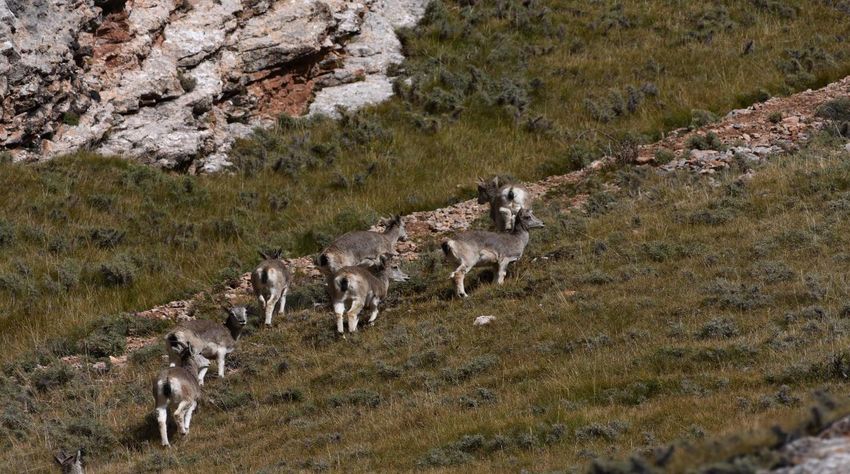
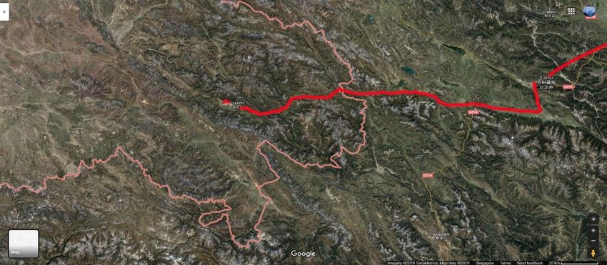
TIBET: KAMA CHU AND KHARTA VALLEY TREK AND FRIENDSHIP HIGHWAY TIBET May, 2019
PART 2

Mt Everest, the highest mountain in the world and encompassing Qomologangma National Nature Reserve.
After acclimating for several days spent exploring Lhasa, I had the opportunity to spend some
time at the new Songtsam Linka, where I met the manager Lhamo and Baima Dorje’s sister, and
had a chance to catch up with the new Tibetan lodges being built to the east to connect Yunnan
with Kham Tibet and Lhasa. The following morning, we loaded up our gear into a bus and began
the several days journey south to Gyantse, then Shigatse (Old Tingri) along the friendship
highway. Our journey would continue south another days driving to the village of Kharta on the
northern edge of the Himalaya bordering Nepal. We would explore and trek in an isolated area
known as the Kama Valley on the eastern edge of Mt Everest along the Kangshung glacier for 8
days, then complete the journey west across southern Tibet driving along the friendship
highway towards Paiku Co lake below Gyachung Kang 7952 m (26089 ft) before turning south to
Gyirong Town, (Kyirong). We would then cross into Nepal and the final day navigate a very
rough dirt road until Kathamandu.

The Friendship Highway spans some 800 km (500 mi) connecting the capital of Tibet, Lhasa,
with the Chinese/Nepalese border at the Sino-Nepal Friendship Bridge between Zhangmu and
Bramaphutra River (Yarlong Tsangp Tibetan) from road to Gampa La 4800 m overlooking Yamdrock Lake
Kodari on the border with Nepal, or the alternate route past Paingu tso lake to Kyirong on the
Tibet boarder to the west. The main route continues along the Yarlung valley up to Shigatse,
Tibet's second-largest city and formerly the home of the Panchen Lamas. We took the
secondary route that crosses the Yarlung Tsangpo Lake at Chushul and crosses the 4,800m (
15,744 ft) high Gampa La, passes along turquoise Yamdrok Yutso lake before crossing the

Yamdrock Lake
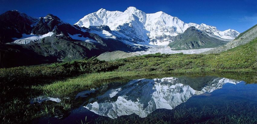
Nyang Chu valley through Gyantse up to Shigatse on the Yarlung Tsampo river. We would soon
5,045m (16,578 ft) high Karo La at the foot of Noijin Kangsang Peak 7191 m/23,593 ft, and
following downstream the be entering Qomologangma (Mt Everest) National Nature Reserve.

Above: Karo La Pass 5060 m, Bahral sheep grazing amidst rocks, Bottom: Noijin Kangsang pk 7,206 m
Qomolangma is the highest altitude biosphere reserve in the world, with complex ecosystems
that extend across the northern slopes of the Himalaya, an area which contains five of the
world's highest peaks: Qomolangma or Mt. Everest 8848 m (29029 ft), Lhotse 8516m (27,940
ft), Makalu 8485 m (27,838 ft), Cho Oyu 8,188m (26,864 ft), and Shishapangma (Xixabangma)
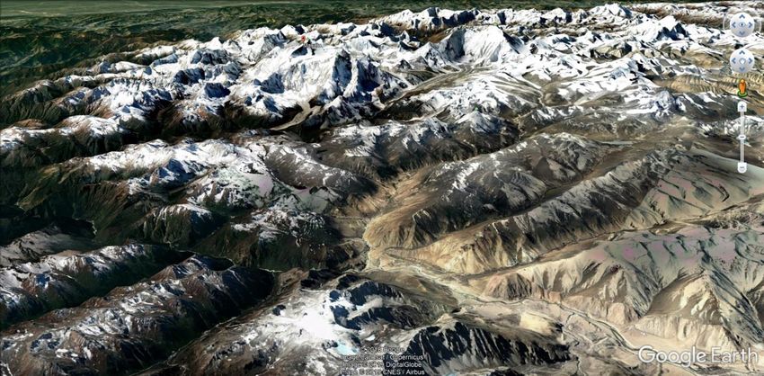
8027 m (26335 ft) along or near the international border with Nepal. Within its south eastern
border lies the khama Valley, the remote area below the kangshung glacier of Mt Everest.
There are two categories of glaciers: the oceanic glacial systems in the southern region and
continental glaciers in the northern region.

Within the boundaries of the Qomolangma National Nature Preserve lies a stunning landscape
ranging from the world’s tallest mountains to deep valleys and gorges that extend northwards
to the Tibetan high plateau and grasslands. Two major bio-geographic zones, the Xizang plateau
and the Himalayan highlands, meet in QNNP to create an exceptional variety of habitats
supporting an extraordinarily high plant and animal diversity, including a few remote valleys of
temperate forest, alpine, and arctic climate zones. Ranging from 1,400 to 8,800 meters in
elevation, the Mount Qomolangma Nature Reserve is one of the most biologically diverse
nature reserves in Tibet. Immediately north along the Himalayan mountain range bordering
Nepal at the southern boundary of the plateau are several water gaps that support temperate
forests along the Phung Chu (Peng Qu) and its tributaries. Along the river valleys of north
flowing river systems from the mountains are where the Tibetans concentrate agriculture and
animal husbandry.

The central and northern part of the Tibetan plateau is representative of the high, cold, semi-
arid Central Asian steppe ecosystems with numerous lakes and wetlands of extraordinary
beauty. The largest lake is Qinghai which is classified as an alkaline lake with a surface area of
4,317 square km (1,667 sq. mi); whereas the landbound Pegu Tso (Paiku Co), is 300 km2 (116
sq. mi) that mirrors the snow-clad peaks of Shishapangma 8027 m (26335 ft) and Gang Benchen
7299 m (23946 ft). The seas of fertile grasslands which blanket portions of the plateau sustain
numerous rare species of wildlife, including the black-necked crane Grus nigricollis, Tibetan wild
ass Equus kiang, Tibetan gazelle Procapra piticaudata, wolf Canis lupus, snow leopard Panthera
uncia, and brown bear Ursus arctos. The preserve also provides habitat for goral, tahr, Langur
monkeys, Himalayan palm civets, jungle cats, musk deer and Tibet’s only population of
Assamese macaque.

Established in 1989, the Qomolangma National Nature Preserve that includes the kharta and
Kama Valleys next to Mt Everest covers an area of 34,965 sq. km (13,500 sq. miles) in the Tibet
Autonomous Region of China. Compared with the Nepal side, the Tibetan terrain is both much
higher in elevation and also considerably less rugged. An estimated 68,000 people live in the
preserve, engaged in agriculture and animal husbandry within a diversity of landscapes that
range from subtropical, densely forested river valleys below 1981m (6,500 ft) to ice-clad peaks.
Geologic history within QNNP include major tectonic plate movement, volcanic activity and
catastrophic evidence of flood deposits of marine sedimentation. Marine sediments more than
10 km (6 mi) thick occur most likely contemporaneously or immediately preceding the
Himalayan region up thrusts. During this great uplift and catastrophic mountain-building, the
Tibetan plateau emerged producing a dramatic climate change richly documented by such
fossils as those of the three-toed horse Hipparion unearthed in Nieruxiong La, the alpine oak
fossils from Shishapangma, and other plant fossils from the Lawula Formation in the Markam
Basin in SE Tibet and the well-preserved palm fossils at the Lunpola Basin in central Tibet. And
there are several major water gaps that include the Yarlung Tsangpo River cutting between
Namche Barwha and Gyalha Peri, and the Phung Chu forming the Arun River that cuts between
Makalu and Kanchenjunga. An alternate theory shows strong evidence these water gaps were
cut through plastic mountain uplifting.

PLANTS There are recorded a good diversity of plants in Qomolangma, including 2,106
angiosperms, 20 gymnosperms, 222 species of ferns, and 472 species of moss. Protected plant
species include the magnolia Alcimandra cathcartii, Himalayan yew Taxus wallichiana, and
Himalayan spruce Picea smithiana. There are rugged gorges that lead down from these peaks to
densely forested river valleys of exceptionally high temperate and sub-tropical biodiversity. The
Yarlung Tsangpo river that forms the Brahmaputra flowing north of Everest, and south of Lhasa
east and the Phung Chu that forms the Arun River in Nepal cut through the Himalayan chain in
these areas, funneling warm air currents and monsoon rains northward from the Indian Ocean
into the edge of the arid Tibetan Plateau. The pristine Kama Valley contains the highest known
forests in the world, at elevations of some 4,300 meters (14,246 feet). Here there are soaring
virgin stands of oak, larch, fir, rhododendron, and birch which amazed early explorers. Within
the Kharta valley and Phung chu River there is a Humid Montane Forest, alpine subtropical
evergreen/semi-evergreen broadleaf forest and evergreen coniferous forest characterized by
tan oak Castanopsis hystrix, laural Machilus yunnanensis, and ring oak Cyclobalanopsis
xizangensis; Subalpine cold temperate evergreen coniferous and deciduous broadleaf forest
with fir, hemlock and oak Abies spectabilis, Tsuga dumosa, Quercus semecarpifolia, and alpine
sub-frigid belt scrub meadow dominated by Rhododendron campanulatum, R. wightii, R. nivale.

BIRDS There are 390 bird species belonging to 62 families known in the preserve, a species
richness from both the Palearctic and Oriental realms. Species differences between the
northern and southern slope of QNNR are especially remarkable. The northern slope was
characterized with a small total number whereas the southern flank within Nepal held an
abundance of bird species with complex composition.

MAMMALS There are 53 species of mammals, including 33 nationally protected animal species
such as the endemic snow leopard Panthera uncia, Himalayan tahr Hemitragus jemlahicus, and
Hanuman (or common, gray) langur Presbytis entellus. With increasing attitude, species
richness increased and reached its maximum at 2 500 -3 300 m where 48 species were found,
followed by a rapid decrease in richness at higher elevations. The Fauna on the South Slope
differed significantly from that on the North Slope. There are more mammal species (76) on the
Nepalese side south slope, in contrast to only 66 species on the north slope, with 41 species
belonging to the Orient Realm and 25 belonging to the Palearctic Realm.

KHARTA AND KAMA VALLEY TREK May, 2019
Located at the southern edge of the roof of the world in Southern Tibet, and deep within the
Himalaya at the edge of the highest
peaks in the world, lies the Kama Chu
or Gama valley. The Kama Chu is
known as Everest's Hidden Eastern
Valley within Qomolangma (Mt
Everest) National Nature Preserve
(QNNP) that is three times the size of
Yellowstone National Park. This valley
is hidden, isolated and one of the
sources of the Arun River joining the
Kharta, and to the east the larger
Phung Chu River that flow through a
water gap that cuts and flows south
through the steep Himalaya into
Nepal. The Kharta and Kama valleys
are known to be one of the most
beautiful and undiscovered mountain
landscapes in the world, at the northern Above: Water gap of the Phung Chu, source Arun River of Nepal
northern edge of Makalu and Mt Everest, with pastoral views of meadows and green forested
slopes uncharacteristic of the Tibetan plateau.

The remote Kama valley is isolated, and can only be accessed through several very high passes
above 5000 meters (17,000 feet) at half atmospheric pressure accessed from the Kharta River.
Reaching there involves hard work ascending where wind driven snow storms close entry for
most of the year. Surrounding this hidden valley are the highest mountains in the world:
Everest at 8858 m (29,029 feet), Lhotse 8516 m (27503 feet world's 4th highest), Makalu 8485
m (27,766 feet 5th highest), and Chomolonzo 7804 m (25604 feet).
Kharta Valley south of Tingri on the Phung Chu (river), tributar and source of the Arun river in Nepal
Historically the Kharta Valley was first discovered by Europeans in the 1921 British Mt Everest
Reconnaissance Expedition. The expedition began from Darjeeling Sikkim, and finally
established a base at Tingri to the north of Everest from where the northern and western
approaches were explored. The British leader Howard-Bury moved the whole expedition to
Kharta where various parties explored the Kharta
and Kama valleys eventually discovering that the Kama Chu came from the unscalable
Kangshung Face of Everest. The north col of Everest was climbed by George Mallory, Guy
Bullock and Oliver Wheeler but they could get no further and had an arduous return. The
expedition discovered that, compared with the cold barrenness of the Rongbuk valley north of
Everest, the Kharta and, even more noticeably, the Kama valleys were warm and verdant.
Rhododendron, scrub birch and juniper cover
the valley slopes with willow bordering the
lower streams. The valley was well forested
with plenty of wood for fuel at Rongbuk
whereas at higher elevations the only fuel
had been yak dung. When the 1921 British
Reconnaissance Expedition discovered this
valley at the base of Rongbuk Glacier, they
called it "The Most Beautiful valley in the
Rt 1921 British Expedition team
Northwest face of Mt Everest and left Lhotse from the remote Kama Valley, Tibet( J Hans)

Khama Valley, with milder microclimate than the interior Tibetan Plateau and Kharta Valley immediately north
Beautiful Valley in the World." Charles Howard-Bury who led the expedition wrote of the floral
beauty of the valley.

The thought of those early British climbers that included Mallory dressed in tweeds, reading
Shakespeare in the snow amazed me as they confronted many hazards of this expedition, and
climbing steep ice faces at high altitudes filled me with admiration. These explorers had all had
endured the fires of the Great War WW1, the mud and blood of Flanders. They were not
cavalier about death, but they had seen so much of it in the trenches that it had no hold on
them. What mattered was how one lived, the moments of being alive. Life was precious but
effervescent. Perhaps this explained their willingness to climb to the north ridge, accepting a
degree of risk that might have been unimaginable before the war.

Above: Mt Everest and Lhotse from Kangshung Glacier Face at head of Khama Valley 4800 m, Makalu and Cho
Oyu from Shaola la Pass 5000 m gained by three days trekking from kharta River. Khama Valley below
Mt. Everest is covered with massive glacial systems, with the longest 22.4 km (13.9 miles)
Rongbuk Glacier flowing from the north face, and the Kangshung Glacier 18 km (11.1 miles) at
the foot of the Kangshung Face of Mt Everest that formed the Kama valley. The Kama Chu River
descends the valley southeast and somewhat parallel with Kharta Chu to the north until it joins
the Phung Chu River (the Arun river in Nepal) that descends through a deep gorge above Chatra
Gorge. The Arun descends through this water gap between Makalu 8,485 meters (27,838 ft)
and Kangchenjunga 8,586 m (28,169 ft) massifs the fifth and third highest mountains in the
world, allowing warm monsoonal weather systems to thread north, penetrating the normally
cold, dry Tibetan valleys and permitting lush temperate forest growth. The river’s elevation is
about 3,500 m (11,500 ft) at the border demonstrating the gorge and valley is some 5,000 m
(16,000 ft) deep, one of the world's deepest after the Yarlung Tsampo gorge. These water gaps
scattered along the Himalayan Range create temperate forest refuges created by warm
monsoon rains and climate to penetrate north into the cold Tibetan plateau.

Phung Chu (source of Arun River and water gap allowing monsoon to enter Tibet) lower left. Kharta River
middle, Khama valley top center and Mt Everest Top ctr-rt.
The upper watershed of the Arun River including the Phung Chu River is the greatest snow and
ice-covered area of any Nepalese river basin, forming the largest trans-Himalayan river passing
through Nepal. Leaving the Himalayan rain shadow, the Arun's flow increases substantially in
the monsoonal climate of east Nepal and northern India before flowing into the Ganges River. It
is its canyon and valley that permits the southern warm monsoon to penetrate seasonally into
the cold Tibetan plateau, creating a tremendous plant and animal diversity unique to Tibet.
This seasonal milder air flow and monsoon creates milder temperatures with the valley that
nurtures a lush flora. The Kama Chu is considered the most beautiful valley in the world with
botanically diverse green alpine slopes and alpine lakes contrast greatly with headwaters
formed from dramatic glaciers and the vertical Kangshung face of Mt Everest (Tibetan
Chomolungma).

Above: Phung Chu river where Khama river flows in 70 km from Nepal border; Bottom, Rhododendron spp,
Mecoopsis sp blue poppy, and Saussaria sp.Tibetan Border
Ecosystems in the forests and rangelands around Mount Everest include species from two bio-
geographical realms, of which the Himalayas is the junction of the Northern Paleoarctic and the
Southern Oriental. The valley floor of the Kama Valley descends to 2,438 m (8,000 feet), a 6400
m (21,000 foot) elevation difference between the summits at the top of the valley and the
valley’s floor where the Gama River enters the Arun River. The various ecological zones boast
different types of evergreen and hardwood evergreen primal forests. The valley contains a
transect of botanical diversity from subtropical to warm temperate, cold temperate, alpine, and
Abies sp both left, Rt red birch Betula sp, Kharta River near Phung Chu source River of the Arun River

Primula, rhododendrons Phung chu river water gap, several kilomters from arid landscape to the interior north
arctic zones near the summits of the surrounding peaks. The lower wet valley at the boundary
of Nepal exists a hardwood conifer forest with fantastic biological diversity with trees six feet in
diameter, 12 species of rhododendrons, and diverse meadows of flowers that include poppies,
primulas, and gentians. The most unusual type of forest consists of junipers, which cover a vast
area of the virgin forest. The pristine Kama Valley contains the highest known forests in the
world, at elevations of some 4,300 m/14,246 ft where there are soaring virgin stands of oak,
larch, fir, rhododendron, and birch. The shrub juniper and dwarf rhododendron have been
removed by yak herders to increase grazing land, but this conversion to grassland has also
facilitated the dramatic growth of once rare blue sheep populations, which in turn has
encouraged the return of the equally rare snow leopard during the past several decades.
Wildlife in this region that include snow leopards, wolves, blue sheep and tahr that cross
the border in search of prey or pasture. Migratory birds pass through the open sky and migrate
in elevation according to the seasons. Seeds are carried on the wind, in the guts of livestock,
and in bird droppings.

The north facing side of the Himalayas present a high topographic barrier to the monsoon, and
the region is dry year-round. Partly as a result, glaciers on the north side of Everest are
retreating at a faster rate than those on the south, since little moisture replenishes the snow
that would ensure their continued growth. Vegetation patterns on Mount Everest depend
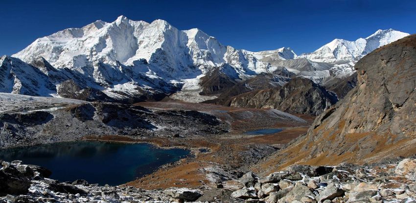
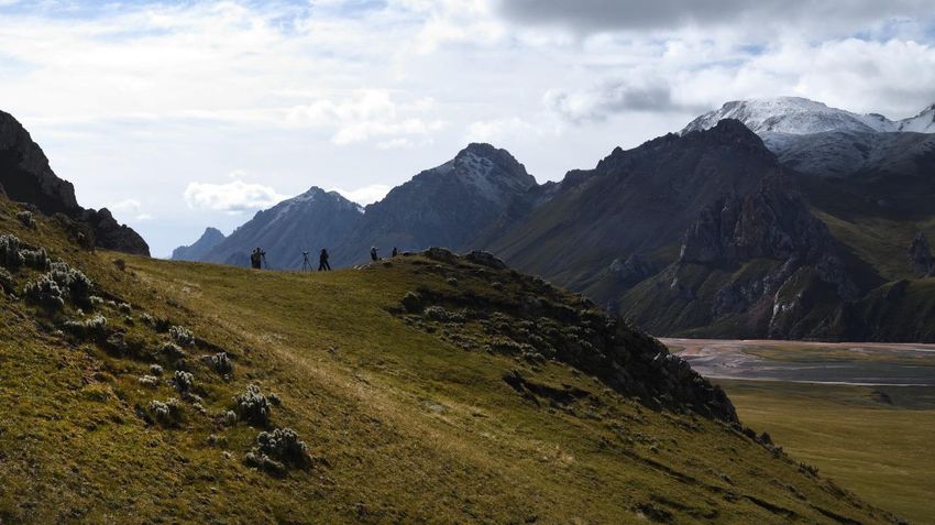
largely on altitude, slope, aspect, precipitation, geology, and human use. On the south-facing
side, warm and dry shrub grasslands were created by herders hundreds to thousands of years
ago, and they now cover the highly modified, but stable, slopes. On the moist and cool north-
facing slopes, fir, birch, and rhododendron forests grow. Above 13,000 feet, shrub juniper and
dwarf rhododendron also contribute to the geomorphic glue that holds the thin, young, and
fragile alpine soils in place. Above 16,700 feet only sparsely distributed cushion plants can
survive. In 1938, the mountaineer Eric Shipton found a saw-wort Saussurea gnaphalodes on a
slope of scree (loose rock debris) at an altitude of 6401 m (21,000 ft) on the north flank of
Mount Everest, the world record for the highest known vascular plant growth.

Shao la lakes and Makalu at sunrise, Khama Valley
QINGHAI SNOW LEOPARD EXPEDITION SEPTEMBER 2019
PART 3 Zadao to Base Camp on the Upper Mekong River Sanjiangyuan Nature Reserve

Medong (Lancang Jiang) River along the route to our base camp
September 18, Wednesday
Left Dzado (Zaduo) in the early morning and travelled SW under a partly cloudy sky,
encountering rugged mountains with verdant alpine slopes as we followed the Mekong upriver.
Many low peaks jagged with metamorphosed rock, and scenic sections where we glassed many
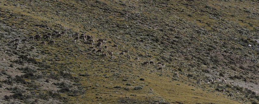
Top: Mekong River, Bottom: Bahral sheep mixed young males and female .Below: wetlands w/black-necked cranes

sheep herds. Above the river we watched one
group above us playing on the edge of a cliff
bouncing and jumping rocks with amazing leaps
and dexterity. Followed the herd for some time
as they were a bit shy of us. We watched the herd
of about 40 females and immature males move to
the green slope, then over the ridge. Several
young lambs continued to play on the grass above
us, bounding around with amazing energy. Then
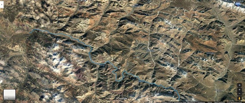
Top: Route from Yushu to Zadao; Bottom: Area of Base camp on the Zha Chu, N Fork of Mekong River

across the river watched four musk deer, three females and one male.

We turned off a primitive gravel road and ascended through several passes as it began to snow
before we finally came to the Mekong River after three hours of rough road. We passed
through a narrow canyon and reached to our campsite for 6 days. The landscape and scenery
Below: upper Mekong River several hours by 4x4 to our base camp

here was stunning with sweeping grasslands flowing from islands of metamorphic peaks, some
with snow that were absolutely dramatic. The Mekong flowed through this broad and remote
valley, full and rust brown. All around us were grazing herds of Bharal sheep, a good sign for
abundant prey for snow leopard. We camped at a nomadic yak herder shelters who Tsebtrim
had befriended from previous trips with BBC. Walked around as I enjoyed the beauty of this
remote part of Tibet that Jamin and Tsebtrim love. Our cook camp was in an abandoned
building and we set up our tents, and cook kitchen in the small shelter. Getting very cold and
the mist is settling in. We are anticipating an amazing week here and hoping the weather will
break. We were hit by periodic rain and sleet, and we welcomed hot water for tea and a meal.
September 20 camp Friday
Rain stopped midnight and the moon came out along with the stars. I exited the tent in freezing
cold at 7 AM, and headed to the cook shelter to get hot water and mix freeze dried coffee with
my supply of hot chocolate mix. Warmed up cold hands and toes, and waited for the sun to
clear the peaks to the east to bring warmth.

Our first day in a remote wilderness, with only a few yak nomad encampments across the river.
We began walking east and I got comfortable with my pack filled with camera gear, but a bit

Sunrise from base camp on the upper Mekong River
Top: Base camp on the upper Mekong River; Bottom, Bahral sheep, primary prey of snow leopard
Chukar partridge, saker falcom, snow finch; Below Plateau pika, Tibetan marmot female and young

Above: Bharal (blue sheep), the major prey of snow leopard; Below: White-lipped deer

winded going uphill at this altitude (4300m or 14,100ft). In warm morning sunlight our small
group crossed a stream, then ascended the grass slope 300 meters below almost a hundred
blue sheep grazing above. Large lammergeier (bearded vulture) and griffon vultures circling
near us with some birds on the ground, a sign of a kill. We spotted the fresh remains of a blue
sheep skeleton made by a snow leopard only a day old, and a half km from us; so close to camp.
Three foxes came onto the kill and chased off the birds to scavenge any meat and bones left.
We spent all morning on a grass ridge above at the base of limestone iron infiltrated
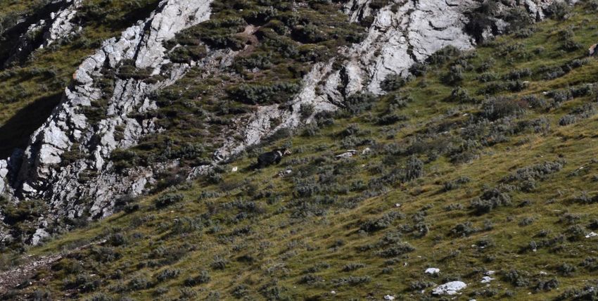
metamorphic rock outcroppings with scattered caves. Time was spent glassing for the snow
leopard that had made the previous days kill. They are well camouflaged and very difficult to
see, at times resting in caves. The view above the ridge revealed a grandeur of rugged
mountains all around us, some covered with small glaciers. The green grasslands and the
Mekong River flowing below to the east contrasted greatly from the sharp jagged toothlike
peaks surrounding us, creating a pastoral scene that reflected images I had seen of the Wind
River Range in Wyoming. Wonderful time and meditation in the mountains with the sun
warming us. No songbirds, nor insects but a few blooming flowers that included a bright blue
gentian Gentianaceae. There were herds of blue sheep all around us, some numbering up to 75
on the other side of the ridge. With excellent pasturage and adjacent rock faces to escape
predators, its no wonder this area is so fecund in wildlife that includes large mammal ungulates
that include Bahral sheep and deer.
Top/Bottom: Ursus arctos, Tibetan brown bear blue bear color phase that is suspected to be the Yeti
Descended the ridge by noon, ate lunch and
ascended the ridge immediately above us. We
had the scopes out by 2 pm where Tuga spotted a
brown bear on the ridge we had just hiked from
earlier in the morning. This bear was big,
probably 200 kg (450 pounds) with a striking dark
blue-black coat, a white-collar strip across its
shoulder and back, and a face that was a light tan.
There is greater diversity in brown bear in Tibetthan North America, varying from the grizzly-like pelage to a blue-black coloration. I wasn’t certain if it was the rarer blue bear pelage of the Tibetan grizzly. After crossing the steep meadow, the bear settled down and fell asleep on the grass at the base of a rock. Above the bear on the ridge was a herd of almost twenty white lipped-deer with one large stag overseeing the herd. They were aware of the bear, but not threatened. We left the knoll and descended along the green alpine pastures, and walked to the west in the opposite direction for several km before we sat and glassed the mountains above us. There was barbed wire fencing for yaks put up by the nomads, meant to keep them close to their scattered permanent dwellings along the river. Within two hours a herd of 40 white-lipped deer appear grazing towards us on the ridge, joining a herd of almost one hundred Bahral below them. Amazing to see such concentrations of large mammals. We were standing in the midst of a pika colony with one sentinel chirping at us as we scoped the ridges when Tuga spotted a lone wolf walking down by the river. At the same time, the bear we had seen at lunch woke up and began to move, then ambled off after 4 hours of a nap before heading towards the big herd of sheep. Wonderful day. At dusk we retreated back to camp. Our dinner was basic and we chose from a duffel of freeze- dried Mountain house dinners that varied from lasagne to macaroni and cheese. Beautiful stars appeared as twilight disappeared into a dark sky, revealing the Milky Way that spread Northeast on the horizon to Southwest. Cassiopeia and Ursus major was found to the north, and in the southern sky Sagitarius and Scorpius. There was no light pollution this deep into the mountains, and I rejoiced in the amazing location of this created earth within our galaxy, where I could see our sister galaxy Andromeda as a smudge with binoculars between the W shape of the constellations Cassiopeia and its neighbor Pegasus. The following morning, I witnessed a red /turquoise sunrise to the east as I emerged from my tent, thankful that good weather was with us and the sun will soon warm up the cold mountain air. Reached -4 C (28 F) last night, but was warm in my down sleeping bag. This morning we left
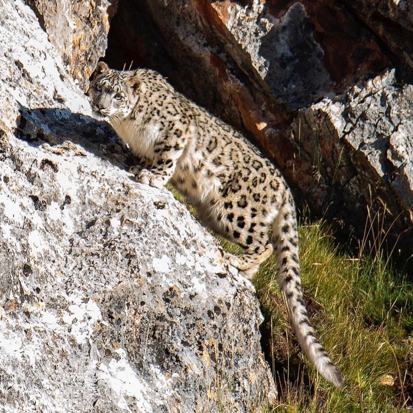
early under a beautiful cloudless sky and
ascended a steep slope above our camp.
Once at a saddle above I laid my heavy
camera next to me and kneeled by Linus and
Jamin to scope the rocks above us. Within
seconds below Linus spotted a snow leopard
below us only 30 m (100 ft) away and yelled
it out, causing the cat to get up and leave. I
was stunned, and amazed with a five second
view only 30 meters away, so close. I
immediately caught it walking away from us
Right: Snow leopard leaving below us. Linus Helm Ph.
Snow leopard less than 30 meters from us. Linus Helm
below, then the beautiful cat stopped for a moment looking back and continued up a grass
slope between two rock ledges, stopped one more time to look
at us, then disappeared.

Incredibly found it hard to believe I had seen one, as it was a fleeting moment observing the
most elusive animal in the Tibetan plateau and Himalayas. Amazing. Spent a half hour trying to
find which direction it might have gone, but it literally vanished, like a shadow. This snow
leopard had a striking beauty, with a smoky-colored coat tinted with cream and yellow shades
covered with a pattern of black rosettes. The cat was most likely a female of medium size,
about 60cm (2 feet) at the shoulder with a 1m (3.3 ft) long tail. This cat matched the size of a
female which can weigh around 35-40kg (77 ib), while males can weigh 45-55kg (100-121 ib).
Unique among other cat species it briefly stared at us with pale grey/ greenish eyes.

The snow leopard is often called a phantom cat with few who have actually seen it, and this
experience is what we had hoped for as prey was so abundant around us, including the fresh
kill near our camp. Tsebtrim, who guided both BBC and Disney film crews on filming snow
leopards in this area stated the area of southern Qinghai has the highest density in the world,
and his experience in this location was about a 85% probability of seeing one. It took six months
for the Disney film team to film them here. Snow leopards are solitary animals, but share a
common space. They are active mostly at dawn until early morning and again in afternoons and
early evenings and here mostly rest near cliffs and ridges that provide vantage points and
shade. All these features are essential for their survival and make them especially hard to track,
even for the hardiest researchers. But leopards are, to a degree, predictable, frequenting game
trails and ridges and often spraying rocks to mark their territory. Researchers in Nepal's Shey-
Phoksundo National Park found the home ranges of five adult radio-collared snow leopards
overlapped to a large extent, though they rarely met. Their individual home ranges ranged in
size from 12 to 39 km2 (4.6 to 15.1 sq. mi). They covered up to 7 km (4.3 mi) in a single night.

The snow leopard is designed with several adaptations for living in a cold, mountainous
environment, unlike other big cats. Snow leopards have the longest and thickest fur of any big
cat, and has small rounded ears that help to minimize heat loss. Its broad paws distribute their
body weight over more surface area for walking on snow, with fur on their undersides to
minimize heat loss and to increase the grip on steep and unstable surfaces. Its long, thick, and
flexible tail helps to maintain balance in the rocky terrain and stores fat, very thickly covered
with fur, which allows the cat to use it like a blanket to protect its face when asleep. They
possess a large nasal cavity and broad facial bones facilitating inhalation to breathe in very cold
air and warm it before entering the lungs. They also have a high concentration of red blood
cells that maximizes oxygen intake, facilitating their ability to easily climb mountainous terrain,
comfortable at heights reaching 5500 m (18,000 ft).

The snow leopard's vocalizations include meowing, grunting, prusten (like a snort), and
moaning. It can purr when exhaling. It cannot roar, despite possessing partial ossification of
the hyoid bone. This partial ossification was previously thought to be essential for allowing
the Panthera cats to roar, but new studies show that the ability to roar is due to
other morphological features, especially of the larynx, which are absent in the snow leopard.
Like other cats, snow leopards use scent marks to indicate their territories and common travel
routes. These are most commonly produced by scraping the ground with the hind feet before
depositing urine or scat, but they also spray urine onto sheltered patches of rock. Females with
her cubs usually stay together, and they rear them in dens in the mountains for extended
periods.
The snow leopard is capable of killing most animals in its range, with the probable exception of
the adult male yak. It also eats a significant amount of vegetation, including grass and
twigs. Snow leopards have been recorded to hunt in pairs successfully, especially mating pairs.
It is an opportunistic hunter but will also eats carrion. Its preferred wild prey species
are Himalayan blue sheep Pseudois nayaur, Himalayan tahr Hemitragus jemlahicus, argali Ovis
ammon, markhor Capra falconeri and wild goat C. aegagrus, and domestic yaks. It prefers prey
ranging in weight from 36 to 76 kg (79 to 168 lb.), but also hunts smaller mammals such
as marmot, pika and vole. The diet of the snow leopard varies across its range and with the
time of year, and depends on prey availability. In the Himalayas, it preys mostly on Himalayan
blue sheep and Siberian ibex Capra sibirica. In the Karakoram, Tian Shan, Altai and Mongolia's
Tost Mountains, its main prey consists of Siberian ibex, White lipped deer Cervus
albirostris, Siberian roe deer Capreolus pygargus and argali. Other species hunted when
available include snow cock and Chukar partridge.
Snow leopards prefer to ambush prey from above, using broken terrain to conceal their
approach. They will actively pursue prey down steep mountainsides, using the momentum of
their initial leap to chase animals for up to 300 m (980 ft). They kill with a bite to the neck, and
may drag the prey to a safe location before feeding. They consume all edible parts of the
carcass, and can survive on a single Himalayan blue sheep for two weeks before hunting again.
Annual prey needs appears to be 20–30 adult blue sheep.
Glassed across the valley and observed three lammergeier on a rock across the narrow valley.
There was a large group of males, large- horned sheep that were actually separated from the
nearby mixed herd of sheep. Below we saw a large animal moving across the meadow where a
brown bear appeared, and worked its way down to the stream to drink, its black/bluish fur
rippling as it descended. It was so amazing to watch it drink, climb back up to the road, then
back, then finally ascended the meadowed slope. Glassing the bear with a scope, I found it was
the rare color-phase known as a Tibetan blue bear found in the alpine regions of eastern Tibet,
The Tibetan blue bear is one of the rarest bear subspecies in the world. It is also known as the
Tibetan brown bear, Himalayan blue bear, Himalayan snow bear, yak dhom (yak bear), and iha
dhom (mountain bear). This brown bear subspecies Ursus arctos pruinosus was first classified in
1854 by English zoologist Edward Blyth. It is thought by some to be the source of the legendary
yeti. They are aggressive, and have been known to attack and kill nomads in their camps. We
were a good safe distance from the bear, and continued to observe its movements while
foraging on grass and herbs that make up most of its diet. Its primary prey is pika.

Scoping towards the river, Tsebtrim discovered a Tibetan wolf traversing a terrace, a female
with her yearling pup trailing behind. They were looking for carrion or to catch an unwary pika
or marmot for a meal. Amazing morning, and we were all grateful, knowing how fortunate we
were to have seen the snow leopard.

Walked west to the same ridge we had yesterday afternoon and this time the white-lipped deer
had moved grazing below the ridge near a herd of Bahral sheep mixed with three Tibetan
gazelles. Tsebtrim had never seen these three species together before. The rarer relative the
Tibetan red deer, found in southern Tibet and Bhutan all belong to the Asian group of wapiti
that includes the white-lipped deer, but without the characteristic white muzzle. They were
almost driven to extinction, but remnant populations still survive.
We continued to walk towards the herds and finally reached the edge of the valley alerting the
gazelle and sheep that then moved higher up the slopes. The white-lipped deer remained.
Several bulls were shedding their velvet, with large six-point bull that had the most outstanding
rack. Mature males may have antlers measuring up to 110 cm (43 in) in beam length, weighing
as much as 4 kg (8.8 lb). Compared with those of wapiti or red deer, the antlers are flattened
with the first and second tines spaced far apart. The antlers number as much as seven tines,
which all lie in the same plane. They are shed annually in March, reaching their full length by
late summer.

As the sun set behind the mountains to the west, one final check with the scope revealed
another Tibetan wolf by the river. Left by 630 pm and back to camp by 7 pm. An absolutely
incredible day.
You can also read