WATERQ2: UNDERSTANDING WATER QUALITY & QUANTITY IN THE LIMPOPO BASIN - USAID
←
→
Page content transcription
If your browser does not render page correctly, please read the page content below
WATERQ2: UNDERSTANDING WATER
QUALITY & QUANTITY IN THE LIMPOPO BASIN
Quarterly Report, 01 July – 30 September 2019
13 December 2019, version 1

Milestone #7

DISCLAIMER: This work was supported by the United States Agency for International Development (USAID), Southern Africa Regional
Mission, Fixed Amount Award 72067419FA00001. This work reflects the work of the authors and does not necessarily reflect the views of
USAID or the United States Government.

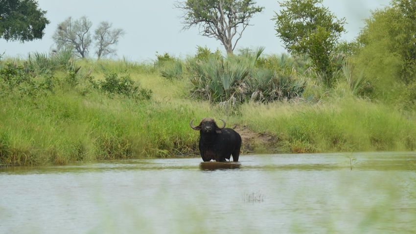
WaterQ2: Understanding Water Quality and Quantity in the Limpopo Basin

Suggested citation:

Kahler, D. M., Edokpayi, J. N., Rose, K. C., (2019). WaterQ2: Understanding Water Quality and
Quantity in the Limpopo Basin, Quarterly Report, 01 July-30 September 2019. Thohoyandou, South
Africa: Limpopo Resilience Lab.

Cover photo: Cape buffalo standing in Shingwedzi River, Kruger National Park, photo credit: Mackenzie
Martin.
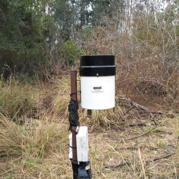
TABLE OF CONTENTS

INTRODUCTION                                                                       1

PROJECT ADMINISTRATION                                                             3

STUDENT PROGRESS                                                                   3
EQUIPMENT                                                                          3

MODULES 1&3: WATER MONITORING                                                      3

HYDROMETEOROLOGICAL STATION NETWORK                                                3
SATELLITE ALGORITHMS                                                               5
WATER POLICY                                                                       5
CITIZEN SCIENCE                                                                    5
REFERENCES                                                                         6

MODULE 2: TRAINING, WORKSHOPS, AND CONFERENCES                                     6

PROJECT-SPONSORED EVENTS                                                            6
UNIVERSITY OF VENDA MEETING                                                         7
KRUGER NATIONAL PARK MEETING                                                        7
PRETORIA STAKEHOLDER MEETING                                                        9
RESILIENT WATERS MEETING                                                            9
ENDANGERED WILDLIFE TRUST                                                           9
TRAINING WORKSHOP: RIVER DISCHARGE MEASUREMENT AND MONITORING                      10
OTHER EVENTS                                                                       10
GLOBAL LAKE ENVIRONMENTAL OBSERVATORY NETWORK (GLEON) CONFERENCE                   10
WATER INSTITUTE OF SOUTHERN AFRICA (WISA) 2020                                     11
ASSOCIATION FOR THE SCIENCES OF LIMNOLOGY AND OCEANOGRAPHY MEETING, JANUARY 2020   11

MODULE 4: LIMPOPO RESILIENCE LAB                                                   12

MONITORING AND EVALUATION                                                          13

MODULES 1 AND 3: WATER MONITORING                                                  13
MODULE 2. IWRM TRAINING, WORKSHOPS, AND CONFERENCES                                14

PROJECT PROGRESS                                                                   15

WORK PLAN PROGRESS                                                                 15
MILESTONE PLAN                                                             16

FINANCIAL                                                                  18

PRIME RECIPIENT                                                            18

APPROVAL                                                                   19

APPENDIX A: PROJECT WEBSITE MAP                                            20

APPENDIX B: WEBSITE TRAFFIC REPORT                                         21

APPENDIX C: SUBAWARD JUSTIFICATION LETTERS                                 23

APPENDIX D: WISA PRESENTATION ABSTRACT                                     30

TITLE: A SWOT ANALYSIS OF WATER RESOURCE MANAGEMENT OF THE LIMPOPO RIVER
BASIN                                                                      30
BACKGROUND                                                                 30
METHOD                                                                     30
RESULT                                                                     30
CONCLUSION                                                                 31
REFERENCES                                                                 32
Project Information
Project Title           Water Q2: Understanding Water Quality and Quantity in the Limpopo Basin
Geographic Locations    Botswana, Mozambique, South Africa, and Zimbabwe
Award Number            72067419FA00001
Implementation Dates    March 2019 to March 2022

Prepared for: Akinwale Aboyade                              Graham Paul
              Agreement Officer’s Technical                 Alternate Agreement Officer’s Technical
              Representative                                Representative
              USAID/Southern Africa                         USAID/Southern Africa

INTRODUCTION
The transboundary Limpopo River Basin crosses Botswana, Mozambique, South Africa, and Zimbabwe.
At over 400,000 km2, the Limpopo River Basin is home to 18 million people living in both rural and
urban areas. Industries in the Basin include businesses in the urban areas and water-intensive uses such
as agriculture and mining; industrial water use is growing rapidly. In addition to the human residents, the
Basin contains some of the most biodiverse natural areas on the planet.

The rainfall in the Basin is heterogeneous with some sub-basins receiving less than 400 mm on average
and other downstream sub-basins in Mozambique receiving over 750 mm annually. Even meteorological
stations located in close proximity demonstrate substantial spatial variation within sub-basins. The Basin
has experienced severe droughts in the last decade. In addition to the variation in the amount of rainfall,
the timing, especially the start of the growing season, has varied significantly. However, there remain
many questions about the reliability of rainfall data and other water measurements due in part to the
infrequent calibration and validation of field site measurements. The limited confidence in these
data, combined with the substantial variation through time and space necessitates an
integrated approach to improve data collection, validation, and overall Basin water
resource management in the Basin.

The goal of this project is to build resilience through the support of Basin stakeholders, including The
Limpopo Watercourse Commission (LIMCOM), to improve governance around water resources
management and water security in the Basin. A systems approach, such as integrated water resources
management (IWRM) is needed to address such complex, large, and interrelated components of water
resources. IRWM is recommended by the United States Agency for International Development (USAID)
Water and Development Strategy Implementation Guide (2014). This context will be combined with
data collection and validation, data sharing, and continuous evaluation of the interrelations that affect
water resources.

This project will support water resources monitoring, and the development of methods for water
quality and quantity measurement based on in situ sensors and satellite measurements. These
measurements will enable characterization of water resource dynamics at the whole Basin scale and
form the foundation for hydrologic modeling that can help estimate hard-to-measure parameters and
also provide holistic assessments of Basin scale stocks and flows. To support data sharing, the project
will use cloud-based, automated data collection and web-based data sharing.

DUQ.EDU/LIMPOPO                                              WATER Q2 QUARTERLY REPORT, JUL-SEP 2019   |   1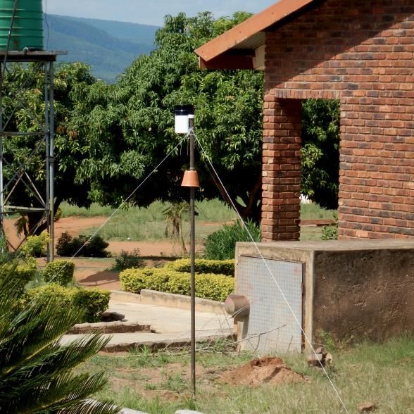
The Development of local capacity to maintain water resources and make proactive, scientifically
justified management decisions requires a substantial human capital resource that is currently lacking in
the Basin. The project will provide training, workshops, and conferences will focus on integrated water
resources management (IWRM) and environmental flow analysis.

The results of the water resources and biodiversity studies conducted will be compiled into a report for
the Basin stakeholders. Continued high-quality data collection, training, and general logistics depends on
dependable physical infrastructure. To support data collection efforts as well as training and
collaboration the Limpopo Resilience Lab at the University of Venda will be established. The
sustainability of lab activity will continue with the implementation of a small user fee beyond the
duration of the project. Annual training workshops and conferences will be located at or nearby the
Resilience Lab.

In this report, the collaborators, Duquesne University (Duquesne), Rensselaer Polytechnic Institute
(RPI), and University of Venda (Univen) report their activities and progress in the second quarter (Q2)
of project year 2019-20 (PY 2019-20).

2   |   WATER Q2 QUARTERLY REPORT, JUL-SEP 2019                                           DUQ.EDU/LIMPOPO
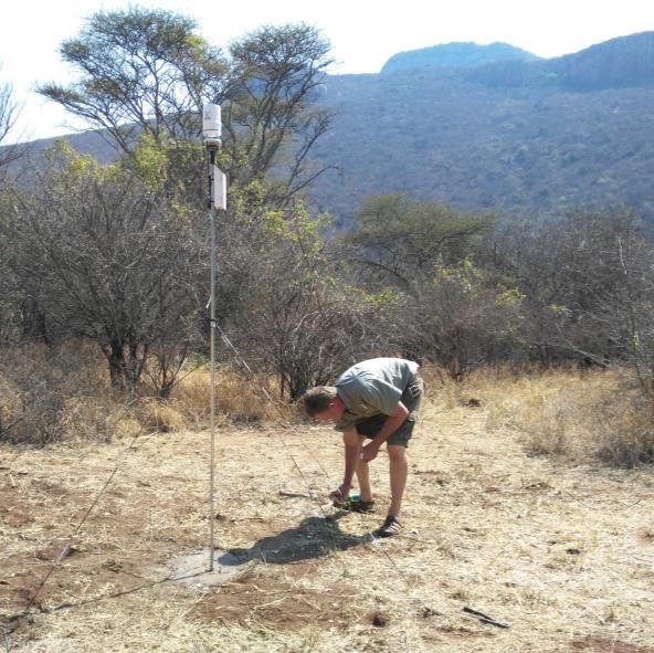
PROJECT ADMINISTRATION

STUDENT PROGRESS
Master of Science candidate, Mr. Hilton Thivhonali Shimbabu, has submitted his thesis proposal to
Univen after consultation with his research supervisors and project PIs, Drs. Edokpayi and Kahler. The
proposal has been approved by Univen.

EQUIPMENT
Univen has obtained a current meter and multiparameter water quality meter consistent with the items
in the proposed budget.

MODULES 1&3: WATER MONITORING

HYDROMETEOROLOGICAL STATION NETWORK

Figure 1: The Limpopo River Basin and Sand River catchment (pink) and Levuvhu/Mutale River catchment (dark green). The Basin spans
Botswana (light green), Mozambique (light pink), South Africa (lavender), and Zimbabwe (light blue). Locations of installed and proposed
stations, transect locations, and proposed groundwater investigation locations. The Leshiba Wetlands are located near the station in the Sand
River.

DUQ.EDU/LIMPOPO                                                                  WATER Q2 QUARTERLY REPORT, JUL-SEP 2019                |   3
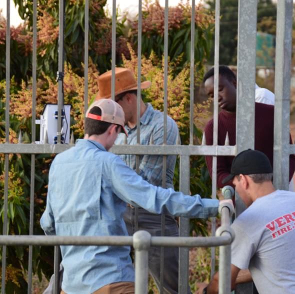
Figure 2: photographs of the current stations: Mutale Weir (upper left), Mbehela School (upper right), Leshiba Wetland (lower left), and Medike
Nature Reserve (lower right).

Stations were set up in key watersheds (Figure 1, 2) in the Limpopo Basin. Data are available through
the Development Data Library, (data.usaid.gov); however, users may find the map interface on the
WaterQ2 project website to be more convenient to locate the data. The following stations have data
available:

     •     Mutale Weir: https://data.usaid.gov/Environment/Mutale-Weir/9ru6-b4nc
     •     Medike Nature Reserve: https://data.usaid.gov/Environment/Medike-Nature-Preserve/chfb-yzu5

4    |   WATER Q2 QUARTERLY REPORT, JUL-SEP 2019                                                                         DUQ.EDU/LIMPOPO
SATELLITE ALGORITHMS
Work continues on the use of satellites to measure river discharge. Drs. Rose and Mlotha have begun
work on measuring critical water quality parameters, specifically, turbidity and chlorophyll. For both
projects, collaborators placed additional sensors at the Mutale River station during fieldwork in August.
This expansion of the Mutale Weir and other stations is described in the Hydrometeorological Station
Report available through the project website and introduced in this report above.
Satellite imagery for this research is from the Landsat mission (NASA, https://landsat.gsfc.nasa.gov/) and
Planet Labs, Inc. (planet.com) Education and Research Program. Additional work has been discussed with
scientists at Kruger National Park.
WATER POLICY
To support the work on national water laws and policies, and the human right to water in the Limpopo
Basin, Duquesne has begun to catalog as many documents as possible in an online library collection. The
Gumberg Library at Duquesne has supplied space within the institutional repository. The online library
is linked through the project website and available at dsc.duq.edu/limpopo.
CITIZEN SCIENCE
In the WaterQ2 Stakeholder Engagement meeting in August 2019 in Pretoria, participants expressed the
need for citizen participation in water resources management. This participation would be part of a
larger effort by national governments to educate the general public on water scarcity. Citizen science
was proposed to address two challenges: first, the participation of the general public in water resources
surveillance, and second, data acquisition and quality control for water resources data.
As an example, the United States Geological Survey (USGS) and the State University of New York at
Buffalo (SUNY) have developed software that uses Google Voice and a server-side python script to
collect river height data sent via text message (Fienen and Lowry, 2012). The experiment showed that
the river level reported by the citizen science program was consistent with traditional data loggers
(Lowry and Fienen, 2013). Researchers also determined several limitations of the program; such river-
monitoring programs needed feedback to the community to encourage continued participation (Lowry
et al., 2019). Data collection also benefited from particular members of the community becoming
involved and engaged in data collection; these citizen scientists were consistent data collectors (Lowry
and Fienen, 2013).
WaterQ2 would like to develop a similar system in the Limpopo River Basin to collect citizen-science-
reported river height data. These data can be used to measure river discharge (flow) as long as
collected where a rating curve (Leopold and Maddock, 1953) exists or can be established, can be used
to either provide a data quality check or populate the data itself.
Currently Planned Solution
1. Citizen sees the river gage plate. Nearby there is a sign that explains that citizens are needed to
verify river height for the accurate monitoring and provisioning of water. The sign has a
whatsapp number on it that requests that citizens submit information on river gage height.
DUQ.EDU/LIMPOPO WATER Q2 QUARTERLY REPORT, JUL-SEP 2019 | 52. Signs will be individualized; one per location. Use existing codes for each site. Be intentional on
where to put the sign, requesting that people take the picture from that specific location toward
the gage plate.
3. On the sign, citizens are asked to either
a. text in the site code and gage height as a single text string (e.g., RIVERCODE 136,
where “RIVERCODE” is the unique identifier code for that location and “136” is the
gage height recorded in pre-determined units such as cm).
b. take a picture of the gage plate along with a text of the unique identifier
4. Then they send this information to a phone number or WhatsApp address (that looks like a
phone number). A single number will work as along as all received texts are accompanied by the
unique site identifier code.
5. We then process it into data, and assign some sort of confidence score to it.
a. Data includes: location, date/time, river gage height, submitter
b. Derived characteristics can then be calculated, such as the difference between river gage
height measured by the person and the river gage height recorded by the pressure
sensor.
6. The Department of Water and Sanitation can then either set up a link to the citizen-science
database (essentially using citizen data as another sensor) or query it for a particular river when
you need to recalibrate the sensors. A query for a particular station would return a set of height
and time readings (We can also add additional processing/data if that would be helpful).
REFERENCES
Fienen, M. N., & Lowry, C. S. (2012). Social.Water—A crowdsourcing tool for environmental data
acquisition. Computers & Geosciences, 49, 164–169. https://doi.org/10.1016/J.CAGEO.2012.06.015
Leopold, L. B., & Maddock, T. J. (1953). The hydraulic geometry of stream channels and some physiographic
implications. Washington, D.C.
Lowry, C. S., & Fienen, M. N. (2013). CrowdHydrology: Crowdsourcing Hydrologic Data and Engaging
Citizen Scientists. Ground Water, 51(1), 151–156. https://doi.org/10.1111/j.1745-
6584.2012.00956.x
Lowry, C. S., Fienen, M. N., Hall, D. M., & Stepenuck, K. F. (2019). Growing Pains of Crowdsourced
Stream Stage Monitoring Using Mobile Phones: The Development of CrowdHydrology .
Frontiers in Earth Science .
MODULE 2: TRAINING, WORKSHOPS, AND CONFERENCES
PROJECT-SPONSORED EVENTS
Central to the work of the WaterQ2 project is gaining information from a range of stakeholders who
work in the Limpopo River Basin and building collaborative relationships with these stakeholders. This
section reflects the meetings held with stakeholders in August 2019. A comprehensive report is
available through the Development Experience Clearinghouse (dec.usaid.gov) and linked from the
project website.
6 | WATER Q2 QUARTERLY REPORT, JUL-SEP 2019 DUQ.EDU/LIMPOPOThe project also conducted a training workshop with students from the University of Venda on surface
water measurement. This short course focused on practical river measurement techniques and data
quality assurance.
UNIVERSITY OF VENDA MEETING
The collaborators met with Professor John Odiyo, Dean of the School of Environmental Sciences at the
University of Venda (Univen). The collaborators discussed the current initiatives under the USAID-
funded WaterQ2 project and specifically the training programs that have been planned. Many of these
training programs will be offered at Univen. The Dean was very excited for Univen to be part of the
USAID grant and he looked forward to the upcoming training sessions. The WaterQ2 project also
supports two graduate students and their research, and attendance for the Univen collaborators to
attend and share their research at international scientific meetings.
The collaboration between the collaborators and the University of Venda has made this work in the
local communities possible. The Dean of Environmental Science gave us his full support and offered to
set up future talks and learning opportunities at the university, and invited the collaborators to present
public lectures at the Univen to help increase awareness of the project and its goals.
Duquesne and Univen are drafting a memorandum of understanding (MOU) to formalize the
relationship between the universities. This MOU will facilitate future research collaboration, and
student and faculty exchanges.
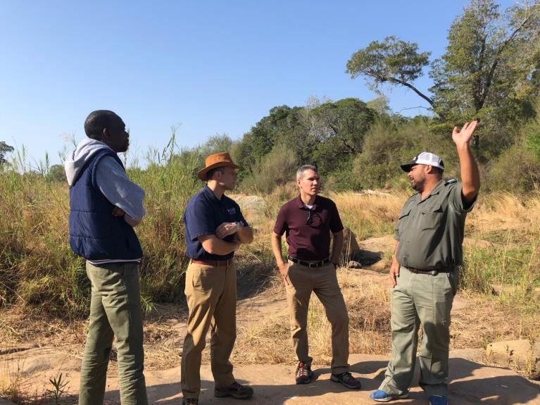
KRUGER NATIONAL PARK MEETING
The collaborators were invited to meet with staff from the Conservation Services and Scientific Services
of Kruger National Park. These groups work in concert to fulfil the park’s role as stewards of the vast
natural resources within this protected area. As part of the Greater Limpopo Conservation Area and
responsible for monitoring rivers of
two transboundary watersheds (the
Limpopo and the Komati river
basins), Kruger staff play an
important role in transboundary
natural resources management.
The collaborators met with
scientists at Kruger National Park to
find out more about their current
projects and their data needs. In
discussions with the scientists at
Kruger National Park, the
collaborators identified several
potential projects to enhance the
research collaborations with
Figure 3: WaterQ2 collaborators Joshua Edokpayi, David Kahler, and Kevin Rose
Univen. discuss aquatic species conservation in a riverbed with Kruger National Park Scientist
Robin Petersen (left to right).
DUQ.EDU/LIMPOPO WATER Q2 QUARTERLY REPORT, JUL-SEP 2019 | 7Understanding temperature and turbidity effects on fishes of Kruger National Park
The rivers of Kruger National Park contain nearly 50 fish species, yet little is known about how these
fishes respond to environmental perturbations or climate change. For example, the thermal tolerances
of fishes are unknown. Temperatures have been increasing with unknown consequences. Additionally,
Kruger maintains minimal environmental flows in Park rivers by having upstream dams release water
during the dry season when flows fall below a legally defined minimum. However, dam releases are
usually pulsed water from the hypolimnion of the water column, and the temperature of released water
is substantially colder than the what is in the rivers beforehand. The ecological consequences of these
pulsed dam releases and the rapid changes in water temperature are unknown; while they may preserve
the minimum environmental flows, the cold temperature may have other adverse ecological impacts.
Finally, agricultural growth throughout the Limpopo River Basin is correlated with an increase in river
turbidity levels. Anecdotal evidence collected by Kruger National Park scientists indicate that the deep
river pools, which are essential for the largest fishes, have been filling in. Yet it is unknown what this loss
of habitat has on the biodiversity of the rivers.
The impact of agriculture and sand mining on river ecology
Local agricultural production is a keystone for food security and jobs provisioning in South Africa.
However, South Africa’s Department of Environmental Affairs estimated that 1.5 million hectares is
degraded. Erosion, mineral and sand mining, and lack of land management have contributed to land
degradation, which has diminished agricultural productivity and increased river turbidity levels. CSIR has
proposed engaging with stakeholders and land managers to establish strategies to rehabilitate land. The
Olifants River catchment (see Figure 1) is one area that has been identified as an area of substantial land
degradation. However, best practices guidelines for agriculture have not been established. Additionally,
there is a growing sand mining industry in the Basin, which is unregulated, occurs on riverbanks, and
whose ecological and water resources impacts are unknown.
The hydrology of the Makuleke wetland
The Makuleke Wetlands is located along the northern border of the Park and adjacent to the confluence
of the Levuvhu and Limpopo Rivers. The Makuleke wetland is 7,757 hectare, Ramsar-recognized
wetland within South Africa (http://www.saramsar.com/2015/06/makuleke-wetlands.html,
https://rsis.ramsar.org/ris/1687). The wetland consists of 31 pans; however, the groundwater-surface
water interactions have not been investigated. The wetlands are important to support the unique
biodiversity of northern Kruger and provide regulation ecosystem services of river flow and water
quality in the Levuvhu and Limpopo Rivers.
Plans with Kruger National Park
The collaborators will apply to conduct research activities within Kruger National Park. This will allow
the collaborators to conduct the identified projects in the Park and access the Park research
infrastructure. These projects currently include:
• Hydrologic investigation of the Makuleke Wetland with ERT and
• Water quality and its relationship to upstream land use in the Ollifants River.
8 | WATER Q2 QUARTERLY REPORT, JUL-SEP 2019 DUQ.EDU/LIMPOPOPRETORIA STAKEHOLDER MEETING
The WaterQ2 project is pleased to welcome our partner in research, the Council for Scientific and
Industrial Research (CSIR) in Pretoria. CSIR graciously hosted the Pretoria Stakeholder Meeting. CSIR
was also instrumental in the identification of key stakeholders in the South African government, other
riparian state governments, and other scientific organizations near Pretoria. A two-day meeting was
held at CSIR, Pretoria campus. The goals of the meeting were to learn from the stakeholders about
their needs around:
• Module 1: Water Resources Monitoring and Modeling,
• Module 2: Stakeholder meetings, technical training, and scientific conferences,
• Module 3: Reporting and sharing information, and
• Module 4: Limpopo Resilience Lab and technical resources in the basin.
In the WaterQ2 project application, the collaborators planned to hold large stakeholder meetings at
Univen and invite representatives from all of the riparian states (Botswana, Mozambique, South Africa,
and Zimbabwe), relevant transboundary organizations (e.g. LIMCOM), and sub-national stakeholders.
While gauging interest in the meeting, the collaborators were advised that representatives would likely
not be permitted to travel for a week (the proposed duration and pragmatic for the longer journey) for
a meeting with a new organization. The collaborators decided to change the stakeholder meeting
format in favor of smaller meetings close to the centers of government. To start, the collaborators
selected Pretoria to target representatives from stakeholders from the South African government.
Representatives were invited (invitation Appendix A) from LIMCOM and the other riparian states and a
representative from Botswana was able to attend. Future meetings are targeted for Maputo,
Mozambique in January 2020 and Gaborone, Botswana in August 2021.
RESILIENT WATERS MEETING
The United States Agency for International Development, Southern Africa Regional Mission has a large
program on water security run by Chemonics, Inc. called Resilient Waters. This program is staffed in
Johannesburg. In addition to staff from Resilient Waters attending the WaterQ2 stakeholder meeting,
the collaborators were invited to meet with the Resilient Waters staff. The discussion included a
discussion of the shared goals of these two programs and potential collaborations. Professor Willem
presented his work on the Vhembe Biosphere Reserve.
Resilient Waters has issued an annual program statement with a grant program. Univen is interested in
applying to this program to support continued activities within the Limpopo Resilience Lab.
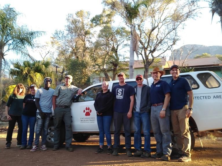
ENDANGERED WILDLIFE TRUST
Endangered Wildlife Trust (EWT) has a field station at Medike Nature Reserve and collaborative
conservation agreements with Leshiba Wilderness Reserve, Sigurwana Lodge, and Lejuma Research
Center. EWT received funds from World Wildlife Fund South Africa and the Coca-Cola Foundation to
DUQ.EDU/LIMPOPO WATER Q2 QUARTERLY REPORT, JUL-SEP 2019 | 9remove invasive trees from the
various farms and lodges near
Medike Nature Research in the Sand
River catchment in the Soutpansberg
Mountains. The trees to be
removed are the Black Wattle, or
Acacia, Acacia mearnsii and
Eucalyptus Eucalyptus camaldulensis.
These trees are not adapted to
water-stressed environments and
have been shown to detrimental to
groundwater resources (Le Maitre
et al., 2002). The trees in this
western Soutpasnberg region are
sparsely populated in contrast to the
occurrence of timber farms with
Eucalyptus trees and the spread of Figure 4: WaterQ2 and EWT staff after a tour of the tree removal projects.
this invasive species in the eastern
Soutpansberg. EWT’s goal is complete eradication of these invasive species in the western
Soutpansberg. The research component of this conservation measure is to monitor the water budget in
these high-elevation catchments to determine if the removal of these trees increases the water
resources that flow to the Sand River. The Sand River is dry through the Soutpansberg Mountains;
these high-elevation catchments may be the most important water source for the agricultural region
north of the mountain range.
TRAINING WORKSHOP: RIVER DISCHARGE MEASUREMENT AND MONITORING
TRAINING OBJECTIVES: participants should be able to:
• Apply empirical formula to the calculation of discharge
• Apply the mathematical relationships of hydraulic geometry to river gages
• Measure the discharge of a river with a current meter
Participants were provided the training outline with additional resources (Appendix E) and participate in
hands-on training on river discharge measurement (Figure 10 and 11). Additionally, students will gain
experience with an automatic level used in surveying (Figure 12) and other hydrology and water quality
instruments as available.
OTHER EVENTS
GLOBAL LAKE ENVIRONMENTAL OBSERVATORY NETWORK (GLEON) CONFERENCE
Dr. Mlotha (as first author) has been accepted for a poster presentation to the GLEON 21 meeting in
Ontario, Canada in November.
TITLE: Monitoring water quality in Limpopo River Basin, Southern Africa using remote sensing.
AUTHORS: Mlotha, J. M., Kahler, D. M., Edokpayi, J. E., and Rose, K. C.
10 | WATER Q2 QUARTERLY REPORT, JUL-SEP 2019 DUQ.EDU/LIMPOPOABSTRACT: Monitoring the quantity and quality of inland water bodies is essential for understanding ecological processes and providing water for human use. The ability to characterize water quality enables communities, governments, and the public to plan utilization of aquatic resources and manage pollution control programs for healthy aquatic ecosystems. While in situ monitoring is common in many regions, it is often not practical in many developing countries due to factors such as cost, potential equipment losses, and technical expertise. It is with this concern that geospatial technologies like satellite remote sensing imagery provide a useful tool to monitor water quantity and quality over large areas of land. In this current study, we report the use of satellite imagery to understand spatial and temporal variability of water resources in the region, focusing on remote sensing of turbidity and chlorophyll a as indicators of water quality. The Limpopo Basin is characterized by water scarcity compounded by a changing climate and ongoing drought. Both mining, wastewater discharge and agricultural activities are increasing in impact, and land use transformations appear to be reducing water quality. Our research indicates that publicly available imagery, such as Landsat, is adequate to characterize land use patterns and changes and assess water quality in large rivers during wetter times of the year. However, dry conditions, which are occurring more frequently, limit the applicability of publicly available imagery due to course pixel size. Complementing this, commercially available imagery enables characterization of water quality in smaller river and lake networks. WATER INSTITUTE OF SOUTHERN AFRICA (WISA) 2020 The collaborators have been accepted for an oral presentation at WISA 2020. The abstract is an expanded abstract (Appendix D). ASSOCIATION FOR THE SCIENCES OF LIMNOLOGY AND OCEANOGRAPHY MEETING, JANUARY 2020 Dr. Rose and others have proposed a session at the ASLO meeting. TITLE: Big data ecology: leveraging large scale data sets to understand aquatic ecosystem structure and dynamics at macrosystem scales ABSTRACT: Aquatic ecosystems are experiencing substantial pressure in many regions from population growth, urbanization, changing land use, invasive species, and climate change, among other drivers. To address these challenges, researchers are increasingly using large volumes of compiled field, model, and remotely sensed data, including from programs such as the EPA National Aquatic Resource Surveys (NARS), the USGS National Water Quality Assessment (NAWQA), the National Ecological Observatory Network (NEON), the Lake multi-scaled geospatial and temporal database (LAGOS), and satellites such as Landsat and Sentinel series. Analysis of these large datasets enable characterization and attribution of environmental patterns, variability, and change at macrosystem scales. In this session, we invite contributions that improve understanding of spatial and temporal patterns and dynamics in aquatic ecosystems at regional to continental scales. We also encourage contributions that describe improvements in analytical techniques (e.g., algorithms or software packages) for generating insights into aquatic ecosystems at these broad scales. We seek to highlight novel applications and advancements in using these tools and data sets to understand aquatic ecosystems and to synthesize similarities and differences in lotic, lentic, wetland, and coastal ecosystem responses to climate, land use, hydrogeomorphic, and other key drivers. DUQ.EDU/LIMPOPO WATER Q2 QUARTERLY REPORT, JUL-SEP 2019 | 11
Proposed (to be convened) by W. Beck (US EPA), M. Glines (RPI, WaterQ2), K. Hondula
(University of Maryland College Park), M. J. Mlotha (RPI, WaterQ2), and K. C. Rose (RPI,
WaterQ2)

MODULE 4: LIMPOPO RESILIENCE LAB
The collaborators have identified space available at the University of Venda, School of Environmental
Science for the Limpopo Resilience Lab. The space will undergo a large cleanup and signage consistent
with the Marking and Branding Plan. Univen is currently renovating additional laboratory space and the
school administration may wish to distribute the functions of the Lab across several units within the
school. In this event, consistent branding will be placed in each location.

The Limpopo Resilience Lab has unveiled the website. The website, which is the same as the project
website, is named the Limpopo Resilience Lab in order to have continuity from this project to the
ongoing Lab presence. The website is available at duq.edu/limpopo, with the site map (Appendix A) and
usage information (Appendix B) available.

12   |   WATER Q2 QUARTERLY REPORT, JUL-SEP 2019                                       DUQ.EDU/LIMPOPO
MONITORING AND EVALUATION

MODULES 1 AND 3: WATER MONITORING
There are two primary research activities that have continued in this quarter that are supported
through this project. They all fall into USAID category, Production Systems Research, as they are a
component of natural resources management: they are both in the field-testing phase of research. The
two areas of research are:

    •    Satellite methods to determine river flow
    •    Satellite methods to determine water quality (e.g., turbidity and chlorophyll)

The investigators have already begun to prepare a manuscript on the river flow method, which will be
submitted to USAID when submitted for publication. For the first quarter, no other activities have
reached monitoring values.

 TABLE 1: MODULES 1&3 INDICATORS

 INDICATOR                                 DISAGGREGATION                 CURRENT VALUE      PROJECT TOTAL

 Number of technologies, practices, and    Phase: Under research          0                  2
 approaches under various phases of
 research, development, and uptake as a    Under field testing            2                  2
 result of USG assistance
                                           Made available                 0                  0

                                           Demonstrated uptake            0                  0

 Number of peer-reviewed scientific        None                           0                  0
 publications resulting from USG support
 to research and implementation programs

 Number of hectares of land under                                         0                  0
 improved technologies or management
 practices with USG assistance

 Number of datasets shared, which were     Basin country                  0                  0
 generated as a result of USG assistance

DUQ.EDU/LIMPOPO                                                    WATER Q2 QUARTERLY REPORT, JUL-SEP 2019   |   13
MODULE 2. IWRM TRAINING, WORKSHOPS, AND CONFERENCES Module 2 contains two primary components: convene stakeholder workshops and trainings; and convene future collaborators at conferences. The first stakeholder workshop has been scheduled for August 2019 at CSIR in Pretoria. The project-level goals for these are to identify environmental champions and cultivate partnerships for future collaborations, especially with the Limpopo Resilience Lab. Project staff has been in close contact with CSIR, Kruger National Park, and Endangered Wildlife Trust. These groups will strengthen the network of water resources and biodiversity professionals in the area. TABLE 2: MODULE 2 INDICATORS INDICATOR DISAGGREGATION CURRENT VALUE PROJECT TOTAL Number of people trained in sustainable Sex Male Female Male Female natural resources management and/or biodiversity conservation as a result of 5 5 5 5 USG assistance Number of water and sanitation sector Institutional scale 0 0 institutions strengthened to manage water resources of improve water supply and sanitation services as a result of USG assistance 14 | WATER Q2 QUARTERLY REPORT, JUL-SEP 2019 DUQ.EDU/LIMPOPO
PROJECT PROGRESS

WORK PLAN PROGRESS
Table 3 outlines progress on work plan activities (outlined in the Mobilization Plan) and the ongoing
research activities. As specified in the Project Description, the following activities were planned.

 TABLE 3: PROJECT ACTIVITIES

 #   ACTIVITY                 2019               2020                     2021                            2021

                              2      3     4     1      2   3      4      1      2       3      4         1

     Startup activities:
     Mobilization Plan,
     Staffing, EMMP

 1   Establish                       *
     meteorological, river,
     and groundwater
     stations, Water
     Monitoring and
     Algorithm Development
     Report

 1   Groundwater
     measurements (ERT),
     to be included in
     Water Monitoring
     Report

 1   Develop satellite
     algorithms

 1   Develop hydrologic
     and water quality
     models

 2   Convene
     stakeholders in
     workshops

 2   Scientific conferences

 2   Training workshops                    *     *

 3   Publish and present
     basin report

 4   Launch Limpopo
     Resilience Lab

                                     Completed                            In-progress/planned

The activities marked with a star (*) have been adjusted for scheduling purposes. Hydrometeorological
data collection was scheduled for July 2019; however, due to scheduling, has been moved to August
2019. This results in a one-month delay of the first report on the locations and data collection outlined
in Milestone 4. Additionally, the staff has decided to add training opportunities in January 2020 following

DUQ.EDU/LIMPOPO                                             WATER Q2 QUARTERLY REPORT, JUL-SEP 2019   |       15
recruitment in the first stakeholder meeting. Groundwater investigations have also been delayed due to
an unforeseen shipping delay.
MILESTONE PLAN
TABLE 4: MILESTONE PLAN
# MILESTONE 2019 2020 2021 2021
Quarter: 2 3 4 1 2 3 4 1 2 3 4 1
1 Mobilization Plan Apr
2 Environmental Jun
Mitigation and
Monitoring Plan
3 Quarterly Report Jul
4 Water Monitoring Dec*
and Algorithm
Development Report
5 Stakeholder Nov
Workshop Report
6 Annual Work Plan Aug
7 Quarterly Report Dec*
8 Quarterly Report Jan
9 Quarterly Report^ Apr
10 LRL Website and Apr
Planning
11 Scientific Conference Jul
12 Basin Report Jul
13 Quarterly Report Jul
14 Stakeholder Sep
Workshop Report
15 Annual Work Plan Aug
16 Quarterly Report Oct
17 Quarterly Report Jan
18 Quarterly Report^ Apr
19 Scientific Conference Jul
20 Quarterly Report Jul
16 | WATER Q2 QUARTERLY REPORT, JUL-SEP 2019 DUQ.EDU/LIMPOPO21 Stakeholder Sep
Workshop Report
22 Water Monitoring: Aug
Two manuscripts
23 Annual Work Plan Aug
24 Quarterly Report Sep
25 Quarterly Report Jan
26 Basin Report Mar
27 LRL Continuity Mar
Report
28 Quarterly Report Apr
Shaded items are completed or pending approval. It is recommended that the Milestone Plan be revised
so that the annual cost share report, which was originally marked to occur for the reporting quarters
#5, 9, and 12, will be included in quarterly reports, marked with a carrot (^), for reporting quarters #4,
8, and 12. The water monitoring report (Milestone #4) is also marked (*).
DUQ.EDU/LIMPOPO WATER Q2 QUARTERLY REPORT, JUL-SEP 2019 | 17FINANCIAL PRIME RECIPIENT Duquesne University has used project funds for the expenditures in Table 5. Duquesne University has used other funds for the expenditures in Table 6; these represent cost share. TABLE 5: PROJECT EXPENDITURES ITEM Q2 EXPENDITURE PROJECT TOTAL Financial details have been withheld from the published report. Total $106,623.89 $106,623.89 Notes: Student support is billed to accounts at the start of the University’s fiscal year in June for the upcoming academic year. Subaward payments are accounted in the budget justification letters provided (Appendix C). TABLE 6: COST SHARE ITEM Q2 EXPENDITURE PROJECT TOTAL Financial details have been withheld from the published report. Total $0 $52,049.46 Subawardee cost share will be accounted annually. 18 | WATER Q2 QUARTERLY REPORT, JUL-SEP 2019 DUQ.EDU/LIMPOPO
APPROVAL
This Quarterly Report has been received and approved by USAID. This satisfies the requirements set
forth in the Milestone Plan, item #7: Completion of Quarterly Report (Q2).

Signature:        ____________________________________________________________

Name:             ____________________________________________________________
                  Agreement Officer’s Representative

Date:             ____________________________________________________________

DUQ.EDU/LIMPOPO                                         WATER Q2 QUARTERLY REPORT, JUL-SEP 2019   |   19
APPENDIX A: PROJECT WEBSITE MAP
The project website is easily accessible by the link, duq.edu/limpopo, which points to the full universal
resource locator at https://www.duq.edu/academics/schools/natural-and-environmental-
sciences/academics/departments-and-programs/environmental-science-and-management/limpopo-
resilience-lab. It is the intention of the collaborators to forge a long-standing relationship; this website
has been named for the Limpopo Resilience Lab, which is the project’s sustainable entity, which will
remain functional after the end of the current grant.
About
DDL
Data
Limpopo Resilience Lab
Citizen Science
DEC
Reports
DSC
Scientists
Training Workshops Training Registration
Stakeholder Engagement
Conferences
Technical Services Undergraduate research opportunities
Limpopo Resilience Lab (Duquesne University)
Gumberg Library at Duquesne University
USAID
In-progress or proposed component
• Data are housed at USAID’s Development Data Library, data.usaid.gov. The collaborators are
considering other databases better designed for scientific data.
• Reports will be housed at USAID’s Development Experience Clearinghouse, dec.usaid.gov.
• Some materials that are not generated by the project will be stored on Duquesne University’s
institutional repository, the Duquesne Scholarship Collection (DSC), dsc.duq.edu/limpopo.
• In preliminary discussions with the South Africa Department of Water and Sanitation (DWS),
DWS has indicated willingness to ultimately host the database on their server. Currently, the
testing software is hosted on a development server at RPI.
20 | WATER Q2 QUARTERLY REPORT, JUL-SEP 2019 DUQ.EDU/LIMPOPOAPPENDIX B: WEBSITE TRAFFIC REPORT
The project website has experienced some traffic since going live; however, we expect the website
traffic to increase as more materials are made available. Site visits have come from around the world
(Figure B1) with a concentration from the United States of America and South Africa (Table B1).
Figure B1: Map of audience for 01 June to 10 December 2019. Plotted are unique users for the period according to access of any page within
the Limpopo Resilience Lab website (as indicated in Appendix A, excludes the DSC). Graphic from Google Analytics.
TABLE B1: GEOGRAPHICAL WEBSITE TRAFFIC REPORT FROM 01 JUNE TO 10 DECEMBER 2019
COUNTRY UNIQUE USERS SESSIONS PAGES PER SESSION AVERAGE SESSION
DURATION (H:MM:SS)
United States of America 116 161 1.94 0:02:24
South Africa 65 86 2.57 0:03:45
Italy 2 2 6 0:01:54
Egypt 1 1 3 0:18:03
Lebanon 1 2 1.5 0:04:18
Mozambique 1 1 5 0:17:17
Finland 6 6 1 0:00:00
DUQ.EDU/LIMPOPO WATER Q2 QUARTERLY REPORT, JUL-SEP 2019 | 21France 2 2 1 0:00:00 United Kingdom 1 1 1 0:00:00 Portugal 1 4 1 0:00:00 Unique user access of the website (Figure B2) shows light use of the website except for the period of application for the upcoming GIS and Image Processing training offered at Univen in January. Data show the most frequently accessed page, other than the landing page, is the training workshops page. Figure B2: Daily unique users of all pages within the Limpopo Resilience Lab. Website analytics will continue to be reported to USAID in quarterly reports. 22 | WATER Q2 QUARTERLY REPORT, JUL-SEP 2019 DUQ.EDU/LIMPOPO
APPENDIX C: SUBAWARD JUSTIFICATION LETTERS
The following attached letters provide the budget itemization and justification for the subaward invoices.
The letters are provided without the enclosures; however, all enclosures are on file for inspection at the
request of the AOR or AO.

DUQ.EDU/LIMPOPO                                            WATER Q2 QUARTERLY REPORT, JUL-SEP 2019   |   23
This page has been removed because it contains sensitive financial information.

24   |   WATER Q2 QUARTERLY REPORT, JUL-SEP 2019                                  DUQ.EDU/LIMPOPO
This page has been removed because it contains sensitive financial information.

DUQ.EDU/LIMPOPO                                            WATER Q2 QUARTERLY REPORT, JUL-SEP 2019   |   25
This page has been removed because it contains sensitive financial information.

26   |   WATER Q2 QUARTERLY REPORT, JUL-SEP 2019                                  DUQ.EDU/LIMPOPO
This page has been removed because it contains sensitive financial information.

DUQ.EDU/LIMPOPO                                            WATER Q2 QUARTERLY REPORT, JUL-SEP 2019   |   27
This page has been removed because it contains sensitive financial information.

28   |   WATER Q2 QUARTERLY REPORT, JUL-SEP 2019                                  DUQ.EDU/LIMPOPO
This page has been removed because it contains sensitive financial information.

DUQ.EDU/LIMPOPO                                            WATER Q2 QUARTERLY REPORT, JUL-SEP 2019   |   29
APPENDIX D: WISA PRESENTATION ABSTRACT

TITLE: A SWOT ANALYSIS OF WATER RESOURCE MANAGEMENT OF THE LIMPOPO RIVER
BASIN

BACKGROUND
The Limpopo River Basin (LRB), located in sub-Saharan Africa, is a transboundary river basin shared by
the countries South Africa, Botswana, Zimbabwe, and Mozambique. The Limpopo river basin covers an
area of 416, 296 km2, and is home to approximately 18 million people as of 2012, expecting to surpass
20 million by 2040. According to the United Nations Environment Programme assessment on water
scarcity, the LRB will be in a state of physical water scarcity. Physical water scarcity is defined as physical
access to water is limited, the demand for water is higher than the availability. The development of local
capacity to maintain water resources and make proactive, scientifically justified management decisions
requires a substantial human capital resource that is currently lacking in the basin.

METHOD
A stakeholder meeting was convened with major players in the water industry in Southern Africa region.
Major participants were from the Department of Water Affairs and Sanitation of South Africa and
Botswana. Research scholars from CSIR and Agricultural council of South Africa were also present with
water experts from both national and international Universities. SWOT Analysis is a tool used for
strategic planning and strategic management was used in this study to identify various areas of strength,
weakness (needing improvement), opportunities and threat in the management of the Limpopo River
Basin (Nazarko et al., 2017; Gürel and Emet, 2017).

RESULT
Strengths
    • Organizational relationships intra- and inter-basin.
    • Availability of policies at national-level and transboundary level
    • Effective collaboration between riparian states
    • Availability of local expertise
    • Donor-funded projects and data
    • Resilient Waters identified hotspots already
    • Strong stakeholder participation
    • Existence of and functionality of the River Basin Organisation (such as the Limpopo
        Watercourse Commission (LIMCOM), Southern African Development Community (SADC),
        Joint Permanent Technical Committee, JPTC).
    • Groundwater aquifer research
    • Networks of quality and quantity monitoring.

Areas for improvement
   • Drought extent, prediction
   • When will rainfall starts – for farmers for mitigation

30   |   WATER Q2 QUARTERLY REPORT, JUL-SEP 2019                                              DUQ.EDU/LIMPOPO
• Real-time information on a number of parameters. Floods. Early-warning systems (drought,
flood)
• Indicators suggest that water quality and quantity are declining, need prioritization of monitoring
networks, alternative products (e.g., satellites).
• Knowledge management, lots of work done, hard to find what was done, hard to access data.
• Enhanced capacity building, joint cooperation, focused courses
• Best practices for data management, QA/QC, infrastructure, monitoring, and management
• Consistency/sustainability from basin organizations for M&E for water data
• Sharing of data, one center for your data/common repository
• Collection and management of water data – harmonization (QA/QC, metadata)
• Effective, integrated planning for wasted water
• Planning for results, long-term
• Surface water, lots of data, need to take data from just numbers to actionable, derived products
(e.g., floods in Limpopo)
Opportunities
• EFTEON (call for landscapes - 6, 20 years, provides infrastructure)
• Digital Earth Africa (Australian)
• External donors (EFTEON, NRF, ODAs, UNESCO, SIDA, GIZ)
• Other support, data management (IGRAC, ORASCOM)
• New organizations: SADC GMI (groundwater)
• Other organizations: Waternet (capacity building), mining organizations (Chamber of Mines,
NBI), agriculture (farmers’ union), local municipalities.
• WSSLG – water and sanitation sector leader group (”360 group”, high-level)
• Gender and water
Threats
• Demographic changes
• Data access and availability from external organizations: cost, availability
• Open-access as a key principle
• Lack of information infrastructure: external data sources, formatting, data infrastructure (NIWIS
as an opportunity to address this)
• Highest-level prioritizations sometimes don’t consider long-term
• Lack of polluter pays principles
• Limited institutional knowledge management
• ODAs
• Gender disparity in the water sector
CONCLUSION
Results from the SWOT analysis can be used to mitigate the threat identified associated with the
current management of Water Resources in the LRB. The strengths and opportunities identified can be
harnessed such that their effects can work simultaneously to improve water resource management in
the LRB. Also, strategy on minimizing the weakness and threats while exploiting the available
opportunities will also lead to improved Water resource management in the river basin
DUQ.EDU/LIMPOPO WATER Q2 QUARTERLY REPORT, JUL-SEP 2019 | 31REFERENCES
Gürel and Emet. “Swot Analysis: A Theoretical Review.” Journal of International Social Research, vol. 10,
no. 51, 2017, pp. 994–1006., doi:10.17719/jisr.2017.1832.
J Nazarko, J Ejdys, K Halicka, A Magruk, Ł Nazarko, A Skorek. Application of Enhanced SWOT Analysis
in the Future-oriented Public Management of Technology Procedia Engineering 182 (2017) 482 –
490: doi:10.1016/j.proeng.2017.03.140
32 | WATER Q2 QUARTERLY REPORT, JUL-SEP 2019 DUQ.EDU/LIMPOPOWaterQ2: Understanding Water Quality and Quantity in the Limpopo Basin
You can also read