Draft Flood Management Strategy Port Phillip and Westernport - Clearwater
←
→
Page content transcription
If your browser does not render page correctly, please read the page content below
Draft Flood Management Strategy Port Phillip and Westernport
This strategy reflects the work
and expertise of floodplain
managers across the region.
Melbourne Water prepared
this strategy with governance
and oversight from a Project
Control Board representing
key stakeholders.

ACKNOWLEDGEMENTS
Our Flood Strategy Project Control Board included representatives from:

Bureau of Meteorology                                    Insurance Council of Australia
City of Kingston                                         Melbourne Water
City of Melbourne                                        Metropolitan Planning Authority
City West Water                                          Municipal Association of Victoria
Department of Environment, Land, Water and Planning      South East Water
Department of Health and Human Services                  Victoria State Emergency Service
Emergency Management Commissioner (Chair)                Wyndham City Council

Melbourne Water thanks everyone for their involvement; it means we now share a vision and
an understanding of the challenges facing our region and the best ways to address them.
Contents
PREFACE                                             2   SECTION 4
                                                        Objectives, targets and actions                                        20
SECTION 1
                                                        Understanding the risk and sharing information                         21
Introduction                                       3
                                                        Taking action to manage current and future risks                       27
Why we need a flood strategy                        3
                                                        Working together to improve our effectiveness                          34
About the Port Phillip and Westernport region       5
Building on progress so far                         6   SECTION 5
                                                        Delivering this strategy                                               36
SECTION 2
                                                        Review process                                                         36
A shared vision for Port Phillip and Westernport   7
                                                        Endorsement and participation                                          37
Targets                                            8
                                                        Oversight                                                              37
SECTION 3                                               Monitoring and reporting                                               37
Flooding in our region                             10   Implementation                                                         37
The impact of floods                               11
                                                        APPENDIX 1
Managing large and small floods                    16
                                                        Flood management roles                                                 38
How flooding is managed                            18
Who participates in floodplain management?         19   GLOSSARY                                                               40

                                                        ACRONYMS                                                               42

                                                        BIBLIOGRAPHY                                                           42

                                                                Draft Flood Management Strategy Port Phillip and Westernport    1
Preface
Melbourne Water prepared this draft strategy by consulting widely.

Consultation included discussions and workshops with many stakeholders including state government
departments, councils, emergency service organisations, and communities.

Most government agencies with a role in flood management for the Port Phillip and Westernport region
contributed their expertise. This strategy reflects the effort and activities of floodplain managers across
the region.(Throughout this strategy ‘we’ refers to all relevant flood management agencies.)

Your feedback on this draft including our proposed direction, actions and targets, will inform
development of a final strategy.

                              Testing
    Research                     key                       Draft       Final
                             directions                  strategy    strategy

                                                     CONSULTATION

2    Draft Flood Management Strategy Port Phillip and Westernport
Floodwater is dangerous – never drive, walk or ride through floodwater.

SECTION 1
Introduction

Why we need a flood strategy
Flooding is natural and inevitable. Like fire and other natural hazards, it is a part of the
Australian landscape.
Floods are a natural occurrence in the Port Phillip and                   While this strategy discusses all aspects of flooding in our region,
Westernport Region. We can’t stop them happening,                         its key focus is flood prevention and risk-reduction activities.
but we can plan for and manage the risk.                                  These are often referred to as ‘floodplain management’. These
                                                                          activities support other aspects of general flood management
This strategy sets out how we will work to understand,                    including emergency response and recovery, and planning for
avoid and reduce flood risks, and how we can support
                                                                          natural environments and liveability. This strategy is part of
flood-emergency preparation and response, across the region.
                                                                          the Victorian ‘all hazards, all agencies’ approach to emergency
It sets out a vision for the Port Phillip and Westernport region,         risk assessment, prevention, preparedness, response and recovery.
and creates a framework to help guide the work of the many
organisations managing flood risks to deliver on this vision. This
strategy will inform current and future approaches to research,
flood planning and investment, and engaging with communities.

                                                                                     Draft Flood Management Strategy Port Phillip and Westernport   3
The focus of this flood management strategy

                                                                   RESPONSE
                                                         Personal response plans
                                                              Sandbagging
                                                               Monitoring
                                                               Evacuation

                                     Warnings                                      Temporary
                                   Information                                  accommodation
                                    Education                                    Relief centres
                                                               Planning
                                                             Preparedness
                                                                Training
                                                          Community awareness
                                                                Funding
                                                               Advocacy
           PREVENTION                                                                    RECOVERY
             Urban planning                                     Insurance                  Community
       Legislation and regulation                               Rebuilding              Support programs
           Land use controls                                 Community action              Counselling
            Structural works                                   Restoration               Personal support
          Asset management                                      Advocacy                   Material aid

(There is more information about the organisations contributing to prevention, response and recovery throughout
this document. Appendix 1 shows a summary of flood management roles.)

4   Draft Flood Management Strategy Port Phillip and Westernport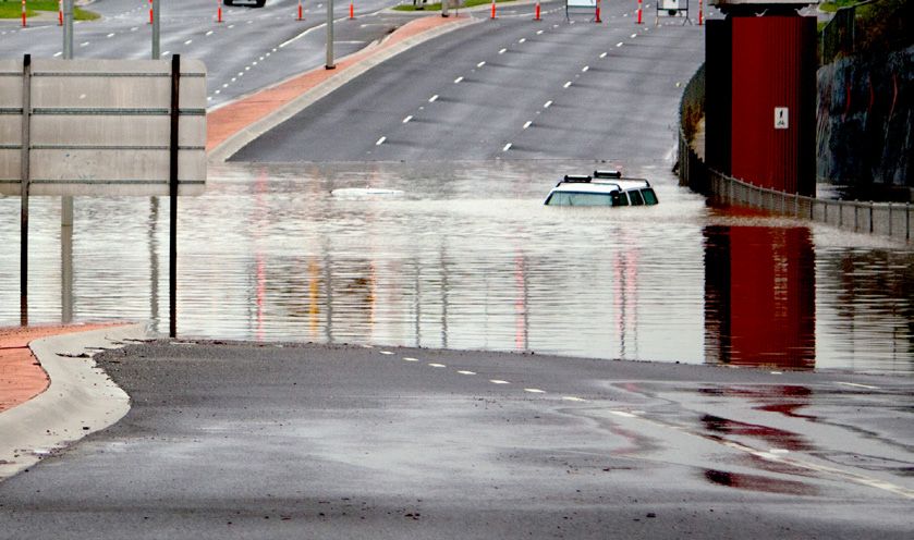
SECTION 1

About the Port Phillip and Westernport region                    Approximately 130,000 properties are known to be affected
                                                                 by floods. (More information about the number of properties
Our region is home to over four million people.                  at risk is available on page 11.)
It is densely covered with homes, businesses,                    The consequences of floods are serious for people living in
agricultural land, and infrastructure.                           affected areas, and can have major economic repercussions
                                                                 for the state.2 As the region continues to grow, we need to
The region’s population is expected to almost                    manage the risks to avoid new or increased hazards to people,
double by 20501. This means that floods have                     and minimise property and environmental damage, economic
                                                                 costs, and disruption to communities.
the potential to affect a great number of people
and assets.                                                      Our region is unique in Victoria because of the many different
                                                                 organisations that work together to manage flood risks,
                                                                 including 38 councils, retail and wholesale water authorities,
The Port Phillip and Westernport region, Victoria                and policy, planning and emergency management agencies.
Our region covers approximately 13,000 square kilometres,
extending from high in the Yarra Ranges to the east, to Ballan
in the west, to Kinglake in the north, and south to include      1. Plan Melbourne 2013, Victoria in Future 2014
Mornington Peninsula, and Phillip and French Islands.            2. Victorian Economic and Financial Statement 2011

     The region includes
     five major river
     basins: the Werribee,
     Maribyrnong and Yarra
     Rivers, Dandenong Creek,
     and the Westernport
     river systems.

     Legend:
         Region
         Major waterways
         River basins
         Established urban area
         Growth corridors

                                                                             Draft Flood Management Strategy Port Phillip and Westernport   5
Building on progress so far                                          Updated flood mapping and ongoing development advice
                                                                     • Ongoing updates to planning schemes to include flood
This strategy builds on progress delivered                              mapping, and ongoing development advice to councils
under the 2007 Flood Management and                                     and landowners where new developments could be
                                                                        affected by flooding.
Drainage Strategy.
                                                                     The experience and working relationships developed through
Outcomes of the 2007 strategy include:                               delivering the 2007 strategy have highlighted challenges for
Improved knowledge                                                   the region, and opportunities to keep improving our service.
• Improved knowledge of regional flood risks through ongoing        Challenges and opportunities include:
   flood modelling and mapping, development of a standardised
   risk assessment framework, and ongoing inclusion of flood         Infrastructure upgrades
   information in planning schemes and growth corridor plans.        • Infrastructure upgrades have been targeted at the highest-
                                                                        priority and best-value locations, and designed to be as
Improved understanding                                                  cost-effective as possible; however, they are generally
• Improved understanding of the potential future pressures on          very expensive. As we work to address risks in areas where
   existing drainage systems resulting from predicted climate           infrastructure upgrades are more difficult, the cost of
   change and increased development in established urban areas.         traditional infrastructure works could outweigh the benefit.
                                                                        We need to consider all available tools to build resilience
Local flood management plans and improved collaboration                 and deliver good value flood risk management, tailored for
• Progress toward agreed approaches to the management of               each location and community.
   existing regional flooding problems and improved collaboration,
   through development of local flood management plans for           Catchment scale issues
   every municipality in the region.
                                                                     • Catchment scale issues including integrated water
                                                                        management, land use and development planning, and
Reduction of ‘intolerable’ flooding                                     drainage management are critical to effective flood
• Reduction of ‘intolerable’ flooding by 10% across the region         management. They can be key drivers of both flood risks
   through measures to decrease either likelihood or impact,            and flood solutions. Coordinating activities in all these
   including a number of major drainage system upgrades,                areas will support good outcomes in the long term.
   education programs, and warning systems.
                                                                     Supporting emergency response and recovery preparation
Local flood and drainage infrastructure upgrades                     • A s we cannot remove all flood risks, well-prepared and
• Delivery of a wide range of localised flood and drainage             aware communities and emergency response services
   infrastructure upgrades to support local risk reduction              are essential; they can help reduce the impact of floods
   and development.                                                     and speed up recovery, improving resilience. Floodplain
                                                                        management activities need to support emergency response
Enhanced community education, awareness and preparedness                and recovery preparation, and help build resilience.
• Enhanced community education, flood awareness and
   preparedness in partnership with VICSES and councils.             To meet emerging challenges and to continue delivering services
                                                                     effectively, the flood managers contributing to development
Expanded network of streamflow gauges and flood                      of this strategy have identified ongoing communication, greater
warning services                                                     collaboration, and more transparent decision making and
• An expanded and maintained network of streamflow                  planning by all stakeholders as key areas for focus.
   gauges, and ongoing provision of targeted flood warning
   services in partnership with BoM and VICSES.

6    Draft Flood Management Strategy Port Phillip and Westernport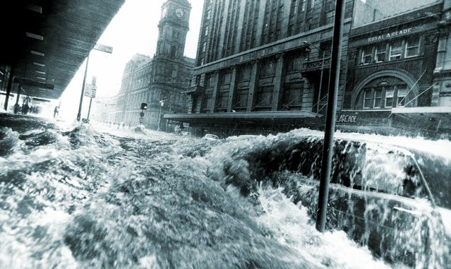
SECTION 2
A shared vision for Port Phillip
and Westernport

                                         Together we are aware, responsive and resilient.
            VISION                       Communities, business and government understand
                                         flooding, plan for challenges, and take action to
                                         manage risks.

          OBJECTIVE 1                            OBJECTIVE 2                                        OBJECTIVE 3
      The right information is            Flood risks are addressed to                      Land, water and emergency
     available at the right time          reduce impacts and get the                          planning agencies work
       to people who need it               best social, economic and                       together to manage flooding
                                           environmental outcomes

                                                  OUTCOMES
  • Flood data and risk information    • Flood risk management                         • Ongoing floodplain management
     is produced and shared to meet        programs are delivered for                       activities are supported by clear
     regional priorities and needs.        the best value, focusing on                      roles and responsibilities.
                                           highest-priority areas first.
  • Flood decision makers have                                                          • Land, water and emergency
     up-to-date information, and the    • Future risks are identified and                  planning activities are well
     skills and capacity they need to      included in flood management                     coordinated to help reduce risks.
     be effective.                         planning.

  • Communities understand their       • New developments and suburbs
     flood risks and how they can          are well planned, to avoid
     manage them.                          increases in flood risk.

                                        • Risks associated with climate
                                           change and urban development
                                           are planned for and managed.

                                                                           Draft Flood Management Strategy Port Phillip and Westernport   7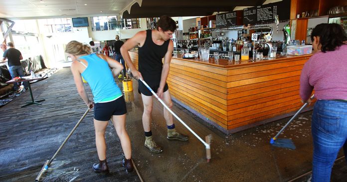
Targets
Targets have been developed to track critical indicators of progress toward the vision and objectives.

While each target has a primary relationship with one objective, they work together as a group to track how implementation
of the overall strategy is delivering the vision and the three objectives. The objectives and targets track the outcome of work
by many organisations.

Objective                                2021 targets*                                 More information

1. T
    he right information                1a 	65% of catchments and coasts             Progress in mapping and understanding flood risk,
   is available at the right                 are flood-mapped, and current             and sharing information, is an essential outcome.
   time to people who                        and future risks are assessed
   need it                                   to an agreed standard, starting           This strategy outlines actions to ensure ongoing mapping
                                             with priority catchments;                 and risk assessment produces the right information for
                                             information is made publicly              our region, and that it is shared. We aim to complete all
                                             available.                                remaining mapping and risk assessments as soon as
                                                                                       practical, and continue to update them over time.
                                         1b 	100% of available public
                                             flood risk information is made            Flood information will be made as accessible as possible
                                             accessible to help everyone               to the general public through improved design and
                                             understand and manage                     availability, supporting people to find and use the
                                             their flood risks.                        information they need.

                                         1c	30% of people directly affected Research indicates that public awareness of flood risk
                                            by flooding are aware of their   is low, and many people do not realise they could be at
                                            flood risks and know what to do. risk. Targeted awareness-raising will be undertaken to
                                                                             improve awareness and preparedness, reducing flood
                                         (Effort is targeted at              risks and impacts. We will work to increase awareness
                                         highest-risk areas first).          in highest-risk areas first, and improve awareness
                                                                             everywhere over time.

2. Flood risks are addressed 2.Agreed flood management                               This target tracks our progress in developing and
    to reduce impacts and get   approaches are being delivered                         implementing agreed flood management solutions
    the best social, economic   in 100% of highest-priority                            in the areas where they are needed most.
    and environmental           areas to address the likelihood
    outcomes                    or consequences                                        Actions in this strategy outline how priorities will
                                of flooding.                                           be agreed, and how flood management decisions
                                                                                       will be made, to make best use of available funds.

3. Land, water and                      3. B
                                             y 2021, locally and                      This target measures our progress in planning for the
    emergency planning                      regionally appropriate flood               present and future across the entire region.
    agencies work together                  management approaches will
    to manage flooding                      be collaboratively developed for           All stakeholders influencing flooding will need to work
                                            40% of catchments and coasts,              together to ensure flooding is managed across the region,
                                            taking into account current and            and take actions required now to ensure risks do not get
                                            future risks.                              worse in future.

* Baseline data is now being collated. Targets and Melbourne Water’s contribution to delivering them will be finalised using this data and feedback
   on this draft strategy.

8     Draft Flood Management Strategy Port Phillip and Westernport
SECTION 2
These targets require input from all flood management stakeholders. Melbourne Water’s estimated contribution
is outlined below.
Melbourne Water will also continue a wide range of related flood management activities including actions outlined
in this strategy to continue delivering effective floodplain management services for the region.
2050 outcomes Melbourne Water contribution Key terms
to 2021 targets
100% of catchments and coasts 1a MW will lead mapping and risk Highest-priority areas
are flood-mapped, and current assessments to agreed standards, Highest-priority areas will be
and future risks are assessed to for prioritised catchments across the developed for the region in
an agreed standard; information region. A whole-of-catchment approach collaboration with government
is made publicly available. will be taken wherever possible. stakeholders and communities.
(More on this process is outlined
100% of available public flood risk 1b MW will lead a review and update of
in actions on pagse 21 and 28).
information is made accessible to all MW-generated flood information
help everyone understand and and sharing processes.
manage their flood risks. Flood awareness
1c MW will contribute to development
Flood awareness describes public and
100% of people directly affected and delivery of a regional community
community knowledge of local risks
by flooding are aware of their flood planning and education program
and the possible impacts of flooding,
risks and know what to do. delivered by VICSES, targeting areas
and individuals’ understanding of how
identified as most urgent or at
they can manage their own risks.
greatest risk.
Locally and regionally appropriate
flood management approaches
Appropriate approaches to minimise
current or future flood risks in a local
area, considering regional needs.
Agreed flood management 2. MW will continue to develop and
Flood management approaches are
approaches are delivered in all implement flood management approaches
developed by flood managers working
catchments and coasts, taking into in the region’s highest priority areas. We
with local communities to determine
account local and regional needs, will work with all stakeholders to achieve
the most effective and viable methods
and current and future risks. this target. Developing and agreeing on
to reducing flood risks and their impacts.
appropriate approaches in each location
will require input from all participating (See the glossary on page 40).
stakeholders.
3. MW will support development of flood
management solutions across the region,
in collaboration with councils, VICSES,
and other stakeholders. Delivery of this
target will require participation
by everyone.
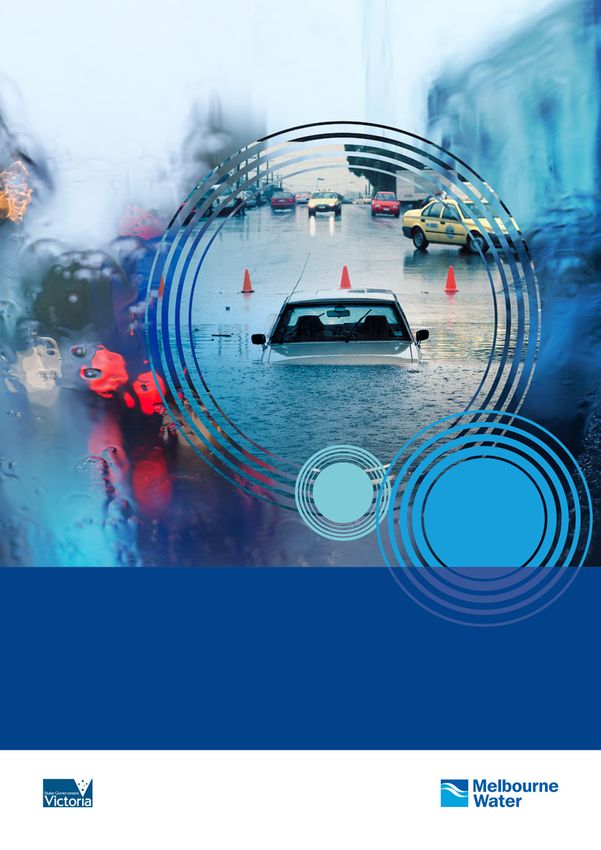
Draft Flood Management Strategy Port Phillip and Westernport 9Car stuck in floodwater, Narre Warren.
Floodwater is dangerous – never drive,
walk or ride through it.
Image by David Dashwood
SECTION 3
Flooding in our region
This section outlines the impact of flooding in our region, and the framework we use for
managing flood risks.
A short history of flooding in Port Phillip Drainage systems built as part of early developments were
and Westernport not designed to hold the volumes of water we now know can
flow through our landscape. When there is more runoff than
Aboriginal inhabitants of our region harvested food and other underground drains can carry, water overflows onto
resources from waterways and floodplains. Floodplains retain surrounding land, flooding roads and properties.
important cultural significance.
Urban development standards for flooding were improved in
Later European settlement and urban development occurred the 1970s, when new suburbs were required to provide space
within floodplains due to their fertile soils and access to water. for floodwaters to be stored, and to flow overland. Suburbs
This has placed buildings and people in the path of flooding. built after the 1970s have a much lower risk of flood damage.
We have also increased the volume of floodwater by clearing The history of the Port Phillip and Westernport region has
forests and developing land; water now flows more swiftly been marked with many serious and damaging floods. In
off the surface of cleared and paved landscapes, instead of some locations small, frequent flooding causes significant
filtering into soils. local damage, inconvenience and disruption.
10 Draft Flood Management Strategy Port Phillip and WesternportSECTION 3
The impact of floods
Floods are dangerous to people. Drowning The broader, indirect economic costs of floods have
an impact on everyone.
and injury are serious risks, and floodwaters
Floodwaters can cause significant damage when very deep or
can become contaminated with sewage
widespread, or when moving quickly. Flooding deep enough to
and other pollutants that pose health cover floors can cause extensive damage to buildings and public
risks to people. infrastructure; however, such large events are quite rare.
There are currently approximately 130,000 properties that Smaller, more frequent floods do not generally cause as much
we know are at risk of flooding in our region.3 physical damage, but the cumulative cost of repeated damage,
disruption and social impacts (such as stress) can be very high.
Of these, it is estimated that approximately 15,000 properties
include buildings that are at risk of flooding over the floor level.4 The personal and social costs of flooding are less visible
than safety hazards and physical damage, but are also very
There are likely to be more properties at risk in areas where significant. Those who have suffered in floods report long-
flood mapping is yet to be completed. More will be affected term stress and disruption from the flood itself, and from
in the future if flood patterns change as a result of predicted losing homes, vehicles, valued personal possessions, and
climate change. serious disruption to daily life.
The average annual damage (AAD) costs of flooding in the Floods and floodwaters can damage the natural environment,
Port Phillip and Westernport region are extremely high. causing erosion, pollution, and ecological losses that may last
Insurance industry information indicates that floods are our much longer than damage to buildings and infrastructure. In
most expensive natural hazard.5 (The personal costs and some areas, floodwaters have environmental benefits; for
regional economic effects of flooding are not included in this example, providing natural seasonal changes in streamflow,
AAD figure because accurate dollar values cannot be easily replenishing water to natural floodplains, and supporting
determined using the data we have available.) native vegetation.
Flooding in Port Phillip
and Westernport
This diagram shows current Melbourne
Water flood mapping for a 1% AEP flood
event. It does not include flood mapping
undertaken by other authorities.
Legend:
Floodplain
Coastal floodplain
Established urban area
Growth corridors
Melbourne Water region
3. This is the number of properties we know to be at risk from a 1% AEP flood event; that is, a flood with a 1% chance of occurring in any given year. These properties
are at risk of floods that arise along waterways and regional drains. This number is drawn from flood mapping completed by Melbourne Water. More properties may
be at risk along local drainage lines, and where mapping is yet to be completed.
4. This is a conservative estimate based on information currently held on Melbourne Water databases. The actual number of buildings that could be at risk of above
floor flooding during a 1% AEP flood is likely to be higher, and will be determined as more data is collected and analysed.
5. Flood Risk Management in Australia 2008
Draft Flood Management Strategy Port Phillip and Westernport 11Past risk assessment
This diagram shows catchments where risk assessments have been made by Melbourne Water. Risk assessments are
updated as better information becomes available.
Risk assessment outcomes are shown for entire catchments, but the area actually at risk of flooding is much smaller.
You can see a diagram of floodplains on page 11.
Risk assessments are made using a Flood Risk Assessment
Framework that allows the likelihood and consequences of
floods to be quantified in a consistent way. The framework
considers a range of issues including:
• the possible size of floods past flooding
• how hazardous floods could be
• the number of properties affected
• potential physical damage
• local issues such as possible effects
on vulnerable communities
• flood management measures
already in place.
(More information about the framework and how
we plan to update assessments and expand our
approach to understanding flood risks is available
on page 21).
Legend:
Many flood management projects have Urban growth boundary
been completed to reduce risks across the Catchment with extreme flood risk
region; more information about regional Catchment with high flood risk
flood management projects can be found Catchment with medium flood risk
at: www.melbournewater.com.au Risk yet to be assessed
Flooded foot path, Lower Yarra
12 Draft Flood Management Strategy Port Phillip and WesternportSECTION 3
HISTORY OF FLOODING
Below is a timeline showing some of the flooding that has occurred over the last 123 years and the changes in our
approach to flood risk management.
Port Phillip and Westernport Flooding Timeline
1891 1972
1934
The 1974
Great Elizabeth
Flood St flooding -
Over 200mm 78.5mm of rain Maribyrnong
of rain fell in fell in 1 hour River –
48 hours over
110mm of
the Yarra
rain fell over
Catchment
48 hours
1983 1996
1994
Werribee –
Bunyip -
60mm of
Highest 42mm of
rain fell in
tide reading rain fell in
24 hours
at St Kilda 24 hours
Marina
- 1.29m
2004 2006
2003
2005
Darebin, Severe Northcote
Banyule, localised storms and Coburg
Whitehorse and Widespread
across eastern & – 75.2mm of
Manningham riverine flooding
north eastern rain fell in
106.5mm of rain across the
suburbs 30 minutes
fell in 2.5 hours Melbourne region
up to 125mm
of rain fell in
24 hours
2012
2011 2014
Koo Wee Rup,
Melbourne CBD, 80mm of rain
Elwood, Werribee fell over Second highest
and Bunyip region 2 days tide reading at
up to 150mm St Kilda Marina
of rain fell in - 1.28m
14 hours
Draft Flood Management Strategy Port Phillip and Westernport 13What happens when it floods
Flooding is a part of the natural environment.
We can’t stop it, but we can manage the risk.
1
Natural Floodplain –
Flooding can benefit natural
landscapes.
2
Riverine flooding occurs where
we’ve built in natural
floodplains – when rainfall
exceeds the capacity of a river
or creek it overflows onto the
surrounding land.
4
Flooding can happen in places you
might not expect. Overland flooding
happens when rainfall exceeds the
capacity of our drains and pipes.
3
Flooding is a risk to safety. It can
damage homes, causing stress
and personal loss.
6
5 Very high tides caused by
Flooding costs everyone and not just financially. storms can result in coastal
Even if you aren’t flooded, public transport and flooding. Climate change
roads can be blocked, stopping people getting could make this worse.
where they need to go. Flooding can cause
damage to workplaces, businesses and public
infrastructure. These issues have broad
economic impacts.
The Port Phillip and Westernport region is at risk of flooding and if we don’t continue to
manage these risks it could get worse. Within our region we know of approximately
130,000 properties at risk of flooding. Flooding is our most expensive natural hazard.
14 Draft Flood Management Strategy Port Phillip and WesternportFlooding on Elizabeth Street, 1972
Flooded house, Elwood A VICSES worker exits
a flooded underground
carpark, St Kilda
Road closures due to flooding, Narre Warren
Image by David Dashwood
Draft Flood Management Strategy Port Phillip and Westernport 15Managing large and small floods
This strategy will help flood managers address all kinds of flooding, from the small and frequent floods to very large,
infrequent floods
Types of flooding and their effects:
COMMON TERMS Minor Moderate Major
SIZE Smaller Bigger
FREQUENCY Occur often Occur less often
RISK Maybe smaller Maybe bigger
Drainage system operating
Drainage system overflows
Overland flooding
Riverine flooding
Coastal and storm surge
WHAT’S HAPPENING
Stormwater is contained
FLOODING Stormwater overflows into streets and possibly Major overflow and
in the drainage system
IMPACTS properties. Inconvenience and disruption, some damage widespread flooding.
and rivers and creeks Damage to property
and environment. Major
disruption. Social impacts.
Social, environmental and economic impacts
(See the glossary on page 40 for an explanation of terms in this diagram.)
16 Draft Flood Management Strategy Port Phillip and WesternportSECTION 3
Common terms to describe severity Types of flooding – where water
of floods comes from
There are a range of terms used to describe the scale or Overland flooding
severity of floods. The terms below are used to describe Overland flooding occurs when runoff from storms exceeds
the size of floods, and are often used in flood warning the capacity of our drains and pipes, and overflows onto
services and other public communication about flooding. surrounding properties. Overland flooding can happen very
quickly. Floods that rise very rapidly are often known as
Minor flooding
‘flash’ floods.
Minor flooding causes inconvenience. Low-lying areas next
to waterways are inundated. Minor roads may be closed Riverine flooding
and low-level bridges submerged. In urban areas inundation Riverine flooding occurs when runoff from storms exceeds
may affect some backyards and buildings below the floor the capacity of a river or creek and overflows onto
level, and affect some bicycle and pedestrian paths. In rural surrounding land.
areas removal of stock and equipment may be required.
Coastal and storm surge flooding
Moderate flooding Very high ocean tides occurring during storms can cause
In moderate flooding main traffic routes may be affected. flooding along coasts and the lower reaches of rivers,
Some buildings may be affected above the floor level. particularly when combined with high rainfall.
Evacuation of flood affected areas may be required. In
rural areas removal of stock is required.
Local flooding can cause disruption. Floodwater is dangerous - never drive,
walk or ride through floodwater.
Major flooding
Extensive rural areas and/or urban areas are inundated.
Many buildings may be affected above the floor level.
Properties and towns are likely to be isolated and major
rail and traffic routes closed. Evacuation of flood-affected
areas may be required. Utility services may be impacted.
These definitions are taken from the Bureau of Meteorology’s
Definitions of Terms Used in Flood Warnings (See the
glossary on page 40.)
When describing the risk of floods, Melbourne Water currently
uses the terms Extreme, High and Medium. These labels
are applied where flood risk (including both the likelihood
and consequence) has been assessed by Melbourne Water.
The following sections outline how the current approach to
understanding flooding and risk will be updated to better
reflect all kinds of flooding.
Draft Flood Management Strategy Port Phillip and Westernport 17How flooding is managed
Although we cannot ‘fix’ all flooding, we can work to reduce the likelihood of flooding in some locations, and minimise the
impact when a flood does happen by being well prepared and ready to manage the consequences.
Flood risks in Port Phillip and Westernport are managed according to national and state best practice guidelines set out in the
Revised Draft Victorian Floodplain Management Strategy and Managing the floodplain – a guide to best practice in flood risk
management in Australia.6 The table below summarises the floodplain management process in our region.
The floodplain management process
Understand the risk Objective 1
• Mapping and assessing risks The right information is available at the
LAND & WATER & FLOODPLAIN EMERGENCY
• Sharing information with those who need it
INFRASTRUCTURE WATERWAYS right timeMANAGEMENT
to people who need it MANAGEMENT
• Engaging communities to understand risk and build resilience
State • Victorian Climate • Water supply policy and • Victorian Floodplain • Victorian Emergency
Change
Manage existing risksAdaption Plan IWM policies and plans Management
Objective 2 Strategy Management Framework
• Victorian Waterway • State Flood
Implementation
Management Strategy Emergency Plan
• Manage known risks making best use of resources Flood risks are addressed to reduce impact
• Avoid new risks
Regional byMelbourne
• Plan managing development
• Regional Healthy and get the best
• Regional social, economic
Flood and environmental
• Central Flood
Waterways and outcomes
Management Emergency Plan
• Plan ahead for future risks Stormwater Strategies Strategy
Localtogether• Precinct
Work Structure
to improve ourPlans • Municipal water
effectiveness • Municipal
Objective 3 Flood • Municipal Emergency
• Municipal Planning strategies Management Plans Management Plans
Policies (where applicable)
• Clarify roles where necessary Land water and emergency planning agencies work together
• Improve coordination across all flood managers to manage flooding
This strategy sits within a framework of related policies and strategies that work together to help prevent and manage flooding,
and support response and recovery.
LAND & WATER & FLOODPLAIN EMERGENCY
INFRASTRUCTURE WATERWAYS MANAGEMENT MANAGEMENT
State • Victorian Climate • Water supply policy and • Revised Draft • Victorian Emergency
Change Adaption Plan IWM policies and plans Victorian Floodplain Management Framework
• Victorian Waterway Management Strategy • State Flood
Implementation
Management Strategy Emergency Plan
Regional • Plan Melbourne • Regional Healthy • Regional Flood • Central Flood
Waterways and Management Emergency Plan
Stormwater Strategies Strategy
Local • Precinct Structure Plans • Municipal water • Municipal Flood • Municipal Emergency
• Municipal Planning strategies Management Plans Management Plans
Policies (where applicable)
6. Revised Draft Victorian Floodplain Management Strategy, 2015, Managing the Floodplain: a guide to best-practice flood risk management in Australia, 2013
18 Draft Flood Management Strategy Port Phillip and WesternportSECTION 3
Who participates in floodplain management?
Many organisations have a role in preparing for and managing flood risks, including activities in prevention, preparation,
response and recovery; such as:
• M
elbourne Water (regional drainage and floodplain • Victorian State Government departments and agencies:
management authority): > set policies and state guidelines for floodplain
> coordinates planning and delivery of flood management management, urban planning and development,
services at a regional level and water resource management
> manages waterways > support recovery from floods.
> contributes to development and implementation of
integrated water management (IWM) knowledge and tools. • Emergency services agencies:
> lead emergency preparation and response
• 38 councils: > deliver community, education, awareness and
> manage local urban planning and building local drainage preparation programs.
> support local community resilience
> contribute to regional flood management • Federal Government organisations:
> develop and implement local flood plans and IWM > set national policies and guidelines for flood and
infrastructure as appropriate. emergency management
> coordinate national research and data
• Retail water authorities: > provide some funding for flood prevention and
> manage urban water resources recovery activities.
> undertake technical research
• Communities, individuals and businesses:
> develop and implement IWM infrastructure
> responsible for understanding personal and local risks, and
and tools with other stakeholders.
taking appropriate preparation and risk management steps
> can contribute to development of local flood
management plans and projects.
Melbourne Water retarding basin holding flood water, Narre Warren South.
Image by David Dashwood
Draft Flood Management Strategy Port Phillip and Westernport 19Yarra River in flood
SECTION 4
Objectives, targets and actions
Understanding the risk and sharing information
OBJECTIVE 1 This section covers:
• Mapping and assessing risk
The right information is available at • Sharing information with those who need it
the right time to people who need it • Engaging communities to help them understand
their risk and build resilience
RELATED TARGETS
By 2021, 65% of catchments and coasts
1a 1b By 2021, 100% of available By 2021, 30% of people
1c
are flood-mapped, and current and future public flood risk information directly affected by
risks are assessed to an agreed standard, is made accessible, to help flooding are aware of
starting with priority catchments; everyone understand and their flood risks and
information is made publicly available. manage their flood risks. know what to do.
20 Draft Flood Management Strategy Port Phillip and WesternportSECTION 4
Understanding the risk Flood mapping
The first step to manage flooding is to understand risk. Melbourne water undertakes flood modelling and mapping
Risk is the combination of the likelihood and consequence along regional waterways and drainage assets. Modelling has
of flooding.7 been completed across growth corridor catchments, and
some mapping has been undertaken in approximately 64%
We can model and map potential flooding to understand
of established urban catchments and rural catchments.
where floodwaters are likely to flow, how fast they might
rise and fall, and how often. We can estimate the local This work has focused on urban and intensively farmed areas
impact using information about local communities where floods are expected to cause most damage. Detailed
and infrastructure. risk assessments have been completed in catchments where
mapping is available, and where higher risks are more likely.
We can then calculate risk in a particular location by
Ongoing mapping and risk assessment is needed to fill gaps
combining the likelihood of flooding and information
and upgrade data in line with new standards as they emerge.
about the local consequences of floods. In our region,
a Flood Risk Assessment Framework (FRAF) is used to Possible flooding from storm-tides and future sea level rise
analyse detailed information about the possible size and has been mapped for the whole Port Phillip and Westernport
impact of floods in each catchment in a standardised coastline.8 (More information about future coastal risks is
and systematic way. In this way, we can quantify and provided on page 33.)
compare risk in different locations.
Melbourne Water has a rolling program of mapping in place
This information allows us to prioritise our efforts and to fill the gaps in regional flood mapping, and update existing
consider what kinds of management approach may be data to provide a more comprehensive picture of current and
appropriate in each location. future risks across each catchment.
Flood mapping and risk assessment is yet to be completed for
areas with low populations or little urban development, and
for many local drainage systems.
Next steps
1. P
rioritising and completing flood mapping and risk assessment studies to address the most urgent information gaps. This
includes understanding what level of information is required from rapid-response maps to highly detailed flood mapping.
Actions Lead Key participants
1.1 F acilitate and lead development of a new flood mapping prioritisation tool for the whole of MW Councils,
our region, in collaboration with stakeholders, including communities. A new tool will address VICSES, DELWP,
both urgency and levels of detail required, to ensure fit for purpose information is produced. MAV, MPA
1.2 R
egularly prioritise mapping and risk assessment projects in consultation with MW Councils,
stakeholders and local communities. (Prioritisation will be undertaken on a whole VICSES
of catchment basis where possible).
1.3 C
ontinue delivering priority mapping and risk assessment projects in consultation with MW Councils,
stakeholders (on a whole of catchment basis where possible). VICSES
1.4 C
ontinue contributing local and technical expertise, requirements and knowledge Councils,
to regional prioritisation, and to mapping and risk assessment projects. MPA
1.5 U
ndertake additional local flood mapping and assessment if required due to local Councils MW, VICSES
priorities, in consultation with stakeholders and local communities.
7. Managing the Floodplain: a guide to best-practice flood risk management in Australia, 2013
8 The Victorian Coastal Inundation Data Set produced through the government’s Future Coasts program models and maps current and possible future coastal
flooding. Melbourne Water has completed additional coastal flood mapping for Port Phillip and Westernport.
Draft Flood Management Strategy Port Phillip and Westernport 212. Agreed mapping and risk assessment standards and processes tailored to our region are needed to ensure we produce
the right information as efficiently as possible.
Actions Lead Key participants
Lead review and update of modelling, mapping and risk standards and processes
2.1 MW DELWP, Councils,
for our region, in alignment with state and national standards and in VICSES, BoM, other
collaboration with stakeholders. regional and technical
authorities as required.
2.2 Participate in review and update of regional flood study standards and processes Councils
to help ensure new approaches can be applied in local as well as regional scales.
2.3 Continue sharing mapping and risk assessment outcomes with stakeholders. MW,
Councils
3. Better data on existing drainage and flood assets and changing landscapes is needed to inform ongoing asset
management, and to underpin all flood mapping and management projects. (Good records of infrastructure were
not kept during the early development of our region.)
Actions Lead Key participants
3.1 C
ontinue and enhance collection and sharing of data of flood and Melbourne Water, DELWP
drainage assets and land, to inform flood studies and asset Councils, Retail Water
management programs, and respond to new information requirements authorities
as they arise.
(For assets under each
agencies’ control)
Outcome: Flood data and risk information is produced and shared to meet regional priorities and needs.
Cleaning up after flooding at the
Angler’s Tavern, Maribyrnong
22 Draft Flood Management Strategy Port Phillip and WesternportSECTION 4
Sharing information • M
W provision of flood mapping information to the
Victorian Flood Database
It takes the actions of many stakeholders to manage flood
• O
ngoing flood information updates from Melbourne
risks, and everyone needs to use good information.
Water to VICSES
Detailed flood information is required for managing existing • Flood warning systems
risks, and for good urban planning, emergency planning, • Emergency planning processes
community education, and adaptation. These activities are
• P roject-based information sharing between Melbourne
undertaken by many organisations. Critical infrastructure and
Water, councils, BoM, and VICSES
service providers need information on flooding to enable
them to design and provide resilient services. • Development advice to landowners
• S tatutory public information processes such as planning
State government departments, councils, and emergency
schemes, property information statements and flood
services all share flood mapping and risk information to
level advice
support flood risk reduction and to plan for flood emergencies.
• P rovision of flood mapping to the insurance industry
Information is currently shared through many channels including: through the Insurance Council of Australia (ICA).
• Annual flood updates for councils from Melbourne Water
Continued information sharing is essential, and there
• C
ollaborative development of Local Flood Management are opportunities to improve current processes.
and Flood Emergency Plans
Community education and awareness programs are a
• O
ngoing knowledge sharing and capacity building programs
critical aspect of information sharing. (The ongoing delivery
run by government and research organisations
and improvement of community awareness programs is
• F lood information included in municipal planning schemes addressed in more detail in the following section.)
and policies
Next steps
4. B
uilding knowledge and skills will help all stakeholders keep up with a changing environment, new research, and new
flood management approaches and technology. This is necessary to continue delivering good value and effective services.
Actions Lead Key participants
4.1 Identify and prioritise regional floodplain management knowledge MW DELWP, VICSES, Councils, MAV,
and capacity gaps. technical and research authorities
4.2 Lead and facilitate targeted research and stakeholder capacity MW DELWP, VICSES, Councils, MAV
building programs to address priority gaps.
4.3 Identify local or subject matter knowledge and capacity gaps, VICSES, MW, DELWP
and coordinate with other authorities to help address them. Councils
5. Learning from floods when they do occur allows flood models and maps to be checked against real data, and supports
ongoing improvement of emergency response and management processes. Ongoing information gathering from all
participating authorities is required.
Actions Lead Key participants
Review what data is being collected by different organisations during and
5.1 MW VICSES, Councils, MAV
after floods, and identify further opportunities to collect and share data.
5.2 Facilitate data and information sharing following floods, and use new MW Councils, BoM
information to review and update flood models and emergency planning.
Draft Flood Management Strategy Port Phillip and Westernport 236. Ongoing improvement of information sharing programs and technology is needed to ensure that up-to-date
information is accessible and can be used by those who need it. This supports good flood management decision making
by all stakeholders who influence floodplains. It enables insurance companies to understand true risks, helping them
avoid defensive policy pricing.
Actions Lead Key participants
Review current information storage and sharing processes, and
6.1 MW VICSES, Councils, MAV, Retail
identify where the type, format, and timeframe of information DELWP Water Authorities,
sharing could be improved.
6.2 Regularly share updated regional flood data with relevant authorities MW ICA
and the insurance industry (through the ICA), to support strategic urban
development, emergency planning, and appropriate insurance pricing.
Outcome: Flood decision makers have up-to-date information, and the skills and capacity they need to be effective.
Building community resilience
Communities and businesses have an important role in with Melbourne Water, and by some councils. General flood
managing their own risks, reducing the local impacts and information is also available in planning schemes, and
costs of flooding. through property information statements and flood level
advice provided on request by Melbourne Water.
‘Flood ready’ communities and individuals understand their
risks, are prepared for flooding, and respond to warnings. Flood warnings are in place for flood risk areas along most
They can make informed investment and insurance decisions major river systems. Pilot warning systems are in place in two
to reduce their risk exposure. Flood ready communities that locations at risk of severe flash flooding. Further early warning
have taken steps to prepare for and manage risks are likely systems for urban flooding are currently in development using
to experience less loss, damage, stress and disruption, and Bureau of Meteorology and Melbourne Water data.
recover faster.
Resilience better enables “cities, organizations, and
Community flood awareness is currently supported through communities better prepare for, respond to, and transform
local flood guides and education programs. These are delivered from disruption”.9 Flood awareness and readiness is an
by VICSES (Victoria State Emergency Service) in partnership important aspect of resilience.
9. Rockefeller Foundation 2015
24 Draft Flood Management Strategy Port Phillip and WesternportSECTION 4
Next steps
7. Ongoing community engagement and education programs are needed to help people understand what to do before
and during a flood, and the benefits of being prepared. Effective engagement requires accessible, locally relevant
information.10 Sustainable resourcing for ongoing delivery, and regular evaluation and updates are required to ensure
programs are effective.
Actions Lead Key participants
Identify the highest priority locations and communities for flood risk awareness and
7.1 VICSES MW, Councils,
engagement programs, with input from relevant authorities. DHHS
7.2 Regularly evaluate and update regionally-funded education and awareness programs. MW, EMV, Councils
VICSES
7.3 Continue to deliver targeted education and awareness raising programs and VICSES MW, Councils
materials, with support and input from delivery partners.
Lead targeted education and support for vulnerable communities community service
7.4 DHHS Councils
organisations, where necessary to deliver statutory or policy responsibilities, and
address local priorities.
7.5 Contribute local knowledge to regional education and awareness planning. Councils
8. Flood warnings can help communities to respond to floods effectively. Effective warning services for urban areas prone
to flash flooding are a particular challenge for our region. This is because flash floods happen quickly, and are hard to
predict in advance. Any warnings must be extremely accurate and rapid to give people time to respond.
Actions Lead Key participants
Review regional flood warning services and processes to ensure:
8.1 MW, BoM, EMV, DELWP,
• Alignment with relevant state and national standards and guidelines VICSES Councils
(eg Victorian Total Flood Warning Service guidelines)
• That they provide a fit-for-purpose service proportionate with regional risks,
including flash flooding.
8.2 Continue to operate stream and rainfall gauging networks to support flood MW
prediction and warning services.
10. Findings from VICSES and Melbourne Water Education Program Evaluation Survey research, 2012
Draft Flood Management Strategy Port Phillip and Westernport 259. Build awareness through improved public flood information sharing. Making clear flood risk information accessible
to people and businesses enables and encourages them to review their personal flood and property planning, and make
appropriate flood insurance decisions.
Actions Lead Key participants
Review statutory and routine information sharing processes such as
9.1 MW, DELWP, Councils
local flood guides, Property Information Statements and Flood Level VICSES
Advice for accessibility, and where necessary revise them in
consultation with stakeholders.
Communities also need to be engaged in development and decisions about local flood management programs.
(This is addressed in the next section.)
Outcome: Communities understand their flood risks and how they can manage them.
Flooding at Dights Falls on the Yarra
26 Draft Flood Management Strategy Port Phillip and WesternportSECTION 4
Taking action to manage current and future risks
OBJECTIVE 2 This section covers:
• Manage known risks – making best use of resources we have
Flood risks are addressed • Avoid new risks
to reduce impact and get the • Plan ahead for future risk.
best social, economic and
environmental outcomes
RELATED TARGETS
2. By 2021, agreed flood management approaches are being delivered in 100% of highest-priority areas to address
the likelihood or consequences of flooding.
Managing existing flood risks
Flood management activities can range from major Melbourne Water has worked with a range of stakeholder
infrastructure works to protection of natural floodplains, agencies to develop a risk assessment framework to prioritise
urban planning, water harvesting, community education, catchments for flood management activity. This has informed
emergency response and recovery, and insurance. These our program of work over the last five years.
activities can have widely varying costs and benefits, and
acceptability in different community settings. Many councils have also undertaken works to reduce local
risks, and provide education and emergency response
In taking action, flood managers must consider the overall programs to help speed recovery.
cost and effectiveness, the number of people and properties
that benefit, and the positive outcomes (for example Even where flooding can be reduced through physical works,
environmental protection, recreation and green space, and a lower risk may continue to exist, and in some areas it is not
local amenity) that could be provided. feasible to reduce the likelihood of physical flooding. A range
of other tools must also be used to reduce the consequences
Available funding cannot remove all flood risks immediately, of floods.
and some flooding is unlikely to ever be possible to remove.
Starting with the highest-priority locations, we will Other measures to reduce risks include:
investigate what can be done to reduce physical flood • F lood emergency response planning across the region,
hazards, and reduce or manage consequences. undertaken by VICSES using input from government and
communities
Communities are an essential contributor to the development
• C
ommunity education and awareness programs, enabling
of local flood management options. They provide local
local preparation and risk management such as insurance
knowledge and priorities, and contribute to decision making
on how local flood infrastructure should be designed to • S tream and rainfall monitoring networks and flood
complement local urban settings and community uses. warning systems.
Draft Flood Management Strategy Port Phillip and Westernport 27Choosing the right Be prepared Plan and build wisely
approach
Emergency organisations and Don’t build in the path of flooding
communities prepare for floods and build safely.
e.g warnings and insurance.
Though we can’t prevent all flooding we
can manage some of the risks. Benefits
Managing flood risks can reduce costs to • Very low cost
Benefits Issues • Very effective
individuals and the community. • Low cost activities can • Requires people to • Green space for
reduce personal risk be aware and take community recreation
responsibilty for • Stops redevelopment
their flood risk. making things worse.
Collect and store Upgraded infrastructure There are many different tools to
rainwater where it falls For example building retarding basins, manage flood risks, but not all
channels and bigger pipes to contain
For example using rain tanks.
flood water.
measures are equal.
We need to weigh up the costs
Benefits Issues Benefits Issues
• Can provide benefits • Only works in some • Where feasible it • Very expensive
and benefits of each measure
beyond flood places can be very effective • Can be very disruptive when deciding what to do.
protection e.g water • Needs careful at reducing risk
supply management
Costs
Benefits
Next steps
10. To identify the highest priority areas for action over the next five years, we will review and update our current prioritisation
framework to better account for the wide range of current and future flood risks we face. Risk assessment and planning will
be updated through a rolling program to ensure we are planning for long-term and short-term requirements.
Actions Lead Key participants
10.1 R
eview and update the framework for identifying highest priority areas for flood MW Councils, VICSES,
management action (including current and future risks), in collaboration with DELWP, MAV,
stakeholders and communities, to enable transparent prioritisation at regional EMV, EPAA
and local scales.
10.2 Regularly prioritise regional flood risk areas in collaboration with partner MW Councils, VICSES
organisations, and communicate priorities to all stakeholders including communities.
10.3 Contribute local knowledge and priorities to development of a regional flood Councils
prioritisation framework, and development of priority lists.
10.4 Prioritise and plan for local risks as required, and share related information with Councils MW, VICSES
MW and VICSES.
28 Draft Flood Management Strategy Port Phillip and WesternportYou can also read