Strategic bushfire management plan - South Western - Safer Together
←
→
Page content transcription
If your browser does not render page correctly, please read the page content below
Strategic bushfire
management plan
South Western

Mildura
Mallee and Murray
Goulburn
Wangaratta
Bendigo Alpine and
Horsham
North East
West
Central
Alpine and Greater
South
Ballarat Gippsland
Western
Melbourne East Bairnsdale
Central
Geelong
Morwell
Barwon
Otway
© The State of Victoria Department of Environment, Land, Water and Planning 2015
This work is licensed under a Creative Commons Attribution 4.0 International licence. You are free to re-use the work under that licence,
on the condition that you credit the State of Victoria as author. The licence does not apply to any images, photographs or branding, including
the Victorian Coat of Arms, the Victorian Government logo and the Department of Environment, Land, Water and Planning (DELWP) logo.
To view a copy of this licence, visit http://creativecommons.org/licenses/by/4.0/
Printed by Impact Digital, Brunswick.
ISBN 978-1-74146-706-2 (print)
ISBN 978-1-74146-707-9 (pdf)
Disclaimer
This publication may be of assistance to you but the State of Victoria and its employees do not guarantee that the publication is without flaw
of any kind or is wholly appropriate for your particular purposes and therefore disclaims all liability for any error, loss or other consequence
which may arise from you relying on any information in this publication.
Accessibility
If you would like to receive this publication in an alternative format, please
telephone the DELWP Customer Service Centre on 136186, email
customer.service@delwp.vic.gov.au, or via the National Relay Service on 133 677
www.relayservice.com.au. This document is also available on the internet at
www.delwp.vic.gov.au.
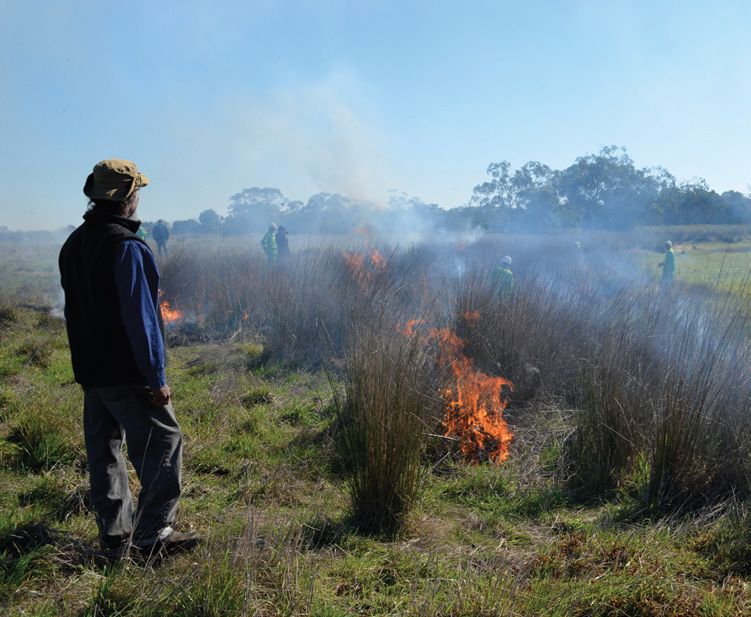
Front cover image: Planned burning in the Grampians National Park heathlands © Glenn Rudolph
Contents
Introduction                                                                                                                                                                                      2

About bushfire in our landscape                                                                                                                                                                   4

What this plan prioritises for protection                                                                                                                                                         8

     How do we decide what to prioritise for protection?...................................................................................................................8
     Communities...............................................................................................................................................................................11
     Infrastructure..............................................................................................................................................................................11
     Economy .....................................................................................................................................................................................11
     Environment ...............................................................................................................................................................................12
     Cultural heritage..........................................................................................................................................................................14

How we will protect our landscape                                                                                                                                                               15

Our fuel management strategy............................................................................................................................................... 15
     About our fuel management strategy.........................................................................................................................................15
     Reducing bushfire residual risk...................................................................................................................................................15
     Fire management zones..............................................................................................................................................................19
     Fire operations planning.............................................................................................................................................................19
     Balancing our fuel management approach.................................................................................................................................20

Other bushfire management strategies................................................................................................................................... 23
     Preventing bushfires....................................................................................................................................................................23
     Being prepared for bushfires.......................................................................................................................................................23
     Responding to bushfires..............................................................................................................................................................23
     Recovering after bushfires...........................................................................................................................................................23

How we will continuously improve the planning process                                                                                                                                           24

Glossary                                                                                                                                                                                        25
Planned burning in the Grampians National Park © Glenn Rudolph

Introduction
Victoria is one of the most fire-prone areas in the world.      This plan explains the fuel management strategy that
In past decades, we have seen the disastrous effects that       we—DELWP and Parks Victoria (PV)—will undertake to
bushfires can have on communities — on people, properties,      minimise the impact of major bushfires on people, property,
our economy and the environment.                                infrastructure, economic activity and the environment, to
                                                                achieve the two code of practice objectives. It explains how
Under the Forests Act 1958, and in line with the Code of
                                                                we will do this by placing fire management zones—asset
Practice for Bushfire Management on Public Land 2012,
                                                                protection zones, bushfire moderation zones, landscape
the Department of Environment, Land, Water and Planning
                                                                management zones and planned burning exclusion zones—on
(DELWP) is responsible for managing bushfire risk on public
                                                                public land, and by doing other fuel management activities.
land. The code of practice’s two objectives are to:
                                                                History tells us a small number of major bushfires have caused
• minimise the impact of major bushfires on human life,
                                                                the greatest losses of human life, although any bushfire has
  communities, essential and community infrastructure,
                                                                the potential to result in loss of life and property. In some
  industries, the economy and the environment: human life
                                                                cases, major bushfires have also damaged fire-sensitive
  will be afforded priority over all other considerations
                                                                ecosystems and species.
• maintain or improve the resilience of natural ecosystems
                                                                As well as fuel management, the code of practice emphasises
  and their ability to deliver services such as biodiversity,
                                                                reducing bushfire risk through other strategies and actions
  water, carbon storage and forest products.
                                                                for:
The code of practice requires DELWP to undertake
                                                                • prevention, to minimise the occurrence of bushfires,
strategic bushfire management planning. This is the first
                                                                  particularly those started by people
strategic bushfire management plan for the South Western
bushfire risk landscape, one of Victoria’s seven bushfire       • preparation, so we are adequately prepared for bushfires
risk landscapes. The strategic planning approach we used          and can better respond to them when they occur
to develop this plan replaces our previous fire protection
                                                                • response, to ensure a timely and adequately resourced
planning approach.
                                                                  initial attack on all detected bushfires on public land
We developed this plan in the context of Victoria’s new
                                                                • recovery, to ensure we identify risks and damage resulting
emergency management arrangements. The Victorian
                                                                  from bushfires.
Government’s Emergency Management Reform White Paper
and subsequent legislation aim to build community resilience
through increased participation and shared responsibility.

2 Strategic bushfire management plan | South Western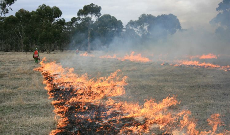
Planned burning in the Wannon Heath, Grampians National Park © Glenn Rudolph

Over the next few years, with community and stakeholder         industry representatives, including of plantation companies,
engagement, we will refine and document risk-based              apiarists and winegrowers; conservation and environmental
strategies for bushfire prevention, preparedness, response      management groups; and the public. We will continue to work
and recovery.                                                   in partnership with the agencies and organisations above, and
                                                                with all other interested parties, to reduce bushfire risk on
We use a risk-based approach to planning for bushfire
                                                                public and private land. We will also encourage residents and
management, based on the International Standard for Risk
                                                                land owners to find out about bushfire risk on their property
Management ISO 31000. Our approach:
                                                                and have up-to-date bushfire plans.
• pairs local knowledge with world-leading bushfire
                                                                We welcome this strategic, risk-based approach. As the
  simulation software, historical data and the best-available
                                                                officers responsible for ensuring DELWP’s compliance with
  science to understand how bushfires behave
                                                                the code of practice, and for effective strategic planning
• incorporates the views of communities, industries and         and implementation at the regional level, we consider it will
  other stakeholders about what they value and want to          result in better bushfire risk management, safer communities
  protect from bushfires                                        and property, stronger local economies and more resilient
                                                                ecosystems.
• proposes ongoing monitoring, evaluation and reporting
  about how implementation of our planning approach is          This document is a summary of our planning approach, and
  reducing bushfire risk.                                       there is much information that sits behind it. To find out
                                                                more, including how you can be involved in reviews and
The international standard for risk management, with which
                                                                updates of the plan, visit www.delwp.vic.gov.au.
our strategic planning approach complies, reflects the fact
that risk can never be completely eliminated. Bushfires will
still occur, and everyone needs to be prepared and ready to
respond. But bushfire risk can be reduced with a high-quality
risk management approach.
We thank everyone who is contributing to our planning
approach. This includes staff and representatives of
DELWP, PV, Country Fire Authority, Victoria Police, local
governments, water corporations, catchment management
authorities, traditional owners and private land managers;       Alan Goodwin                          Brendan Roughead
                                                                 DELWP Chief Fire Officer              DELWP Regional Director
                                                                                                       Grampians

                                                                                        Strategic bushfire management plan | South Western 3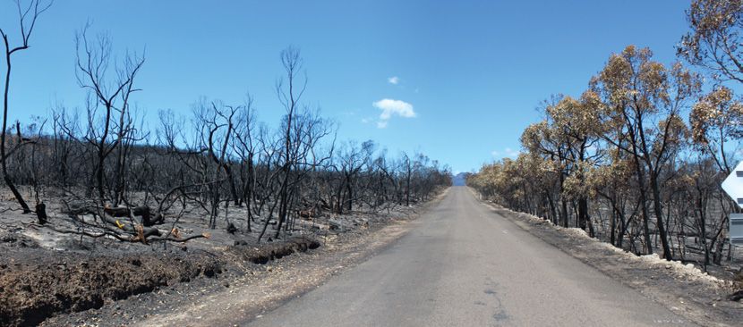
Bushfire near Tallageira © Glenn Rudolph

About bushfire in our landscape
For strategic bushfire management planning purposes, DELWP          On Severe, Extreme and Code Red fire danger days, bushfires
and PV divide Victoria into seven bushfire risk landscapes.         can start and spread quickly to become major bushfires.
These are areas where bushfire behaviour—including the              Typically on such days, a strong north-westerly wind blows
types of places that bushfires start, the terrain and vegetation    hot, dry air from central Australia across Victoria. If a bushfire
through which they spread, and the types of impact they             ignites, or is already burning, this wind can push it rapidly
have—is sufficiently common to plan for the area as a whole.        south-east, creating a relatively narrow fire front and long fire
                                                                    flanks on its western and eastern sides. Then, an approaching
Map 1 shows the South Western bushfire risk landscape. It is
                                                                    cold front with a strong south-westerly wind can expand the
4 051 447 ha, or 17% of the state’s area. Of the South Western
                                                                    bushfire’s eastern flank into a wide fire front, and intensify
landscape, 17% is public land and 83% is private land.
                                                                    the fire. These weather conditions can create fast-moving
Managing bushfire risk is essential. Since 1977, the most           bushfires and powerful convection columns, which in turn
disastrous bushfires in our landscape have killed some 20           cause ember storms, wind-blown debris, downbursts, fire
people and destroyed 254 houses and more than 500 other             tornadoes and explosive balls of igniting eucalyptus vapour.
buildings. In the last three decades, DELWP responded to an         This was what we saw on 16 February 1983 (Ash Wednesday)
average 72 bushfires a year in our landscape. We suppressed         and 7 February 2009 (Black Saturday).
71% of these bushfires before they grew to 5 ha. Rapidly
                                                                    Climate change is increasing bushfire risk in Victoria and
detecting and suppressing bushfires before they grow to a size
                                                                    lengthening the average fire season. Climate change
and intensity that makes them difficult to control is a core part
                                                                    projections indicate that Victoria is likely to have up to 70%
of our approach to managing bushfire risk.
                                                                    more Severe, Extreme and Code Red days by 2050. We will
Accidental ignitions by people caused 51% of bushfires in our       also likely have:
landscape between 1975 and 2013. These bushfires were
                                                                    • reduced average rainfall and streamflows
mainly started by machinery, trains, escapes from campfires
and private burn offs. Deliberate action by people accounted        • fewer rainfall days (with heavier rainfall) and more
for 15% of bushfires and lightning 34%. On average, more area         consecutive dry days
in our landscape is burnt by fires caused by lightning than by
                                                                    • more frequent and widespread droughts
human-ignited fires.
                                                                    • more days over 35°, and a higher annual mean
                                                                      temperature.

4 Strategic bushfire management plan | South Western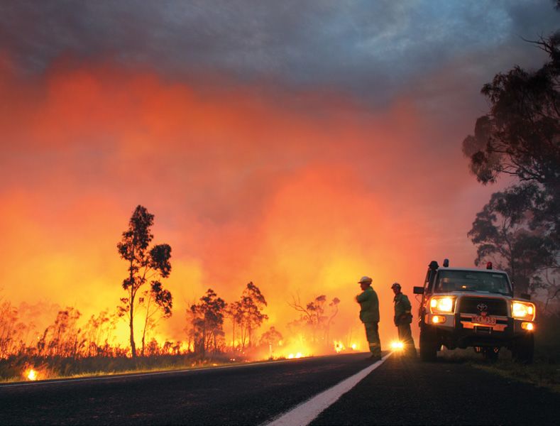
Mt Lubra bushfire, Grampians National Park © Glenn Rudolph

Climate change is also likely to alter the attributes and          Map 1 also shows where bushfire simulations predict
availability of habitat for the landscape’s plants and animals.    bushfires would cause maximum damage to property.
This will magnify existing threats such as fragmentation           These locations have relatively high numbers of properties,
(which isolates some species in particular areas) and loss of      and are in the path of many simulated bushfires. The map
habitat (such as hollow-bearing trees). It may also increase       shows the simulated property risk is highest around Beaufort,
the spread of some invasive species.                               Bolwarra, Halls Gap and Snake Valley.
Map 1 shows the landscape’s bushfire catchments. These
are areas where the worst bushfires could start, spread and
impact on priority communities and assets in a single day.
These are important things to know because:
• at likely ignition points, we may conduct patrols on Severe,
  Extreme and Code Red fire danger days, and manage fuels
  (particularly if the spread or impact areas of these bushfires
  are difficult to treat)
• along spread paths, fuel management is the key to reducing
  the impact of major bushfires by reducing their spread and
  intensity
• managing fuel around and next to priority assets
  helps to minimise flame contact, radiant heat, ember
  generation and short-distance spotting potential. This fuel
  management can be difficult as it generally requires more
  resources and skills, and it may also rely on landowners
  making their properties as bushfire-safe as possible
• when a bushfire starts, we can use our knowledge of its
  likely spread paths and impacts to most effectively fight the
  fire, and provide information to communities that may be in
  its path.

                                                                                       Strategic bushfire management plan | South Western 5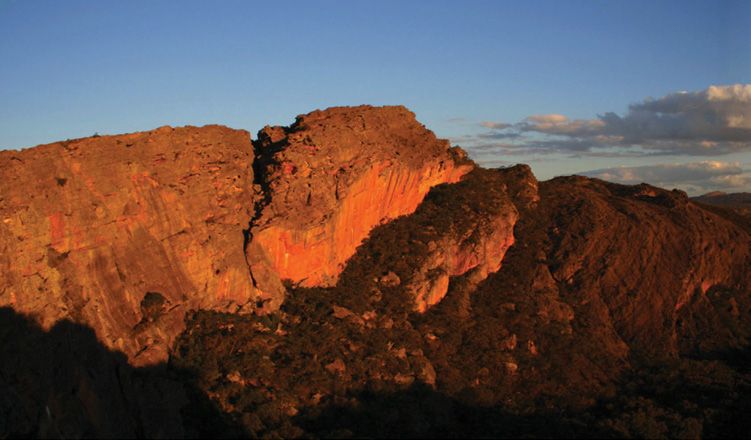
Map 1: Bushfire catchments and simulated property risk

  The public land in our landscape is highly fragmented and dispersed. Because
  we have a high proportion of private land compared to other landscapes, it is
  harder to mitigate bushfire risk by managing fuel on public land: major fires can
  go around our blocks, or the extent to which we would have to burn them to
  significantly reduce risk can be environmentally unacceptable. Fuel management
  on private land is particularly important in our landscape.

  The Southern pipewort is a
  small, semiaquatic, annual
  herb endemic to a small area in
  western Victoria and adjoining
  South Australia. Less-frequent
  inundation of the wetland in
  which it grows is a threat to
  the survival of this species.
  We are protecting this sensitive
  herb from bushfires by burning
  around its wetland habitat, to
  protect it from bushfires that
  could burn the dry wetlands.

  This area has large areas of
  Stringybark woodlands and is
  the main feeding habitat of the
  South-eastern red-tailed black-
  cockatoo, a rare and threatened
  species whose habitat is highly
  sensitive to fire.

  Plantations are concentrated in
  the south-west corner of our
  landscape, in the Green Triangle
  region, and contribute greatly to
  our regional economy. In some
  cases, they provide continuous
  fuel right up to the outskirts
  of communities, increasing
  their bushfire risk. But they are
  also an important economic
  asset, themselves at-risk from a                                                                               Branxholme
  bushfire.

  The Cobboboonee National Park and
  adjoining forest park provide habitat for
  threatened and fire-sensitive species such
                                                                                          Gorae
  as the Southern brown bandicoot, the
  Long-nosed potoroo and the Powerful                                                           Bolwarra
  owl. Communities living close to the
  Cobboboonee parks are also at risk from a
  bushfire. We aim to find the right balance
  between protecting communities and
  ensuring the survival of threatened and
  fire-sensitive species.

                                                           The Wrinkled cassinia is a small shrub that depends on fire or
                                                           other disturbances for its survival. It is a threatened species
                                                           and only occurs in small populations in swampy habitat. We
                                                           are trialling early-autumn planned burning to encourage it to
                                                           reproduce, to ensure its survival.

6 Strategic bushfire management plan | South Western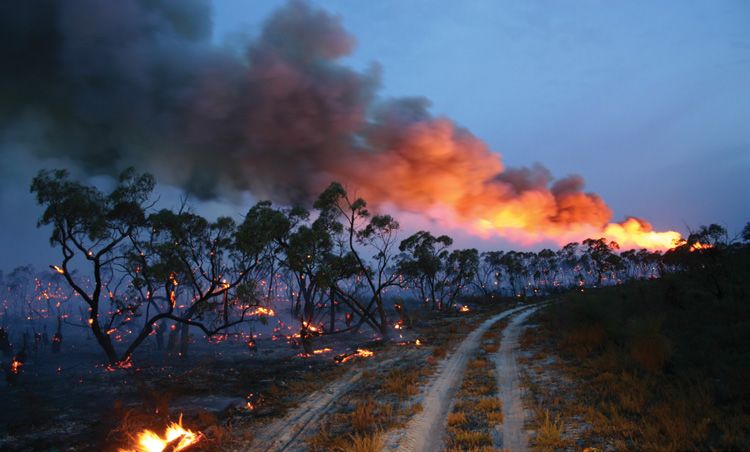
The Kara Kara National Park contains many fire-sensitive
                                                   animal species, many of which depend on old trees and their
                                                   hollows for habitat. Fire can destroy these trees, and many
                                                   areas important to fire-sensitive species have not been burnt
                                                   for many years.

                                                   In the last decade, the Grampians National Park (Gariwerd)
                                                   has had three major bushfires: Mt Lubra in 2006 (burning
                                                   46% of the park and, including private land, a total 129 214
                                                   ha), Victoria Valley in 2013 (burning 17%, in total 36 493 ha)
                                                   and Northern Grampians in 2014 (burning 23%, in total 55
                       Moonambel                   304 ha). Some areas in our landscape are prone to major
                                                   bushfires, even when they have been recently burnt.

                                                                Large communities close to forested land can be
                                                                at high risk of impact by a bushfire, and could
Pomonal                                                         lose many properties if one did occur. This plan
                                                                prioritises communities that are at high risk, and
                                                                are also close enough to public land for our fuel
                                                                management to reduce this risk.

                                                                Large areas of private bush surround this town.
                                                                To most effectively mitigate risk, we need to
                                                                coordinate our actions on public land and the
                                                                actions of the CFA and private landowners.

                                             Snake Valley       Burning small patches each year of the Wannon
                                                                heath, which is habitat for the Southern brown
                                                                bandicoot, creates a mosaic that protects this
                                                                species from having its habitat completely burnt
                                                                out by a major bushfire.

          Very large, fast-moving grass fires can impact on
          numerous communities in a single day (as the
          Framlingham fire did on Ash Wednesday 1983).
          Impacts can include houses destroyed, farmland
          burnt, roads closed, choking smoke or the need
          to leave the area. As there is very little public              Simulated property risk:
          land in this area, we need to work closely with
                                                                               Low
          CFA and landowners as they manage fuel on
                                                                               Moderate
          private land.
                                                                               High
                                                                               Very high
                                                                               Extreme

          The Budj Bim National Heritage Landscape is
          rich with Aboriginal cultural heritage assets,                       Bushfire catchments
          including the only remaining permanent houses
          in Australia built by a pre-contact Aboriginal
          community. The high concentration of cultural                        Public land
          heritage sites that need protection, and the rocky
                                                                               Private land
          nature of these volcanic woodlands, make access
          difficult and mean that it can be very difficult to                  Main roads
          do planned burning and suppress bushfires in
          the area.
                                                                         0km          10km      20km

                                                                   Strategic bushfire management plan | South Western 7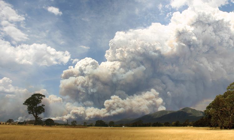
What this plan prioritises for protection
How do we decide what to prioritise                                We consult with communities, stakeholders and experts.
                                                                   This includes representatives of industry, land managers,
for protection?                                                    emergencies services and local governments, and with
Our planning method is based on the International Standard         a wide range of experts including ecologists and cultural
for Risk Management ISO 31000. The risk assessment process         heritage experts. We consult about our modelling tools,
aims to determine the likelihood and consequence of a major        bushfire behaviour, our risk assessment methods, the
bushfire impacting on people and their property, on the            landscape’s assets and the vulnerability of those assets.
landscape’s key infrastructure and economic assets, and on         By drawing on the knowledge and experience of local
ecosystem resilience. We prioritise something for protection       communities, we can better understand what they value
if there is a strong likelihood a major bushfire would impact      and how they see bushfire risk, and engage with them in
on it and there would be severe consequences if it did, and        planning the best course of action.
we can significantly mitigate bushfire risk to it through our      We use PHOENIX RapidFire bushfire simulation software,
fuel management strategy. That is, something has a high risk       which is world-leading technology developed by The
rating if:                                                         University of Melbourne and the Bushfire and Natural Hazards
• it is very likely to be exposed to a major bushfire              Co-operative Research Centre, in conjunction with DELWP.
                                                                   PHOENIX RapidFire simulates how bushfires spread from
• it is vulnerable to fire: that is, if fire would damage and/or   a grid of ignition points across the landscape, given:
  disrupt it
                                                                   • terrain and fuel (being a result of any location’s fire history,
• there would be consequences ranging from important to              type of vegetation and modelled fuel accumulation) at the
  catastrophic if bushfire damaged or disrupted it.                  starting point and along spread paths
Once we have identified the assets at highest risk from            • weather conditions (we use worst-case weather conditions
bushfire, we design a fuel management strategy which                 similar to those in Victoria on Ash Wednesday 1983 and
prioritises those assets for protection.                             Black Saturday 2009).
Our planning method draws on the best available information        Victorian Bushfire Risk Profiles provides more information
from data and community consultation. We use the Victorian         about how DELWP uses PHOENIX RapidFire to quantify risk.
Fire Risk Register, past bushfire experience and local
knowledge to identify our most at-risk communities and most
important infrastructure.

                                                                                          Taipan wall, Grampians National Park © Steffen Schultz

8 Strategic bushfire management plan | South Western
Map 2: Priorities for protection
Tr a
ns
mi
ss Moonambel
ion
lin
e
Kanawinka
gas substation
Pomonal
Mt William
communication
towers
Snake Valley
Branxholme
l in e
s io n
s m is
Tr a n
Gorae
Bolwarra
Mt Clay
zone
substation
Port of
Portland
Priority communities
Portland
aluminium
Priority infrastructure
smelter
Grampians National Park
Plantations
Highly ecologically fire-sensitive areas
Endemic and highly localised species
Public land
Private land
Main roads
0km 10km 20km
Strategic bushfire management plan | South Western 9Running postman © Steffen Schultz
Map 3 compares PHOENIX RapidFire’s bushfire simulation
to the actual final extent of the 2015 Moyston bushfire.
The differences between the simulated and actual extent
were mostly due to local weather dynamics—the simulation
used weather data recorded at Stawell, which is 25 km
away—and firefighting efforts to stop the bushfire spreading.
The map also shows simulated flame heights, which indicate
the intensity of the bushfire.
Map 3: Actual and simulated extent of 2015 Moyston bushfire
Simulated extent after 24 hours,
showing flame height (m):
0–1
1–4
4-10
10+
Actual final extent
0km 5km
10 Strategic bushfire management plan | South WesternFrogmouth family © Steffen Schultz Rufus songlark © Steffen Schultz
Communities Infrastructure
Map 2 shows our landscape’s priority communities. The code Map 2 shows our landscape’s priority infrastructure.
of practice prioritises minimising the impact of bushfires on They are the Moorabool to Heywood 500 kV transmission
human life over all other considerations. Our ten highest line, Heywood to Alcoa Portland 500 kV transmission line,
priority communities are Beaufort, Snake Valley, Halls Gap, Heywood to south-eastern (South Australia) switching station
Ararat, Pomonal, Bolwarra, Branxholme, Gorae, Moonambel transmission line, Ballarat to Horsham 220 kV transmission
and Stawell. line, Kanawinka gas substation, Mt Clay zone substation,
Mt William communications towers and Port of Portland.
We prioritised these communities because they have the
highest risk to life and property, and we have the greatest We prioritised this infrastructure because bushfire damage
ability to reduce their risk by managing fuel on public land. to it would impact on Victoria and indeed Australia. Port
Simulations show these communities would lose the most of Portland handles some 6 million tonnes of agricultural,
houses when exposed to major bushfires, if there was no fuel forestry and mining products a year, worth about $2.5 billion
management. This might be because of their location and to the regional economy. The prioritised gas, electricity and
local topography (as with Halls Gap), because they are close to communications infrastructure services much of Victoria’s
forest (such as Bolwarra, near Portland), or because they have south-west and parts of south-east South Australia, and
many people and properties (for example, Ararat). Although bushfire damage would cause major disruptions.
we can mitigate bushfire risk to communities close to public
To protect our priority infrastructure, we:
land by managing fuel, our ability to do so is limited if they are
surrounded by private land (including private bush). • check that zoning decisions we make to protect
communities and assets also result in an acceptable level of
Some communities and groups of people are more vulnerable
protection for priority infrastructure
to bushfire than others, including those who lack experience
of bushfire, summer visitors, people with disabilities or • Work with the owners and managers of the infrastructure
illness, the elderly and people from non-English-speaking to help them implement their fire plans.
backgrounds. These people and communities in particular
tend to be less-aware of bushfire risks, less prepared for
bushfire, and less able to quickly respond to it. These factors
Economy
can also compromise evacuation and firefighting efforts. Map 2 shows our landscape’s priority economic assets, the
Portland aluminium smelter and the landscape’s hardwood
To protect our priority communities, we:
and softwood plantations. We also prioritised the Grampians
• place asset protection zones or bushfire moderation zones National Park (Gariwerd), which is important for tourism and
close to communities, to slow bushfires before they reach water harvesting.
those communities and to reduce short-distance spotting
We prioritised these assets because they are major
that causes ember attack on properties
contributors to the local and Victorian economies, and
• place bushfire moderation zones where bushfires that bushfires could cause great economic losses. The Portland
might threaten communities are likely to most quickly aluminium smelter is one of Victoria’s largest exporters and a
spread and intensify, making them more difficult to major employer in our landscape. Tourism contributed some
suppress. Reducing fuel load in these areas moderates the $949 million to the Grampians’ economy in 2011–12 (22% of
impacts of major bushfires. gross regional product) and employed about 8300 people.
Strategic bushfire management plan | South Western 11Bearded dragon © Kirrin Brown
The Green Triangle region between Mt Gambier, Hamilton highly at-risk from fire (such as wetlands) and vegetation
and Warrnambool has about half Victoria’s hardwood that cannot produce seed, and thus survive, if it is burnt too
plantations (more than 145 000ha), and many softwood frequently. These areas are most at risk from both bushfire
plantations (more than 76 000 ha). Plantations are generally and planned burning, so we prioritise them for protection.
fragmented and are often adjacent, or close to, native forest.
Endemic and highly localised species we prioritise are species
They can increase bushfire risk by providing continuity of fuel
found mainly in our landscape, and which are often confined
for bushfires to spread.
to small parts of it. If bushfire or planned burning occur too
We recognise bushfires have other major economic impacts. frequently, the entire species may become extinct.
Bushfires destroy and damage buildings, fencing, machinery
Environmental assets can be at risk both from bushfires
and equipment. They kill and injure livestock and damage
and from fuel management activities. While most native
productive plants, such as timber plantations and grape
vegetation in our landscape needs fire to regenerate, some is
vines. Smoke from fires can permeate the skin of fruits. The
sensitive to being burnt too often, in the wrong season, or by
viticulture industry is particularly vulnerable to smoke taint
fire that is too intense; or to too much area of an ecological
during the summer bushfire season and autumn planned
fire group or individual species being burnt at once. These
burning periods, which are when fruit ripens. Bushfires also
risks can result in individuals and even entire species dying
damage the natural environments and infrastructure on which
out, if there are no viable seeds or seedlings to recolonise the
tourism industries rely.
area. If this happens, the composition of the species in the
To protect our priority economic assets, we: area will change. Multiple fires (bushfires or planned burning)
can reduce the capacity of environmental assets to withstand
• place bushfire moderation zones in and around the
and recover from a range of disturbances, including fire and
Grampians National Park, to reduce the bushfire risk to the
drought.
tourism industry
To protect our priority environmental assets, we prefer not to
• check that zoning decisions we make to protect
zone highly ecologically fire-sensitive areas and areas where
communities and assets also minimise post-bushfire
endemic and highly localised species live as asset protection
landslide risk, which could degrade water quality in the area
zones or bushfire moderation zones (zones in which planned
• work in partnership with owners of plantations as they burning occurs more frequently). However, we do sometimes
implement their own fuel management strategies. need to place these two zones in areas with priority
environmental assets, if this is necessary to reduce high risk to
life and property. If so, we aim to do planned burning in a way
Environment that minimises the impact on priority environmental assets.
Map 2 shows our landscape’s priority environmental assets, This may include burning when species (such as orchids)
which are our highly ecologically fire-sensitive areas and the are dormant and can therefore tolerate fire, or protecting
known locations of endemic and highly localised species. important habitat (such as the nest trees of Powerful owls)
during individual burns.
Highly ecologically fire-sensitive areas include large amounts
of habitat of threatened, fire-sensitive animals, vegetation
12 Strategic bushfire management plan | South WesternLarge duck orchid © Steffen Schultz South-eastern red-tailed black-cockatoo © Michael Sverns
South-eastern red-tailed black-cockatoo
The South-eastern red-tailed black-cockatoo is a rare, large nomadic
cockatoo found only in south-west Victoria and south-east South
Australia. The state and Commonwealth governments recognise it
as threatened, and it is one of Victoria’s most fire-sensitive animal
species. A national recovery team, formed in 1997 and including our
representatives, coordinates the management and recovery of the
cockatoo, and we have actively participated on this team since its
inception.
The cockatoo is mainly restricted to stringybark woodlands where it relies
on the seeds of Brown stringybark and Desert stringybark for food. Fire is
important for the health of the highly flammable stringybark woodlands:
bushfires are common and the vegetation’s reproductive cycle depends
on fire. However, fire also reduces (for about 10 years) the amount of
seeds stringybark trees produce, reducing the cockatoo’s food source.
This is particularly important during breeding season, when the species
needs the most food.
When we do planned burning of stringybark woodlands, we aim
to minimise burning in areas where the cockatoos feed. We have
researched how to reduce scorching of the stringybark canopy when we
do planned burning, to minimise the reduction in seed production. We
are also researching how to improve monitoring methods, identifying
the best mix of growth stages for stringybark woodlands for the cockatoo
and other species that live there, and improving our data about the
cockatoo’s range and preferred habitat.
To ensure we can continue to enjoy the sights and sounds of this
beautiful bird, we will continue to work with species experts and land
managers to increase knowledge of the cockatoo’s biology and best
balance community protection and ensuring the cockatoo can find
enough food now and in future. We will do this by supporting research,
educating staff in how to conduct burns in the cockatoo’s habitat and
continuing our involvement in the national recovery team.
Strategic bushfire management plan | South Western 13Indigenous cultural burning © Andrew Govanstone
Cultural heritage Traditional Owners Aboriginal Corporation, Martang Pty Ltd
and Wathaurung Aboriginal Corporation. There have also
Our landscape’s cultural heritage stretches back thousands been three successful native title determinations with the
of generations and includes the use by Aboriginal people of Gunditjmara, Eastern Maar and Wotjobaluk people, and the
fire for environmental, economic and social purposes. Our Dja Dja Wurrung people have achieved the first full settlement
landscape today has thousands of Aboriginal cultural heritage under the Victorian Traditional Owner Settlement Act 2010
sites including ceremonial gathering places, shell middens, providing for a recognition and settlement agreement with
burial sites, scar trees and artefact scatters. It also has post- the state. We will continue to work with these groups to
contact sites, such as missions and conflict sites. ensure the best possible protection of our cultural heritage.
The Lake Condah area in the Budj Bim National Heritage The landscape also has many non-Indigenous cultural heritage
Landscape has the remains of one of Australia’s and the sites including community buildings, churches, sawmills,
world’s oldest aquaculture systems, dating back 6000 years, lighthouses, war memorials, settler’s homesteads and
and the only remaining permanent houses built by a pre- cemeteries relating to the last 200 years of settlement. In
contact Indigenous community in Australia. The Grampians 1857, Chinese immigrants discovered the Canton Lead, one
National Park (Gariwerd), which is also a national heritage of the world’s richest alluvial goldfields, and founded Ararat,
landscape, is one of the richest Indigenous rock-art sites in the only Australian city founded by Chinese immigrants.
south-eastern Australia. The landscape has many culturally significant assets and sites
Bushfire risk management must draw on the wisdom and relating to these pioneers.
experience of our Traditional Owners, and support the To protect our priority cultural heritage assets, we:
landscape’s Aboriginal people to rebuild and maintain
connections to Country. • protect known cultural heritage sites from disturbance
when we manage fuel, and when we suppress bushfires
The registered Aboriginal parties in our landscape are
Barengi Gadjin Land Council Aboriginal Corporation, Dja • during all of our activities, keep a watch out for unidentified
Dja Warrung Clans Aboriginal Corporation, Gundtj Mirring sites: only a very small percentage of Victoria’s area has
been formally assessed for Aboriginal cultural heritage.
14 Strategic bushfire management plan | South WesternHow we will protect our landscape
Our fuel management strategy
About our fuel management strategy Reducing bushfire residual risk
Map 4 shows the landscape’s fuel management strategy. Residual risk is the risk, on average and across the whole
The strategy comprises fire management zones, which landscape—including public and private land—that bushfires
establish our long-term balanced fire regime on public land by will impact on life, property or other assets. It is expressed as
defining objectives for fuel management across the landscape. the percentage of the risk that remains after bushfire history
Zones specify the location and frequency of fuel management and fuel management (mainly planned burning) activities are
on public land. taken into account. For example, 80% residual risk means that
the risk of property and infrastructure being impacted by a
The main fuel management action is planned burning, which
bushfire—on average, throughout the landscape—is 20% less
is deliberate burning to reduce the quantity of leaf litter,
than it would have been had we never had bushfires and fuel
twigs, bark and undergrowth. It is the most effective method
management to reduce the fuel load. The complex mosaic of
of managing fuel on large areas of public land, and the main
fuel-managed and bushfire-burned patches—with different
way we reduce bushfire risk. Fuel management also serves
times since the last fire—across the landscape is mainly
ecosystem resilience purposes, such as regeneration of plant
what determines residual risk at any point in time. Residual
species and habitat. We also manage fuel by ploughing,
risk changes constantly as bushfires burn new areas, as we
mulching, applying herbicide, chain rolling, grazing, thinning,
manage fuel, and as fuel accumulates.
mowing and slashing: we use the most efficient and effective
method depending on the circumstances. One way DELWP measures the effectiveness of the fuel
management strategy is by how well it reduces residual risk.
To develop our fuel management strategy, we combined our
PHOENIX RapidFire allows us to simulate the reduction in
knowledge of bushfire behaviour and PHOENIX RapidFire
residual risk at any particular location, at a particular point of
simulations with our prioritisation of communities and
time, if we reduce fuel load at the ignition points and along
infrastructure, environmental, economic and cultural heritage
the spread paths of bushfires that could impact on it.
assets.
Annual fuel management activities will be guided by a long-
term residual risk target.
Planned burning © Glenn Rudolph
Strategic bushfire management plan | South Western 15Map 4: Fuel management strategy
Our strategy aims to provide
a high level of protection
to priority communities,
infrastructure, economic
activity and environmental
assets consistent with
the two code of practice
objectives.
The bushfire moderation
zone in this area will help
to protect popular camping
areas.
We use planned burning
to create strategic fuel-
reduced strips in large forest
sections, to prevent the
whole forest being burnt by
a major bushfire. This helps
us protect environmental
assets and suppress major
bushfires before they develop
an intensity and spread that
threatens communities. To
do this, we burn bushfire
moderation zones and some
adjoining areas of landscape
management zones.
Branxholme
We do planned burning in landscape
management zones for fuel management Gorae
and ecological reasons (such as burning Bolwarra
around an area with a particular species to
protect it from bushfires, burning an area
that’s approaching its maximum tolerable fire
interval, or burning to maintain a diversity of
age classes in an ecological fire group or to
implement a mosaic).
This planned burning exclusion zone
helps to protect the many Aboriginal
cultural heritage assets in this area.
16 Strategic bushfire management plan | South WesternOur strategy will increase planned burning in this area: it is
where major bushfires, that can develop powerful convection
columns, would increase in intensity if we did not reduce the fuel
load. Such fires could threaten Halls Gap, Pomonal and other
communities next to the Grampians National Park.
Locating bushfire moderation zones near to priority communities
means we can reduce the risk to properties while reducing the
impacts of planned burning on the landscape’s highly ecologically
fire-sensitive areas. More widespread burning in the landscape
can achieve equivalent risk reduction, but with much larger
impacts on environmental assets.
Moonambel
The combination of asset protection zones and bushfire
moderation zones provides protection to communities
that are highly at-risk. Reducing fuel in an asset protection
zone close to properties can help to reduce flame contact,
Pomonal radiant heat and ember attack during a bushfire.
A bushfire moderation zone around an asset protection
zone can slow bushfires down and have some of the same
benefits, but without as much environmental impact.
Our strategy aims to protect priority environmental
assets, as well as communities. Planned burning in this
bushfire moderation zone creates a barrier that helps
prevent fires from jumping across ranges within the
Grampians. It also protects high-altitude fire-sensitive
species along the top of the ridge.
Snake Valley
We burn small areas of large blocks of
landscape management zones to stop
a bushfire burning large areas of forest,
or developing an intensity and spread
sufficient to threaten communities.
Asset protection zone
Bushfire moderation zone
Landscape management zone
Planned burning exclusion zone
Main roads
0km 10km 20km
Strategic bushfire management plan | South Western 17Figure 1 shows measured and expected residual risk in our because fire-sensitive ecosystem areas could be threatened
landscape from 1980 through to 2050. It shows residual risk by repeated burning, or for other reasons (such as fuel and
(the blue line and shaded darker blue area): weather conditions limiting the number of days in any given
year we can safely do planned burning). Also, in some areas,
• decreased to about 80% as a result of the 2006 Mt Lubra
the environmental damage that would result would outweigh
bushfire in the Grampians
any small temporary reductions in risk we achieved.
• has steadily decreased since 2006, with planned burning
The figure also shows (the red dotted line) that fuel
and bushfires
management on private land could theoretically reduce
• by implementing our fuel management strategy on public residual risk to as low as 13%. However, this would need
land, could reduce to 65%. all public and private land to be treated annually, which is
unrealistic. It does however indicate that total residual risk
The exact residual risk in future will depend on where we
can be reduced by about 30% by fuel management on private
schedule our planned burns each year within the zones; the
land. DELWP will support other agencies (mainly CFA and local
size, intensity and location of bushfires when they occur;
governments) and landowners to prioritise and focus their
and how quickly fuel re-accumulates in burnt areas. We have
fuel management activities on the highest-priority areas of
forecast the future residual risk using PHOENIX RapidFire
private land. Local governments can also use our information
bushfire simulation software and multiple planned burning
and products when developing their own strategies for
scenarios. The uncertainty of all the factors that influence
managing risk on private land.
residual risk reduces our ability to pinpoint exactly what
residual risk will be in the future. However, continuous The remaining 13% of risk, which is on public and private land
improvement in our planning methods and operations should and which cannot be treated by fuel management, highlights
see residual risk decrease towards the lower end of the the importance of other bushfire management strategies for
indicated range. prevention, preparedness, response and recovery.
The figure shows (the green dotted line) that planned burning
on public land could theoretically reduce residual risk to as The fuel management strategy aims to ensure that
low as 46%. However, this would require us to treat all public through to 2050, residual risk to life and property will
land every year, which is not realistic. It is also not possible not return to pre-2010 levels as fuel re-accumulates in
to treat all areas of public land because some areas are forests burnt in 2006, 2013 and 2014.
inaccessible, because it is not safe to manage fuels on some,
Figure 1: Residual risk 1980–2050
100%
90%
80%
Expected range of residual risk
after implementing our strategy
70%
60% Maximum risk reduction if all
Residual risk
public land was treated
50%
40%
30% Maximum risk reduction if all public and
private land was treated
20%
10%
Risk that can’t be reduced by fuel management
0
1980
1985
1990
1995
2000
2005
2010
2015
2020
2025
2030
2035
2040
2045
2050
Residual risk Maximum risk reduction Maximum risk reduction if all public
if all public land was treated and private land was treated
Note: The expected range and theoretical maximum levels of risk reduction to human life and property shown in this figure were simulated under a weather
scenario of a Forest Fire Danger Index of 130.
18 Strategic bushfire management plan | South WesternPlanned burning stringybark woodlands © Kirrin Brown
Fire management zones of bushfires. In the other areas of these zones, we will also
consider ecological objectives.
Fire management zones (FMZs) define objectives for
fuel management across the landscape. FMZs were first In landscape management zones, we will do planned burning
established in Victoria in 1995 and outline how frequently to mainly to maintain and improve ecosystem resilience, and
treat areas. We will review and adjust FMZs occasionally, as also to reduce the fuel hazard. We will use the tolerable
new technology, science and information become available. fire intervals of fire-sensitive vegetation in these zones to
This plan incorporates the outcomes of a review of our determine the frequency of planned burning. This means that
landscape’s FMZs. in particular areas of these zones the frequencies of burning
may be very different: this acknowledges that some areas are
There are four types of FMZs. They are: more fire-sensitive than others, and that some also contribute
• Asset Protection Zone: an area around properties and to reducing risk to communities and assets.
infrastructure where we do intensive fuel management to
provide localised protection against radiant heat and ember Fire operations planning
attack in the event of a bushfire
Each year we produce an updated fire operations plan for
• Bushfire Moderation Zone: an area where we manage fuel each fire management district in our landscape. These plans:
load to reduce the speed and intensity of bushfires, and to
• are rolling schedules of fuel treatments specifying the total
protect nearby assets, particularly from ember attack in the
area where we aim to reduce fuel, and the location and
event of a bushfire
sequencing of individual burns and other treatments
• Landscape Management Zone: an area where we manage
• are guided by priority fuel management areas, to ensure
fuel to reduce residual risk, improve ecosystem resilience,
our fuel management program continues to drive down
and for other purposes (such as to regenerate forests and
residual risk
protect water catchments)
• cover all fuel treatment on public land, including areas of
• Planned Burning Exclusion Zone: an area where we try
lower risk
to avoid planned burning, mainly because the vegetation
cannot tolerate fire or because we cannot burn it safely. • address factors such as public safety and access
Map 4 shows the location of FMZs in our landscape. • identify how specific assets within or adjacent to fuel
treatment areas will be protected.
In asset protection zones, we aim to reduce the fuel hazard by
planned burning or other methods about every 5–7 years. If The actual residual risk reduction we achieve across the
fuel accumulates and the fuel hazard increases more rapidly, landscape depends on the extent to which we can implement
we will burn more frequently. our fire operations plans: how much fuel management we
are able to conduct (given the weather and other operational
In bushfire moderation zones, we aim to reduce the fuel
constraints), the amount of area where we can reduce fuel,
hazard about every 8–15 years. We will burn areas in this
the arrangement of the burns or other treatments in the
zone more frequently if they have higher bushfire risk (due to
landscape and other factors. Over time, the residual risk will
their location or fuel load) or are on the likely spread paths
also be influenced by bushfires.
Strategic bushfire management plan | South Western 19To inform fire operations planning, each year we identify Balancing our fuel management
priority fuel management areas, areas of public and private
land where it is most important to reduce the current fuel approach
hazard and bushfire risk. When identifying these areas, While the primary aim of our fuel management strategy is to
we take account of recent bushfires and fuel management reduce the risk of bushfire impacts on life and property, we
activities. also aim to maintain and improve ecosystem resilience.
We recognise that planned burning can affect communities, An ecosystem’s resilience is reflected in its capacity to
infrastructure, economic activity, cultural heritage and withstand and recover from a range of disturbances, including
community assets and ecological assets. We will continue fire. We measure ecosystem resilience by looking at the whole
to identify measures to mitigate these impacts though landscape and at multiple fires with various frequencies of
fire operations planning and burn planning—without burning.
compromising our strategic fuel management objectives—
and to implement our procedures to mitigate risks to priority We currently measure risk to ecosystem resilience across
environmental assets. the landscape using tolerable fire intervals (TFIs). TFIs are
the minimum and maximum recommended times between
fire events for a particular group of vegetation communities
with common ecological requirements for fire, and common
DELWP will ensure our fire operations planning process:
fire behaviour characteristics. These groups of vegetation
• is directly informed by the fuel management strategy communities are known as ecological fire groups (EFGs). TFIs
and priority fuel management areas are an interim measure: we are working on other measures,
including growth stages of vegetation.
• fully complies with the objectives of FMZs.
Burning within these intervals can assist in maintaining
healthy and resilient ecosystems. Burning repeatedly
outside these intervals increases the risk that there will be
fundamental changes in the abundance and composition
of species and in the type of vegetation in the EFG. It may
Figure 2: EFGs proposed for repeated planned burning below minimum TFI
180,000
170,000
160,000
150,000
140,000
130,000
120,000
110,000
Area (hectares)
100,000
90,000
80,000
70,000
60,000
50,000
40,000
30,000
20,000
10,000
0
whipstick
Grassy/heathy
Broombush
Damp scrub
Foothill forest
Forby forest
dry forest
Heathland
(sands)-general
High altitude
Ironbark / box
Lowan Mallee
Moist forest
Riparian
(higher rainfall)
Rocky knoll
Tall mist
forest
Treed swampy
wetlands
shrubland /
woodland
Minimum TFI
(years)
20 15 10 15 10 12 35 12 20 25 30 12 80 20
Percentage
below min TFI
6% 12% 16% 17% 19% 6% 22% 6% 5% 10% 20% 26% 73% 5%
Area in landscape Maximum area we could repeatedly burn below minimum TFI under the fuel management strategy
20 Strategic bushfire management plan | South Westernalso increase the risk of weed invasion, erosion and the loss in these areas, we consider it achieves an acceptable balance
of nutrients in the soil. We are currently investigating ways between reducing bushfire risk to life and property and
to better understand the impacts of burning outside the maintaining ecosystem resilience across the landscape.
minimum and maximum TFIs.
Under the strategy, up to 19% of the Grassy/heathy dry
Multiple major bushfires can also result in EFGs being burnt forest EFG might be burnt below its minimum TFI; up to 17%
under minimum TFI and can negatively affect fire-sensitive of Forby forest; up to 26% of Rocky knoll; and up to 6% of
ecosystems and species. Elements of our fuel management Heathland (sands) - general. Tall mist forest has the highest
strategy try to reduce the impact of these outcomes. percentage of its area (73%) that could potentially be burnt:
however, it is usually in small patches and we can often
Initial work on the measure (growth stage of vegetation) is
exclude it from individual burns, so we expect to burn less
showing promising results in measuring ecosystem resilience.
than this percentage.
The growth stage of vegetation depends on when it was
last burnt, or subject to other disturbance. Each vegetation We recognise that fuel management activities have impacts.
type passes through distinct stages following disturbance, These can be local and species-specific, and we can manage
each stage differing in the quality of the habitat it provides them through fire operations planning (such as scheduling
for plants and animals. Lack of diversity of growth stages in burns in the season necessary for a species to survive) or
a landscape may reduce the ecosystem’s capacity to resist during planned burning (such as protecting particular areas
damage and maintain its basic structure and type after being or habitat before we burn). At other times, our impacts can
disturbed by fire. be widespread and affect many species. We will work with
partner agencies, community and industries to mitigate
Figure 2 shows the area of the EFGs in our landscape we
the impacts of our fuel management activities. We will
expect to repeatedly treat by planned burning below their
continue to identify measures to mitigate these impacts
minimum TFI under the fuel management strategy.
though fire operations planning and burn planning, without
Under the strategy, a total of 67 339 ha, or 9.7% of the compromising our strategic fuel management objectives.
landscape’s public land, will be repeatedly burnt below its
minimum TFI, primarily in asset protection zones and bushfire
moderation zones. Although this risks changing the vegetation
Planned burning near Amphitheatre © Steve Balharrie
Strategic bushfire management plan | South Western 21Reducing bark hazard © Andrew Govanstone Candy spider-orchid © Kirrin Brown
Vegetation recovery after fire, Grampians National Park © Glenn Rudolph
22 Strategic bushfire management plan | South WesternOther bushfire management strategies
As well as implementing our fuel management strategy, we DELWP will work with relevant agencies and infrastructure
will also undertake prevention, preparedness, response and managers to develop and implement bushfire mitigation
recovery actions on public land. We will also continue to actions for infrastructure identified as having high-to-extreme
share bushfire risk information and work in partnership with risk of bushfire damage.
other agencies (including CFA, local government, Emergency
DELWP will develop and maintain its staff capability in
Management Victoria, and Victoria Police). These actions will
bushfire management, including emergency response.
strengthen bushfire management across our landscape.
DELWP will work in partnership with other agencies (including
Preventing bushfires Emergency Management Victoria, CFA, local governments and
Victoria Police) to include strategic risk analysis and PHOENIX
Preventative actions minimise the occurrence of bushfires, RapidFire simulation in municipal and regional fire and
particularly those started by people when weather conditions emergency management planning.
are extreme. To improve bushfire prevention, DELWP and PV
will: DELWP will provide bushfire risk information to Victoria
Police, local governments and CFA to help them develop
• prioritise compliance activities, including community evacuation and traffic management plans for priority
education and enforcement patrols with Victoria Police and communities and locations.
other land and resource managers, to reduce intentional
ignitions
Responding to bushfires
• close some state forests and national parks on days of
DELWP is responsible for suppressing fires in state forests
extreme bushfire weather, to increase public safety and
and national parks, and on protected public land. To improve
reduce the likelihood of fires starting in forested areas
bushfire response, DELWP will:
• share bushfire risk analysis information with local
• continue to provide an integrated response to bushfires
governments, other emergency services agencies, land
with CFA and other emergency managers
managers and community-based planning forums, to
improve bushfire prevention activities on public and private • share bushfire risk assessment data and information with
land. other fire agencies and land managers (such as PV, CFA,
VicForests and private plantation owners) to support
Being prepared for bushfires bushfire response
We must be adequately prepared for bushfires, to improve • continue to identify and validate our landscape’s priority
our response to them when they occur. assets for protection.
Well-maintained roads and tracks are essential for quick
response and for community and firefighter safety. DELWP
Recovering after bushfires
manages roads on public land in our landscape; they allow DELWP and PV are responsible for the recovery of public land
access for heavy firefighting machinery, safe access for after a bushfire. To improve bushfire recovery, DELWP will:
bushfire response and a safe environment for planned
• work with other agencies and communities to identify
burning.
recovery priorities
DELWP will manage our strategic roads and bridges to
• address recovery priorities to re-establish access to public
the standard for bushfire management agreed with other
land in a timely manner, and support bushfire-impacted
agencies, and ensure road maintenance budgets are
communities to return to normal daily life.
prioritised consistent with this.
Each year, before the bushfire season, DELWP and CFA will
jointly assess the bushfire risk across the whole landscape
to identify priority areas for response, fuel management and
community engagement, and develop local mutual aid plans
that cover our joint preparedness and response activities.
DELWP and PV will review and revise emergency management
plans for closing, evacuating and protecting priority visitor
sites (such as camping sites, walking tracks and day-use areas)
when the fire danger rating is Severe or above, and where
people may be at risk from bushfire.
Strategic bushfire management plan | South Western 23You can also read