BILLION DOLLAR THE ANATOMY OF A HAILSTORM - By Julian Brimelow and Sudesh Boodoo
←
→
Page content transcription
If your browser does not render page correctly, please read the page content below
Candeena Langen

THE ANATOMY OF A
 BILLION DOLLAR
   HAILSTORM
               By

Julian Brimelow and Sudesh Boodoo

            26 June 2020

    Julian.Brimelow@Canada.ca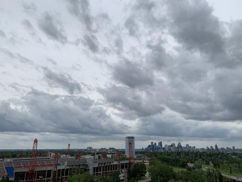
OVERVIEW                     Tyler Clowes

•   Background on Canada’s “Hail Alley”.
•   Information on hailstorms in this area.
•   How rare was this event?
•   Impacts of the 2020 hailstorm.
•   Antecedent atmospheric conditions.
•   Atmospheric profiles.
•   Overview of reflectivity and Doppler products.
•   Introduction of PARCA.
•   Comparison with GPM overpass.
•   Brooks/Duchess hailstorm.
•   Summary.
HAIL ALLEY
• Region between Edmonton and High River
  known for damaging hailstorms.
• Most active region for hail is between Red
  Deer and Calgary.
• High incidence of thunderstorms and
  atmospheric conditions favoring hailstorms.
• Storms typically develop over the foothills
  and intensify as they move eastwards.            Lightning Days (1999-2018)
• Area has a relatively high population density
  and also extensive agriculture.
• Short but intense severe storm season from
  mid June through late August.
• Former study area of the Alberta Hail Project.
                                                    Kochtubajda & Burrows (in prep.)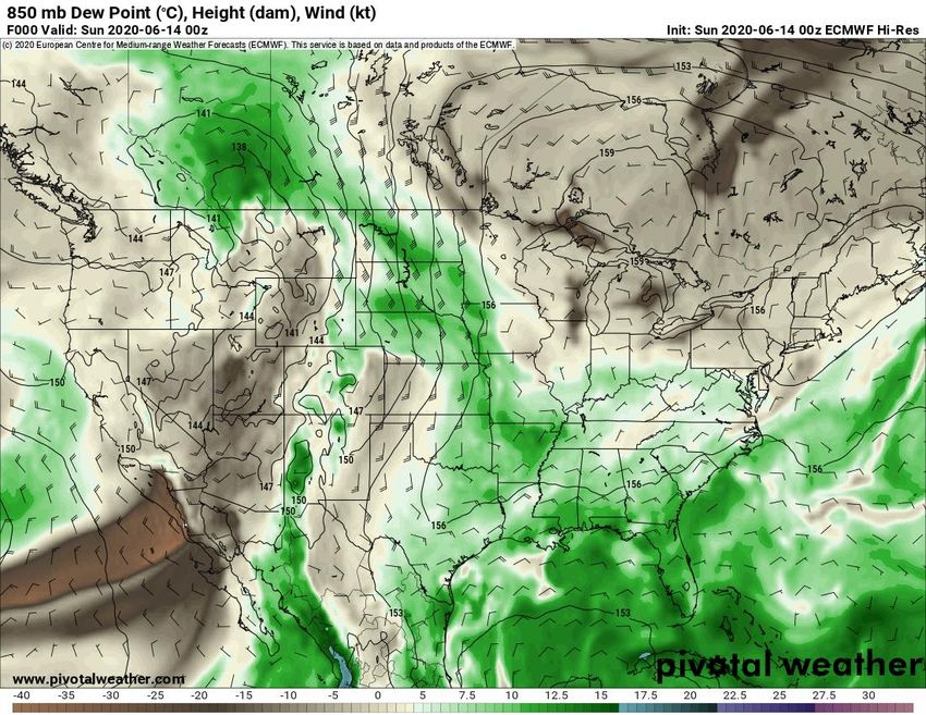
HAIL ALLEY: TYPICAL SEVERE
      HAILSTORM CONDITIONS
• Conditions preceding hailstorm formation
  in this region are well documented.
• Warming during morning and afternoon.
• Upslope flow in low levels, drawing
  moisture against foothills.
• Approaching upper-air trough with strong
  mid- and upper-level SW’ly to W’ly flow.
• Result: steep lapse rates, instability,
  vertical wind shear, convergence along
  orography to trigger storms.
• Storms typically intensify as they move
  off the foothills into deeper moisture.
CALGARY: GROWTH AND
             HAILSTORMS
• Area is no stranger to damaging hailstorms. Previous storms:
   • 28 July 1981 ($150 million)
   • 7 September 1991 ($342 million)
   • 12 July 2010 ($400 million)
• Similar to other hail-prone areas (e.g., Denver), Calgary has
  experienced rapid growth in recent decades (since 1996 1.4 to 3.7%).
• Population for Red Deer, Airdrie, Calgary and Okotoks is ~1.5 million.
• Rapid urban growth and marked urban sprawl.

                                                         Monthly housing
                                                         starts in Calgary
                                                         since 1948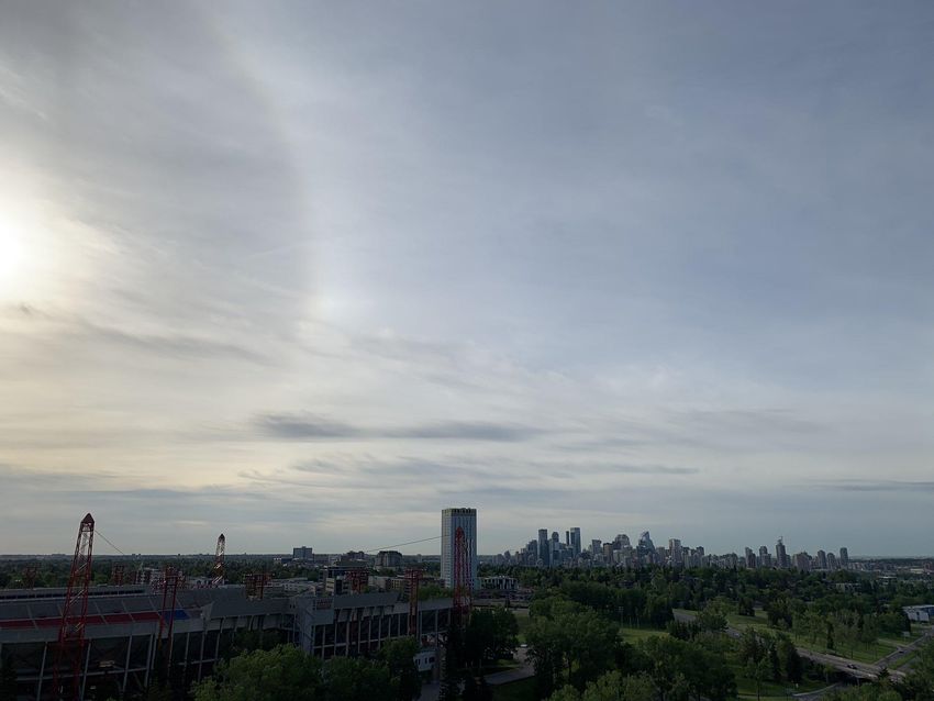
CONTEXT
                              Hail days over the AHP
                              between 1957 and 1973
                              (Wojtiw 1975)

Pentad data for days with
> 5 cm hail in the vicinity
of Calgary for 1978-2019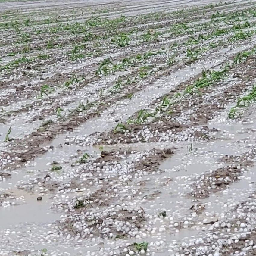
COMMENTS ON HAIL DAMAGE
• Impact energy of hail scales with D4.
                                                   Púčik et al., 2019: MWR
• European research found that hail
  damage increases significantly when
  its diameter exceeds 3 to 4 cm.
• For diameters beyond 5 cm, even more
  serious impacts to vehicles and houses.
• The amount of hail is also critical. Hail has
  a density of ~900 kg m-3, so its weight can
  inflict damage.
• Consequently, damage potential is a
  function of the size and amount of hail, N*D4.
• Did the storm produce copious amounts of
  small hail or small amounts of large hail?
• Winds are also a major factor.
• For a 5-cm stone, impact energy falling in 50
  km h-1 winds is increased by 25% compared
  to calm and 50% for 70 km h-1 winds.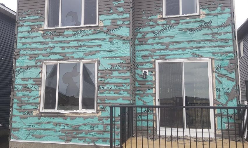
SUMMARY OF 13 JUNE 2020 STORM
•   The storm developed over south-central Calgary
    near 0025Z June 14, and rapidly intensified in the
    next 15-20 minutes to a severe storm.           Beth Allen
•   Most of the city and Airdrie to the north were
    spared the worst of the hail and rain.
•   The northeastern portion of Calgary bore the
    brunt of the damage.
•   Copious amounts of golf ball & larger hail,
    coupled with high winds, caused devastating
    damage to homes, vehicles & other assets.
•   The hail was accompanied by torrential rain
    that led to widespread urban flooding.
•   As the storm moved northeastwards from
    Calgary, it left a long hail swath that destroyed
    young crops and flooded fields.
•   Farther to the southeast, supercell storms
    produced very large hail and an EF-0 tornado.
•   These storms also caused extensive damage
    to crops and localized flooding.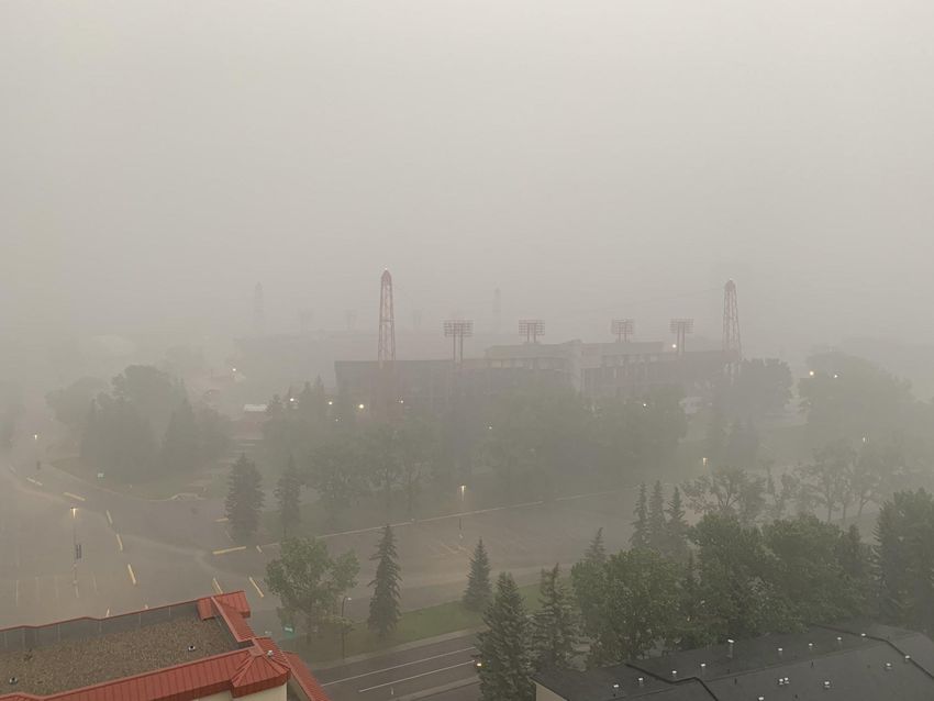
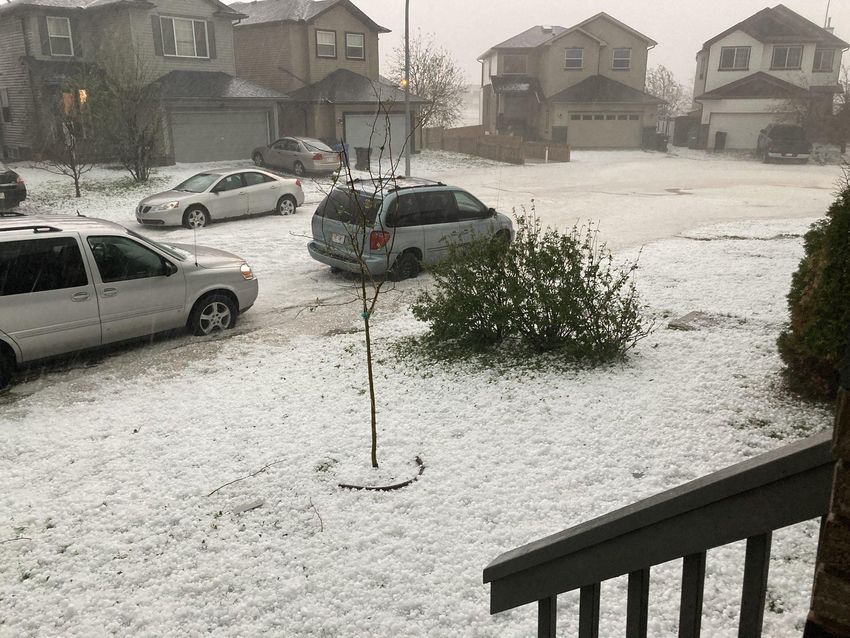
THE HAIL
THE HAILSTORM   WxKenYYC
Melanie
7:44
5:31    Brown
       am
6:37 pm
6:58
IMPACTS FROM HAIL
Saif Kaisar Tom Ross
StevieissIMPACTS FROM HAIL
Autumn BarnesIMPACTS FROM RAIN Spencer • Stations at Calgary Int’l reported 60 mm. • Daily record for June is 79 mm in 1932. • NE of Calgary, two sites measured 35 mm.
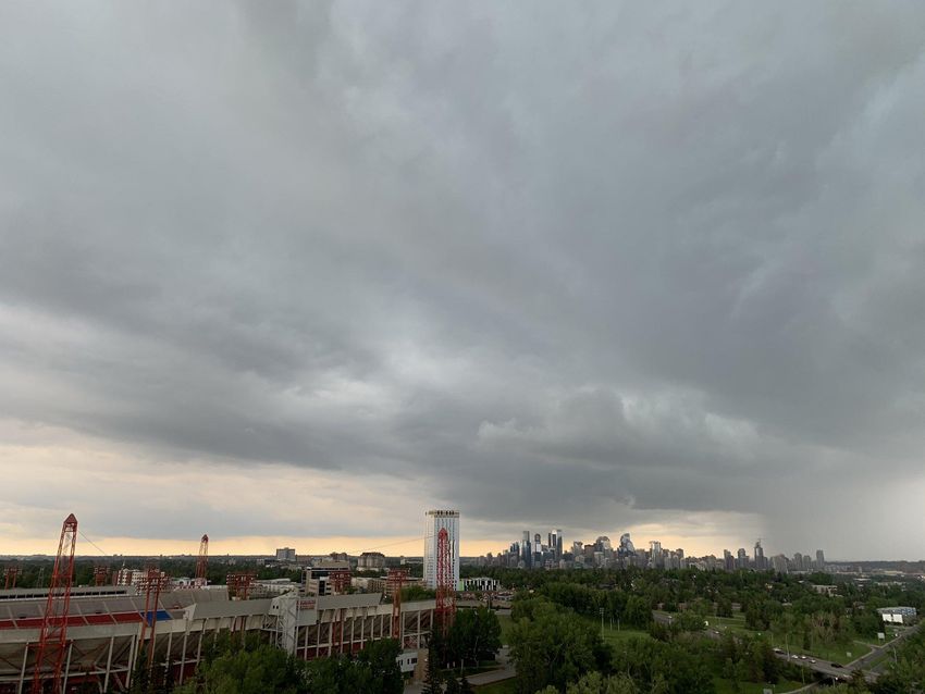
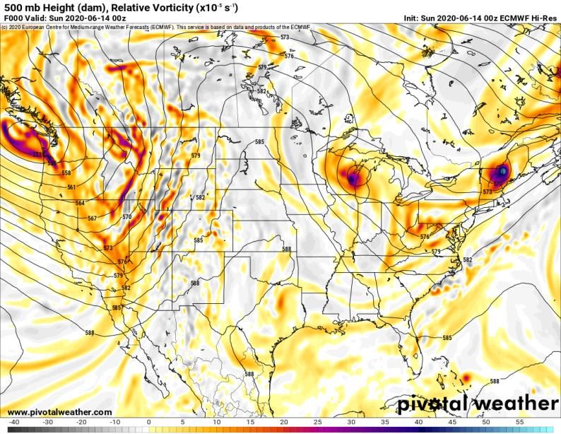
THE BIG PICTURE:
ANTECEDENT CONDITIONS
CONTINUED
PROFILES AND HODOGRAPHS:
             CALGARY
•   MLCAPE = 1360 to 2240 J kg-1
•   0-6 BWD = 45-50 knots
•   SRH3 = 110 to145 m2 s-2
•   SR flow0-3 = 40-50 degrees at ~20 kt
•   SCP = 2 to 7
•   SHIP = 1.2 to 1.8
•   Hodograph shape is intriguing
PROFILES AND HODOGRAPHS:
BROOKS/DUCHESS
• MLCAPE = 1528 to 1971 J kg-1
• 0-6 BWD = 45 to 55 knots
• SRH3 = 140 to 240 m2 s-2
• SR flow0-3 = 55 to 60 degrees
at ~20 kt
• SCP = 5.0 to 8.5
• SHIP ~ 2 Kyle BrittainMAXIMUM MESH MAP
STORM EVOLUTION: CALGARY
CROSS-SECTIONS
PARCA
GPM DATA
BROOKS/DUCHESS STORM
BROOKS/DUCHESS CONTINUED
SUMMARY
•   The storm developed over south-central Calgary near 0025Z, and rapidly
    intensified in the next 15-20 minutes to a severe storm.
•   The northeastern portion of Calgary bore the brunt of the damage.
•   Copious amounts of golf ball and larger hail, coupled with strong winds caused
    devastating damage to homes, vehicles & other assets.
•   The hail was accompanied by torrential rain that led to widespread urban
    flooding.
•   Farther to the southeast, two long-lived supercell storms produced giant hail
    and an EF-0 tornado.
•   Still very early in the process of understanding why this storm developed over
    Calgary and why is produced so much large hail.
•   Initial indications are that it is rare to have such a severe hailstorm this early.
•   Some aspects of antecedent conditions at odds with conceptual model for
    severe hailstorms in this area. Hybrid multicell-supercell storm?
•   Scale and nature of hail damage raises questions about building codes for
    houses in hail-prone areas and mitigating risk.
THANKS
• Dan Kulak (ECCC)
• Randy Chase (GPM data)
• Pivotal Weather and College du Page
Thank You – Merci BeaucoupYou can also read