Bobcat Gulch Fire CO-ARF-23777 - Final Summary, Fire Weather Fire Behavior - Gary Bennett, Incident Meteorologist
←
→
Page content transcription
If your browser does not render page correctly, please read the page content below
Bobcat Gulch Fire
     CO-ARF-23777
          Final Summary,
           Fire Weather
           Fire Behavior

                   Photo courtesy Dou VanReeth, Loveland Herald-Tribune

Gary Bennett, Incident Meteorologist
 Kelly Close, Fire Behavior Analyst
WEATHER - BOBCAT GULCH FIRE

IMET arrived on site late evening, at the ICP, on Tuesday June 13, 2000. Fire made a substantial run
that day prior to the IMET’s arrival. Weather was a factor for the large run on Tuesday. Gusty
westerly channeled winds developed in the late afternoon as temperatures warmed into the 80's. The
warmer maximum temperatures heated through the upper level wind field bringing the stronger
winds from aloft to the surface. The burn pattern of the Bobcat fire was strongly affected by the wind
direction and speeds of 20-30 mph.

The weather did settle down on Wednesday June 14th with wind subsiding and warm daytime max
temperatures and lower relative humidity. Max temperatures were in the middle 80s with RH’s
dropping to below 20 percent at a few areas on the fire. Readings were taken by belt weather kits
that the fire crews carry. A Fire Weather Watch was issued, from the Fire Weather Office in
Boulder, Wednesday afternoon for a dry cold front expected in on Thursday. The Fire Weather
Watch was disseminated to all incident personnel.

The Fire Weather Watch issued Wednesday was upgraded to a Red Flag Warning late Wednesday
night. The Red Flag Warning was issued for the strong cold front that was forecast to hit the fire
area Thursday June 15th in the late afternoon or early evening. The front swept into the Bobcat Gulch
Fire, from the north, at approximately 3:30 PM Thursday afternoon. Skies clouded over,
temperatures cooled dramatically, RH’s increased, and winds increased markedly and shifted
direction. Temperatures were very warm Thursday. Maximum temperatures ranged from the lower
80s to near 90 in the fire area before the passage of the cold front. After the cold front temperatures
plummeted into the low and middle 60s, about a 25-30 degree fall. Relative humidity doubled from
the mid teens to around 40 percent. Again, the biggest influence on the Bobcat Fire was the wind.
Wind speeds prior to the frontal passage were quite strong ranging from 15 to 25 mph with
occasional gusts to 30-35 mph. The direction of the pre-frontal wind was westerly. As the cold front
approached wind speed increased to 20-35 mph with gusts to 40-50 mph. There were gusts reported
over the ridges of 50-60 mph just after the front passed and the wind direction shifted to the
northeast. The northeast upslope flow brought in heavy cloud cover and light rain began around
midnight.

The northeast to east upslope flow continued to mid morning Friday . Rain fell steadily all night and
began to taper off by 10 AM. The wind flow aloft shifted westerly again and skies cleared by
afternoon. The amount of rain that fell on the fire ranged from three tenths (.30) to near one-half inch
(.50). The cold air mass associated with the front dropped the snow level to near 7000 feet. In fact,
4-6 inches of wet snow was reported in the higher elevations of the fire. Fire progression was halted
by the rain and high humidity. Down slope westerly winds did allow for some drying late Friday
afternoon. Maximum temperatures were very cool even with the partial afternoon sunshine.
Temperatures ranged in the 50s and lower 60s for the lower elevations and in the 30s and 40s for
higher elevations.

Sunny skies and gradual warming temperatures typified the weather for Saturday and Sunday. High
temperatures warmed into the upper 60s and lower 70s Saturday and middle 70s to lower 80s
Sunday. Lower relative humidity aided by a westerly wind helped to dry out the lower levels of the
atmosphere. Ground and fuel conditions warmed and dried quickly putting the fire back into an
active stage by Sunday afternoon. A Fire Weather Watch was issued for dry lightning, gusty winds
and low humidity for Monday.

On Monday June 19th, the day started rather benign but by afternoon, thunderstorms began building
over the fire area. Numerous lightning strikes were reported with rain and gusty winds from these
thunderstorms. The front passed in the evening around 8:00 PM with increasing northwest wind. The
wind subsided after midnight but some gustiness still remained over the higher ridges on the Bobcat
Gulch Fire into early Tuesday.

FIRE BEHAVIOR SUMMARY

The Bobcat Gulch Fire was a wind- and terrain-driven wildland fire that started the morning of June
12. Fire spread was by intense surface fire, torching, intermittent crown fire runs, and medium- long-
range spotting. Fire behavior was extreme, and spread rapid, due to unseasonably warm, dry
weather and low live and dead fuel moistures. The fire made several major runs, burning north and
east from Bobcat Gulch to northwest of Masonville, CO. The fire was managed with aggressive
initial and extended attack under a full suppression strategy throughout its duration.

Fuels and Fuel Moisture
The previous winter and spring in northern Colorado had been unseasonably dry, with below-normal
precipitation for the majority of the winter and spring. Live fuel moisture in conifers was reported to
be 90-99% the week prior to the fire, and 1000-hr fuel moistures were at 10%. Grasses were
reaching maturity, though no curing had commenced. However, needle cast enabled fire spread in
grasses in many areas.

Extensive coniferous stands covered most of the area. The predominant overstory consisted of open,
dry ponderosa pine (PP) at lower elevations with grass and bitterbrush understory, more closed PP
and lodgepole pine (LPP) stands at mid-elevations, mixed conifer (PP, LPP, Douglas-fir) at mid-
upper elevations, and LPP at the highest elevations. Numerous houses scattered throughout the fire
area did not contribute to the spread of the fire. A large grassy meadow in the middle of the fire area
(Cedar Park) was green and did not carry any fire. Based on observed weather, fine dead fuels were
approx. 4-6% during the first several days of fire spread.

Fire Behavior Prediction System (FBPS) fuel models 9 and 10 best characterize the majority of the
fuel bed supporting surface fire spread, with lesser areas of model 8 at the highest elevations. The
primary carrier of the fire was the heavy accumulation of surface fuels, conifer, reproduction, as well
as substantial portions of tree canopies. All dead fuels were very dry and burned readily, with nearly
complete consumption. Live coniferous fuels burned readily. Large pockets of “doghair stands”
were present throughout the area.
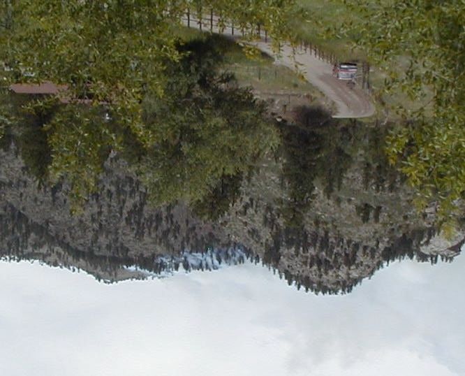
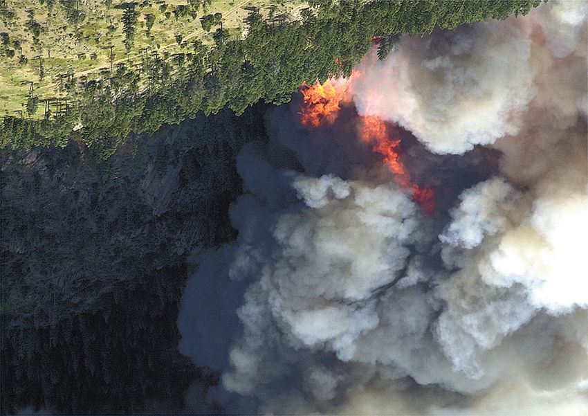
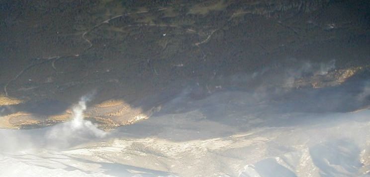
Ladder fuels found throughout the area            Typical forest cover at mid-elevation

Topography
The predominant drainages in the vicinity are Big Thompson Canyon to the S and Buckhorn Creek
to the E/NE. The fire burned in a side-drainage of Big Thompson Cyn., Bobcat Gulch, through
Cedar Park, and ultimately east to Buckhorn Creek. Terrain is generally steep and complex, with a
large flat meadow near Cedar Park. Elevation in the area ranged from 6,000 ft. to 8400 ft.

General terrain in the area; looking toward Cedar Park from over Galuchie Park

Weather
Fire danger during the fire start and subsequent four days was extreme, and unseasonably dry for
June. ERC values for the Estes Park RAWS station for two weeks prior were 68-72 and setting the
historic maximum. During the same time period, 1000-hr fuels were setting historic minimums. The
trend for the previous 6-8 months was for conditions warmer and drier than usual, with snowpack
levels 60-80% of normal below 9,000 ft.
The day of ignition, temperatures reached the low 80s and min. RH values were 15-18%. Initial
crews remarked on the unusually warm conditions earlier that morning. Winds at 1000h were
reported as “battling” between S and NW, eventually stabilizing N and upslope/upcanyon at approx.
10-15 mph. No significant cloud cover was reported in the area. Throughout the duration of the
fire, peak burning conditions occurred between 1530 and 1630h; this time period was notable for
strong winds and low RH values. Humidity recovery began by 1900h, though was moderate to poor
the first 3 nights. No precipitation occurred during the first three operational periods. Precipitation
on June 16, following a cold front passage, wetted the canopies, surface fuels and top 1 to 1-1/2" of
duff, dampening further fire activity.

Chronology and Significant Fire Behavior
Initial attack crews on June 12 reported extreme burning conditions upon arrival at 0820h. Surface
fire was completely consuming fuels, and torching and crowning were common. Several individuals
remarked that “all fuels were available to burn, and did.” By 1000h, the fire had spread to 50 acres,
burning aggressively in both surface and aerial fuels. By 1200h, the fire had reached the Hyatt Mine
to the N and burned approx. 150 ac. Between 1200-1300h, winds shifted to W, channeled by local
terrain, and the fire reached Spruce Mtn Dr. to the N and the 128 Rd. to the E. Winds had increased
to 15-20 mph, and the fire burning as intermittent crown runs with intense surface fire and torching.
Spotting was frequent, from ¼ to ½ mile. By 2100h, the fire had reached 1,600 acres and continued
to burn actively through the night.

Origin and fire area for June 12
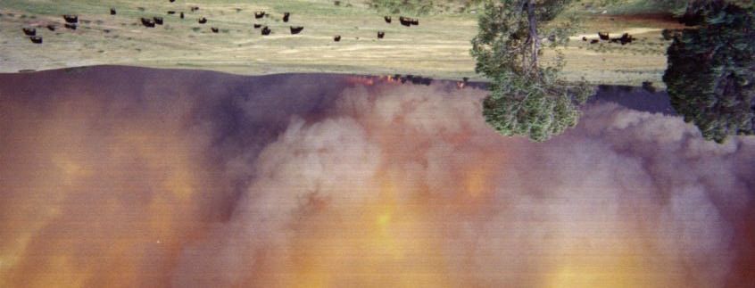
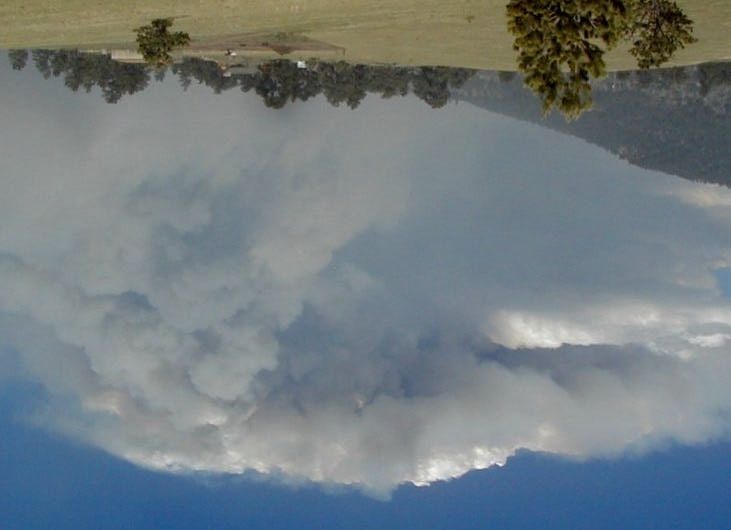
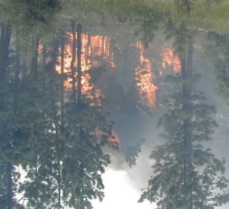
Fire backing from near origin 6/12                  Fire crosses Rd. 128, 1330h

On June 13, the fire burned into Jug Gulch, an area with heavy downed woody fuel accumulation,
with frequent torching and spotting. At approx. 1530h, W winds increased and the fire became an
intense crown fire, burning up and across the W and S sides of Spruce Mtn. From that point, the fire
moved E across Green Ridge, as a “pulsing” crown fire interspersed with intense surface runs and
torching. The column was nearly vertical, bending slightly to the E, with a well-developed cumulus
cap. The fire eventually burned into agricultural land west of Masonville at approx. 2000h, where
spread was slowed by irrigated fields. Acreage increased to 6,640 ac.

Spotting and torching out of Jug Gulch    Convective column development 6/13
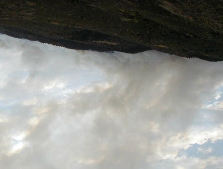
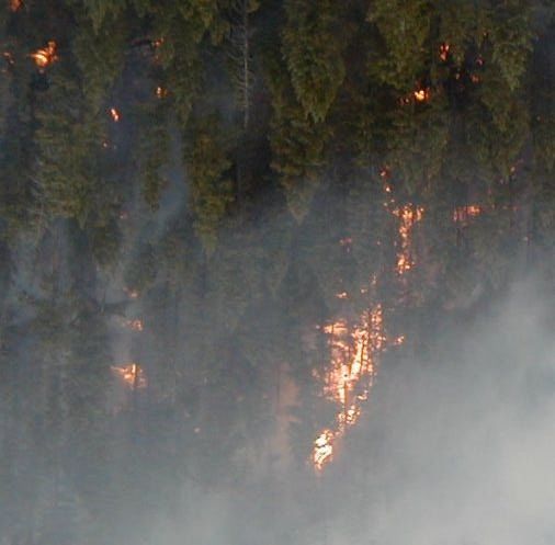
Fire front hits west of Masonville 6/13; photo courtesy of Duane and Phyllis Thompson

Activity was subdued on June 14, though the fire was active to the N in several places. Spread was
primarily by backing surface fire, and short uphill runs with torching and intermittent, limited
crowning. On June 15, The fire made another significant run under the influence of warm, dry W
winds ahead of a dry cold front. Spread was largely to the N and W, with intense surface fires and
torching; limited crown runs were also observed. Acreage increased an additional 3100 ac. At 1530,
the cold front hit the fire area, increasing wind speeds and changing direction to E, then N. The main
column began to lay over, then disappeared entirely as the cold front moved E across the fire.

Torching and crowning on the east perimeter           The cold front hits the eastern edge of the fire

Precipitation behind the front dampened the fire spread, resulting in no further significant spread.
Despite a warming, drying trend the next two days, fire activity after June 16 consisted of isolated
smokes interior to the perimeter, largely in unburned islands. No increase in fire activity or
additional spread had occurred as of June 19.
You can also read