Burbage Neighbourhood Development Plan - Burbage Parish 2017 2026 - Post Regulation 14 Additional Consultation Draft January 2017 - Burbage ...
←
→
Page content transcription
If your browser does not render page correctly, please read the page content below
Post-Reg.14 Additional Consultation Draft
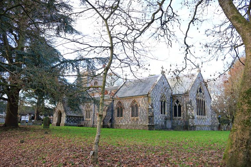
Burbage
Neighbourhood
Development Plan
Burbage Parish 2017 - 2026
Post Regulation 14 Additional Consultation Draft January 2017
Post-Reg.14 Additional Consultation Draft
Post-Reg.14 Additional Consultation Draft

Burbage
Neighbourhood
Development Plan

Contents
1.0    Introduction                                                        5

2.0    Area Covered by the Plan                                            5     The Burbage
                                                                                NDP has been
                                                                               prepared by the
3.0    Executive Summary                                                   6
                                                                               local community
                                                                                 under powers
4.0    Evidence Base                                                      10    granted by the
                                                                                 Localism Act
5.0    Planning Policy Context                                            12         2011.

6.0    Physical, Social and Economic Context                              15
                                                                                       The
7.0    Vision of the Plan                                                 22    Neighbourhood
                                                                                  Plan will sit
                                                                                 alongside the
8.0    Main Objectives of the Plan and Non-Land Use Aspirations           23
                                                                                 Wiltshire Core
                                                                                 Strategy as a
9.0    Policies of the Plan                                               24   part of the overall
                                                                                 Development
10.0   Non-Planning Actions                                               43   Plan for Wiltshire.

11.0   Monitoring                                                         44
                                                                               It will help guide
                                                                                  and manage
                                                                                development in
                                                                                  the Parish of
Appendix      1       Evidence Base per Section
                                                                                 Burbage until
                                                                                      2026.
Appendix      2       Housing Needs Survey

Appendix      3       Burbage and the AONB

Appendix      4       Burbage and Flood Risk
Post-Reg.14 Additional Consultation Draft

                              Glossary of Terms

Acronym or Term      Definition

BNDP                 Burbage Neighbourhood Development Plan

CA                   Community Area

Community            Initial community engagement survey of 2014
Engagement Survey
HRA                  Habitat Regulations Assessment

LDF                  Local Development Framework

LoD                  Limit of development (e.g. village boundary)

LPA                  Local Planning Authority (Wiltshire Council)

NDP                  Neighbourhood Development Plan

NPPF                 National Planning Policy Framework - 'The Framework' sets out
                     planning policies for England and how they are expected to be
                     applied. It provides guidance for local planning authorities and
                     decision-takers, both in drawing up plans and making decisions
                     about planning applications.
PC                   Parish Council

Qualifying Body      Body authorised by law to create a Neighbourhood Plan. Normally
                     the Parish Council.

Reg. 14 / 15         Regulation 14 of the Neighbourhood Plan (General) Regulations
                     2012 requires that a formal 6-week Consultation be carried out.
                     Regulation 15 Requires a Consultation Statement to be submitted.

SA                   Sustainability Appraisal – A wide-ranging appraisal of the impacts
                     of policy (such as this plan) to include socio-economic as well as
                     environmental factors.

SEA                  Strategic Environmental Assessment – European legislation
                     requiring all plans to be assessed for environmental effects. In the
                     UK compliance with the SEA Regulations can be achieved
                     through SA or Sustainability Appraisal which takes into account
                     socio-economic as well as environmental factors.

SHMA                 Strategic Housing Market Assessment

VDS                  Village Design Statement

WCS                  Wiltshire Core Strategy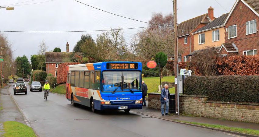
Post-Reg.14 Additional Consultation Draft
1.0 Introduction
The Neighbourhood Area
1.0 The Localism Act invites
communities led by a ‘Qualifying
Body’, usually the local Parish
Council (PC), to write Neighbourhood
Development Plans (NDPs). Such
plans set out how communities
want their area to develop over a
given period; for Burbage, the NDP’s
timeframe is the same as the Wiltshire
Core Strategy, from 2016 to 2026.
1.1 In 2013 Burbage Parish Council
approved the setting up of an NDP
Working Group under the
chairmanship of Martin Cook. The
Working Group is responsible for
drafting the NDP.
1.2 In an initial community engagement
survey in 2014, 85% of respondents
supported the creation of a
Neighbourhood Plan. The same
proportion felt that this should cover
the entire Parish and not just the
main village (see Survey analysis
given in Consultation Statement).
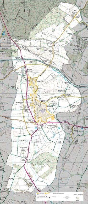
2.0 Area Covered by Plan
2.0 The whole Parish of Burbage is
embraced by this NDP and is
considered appropriate for
designation as a Neighbourhood
Area because:
• Burbage PC is an elected democratic
body representing the entire local
community within the Parish and is
committed to ensuring the
community’s views are fully reflected
in future local planning decisions
• Designation of the whole parish will
ensure that the Plan will take into
account planning issues relating not
only to Burbage village but also
smaller communities including Durley
and the area near Southgrove Farm
• It is a properly constituted, well
recognised and clearly defined Parish
area and is entirely within the remit of
the Parish Council
• Community consultation among residents of the Parish has endorsed this area for designation.
-5-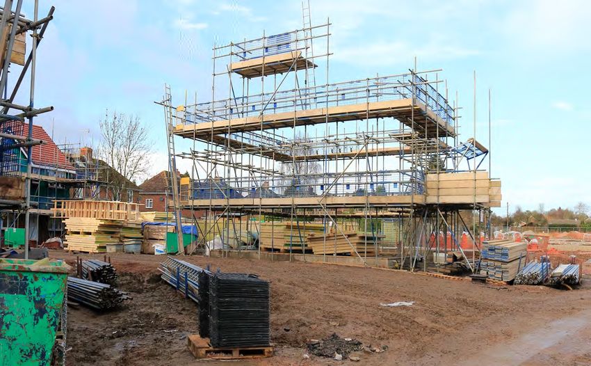
Post-Reg.14 Additional Consultation Draft

3.0 Executive Summary

3.1   The Burbage Neighbourhood Development Plan (NDP) is built on two main foundations;
      careful research and community engagement. The former is contained mainly in the
      separate SA Scoping Report, the latter in the Consultation Statement. Readers should
      refer to these if they need more detail. A short summary of the scoping research is
      however given in the NDP document following, as an immediate context to the polices
      and to avoid the need for too much cross referencing.

3.2   While accurate research is essential, as policies must be based on sound evidence,
      ultimately the plan belongs to the community. It is their wishes, expressed through
      the various layers of community engagement and consultation, that have really moulded
      the policies of the plan. Indeed, the Consultation Statement explains clearly and honestly
      how the originally-suggested strategy of high-growth/ high benefit was decisively rejected
      by the community and how this forced a re-think of policies and indeed the entire strategy
      of the plan. There is no doubt in the minds of the Steering Group that this ultimately
      resulted in a better NDP. The accompanying Consultation Statement indicates how
      policy was actually created from all sources including objective scoping research, the
      policy background and the wishes of the community.

3.3   Policies of the plan have also been subjected to Sustainability Appraisal (SA), meeting
      the obligations due under the SEA Directive. The process is explained in the separate SA
      Scoping Report and the SA Environmental Report. Policies revised as a result of the Reg.
      14 Consultation were re-tested against the SA Framework in a separate new section of
      the Environmental Report added after that time. The job of the SA is really to give the
      plan an ‘eco-MOT’ – a test to ensure that, if implemented it would help deliver sustainable
      development. The SA as repeated for changes resulting from the Reg 14 Consultation.

3.4   There are in fact a suite of documents which together contain the full NDP:

      The SA Scoping Report
      The Site Selection Report
      The SA Environmental Report
      The Consultation Statement
      This document - The NDP itself.

                                              -6-
Post-Reg.14 Additional Consultation Draft

3.5   The Vision

      The Vision of the plan was developed from public consultation including participatory public
      meetings, a full Parish Household Survey, a Business Networking Seminar and community events
      and activities. It has also been constructed to tackle the issues and problems identified in the SA
      Scoping Report. The vision was amended following the Reg. 14 Consultation:

                                           Burbage NDP VISION

         Burbage will continue to flourish as a living, working village. Future developmental
         growth will be moderate and in general keeping with Burbage’s position in the
         settlement hierarchy of the Wiltshire Core Strategy as a ‘Large Village’.

         Housing development will continue to slowly grow the village in a moderate manner,
         but, whenever possible, this will be matched by appropriate local employment
         opportunities to improve the self-containment of the village and reduce the need for
         out-commuting as far as is possible. We will protect the most important green
         spaces.

         The vitality of the village will be enhanced by the provision of new infrastructure
         including if possible an extended doctor’s surgery and better facilties for recreation
         and young people. Parking and road safety will be improved as will sustainable
         transport such as the foot and cycle path network.

         The BNDP intends to ensure that the local community has a powerful voice in
         managing future change in the village and in particular a greater say in where, how,
         what and when development occurs.

3.6   Objectives

      Following the community consultation exercises and the Reg, 14 Consultation (and subsequent
      modifications), the main Planning Objectives of the Burbage Parish Neighbourhood Plan are
      designed to take forward the Vision; identifying key aims that policy will address.

                             The OBJECTIVES OF THE Burbage NDP

        1. To deliver the housing and employment the village needs
        2. To steer development to locations that are supported by the community
        3. To encourage employment, including tourism and micro and start-up businesses
        4. To ensure that the community benefits in terms of improved infrastructure
        5. To encourage healthy lifestyles, reduce car use and improve sustainable transport
        6. To protect and if possible enhance the recreational green spaces of the Parish
        7. To protect the quality, character and local distinctiveness of the natural and historic
           landscape and village buildings, and maintain high design quality, especially within the
           conservation area
        8. To improve opportunities for leisure and recreation, especially for young people.

                                                  -7-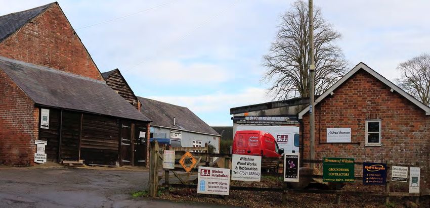
Post-Reg.14 Additional Consultation Draft

3.7   Policies

      The development of policies is described in some detail in the Consultation Statement
      and SA Environmental Report. Broadly speaking however, policies sprang from an
      understanding of the local context (physical and planning policy) and the wishes of the
      community. Regulation 14 Consultation responses required a considerable re-drafting
      and revision of the plan and its policies.

3.8   The final policies are:

          Policy 1    Development Strategy
                      A broad ‘what goes where’ policy for housing and employment but without
                      specific sites.

          Policy 2    Housing (General)
                      The nature of the housing needed in Burbage

          Policy 3    Housing (Site)
                      Specific housing development site - Grafton Road

          Policy 4    Developer Contributions
                      List of priorities for investment from both Section 106 Agreements and CIL

          Policy 5    Economy (Business, Employment and Tourism)
                      The nature of employment needed in Burbage

          Policy 6    Economy (Business, Employment and Tourism) Site
                      Specific site for employment uses

          Policy 7    Local Green Spaces
                      Protection of the most cherished local spaces

          Policy 8    Transport
                      Transport matters directly related to new transport

          Policy 9    Heritage
                      Protection of listed buildings and the conservation area.

                                                  -8-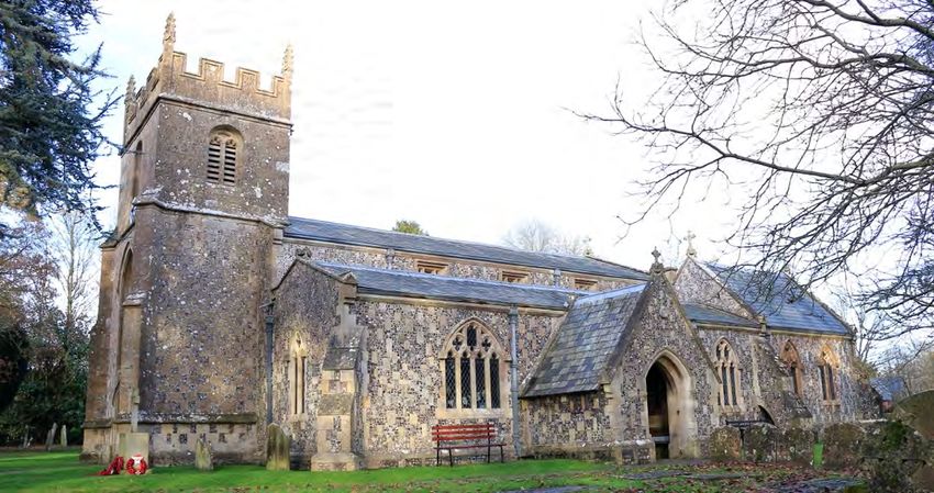
Post-Reg.14 Additional Consultation Draft

3.9    Non-Planning Actions.

       Some issues raised in the consultation process are not suitable for inclusion in the plan, generally
       because they do not relate precisely to land-use issues and so fall outside the legal land-use
       planning system of which the NDP is a part. However, there seems to be no logical
       reason why, in addition to its binding Development Plan policies, the NDP cannot also act as a
       focus for informal local action by identifying and agreeing priorities for non-plan action stemming
       from the issues identified in Scoping and Community Engagement. Leadership for taking the
       matters forward may fall to the Parish Council

3.10   Although not forming part of the formal land use policies of this Plan, the following matters
       are aspirational aims for future community action and were suggested during the community
       engagement.

                                        The Community Aims:

3.11   Monitoring

       Monitoring of development plan documents is required by law. Wiltshire Council currently
       produces an annual monitoring report (AMR) and will assess the overall performance of the
       Development Plan in Wiltshire. This will meet the main requirements for monitoring.

3.12   However, the Parish will also be carrying out monitoring as part of its ongoing SA work.

3.13   As part of this the Parish Council will produce a Local Monitoring Report (LMR) and this will be
       supplied to the LPA. It will also be made available to the community via the Parish Website. The
       LMR will take the form of a simple table plus a few paragraphs of explanatory and advisory text.
       The table and its monitoring indicators is given in page 94 of the accompanying SA Environmental
       Report.

3.14   Appendices

       While site and most other maps are incorporated within the main text of the plan for ease
       of reference, some matters have been reserved to appendices. These are:

       •   Appendix 1        Evidence Base per Section
       •   Appendix 2        Housing Needs Survey
       •   Appendix 3        Burbage and the AONB
       •   Appendix 4        Burbage and Flood Risk.

                                                   -9-
Post-Reg.14 Additional Consultation Draft

4.0 Evidence Base
4.0   In addition to information contained within the NDP itself, the evidence base for the
      NDP includes four supporting documents: the SA Scoping Report, the SA Environmental Report,
      the Site Selection Report, and the Consultation Statement. These contain research
      (documents read and absorbed, comments of consultees), site based assessment and inputs from
      the community. The Consultation Statement also indicates how community involvement shaped
      policy and how policy was actually created from all sources.

4.1   In the case of the Burbage NDP, the SA Scoping Report began as a simple NDP Scoping
      and Research Report – in the early days before it was confirmed that an SEA would be needed.
      Into this report was condensed all of the documentary research and statutory consultee responses
      that were received during the initial research into the plan (some 18 months’ work). Once it was
      confirmed by the LPA that an SEA would be required (Screening completed in September 2014), it
      was decided to adopt the more comprehensive SA model (as the plan deals with more than just
      environmental issues). This report (re-titled ‘SA Scoping Report’) therefore provides a record of
      some of the detailed research undertaken to:

      •   Identify Issues and problems
      •   Take account of other plans, programmes and policies and understand the context
      •   Consider the actions needed to correct the problems and tackle the issues as a basis for policy
      •   Create a set of Sustainability Objectives that all policies should contribute towards.

                                                 - 10 -
Post-Reg.14 Additional Consultation Draft
4.2 The SA Scoping Report provides an account of some of the evidence base for the plan. But, in
addition to that, the input of the community and those stakeholders consulted throughout were
also critical and their comments also effectively are part of the evidence foundation of the NDP.
These records can be found in the Consultation Statement.
4.3 The SA Environmental Report tested the environmental credentials of the plan and its proposals
before the first Regulation 14 Consultation and was revised thereafter as necessary. The separate
Site Selection Report considered the land use planning issues regarding sites proposed before
the Reg 14 Consultation stage. This however has been largely overtaken by events. In particular,
following the Reg 14 Consultation it was clear that the community had decisively rejected the ‘high
growth / high benefit’ strategy proposed. A complete re-think of policy then took place and policy
were revised and sites deleted. Sites were dropped, but no new ones added. This process is
recorded in the Consultation Statement.
4.4 In order to facilitate cross-referencing, each policy in this plan document begins with a text box
listing references to; ‘Plan Objectives, the NPPF and the WCS’ – to give an indication of links to
these key aspects of evidence. Additionally, the policies of the Plan are followed by sections
entitled: “Evidence Base” and “Justification”. These sections give a brief summary of underlying
evidence and the reasoning behind each item or policy.
4.5 Detail of background research is provided by the Evidence Base list, given as Appendix 1, which is
divided into these sections:
• Creating the Plan
• Vision
• Objectives
• Policies
In this way, although it does entail some repetition, it is possible to monitor at a glance exactly
what evidence foundations each aspect of the plan has. This is important, not only to satisfy an
examiner and to reflect good practice in planning, but also as a key quality control tool that has
been useful to the team in putting together the NDP – cross referencing and feeding back into the
polices as they grew.
4.6 Finally, in order to provide the reader with an initial overview of both the policy and physical
contexts, and to lead thereby naturally into the policies of the plan, the next two sections are
essentially summaries of the evidence base that deal with these two critical cornerstones.
- 11 -Post-Reg.14 Additional Consultation Draft
5.0 Planning Policy Context
5.0 The planning context for the NDP begins with Legislation and Regulations, including the Town
and Country Planning Act 1990 (as amended), the Planning and Compulsory Planning Act 2004,
The Localism Act 2011, the Neighbourhood Planning (General) Regulations 2012 The
Neighbourhood Planning (General) (Amendment) Regulations 2015,The Neighbourhood Planning
(General) and Development Management Procedure (Amendment) Regulations 2016 and the
Environmental Assessment of Plans and Programmes Regulations 2004. In addition to legislation
and regulations, the Government has provided National Planning Policy Framework and Planning
Practice Guidance (online resource) published by the DCLG.
5.1 The National Planning Policy Framework (NPPF) has much to say that is relevant to the
Burbage NDP. The NPPF indicates that Neighbourhood Plans, ‘give communities direct power to
develop a shared vision for their neighbourhood and deliver the sustainable development they
need.’ It also makes it clear that, while Neighbourhood Plans must be ‘in general conformity’ with
the development plan and take forward its strategic policies, outside of this limitation, they are free
to ‘shape and direct sustainable development in their area.’ These plans, it makes clear, should be
backed by a ‘proportionate evidence base’. The NDP relies to a great extent on the same
evidence base as the WCS, including its topic papers. However, there is some additional research
also.
5.2 The NPPF sets out principles governing a number of key areas of the Burbage Neighbourhood
Plan including the following which have been especially informative for the NDP:
• Nature, quantity and type of housing (47-55)
• Promotion of Mixed Use Developments (38)
• Use of Brownfield Land (111)
• Design Standards (58)
• Protecting the AONB (117/8)
• Conserving and enhancing Heritage (137/38)
• Planning for flood risk (99/100)
• Conserving biodiversity (117/8)
• Preserving green infrastructure (74)
• Designating Green Space (76/77)
• Ensuring viability and deliverability of sites (173)
• Encouragement of sustainable transport (29-41)
• Employment and jobs in rural areas (28)
5.3 In terms of the Development Plan, this consists of the Wiltshire Core Strategy
(2015) plus saved polices of the Kennet Local Plan (2003). In 2008 a Conservation
Area Character Appraisal was published with the aim of recording and protecting local
distinctiveness and heritage. This has been adopted by the local planning authority and is a
material consideration for development management purposes.
5.4 The Wiltshire Core Strategy (WCS) places Burbage in the category of ‘Large Village’.
Large Villages are defined as settlements with a limited range of employment, services
and facilities. Development in Large Villages will be limited to that needed to help meet
the housing needs of settlements and to improve employment opportunities, services
and facilities. Within the limits of development, there is a presumption in favour of
sustainable development.
- 12 -Post-Reg.14 Additional Consultation Draft
5.5 In other words, development should be of a moderate scale, reflecting the range of
services and facilities available, and the most favoured location for this growth is within the
limits of development – i.e. the village boundary. However, the NPPF stresses the
need for flexibility in plan making (paragraph 14) and states that neighbourhood plans
should (paragraph 16); ‘plan positively to support local development, shaping and
directing development in their area that is outside the strategic elements of the Local
Plan’.
5.6 The WCS has designated nearby Pewsey as the Local Service Centre and the strategy is
for most development within the Pewsey Community Area to take place there. Burbage is
not expected to absorb significant levels of development between now and 2026. However,
Burbage is proving to be popular with new houses selling well. Bearing in mind the fact that the
WCS figures for housing are minima, and that Burbage enjoys a fine setting and many green
spaces, it seems very likely that the village will attract a fair amount of development interest over
the next 10 years.
5.7 The village provides a range of services for the surrounding rural area including Doctors Surgery,
primary school, petrol station, convenience store and Post Office. These facilities and services are
much valued by the local community as they keep Burbage alive and greatly improve quality of
life, especially for those who find travel difficult due to age or health.
5.8 The WCS (e.g. policy CP18) stresses the need for development in the Community Area to
respect the high value placed on the rural landscape and especially the AONB. The Core
Strategy (CP41) also promotes low carbon construction and low-energy buildings, sets a
policy context (CP’s 43,44,45) for housing which states that homes should provide for the
entire range of needs and has policies that encourage the retention of rural businesses and
services (CP’s 48 and 49). As one would expect with a strategic document of this nature,
the WCS also has polices requiring the protection of biodiversity (CP 50), the historic
environment (CP58) and air quality (CP55) as well as governing the management of flood
risk (CP67). It sets out a policy promoting sustainable transport, tourism (CP’s 39, 40) and
the protection of employment land (CP35). It also requires (CP52) development to retain
and enhance Green Infrastructure such as sports fields, open spaces, woods, gardens and
rights of way.
- 13 -Post-Reg.14 Additional Consultation Draft
5.9 Some policies of the old Kennet Local Plan (pre-Wiltshire Core Strategy) have been saved
and carried forward. All were considered, however the most relevant for the NDP were felt to be:
• Countryside, Landscape and Biodiversity: NR4, NR6, NR7, NR19, TR20
• Heritage: HH1, HH10
• Parking Standards: AT9
• Developer Contributions: AT10.
NDP policies were checked against these polices and those of the WCS.
5.10 The existing Conservation Area Character Appraisal was formally adopted by the then
LPA, Kennet District Council, in February 2008. It remains a material consideration in the
determination of planning applications. The Character Appraisal also includes management
proposals. The NDP takes forward the concerns and issues of the Character Appraisal and
the Management Proposals. In particular, the following were influential:
• The description of Burbage as growing from a linear settlement with several distinct ‘Character
Areas’ based on historic hamlets and modern building.
• The importance of the landscape setting, the canal and vernacular buildings, including the
more than 40 which are Listed.
• The low overall density of development
• The importance of Green spaces, mature trees, green verges and hedges
• The views and vistas from the conservation area that emphasise roominess and space, even
in an urban setting.
• The mixed architectural styles, traditional materials and structures, including some that detract
from the quality of the village.
• The importance of hamlets and isolated farmhouses in the area surrounding Burbage
• Issues and problems including the number of overhead wires
• Presumption against developing open spaces including land south of old bakery.
• Need for high quality design in the Conservation Area (together with design requirements)
• The existence of archaeology Zone Maps
• A List of possible enhancements of the public realm.
5.11 The broad aim of the NDP is to take forward, interpret and add detail to this policy
framework in ways that have community support and reflect community wishes and ambitions.
This will add certainty for both developers and the local community and, as the policy framework
has already been subjected to extensive SA, help ensure that the development will be sustainable.
- 14 -Post-Reg.14 Additional Consultation Draft
6.0 Physical, Social and Economic Contexts
6.0 The physical context, environmental and development constraints are explored more fully in
the SA Scoping Report and SA Environmental Report. The following therefore is an overview of
the physical layout and social characteristics of the village, repeated here to remove the need for
too much cross referencing.
6.1 Burbage Parish is set in an area of distinctly rural character nestled in the North Wessex Downs
AONB. The main purpose of the AONB designation is to conserve and maintain the natural
landscape, enhancing its unique beauty; with a secondary aim of meeting the needs of those
who live and work there.
6.2 The Parish starts at Warren Farm in the north and stretches in a southerly direction to
Southgrove Farm on the border with Collingbourne Kingston Parish, includes more than just the
village. The western boundary is designated by the hamlet of Ram Alley, Bowden Farm and
Goldenlands Farm stretching east to the boundary of Tottenham House Deer Park, enclosing
Wolf Hall Farm and heading south to the edge of Southgrove Copse.
6.3 The Parish lies towards the eastern end of the Vale of Pewsey and Pewsey Downs, a very
fertile region which acts as the catchment area for the Salisbury Avon although no river actually
runs west-east. The vale runs between chalk downs rising in places to 289 metres. To the east of
Burbage, the Kennet valley cuts through the Downs so that effectively Burbage lies on a
connecting ridge of higher ground about 11 miles wide with the Marlborough Downs to the north
and the Hampshire Downs to the south.
6.4 The northern edge of the Parish boundary crosses into the Savernake Estate, including the
ancient Savernake Forest, a former royal hunting park. The setting of the settlement in this
landscape makes a key contribution to the character and appearance of the conservation area, the
forest of Savernake and the surrounding agricultural environment directly contribute to the rural
flavour of the area.
6.5 Geologically much of Burbage lies on the tongue of greensand which extends east from
Pewsey Vale. Chalk overlies the greensand to the south of the village and north of the canal the
chalk sequence returns with deposits of clay-with-flints. Soils vary from the thinner soils overlying
chalk to deep, rich, loamy but still well-drained soils of the valleys. Both types are valuable to
agriculture; mainly arable on the chalk and a mixture of uses including vegetable growing on the
heavier valley soils.
6.6 Heritage is an important issue in the village. Burbage, lying on the north-south route of the
Marlborough to Salisbury road where it crosses the Vale of Pewsey, was first designated a
conservation area in 1993 in recognition of its architectural and historic character. However, it is a
linear settlement which has evolved from several hamlets on the periphery of the Savernake
estate. Consequently, it does not have a uniform character, but rather areas of quite different
appearance and atmosphere within the overall built environment, strung out along and aside the
High Street (over a mile long) which runs from Stibb Green in the North to Marr Green in the
South.
6.7 While the ages of property along the High Street itself span several centuries, from modern
brick houses to timbered and thatched cottages, the east and southeast parts of the village
are more dominated by developments of the twentieth century.
- 15 -Post-Reg.14 Additional Consultation Draft
6.8 There are 73 Listed Buildings in Burbage. Despite this, seen overall, it could be said that the
village lacks a cohesive architectural style. It is more accurate to say that it contains a mixture of
old and new buildings, but with character ‘hotspots’ of higher quality, based around the historic
cores of the former hamlets of which the village is composed. Nevertheless, the older ‘character’
buildings are much valued by the community as landmarks, for their beauty and for their own sake
– as the local heritage.
6.9 In addition to historic buildings, the Kennet and Avon Canal (opened 1810) north of the village
provides a strong landscape feature and working record of the local industrial past. The village
church was founded in the twelfth century and the village slowly grew during the middle-ages. Far
older artefacts have been found locally, including stone weapons. Given the length of occupation,
and the location including favourable climate and soils, it is likely that the area contains a
wealth of archaeology.
6.10 The published Conservation Area Appraisal describes the character of the older part of
Burbage in some detail. However, the following can usefully be added here as a brief introduction.
Firstly, the Conservation Area broadly follows the linear structure imposed by the High Street to
the depth of the frontage buildings or a little beyond. This reflects the historic evolution of
Burbage – the modern village having grown from the linking of earlier mediaeval settlements and
dwellings by the road that is now the High Street. Put simply, most of the older properties are
either along the High Street or are related to it in the form of sub settlements (formerly separate
hamlets) clustered just off it.
6.11 The High Street itself is largely characterised by high banks bordered by mature trees and
hedgerows; these narrow enclosed areas are however interspersed with wide open zones. The
essential pattern of buildings in the High Street is created by widely spaced, set back frontage
buildings set in their own grounds. This form of development contrasts markedly with the housing
estates built in the village during the latter half of the twentieth century – mainly to the east. These
large scale developments leak through upon the more traditional appearance of the High
Street in the form of large, open visibility splays at the various road junctions.
The Layout of Burbage Village
High Street
Eastcourt
- 16 -Post-Reg.14 Additional Consultation Draft
6.12 The North Wessex Downs AONB Management Plan runs from 2014-2019. In addition to
providing a useful description of the AONB (the setting for Burbage) it also contains
proposals to assist in the management of the area, not only for the countryside and
biodiversity, but also for the communities that live and work there.
The Management Plan has been useful because it provides an accurate description of
Burbage’s surroundings and summary of character and explains why key aspects of them
are important;
• Pattern of villages and isolated farms within quiet countryside and patches of woodland
• Views of scarps and valleys, openness of the downs, the enclosure of the forest,
• Low density of human population
• Instances of beneficial interaction between human activity and nature (buildings and
agriculture)
• Habitats; their locations and importance, the need to maintain and expand them and enhance
connectivity
• History, archaeology and implications for development
• Water and water resources
• Preference for new housing on brownfield land within settlements
• Small scale developments on village edge may be acceptable where there is local need
• Overdevelopment by infilling
• Green tourism may be acceptable subject to impacts
• Need to conserve water use and manage drainage
• Need to enhance Green infrastructure
• Need for landscape assessment for significant development
• Support for improved broadband
• Support for sustainable transport enhancement, including PROW
• Dark skies and tranquility
6.13 At the European level, the EU Biodiversity Strategy 5 was adopted in May 2011 in order to
deliver an established new Europe-wide target to ‘halt the loss of biodiversity and the degradation
of ecosystem services in the EU by 2020’. The Wiltshire Biodiversity Action Plan (shortly to be
supplemented by a new Wiltshire and Swindon Landscape Conservation Framework) identifies
the area Burbage lies within as being rich in quality habitat and species. In particular Savernake
Forest, part of which lies within the Parish, is one of the largest woods in Wiltshire, and contains
important species of plants, fungi and invertebrates. Birds include Wood Warblers, Turtle Dove
and Woodcock, as well as Tree Pipits and Spotted Flycatcher. Mammals include Dormice and
bats (including Barbastelle Bats). The BAP sets out Action Plans for a range of Habitats including
those within the Plan area.
6.14 Burbage is located within the River Avon Special Area of Conservation (SAC) and is also
covered by the Salisbury Plain SAC. This means that the area contains sensitive and important
biodiversity interests and that extra attention needs to be paid to development that could possibly
affect the catchment area by the pollution of watercourses. Development has the potential to
mitigate negative effects or to actually positively enhance habitat.
- 17 -Post-Reg.14 Additional Consultation Draft
6.15 The NDP was fully screened under HRA Regulations in September 2016. This found that the
NDP will have no likely significant effect on any European designated sites. However, if further
significant changes are made to the Plan, the HRA would need to be updated. The HRA Report
can be seen as an Appendix in the SA Report. The initial community engagement did not indicate
any local priorities or concerns. In responding to the Scoping Consultation, English Nature was
most concerned with landscape impacts, given the fact that the Parish is washed over by the
AONB.
6.16 The Burbage NDP relies on the same flood-risk and climate change evidence as does the WCS –
namely the Wiltshire Council Strategic Flood Risk Assessment SFRA carried out in 2008 /9 and
updated in 2013 and the UK Climate Projections (2009). The key points of the SFRA for the
Burbage NDP are:
The most significant type of flood risks in the area are:
• River flooding
• Flooding from the Kennet and Avon Canal
• Water run-off flooding (this is the most likely risk)
• Overall flood risk in Burbage itself is, however, low (i.e. the village itself lies in Flood Zone 1,
as does most of the Parish).
• The River Bourne has its source south of Burbage but flows south- away from the village.
• There are some land drains / streams in and around the village and a few ponds
• The Flood Risk Map (Appendix 6) – should be used as an advisory tool.
6.17 Additionally;
• Site selection and development design should seek to reduce flood risk to new and existing
properties
• An important aspect of reducing flood risk locally is likely to be SUDS as this can slow down
run-off
• Climate change will worsen all present flood risks
• There are water Source Protection Zones within the Parish
• It is important to protect such water source areas from pollution.
6.18 Given the fact that local flood risk is low and that climate change measures relating to
development (such as SuDS) are already contained within higher level policy such as the NPPF
and the Wiltshire Core Strategy, it is not proposed to include specific policies in the NDP requiring
any additional local measures. Having said this, proposals for development that pay high regard
to minimising carbon emissions or mitigating the expected effects of climate change, will be
viewed favourably, subject to compliance with other polices of the plan.
6.19 Population (from HNS and Census)
Burbage has a population of 1,772 according to the 2011 Census, comprised of 728
households. There were approximately thirty more dwellings recorded in the parish in the 2011
than in the 2001 Census. The Pewsey Community Area as a whole is one of the least populous in
Wiltshire, population density, based mainly in small villages and hamlets is low.
6.20 Deprivation
Overall, as shown by the Wiltshire JSA (based on 2011 Census data) Burbage has less
deprivation than the South West or Wiltshire averages. However, within that wider picture, it is
nevertheless true that Burbage remains a socially mixed village. It contains a mixture of
properties from the relatively grand to the modest and everyday.
- 18 -Post-Reg.14 Additional Consultation Draft
6.21 Age Structure
Pewsey Community Area (CA) has about the average population of younger people, fewer of
working age and more of retirement age that the average for England. The retirement-age
population increased by 520 persons to 3,350 persons, an increase of 18.4% from 2001 – 2011,
although this was well below the Wiltshire average increase of 24.4%.
6.22 Health and Wellbeing
The Wiltshire (Joint Strategic Assessment (JSA) for Pewsey Community Area shows that the
health of residents in the Area is above average for the South West. Female life expectancy in
the Community Area is 2.7 years longer than the Wiltshire average (86.6 years compared to
83.9 years for Wiltshire). Male life expectancy is, however, around a year less than the Wiltshire
average (79.5 years compared to 80.4 years for Wiltshire).
6.23 Overall, 86.8% of people in the Community Area said they were very satisfied, or satisfied
with their lives compared to 82.6% in Wiltshire. However, the Area has a slightly higher rate of
preventable mortality than the Wiltshire average, although still substantially better than the
average for England. The latter point suggests that efforts still need to be made to encourage
preventative action – for example increased use of recreation facilities for exercise.
6.24 Housing is a key element of the NDP and evidence of need was first obtained via a Housing
Needs Survey (HNS) undertaken, at the Parish Council’s request, by Wiltshire Council as the
Housing Authority in 2014. The report is given as Appendix 3. Information on local market
conditions was obtained from the SHMA 2011.
6.25 The HNS indicated that the majority of residents who responded supported more housing in
Burbage (85.7%). The most popular scale for development was between 21 and 40 homes. Of
these, the survey found a demonstrable need for affordable housing of all types of 17units. The
Community Engagement Survey, carried out by the Parish Council, indicated a slightly different
picture.
• There was an appetite for what can best be described as ‘moderate and balanced growth’
• 42% wanted between 26 and 50 homes, but
• 20% wanted 51-100 and 9% wanted over 100 houses.
• It was felt important to balance new development with new infrastructure
• The majority felt that some affordable housing was needed, and, among a range of types, a
significant number of one and two bedroom homes.
• There was an appetite for development ‘infilling’ within the village boundary and outside.
• The area between the village and the bypass was suggested.
6.26 In terms of market housing, the HNS survey also confirmed the anecdotal evidence of Steering
Group members that affordability of homes was an issue for first time buyers who would otherwise
have been likely to gain a mortgage. The survey showed that a typical 2-bedroom house in the
village cost approximately £244,300. The Annual Survey of Hours and Earnings indicates
the gross annual median income of employed persons in the area in 2011 was only £21,712.
6.27 According to the SHMA, Burbage is located within the ‘East’ Housing Market Area. This is an area
that looks east towards London. Demand for housing is strong, especially from east-bound
commuters. The area is experiencing net in-migration and is perceived as an affordable and
attractive alternative to locations closer to London, due to lower prices and attractive countryside.
6.28 The location and sustainability of Burbage is generally considered to be good in terms of
self-containment, especially for a settlement of moderate size, with numerous facilities available
locally including a doctor’s surgery, 2 pubs, a village shop, a school, a service station, playing
fields, a village hall and numerous sporting and other clubs to name a few. These facilities and
services are much valued by the local community as they keep Burbage alive and greatly
improve quality of life, especially for those who find travel difficult due to age or health
- 19 -Post-Reg.14 Additional Consultation Draft
6.29 Employment.
However, there is a shortage of employment possibilities locally. The HNS provided the following
interesting data.
Distance to work
Persons in
household Up to 2
2 - 10 miles 10 - 50 miles 50 miles + Total
miles
Person 1 32 42 82 22 178
Person 2 24 37 31 18 110
Person 3 2 9 2 1 14
Person 4 0 2 1 0 3
Person 5 0 0 0 0 0
Total 58 90 116 41 305
6.30 The HNS states:
“These results suggest a mixed level of sustainability for new housing development in Burbage,
indicated by the survey respondents. While 48.5% of households’ working members usually travel
less than ten miles to their place of work, 51.5% travel more than that, suggesting a potential lack
of more local sources of employment”.
6.31 This conclusion was supported by the first Community Survey, where 70% of respondents
wanted more employment opportunities within the village. Numerous small employers were
preferred rather than one or two major developments. While some uses were felt to be better on
separate sites, low-impact businesses were felt to be able to co-exist with housing. As such,
mixed-use development is a possible way forward. There is also an appetite for improved shops
and services located centrally – possibly in the High Street.
6.32 The existing employment base is varied, however three sectors that could be developed (thanks
principally to location but also to feedback from the community engagement Survey) are:
• Tourism (Savernake Forest and the AONB)
• Services (especially self-employment and working from home)
• Agricultural diversification (the village already contains one farm shop).
Tourism in particular has potential. While Burbage is unlikely to become a tourist
destination in itself it is located in the AONB, close to Marlborough and near Savernake
Forest. Many passing visitors will require fuel, food and accommodation and part of their
overall spend could be retained by the local community if better facilities existed.
6.33 There is a strong desire to retain and enhance employment opportunities for all age
groups. Many older residents are active and wish to continue to be able to work, while for
younger residents, local employment would reduce the need to travel.
- 20 -Post-Reg.14 Additional Consultation Draft
6.34 Transport
Despite being by-passed by the A346, traffic volumes and excessive speeds were themes of early
community consultation responses. However, accident statistics (JSA) show that the area actually
has a lower accident injury rate than the Wiltshire average. Similarly, traffic flows are below
average and have remained relatively constant since 2008.
Community consultation identified the following issues as being locally significant:
• Poor bus services
• Parking problems
• Noise from the by-pass
There is support for enhancement of local employment, retail and other facilities to reduce
the need to travel outside the village.
6.35 Leisure and recreation
Burbage has numerous clubs and societies and many residents have a keen interest in sport and
informal recreation. The village is blessed with a number of green spaces, including:
• The football and cricket pitches
• The Village Hall
• Stibb Green
• Church Green / East Court
6.36 There is a strong desire in the village to protect these green spaces from development and if
possible to enhance their quality and facilities. Not only do these spaces offer facilities for both
formal and informal recreation, they also help to retain an open and natural feel to Burbage,
offering a welcome contrast to the more built up parts. They are well located in relation to the
village population and their use is daily.
- 21 -Post-Reg.14 Additional Consultation Draft
7.0 Vision of the Plan
7.0 The vision of the plan has been developed from public consultation including participatory
public meetings, a full Parish Household Survey, a Business Networking Seminar and
participation in established community events and activities. It has also been constructed to tackle
the issues and problems identified in the SA Scoping Report.
7.1 The vision of the plan, as amended following the Reg. 14 Consultation is:
Burbage will continue to flourish as a living, working village. Future developmental growth
will be in keeping with Burbage’s position in the settlement hierarchy of the Wiltshire Core
Strategy as a ‘Large Village’.
Housing development will continue to slowly grow the village in a moderate manner, but,
whenever possible, this will be matched by appropriate local employment opportunities to
improve the self-containment of the village and reduce the need for out-commuting as far as is
possible.
The vitality of the village will be enhanced by the provision of new infrastructure including if
possible an extended doctor’s surgery and better faculties for recreation and young people.
Parking and road safety will be improved as will sustainable transport such as the foot and
cycle path network.
The BNDP intends to ensure that the local community has a powerful voice in managing future
change in the village and in particular a greater say in where, how, what and when
development occurs.
7.2 Evidence Base
Consultation: Community Engagement including the Survey, Results of Reg. 14 Consultation
Documentary: All in Evidence Base
7.3 Justification
The Vision encapsulates the wishes of the community, includes all of the most important issues
identified in research and consultation and is intended to provide both a focus for the NDO and
clarity for developers. It is consistent with the NPPF and the WCS
- 22 -Post-Reg.14 Additional Consultation Draft
8.0 Main Objectives of the Plan
8.0 Following the community consultation exercises and the Reg, 14 Consultation (and subsequent
modifications), the main Planning Objectives of the Burbage Parish Neighbourhood Plan are
designed to take forward the Vision; identifying key aims that policy will address. The original
Planning Objectives were tested against the environmental Objectives (the ‘SA Framework’)
established in the Sustainability Appraisal Scoping Report. This testing was given in the full SA
Environmental Report and examined the environmental suitability of the Plan Objectives and
assess whether they are likely to result in ‘Sustainable Development’. Plan policies will also be
subject to the same testing. Following revision of the Objectives in the Reg 14 Consultation, the
new ones were tested in a separate SA Chapter.
8.1 Following revision by the Reg 14 Consultation process, the NDP Objectives are:
The NDP Objectives are:
1. To deliver the housing and employment opportunities the village needs
2. To steer development to locations that are supported by the community
3. To encourage employment, including tourism and micro and start-up businesses
4. To ensure that the community benefits in terms of improved infrastructure
5. To encourage healthy lifestyles, reduce car use and improve sustainable transport
6. To protect and if possible enhance the recreational green spaces of the Parish
7. To protect the quality, character and local distinctiveness of the natural and historic
landscape and village buildings, and maintain high design quality, especially within the
conservation area
8. To improve opportunities for leisure and recreation, especially for young people.
8.2 Evidence Base
Consultation: Community Engagement including the Survey, Results of Reg. 14 Consultation
Documentary: All in Evidence Base, especially Scoping Report
8.3 Justification
The Objectives stem directly from identified issues and problems (e.g. as set out in the SA
Scoping Report). They summarise what the plan aims to achieve in general and they help give
focus to policy creation and form an agreed set of principles underpinning the plan. They are not
intended to represent a set of Objectives to deal with all issues facing the community, not least
because some of these (e.g. Climate Change) are already covered by relevant policies elsewhere.
- 23 -Post-Reg.14 Additional Consultation Draft
9.0 Policies of the Plan
9.0 This section of the NDP contains the policies that, together with the WCS, other plans of the Local
Development Framework and the NPPF, will manage development in the area until 2026. These
policies are intended to help deliver the NDP’s Vision and Objectives. The policies have been
informed by both the public consultation (especially the Reg 14 Consultation) and are generally
consistent with the WCS, saved policies of the KLP and the NPPF. In order to make links with
higher levels of policy clear, each policy in the plan is preceded by a section detailing the various
policy connections. Following each policy, a section provides additional justification. The separate
Consultation Statement indicates how policy was actually created from all sources including
scoping research, the policy background, and the wishes of the community. Policies were revised
as a consequence of SA and where this occurred it is indicated within the relevant policy wording.
Policy 1 – Development Strategy
9.1 The community recognises that as a Large Village, there is a need for some development - both
residential and employment - in the Parish to maintain the viability of local businesses and to
stimulate the continued vitality of the local area and to deliver the development foreseen by the
WCS and anticipated as a result of population growth.
9.2 However, the plan has a positive attitude towards controlled growth and it cannot block all
development, nor apply an arbitrary limit on housing numbers. Indeed, the NDP explicitly
recognises the fact that the WCS figures were expressed as minima and not as a target or limit.
Instead it seeks to direct and control it in the interests of sustainability, the wishes of the
community and the provision of infrastructure for the benefit of the village.
9.3 During Community engagement 79% of respondents mentioned a need for some additional
housing in the Parish, with only 14% declaring they see no need for additional housing. 42%
wanted between 26 and 50 homes, but 20% wanted 51-100 and 9% thought that more than 100
would be appropriate. The Wiltshire Council Housing Needs Survey recommended 17 houses
were urgently required to meet need in 2014 for either subsidised rented housing or shared/low
cost home ownership.
9.4 The original strategy for substantial growth was abandoned following the Reg. 14 consultation
and a more moderate plan in accordance with the wishes of the community was drafted as
follows.
9.5 This strategic policy therefore sets out a positive but carefully controlled attitude toward
moderate-scale development that could improve the critical mass of Burbage, help
safeguard the vitality of businesses and services and deliver needed infrastructure benefits, yet
which will not compromise environmental quality or assets valued by the community. The total
number of dwellings proposed is 30. However, additional development is likely over the plan
period by means of windfalls, especially ‘infill’ developments.
9.6 While accepting of moderate quantities of development, in appropriate locations, there is a
strong desire in the community to preserve existing green spaces within the village in particular
those used for formal and informal recreation.
9.7 Notwithstanding the above, wherever it is located, there is a need and desire to balance further
growth of housing with employment possibilities. Since the development of stand-alone
employment facilities are not always commercially viable, proposals for mixed-use schemes
incorporating housing and B1, B2 or retail uses will be considered favourably subject to
compliance with other plan policies.
- 24 -Post-Reg.14 Additional Consultation Draft
9.8 While most development will take place in Burbage, the community does not want smaller rural
settlements in the Parish to stagnate in a 'sustainability trap', where no development at all is
permitted, particularly for small-scale employment. Accordingly, while the bulk of development in
the Parish must take place in Burbage, some very limited employment development will be
permitted in the outlying hamlets.
9.9 There is a desire in the village for housing to meet the needs of all sections of the
community. In particular, all developments should include, where practicable, 1 and 2-bedroom
starter homes. Additionally, subject to compliance with other polices of the plan, schemes that
provide for a variety of tenures will be treated favourably.
9.10 Lastly there is a wish that continued development of the village is balanced by improving
infrastructure, particularly in the matter of the village doctor’s surgery which is much valued by
the village.
Policy 1 – Development Strategy
Context References
Burbage NDP Objectives 1, 2, 3, 4
Wiltshire Core Strategy CP1, CP2, CP18, CP48, CP51
NPPF Paragraphs 7, 17, 28,37-38,47-55, 183-185
Policy 1 - Development Strategy
i. The bulk of local housing need is expected to be met by infilling and modest schemes of
no more than 10 houses. Exceptions to this rule will have to demonstrate a clear need
for development on this scale.
ii. Mixed-use developments including housing and retail or B1 and B2 industrial
employment uses are encouraged and will receive favourable consideration subject to
compliance with other policies of the NDP and Core Strategy and the scheme resulting
in acceptable impacts from the employment uses on the occupants of the dwellings.
iii. In all developments of greater than 5 units a proportion of homes should be aimed at
first-time buyers. For the purposes of this policy, this means one and two-bedroom
dwellings.
iv. Development in the hamlets and outer small settlements of the Parish area will
normally be limited to the conversion or extension of existing buildings and will be
modest in scale. New buildings for small-scale employment use may be acceptable, for
example, adjacent to existing rural ‘parent’ dwellings or farms, development of modest
micro-business employment facilities such as workshops, providing such schemes
comply with other policies of the Plan. In these cases, in order to minimise landscape
impact and keep any new structures subservient to the main buildings, the footprint of
the new development must be smaller than the existing ‘parent’ building and
landscaping must be of high standard, with the aim of reducing visual impact on the
wider landscape. A travel plan will be required to demonstrate how the business aims to
reduce the need to travel and encourage the use of sustainable modes where possible.
Note: Original Policy amended in light of SA to include better landscaping. See SA’s Appendix 8.
- 25 -Post-Reg.14 Additional Consultation Draft
9.11 Evidence Base
Consultation: Community Engagement Survey, Reg 14 Consultation
Documentary: Housing Needs Survey
Appendix: See also Appendix 1
9.12 Justification
This policy is the approach that the community has decided to support. It is intended to achieve
the following planning objectives:
• To add local detail and interpretation to policies of the Wiltshire Core Strategy
• To permit a type of development acceptable to the local community
• To ensure that young people can afford to buy their home within the village
• To protect the countryside and especially the AONB, but
• To permit limited, natural economic growth in the smaller hamlets to prevent stagnation and
allow all of the community to benefit from appropriate development. It is accepted that the
businesses provided by this means would not pass a strict sustainability test however this is
considered to be acceptable given the modest scale of the proposal and the benefits in terms
of local economy and rural vitality.
• To reduce the need to travel by encouraging the balancing of housing and employment
• To ensure that any development in the countryside does not have an unacceptable impact on
the wider landscape.
- 26 -Post-Reg.14 Additional Consultation Draft
POLICY 2 – Housing (General)
Context References
Burbage NDP Objectives 1, 3, 4
Wiltshire Core Strategy 1, 2, 18, 45, 46
National Planning Policy
Framework 28, 47-55
Policy 2- Housing (General)
i. Any development of 5 or more houses must include at least 1 unit of the total number of
as 1 or 2 bedroom dwellings.
ii. Developments for retirement housing will be looked on favourably, whether as stand-
alone or as elements of a larger scheme, subject to compliance with other policies of
the plan.
iii. Developments of more than 25 homes should include provision of at least one home
specifically design for disabled access or to facilitate care at home whether this is an
affordable or open market home.
9.13 Feedback has been obtained by means of consultation exercises and the Wiltshire Council
“Housing Needs Survey for Burbage” (February 2014). The findings of these separate exercises
are similar. Both revealed a need for housing in all categories; social, affordable and open
market. Of all respondents, 79% mention a need for at least some additional housing in the Parish.
The Wiltshire Council Housing Needs Survey recommends 17 houses are urgently required to
meet current need for either subsidised rented housing or shared/low cost home ownership. 7 of
8 Housing Needs Survey respondents not eligible for affordable housing stated it was not possible
to meet their housing needs on the open market. The most needed housing unit (with 80.6%
favourable response in the consultation) is the small, 1 or 2-bedroom property. This is also
reflected by the high number of respondents looking for new housing (76.2%), affordable housing
(80.52%) or retirement housing (64%) - all of which could be met by smaller housing units. The
Housing Needs Survey also identifies immediate demand for 7 family size houses as well, so this
Policy reflects mixed need to suit all sections of the community.
The policy has been amended (iii) to include the recommendation made in the SA for inclusion of disabled
access properties. This need was also revealed in the HNS.
9.14 Evidence Base
Consultation: Community Engagement Survey, Reg.14 Consultation
Documentary: Housing needs Survey
Appendix: See also Appendix 1
9.15 Justification
The policy is designed to ensure:
• Appropriate housing opportunities are created for local people, especially the young
• That the community’s wish for small and affordable housing units is satisfied.
• Disabled people can be cared for within the village
- 27 -You can also read