City of Palm Bay Bayfront Community Redevelopment District 2024 Plan: "Creating a Bayfront Village on the Indian River Lagoon"
←
→
Page content transcription
If your browser does not render page correctly, please read the page content below
City of Palm Bay
Bayfront Community Redevelopment District 2024 Plan:
“Creating a Bayfront Village on the Indian River Lagoon”

                    Adopted February, 2010

                                  Prepared for:
                                 City of Palm Bay
                    Bayfront Community Redevelopment Agency
                                120 Malabar Road
                               Palm Bay, FL 32907
                                  321.409.7187

                                 Prepared by:
                                 MSCW, Inc.
                              4750 New Broad St.
                              Orlando, FL 32814
                                                              ®
                             www.MSCWINC.com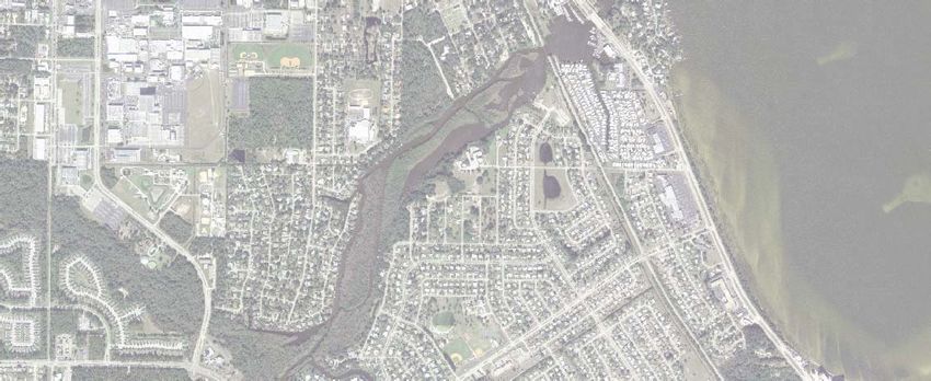
Acknowledgements
MSCW would like to thank the following people for their assistance in preparation of this plan.

Bayfront Community Redevelopment Agency:
Community Redevelopment Agency Commissioners
Commissioner, Michael McGarry
Commissioner, Mary Jane Browning
Commissioner, Michael Herbst
Commissioner, Rainer Warner
Commissioner, Donna Brooks
Commissioner, John Russo
Commissioner, James Ritter
Tim Ford, Administrator
Carol Gerundo, Administrative Secretary

City of Palm Bay:
Mayor, John Mazziotti
Deputy Mayor, Kristine Isnardi
Councilman, Milo Zonka
Councilwoman, Michele Paccione
Councilman, William Capote
City Manager, Lee Feldman
Growth Management
Land Development
Public Works
Finance
Engineering

MSCW Project Team:
James A. Sellen, MSP., Principal-in-Charge
James E. Anaston-Karas, MCRP, Project Manager
David A. Perry, RLA, ASLA, Urban Design Studio Leader
Chris Arnold, ASLA , Project Urban Planner
Eric Warren, P.E., Project Engineer
Ben Forshee, GIS Specialist
Gerald S. Langston, Jr., AICP, Planning Solutions Corp.
Owen Beitsch, PhD., Real Estate Research Consultants, Inc.

                                                  Bayfront Community Redevelopment District 2024 Plan | i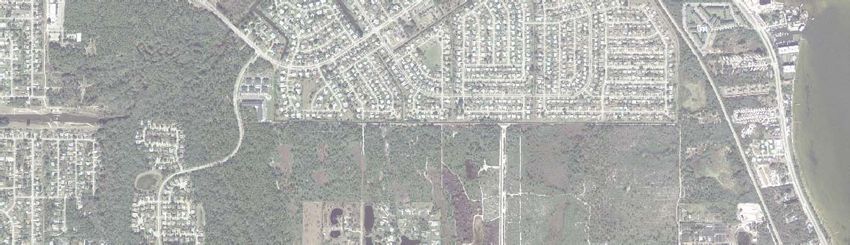
Table of Contents

1.0        Executive Summary.....................................................................................................................1

2.0        Area History, CRA Formation, and Redevelopment Progress......................................................3

3.0        Bayfront Community Redevelopment District Description........................................................6

4.0        Bayfront Community Redevelopment Plan.................................................................................9
           4.1 Vision and Intent...........................................................................................................................9
           4.2 Goal and Implementation Policies..................................................................................................10
           4.3 District Goals and Objectives.........................................................................................................12
                    4.3.1 Bayfront Village............................................................................................................12
                    4.3.2 South Cove..................................................................................................................15
                    4.3.3 Riverview District........................................................................................................16
                    4.3.4 Powell’s Subdivision/Driskell Heights Neighborhood........................................................16
                    4.3.5 Kirby Industrial Area...................................................................................................17
           4.4 Future Conceptual Land Use Plan................................................................................................18
                    4.4.1 Mixed Use Commercial.................................................................................................20
                    4.4.2 Anticipated Neighborhood Impacts.................................................................................21
           4.5 Transportation.............................................................................................................................22
           4.6 Public Facilities.............................................................................................................................23
           4.7 Environmental Quality..................................................................................................................23

5.0 Bayfront District Plan Redevelopment Initiatives.............................................................................24
        5.1 Redevelopment Programs...............................................................................................................24
                5.1.1 Public Information Program.........................................................................................24
                        5.1.1.1 Project Management and Public Resources.....................................................25
                5.1.2 Developer Incentive Program........................................................................................25
                        5.1.2.1 Project Management and Public Resources...................................................26
                5.1.3 Business Recruitment and Marketing Program...............................................................26
                        5.1.3.1 Program Management and Public Resources...................................................27
                5.1.4 Business Assistance Program..........................................................................................28
                        5.1.4.1 Program Management and Public Resources...................................................28
                5.1.5 Façade Improvement Program and Architectural Guidelines...........................................29
                        5.1.5.1 Project Management and Public Resources.....................................................30
                5.1.6 Land Banking Program...............................................................................................30
                        5.1.6.1 Program Management and Public Resources...................................................31
                5.1.7 Community Policing Program......................................................................................32
                        5.1.7.1 Program Management and Public Resources...................................................32
                5.1.8 Regulatory Review and Assistance Program.....................................................................33
                        5.1.8.1 Program Management and Public Resources...................................................34

           5.2 Physical Improvements - Projects....................................................................................................34
                    5.2 1 Character District Initiative: Bayfront Village.............................................................37
                    5.2.2 Infrastructure, Transportation Improvements.................................................................40
                    5.2.3 Open Space and Trail Master Plan.............................................................................42
                    5.2.4 Character District Improvements: Riverview District...................................................44

ii | Bayfront Community Redevelopment District 2024 Plan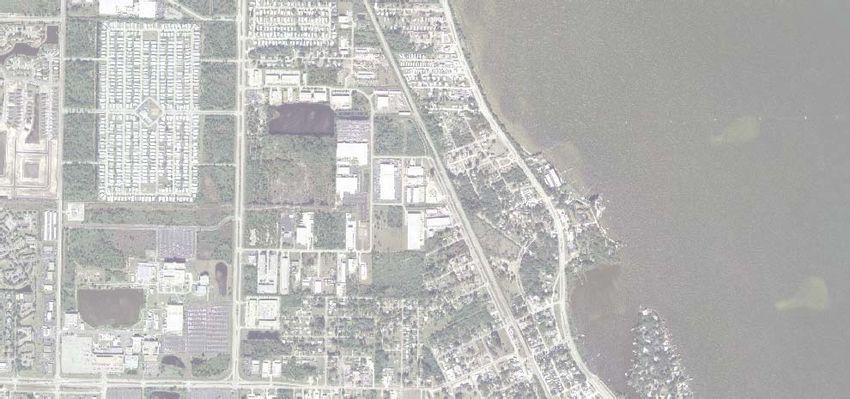
5.2.5 Character District Improvements: South Cove.............................................................45
                  5.2.6 Character District Improvements: Powell’s Subdivision/Driskell Heights........................47
                  5.2.7 Character District Improvements: Kirby Industrial Area...............................................48

6.0 The Financial Plan......................................................................................................................49
    6.1 Tax Increment Revenue Forecast.....................................................................................................49

7.0 Administrative Work Program and Budget.................................................................................51

8.0 Management and Administration Plan.......................................................................................53
    8.1 Private/Public Partnerships...........................................................................................................53
    8.2 Bayfront Community Redevelopment Agency..................................................................................53
    8.3 City of Palm Bay..........................................................................................................................53
    8.4 Other Governmental Agencies........................................................................................................53
    8.5 Non-Profits...................................................................................................................................53
    8.6 Administration.............................................................................................................................53
    8.7 The Redevelopment Trust Fund.....................................................................................................53
    8.8 Relocation Procedures....................................................................................................................54

9.0 Plan Adoption, Duration, Modification, and Consistency..........................................................55

10.0 Redevelopment Powers..............................................................................................................56

11.0 Project Closeout........................................................................................................................58

Sources Consulted.............................................................................................................................59

List of Figures......................................................................................................................................
    Figure 1 Here’s What’s Happening in the Bayfront..................................................................................5
    Figure 2 Bayfront Community Redevelopment District Plan.................................................................13
    Figure 3 Future Land Use Plan..........................................................................................................19
    Figure 4 Project Priorities Plan...........................................................................................................35
    Figure 5 Conceptual Open Space Plan.................................................................................................36
    Figure 6 Conceptual Bayfront Village Center Master Plan....................................................................38
    Figure 7 Infrastructure Improvements Plan..........................................................................................41
    Figure 8 Estimated Future TIF Collections............................................................................................50

Appendices...........................................................................................................................................
   A. Field Inventory and Analysis
   B. Reference Maps
   C. Recommended 16-Year Budget
   D. Land Banking Priorities, Policies and Procedures
   E. Finding of Necessity (1994)
   F. Resolutions and Ordinances

                                                                     Bayfront Community Redevelopment District 2024 Plan | iii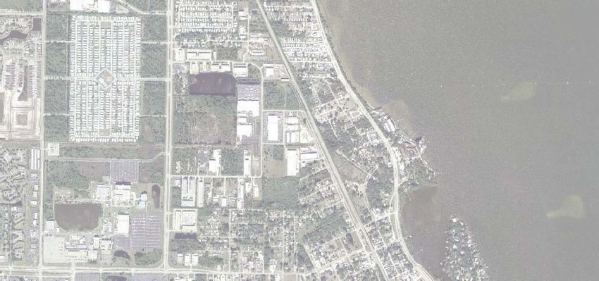
1.0 Executive Summary

In 1994 the City of Palm Bay completed a “Finding of Necessity” study leading to the creation of
the Bayfront Community Redevelopment Agency (BCRA) and the approximately 1,070-acre Bayfront
Community Redevelopment District (BCRD), with the support of the Brevard County Commission.
In 1999 the BCRA adopted the first BCRD Redevelopment Plan. In 2009, the BCRA initiated this
update of its 10-year old plan. While the 1994
Finding of Necessity concluded that nearly half of the
structures in the District showed some evidence of
deterioration, this BCRD Plan update includes a field
inventory and analysis which identifies opportunities
for redevelopment and the continuing need for
revitalization.

In its first ten years, the BCRA began to accrue a
significant amounts of tax increment revenues to
initiate several projects and programs: issued a $6.0 million bond in 2006; adopted a mixed use category
for land use and zoning over strategic portions of the District; and implemented improvements to
heighten awareness of the District’s mission, Castaway Park renovation arguably the most successful of
those efforts.

This revised Redevelopment Plan re-establishes a vision, goals and objectives for redevelopment; identifies
eight redevelopment programs and seven project areas; identifies financing and implementation strategies;
and identifies management and administration opportunities to carry out the Plan within the 2024
planning horizon. The boundaries of the BCRD remain unchanged.

Among the most important projects and goals are to adopt a Bayfront Village Master Plan, solve the
circulation, traffic, and stormwater infrastructure issues to promote the Village as a pedestrian-friendly
destination, acquire necessary land, continue to improve public safety, and finish the open space and
trail plan. The Village must become a desirable destination with convenient access via US 1 and Palm
Bay Road. These actions will capitalize on the area’s Indian River Lagoon waterfront, historic, and
marine-based activity assets. The investment of public funds for planning and design, infrastructure
improvements, public awareness, and other activities is intended to catalyze private investment and
redevelopment activities to accelerate redevelopment and revitalization progress throughout the five sub-
Districts in the BCRD.

Also contained in the Plan’s goals and objectives is to attract a food market convenient for neighboring
residents, establish a vibrant public meeting area (such as indoor civic meeting hall and outdoor “town
square” concept), promote special events at Castaway Park, and expand the City marina as an activity

                                                   Bayfront Community Redevelopment District 2024 Plan | 1
center anchoring the Bayfront Village. Redevelopment activities should promote sustainable design and
building practice, and observe the City’s ordinance requiring Florida vernacular style architecture. The
BCRD Plan remains consistent with the City’s Comprehensive Plan.

Funding sources for the BCRA activities and Plan implementation include the outstanding $6 million
revenue bond, possible future bonds, estimated annual TIF revenue of $1.2 million, and a variety of
other funding partnerships. A recommended long-range budget presents over $29 million of project
and program cost estimates as a tool for capital improvements and operating budgeting over the next 16
years.

2 | Bayfront Community Redevelopment District 2024 Plan
2.0 Area History, CRA Formation, and Redevelopment Progress
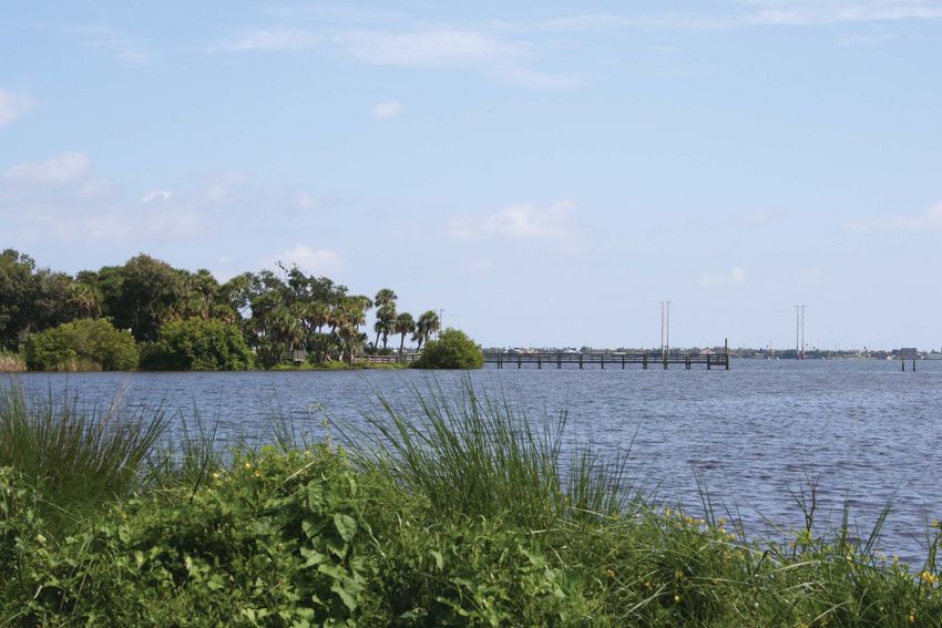
For centuries the waters of Palm Bay have brought vitality to this area. Named for the white sands and
sabal palms along the mouth of Turkey Creek, Palm Bay has long attracted people who live off of the
bounty of the land and the river. Originally the Timucuan Indians inhabited this area, drawn by the
freshwater springs and abundant wildlife resources. Other Native American tribes that found homes
include the Jaegas, Seminoles and Ais. Not until the mid-nineteenth century was the mouth of Turkey
Creek settled by Caucasians. They knew this area as the Town of Tillman.
Settlers planted orange groves along Turkey
Creek, cut lumber, and herded cattle. Agricultural
development increased with the arrival of the
railroad in 1894, and received a tremendous boost
in the 1920s upon the creation of the Melbourne-
Tillman Drainage District. This District’s canal
project opened up over 40,000 acres of marshland
for agricultural cultivation, which was marketed
by the Indian River Land Company. Tillman was
renamed Palm Bay in 1925. Hurricanes and the Great standstill.
eat Depression brought development to a standstill
Significant growth did not resume until the arrival of naval air stations and space related industries in
the 1940s and 1950s. That growth continued as the General Development Corporation presented Port
Malabar, a major residential development project, that began just south of Turkey Creek’s bay of palms.
By the early 1990s, the area was experiencing decline and blight, and in 1994 the City of Palm Bay
initiated the process of redevelopment of its historic core. In April 1995, the Finding of Necessity was
completed which concluded that “… almost half of the structures in the study area (47.6 %) show[ed]
some evidence of deterioration.” The “Finding of Necessity” is incorporated herein, by reference
(Appendix E). The Finding of Necessity was followed by the Basis of Planning report completed in
1996. Based on these findings and reports, the BCRA adopted its first redevelopment plan in 1999, and
has subsequently initiated the update of its Plan in 2009.
As presented in the BCRA’s Strategic Planning document known as “Leader’s Guide 2007,” the top ten
achievements of the BCRA in its ten year history are listed below, and presented with other developments
in the District in Figure 1 “Here’s What’s Happening in the Bayfront.”
1. Mobile Park Removal: U.S. 1 and Palm Bay
2. Castaway Cove Project: Park, New Sidewalks, Open Space
3. Bond Project and Funding: Approval, Initiated Design
4. Relations with Liberia Area: Series of Meetings with City Staff on Drainage Project, Linear Park,
Public Involvement
Bayfront Community Redevelopment District 2024 Plan | 3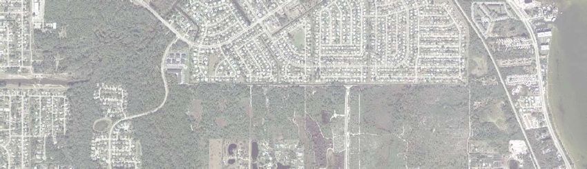
5. Victoria Park – Removed Trailer, Park Conversion, Property Acquisition, Grants, Permitting
   6. Chamber Building: Relocation to Bayfront, Potential to Attract New Businesses, Building
       Renovation
   7. Drainage for River and Turkey Creek
   8. Derelict Boat Removal (11): Cleaned Up Riverfront
   9. New Businesses Attracted Areas – International Truck, Kirby
   10. Rezoning for Properties Along US 1 – New Zoning Classification, Mixed-Use Development

Commitment toward District improvements has been further evidenced by the Agency’s issuance of a $6
million bond in June 2006 to fund the following capital projects:

   •   Sidewalk on the east side of US 1
   •   US 1 Landscaping
   •   Robert J. Conlan Boulevard Landscaping
   •   Castaway Cove Beach Park Improvements
   •   1575 Main Street City Hall Renovation for public meeting spaces
   •   Land Acquisition

4 | Bayfront Community Redevelopment District 2024 Plan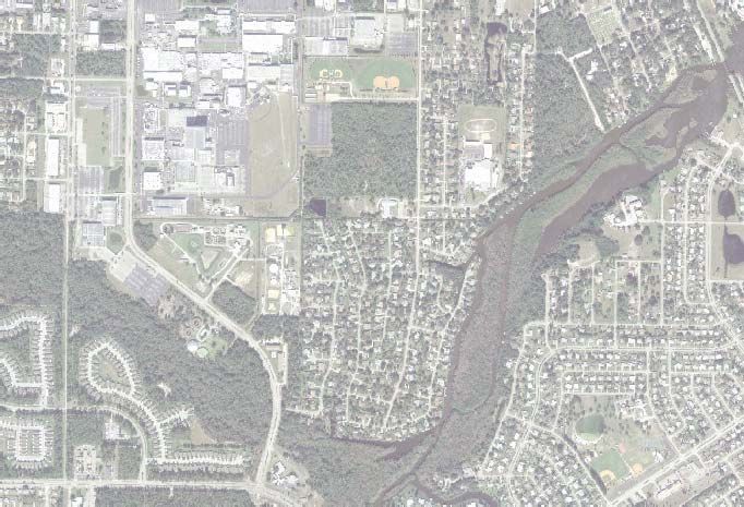
Figure 1: Here’s What’s Happening in the Bayfront
/
Southeast Honda
Dealership Expansion
Pence Septic & Land Display Area Has Been
Expanded
Materials Office
A 2,000 Sq. Ft. Office
Completed At The Corner Of
Spence Dr. And US-1 Lagoon House
Winner of 2006 BEST NEW BUILDING
IN SOUTH BREVARD COUNTY Gateway Visitor's Center
For The Indian River Lagoon
Victoria Dr./Farview Neighborhood Scenic Highway and Public
Drainage & Park Improvements Made Information Center For The
2006/2007 Marine Resources Council
New Victoria Park
Liberia Linear Park/
Driskell Heights Enhancements Indian River Lagoon Scenic Highway Study
Drainage, Street and Park A Study To Enhance The Scenic Highway
Improvements Completed In By Providing Standards For Parking Facilities,
The Summer Of 2006 Traffic Calming Measures, Bicycle/Pedestrian Facilities,
and Water Taxi Feasibility was completed in 2006
U.S. 1 Resurfacing,
October 06 - April 07
Hammond Property
9.3 Acres of Light
Industrial With Rail Access
US-1
for Sale
HW
James Parks Industrial Buildings
Y
10,500 s.f. of Office/Warehouse
Built in 2007
Hamilton Masonry Co.
Building Site Riverside Professional Offices
12,000 s.f. of Industrial A 2 Story Office Building Anchored
Built in 2008 With Wade Trim Consulting Engineers
Beta Max Hoist
Building (Completed) Indian River Cottages Demolished
Property Rezoned to Multi-Family
Kirby Industrial Park Wipperman and Dacotah Avenues Repaved
Designated State Brownfield
Site, MC-Assembly To Create Hillside Villas
300-400 New Jobs Due To 38 Unit, 2 Story Townhouse
State/Federal Incentives Development Is In
Permitting
Bay Commerce Industrial Castaway Point Park Enhancements
Subdivision Includes Castaway Cove Beach Improvements
16 Lot Subdivision (Under Such as a Paved Trail, Beach Walk Overs,
Construction) Home Lighting, Landscaping, Pavilion, and Bathroom
To Mauldin International Improvements at Castaway Point Park.
Truck Repair
BLVD
MA
IN
Chamber Of Commerce Renovation
ST
CONLAN
AAA RV, Boat Storage Turkey Creek Neighborhood
And Self Storage
J
Park Project (Bayfront Park):
ROBERT
Under Construction Initial Improvements Will Include
A Footbridge, Pedestrian Way,
Lighting, & Landscaping. Future
ATM RECYCLING FACILITY Enhancements will include a
20,000 SF of Industrial Pier, Informative Signage and
Recycling Facility Under E Other Improvements
AV
Construction In 2009 HE
SS
EY
Bayfront Village Project:
The Falls Commerce Park Improvements Consist Of;
150,000 SF of Warehouse, Landscaping, Drainage, Traffic Flow
Office And Flex Space Streetscaping, and Possible Road
Proposed PALM BAY RD Realignments
7 UNIT RETAIL CENTER
Derelict Vessels
7,925 SF Building Under
Construction In 2009 Removed In
City Of Palm Bay
June/July 2006 & 2008
Original City Hall
Palm Bay Road Streetscaping Was Renovated in 2009. The
Project:
Savastano Building Building is the Home to Ozzie's Crab House
3,321 s.f. of Building Renovated The Palm Bay Police East Precinct.
Includes Landscape Enhancements, into Retail/Office Space Opened in 2009
Traffic Calming Measures, Pedestrian
Amenities, On-Street Parking, and
Stormwater Improvements. This Palm Bay Shopping Plaza
Project Will Be Part Of A 2nd Phase
Bond Project List, In the Meantime the $500,000 Renovation
Road Will be Resurfaced in 2010 (Completed)
Fitzsimmons
Mobile Home Park
Property Was Razed Estopeliz Mixed Use Complex
And Sold At Auction Old Port Malabar Shopping Plaza
Demolished And Proposed To Be Replaced With A
Mixed Use (Commercial/Multi Family)
Project To Be Called
Country Bingo Parlor Eztopeliz
and Retail Center
Opened in 2009
VD
The Cape at Palm Bay
R BL
MA
LABA Mixed-Use Development
RT
PO
Old Crows Nest Restaurant Site
Rezoned From
Commercial To Multi-Family
A Mixed Use Office
And Residential
Condominium Complex To
Days Inn Site Be Called The Cape At Palm Bay
Is Planned
Re-Zoning From
"Here's What's Happening In The Bayfront" Commercial To Multi-Family
Barrington Bluffs
$6 Million Bond For Capital Improvements Townhouses
A 3 Building, 13 Unit
3 Story Complex Is
A $6 Million Bond Will Be Issued To Fund Under Construction
The First Phase Of The Redevelopment District's
Capital Improvement List. Projects Include The
Bayfront Boardwalk, Castaway Beach Improvements, Venetian Bay
US-1 And RJ Conlan Landscaping, US-1 Sidewalk, Luxury
Condominiums
And Property Aquisition For Public Improvements (Completed)
COMPLETED PROJECTS = BLACK TEXT
PROPOSED PROJECTS = RED TEXT
Thompson Property
Re-Zoning From
1,000 500 0 1,000 Commercial To Multi-Family
Feet Boozer Property
Re-Zoning From
Commercial To Multi-Family
DATE: June, 2009
Breezy Palms RV Park
Re-Zoning From Toma Property
Commercial To Multi-Family Re-Zoning From
Commercial To Multi-Family
Bayfront Community Redevelopment District 2024 Plan | 5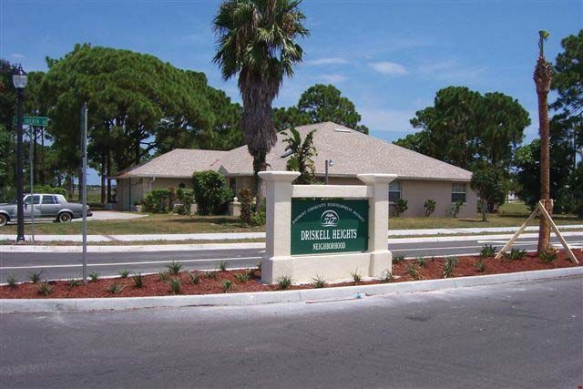
3.0 Bayfront Community Redevelopment District Description

The Bayfront Community Redevelopment District is located within the City of Palm Bay in Brevard
County, Florida, just west of the vital Indian River Lagoon. US 1/Dixie Highway forms the spine of the
District stretching from the City limits at Melbourne south to the boundary of the Town of Malabar.
The Redevelopment District also extends the length of the City along the lagoon. The limits of the
redevelopment area are more specifically described as follows.

Beginning at the Palm Bay/Melbourne City limits at the Indian River Lagoon, the limits extend
   • West to US 1 along the City limits;
   • South along US 1 approximately 500 feet;
   • West to the Florida East Coast Railroad;
   • South along the railroad 2,200 feet;                                      RIVERVIEW

   • West along the City limits to Lipscomb Street;                 DRISKELL
                                                                    HEIGHTS
   • South on Lipscomb Street to Doreatha Fields
       Avenue (Pacific Avenue);
   • East on Doreatha Fields Avenue (Pacific Avenue)
       to Northview Street;
   • South on Northview Street to Robert J. Conlan                                  KIRBY
                                                                                 INDUSTRIAL

       Boulevard;                                                                             BAYFRONT
                                                                                               VILLAGE
   • South on Conlan Boulevard to Palm Bay Road;
   • East along the southern property lines of lots
       fronting on Palm Bay Road to Main Street;
   • South on Main Street approximately 200 feet;
   • East to the railroad;
   • South on the railroad to the City limits at the                                                     SOUTH
                                                                                                          COVE
       Town of Malabar;
   • East to the Indian River Lagoon; and
   • North along the river to the City limits at
       Melbourne.

The area within the Redevelopment District is approximately 1,0701 acres and comprises a range of land
uses, namely residential, office, commercial, industrial and publicly-owned. Single family residential

1        Acreage calculations for each of the 5 Character Districts are based on the GIS Future Land Use
layer as evaluated by MSCW in 2009, as follows: Village- 140 acres, South Cove- 144 acres, Kirby- 394 acres,
Riverview – 211 acres, Driskell- 63 acres. It is assumed that approximately 118 acres is comprised of such fea-
tures as roadways, railway, and water features throughout the District. The total acreage in the Redevelopment
District provided in the 1999 Plan, approximately 1,070 acres, was not independently verified.

6 | Bayfront Community Redevelopment District 2024 Plan
neighborhoods within the District include the Farview Subdivision, Powell’s Subdivision now known as
the Driskell Heights Neighborhood, Palm Bay Point and Port Malabar Unit One. Multifamily dwelling
units can be found along Castaway Point and Cape Malabar.
Retail and service businesses exist along US 1, Palm Bay Road and Conlan Boulevard. One shopping
strip mall is located along US 1 north of Port Malabar Boulevard. A second shopping strip center was
damaged by the hurricanes of 2004 and demolished.
The primary industrial uses within the District are situated in the Kirby Industrial Park west of the FEC
Railroad, and range from light industrial assembly plants to heavy industrial concrete processing facilities.
Based on a built coverage analysis of the industrial park area, this area appears to be roughly 80% built-
out with a 70% occupancy rate at current. Although there are isolated blocks of residential mixed within
this industrial park area, it is relatively limited. Assemblage of these parcels for development/redevelop is
possible but would require substantial effort with limited development acreage potential. Many of these
residences range in their condition from being moderately well kept to severely blighted.
Public use sites in the BCRD are as follows:
Driskell Park – This parcel is a 2 acre public community park located within the Driskell Heights/
Powell’s Subdivision. This park facility serves neighborhood needs and is not intended to support regional
recreation needs.
Stearn’s Point Park – At approximately 2 acres, this
small park is located on the northeast side of Turkey
Creek and US 1. It is accessible only by foot, with no
dedicated parking. The park has a unique pedestrian
connection to the public marina site on the west side of
US1 via a sidewalk connection under the bridge. Public
activities are limited to fishing, viewing of Turkey Creek
River and Bay area with limited picnic opportunities (one
covered shelter), and a kayak/canoe landing.
Castaway Point Park – Construction of the beach portion
of the park was completed in 2008. The park consists of
limited parking, a fishing pier, a waterfront boardwalk
system, interpretive signage and some picnic facilities.
The agency has developed design plans to improve the
castaway point portion of the park. Both Castaway Point
Park and Stearn’s Point Park were planned to be part of
Bayfront Community Redevelopment District 2024 Plan | 7an interconnected greenway/blueway network that connects the Bayfront Village to the Town of Malabar to the south. Currently a sidewalk improvement plan is proposed to connect the two parks. Pelican Harbor Marina – This is a City owned public marina facility located on the west side of US1, north of Turkey Creek. This public marina currently has a large number of public slips, a dockmaster building, and ancillary support structures. Based on the current availability of adjacent lands, expansion of this parcel and use is possible. FIND Recreational Site - Another publicly owned site is the 34-acre Florida Inland Navigational District (FIND) site situated along US 1 south of Conlan Boulevard. This site shall be utilized as a dredge material management area where dredge material from the Indian River Lagoon can be deposited approximately every 10 years. In the interim years, the site shall serve as a municipal park with play fields and other recreational facilities, provided a legal agreement can be negotiated with FIND. 8 | Bayfront Community Redevelopment District 2024 Plan
4.0 Bayfront Community Redevelopment Plan

4.1 Vision and Intent
The Bayfront Community Redevelopment District (BCRD) shall be redeveloped as an attractive, inviting,
environmentally sustainable and economically successful community with residential commercial/retail,
and mixed use areas that promote a positive image and marine village for the enjoyment of the Community
and Region. The Bayfront Redevelopment Plan builds on the allure of the natural environment to
recreate the once thriving, spirited community along the Indian River Lagoon.

The BCRD is comprised of Character Districts
with different land use and development emphases
and objectives. The most central of these shall
host a community-serving commercial District,
the Bayfront Village, which is the historic center
of the community. The central District/Bayfront
Village shall be transformed and feature a
turn-of-the-century Florida vernacular style of
architecture in keeping with the “village-like”
historic character of the area; a compact built
environment; a traditional network of improved narrow streets; pathways leading to public spaces and
enhanced views to the Indian River Lagoon. A network of trails and public open spaces oriented along
US Highway 1 shall connect the Character Districts. The economic vitality of the BCRD shall be
further enhanced by the development of incentives to encourage additional industrial development in
appropriate areas within the community.

The primary objective of BCRD redevelopment is to provide recreation, support services (such as retail,
office, a food market, and commercial activity), and entertainment for the area residents, workers and
visitors, and secondarily, to create a tourist destination.

This Plan shall guide the redevelopment of the Bayfront District through 2024. The intent is to develop
a thriving mixed-use environment that harkens back to a style reminiscent of turn-of-the-century Florida
vernacular architecture. To do so, this plan:

   •   Establishes a vision, goal and objectives for redevelopment;
   •   Identifies redevelopment programs and projects;
   •   Identifies financing and implementation strategies and
   •   Identifies management and administration opportunities.

                                                  Bayfront Community Redevelopment District 2024 Plan | 9
Specifically, this Plan identifies redevelopment projects for areas expected to have strong market support
for private investment and that will help reverse blighting conditions. The recommendations range from
initiatives that may be applied District-wide while others are specific to particular sites or Character
Districts. A 16-year recommended budget is presented in Appendix C which suggests a long-range
work plan.
4.2 Goal and Implementation Policies
Goal
In partnership with stakeholders, landowners, the City of Palm Bay, the BCRA and the private sector
development industry, the BCRA shall reverse the process of blighting conditions by establishing the
development framework for the creation of a desirable Bayfront destination (aka the Bayfront Village)
on the Indian River Lagoon within the 2024 planning horizon. This development framework shall focus
on:
• Development of a guiding vision plan for the Bayfront Village area
• Development of a planned Development District that allows for a supportive mixture of land
uses
• Creation of area specific site design criteria that allows for integration of mixed land uses that
reinforce the concept of a village environment through pedestrian design focus, building massing
and scale, and unique architectural styling
• Development of integrated useable public open spaces and recreational use areas
• Development of a thematic master streetscape program for the US 1 corridor and interconnecting
streetscapes
• Creation of iconic identification elements to identify the Bayfront Village area
• Development of Master Signage Program for the Bayfront Village area
• Establish private sector development incentive programs to encourage private development
within the Bayfront Village
• Development of property owner redevelopment incentive programs to encourage property
assemblages and redevelopment
• Pursuit of public sector acquisition of strategic parcels for both public and private sector
development
Implementation Policies
The following implementation policies are strategies designed to support the objective of urban
redevelopment within each of the five BCRD Character Districts through direct and indirect incentives,
and to promote economically sustainable development patterns.
Land Use and Zoning: Promote land uses and zoning which support the proposed urban framework and
are compatible with the Character Districts and the overall vision.
10 | Bayfront Community Redevelopment District 2024 PlanEconomic Development & Revitalization: Encourage new mixed use, commercial, office, and industrial,
housing development consistent with the BCRD Plan.
Marine-Based Commerce and Activities:
Promote economic development, recreation
and special events linked to the marine-based
assets of the Bayfront Village, marinas, Turkey
Creek and environs, and Indian River Lagoon
waterfront.
Infrastructure Improvements: Evaluate and
provide public infrastructure according to the
desired development pattern as indicated in
the future land use plan.
Aesthetic Infrastructure: Develop coordinated landscaping, public and private wayfinding, signage, and
beautification design concepts for parkways and open spaces which complement the riverfront location.
Promote visual continuity throughout the Character Districts. Continue to support the Indian River
Lagoon Scenic Highway Program.
Historic Resources and Architectural Character: Promote renovation and reuse which contributes to
historic resources where possible. Maintain the adopted Florida Vernacular Architectural Design
Standards for all commercially zoned and Bayfront Mixed Use (BMU) zoned areas to provide architectural
continuity in new and redeveloping properties over time.
Transportation Improvements: Provide an enhanced and interconnected transportation network which
focuses on improving the pedestrian and bicycle environments along the US 1 corridor and in the Bayfront
Village. Establish the Bayfront Village as a destination, thereby encouraging the arrival of vehicular and
pedestrian traffic instead of pass-by traffic. Primarily in the Kirby Industrial District, improve vehicle
access within future industrial developments to encourage development of new industry.
Funding: Identify and secure all feasible sources of funding including tax increment finance (TIF)
revenue and bonds, Community Development Block Grant (CDBG), grants, general revenue and other
sources to aid in implementing the redevelopment plan.
Incentives: Identify and offer an array of incentives to encourage the redevelopment and revitalization of
the BCRD through the realization of specific plan objectives.
Management and Administration: Implement program administrative policies supporting the objectives
Bayfront Community Redevelopment District 2024 Plan | 11outlined in the redevelopment plan. Evaluate the use of supplemental management programs such as Florida Main Street to provide support to the BCRA. 4.3 District Goals and Objectives The Palm Bay BCRD is comprised of five Character Districts: Bayfront Village, Riverview, South Cove, Kirby Industrial Area and Powell’s Subdivision/Driskell Heights Neighborhood. Each District should encourage a distinctive built environment created by different development patterns and mix of land uses. Goals and objectives for each District are presented below. (See Figure 2) 4.3.1 Bayfront Village The primary focus of the BCRD Plan is to redevelop Bayfront Village as the heart of the community featuring a main street character with Florida vernacular architectural style and conceptual design which is anchored on one end by Castaway Point Park, on the other end by the City Marina with public events/ meeting space, and which creates a destination and sense of arrival for traffic arriving on the Palm Bay Road corridor. The comparative mix of land uses in the village would be 45 percent mixed use, 10 percent single family residential, 15 percent multi-family residential, and 30 percent civic/ park. This compares favorably with other successful villages, and offers a higher proportion of public/ civic/ park land use. Goal The area shall become a destination recognized as a pedestrian-friendly, mixed use community with a Mainstreet Village character capitalizing on its waterfront location that boasts improved narrow streets, pedestrian pathways and US 1 crosswalks leading to public spaces including waterfront parks, attractive views and a waterfront theme. 12 | Bayfront Community Redevelopment District 2024 Plan
Figure 2: Bayfront Community Redevelopment District Plan

                   RIVERVIEW

        DRISKELL
        HEIGHTS

                        KIRBY
                     INDUSTRIAL

                                          BAYFRONT
                                           VILLAGE

                                                                        SOUTH
                                                                         COVE

                                  Bayfront Community Redevelopment District 2024 Plan | 13
Objectives
• Compose and adopt a Master Plan for a riverfront village based on:
- Broad-based community-support
- Real estate market feasibility
- A compatible mix of public and private uses including restaurants, retail venues, offices,
marinas and marine-related business, public events/meeting space, entertainment and
hospitality venues, and housing.
• The Master Plan should :
- Improve sub-standard public infrastructure wherever possible in the Character District,
meaning sidewalks and pathways, public stormwater management systems, streets,
streetscaping, lighting, signage and parking. Identify and promote suitable locations for
parking and stormwater retention facilities.
- Employ traffic calming, additional synchronized stops, or other appropriate means of
reducing the pedestrian safety conflicts with US 1 while promoting a walkable village
concept. Equally, support and accommodate a sense of arrival using the Palm Bay Road
corridor.
- Provide sufficient detail for the marina and marina basin, provide pedestrian orientation,
public meeting spaces and civic meeting hall, and connections to the waterfront and
Stearn’s Park. Initiate a catalyst redevelopment project using the City’s marina property, and
considering assembly of other properties, or a public-private partnership.
- Integrate with the Bayfront Village the open-space and pedestrian network along the
waterfront focusing on pedestrian and bicycle users.
- Achieve improved pedestrian connections and preserve viewsheds across US 1 to the Indian
River Lagoon.
- Include a wayfinding plan to include signage, nodes and other features while improving
the appearance of public and private signs through standards, guidelines and City initiated
directional sign programs.
• Sponsor, co-sponsor, and promote marina, river and creek-based activities and events to attract
citizens and visitors to the Bayfront Village.
• Based on an inventory of existing businesses and activities, define the desired types of businesses,
concessions, activities, businesses, and business clusters to attract to the Village, and adopt
strategies to attract those businesses. Emphasize marine-based businesses and activities.
• Develop a comprehensive beautification program for rights-of-way and medians including
enhanced river views which includes maintenance of enhancements and improvements.
• Promote the preservation of structures recognized in the BCRD plan for their local historical
significance.
• Redevelop the village in a manner consistent with good design principles such as Neo Traditional
Town Planning, “New Urbanism”, and Smart Growth. Ensure that basic design standards
establish certain minimums and character for the District such as size, location, and other
aesthetic features.
14 | Bayfront Community Redevelopment District 2024 Plan• Maintain an architectural design manual and/or design patterns book, and a façade & property
beautification grant program to be applied to development and redevelopment activity within
the District.
• Utilize publicly owned land for development according to the BCRD plan.
4.3.2 South Cove
The South Cove is largely characterized
by a combination of strip commercial and
higher density housing including rental and
condominiums. This corridor is different from
many other strip areas in that development is
located mostly on only one side of the highway.
Traditional commercial areas normally have
commercial facing on both sides of a highway.
The latter environment encourages positive
competition and many of the commercial
businesses feed off of each other’s customers. The
total acreage of vacant and improved property is approximately 144 acres with the following proposed
land uses: 12 acres of mixed use, 9 acres of single-family residential, 94 acres of multi-family residential,
28.5 acres of commercial, and less than an acre of office or open space.
Goal
The US 1 corridor south of Bayfront Village has a unique opportunity to become a beautiful and
multi-functional riverfront boulevard lined with riverside pedestrian/bicycle facilities featuring a food
market supported neighborhood-servicing retail center and higher intensity residential uses. In working
with residential developers and jointly with property assembly, the corridor contains some of the most
marketable residential real estate in the BCRD as evidenced by the newer housing developments near
the Town of Malabar City limits.
Objectives
• Beautify streetscapes/medians to foster reinvestment within the District.
• Create pedestrian and bicycle facilities along the riverfront and rail trestle to link the Town of
Malabar and other residential developments to Bayfront Village.
• Encourage the redevelopment and revitalization of the mobile home and residential properties
north of Gran’s Avenue to higher intensity residential or park use.
• Continue to implement architectural design requirements and Façade grant programs to improve
the condition and appearance of buildings and sites.
• Beautify, and otherwise improve the former General Development Corporation stone monument
at Port Malabar Boulevard intersection.
• Establish gateway signs/icon elements and landscaping at entry points to the BCRA District.
Bayfront Community Redevelopment District 2024 Plan | 15• Develop a signage & wayfinding master plan to improve the appearance of public and private
signs through standards, guidelines and City initiated directional sign programs.
4.3.3 Riverview District
The northern part of the Riverview District is mostly commercial in character with properties that are
underutilized and subject to change. The area contains some vacant industrial land which is located at
Conlan Boulevard and US 1. Some properties have poor visual appeal and a negative image. The total
acreage of vacant and improved property is approximately 211 acres with the following proposed land
uses: 62 acres of commercial, 52 acres of industrial, 40 acres of single-family residential, 43 acres of
multi-family residential and 14 acres of park/open space.
Goal
The goals and objectives have been crafted to eliminate this negative image. Similar in physical nature to
South Cove, the District has a unique opportunity to become a beautiful and multi-functional riverfront
boulevard lined with pedestrian/bicycle facilities supported by higher intensity residential and mixed
land uses. With City/BCRD intervention and some property assembly, the corridor contains marketable
real estate.
Objectives
• Beautify streetscapes/medians to foster reinvestment within the District.
• Create pedestrian and bicycle facilities along the river to link residential developments to Bayfront
Village.
• Purchase and otherwise aggregate substandard or “problem” properties through the Agency’s
adopted Land Banking Program which together contribute to the creation of a negative
investment environment within the District. (See Appendix D. Land Banking Priorities, Policies
and Procedures.)
• Offer incentives to private property owners to improve the condition and appearance of buildings
and sites through the Agency’s Façade and Property Beautification Grant Program.
• Maintain the adopted architectural design requirements to be applied to development and
redevelopment activity within the District.
• Develop and maintain a northern gateway entrance with improved landscaping and signs.
• Work with FDOT in creating a functional linear park/pedestrian/bicycle trails system along the
US 1 corridor to support the interconnectivity of US 1 parcels and the Bayfront Village area
• Develop a master signage and wayfinding plan to improve the appearance of public and private
signs through standards, guidelines and City initiated directional sign programs.
4.3.4 Powell’s Subdivision/Driskell Heights Neighborhood
This area is characterized as a low-income area, which has a large amount of deteriorated housing stock
and poorly developed infrastructure, resulting from lack of private reinvestments. While the CRA
16 | Bayfront Community Redevelopment District 2024 Planhas provided assistance for neighborhood revitalization, this has not lead to substantial private sector
reinvestment dollars. Significant investments are approximately $2 million and have resulted in tangible
improvements for neighborhood revitalization. The total acreage of vacant and improved property is
approximately 63 with the following proposed land uses: 57 acres of single-family residential , 2 acres of
park/open space and 4 acres of multifamily residential development.
Goal
The primary goal is to improve living conditions for area residents and stabilize the neighborhood through
infrastructure improvement, continued maintenance of improvements and new housing construction.
Objectives
• Utilize the Agency’s adopted Land Banking Program to aggregate large enough blocks of
property to entice speculative builders. (See Appendix D. Land Banking Priorities, Policies and
Procedures. )
• Create architectural standards to enhance area appearance and further attract private
investment.
• Utilize an array of publicly supported incentives to encourage property redevelopment.
• Develop a neighborhood non-profit organization with a mission to further stabilize the area and
promote redevelopment ad reinvestment, and operate Evan’s Market as a grocery and community
center.
• Continue the use of state and federal grants for neighborhood improvements.
4.3.5 Kirby Industrial Area
The Kirby Industrial Area offers ample industrial land
inventory and great opportunities for tax increment
revenue generation. Because of this revenue potential,
industrial development is an important component
of the Bayfront Community Redevelopment Plan.
The total acreage of vacant and improved property is
approximately 394 acres with the following proposed
land uses: 41 acres of commercial, 253 acres of
industrial and 84 acres of single-family residential, 2
acres of public open space and 14 acres of mobile home
residential.
Goal
While enhancing a main Palm Bay Village entry corridor along Palm Bay Road with primarily commercial
uses and revitalizing the adjacent residential neighborhood, support the City, Economic Development
Commission of the Space Coast, or other economic development initiatives which encourage new
industrial development and create jobs, enhance the tax base and compliment the character of this
Bayfront Community Redevelopment District 2024 Plan | 17District.
Objectives
• Support the City’s economic development efforts where possible to implement a coordinated
strategy to attract new industry and create local jobs, including a menu of incentives to lure
desired industrial tenants
• Protect the residential area and surrounding sub-districts from encroachment of industrial land
uses such as through the creation of improved industrial buffering standards.
• Assure industrial development occurs in a way that respects the character of the BCRD District
(focus on architectural, landscaping, maintenance standards and sign regulations).
• Stabilize and enhance the single family neighborhoods using tools such as the NICE program.
• Develop Palm Bay Road as a major entry into the BCRD’s Bayfront Village and focus on
landscaping improvements to the parkways and directional signs. Implement the Palm Bay
Road Conceptual Design including the traffic circle at the s-curve intersection of Palm Bay Road
and Main Street.
• In the event a passenger rail station becomes a
viable option on the FEC line to be located in
Palm Bay, promote the intersection of Palm Bay
Road at the FEC line as a preferred location to
complement an active village center and serve
commuters to the nearby employment center.
• Improve appearance of Conlan Boulevard
through streetscaping.
• Develop and enforce a coordinated approach to
industrial directional signs.
4.4 Future Conceptual Land Use Plan
A new conceptual land use plan has been developed and is incorporated into the plan as a guide for changes
to the comprehensive plan and subsequent future development to provide the necessary framework for
redevelopment (See Figure 3).
Prior to the BCRD 2010 Plan update, a new Bayfront Mixed Use land use category was adopted for a
majority of the Bayfront Village planning area to support the District’s vision. In the Bayfront Village
area, the total area of vacant and improved property is 138.5 acres with the following proposed land uses:
53.8 acres of Bayfront Mixed Use, 20.8 acres of commercial, 23.9 acres of mobile home residential, 6.7
acres of multifamily, 29 acres of single family and some additional public and open space.
18 | Bayfront Community Redevelopment District 2024 PlanFigure 3: Future Land Use Plan
UNIVERSITY BLVD E
%&5$%281'$5<
&2033/$1/$1'86(
6,1*/()$0,/<
LIPSCOMB ST
02%,/(+20(
RIVERVIEW
08/7,)$0,/<
&200(5&,$/
NE
LIPSCOMB ST NE LIPSCOMB ST
,1'8675,$/
DRISKELL
%$Land uses along US 1 from Conlan Boulevard south
to the City limits should accommodate future housing
and commercial growth. While a prior economic
evaluation showed significant growth potential in
multi-family apartments and condominium markets,
demand in these market sectors remains at an historic
low in 2009. The existing land use, development
and lot patterns do not currently support this type
of development. When market conditions recover
to accommodate such housing, this plan acknowledges that h riverfront
i f llocations
i will
ill remain
i in
i demand,
d d
and larger tracts of property will be necessary to make them feasible and attractive to developers.
The properties best suited for this type of redevelopment are located south of the Port Malabar Plaza
and immediately north of the Bayfront Village. Given the current mixture of uses of these properties
and its current susceptibility to change, as identified in the Basis for Planning, they are ideally suited for
redevelopment.
The proposed future land use category for this type of development is medium intensity residential mixed-
use. The mixed-use component of this classification may also include some secondary neighborhood
supporting commercial uses. The majority of development within this classification must, however, have
a multi-family residential component. The Planned Community Redevelopment (PCR) Zoning District
was created to allow for mixed use developments with 2.5 acres and more.
To encourage activity and vitality in some areas while simultaneously encouraging open space, low
density, or preservation in others, the BCRA may consider applying such planning tools which accomplish
the transfer of density or development rights from one City or BCRD locale to another. Typically
accomplished as a zoning overlay, the policy must be consistent with City code.
4.4.1 Mixed-Use Commercial
The District vision focuses efforts toward re-establishing the Bayfront District as a village center. In
time, as the area improves, the vision supports the development of a small neighborhood supporting
commercial District composed of appropriate scale retail, restaurant, office and residential users. The
primary focus of this area is commercial development with a waterfront theme.
The present future land use designation and zoning supports development of a mixture of separately
classified properties achieving the same vision. In order to develop a “village” image, it is recommended
the area have a similar land use classification. This, in conjunction with cohesive design and site plan
regulations, has the opportunity to create a quaint small commercial center for the community. The
vision supports the development of a small commercial District oriented along US 1 and Palm Bay Road
20 | Bayfront Community Redevelopment District 2024 Planwith similarly themed adjacent supporting uses such as offices and residences on Orange Blossom Trail.
The Bayfront Mixed Use (BMU) Zoning District was created and applied to the original village area
around the US Route-1 and Palm Bay Road intersection around the Bay.
Implementation of the Conceptual Future Land Use Map may be accomplished with the regular Land
Use Plan Update as prepared by the City.
4.4.2 Anticipated Neighborhood Impacts
The purpose of redevelopment activities is to protect, preserve, improve and enhance the built and
natural environments characterizing this community. These activities, including the construction of
new residential units cannot be accomplished without impacting existing neighborhoods, transportation
systems, public facilities and services and environmental systems. The intent is to ensure that those
impacts have an overall beneficial effect to the residents, property owners and business owners within the
District as well as the larger community of Palm Bay.
Throughout the BCRD, there are approximately 34 acres of vacant land zoned for multifamily
development. Implementation of the plan is expected to increase the resident population within this
Redevelopment District. The plan calls for the development of additional single family and multifamily
dwelling units. Multifamily development shall occur in a mixed-use multifamily-commercial area that
promotes traditional pedestrian-oriented development and community appropriate products and services.
This description is especially true of multifamily development immediately adjacent to the Bayfront
Village.
By providing housing close to commercial and industrial sites, the City is able to offer a unique
opportunity to its current and future residents. That opportunity is the ability to work within a safe
walking distance to one’s residence, to bicycle to recreational areas where water-based activities occur and
to patronize shops within one’s neighborhood. These opportunities are likely to attract persons of various
ages, incomes and backgrounds to the Bayfront Community Redevelopment District.
Additionally, the Plan includes the preservation and revitalization of Powell’s Subdivision/Driskell
Heights Neighborhood, a low-income neighborhood battling blighted conditions. This redevelopment
plan serves as a springboard for the implementation of planned studies, improvements, programs and
policies that shall greatly benefit residents. Powell’s Subdivision/Driskell Heights Neighborhood connects
with residential areas in the southern portion of the City of Melbourne. By providing aesthetic and
infrastructure improvements, the entire community shall benefit from the enhanced image.
The impact to nearby residents is expected to be minimal. Throughout much of the study area, the FEC
Railroad and Conlan Boulevard buffer the BCRD from lands outside of the BCRD. The recommended
improvements to these transportation facilities are beautification projects that will only serve to enhance
Bayfront Community Redevelopment District 2024 Plan | 21You can also read