Bushfire Management Plan - Beenyup Grove, Byford
←
→
Page content transcription
If your browser does not render page correctly, please read the page content below
Bushfire Management Plan
Beenyup Grove, Byford
Prepared for
Parcel Property

20 September 2017
Bushfire Management Plan
                                                                                                           Beenyup Grove, B yford

DOCUMENT TRACKING

  Item                         Detail

 Project Name                  Bushfire Management Plan, Beenyup Grove, Byford

 Project Number                7346

 Project Manager               Daniel Panickar

 Prepared by                   Daniel Panickar (BPAD37802-L2)
 Technical review by           Bruce Horkings (BPAD29962-L3)
 Approved by                   Bruce Horkings (BPAD29962-L3)
 Status                        Final
 Version Number                V3
 Last saved on                 21 September 2017

This report should be cited as ‘Eco Logical Australia, August 2017. Bushfire Management Plan, Beenyup
Grove, Byford. Prepared for Parcel Property.’

 Disclaimer
 This document may only be used for the purpose for which it was commissioned and in accordance with the contract between Eco
 Logical Australia Pty Ltd and Parcel Property (client). The scope of services was defined in consultation with Parcel Property, by
 time and budgetary constraints imposed by the client, and the availability of reports and other data on the subject area. Changes
 to available information, legislation and schedules are made on an ongoing basis and readers should obtain up to date information.
 Eco Logical Australia Pty Ltd accepts no liability or responsibility whatsoever for or in respect of any use of or reliance upon this
 report and its supporting material by any third party. Information provided is not intended to be a substitute for site specific
 assessment or legal advice in relation to any matter. Unauthorised use of this report in any form is prohibited.

                                                                                                                            Template 12/04/13

  © ECO LOGICAL AUSTRALIA PTY LTD                                                                                                      i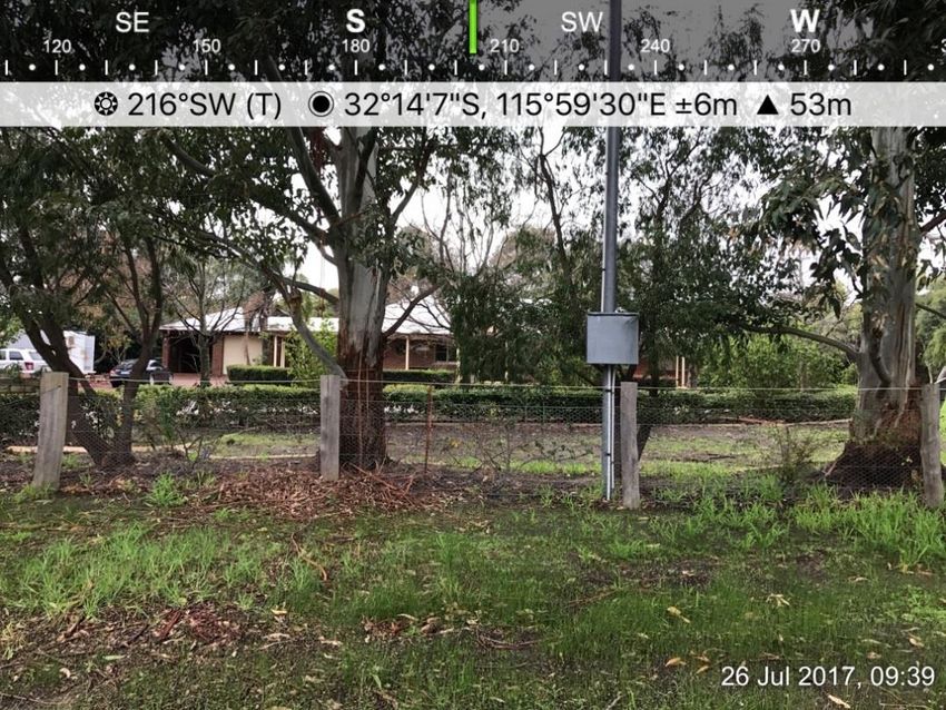
Bushfire Management Plan
                                                                                                                               Beenyup Grove, B yford

Contents
1          Introduction ................................................................................................................................. 4
1.1        Project overview ........................................................................................................................... 4
1.2        Purpose and application of the plan ............................................................................................. 4

2          Spatial consideration of bushfire threat .................................................................................. 6
2.1        General ......................................................................................................................................... 6
2.2        Bushfire fuels ................................................................................................................................ 6
2.3        Topography and slope under vegetation ...................................................................................... 6
2.4        Bushfire history, risk of ignition and potential bushfire scenarios ................................................. 6
2.5        Bushfire Attack Level (BAL) assessment ..................................................................................... 8
2.5.1      Fire Danger Index ......................................................................................................................... 8
2.5.2      Vegetation class ........................................................................................................................... 8
2.5.3      Slope under classified vegetation ................................................................................................. 8
2.5.4      Distance between proposed development areas and classified vegetation ................................ 8
2.5.5      Method 1 BAL assessment........................................................................................................... 8
2.6        Identification of issues arising from the BAL assessment ............................................................ 9

3          Proposal compliance and justification ................................................................................... 11

4          Bushfire management measures ............................................................................................ 13

5          Implementation and enforcement ........................................................................................... 24

References ............................................................................................................................................. 26

Appendix 1 Plates ................................................................................................................................. 27

Appendix 2 Standards for Asset Protection Zones ........................................................................... 34

Appendix 3 Vehicular access technical requirements (WAPC 2017) .............................................. 36

    © ECO LOGICAL AUSTRALIA PTY LTD                                                                                                                       ii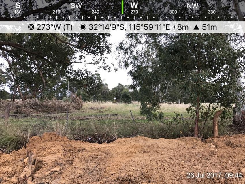
Bushfire Management Plan
Beenyup Grove, B yford
List of figures
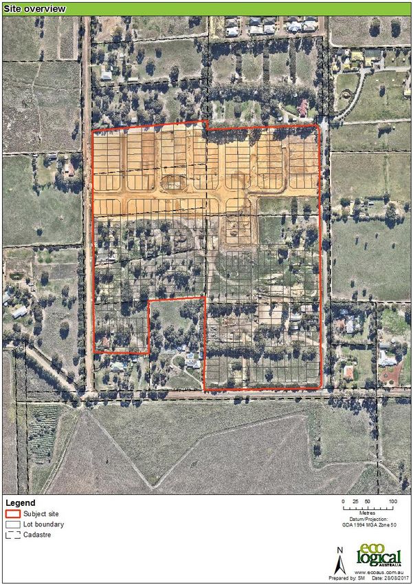
Figure 1: Site overview .............................................................................................................................. 5
Figure 2: Vegetation class ......................................................................................................................... 7
Figure 3: Bushfire Attack Level (BAL) contour map ................................................................................ 10
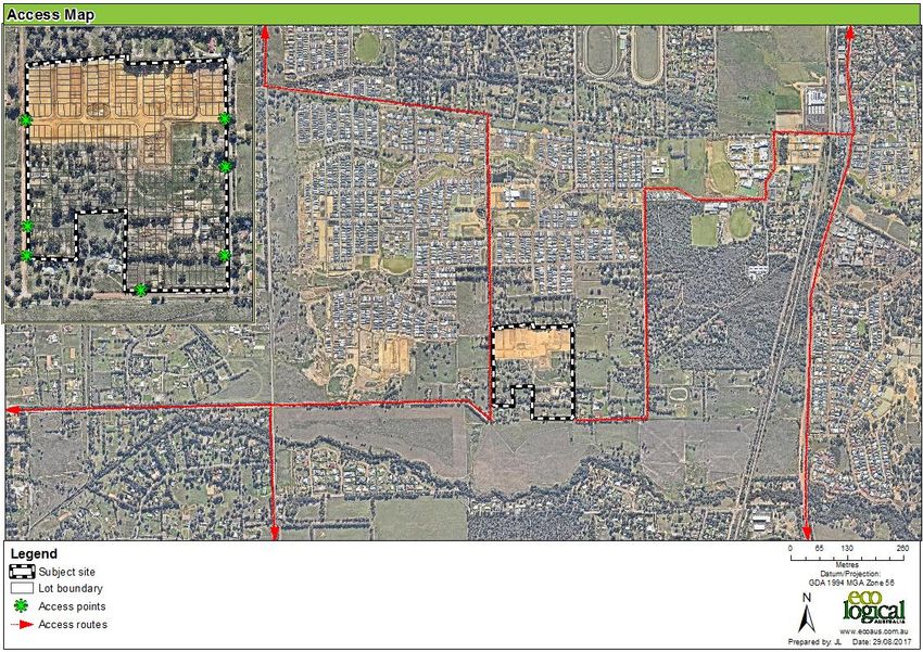
Figure 4: Access map .............................................................................................................................. 23
Figure 5: Illustrated tree canopy cover projection (WAPC 2017) ............................................................ 34
List of tables
Table 1: Method 1 BAL calculation (BAL contours) ................................................................................... 9
Table 2: Summary of solutions used to achieve bushfire performance criteria ...................................... 13
Table 3: Assessment against Bushfire Performance Criteria ................................................................. 14
Table 4: Proposed works program ........................................................................................................... 24
List of appendices
Appendix 1 Plates .................................................................................................................................... 27
Appendix 2 Standards for Asset Protection Zones .................................................................................. 34
Appendix 3 Vehicular access technical requirements (WAPC 2017) ...................................................... 36
© ECO LOGICAL AUSTRALIA PTY LTD iii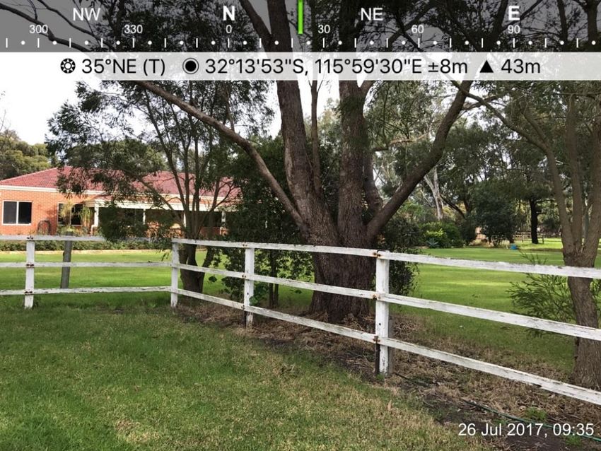
Bushfire Management Plan
                                                                                 Beenyup Grove, B yford

1     Introduction
1.1    P roj e ct ov e rv i ew
Eco Logical Australia (ELA) was commissioned by Parcel Property to prepare a Bushfire Management
Plan (BMP) to support a subdivision application being prepared for the Beenyup Grove Estate at Lots
127-130 and 202 Doley Road, Lots 2-3 Lawrence Way, and Lot 1 Orton Road, Byford (hereafter referred
to as the subject site; Figure 1).

The subject site is within a designated bushfire prone area as per the Western Australia State Map of
Bush Fire Prone Areas (DFES 2017), which triggers bushfire planning requirements under State
Planning Policy 3.7 Planning in Bushfire Prone Areas (SPP 3.7; WAPC 2015) and reporting to
accompany submission of the subdivision application in accordance with the associated Guidelines for
Planning in Bushfire Prone Areas v 1.2 (the Guidelines; WAPC 2017).

This assessment has been prepared by ELA Senior Bushfire Consultant, Daniel Panickar (FPAA BPAD
Level 2 Certified Practitioner No. BPAD37802-L2) and quality assurance undertaken by ELA Senior
Bushfire Consultant, Bruce Horkings (FPAA BPAD Level 3 Certified Practitioner No. BPAD29962-L3).

1.2    Pu rpo s e and app li ca t ion of t he p lan
The primary purpose of this BMP is to act as a technical supporting document to inform planning
assessment.

This BMP is also designed to provide guidance on how to plan for and manage the bushfire risk to the
subject site through implementation of a range of bushfire management measures in accordance with
the Guidelines.

    © ECO LOGICAL AUSTRALIA PTY LTD                                                                 4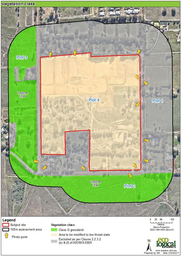
Bushfire Management Plan
                                       Beenyup Grove, B yford

Figure 1: Site overview

  © ECO LOGICAL AUSTRALIA PTY LTD                         5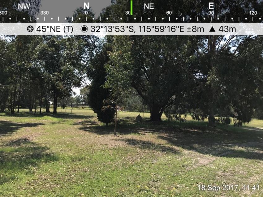
Bushfire Management Plan
                                                                                         Beenyup Grove, B yford

2     Spatial consideration of bushfire threat
2.1     G en e ra l
The subject site is located in the Shire of Serpentine-Jarrahdale, and is bound by Doley Road to the
west, Lawrence Way to the east, Orton Road to the south, and rural-residential properties to the north.
Historically, the subject site comprised multiple rural properties which are now being cleared and
levelled for development.

2.2     Bus hf i r e f ue ls
Vegetation within the subject site and surrounding 150 m (the assessment area) was assessed in
accordance with the Guidelines and AS 3959-2009 Construction of Buildings in Bushfire Prone Areas
(SA 2009) with regard given to the Visual guide for bushfire risk assessment in Western Australia (DoP
2016). Site inspection was undertaken on 26 July 2017.

The following vegetation classes and exclusions were identified within the assessment area as depicted
in Figure 2 and listed below:

•     Class G grassland; and
•     Exclusions as per clause 2.2.3.2 (e) and (f) (i.e. non-vegetated areas and low-threat vegetation).

Photographs relating to each vegetation type are included in Appendix 1.

The BAL assessment addresses this topic further in Section 2.5.

2.3     T opogr aph y and slo p e u nd er v eg et ati on
Effective slope under vegetation was assessed for a distance of 150 m from the subject site in
accordance with the Guidelines and AS 3959-2009 and is depicted in Figure 2. Slope on all land within
150 m of the subject site is effectively upslope/flat.

The BAL assessment addresses this topic further in Section 2.5.

2.4     Bus hf i r e h i st o r y, r is k of ign iti on and po te nti al bu shfi r e s ce na r i os
Visual assessment of the surrounding vegetation within the assessment area did not identify any recent
fire scars and fire history was not able to be determined. Accumulation of vegetative matter over time,
combined with the moderate to high risk of ignition associated with high levels of public access and
proximity to urban areas would potentially facilitate a bushfire occurrence in this area.

Agricultural land uses within undeveloped land around the subject site contributes to the largely grass
dominated fuels in these areas, all of which are subject to grazing or management. Firefighting services
would have relatively straightforward access to fire-fronts through public roads and farm tracks.

    © ECO LOGICAL AUSTRALIA PTY LTD                                                                         6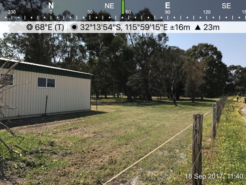
Bushfire Management Plan
                                       Beenyup Grove, B yford

Figure 2: Vegetation class

  © ECO LOGICAL AUSTRALIA PTY LTD                         7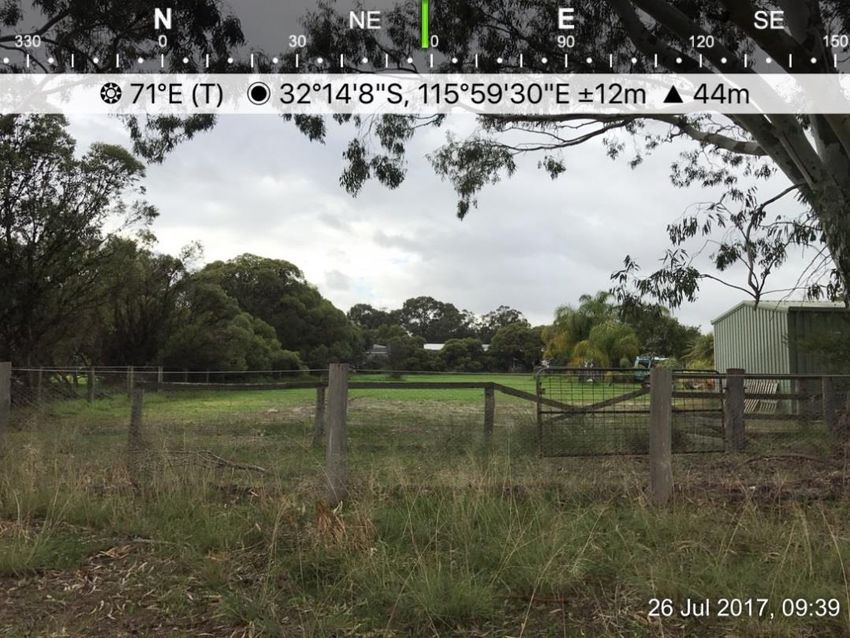
Bushfire Management Plan
                                                                                     Beenyup Grove, B yford

2.5     Bus hf i r e At t ac k Lev e l ( B AL) as s es sm ent
All land located within 50 m of the classified Class G grassland vegetation depicted in Figure 2 is
considered bushfire prone and is subject to a BAL assessment in accordance with AS 3959-2009.

A Method 1 BAL assessment (as outlined in AS 3959-2009) has been completed for the proposed
development and incorporates the following factors:

•     State adopted Fire Danger Index (FDI) rating;
•     Vegetation class;
•     Slope under classified vegetation; and
•     Distance between proposed development areas and the classified vegetation.

Based on the identified BAL, construction requirements for proposed buildings can then be assigned.
The BAL rating gives an indication of the expected level of bushfire attack (i.e. radiant heat flux, flame
contact and ember penetration) that may be received by proposed buildings and subsequently informs
the standard of construction required to increase building survivability.

2.5.1 Fire Danger Index
A blanket rating of FDI 80 is adopted for Western Australian environments, as outlined in AS 3959–
2009 and endorsed by Australasian Fire and Emergency Service Authorities Council.

2.5.2 Vegetation class
Vegetation class is described in Section 2.2, depicted in Figure 2 and is comprised of:

•     Class G grassland.

2.5.3 Slope under classified vegetation
Slope under classified vegetation is depicted in Figure 2. Slope on all land within 150 m of the subject
site is effectively upslope/flat.

2.5.4 Distance between proposed development areas and classified vegetation
Separation distances between proposed development areas within the subject site and classified
vegetation are depicted in Table 1.

2.5.5 Method 1 BAL assessment
Table 1 and Figure 3 display the Method 1 BAL assessment (in the form of BAL contours) that has
been completed for the proposed development in accordance with AS 3959-2009 methodology.

    © ECO LOGICAL AUSTRALIA PTY LTD                                                                      8
Bushfire Management Plan
                                                                                    Beenyup Grove, B yford

Table 1: Method 1 BAL calculation (BAL contours)

                                      Hazard
 Plot and Vegetation      Effective
                                      separation   BAL rating   Comment
 classification           slope
                                      distance

 Plot 1
 Excluded as per          N/A
 clause 2.2.3.2 (f) of
 AS3959-2009
Bushfire Management Plan
Beenyup Grove, B yford
Figure 3: Bushfire Attack Level (BAL) contour map
© ECO LOGICAL AUSTRALIA PTY LTD 10Bushfire Management Plan
Beenyup Grove, B yford
3 Proposal compliance and justification
The proposed subdivision is required to comply with SPP 3.7 and the Guidelines, as per the following
policy measures:
6.2 Strategic planning proposals, subdivision and development applications
a) Strategic planning proposals, subdivision and development applications within designated bushfire
prone areas relating to land that has or will have a Bushfire Hazard Level (BHL) above low and/or where
a Bushfire Attack Level (BAL) rating above BAL-LOW apply, are to comply with these policy measures.
b) Any strategic planning proposal, subdivision or development application in an area to which policy
measure 6.2 a) applies, that has or will, on completion, have a moderate BHL and/or where BAL-12.5
to BAL-29 applies, may be considered for approval where it can be undertaken in accordance with
policy measures 6.3, 6.4 or 6.5.
c) This policy also applies where an area is not yet designated as a bushfire prone area but is proposed
to be developed in a way that introduces a bushfire hazard, as outlined in the Guidelines.
6.4 Information to accompany subdivision applications
Any development application to which policy measure 6.2 applies is to be accompanied by the following
information prepared in accordance with the Guidelines:
a) BAL Contour Map to determine the indicative acceptable BAL ratings across the subject site, in
accordance with the Guidelines. BAL Contour Maps should be prepared by an accredited Bushfire
Planning Practitioner;
b) the identification of any bushfire hazard issues arising from the BAL Contour Map; and
c) an assessment against the bushfire protection criteria requirements contained within the Guidelines
demonstrating compliance within the boundary of the subdivision site
This information can be provided in the form of a Bushfire Management Plan or an amended Bushfire
Management Plan where one has been previously endorsed.
© ECO LOGICAL AUSTRALIA PTY LTD 11Bushfire Management Plan
Beenyup Grove, B yford
Implementation of this BMP is expected to meet the following objectives of SPP 3.7:
• 5.1: Avoid increasing the threat of bushfire to people, property and infrastructure. The preservation
of life and the management of bushfire impact is paramount;
• 5.2: Reduce vulnerability to bushfire through the identification and assessment of bushfire hazards
in decision-making at all stages of the planning and development process;
• 5.3: Ensure that planning proposals and development applications take into account bushfire
protection requirements and include specified bushfire protection measures where land has or will
have a moderate or extreme bushfire hazard level, and/ or where a rating higher than BAL-Low
applies; and
• 5.4: Achieve a responsible approach between bushfire management measures and landscape
amenity and biodiversity conservation values, with consideration of the potential impacts of climate
change.
In response to the above requirements of SPP 3.7 and the Guidelines, bushfire management measures,
as outlined in Section 4 have been devised for the proposed development in accordance with Guideline
acceptable solutions to meet compliance with bushfire protection criteria. The ‘acceptable solutions
assessment’ is provided in Section 4 to assess the proposed bushfire management measures against
each bushfire protection criteria in accordance with the Guidelines and demonstrate that the measures
proposed meet the intent of each element of the bushfire protection criteria.
© ECO LOGICAL AUSTRALIA PTY LTD 12Bushfire Management Plan
Beenyup Grove, B yford
4 Bushfire management measures
This section assesses the proposal against the Bushfire Performance Criteria as outlined in the
Guidelines and listed below:
• Location;
• Siting and design of development;
• Vehicular access; and
• Water.
ELA has identified a range of bushfire management measures that on implementation will enable all
proposed areas to be developed with a manageable level of bushfire risk whilst maintaining compliance
with the intent of the Bushfire Performance Criteria.
Table 2 outlines the Acceptable Solutions (AS) that are relevant to the proposal, identifies where a
Performance Solution (PS) has been used instead of an AS and summarises how the intent of each
Bushfire Protection criteria has been achieved.
Table 3 contains a full assessment of the proposal against the Bushfire Performance Criteria.
Table 2: Summary of solutions used to achieve bushfire performance criteria
Bushfire Performance Criteria AS PS N/A Comment
Element 1: Location All proposed lots are located in areas subject
☒ ☐ ☐
to BAL ratings of BAL-12.5 or lower.
Element 2: Siting and design of development APZs will be maintained between all
proposed buildings and classified vegetation
☒ ☐ ☐
in the form of roads and other non-vegetated
and landscaped areas.
Element 3: Vehicular access Seven access routes to/from the subject site
are available (Figure 4). All roads will
☒ ☐ ☐
comply with requirements outlined in the
Guidelines (Appendix 3).
Element 4: Water The subject site has a reticulated water
☒ ☐ ☐
supply.
© ECO LOGICAL AUSTRALIA PTY LTD 13Bushfire Management Plan
Beenyup Grove, B yford
Table 3: Assessment against Bushfire Performance Criteria
Bushfire
Intent and Performance Principle Design response Compliance statement
protection criteria
Element 1: Intent: To ensure that strategic Acceptable solution A1.1 Development location The proposed development is
Location planning proposals, subdivision and considered compliant with Element 1
The strategic planning proposal, subdivision and development
development applications are in areas Location.
application is in an area that is or will, on completion, be subject to
with the least possible risk of bushfire
either a moderate or low bushfire hazard level, or BAL–29 or below.
to facilitate the protection of people,
Management measures / development response
property and infrastructure.
All proposed lots are located in areas subject to a BAL rating of
Performance Principle (P1): The BAL-12.5 or lower (Figure 3).
strategic planning proposal,
subdivision and development
application is in an area where the
bushfire hazard assessment is or will,
on completion, be moderate or low, or
a BAL–29 or below, and the risk can
be managed. For minor development
in areas where BAL–40 or BAL–FZ
applies, demonstrating that the risk
can be managed to the satisfaction of
the Department of Fire and
Emergency Services and the
decision-maker.
© ECO LOGICAL AUSTRALIA PTY LTD 14Bushfire Management Plan
Beenyup Grove, B yford
Bushfire
Intent and Performance Principle Design response Compliance statement
protection criteria
Element 2: Intent: To ensure that the siting of Acceptable Solution A2.1 Asset Protection Zone (APZ) The proposed development is
Siting and development minimises the level of considered compliant with Element 2
Every building is surrounded by, and every proposed lot can
design of bushfire impact. Siting and design of development.
achieve, an APZ depicted on submitted plans, which meets the
development requirements in Appendix 2.
Performance Principle (P2): The
siting and design of the strategic Management measures / development response
planning proposal, subdivision or The APZs proposed as part of this development are illustrated in
development application, including Figure 3. These APZs will encompass roads and other non-
roads, paths and landscaping, is vegetated and landscaped areas.
appropriate to the level of bushfire
threat that applies to the site. That it
minimises the bushfire risk to people,
property and infrastructure, including
compliance with AS 3959 if
appropriate.
© ECO LOGICAL AUSTRALIA PTY LTD 15Bushfire Management Plan
Beenyup Grove, B yford
Bushfire
Intent and Performance Principle Design response Compliance statement
protection criteria
Element 3: Intent: To ensure that the vehicular Acceptable Solution A3.1 Two access routes The proposed development is
Vehicular access access serving a considered compliant with Element 3
Two different vehicular access routes are provided, both of which
subdivision/development is safe in the Vehicular access.
connect to the public road network, provide safe access and egress
event of a bushfire occurring.
to two different destinations and are available to all residents/the
Performance Principle (P3): The public at all times and under all weather conditions.
internal layout, design and
Management measures / development response
construction of public and private
Seven access routes to/from the subject site are available
vehicular access in the
(Figure 4).
subdivision/development allows
emergency and other vehicles to
Acceptable Solution A3.2 Public road
move through it easily and safely at
all times. A public road is to meet the requirements in Table 4, Column 1 of
the Guidelines (reproduced in Appendix 3).
Management measures / development response
All public roads will comply with relevant requirements.
Acceptable Solution A3.3 Cul-de-sac
A cul-de-sac and/or a dead-end road should be avoided in bushfire
prone areas. Where no alternative exists (i.e. the lot layout already
exists and/or will need to be demonstrated by the proponent), the
following requirements are to be achieved:
• Requirements in Table 4, Column 2 of the Guidelines
(reproduced in Appendix 3);
• Maximum length: 200 metres (if public emergency access
is provided between cul-de-sac heads maximum length
can be increased to 600 metres provided no more than
© ECO LOGICAL AUSTRALIA PTY LTD 16Bushfire Management Plan
Beenyup Grove, B yford
Bushfire
Intent and Performance Principle Design response Compliance statement
protection criteria
eight lots are serviced and the emergency access way is
no more than 600 metres); and
• Turn-around area requirements, including a minimum 17.5
metre diameter head.
Management measures / development response
No cul-de-sacs are proposed as part of the development. All
terminating internal roads will ultimately be linked to those within
adjacent developments in accordance with Structure Plans for the
local area.
Acceptable Solution A3.4 Battle-axe
Battle-axe access leg should be avoided in bushfire prone areas.
Where no alternative exists, (this will need to be demonstrated by
the proponent) all of the following requirements are to be achieved:
• Requirements in Table 4, Column 3 of the Guidelines
(reproduced in Appendix 3);
• Maximum length: 600 metres; and
• Minimum width: six metres.
Management measures / development response
No battle axe lots are proposed.
© ECO LOGICAL AUSTRALIA PTY LTD 17Bushfire Management Plan
Beenyup Grove, B yford
Bushfire
Intent and Performance Principle Design response Compliance statement
protection criteria
Acceptable Solution A3.5 Private driveway longer than 50 m
A private driveway is to meet all of the following requirements:
• Requirements in Table 4, Column 3 of the Guidelines
(reproduced in Appendix 3);
• Required where a house site is more than 50 metres from
a public road;
• Passing bays: every 200 metres with a minimum length of
20 metres and a minimum width of two metres (i.e. the
combined width of the passing bay and constructed
private driveway to be a minimum six metres);
• Turn-around areas designed to accommodate type 3.4 fire
appliances and to enable them to turn around safely every
500 metres (i.e. kerb to kerb 17.5 metres) and within 50
metres of a house; and
• Any bridges or culverts are able to support a minimum
weight capacity of 15 tonnes.
• All-weather surface (i.e. compacted gravel, limestone or
sealed).
Management measures / development response
No private driveways longer than 50 m are proposed.
Acceptable Solution A3.6 Emergency access way
An access way that does not provide through access to a public
road is to be avoided in bushfire prone areas. Where no alternative
exists (this will need to be demonstrated by the proponent), an
emergency access way is to be provided as an alternative link to a
public road during emergencies. An emergency access way is to
meet all of the following requirements:
© ECO LOGICAL AUSTRALIA PTY LTD 18Bushfire Management Plan
Beenyup Grove, B yford
Bushfire
Intent and Performance Principle Design response Compliance statement
protection criteria
• Requirements in Table 4, Column 4 of the Guidelines
(reproduced in Appendix 3);
• No further than 600 metres from a public road;
• Provided as right of way or public access easement in
gross to ensure accessibility to the public and fire services
during an emergency; and
• Must be signposted.
Management measures / development response
No emergency access ways are required or proposed.
Acceptable Solution A3.7 Fire service access routes
(perimeter roads)
Fire service access routes are to be established to provide access
within and around the edge of the subdivision and related
development to provide direct access to bushfire prone areas for
fire fighters and link between public road networks for firefighting
purposes. Fire service access routes are to meet the following
requirements:
• Requirements Table 4, Column 5 of the Guidelines
(reproduced in Appendix 3);
• Provided as right of ways or public access easements in
gross to ensure accessibility to the public and fire services
during an emergency;
• Surface: all-weather (i.e. compacted gravel, limestone or
sealed);
• Dead end roads are not permitted;
© ECO LOGICAL AUSTRALIA PTY LTD 19Bushfire Management Plan
Beenyup Grove, B yford
Bushfire
Intent and Performance Principle Design response Compliance statement
protection criteria
• Turn-around areas designed to accommodate type 3.4
appliances and to enable them to turn around safely every
500 metres (i.e. kerb to kerb 17.5 metres);
• No further than 600 metres from a public road;
• Allow for two-way traffic and;
• Must be signposted.
Management measures / development response
No fire service access routes are required or proposed.
Acceptable Solution A3.8 Firebreak width
Lots greater than 0.5 hectares must have an internal perimeter
firebreak of a minimum width of three metres or to the level as
prescribed in the local firebreak notice issued by the local
government.
Management measures / development response
No firebreaks are required or proposed.
© ECO LOGICAL AUSTRALIA PTY LTD 20Bushfire Management Plan
Beenyup Grove, B yford
Bushfire
Intent and Performance Principle Design response Compliance statement
protection criteria
Element 4: Intent: To ensure that water is Acceptable solution A4.1 Reticulated areas The proposed development is
Water available to the subdivision, considered compliant with Element 4
The subdivision, development or land use is provided with a
development or land use to enable Water.
reticulated water supply in accordance with the specifications of
people, property and infrastructure to
the relevant water supply authority and Department of Fire and
be defended from bushfire.
Emergency Services.
Performance Principle (P4): The
Management measures / development response
subdivision, development or land use
The subject site is currently connected to a reticulated water
is provided with a permanent and
supply. The reticulated system will ensure a year-round supply of
secure water supply that is sufficient
water is provided for the subject site which meets minimum water
for firefighting purposes.
supply requirements.
Acceptable solution A4.2 Non-reticulated areas
Water tanks for firefighting purposes with a hydrant or standpipe
are provided and meet the following requirements:
• Volume: minimum 50,000 litres per tank;
• Ratio of tanks to lots: minimum one tank per 25 lots (or part
thereof);
• Tank location: no more than two kilometres to the further
most house site within the residential development to allow a
2.4 fire appliance to achieve a 20 minute turnaround time at
legal road speeds;
• Hardstand and turn-around areas suitable for a type 3.4 fire
appliance (i.e. kerb to kerb 17.5 metres) are provided within
three metres of each water tank; and
• Water tanks and associated facilities are vested in the
relevant local government.
© ECO LOGICAL AUSTRALIA PTY LTD 21Bushfire Management Plan
Beenyup Grove, B yford
Bushfire
Intent and Performance Principle Design response Compliance statement
protection criteria
Management measures / development response
The subject site is located within a reticulated area and therefore
A4.2 is not applicable.
Acceptable solution A4.3 Individual lots within non-
reticulated areas
Single lots above 500 square metres need a dedicated static
water supply on the lot that has the effective capacity of 10,000
litres.
Management measures / development response
The subject site is located within a reticulated area and therefore
A4.3 is not applicable.
© ECO LOGICAL AUSTRALIA PTY LTD 22Bushfire Management Plan
Beenyup Grove, B yford
Figure 4: Access map
© ECO LOGICAL AUSTRALIA PTY LTD 23Bushfire Management Plan
Beenyup Grove, B yford
5 Implementation and enforcement
Implementation of the BMP applies to Parcel Property and the Shire of Serpentine-Jarrahdale to ensure
bushfire management measures are adopted and implemented on an ongoing basis. A summary of
the bushfire management measures described in Section 4, as well as a works program, is provided
in Table 4. These measures will be implemented to ensure the ongoing protection of life and property
assets is achieved. Timing and responsibilities are also defined to assist with implementation of each
measure.
Table 4: Proposed works program
Bushfire management measure Timing for application Responsibility
Creation of APZs Prior to sale of lots Parcel Property
Maintenance of APZs As required to achieve 2 t/ha Parcel Property
threshold all year until
development
completion.
Individual
landowners
thereafter
Implementation of increased building construction During construction of Builders
standards dwellings
Construction of roads, cul-de-sac and emergency During construction of the Parcel Property /
access way as per the Guidelines proposed resort Construction
contractor
Provision of reticulated water supply During construction of the Parcel Property /
proposed building Construction
contractor
Compliance with current fire control order All year round as specified in Parcel Property
the current fire control order until
development
completion.
Individual
landowners
thereafter
© ECO LOGICAL AUSTRALIA PTY LTD 24Bushfire Management Plan
Beenyup Grove, B yford
Conclusion
In the author’s professional opinion, the bushfire protection requirements listed in this assessment
provide an adequate standard of bushfire protection for the proposed development. As such, the
proposed development is consistent with the aim and objectives of SPP 3.7 and associated guidelines
and is recommended for approval.
Daniel Panickar
Senior Bushfire Consultant
FPAA BPAD Certified Practitioner
No. BPAD37802-L2
© ECO LOGICAL AUSTRALIA PTY LTD 25Bushfire Management Plan
Beenyup Grove, B yford
References
Bureau of Meteorology (BoM). 2017. Climate statistics for Australian locations: Monthly climate
statistics for Medina Research Centre, [Online], Commonwealth of Australia, available from:
http://www.bom.gov.au/climate/averages/tables/cw_009194.shtml, [1 Aug 2017].
Department of Fire and Emergency Services (DFES). 2017. Map of Bush Fire Prone Areas, [Online],
Government of Western Australia, available from:
http://www.dfes.wa.gov.au/regulationandcompliance/bushfireproneareas/Pages/default.aspx,
[27 Jul 2017].
Department of Planning (DoP). 2016. Visual guide for bushfire risk assessment in Western Australia.
DoP, Perth.
Landgate. 2017. Firewatch, [Online], Government of Western Australia, available from:
http://firewatch.landgate.wa.gov.au/landgate_firewatch_public.asp, [27 July 2017].
Standards Australia. 2009. Construction of buildings in bushfire-prone areas, AS 3959-2009. SAI
Global, Sydney.
Western Australian Planning Commission (WAPC). 2015. State Planning Policy 3.7 Planning in
Bushfire Prone Areas. WAPC, Perth.
Western Australian Planning Commission (WAPC). 2017. Guidelines for Planning in Bushfire Prone
Areas Version 1.2 (including appendices). WAPC, Perth.
© ECO LOGICAL AUSTRALIA PTY LTD 26Bushfire Management Plan
Beenyup Grove, B yford
Appendix 1 Plates
Plot Photo ID Photo and vegetation class
1 1
Excluded as per clause 2.2.3.2 (f) of AS 3959-2009
Plot Photo ID Photo and vegetation class
1 2
Excluded as per clause 2.2.3.2 (f) of AS 3959-2009
© ECO LOGICAL AUSTRALIA PTY LTD 27Bushfire Management Plan
Beenyup Grove, B yford
Plot Photo ID Photo and vegetation class
1 3
Excluded as per clause 2.2.3.2 (f) of AS 3959-2009
Plot Photo ID Photo and vegetation class
1 4
Excluded as per clause 2.2.3.2 (f) of AS 3959-2009
© ECO LOGICAL AUSTRALIA PTY LTD 28Bushfire Management Plan
Beenyup Grove, B yford
Plot Photo ID Photo and vegetation class
1 5
Excluded as per clause 2.2.3.2 (f) of AS 3959-2009
Plot Photo ID Photo and vegetation class
1 6
Excluded as per clause 2.2.3.2 (f) of AS 3959-2009
© ECO LOGICAL AUSTRALIA PTY LTD 29Bushfire Management Plan
Beenyup Grove, B yford
Plot Photo ID Photo and vegetation class
1 9
Excluded as per clause 2.2.3.2 (f) of AS 3959-2009
Plot Photo ID Photo and vegetation class
1 13
Excluded as per clause 2.2.3.2 (f) of AS 3959-2009
© ECO LOGICAL AUSTRALIA PTY LTD 30Bushfire Management Plan
Beenyup Grove, B yford
Plot Photo ID Photo and vegetation class
2 7
Class G grassland
Plot Photo ID Photo and vegetation class
3 8
Class G grassland
© ECO LOGICAL AUSTRALIA PTY LTD 31Bushfire Management Plan
Beenyup Grove, B yford
Plot Photo ID Photo and vegetation class
4 10
Area to be modified to low threat state
Plot Photo ID Photo and vegetation class
4 11
Area to be modified to low threat state
© ECO LOGICAL AUSTRALIA PTY LTD 32Bushfire Management Plan
Beenyup Grove, B yford
Plot Photo ID Photo and vegetation class
4 12
Area to be modified to low threat state
© ECO LOGICAL AUSTRALIA PTY LTD 33Bushfire Management Plan
Beenyup Grove, B yford
Appendix 2 Standards for Asset Protection
Zones
The following standards have been extracted from the Guidelines for Planning in Bushfire Prone Areas
v 1.1 (WAPC 2017).
Every habitable building is to be surrounded by, and every proposed lot can achieve, an APZ depicted
on submitted plans, which meets the following requirements:
a. Width: Measured from any external wall or supporting post or column of the proposed building, and
of sufficient size to ensure the potential radiant heat impact of a fire does not exceed 29kW/m² (BAL 29)
in all circumstances.
b. Location: the APZ should be contained solely within the boundaries of the lot on which a building is
situated, except in instances where the neighbouring lot or lots will be managed in a low-fuel state on
an ongoing basis, in perpetuity (see explanatory notes).
c. Management: the APZ is managed in accordance with the requirements of ‘Standards for Asset
Protection Zones’ (below):
• Fences: within the APZ are constructed from non-combustible materials (e.g. iron, brick,
limestone, metal post and wire). It is recommended that solid or slatted non-combustible
perimeter fences are used
• Objects: within 10 metres of a building, combustible objects must not be located close to
the vulnerable parts of the building i.e. windows and doors
• Fine Fuel load: combustible dead vegetation matter less than 6 millimetres in thickness
reduced to and maintained at an average of two tonnes per hectare
• Trees (> 5 metres in height): trunks at maturity should be a minimum distance of 6 metres
from all elevations of the building, branches at maturity should not touch or overhang the
building, lower branches should be removed to a height of 2 metres above the ground and
or surface vegetation, canopy cover should be less than 15% with tree canopies at maturity
well spread to at least 5 metres apart as to not form a continuous canopy (Figure 5).
Figure 5: Illustrated tree canopy cover projection (WAPC 2017)
© ECO LOGICAL AUSTRALIA PTY LTD 34Bushfire Management Plan
Beenyup Grove, B yford
• Shrubs (0.5 metres to 5 metres in height): should not be located under trees or within 3
metres of buildings, should not be planted in clumps greater than 5m2 in area, clumps of
shrubs should be separated from each other and any exposed window or door by at least
10 metres. Shrubs greater than 5 metres in height are to be treated as trees
• Ground covers (Bushfire Management Plan
Beenyup Grove, B yford
Appendix 3 Vehicular access technical
requirements (WAPC 2017)
Fire service
Private Emergency
Technical requirements Public road Cul-de-sac access
driveway access way
route
Minimum trafficable 6* 6 6* 6*
4
surface (m)
Horizontal distance (m) 6 6 6 6 6
Vertical clearance (m) 4.5 N/A 4.5 4.5 4.5
Maximum gradeHEAD OFFICE SYDNEY HUSKISSON
Suite 2, Level 3 Suite 1, Level 1 Unit 1, 51 Owen Street
668-672 Old Princes Highway 101 Sussex Street Huskisson NSW 2540
Sutherland NSW 2232 Sydney NSW 2000 T 02 4201 2264
T 02 8536 8600 T 02 8536 8650 F 02 9542 5622
F 02 9542 5622 F 02 9542 5622
CANBERRA NEWCASTLE NAROOMA
Level 2 Suites 28 & 29, Level 7 5/20 Canty Street
11 London Circuit 19 Bolton Street Narooma NSW 2546
Canberra ACT 2601 Newcastle NSW 2300 T 02 4302 1266
T 02 6103 0145 T 02 4910 0125 F 02 9542 5622
F 02 9542 5622 F 02 9542 5622
COFFS HARBOUR ARMIDALE MUDGEE
35 Orlando Street 92 Taylor Street Unit 1, Level 1
Coffs Harbour Jetty NSW 2450 Armidale NSW 2350 79 Market Street
T 02 6651 5484 T 02 8081 2685 Mudgee NSW 2850
F 02 6651 6890 F 02 9542 5622 T 02 4302 1234
F 02 6372 9230
PERTH WOLLONGONG GOSFORD
Level 1, Bishops See Suite 204, Level 2 Suite 5, Baker One
235 St Georges Terrace 62 Moore Street 1-5 Baker Street
PERTH WA 6000 Austinmer NSW 2515 Gosford NSW 2250
T 08 6218 2200 T 02 4201 2200 T 02 4302 1221
F 02 9542 5622 F 02 9542 5622 F 02 9542 5622
DARWIN BRISBANE
ADELAIDE
16/56 Marina Boulevard Suite 1, Level 3
2, 70 Pirie Street
Cullen Bay NT 0820 471 Adelaide Street
Adelaide SA 5000
T 08 8989 5601 Brisbane QLD 4000
T 08 8470 6650
F 08 8941 1220 T 07 3503 7192
F 02 9542 5622
F 07 3854 0310
© ECO LOGICAL AUSTRALIA PTY LTD
1300 646 131
www.ecoaus.com.auYou can also read