DRAFT MOONEE PONDS CREEK STRATEGIC OPPORTUNITIES PLAN - City of Melbourne
←
→
Page content transcription
If your browser does not render page correctly, please read the page content below
DRAFT MOONEE PONDS CREEK STRATEGIC OPPORTUNITIES PLAN
A CITY PLANNING
FOR GROWTH
Melbourne will be a leader in planning for growth
and technological advancement. We will guide and
influence the future development of the city for
the benefit of all city users and in a way that values
and celebrates its historical and cultural identity.

Acknowledgement of Traditional Owners
The City of Melbourne respectfully acknowledges the Traditional Owners
of the land, the Boon Wurrung and Woiwurrung (Wurundjeri) people
of the Kulin Nation and pays respect to their Elders, past and present.

melbourne.vic.gov.au
CONTENTS

Foreword                                                                                                                                                                         1

Introduction                                                                                                                                                                     2

Purpose                                                                                                                                                                         4

Overview                                                                                                                                                                         6

Challenges                                                                                                                                                                       9

    Growth                                                                                                                                                                       9

    Water management                                                                                                                                                             9

    Governance                                                                                                                                                                   9

Strategic Vision                                                                                                                                                                11

    Transformation                                                                                                                                                              11

    Goals                                                                                                                                                                       11

Opportunities                                                                                                                                                                   13

    North                                                                                                                                                                       14

    Central                                                                                                                                                                     16

    South                                                                                                                                                                       24

What next?                                                                                                                                                                      30

March 2019

Cover Image: ‘Macaulay Terrace’ A Sunny Afternoon. Credit: McGregor Coxall (McGC)

Disclaimer
This report is provided for information and it does not purport to be complete. While care has been taken to ensure the content in the report is accurate, we cannot
guarantee is without flaw of any kind. There may be errors and omissions or it may not be wholly appropriate for your particular purposes. In addition, the publication is
a snapshot in time based on historic information which is liable to change. The City of Melbourne accepts no responsibility and disclaims all liability for any error, loss or
other consequence which may arise from you relying on any information contained in this report.

   To find out how you can participate in the decision-making process for City of Melbourne’s current and
   future initiatives, visit melbourne.vic.gov.au/participate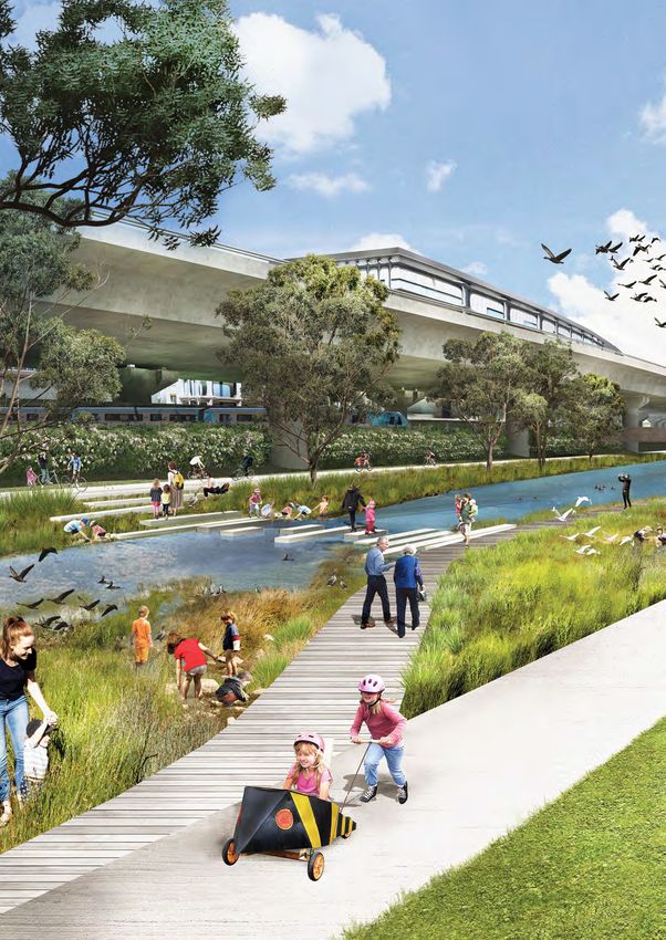
IV melbourne.vic.gov.au
FOREWORD

This is the Draft Moonee Ponds Creek Strategic
Opportunities Plan for community engagement.

It will be considered by the Future Melbourne Committee
on 19 March 2019 for endorsement for community and
stakeholder engagement in March-April 2019.

If the final version of the Plan is endorsed by the Future
Melbourne Committee following consultation, a Foreword
will be inserted here.

                                                             Moonee Ponds Creek Strategic Opportunities Plan   1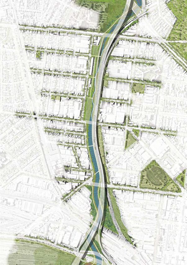
INTRODUCTION

Before European settlement in 1835, Moonee Ponds                In turn, there has been a growing public awareness
Creek was an integral part of the ‘temperate Kakadu’ that       and valuing of the social, economic and environmental
was Melbourne.                                                  importance of the creek.

The Creek – which was a chain of ponds during drier months      •   It is economically important because it runs through and
and a flood plain during heavy rains – was a travel route           connects many of the new inner-city suburbs that will be
and water and food source for the Wurundjeri tribe of the           central to Melbourne’s efforts to become a global hub for
Woiwurrung language group. It also fed into a picturesque           innovation – especially the Arden and Macaulay urban
saltwater lake near to what is now Southern Cross Station.          renewal precincts. The Creek meets the Yarra River in
                                                                    the Port of Melbourne area, home to Australia’s largest
In the decades after 1835, everything changed.                      container port. This part of the Creek is home to freight
                                                                    and rail operations that service the whole city.
The Creek’s cultural importance to local Aboriginal people
was ignored. The saltwater lake was turned into a tip,          •   It is socially important because it could, via walking and
then filled in. Meanwhile, for much of the next 150 years,          cycling paths, become a major local and regional transit
Moonee Ponds Creek was treated as an industrial drain               route – connecting urban renewal precincts, established
and transport corridor.                                             suburbs and the central city, as well as creating new
                                                                    public spaces on the doorstep of the central city.
                                                                •   It is environmentally important because it could – by
                                                                    creating a chain of parks and wetlands and linking to
    “Billabongs and swamps were                                    existing parklands such as Royal Park – strengthen the
                                                                    biodiversity of the city and lessen some of the impacts
      sprinkled right around the bay,                               of climate change (such as increased flooding) through
      and they teemed with brolgas,                                 integrated water design and management.

      magpie-geese, Cape Barren                                 Melbourne is already globally recognised as one of the
                                                                most liveable cities in the world.
      geese, swans, ducks, eels and
                                                                With Greater Melbourne in the midst of its greatest surge in
      frogs. So abundant was the                                population since the Gold Rush, the City of Melbourne needs
      wildlife that we can imagine                              to find new ways to manage growth. To achieve this, the City
                                                                needs to extend best practice planning and design into former
      the Melbourne area in 1830                                industrial neighbourhood precincts like Arden and forge
                                                                new partnerships with stakeholders such as the Victorian
      as a sort of temperate Kakadu                             Government, universities and local communities.
      and, as in Arnhem Land, it                                The urban renewal precincts that run along Moonee Ponds
      was the wetlands that were                                Creek corridor have the potential to – through a combination
                                                                of bold planning and strong partnerships – become a green
      the focus of life.”                                       oasis and enhance the liveability of the City.

    – Tim Flannery, The Birth of Melbourne (2004)               The Arden and Macaulay, Dynon and E-Gate urban renewal
                                                                precincts, along with Docklands are opportunities to
                                                                enhance the inner city’s liveability, sustainability and
                                                                affordability; set benchmarks for smart, sustainable
Since late last century, supporters of the Creek have           development; and strengthen the city’s biodiversity.
worked hard to change perceptions of the Creek and to           However, those opportunities for economic, social and
advocate to restore its natural functions. The Friends of the   environmental renewal cannot be fully realised without
Moonee Ponds Creek (formerly the Moonee Ponds Creek             the revival of the Moonee Ponds Creek corridor.
Association) have worked hard to protect the Creek from
further damage. Their leadership led to the 1992 Moonee         Renewing the creek corridor will support a new inner city
Ponds Creek Concept Plan.                                       of existing and developing neighbourhoods – as well as
                                                                creating urgently needed public spaces for the inner city’s
Since then, many organisations – including local                rapidly growing population. Ignoring the Creek corridor will
government, state government agencies and the local             dislocate local suburbs and urban renewal precincts – and
community groups – have worked hard to address the              harm Melbourne’s liveability, sustainability and prosperity.
complex challenges of the creek. Most recently, this work
has included the development of the Moonee Ponds Creek
Chain of Ponds Plan, prepared jointly by the Moonee Valley
City Council and Moreland City Council.

2      melbourne.vic.gov.au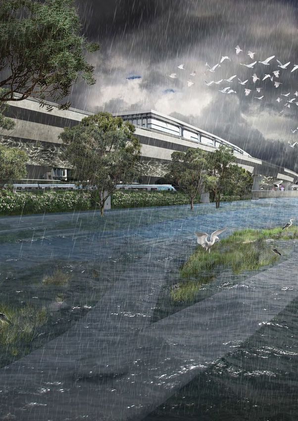
Figure 1. History - Diagram showing evolution of the creek corridor

                                                                           80,000         Pre-European
                                                                                          Settlement
                                                                           YEARS AGO

             Beginning of European
            Settlement at Port Philip         1840s

                                                                           1845        Moonee Moonee was the name
                                                                                       of a Woiworun elder, who died

   Growth of Melbourne continues
 to put further pressure and stress           1860s-
     on the Moonee Ponds Creek -
    Urbanisation + Industrialisation          1890s

                                                                           1892        West Melbourne Dock
                                                                                       under construction

  A sixty year project commenced
     to reconstruct and straighten
        the creek as an urban drain
           to mitigate flood waters
                                              1960s

                                                                           2019        Heavily modified
                                                                                       Moonee Ponds Creek

  Spaces along the creek have the
   potential to be public assets for
surrounding community, providing
                                               FUTURE
                                               POTENTIAL
    significant habitat and ecology

    “Australia’s First Peoples have a history of more than 80,000 years,
      their Descendants have developed intimate knowledge and
      spiritual connection to their natural environment.”

                                                                        Moonee Ponds Creek Strategic Opportunities Plan   3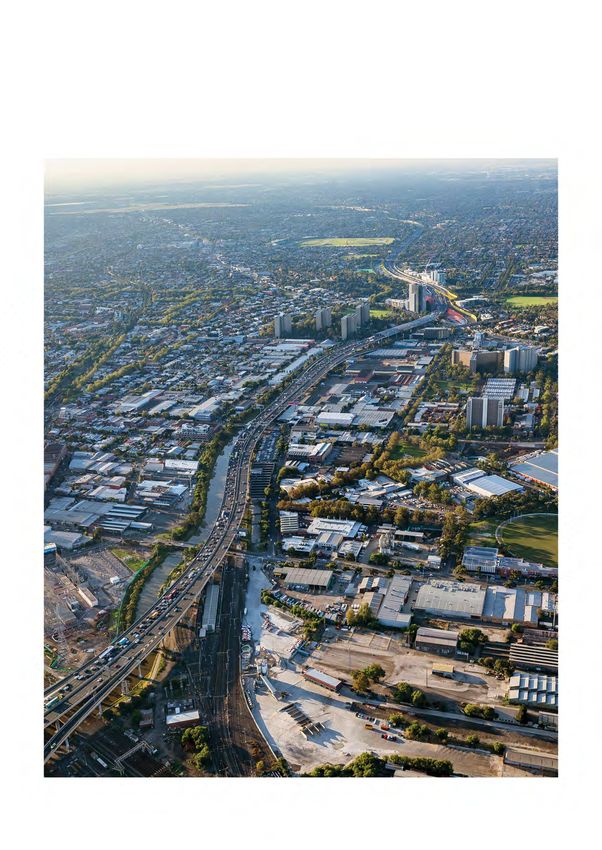
PURPOSE

The City of Melbourne does not own or control the               This plan will deliver on several Council strategies that
Moonee Ponds Creek corridor. The Creek corridor is              have been informed by extensive community engagement
largely controlled by Victorian Government agencies.            over many years, including the Open Space Strategy (2012);
                                                                Urban Forest Strategy: Making a Great City Greener
Consequently, our role is that of an advocate for the current   2012-2031; Nature in the City Strategy (2017); and,
and future residents and communities along the creek            Arden-Macaulay Structure Plan (2012).
corridor. That is why we want to work in partnership
with the Victorian Government, neighbouring councils,
community groups and other partners to revitalise the
Moonee Ponds Creek corridor.
                                                                  “Community sentiment is strong
The purpose of this document is to detail our vision for
the future of the creek corridor. This document sets out the
                                                                    – the creek is a vital asset that
opportunities that the City of Melbourne believes should be         needs restoring along with
taken to turn the creek into an exemplar corridor for water
management, public space and community activity, active             better access and, integration
transport, biodiversity, heritage and culture.                      – and there is no time to waste
We believe these actions will:                                      in delivering these outcomes.”
•   Revitalise an ancient and vital waterway;
•   reconnect the creek corridor to its Aboriginal heritage
    and local history
                                                                The liveability of Melbourne is connected to the future
•   create new, high quality and restorative public spaces      of Moonee Ponds Creek. We look forward to working
•   connect new and established communities                     with the Victorian Government and the local community
                                                                to strengthen that connection, and achieve the right
•   protect and enhance opportunities for biodiversity          balance of growth, sustainability and liveability for local
                                                                communities and the city as a whole.
•   reduce the severity and impacts of a changing climate
•   enable the region’s urban renewal projects to set
    new benchmarks for water management and
    sustainable development.

4      melbourne.vic.gov.au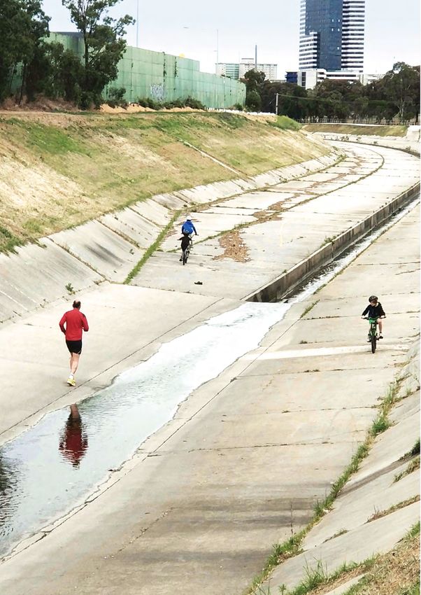
MOONEE
MOONEEPONDS
MOONEE PONDSCREEK
PONDS CREEK
CREEK
MOONEE PONDS URBAN
CREEK
URBAN
URBAN GROWTH
GROWTH
GROWTH CONTEXT
CONTEXT
CONTEXT
MOONEE
Figure
MOONEE PONDS
2. Map showing
PONDS CREEK
growth narrative
CREEK around the Creek
URBAN GROWTH
URBAN CONTEXT
URBAN GROWTH
GROWTH CONTEXT
CONTEXT
URBAN GROWTH CONTEXT
MOONEE PONDS CREEK
URBAN GROWTH CONTEXT
!
!!
MOONEE PONDS CREEK !
!
CREEKURBAN GROWTH CONTEXT SHOWGROUNDS
SHOWGROUNDS
SHOWGROUNDS
!
! ROYAL PARK
STATION ROYAL
STATION
STATION ROYALPARK
PARK
SHOWGROUNDS
SHOWGROUNDS ! !! !ROYAL
EXT SHOWGROUNDS
STATION
SHOWGROUNDS
STATION
SHOWGROUNDS
ROYAL PARK
ROYAL
PARK
ROYAL PARK
STATION
STATION
STATION ! ROYAL PARK
PARK
SHOWGROUNDS
!
!!
STATION ROYAL PARK
NEWMARKET
! NEWMARKET
NEWMARKET
STATION
!
!! STATION
STATION !
!!
NEWMARKET
NEWMARKET RACECO UR
RA SE ROAD
!
! !FLEMINGTON BRIDGE
!
NEWMARKET
STATION
NEWMARKET
STATION
NEWMARKET !
RACE
CECO
COUR
URSE
SERO
ROAD
AD
!!
FLEMINGTON
FLEMINGTONBRIDGE
STATION BRIDGE
! STATION
STATION ! STATION
!
!
SHOWGROUNDS
STATION
NEWMARKET
!
! RACE
RA
RA !
CECO
CO UR
UR SE ROAD
SE RO AD !FLEMINGTON
FLEMINGTON BRIDGE
BRIDGE
STATION
SHOWGROUNDS RACE
RA CECO
CE COUR
CO URSE
SE RO
ROAD !
!FLEMINGTON
! STATION
FLEMINGTON
STATION BRIDGE
BRIDGE ROYAL PARK
PARK
! STATION
STATION STATION ! UR SE RO AD
AD FLEMINGTON
STATION
BRIDGE ROYAL
!
! RACECO UR
SE ROAD !
STATION
STATION
FLEMINGTON BRIDGE
ROYAL PARK STATION
NEWMARKET
NEWMARKET
KENSINGTON
KENSINGTON MACAULAY
MACAULAY
! STATION !
KENSINGTON
STATION ! MACAULAY
! STATION ! STATION
STATION !!
KENSINGTON
KENSINGTON
RA CE
RACECOCO UR SE MACAULAY
ROAD MACAULAY ! MACAULAY ! MACA
NEWMARKET KENSINGTON
STATION
KENSINGTON
STATION
KENSINGTON
UR SE RO
! FLEMINGTON
AD MACAULAY
FLEMINGTON
MACAULAY
BRIDGE
BRIDGE ! MACAULAY
MACAULAY
STATION !!MAMACACAUL
UL
UL
AY ROAD
AY
AYRO
ROAD
STATION ! STATION
STATION
STATION !
!
!
STATION
STATION STATION
STATION AD
RACECO UR
KENSINGTON MACAULAY
MACAULAY
MACAULAY MA CAUL
MACA UL AY
AY RO !
SE ROAD ! STATION
FLEMINGTON BRIDGE !
MACAULAY
STATION
MACAULAY
STATION
MACAULAY
MA
MACA
CAUL
ULAY
RO AD
AD
!
!
STATION STATION
STATION
STATION
MA CA UL AY RO
AY ROAD
RO AD
AD !
MACAULAY ! MACAUL
AY
ROAD
STATION SOUTH CITY
CITY NORTH
SOUTH
SOUTH
KENSINGTON ARDEN
ARDEN CITYNORTH
NORTH
SOUTH
KENSINGTON
KENSINGTON
STATION ARDEN
SOUTH STATION
STATION AR DE N STCITY NORTH
SOUTH
KENSINGTON
SOUTH
KENSINGTON
SOUTH ARDEN !
AR
ARDE
DE CITY
NNST
RE ET
CITY
CITY
RE NORTH
NORTH
ET NORTH
MACAULAYARDEN
ST ET
RE PARKVILLE
KENSINGTON
STATION
KENSINGTON
STATION
SOUTH
KENSINGTON
KENSINGTON MACAULAY ARDEN
ARDEN !N ST
DE!
AR DE CITY NORTH PARKVILLE
PARKVILLE
STATION
STATION
STATION
STATION
KENSINGTON
STATION
STATION !
! ARDEN
DYNON
AR
AR
ARDE
N ST RE ET
RE ET STATION
STATION
!
STATION
! DYNON
DYNON AR DEN
DE N ST
N STRE
ST REET
RE ET
ET
PARKVILLE
PARKVILLE
KENSINGTON MACAULAY !
! MACAULAY ! MA
MACAULAY MACAUL AR DE N ST
AY ! CAUL AY ROAD RE ET NORTH
PARKVILLE
STATION
NORTH MELBOURNE
PARKVILLE
STATION
PARKVILLE
MELBOURNE
STATION ! !
DYNON STATION
STATION
ROAD NORTH
STATION MELBOURNE
STATION
STATION
PARKVILLE
STATION
DYNON
DYNON
DYNON NORTH
NORTH MELBOURNE
MELBOURNE
STATION
STATION
STATION
MACAULAY
STATION
! MACAUL
DYNON
AY ROAD NORTH MELBOURNE
STATION
NORTH
STATION
NORTH MELBOURNE
MELBOURNE
STATION
NORTH MELBOURNE
STATION
STATION
STATION
SOUTH
SOUTH CITY
CITY NORTH
NORTH
KENSINGTON ARDEN
ARDEN
ek
KENSINGTON
reek
ek
STATION
STATION
SOUTH CITY
AR
NNORTH
DE N ST RE
re
AR DE
nd ss sCCre
ST RE ET
ek
ARDEN
nd C
ET
ek
KENSINGTON !
! PARKVILLE
WEST MELBOURNE
PARKVILLE
ek
ek
!
re
WEST
WESTMELBOURNE
Cek
STATION
re
STATION MELBOURNE
!!
ek
STATION
STATION
DYNON
re
AR DE N ST
Pond
STATION
re
DYNON STATIONNorth
C
RE ET
sre
(formerly
nds Cre
! WEST MELBOURNE
WEST MELBOURNE
sC
PARKVILLE (formerly
(formerlyNorth
ssCC
! North
ne Po
NORTH MELBOURNE
MELBOURNE
WEST MELBOURNE E-GATE Melbourne)
ne eeePo
snd
NORTH STATION
WEST MELBOURNE
nd
STATION STATION !
STATION WEST
WEST MELBOURNE
!
MELBOURNE
! ! E-GATE
E-GATE
Melbourne)
Melbourne)
nd
STATION
YNON (formerly
(formerly North
STATION STATION
nd
STATION North
Po
nd
STATION
Po
(formerly North
E-GATE (formerlyMelbourne)
oone
(formerly
Melbourne)North
Po
(formerly
NorthNorth
Po
NORTH MELBOURNE
eePo
onee Po
E-GATE Melbourne)
E-GATE Melbourne)
e
Melbourne)
e
MMoo
E-GATE
E-GATE Melbourne) !
M oo
STATION
ne
ne
!
e
!
ne
!
ne
!
oo
ne
oo
!
oo
!!
oo
ek
!
M
Moo
Mek
M
o
!
!
M
!
re
!
M
ndss CCre
! !
!
re ek
! WEST
WEST MELBOURNE
MELBOURNE !
! STATION
Pond
STATION
(formerly North
North
Po nd s C
(formerly
Po
WEST MELBOURNE
! STATION E-GATE
E-GATE
Melbourne)
Melbourne)
neee
(formerly North !
!
oone
E-GATE Melbourne)
Moo
M oo ne e
! DOCKLANDS
DOCKLANDS ! CROSS
!
M
DOCKLANDS SOUTHERN
!
! !!
!
SOUTHERN
SOUTHERNCROSS
!!STATION CROSS
DOCKLANDS ! SOUTHERN !
!
STATION
STATION
DOCKLANDS
DOCKLANDS
DOCKLANDS
DOCKLANDS
SOUTHERN CROSS
SOUTHERN
CROSS
CROSS CROSS
! !
!
SOUTHERN
! STATION
STATION
SOUTHERN
STATION
SOUTHERN CROSS
CROSS
! STATION
! STATION
STATION
Yaarra
YY arraraR
RRiiver
viveer
YarrYYarra r
FISHERMANS aaaR
YY
BEND Rive
FISHERMANS arrrrriv
ra
aaeR
FISHERMANSBEND
BEND r iivve r
R
R iveerrr
FISHERMANSBEND
FISHERMANS BEND !!
!
FISHERMANS BEND
FISHERMANS BEND
BEND DOCKLANDS
DOCKLANDS
FISHERMANS !
SOUTHERN CROSS
SOUTHERN CROSS
! ! STATION
STATION
DOCKLANDS SOUTHERN CROSS
LEGEND ! STATION
LEGEND
LEGEND
Ya
Yarrrra
Legend
LEGEND
LEGEND err
ive
a Ri
Rv
LEGEND
LEGEND City of Melbourne municipal boundary Tram line Growth Areas
LEGEND City
CityofofMelbourne
Melbournemunicipal
municipalboundary
boundary Tram
Tramline
line Growth
GrowthAreas
Areas
Yarr
City of FISHERMANS
FISHERMANS
Melbourne a boundary
municipal R BEND
BEND
i Tram line Growth Areas
City of Melbourne municipal
City of Melbourne municipal v
boundary
er boundary
Port
Port
of
of
MelbourneTram
Melbourne line Bicycle
BicycleGrowth
Bicycle routes
routes
routes Areas Moonee Ponds Creek
Moonee Ponds
City
City of Melbourne
Melbourne municipal
of Melbourne municipal boundary
boundary Port of Melbourne
Tram line
Tram line
line Bicycle routes
Growth Areas
Growth Areas
Areas Moonee PondsCreek
Creek
City
Port of
of Melbourne municipal boundary Existing open Tram
Bicycle routes Growth
Moonee Ponds Creek
NS BEND Port
Port of of
Melbourne
Melbourne Existing open
spaces
Bicycle routes
spaces
Capital
Capital
Capital
City
Moonee trail
City
City Ponds
trailtrail Creek !
Port of
Port of Melbourne
of Melbourne
Melbourne Existing openBicycle
spacesroutes
Bicycle routes Capital City trail
Moonee
Moonee Ponds Creek
Ponds Creek
Creek
Port
Existing open spaces Bicycle
Cityroutes Moonee Ponds
Existing open spaces ! Train line Capital trail
Capital City trail West Gate Tunnel (under construction)
Existing
Existing
Existing
Existing
open
open
open spaces
spaces
spaces !! Train
Trainline
line Capital
Capital City
City trail
trail
West
WestGate
West Gate
Gate Tunnel
Tunnel (under
Tunnel
(under construction)
(under construction)
construction)
!! Train line open spaces Capital
West Gate City trail
Tunnel (under construction)
LEGEND
LEGEND
Train line Metro Tunnel
Metro Tunnel
(under
Metro Tunnel West(under
construction)
West Gate
(under Tunnel (under construction) New
construction)
construction) New
Metro Station (under construction)
Metro
New Metro Station
Station (under
(underconstruction)
construction) !
!!
!
!! MetroTrain
Train
Train line
Train line line
line
Tunnel (under construction) New
West
West
Gate
Metro
Gate
Gate
Tunnel
Tunnel
! !
Tunnel
Station
(under
(under
(under
(under
construction)
construction)
construction)
construction) New Metro Station (under construction)
Metro Tunnel (under construction) New Metro Station (under construction)
City
Metro
Metro
Metro
ofMetro
City of
Tunnel
Tunnel
Tunnel
Melbourne
Melbourne
(under
(under
Tunnel
(under
construction)
municipal
municipal
construction)
(under construction)
construction)
boundary
boundary
New
New
Tram line
Tram line
Metro
Metro !
Station
!
!Station (under
(under construction)
construction)
New Metro Station (under construction) Growth Growth
Growth Areas
Areas
Areas
Port of
of Tram
Melbourne Bicycle routes
routes Moonee Ponds CreekCreek
oundary Port Tram lineline
Melbourne Bicycle
Growth Areas Moonee
Moonee Ponds
Ponds Creek
Existing
Existing open spaces
open routes
spaces Capital
Capital City
City trail
trail
Bicycle Moonee Ponds Creek
Train
Train line West
West Gate
Gate Tunnel
Tunnel (under
(under construction)
! line
Capital City trail construction) Moonee Ponds Creek Strategic Opportunities Plan 5
Metro Tunnel (under construction) New
New Metro
Metro Station
Station (under
(under construction)
Metro West
Tunnel (under
Gate construction)
Tunnel (under construction) ! construction)
tion) ! New Metro Station (under construction)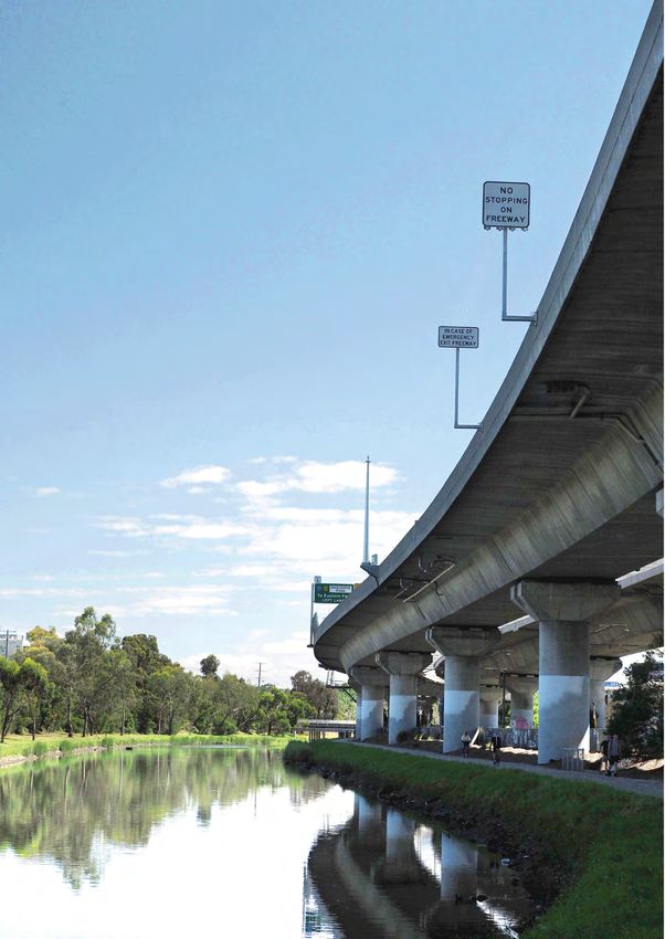
OVERVIEW

The lower reaches of Moonee Ponds Creek – the parts that       Once additional factors are taken into consideration – such
flow through the City of Melbourne – are set to become some    as the opening of the new North Melbourne train station
of the most intensely developed parts of Greater Melbourne.    scheduled in 2025 – an already strong case for action
                                                               becomes urgent.
Moonee Ponds Creek runs for 25 kilometres – starting close
to Melbourne Airport and winding through the north west        Without planned, coordinated action, the potential of the
of the city before merging with the Yarra at Docklands.        Moonee Ponds Creek corridor will be squandered and the
                                                               full social and economic value of the area’s urban renewal
Within the City of Melbourne, the creek starts in the north    sites will not be realised.
at Brunswick Road – beside CityLink – and ends in the south
at Docklands.                                                  There is an urgent need to make plans and take actions
                                                               that ensure the Creek can meet current and future
This document focuses on the strategic opportunities           requirements for:
along Moonee Ponds Creek between Brunswick Road and
Docklands, building on and complementing the Chain of          •   public space and community activity
Ponds Masterplan developed by Moreland and Moonee
                                                               •   biodiversity
Valley Councils to the north.
                                                               •   water management
This part of Moonee Ponds Creek can be divided into
three reaches.                                                 •   active transport
                                                               •   heritage and culture.
1.
   North: Brunswick Road to Racecourse Road.
   This is a concrete stormwater drain, with minimal
   public amenity.

2.
   Central: Racecourse Road to Dynon Road.
   This runs through a rapidly-transforming industrial
   area alongside and beneath CityLink, with minimal
   connections east and west of the creek for pedestrians
   and cyclists.

3.
   South: Dynon Road to the Yarra.
   This runs through largely Victorian Government-owned
   land and is overshadowed by the elevated approach to
   the Bolte Bridge and CityLink.

The creek is a popular active transport route from north-
to-south, with the Capital City Trail giving cyclists and
pedestrians direct access to the central city and Docklands.
From east-to-west though, there is a need to link local
communities by creating more pedestrian and cycling
crossings over the creek.

6      melbourne.vic.gov.au
Figure 3. Current Image of creek
Moonee Ponds Creek Strategic Opportunities Plan 78 melbourne.vic.gov.au
CHALLENGES

The Moonee Ponds Creek corridor has enormous potential.          Water management
                                                                 Moonee Ponds Creek has always had a long history
But to realise that potential, three major challenges must       of flooding.
be turned into opportunities.
                                                                 Modelling indicates that, by 2100, flooding risks will
1.    Growth                                                     significantly increase along Moonee Ponds Creek. This
                                                                 is due predominantly to increasing runoff from urban
2.    Water management
                                                                 densification and more extreme rainfall events and rising
                                                                 sea levels due to climate change.
3.    Governance.
                                                                 There is an urgent need for the development and
Growth
                                                                 implementation of sophisticated water management
The lower reach of Moonee Ponds Creek is set to                  strategies. This includes integrating levees and floodable
become one of the most intensely developed parts                 spaces into the public realm.
of Greater Melbourne.
                                                                 Some water management actions will need to be taken
This growth will be driven by a chain of urban renewal sites     up-stream – north of the Brunswick Road boundary of
that run along the creek, from Arden and Macaulay in the         the City of Melbourne.
north to Dynon, E-Gate and Docklands in the south.
                                                                 Governance
Development will accelerate after 2025 with the
                                                                 The City of Melbourne does not own or manage the Moonee
completion of Metro Tunnel project. This will connect Arden
                                                                 Ponds Creek corridor. The majority of the creek corridor –
to Parkville and the central city via a new train line and the
                                                                 together with the Arden, E-gate and Dynon urban renewal
construction of a new ‘North Melbourne’ train station,
                                                                 areas it bisects– are owned and managed by various
with the existing North Melbourne train station to be
                                                                 agencies and departments of the Victorian Government,
renamed West Melbourne.
                                                                 for a variety of different purposes.
The Moonee Ponds Creek corridor needs to be the
                                                                 Consequently, the governance and management of the
green equivalent of the Metro Tunnel – connecting local
                                                                 Creek corridor is complex.
communities to each other and the central city through a
chain of new public spaces, strengthening local biodiversity,
                                                                 For instance:
and protecting the city through better water management.
                                                                 •   The creek runs through four municipalities, Hume,
The West Gate Tunnel project is another growth-related
                                                                     Moonee Valley, Moreland and Melbourne; with different
issue to consider locally. The City of Melbourne is working
                                                                     sides of the creek falling within different municipalities.
with the Victorian Government to minimise the potential
impacts of this project by seeking to increase tree canopy       •   Being at the southern end of the creek catchment, the
cover and active transport links, and develop the Moonee             extent of flooding in the City of Melbourne section is
Ponds Creek Implementation Plan with the Victorian                   impacted significantly by actions further north upstream
Planning Authority.                                                  in the creek.
                                                                 •   Its water resources are managed by Melbourne Water;
                                                                 •   The Victorian Government owns most of the land in the
     “The Moonee Ponds Creek                                        creek corridor through VicTrack, Development Victoria
                                                                     and the Victorian Ports Corporation; and
      corridor needs to be the                                   •   CityLink’s elevated road is privately operated.
      green equivalent of the
                                                                 To unlock the economic, social and environmental potential
      Metro Tunnel.”                                             of the Creek and the adjacent renewal areas – and create
                                                                 a vibrant new part of the inner city – there is a need for a
                                                                 catchment-wide approach to the governance of the Creek
                                                                 corridor, incorporating the Victorian Government and
                                                                 local councils.

                                                                 To work, catchment-wide governance will need to be
                                                                 collaborative and incorporate the views of residents,
                                                                 stakeholders, agencies and municipalities.

                                                                 In all governance-related issues, the City of Melbourne has
                                                                 acted – and will continue to act – as an advocate for the
                                                                 current and future communities of the Moonee Ponds
                                                                 Creek corridor.

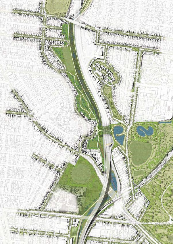
Figure 4. Moonee Ponds Creek North

                                                                     Moonee Ponds Creek Strategic Opportunities Plan               9
MOONEE PONDS CIVIC OVERFLOW ROUTE 10 melbourne.vic.gov.au
STRATEGIC VISION

Moonee Ponds Creek will become a                                 Moonee Ponds Creek:
thriving corridor that supports the                              Key goals by theme
liveability and resilience of the city.
Transformation
To achieve that vision, the three reaches of the Creek that        Water
run through the City of Melbourne need to be transformed.          Management
1.
   North: Brunswick Road to Racecourse Road.                       A resilient creek adapted
   What is now a concrete stormwater drain will be                 to current and future
   remediated – becoming a focal point for the local               extreme weather events
   community and biodiversity.

2.
   Central: Racecourse Road to Dynon Road.
   What is now an industrial area will become an area
   for mixed-use development. The area needs to be                                           Open Space
   revitalised so it connects and supports the growing                                       A diverse network
   communities east and west of the Creek.                                                   of open spaces
                                                                                             to support the
3.
   South: Dynon Road to the Yarra.
   What is now an inaccessible, infrastructure dominated
                                                                                             growing needs
   area will become a significant source of public open                                      of the city
   space in the City of Melbourne, with regionally
   significant benefits as well as benefits for local
   communities and the local environment.

Goals                                                              Biodiversity
To transform Moonee Ponds Creek five goals must                    A healthy
be achieved.                                                       waterway
                                                                   and thriving
1.
   Water management
   Ensure that the creek copes with increased flooding             ecosystem
   risk caused by urban densification as well as climate
   change-induced sea level rises and more frequent
   extreme weather events.

2.
   Open space                                                                                Movement
   Create a diverse network of open spaces                                                   A highly accessible
   large and numerous enough to cater to a                                                   and connected
   rapidly-growing population.                                                               creek corridor
3.   Biodiversity
      Revitalise the creek so that it becomes a rich corridor
       of biodiversity and a thriving habitat for native flora
       and fauna.
                                                                   History
4.
   Movement                                                        and Culture
   Create safe, accessible paths that connect pedestrians
                                                                   A celebrated past
   and cyclists to local communities and facilities on either
   side of the Creek, as well as the Central City.                 and shared vision
                                                                   for the future
5.
   History and culture
   Ensure that the revitalised creek corridor celebrates and
   connects to its Aboriginal heritage and local history,
   and provides new spaces for creativity and public art.                                    Collaborative
6. 	Collaborative Governance.                                                               Governance
     Advocate for transformational change and continue                                       Advocate for
     to work with Councils, Authorities and the community                                    transformational
     to take an integrated catchment management approach.                                    change
Figure 5. Artistic impression of ‘Moonee Ponds Creek
Civic Overflow Route’- after a high water event.

                                                                  Moonee Ponds Creek Strategic Opportunities Plan   11
Brunswick Road
Future Character Reach
Key projects identified in the strategic
opportunities section are spatially located
in the following pages under each character
reach. Visualisations, precedent imagery
and text describe the potential character
and programme of each project.
Tullamarine Freeway
North Debneys
Park
Brunswick Road to Racecourse Road
‘The Collector’
Royal Park
A green open space, collecting Racecourse Ro
ad Flemington
and cleansing water, attracting Bridge Station
and growing community.
Macaulay
Macaulay Ro Station
ad
Central
Racecourse Road to Dynon Road
‘The Urban Connector’
An urban creek interface creating
engaging places for people.
Arden Street
Dynon Road
South
Dynon Road to the Yarra
‘The Tidal Underpass’
A stormwater park and biodiversity
hotspot. A place to meander and Footscray Road West
rest by the waters edge. Melbourne Station
[Former North Melbourne]
E-Gate
Docklands
Ron Barrassi
Snr Park
Yarra River
0 100 300 500 M N
Figure 6. Plan: Future vision of Moonee Ponds Creek.
12 melbourne.vic.gov.auOPPORTUNITIES
The strategic opportunities proposed to improve the
creek corridor and achieve the vision, are identified
over the following pages. Some are focussed on specific
opportunities at points along the waterway, while others
are in multiple locations or intended for the whole corridor.
The information concerning the proposed opportunities,
their location, the major themes they respond to as well
as the additional co-benefits, are contained in the table at
Appendix 1. All initiatives have been assigned a reference
number and these reference numbers are used to locate the
initiatives on the corresponding creek corridor maps.
Interpreting the Key:
The letter identifies the key theme, for example, ‘W1’ relates
to opportunity number 1 under the water management
theme. The icons underneath each opportunity identifies
the related themes or co-benefits that the opportunity can
also deliver.
For example:
W1 - Redesign of Bridges
Remove or re-construct pipe bridges and transport
bridges to reduce the hydraulic constraints they impose,
while improving cycle and pedestrian connections.
W1 has both a water management theme and
a movement co-benefit.
W1
“Consultation on this draft plan
may also elicit additional ideas
about how the Creek corridor
can be improved.”
Moonee Ponds Creek Strategic Opportunities Plan 13North: Brunswick Road
to Racecourse Road
Create a green gateway to the municipality:
a parkland and waterway equivalent to the Metro Tunnel.
Travencore Park Creek Naturalisation Redesign of Bridges
Remove the existing concrete channel and re-naturalise the Remove or re-construct pipe bridges and transport bridges
creek by reinstating a chain of ponds featuring indigenous to reduce the hydraulic constraints they impose, while
plantings, rockwork and wetlands that create a habitat for improving cycle and pedestrian connections.
threatened species. Address flood mitigation and connect
the naturalised creek with Travancore Park in the City of W1
Moonee Valley.
W2 CityLink Water Collection
Harvest runoff from CityLink and divert it into
reconstructed ponds, wetlands and water treatment
Community Canvas zones along the creek.
Use the motorway noise wall as a canvas for art, light
W10
installations and cinema screenings. Integrate the wall as
a feature of the park and as a backdrop for community
and council activities.
Moonee Ponds Creek Cycling & Walking Trails
H2 Create a separated, high-speed commuter path for cyclists
as well as local bike hubs, rest stops and picnic facilities.
Travencore Park Ponds M6
Widen the creek channel and create a series of ponds
that can be used as water storage.
CityLink Land Bridge
W9 Explore a new connection that links the communities
divided by CityLink, potentially creating a biodiversity
connection between Royal Park (on the east side of the
Mt Alexander Road Nature Gateway motorway) and the creek (on the west side) as proposed
Increase the capacity of the detention basin at Melbourne’s in the Chain of Ponds Masterplan.
art gateway to help mitigate flooding. Create a natural
B1
landscape for the basin to provide amenity in high and low
flood conditions.
W3 Flemington Bridge Station Connection Upgrade
Upgrade the connections between the creek and
Flemington Bridge Station.
Debney’s Water Park
Create physical connections between Flemington Housing M1
Estate and the creek. Mitigate against flooding by
investigating the creation of a Debney’s Water Park.
Novel Habitats
W4 Where natural habitats cannot be achieved,
create novel habitats such as bee hotels, wildlife hollows
and in-stream habitat structures. Create nesting boxes
and wildlife habitats in hard structures, such as bridges
and the noise wall.
B7
Figure 7. Future strategic vision for ‘The Collector’
14 melbourne.vic.gov.auW1
Brunswick
Road
enue
Gibson Av
Park Street
Moon
e
e Pon
W2
W2
ds Cr
eek T
rail
H2
Cit
ylin
Travancore
k(
Park
Mo
Tol
olt
lro
an
ad
St
)
re
et
W10
en
AV ue
EN UE
GA
M6
LLEAv
aLlaAd
VIlle
DaAAAv
rkvi
PARK
VeEnNu
Pa
UeE
W9
W9
Storage
B1 Wetlands Trin Warren Tam_
Park boore Bellbird
Waterhole
Mooltan Street
Delth
Reserve
Mt
Al
Manningham
ex
an
de
B7
rR
Debney’s Park
oa
d
Street
et
Royal Park
e
W3
W3
Str
ia
tor
Vic
Flemington
Housing Estate W1
W4
W4
l
ai
Tr
M1
M1
ek
re
Flemington
C
ds
Bridge Station
n
Po
e
ne
oo
M
Fl
W10
em
in
gt
0 30 100 150 M N
y
Boundar
on
Ro
Road
a
d
Moonee Ponds Creek Strategic Opportunities Plan 15Central: Racecourse Road
to Dynon Road
Create a green oasis on the doorstep of the CBD:
the first major addition of parklands to the inner
north-west since the Gold Rush
Arden-Macaulay Pedestrian Bridges Levees as Places for People
To connect Arden-Macaulay with existing communities Design levees that as well as increasing flood capacity
through new lightweight pedestrian bridges that could also create places for recreation and habitats to
incorporate art initiatives. support ecology.
M5 OS1
Expanded Creek Environs Macaulay Terraces
Merge existing open spaces with the waterway, create Create a major new open space connecting to the
a new pedestrian connection along the western edge Moonee Ponds Creek Trail,Macaulay Train Station,
of the creek and expanding the creek environs to facilitate and surrounding neighbourhoods.
recreation opportunities and extensive tree planting.
OS4
OS3
Moonee Ponds Creek Civic Overflow Route
Macaulay Green Links
Create an overflow creek pathway behind the levee that
Increase green spaces and boost stormwater management connects Racecourse and Macaulay Roads.
and biodiversity links on the east side of the creek by
expanding the creek parklands to include roads that W5
currently connect to railways.
OS2
Levee Banks Water Storage
Construct culverts under levees to
re-engage the floodplain storage and improve use of
Langford Road Linear Stormwater Park
western creek berms south of Macaulay Road to improve
Manage stormwater and create more public open space
open space.
by creating a linear stormwater park at Langford Road.
W8
W6
Expanded Creek Environs
Moonee Ponds Creek Art Trail
Expand the creek corridor environs to Arden Central
Investigate creative opportunities along the creek that
providing connections to future open spaces and explore
celebrate the Aboriginal and local heritage of the area
opportunities to celebrate water in the landscape.
and the role of the creek in water management.
B1
H1
Native Grassland Restoration
Moonee Ponds Creek Cycling & Walking Trails
Restore native vegetation, including brackish grasslands
Create a separated, high-speed commuter path for cyclists of the creek corridor.
as well as local bike hubs, rest stops and picnic facilities.
B6
M6
Redesign of Bridges
Remove or re-construct pipe bridges and transport
bridges to reduce the hydraulic constraints they impose,
while improving cycle and pedestrian connections.
W1
Figure 8. Future Strategic Vision For ‘The Urban Connector’
16 melbourne.vic.gov.auFlemington
Racecourse Bridge Station
Road
W1
OS3
M6
Parsons St
reet M5
OS2 Alfred St
reet
OS1
y Road
W5
Boundar
Smith Stre M5
et
reet
OS2 Sutton Stre
W10 et
Stubbs St
OS3
Robertson M5
Street
OS2 Mark Stre
et
OS4 Macaulay
Station
Macaulay
Road
W1
Macaulay
Road
MOONEE PONDS CREEK TRAIL
Chelmsford St
reet
Langford
Clayton
Reserve
M5
Cityli
M
ac
Street
Straker Street
au
la
nk (To
y
Ro
a
B6 W6 t
d
e
llroad
re
St
ie
ac
Gr
)
W8
M5
Arden Stre
et
W1
Arden Stre
et
et
re
St M6
d
oy
Ll
B6 H1
W1
OS3
W1
0 30 100 150 M N
Moonee Ponds Creek Strategic Opportunities Plan 17KEY STRATEGIC PROJECT
OS4 Macaulay Terraces
Shared street Levee Wall
• Raised, shared street with public • Levee wall as dynamic flood gate
park/plaza. with integrated grassed berm.
Berm to include terrace seating
• Tree lined, street and park with
facing plaza.
tables and chairs.
Stormwater-cleansing terraces Picnic terraces
• Terraced landscape as stormwater • Terraces with shelter
cleansing system capturing and picnic facilities.
street and bridge water runoff
and cleansing before water enters
Moonee Ponds Creek.
Figure 9. Artistic impression of ‘Macaulay Terrace’
18 melbourne.vic.gov.auSloped lawn
• Sloped lawn with trees running down
to creek as an activated edge.
• Accessible ramp down to waters edge.
Expanded riparian zone
• Widening of creek riparian zone.
Creek corridor rehabilitation
• Revegetation of native
riparian species.
Celebration of water transition
• Formalisation and celebration
of saltwater/freshwater transition.
Inviting public interaction
with water.
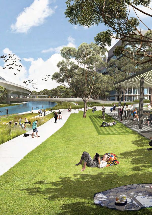
Moonee Ponds Creek Strategic Opportunities Plan 19‘MACAULAY TERRACE’ A SUNNY AFTERNOON 20 melbourne.vic.gov.au
Moonee Ponds Creek Strategic Opportunities Plan
21
                                                  Figure 10. Artistic impression of the ‘Macaulay Terrace’ a sunny afternoon.
‘MACAULAY TERRACE’ A MAJOR RAIN EVENT 22 melbourne.vic.gov.au
Moonee Ponds Creek Strategic Opportunities Plan
23
                                                  Figure 11. Artistic impression of ‘Macaulay Terrace’ - a major rain event.
South: Dynon Road to the Yarra
Create a wetlands wilderness on the doorstep of the
central city: a re-connection to the ‘temperate Kakadu’
of Aboriginal Melbourne.
Dynon Canal Cycle Link E-Gate Stormwater Park
Investigate rehabilitation of the Dynon Road tidal canal and A series of wetlands capture and cleanse catchment
build a shaded and shared path for cyclists and pedestrians. stormwater before entering Moonee Ponds Creek that
could be used for park irrigation and other grey water uses.
M2
W7
The Research Wetlands
Create a series of biodiverse wetlands with varying E-Gate Saltmarsh and Mangrove Reserve
vegetation, habitat and ecologies as a site for research and Create saltmarsh and mangroves reserves, converting
education. Opportunities to research the value of carbon decommissioned rail bridges into pedestrian and bicycle
sequestration ecologies such as mangroves. A simple bridges to link both sides of the creek and investigate a
boardwalk system would allow passive public enjoyment tidal barrier to guard against tidal surges.
of the landscape. B2
B8
Expanded Salt Marsh Zone
The Connected Veloway Create opportunities for enhanced biodiversity and habitats
Leverage West Gate Tunnel works to improve cycling in the creek at Docklands through expanded salt marshes
connections, including a new veloway that gives safe access that are important for carbon sequestration.
to Footscray Road and the Moonee Ponds Creek Trail. B3
M3
Fishermans Bend Connection
Docklands Biodiversity Hot Spot Create a link from Docklands to Fishermans Bend,
Expand the creek corridor, creating wetlands and detention connecting the urban renewal areas of Melbourne
ponds with a focus on flood mitigation and new habitat and the water story of the city.
for threatened species - its isolation could be beneficial M4
for fragile ecologies.
B4
Redesign of Bridges
Remove or re-construct pipe bridges and transport
Moonee Ponds Creek Mouth - A Community Hot Spot bridges to reduce the hydraulic constraints they impose,
Consider making the mouth of Moonee Ponds Creek – while improving cycle and pedestrian connections.
where it meets the Yarra – a community meeting place
W1
with a boardwalk and recreational activities.
OS5
CityLink Water Collection
Harvest runoff from CityLink and divert it into
Moonee Ponds Creek Cycling & Walking Trails reconstructed ponds, wetlands and water treatment
Create a separated, high-speed commuter path for cyclists zones along the creek.
as well as local bike hubs, rest stops and picnic facilities. W10
M6
Figure 12. Future strategic vision for ‘The Tidal Underpass’
24 melbourne.vic.gov.auDyn
on
Roa
d
M2
W1
W7
B8
s
as
rp
ve
lO
n ne
Tu B2
te
t Ga
es
W
W10 E-Gate
M3
W1
Foo
t scr
ay
Roa
d
M6
B4
Trail
nds Creek
Moonee Po
Citylink (Tollroad)
Pe
a
rl R
ive
rR
oa
d
B3
Docklands
ive
Dr
nds
Port c kla
B5 W10 Do
Ron Barrassi
Snr Park
OS5
M4
Yarra River
0 30 100 150 M N
Moonee Ponds Creek Strategic Opportunities Plan 25The Tidal Underpass
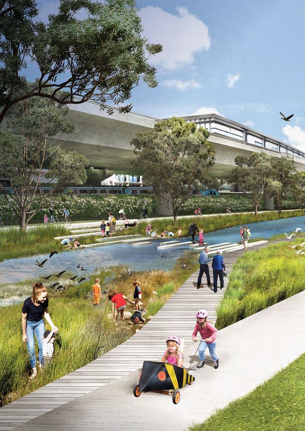
B8 The Research Wetlands
• Salt-water wetlands fed by Moonee Ponds Creek.
Piped network allows flexibility and control over
water levels. Varying water levels, and therefore and
salt, create varying vegetation, habitat and ecologies.
Area to be a site for education and research, with
links to surrounding universities.
• Capture of Citylink stormwater to be pre-treated
and discharged into wetlands for cleansing.
• Simple boardwalk system moving through site allow
passive public enjoyment with the landscape.
Figure 13. Artist impression of the northern section of ‘The Tidal Underpass’
26 melbourne.vic.gov.auMoonee Ponds Creek W7 E-Gate Stormwater Park
• Widened salt marsh • Capture of stormwater to be pre-treated and
and mangrove zone. discharged into wetlands for cleansing before
entering Moonee Ponds Creek.
• Reuse of train bridges
as pedestrian crossing • Simple boardwalk system moving through
site allow passive public engagement with the
landscape, with connections to North Melbourne.
B2 E-Gate Saltmarsh and Mangrove Reserve
• Expansion of creek to create a widened water
body and increase the perimeter ecology.
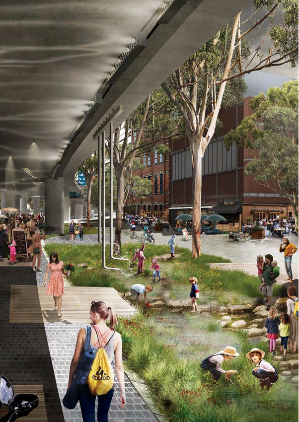
Moonee Ponds Creek Strategic Opportunities Plan 27‘TIDAL UNDERPASS’ SUNDAY MORNING 28 melbourne.vic.gov.au
Moonee Ponds Creek Strategic Opportunities Plan
29
                                                  Figure 14: Artistic impression of the ‘Tidal Underpass’ - Sunday morning.
WHAT NEXT? The City of Melbourne will continue to be an advocate for the transformation of the creek for current and future communities of the Moonee Ponds Creek corridor. This will be progressed in collaboration with stakeholders in the Victorian Government, other partner agencies and the community. The Victorian Planning Authority (VPA) is leading the development of a Moonee Ponds Creek Implementation Plan, in conjunction with City of Melbourne. That plan will build on the engagement outcomes of this draft opportunities plan and seek to prioritise the implementation of key projects along the creek. For more information, to give feedback on the opportunities and identify your priorities about the Moonee Ponds Creek Strategic Opportunities Plan, please visit www.melbourne.vic.gov.au. https://participate.melbourne.vic.gov.au/moonee-ponds- creek On page 31, this table lists all identified Strategic Opportunities by Project Location and Project Co-benefits. 30 melbourne.vic.gov.au
APPENDIX I
ID    INITIATIVE NAME                   LOCATION                             PROJECT CO-BENEFITS

                                                             Water        Open      Biodiversity   Movement    History
                                                             management   Space                                & culture

     LEAD THEME: WATER MANAGEMENT

W1   Redesign of Bridges                Multiple locations

W2   Travencore Park Creek              North
     Naturalisation
W3   Mt Alexander Road Nature Gateway   North

W4   Debneys Water Park                 North

W5   Moonee Ponds Creek
                                        Central
     Civic Overflow Route
W6   Langford Road Linear
                                        Central
     Stormwater Park
W7   E-Gate Stormwater Park             South

W8   Levee Banks Water Storage          Central

W9   Travencore Park Ponds              North

W10 CityLink Water Collection           Multiple locations

     LEAD THEME: OPEN SPACE

OS1 Levees as Places for People         Central

OS2 Macaulay Green Links                Central

OS3 Expanded Creek Environs             Central

OS4 Macaulay Terraces                   Central

OS5 Moonee Ponds Creek Mouth –          South
     A Community Hotspot

     LEAD THEME: BIODIVERSITY

B1   CityLink Land Bridge               North

B2   E-Gate Saltmarsh and               South
     Mangrove Reserve
B3   Expanded Salt Marsh Zone           South

B4   Docklands Biodiversity Hotspot     South

B5   Moonee Ponds Creek Forest          Length of Creek

B6   Native Grassland Restoration       Central

B7   Novel Habitats                     North

B8   The Research Wetlands              South

     LEAD THEME: MOVEMENT

M1   Flemington Bridge Station          North
     Connection Upgrade
M2   Dynon Canal Cycle Link             South

M3   The Connected Veloway              South

M4   Fisherman’s Bend Connection        South

M5   Arden-Macaulay Pedestrian Bridges Central

M6   Moonee Ponds Creek Cycling         Length of Creek
     and Walking Trails

     LEAD THEME: HISTORY & CULTURE

H1   Moonee Ponds Creek Art Trail       Length of Creek

H2   Community Canvas                   North

                                                                     Moonee Ponds Creek Strategic Opportunities Plan       31
APPENDIX II - GLOSSARY OF TERMS Structure Plan - Provides a long-term vision and associated actions to manage change and growth in a defined area. Riparian Zone - Wetlands area adjacent to rivers, streams, creeks and water bodies. Berm - a flat strip of land, raised bank or terrace bordering a river or creek. APPENDIX III – ACKNOWLEDGEMENTS The City of Melbourne would like to acknowledge and thank the following people who contributed to this plan: McGregor Coxall and Wave Consulting; Victorian Planning Authority; Further acknowledgments will be included in the final version. 32 melbourne.vic.gov.au
APPENDIX IV - PHOTO REFERENCES

Figure 1. History - Diagram showing evolution of
the creek corridor

Figure 2. Map showing growth narrative around the Creek

Figure 3. Current Image of creek
Credit: City of Melbourne

Figure 4. Moonee Ponds Creek North
Credit: McGregor Coxall

Figure 5. Artistic impression of W5 ‘Moonee Ponds Creek
Civic Overflow Route - after a high water event’
Credit: McGregor Coxall

Figure 6. Plan: Future vision of Moonee Ponds Creek
Credit: McGregor Coxall

Figure 7. Future strategic vision for ‘The Collector’
Credit: McGregor Coxall

Figure 8. Future Strategic Vision For ‘The Urban Connector’
Credit: McGregor Coxall

Figure 9. Artistic impression of ‘Macaulay Terrace’
Credit: McGregor Coxall

Figure 10. Artistic impression of the ‘Macaulay Terrace’
A Sunny Afternoon
Credit: McGregor Coxall

Figure 11. Artistic impression of ‘Macaulay Terrace’ -
a major rain event
Credit: McGregor Coxall

Figure 12. Future strategic vision for ‘The Tidal Underpass’
Credit: McGregor Coxall

Figure 13. Artist impression of the northern section of
‘The Tidal Underpass’
Credit: McGregor Coxall

Figure 14. Artistic impression of the ‘Tidal Underpass’ -
Sunday Morning
Credit: McGregor Coxall

                                                               Moonee Ponds Creek Strategic Opportunities Plan   33
melbourne.vic.gov.au
You can also read


