DRONES ON THE HORIZON - TRANSFORMING AFRICA'S AGRICULTURE - Africa Goes Digital
←
→
Page content transcription
If your browser does not render page correctly, please read the page content below
DRONES ON THE HORIZON
TRANSFORMING AFRICA’S AGRICULTURE

HIGH LEVEL APET REPORT • DRONES ON THE HORIZON TRANSFORMING AFRICA’S AGRICULTURE

                                           About the AU and NEPAD

The African Union (AU)
The African Union (AU) is a continental union consisting of all 55 countries on the African continent. It was established on 26 May
2001 in Addis Ababa, Ethiopia, and launched on 9 July 2002 in South Africa, with the aim of replacing the Organisation of African
Unity (OAU). The most important decisions of the AU are made by the Assembly of the African Union, a semi-annual meeting of the
heads of state and government of its member states. The AU’s secretariat, the African Union Commission, is based in Addis Ababa.

The AU was established following the 9th September 1999 Sirte Declaration of the Heads of State and Governments of the
Organisation of the African Unity (OAU). The AU is based on a common vision of a united and strong Africa and on the need to build
a partnership between governments and all segments of civil society, in particular, women, the youth and the private sector, in order
to strengthen solidarity and cohesion amongst the peoples of Africa. As a continental organization, it focuses on the promotion of
peace, security and stability. The development work of the AU is guided by the AU Agenda 2063, which is a 50-year plan to harness
Africa’s comparative advantage to deliver on the vision of “The Africa We Want”.

The New Partnership for Africa’s Development (NEPAD)
Created by the African Union, the New Partnership for Africa’s Development (NEPAD) is a strategic framework for pan-African socio-
economic development. NEPAD is spearheaded by African leaders to address critical challenges facing the continent, including
poverty, development and Africa’s international marginalization. NEPAD provides unique opportunities for African countries to
take full control of their development agendas, to work more closely together and to cooperate more effectively with international
partners.

NEPAD is coordinated and facilitated by the NEPAD Planning and Coordinating Agency (NEPAD Agency) which was established in
February 2010 as an outcome of the integration of NEPAD into the AU’s structures and processes. The NEPAD Agency manages
a number of programmes and projects in four investment portfolios, namely Natural Resources Governance, Youth and Skills
Development, Regional Integration, Infrastructure and Trade, and Industrialization, Science, Technology and Innovation.

                                                                                                                                        i
HIGH LEVEL APET REPORT • DRONES ON THE HORIZON TRANSFORMING AFRICA’S AGRICULTURE

        Members of the High-Level African Panel on Emerging Technologies

     Co-chairs
     Calestous Juma, John F. Kennedy School of Government, Harvard University, USA (Deceased)
     Yaye Kène Gassama, Université Cheikh Anta Diop de Dakar, Senegal

     Panel Members
     Abdallah Daar, University of Toronto, Canada
     Berhanu M. Abegaz, African Academy of Sciences, Ethiopia
     Francine Ntoumi, Fondation Congolaise pour la Recherche Médicale, Congo-Brazzaville
     Karim Maredia, Michigan State University (MSU), East Lansing, Michigan, USA
     Oye Ibidapo-Obe, Federal University Ndufu Alike, Ikwo (FUNAI), Nigeria
     Rachel Chikwamba, Council for Scientific and Industrial Research (CSIR), South Africa
     Roseanne Diab, Academy of Science of South Africa (ASSAf), South Africa
     Shireen Assem, the Agricultural Genetic Engineering and Biotechnology Research Institute (AGERI), Egypt

     Secretariat
     Aggrey Ambali (Coordinator) – NEPAD Agency                       Margaret Mahlomuza – NEPAD Agency
     Diran Makinde – NEPAD Agency                                     Barbara Glover – NEPAD Agency
     Towela Nyirenda-Jere – NEPAD Agency                              Mahama Ouedraogo – African Union Commission
     Jeremy Ouedraogo – NEPAD Agency                                  Monica Idinoba – Africa Union Commission
     Hlazo Mkandawire – NEPAD Agency                                  Hambani Masheleni – Africa Union Commission
     Hudu Mogtari – NEPAD Agency                                      Kate Bauer – Harvard University
     Justina Dugbazah – NEPAD Agency

     Research
     Frederick Mbuya (Uhurulabs), Giacomo Rambaldi (Technical Centre for Agricultural and Rural Cooperation ACP-EU), Hamza
     Rkha Chaham (AIRINOV), Kassahun Takele Maru (Haramaya University), Ademola Omojola (University of Lagos), Paxie Chirwa
     (University of South Africa), Diran Makinde(NEPAD Agency), Chris Leaver (University of Oxford), Towela Nyirenda-Jere (NEPAD
     Agency), Aggrey Ambali (NEPAD Agency), Walter Alhassan (Biotechnology and Stewardship for Sustainable Agriculture in West
     Africa)

     Acknowledgements
     We thank the various experts identified by the African Union High-Level Panel, who made contributions and comments on earlier
     versions of this report.
     The NEPAD Agency acknowledges the support of the Technical Centre for Agricultural and Rural Cooperation (CTA) in editing and
     translating the Drones report from English to French.

ii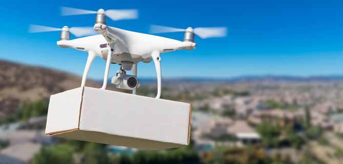
HIGH LEVEL APET REPORT • DRONES ON THE HORIZON TRANSFORMING AFRICA’S AGRICULTURE

                                                 Table of Contents

About the AU and NEPAD                                                                          i
     The African Union (AU)                                                                     i
     The New Partnership for Africa’s Development (NEPAD)                                       i

Members of the High-Level African Panel on Emerging Technologies                               ii
    Co-chairs                                                                                  ii
     Panel Members                                                                             ii
     Secretariat                                                                               ii
     Research                                                                                  ii
     Acknowledgements                                                                          ii

Figures                                                                                        v
Tables                                                                                         v
Acronyms                                                                                      vi
Executive summary                                                                             1
1    Introduction                                                                             3
2    A critical analysis of drones in precision agriculture                                   5
     2.1       Drone types                                                                    5
              2.1.1    Multirotor UAVs                                                         6
              2.1.2    Fixed wing UAVs                                                        7
              2.1.3    Vertical take-off and landing (VTOL)                                   7
     2.2      Emerging civil applications of drones                                           7
              2.2.1    Land mapping and surveying                                             7
              2.2.2    Land tenure and land use planning                                      8
              2.2.3    Cargo delivery                                                         8
              2.2.4    Management of agricultural assets                                      8
              2.2.5    Scientific research                                                    9
              2.2.6    Insurance and damage assessments                                       9
     2.3      Complementary technologies                                                      9
     2.4      Maturity and readiness for implementation                                       11
              2.4.1    Market demand                                                          11
              2.4.2    Status of regulations and infrastructure                               11

                                                                                                    iii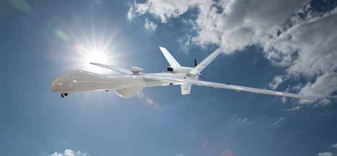
HIGH LEVEL APET REPORT • DRONES ON THE HORIZON TRANSFORMING AFRICA’S AGRICULTURE

     3   Drone implementation in Africa                                                            12
         3.1     Implementation at national level                                                  12
                   3.1.1    Land use planning and land tenure                                      12
                   3.1.2    Small-scale farming and agribusiness                                   12
                   3.1.3    Humanitarian and emergency relief                                      13
                   3.1.4    Surveillance and monitoring                                            13
                   3.1.5    Wildlife monitoring and protection                                     13
                   3.1.6    Cargo delivery                                                         14
         3.2       Implementation at regional level                                                14

     4   Public policy and regulatory systems                                                      15
         4.1      Governance                                                                       15
         4.2       Policies and regulations                                                        16

     5   Challenges and forthcoming solutions                                                      18
         5.1     Technology                                                                        18
         5.2       Economic                                                                        19
         5.3       Legal and regulatory                                                            20
         5.4       Social                                                                          22

     6   Opportunities for leapfrogging                                                            24
         6.1     Public-private partnerships (PPPs)                                                24
         6.2       Research and development (R&D)                                                  24
         6.3       Capacity building and the emergence of new enterprises                          24
         6.4       Intellectual property (IP)                                                      25
         6.5       Increased interest shown by development agencies                                25
         6.6       Decreasing technology costs                                                     25
         6.7       High demand for timely actionable information                                   25
         6.8       Widespread accessibility to free quality satellite imagery                      26
         6.9       Natural resources monitoring and surveillance                                   26
         6.10      Easy-to-deploy solutions for reaching poorly accessible areas                   26

     7   Conclusion                                                                                27

     8   Recommendations                                                                           28

     9   Bibliography                                                                              30

iv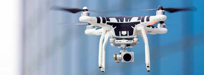
HIGH LEVEL APET REPORT • DRONES ON THE HORIZON TRANSFORMING AFRICA’S AGRICULTURE

                                                   Figures

Figure 1: Examples of multirotor UAVs                                                        6

Figure 2: Examples of fixed wing UAVs                                                        7

Figure 3: Examples of VTOL UAVs                                                              7

Figure 4: Governance architecture for UAS                                                    16

Figure 5: Status of UAV regulations                                                          17

                                                   Tables

Table 1: Drone classification by size and weight                                             5

                                                                                                  v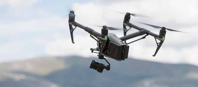
HIGH LEVEL APET REPORT • DRONES ON THE HORIZON TRANSFORMING AFRICA’S AGRICULTURE

                                                          Acronyms

     AU       African Union

     AUC      African Union Commission

     CIP      Crop Intensification Program

     CPA      Conventionally Piloted Aircraft

     CTA      Technical Centre for Agricultural and Rural Cooperation ACP-EU

     EAC      East African Community

     EC       European Commission

     EU       European Union

     FAO      Food and Agricultural Organization of the United Nations

     FSD      Swiss Foundation for Mine Action

     GIS      Geographical Information Systems

     GNSS     Global Navigation Satellite Systems

     GPS      Global Positioning System

     IAEA     International Atomic Energy Agency

     ICAO     International Civil Aviation Organization

     ICT      Information and Communication Technology

     IP       Intellectual Property

     LAI      Leaf Area Index

     NCAA     National Civil Aviation Authority

vi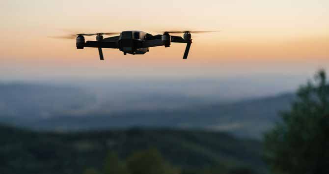
HIGH LEVEL APET REPORT • DRONES ON THE HORIZON TRANSFORMING AFRICA’S AGRICULTURE

NDVI       Normalized Difference Vegetation Index

NEPAD      New Partnership for Africa’s Development

PPP        Public-Private Partnership

PRI        Photochemical Reflectance Index

PwC        PricewaterhouseCoopers

R&D        Research and Development

RGB        Red, Green, Blue

ROMEO      Remotely Operated Mosquito Emission Operation

RPAS       Remotely Piloted Aircraft Systems

SDGs       Sustainable Development Goals

STISA      Science Technology Innovation Strategy for Africa

UAS        Unmanned Aerial System

UAV        Unmanned Aerial Vehicle

UNICEF     United Nations Children’s Fund

USAID      United States Agency for International Development

VTOL       Vertical Take-off and Landing

WFP        World Food Programme

                                                                                            vii
HIGH LEVEL APET REPORT • DRONES ON THE HORIZON TRANSFORMING AFRICA’S AGRICULTURE
Executive summary
This report provides a contextualized review of drones as a vital precision agriculture-enabling technology and its range of relevant
uses for providing detailed and on-demand data in order to enhance decision-making by farmers and hence facilitate much needed
support.
Drones for precision agriculture is a farming management concept which is based upon measuring and responding to inter- and
intra-field variability in crop and animal production. It is not just the application of new technologies, but rather it is an information
revolution that can result in a more precise and effective farm management system. Drones, described as unmanned aerial
vehicles (UAVs) or unmanned aerial system (UAS), the latter including the sensor, software, and so forth, have many applications.
These include, but are not limited to, land mapping and surveying, land tenure and land use planning, inspection monitoring and
surveillance, cargo delivery, scientific research, management of agricultural assets and insurance and crop/infrastructure damage
assessment.
In agriculture, there are several major applications of UAS technology, namely crop scouting/monitoring, crop volume and vigour
assessments, crop inventory (or the counting of individual plants), generation of prescription maps (such as location-specific
nitrogen fertilizer dosage recommendations), precision spraying, inspection of farm infrastructure (including irrigation), high-
resolution mapping and surveying of individual fields (such as farm boundary delineations and crop area calculations), crop
damage assessment and insurance claim forensics. Drones equipped with adequate sensors have the capability to generate
remote-sensing data in near real time in the field rather than the resulting lag in data acquisition from satellite and aircraft-based
imagery.
In comparison to satellites, drones can capture very high-resolution imagery under cloud cover and at desired time intervals. It
is this increased ease and speed of acquiring the imagery from drones that has the biggest potential for improving how growers
respond to much needed crop husbandry interventions. However, drones which tend to be equipped with sensors acquire data, not
information. Meanwhile users especially growers, want information that they can interpret and utilize, not data. Hence whatever
data is captured by the drones need to be converted into actionable information for farmers.
The deployment of drone technology in Africa has its own challenges, which may be classified under four broad categories; namely
technological, economic, social, and legal and regulatory. These include capability, reliability and battery autonomy; commercial
batteries for small UAVs allow 24-40 minutes flight fully charged before battery replacement is required. UAV’s reliance on
communications from a ground operator for control make them vulnerable to signal loss from interference, flying out of range or
hacking. While the demand and provision of UAS services is increasing exponentially where crops are grown as monoculture on
large holdings, the adoption of UAV technology in the framework of small-scale, multi-crop farming systems in African countries
remains a challenge.
More importantly, a skilled workforce is required by the UAV industry whose competences range from planning flight itineraries,
piloting UAVs, operating GIS and data analysis software, interpreting data, and providing agronomic or spatial planning advice.
There exist social challenges, which span a range of issues including security, the right for privacy, data acquisition, storage and
management, causing harm or nuisance to people and animals, damaging property, employment, etc. UAV regulations are still in
its infancy in Africa, the making and the presence of too restrictive, or even disabling regulations governing the import and use of
1HIGH LEVEL APET REPORT • DRONES ON THE HORIZON TRANSFORMING AFRICA’S AGRICULTURE
UAVs can hinder the development of a very promising industry, which could attract and engage educated youth in rural areas. In
some cases, government agencies or the private sector are already working on solutions that are described in this report.
In conclusion, this report considers drone technology for precision agriculture as a potential game-changer for the African continent.
The report recommends that the adoption, deployment and upscaling of UAS in the context of precision agriculture is considered
as a priority. Key areas to be considered in upscaling the technology and realising its potential include capacity-building, enabling
or supporting infrastructure, regulatory strengthening, research and development and stakeholder engagement. In this regard, the
AU High Level Panel recommends the following to the AU organs, member states and Regional Economic Communities (RECs):
At the national level:
• Assess the opportunity cost of UAV technology including external factors and balance it against expected outcomes
such as food security, improved health and the potential for drones to make agriculture attractive to the youth.
• Ensure that stakeholders are engaged in all aspects related to the introduction of UAV technology so that potential
resistance is understood and dealt with systematically.
• Conduct public awareness around UASs and their civil applications to clearly distinguish between civil and military
uses and thereby improve public acceptance. Safety, security and privacy concerns need to be dealt with as part of
this process.
• Address cost and technical barriers to adoption through either subsidies, licensed SMEs or cooperatives and
build a supportive framework for drone governance and regulation to facilitate adoption (including licensing and
registration).
• Encourage and support public-private partnerships for UAV technology uptake.
• Ensure that appropriate national UAV regulations are put in place. Appropriate regulation should strike a balance
between competing public security concerns on the one hand and the need to encourage innovation, economic
development and youth entrepreneurship on the other. In this context, encourage National Civil Aviation Authorities
to establish enabling regulatory frameworks for UAV technology to be deployed and up-scaled to serve precision
agriculture.
• Allocate resources for R&D (cost & benefits) and capacity building to build a critical mass in all aspects of drone
technology such as licensed pilots, scientists and regulators.
• In the context of smallholder farmers, support crop intensification via stimulating the planting of the same crops
simultaneously in contiguous areas to form larger and more rational holdings, which could reap the benefits of UAV
technology for precision agriculture.
At the continental level:
• Develop a continental regulatory framework for the use of UAVs in Africa, and harmonize policies across countries
and regions (regional economic communities)
• Enhance South-South and regional collaborations, partnerships, networks and knowledge-exchanges to facilitate
the upscaling and use of drone technology.
2HIGH LEVEL APET REPORT • DRONES ON THE HORIZON TRANSFORMING AFRICA’S AGRICULTURE
1
Introduction
Agriculture forms the basis for well-being and poverty reduction in Africa. However, with an increase in input costs and uncertainties
of weather patterns, a need has risen for countries to adopt farming practices that will increase yields with lowered inputs while
optimizing profit. Contrary to being self-sufficient in the 1960’s, Africa has currently become a net importer of cereals and other
agricultural products. Additionally, the rising population of the continent remains a serious challenge. For example, it is estimated
that the current population of 1.25 billion will increase to 2.5 billion by 2050 (Blein & Bwalya, 2013). Hence feeding 2 billion people
using existing agricultural interventions will be a difficult task for African countries.
Optimizing agricultural profit through increasing productivity and improved yield has benefitted from several innovative developments
over the years; one of these being the use of drones technology. Whilst such interventions, and the green revolution in particular,
have benefited many developing countries, this has not been the case in Africa. This situation calls for a review of agricultural
policies and practices, and an explicit understanding that enabling policies for the promotion of such drone technologies must be
formulated.
Precision agriculture is a way to apply interventions in the right place at the right time (Gebbers & Adamchuk, 2010). It is considered
to be a modern farming system, supported by different technologies (Yao & Wu, 2011) that are based on detection of variations in
the field and applying each input based on these variations (Robert, 2002). A key feature is the use of global positioning systems
(GPS) and timely spatial data that are major enablers of precision. For example, GPS-based applications in precision farming are
being used for farm planning, field mapping, soil sampling, tractor guidance, crop scouting, variable rate applications and yield
mapping. GPS also allows farmers to work during low visibility field conditions such as rain, dust, fog and darkness (Zarco-Tejada,
2014).
According to Zarco-Tejada et al. (2014), precision agriculture is crucial for the sustainability of agricultural production and
minimizing environmental damage, for example, through reduction of nitrate leaking, improved water-use efficiency and increased
fuel efficiency. Thus, precision agriculture applies various methods such as geographical information systems (GIS) (Talebpour,
Türker, & Yegül, 2015) and remote-sensing, especially temporal and spatially efficient drone-generated data. While GIS techniques
have matured in their use for agricultural decision support, the recent entry of flexible, detailed and timely drone-generated spatial
data is further enhancing precision agriculture applications. Some of advantages of precision agriculture for commercial and
smallholder farmers include the following:
• Economic benefits: Through precision agriculture, an area of land within a field may be managed with different input
levels depending upon crop yield potential (Ajewole et al., 2016). Therefore, input use on specific areas of the farm
can be optimized resulting in increased improved crop production and profit (Godwin, Wood, Taylor, Knight, & Welsh,
2003). However, the cost/benefit analysis of the application of precision agriculture will be dependent on the type of
agriculture and nature of the challenge or threat to yield increase.
3HIGH LEVEL APET REPORT • DRONES ON THE HORIZON TRANSFORMING AFRICA’S AGRICULTURE
• Environmental benefits: Godwin et al. (2003) indicated that precision agriculture helps to protect the environment
from pollution through the use of precise application of pesticides and fertilizers. For instance, the use of variable
rate technology in fertilizer application results in less nitrogen loss (Robertson et al., 2007). Thus, farmers can easily
conform to legal restrictions on agrochemical use (Stoorvogel & Bouma, 2005). In terms of water-use efficiency,
precision agriculture reduces wastage compared to uniform spraying of water or other irrigation systems (Hendriks,
2011).
• Risk reduction: Precision farming provides site-specific management that can help identify problems with
growing conditions, thereby reducing variability in net returns (Ajewole et al., 2016). For instance, soil and weather
information can be used to improve scheduling of operations, which can optimize machinery utilization rates. As a
result, pollution risk can be reduced, as well as the cost of producing a crop in a specified area.
In recent times drones have become one of the world’s most publicized and intriguing technologies that are used by people in a
wide range of professions, from journalism through agriculture to humanitarian aid work. The number of terms used to describe
this technology has also risen and often leads to confusion. Therefore, it is useful to understand the various terms that are
used. Drone is the most commonly used term, but unmanned aerial vehicle (UAV) and unmanned aerial system (UAS) are also
increasingly used. In most cases, the term drone and UAV are considered to be fairly synonymous, while UAS is a reference term
that includes the UAV, the ground control station and the system of connecting the two (UAV Insider, 2013).
The relevance of the precision agriculture-drone nexus in enhancing the socio-economic wellbeing of Africa, through improved food
production and agricultural methods is specifically indicated in some of the Sustainable Development Goals (SDGs), specifically
SDGs 1 and 2, as well as AU Agenda 2063 - The Africa we want, aspirations 1 and 5. It is expected that this AU initiative on emerging
technologies will be working in tandem with Pillars 1 and 6 of the Science Technology and Innovation Strategy for Africa (STISA)
2024.
4HIGH LEVEL APET REPORT • DRONES ON THE HORIZON TRANSFORMING AFRICA’S AGRICULTURE
2
A critical analysis of drones in precision agriculture
To evaluate drone technology in Africa, there have been numerous pilot studies, research and exploratory activities. These have
attempted to determine sectors where drones can be of immediate benefit to the continent and to also ensure that African
countries are primed and ready to embrace this technology as it continues to evolve and offer more potential applications and
benefits. (Efron, 2015) (Hardy, Makame, Cross, Majambere, & Msellem, 2017) (Makoye, 2016) (de Klerk, Droogers, Simons, & van
Til, 2016) (Look, 2013).
Drones can contribute to the development of the continent as this emerging technology provides a ‘leapfrogging’ opportunity for
Africa. In order to understand drones’ full potential for precision agriculture as well as how they can benefit Africa in other ways, it
is important to look at the technology in detail and explore its components as well as a range of selected applications.
2.1 Drone types
There is an ever-growing range of UAVs on the market and this is only set to increase, making it extremely important to first evaluate
the need for UAVs and then consider the options. In drone selection, initial key considerations should be the flight autonomy,
carrying capacity and total weight. All three variables are interdependent; for instance, flight autonomy is often linked to the battery
quality and capacity which in turn, impacts on the total weight. The latter is often the starting point for regulatory guidelines, as
aircraft weight has a direct correlation with its operational risk. Examples of weight and size classifications are detailed in Table 1:
Table 1: Drone classification by size and weight
Class Maximum gross take-off weight Size
Micro 25 kg
5HIGH LEVEL APET REPORT • DRONES ON THE HORIZON TRANSFORMING AFRICA’S AGRICULTURE
The second important element of choice is its mode of control, which can be summarized as follows:
• Full manual control: the pilot has full, unaided control of the aircraft.
• Aided manual control: the pilot is in control but is aided by aircraft-mounted sensors, such as accelerometers, tilt
sensors or GPS sensors.
• Partially automated control: the pilot is typically responsible for setting up the flight, including parameters such as
waypoints (an intermediate point or place on a route or line of travel) and speed when launching the drone. But, once
the drone is airborne, the autopilot takes over and the pilot is only needed in case of an emergency or a change in
flight plan.
• Fully automated: once the aircraft is launched, the pilot does not maintain any form of control.
In addition to the control method, UAVs fall into three main categories. The main types are known as multirotor (or multicopter)
and fixed wing aircrafts. Fixed wing aircrafts usually have the ability to cover a much larger area than a multirotor, while the latter
are easier to pilot and control manually. However, there is a rapidly developing hybrid UAV that has the advantage of the multirotor
vertical take-off, whilst also having the flying range and autonomy of a fixed-wing UAV.
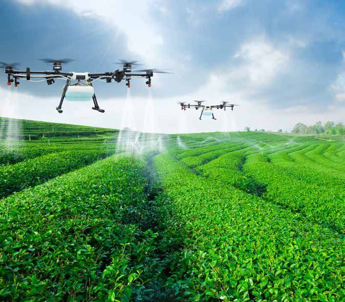
2.1.1 Multirotor UAVs
Multirotor UAVs (Figure 1) are currently the most popular drone type and are defined as a UAV that uses three or more blades to
achieve lift and movement. Companies like DJI1 and Parrot2 have been able to commoditize the multirotor type drones, forcing down
the price and thus removing the cost barrier to using UAVs. The simple rotor mechanics utilized by these UAVs have greatly reduced
the complexity associated with piloting such craft. With better flight control, multirotor aerial vehicles have been extensively used
in applications such as aerial photography and site inspections. One key advantage that multirotors have over fixed wing UAVs is
that they have vertical take-off and landing meaning they need very little space to be deployed.
Figure 1: Examples of multirotor UAVs
1 www.dji.com
2 www.parrot.com
6HIGH LEVEL APET REPORT • DRONES ON THE HORIZON TRANSFORMING AFRICA’S AGRICULTURE
2.1.2 Fixed wing UAVs
There are two main types of fixed wing UAVs: the flying wing (Figure 2, left) and the more traditional airplane configuration (Figure
2, right). Fixed wings need considerably more space for take-off and landing compared to multirotors. However, because of their
improved flight dynamics, they can cover much larger areas making them ideal for applications such as surveillance, land surveys
and large-scale agricultural activities.
Figure 2: Examples of fixed wing UAVs
2.1.3 Vertical take-off and landing (VTOL)
VTOL, or hybrid drones, are a much more recent innovation and take advantage of the multirotor ability for vertical take-off and
landing (Figure 3).
Figure 3: Examples of VTOL UAVs
2.2 Emerging civil applications of drones
2.2.1 Land mapping and surveying
UAVs provide a means of leapfrogging from the traditional methods of land surveying because they can provide accurate data for
faster decision making. UAVs can be deployed rapidly and allow data generation closer to those that will use it as well as provide
a richer dataset of higher resolution and accuracy than using traditional cameras. The data can then be used to generate maps for
7HIGH LEVEL APET REPORT • DRONES ON THE HORIZON TRANSFORMING AFRICA’S AGRICULTURE
land use planning, cadastral generation and/or verification, resettlement and so forth (Zanzibar Commision for Lands, 2017). The
data generated by these surveys also allows research into how low-cost UAVs can be used to generate advanced flood modelling
simulations, therefore replacing the need to use costly and complex manned aircraft. This is demonstrated by Soesilo (2015) in the
drone acquisition for mapping and modelling of flood risks in Dar-es-Salaam, Tanzania.
Until the advent of UAS, the acquisition of mapping and survey data was done either via people surveying on the ground, traditional
manned aircrafts, or satellite imagery. In the USA and many farms in Europe, GPS and associated technology on tractors are
currently used for some of the purposes proposed for drones. One general limitation in UAV mapping is that only those features
that are directly depicted on the aerial images can be modelled. Conventional methods are still needed for the modelling of
obscured features. However, perhaps the most promising aspect of UAV technology is the significant reduction in capital and skills
required for data collection and the ability to rapidly deploy to the field and carry out inspections, monitoring and surveillance.
With the ever increasing demand on natural resources, the ability to closely monitor and get accurate and timely information on
deforestation rates and land degradation for instance, is critical. UAVs offer great opportunities for observing at a distance and
documenting evidence at high resolution.
2.2.2 Land tenure and land use planning
UAVs can be used to accelerate the land registration process, facilitating land tenure assessment and titling. Access to land is
central for ensuring that the millions of people who live in rural Africa have enough food to eat. Even if people are involved in other
trades, land provides an essential safety net during times of economic instability and helps define cultures and identities. The fact
that only 10% of rural land is mapped and registered poses a huge hurdle in overcoming some of the basic land tenure insecurities
experienced by the majority of the African population, especially rural farming communities. In an urban environment, a UAS can
accurately and quickly generate data and high resolution digital elevation models ready for use in land-use planning, verification,
corrections or re-alignment of cadastral boundaries, infrastructure development or upgrading.
2.2.3 Cargo delivery
Where road transport is a challenge for small parcels, UAVs offer the opportunity to change the traditional transport system
and ensure fast airborne delivery. In Africa, the economics of this type of application are at the time of writing, under review in
Madagascar, Malawi and Rwanda (see section 5.4).
2.2.4 Management of agricultural assets
UAS offers a range of exciting opportunities for improving management of agricultural assets. The system provides farmers with a
birds-eye-view of their crops, allowing them to detect subtle changes that cannot be readily identified by ‘crop scouts’ at the ground
level. UAVs equipped with specialized sensors are able to collect multispectral images in order to generate crop data such as
normalized difference vegetation index (NDVI), leaf area index (LAI) or photochemical reflectance index (PRI) which is a measure
of photosynthetic light-use efficiency, thereby allowing users to view crop changes or stress conditions that are otherwise invisible
to the human eye.
NDVI provides information about the different biomass levels within a parcel of land. Interpreted NDVI images provide detailed
information about water pressure, nutrient deficiencies, pest infestations, crop diseases or other conditions affecting crop
development. Imagery indicators such as NDVI, provide a first layer of information that can be added to by information provided
8HIGH LEVEL APET REPORT • DRONES ON THE HORIZON TRANSFORMING AFRICA’S AGRICULTURE
from field visits or a dedicated algorithm. For example, algorithms already exist for fertilization where imagery indicators are
translated into agronomic indicators to guide application of fertilizer.
The data generated by drones can also be used to speed up the process of conducting crop inventories and yield estimates. Cattle
ranchers can also use UAVs to determine the location of their livestock and some have found UAS useful for conducting regular
surveys of fencing (Greenwood, 2016). In Africa, there are increasing efforts for improving farmers’ opportunities to access credit.
The provision of detailed and up-to-date spatially-defined farm data on location, size, standing crops, their health and biomass
can help improve farmers’ credit-worthiness. The field application of this technology is ongoing in Uganda (Rambaldi G, personal
communication 2017).
2.2.5 Scientific research
UAVs are widely used for scientific research. The literature covers a range of UAV uses including archaeological research, measuring
contamination, analysing the ash cloud from volcanic eruptions, examining coastal regions, glacier surveillance, identification of
plant species or phenotyping, plant or game inventorying, among others.
In the domain of agricultural research, once analyzed and interpreted, the high resolution data collected by the UAV’s sensor at
desired intervals offer reliable and objective statistics to compare different micro plots at a given crop development stage and
to better understand the crop cycle. High resolution (e.g. 1 cm/pixel) remote-sensed data can yield information on absorbed
nitrogen, occurrence and distribution of pests, diseases and weeds, water stress, plant density, plant development stages, fresh
biomass, dry matter, etc. Depending on the crops, indicators that can be elaborated include the NDVI, LAI, PRI as well as the green
normalized difference vegetation index, normalized difference red edge index, total chlorophyll index (Cab; i.e. chlorophyll a and
b is used as indicator for the current state of a forest stand and also as an input for various physiological vegetation models),
quantity of chlorophyll per area and more.
2.2.6 Insurance and damage assessments
Farmers in developing countries are slowly buying into crop insurance schemes, but delays in insurance pay-outs can cause
additional stress for affected communities. In India, the national government has been promoting the establishment of a nationwide
insurance scheme supported by UAV technology. The purpose is to ensure rapid assessment and pay-outs of disaster damage,
thereby reducing the financial hardship borne by small-scale farmers (Garg, 2016). Large-scale reinsurers, like Munich Re, have
partnered with UAV data service providers to enhance insurance assessments worldwide by providing faster response times and
increased reporting accuracy in the aftermath of natural disasters (PrecisionHawk, 2016). For the development and humanitarian
sectors, the adoption of UAV data services by insurers offers the opportunity for reducing post-disaster hardship among affected
communities.
2.3 Complementary technologies
There are several complementary technologies which are common to precision agriculture and the use of drones. These
complementary technologies are better understood by looking at the stages involved in the implementation of precision agriculture.
Gottard et al. (1995) revealed that the concept of precision agriculture has been around since very early in the development of
agriculture. However, its practice was facilitated by the development of technology that permitted quantification and differential
management of the natural variability of fields.
9HIGH LEVEL APET REPORT • DRONES ON THE HORIZON TRANSFORMING AFRICA’S AGRICULTURE
The emergence of GPS and the Global Navigation Satellite Systems (GNSS) triggered the evolution of modern precision agriculture.
The ability of farmers and/or researchers to locate their precise position in a field allows spatial variability maps to be created
with as many variables as can be measured (e.g. crop yield, terrain features or topography, organic matter content, moisture
levels, nitrogen levels, pH, etc.). The GNSS is made up of a constellation of earth-orbiting satellites around the world including
the American GPS, Russian Glonass, Europeans Galileo, Chinese Beidou etc. The satellites transmit accurate time and location
information to ground receivers. The location information sent by numerous satellites is received by the ground-receiving units at
a specific time so that the exact location can be determined. Availability of accurate location information at a particular point in
time allows crop, soil and water measurements to be mapped. GNSS receivers which are either carried to the field or mounted on
tractors allow users to return to specific locations to sample or provide appropriate inputs. GNSS-based applications in precision
agriculture are being used for various purposes such as farm planning, field mapping, soil sampling, tractor guidance, crop
scouting, variable rate applications, and yield mapping. GNSS further allows farmers to work during low visibility field conditions
such as rain, dust, fog and darkness.
Another precision agriculture enabling technology is GIS, which is a tool consisting of a hardware-software database system used
to capture, store, retrieve, manipulate, analyze, and display - in map-like form - spatially referenced geographical information. GIS
in the simplest terms is the merging of cartography, statistical analysis and database technology. Orellana et al. (2006) state that
the ability of GIS to analyze and visualize agricultural environments and workflows has proved to be very beneficial to the farming
industry. Boosting a GIS with land-cover data layers has proved helpful to crop growers’ associations, crop insurance companies,
seed and fertilizer companies, farm chemical companies, libraries, universities, federal and state governments and value-added
remote-sensing or GIS companies. Of similar importance to GNSS and GIS in precision agriculture modelling is the use of yield
data. These are crop yield measuring devices that are installed on harvesting equipment. From the monitor, yield is properly
recorded and stored at regular intervals (of distance or time) together with positional data received from the GPS unit. Other data
such as distance and bushels per load, number of loads and fields are also tracked. It is possible to generate yield maps by using
GIS software.
Variable rate technology is another modelling tool which integrates farm field equipment with the capacity to precisely control
tillage operations and the application rate of crop inputs. Variable rate controllers are available for granular, liquid and gaseous
fertilizer or agrochemical materials which enables farmers to add the quantity of crop inputs needed at a precise field location
according to the individual characteristics or requirements of that location.
Last but not least is remote sensing data. Image data generated by remote sensing from soil and crops is processed and added
to a GIS database. There are three sources of remote-sensing data commonly used in agriculture, namely: (i) proximal sensors;
(ii) airborne sensors; and (iii) satellite sensors. Proximal hand-held sensors example, for measuring chlorophyll fluorescence,
are mainly used for basic research. Data obtained by this kind of sensor is used to establish relationships between spectral
behaviour and biophysical parameters of crops under certain stress (nutritional, thermal and water). In aggregate, these field data
are transformed into vegetation indexes that are then related to agronomical parameters, including foliar area index, productivity
and biomass amongst others. Various studies have shown that physical features, such as soil organic matter content, texture and
permeability may be correlated with the spectral response recorded by remote-sensing images (Leone et al., 1995); (Thompson
& Robert, 1994). Thermal temperatures (obtained from thermal images) have also been used to study water content and soil
compaction. The most widely used remote sensing-derived tool is NDVI, which has been related to different crop variables (mainly
yield) and has been used to identify variability in field conditions.
10HIGH LEVEL APET REPORT • DRONES ON THE HORIZON TRANSFORMING AFRICA’S AGRICULTURE
2.4 Maturity and readiness for implementation
2.4.1 Market demand
Drone technologies are considered emerging, and are thus are quite novel, especially in Africa. The readiness with which drone
technologies can be applied to farm production challenges will depend on the demand (pull) for drone technology and the
prevailing barriers to accessing the technology in terms of cost, infrastructure and trained manpower, amongst others. In crisis
situations, many African countries will not hesitate to use drones when exposed to the technology for determining for example,
flood prone areas in Tanzania (Soesilo & Bergtora Sandvik, 2016) and cargo delivery of blood for medical purposes in Rwanda
(Rwanda Biomedical Center, 2016).
In recent times, numerous African countries have encountered a rapid infestation of Fall Armyworms in maize production that have
ravaged about 200,000 ha of farmland in Ghana, for example. The extent of crop devastation and progression of infestation are not
currently known so that effective control can be instituted. The use of remote-sensing facilities like drones (currently not in place)
may allow determination of the extent and progression of infestation in order to put in place effective control practices.
2.4.2 Status of regulations and infrastructure
About 26% of all African countries have UAV regulations in place (https://www.droneregulations.info). Some other countries have
made minor changes to existing regulations and the rest are either in the process of developing regulations for UAVs or have
taken no action (See section 4.2). In addition, the required infrastructure to support drone use and training on piloting and use
of drone data should be promoted. Mauritius, Morocco, Rwanda, South Africa and Tanzania are among the countries where UAVs
are currently deployed for crop scouting purposes but widespread use of drones in agriculture is yet to be adopted across the
continent.
11HIGH LEVEL APET REPORT • DRONES ON THE HORIZON TRANSFORMING AFRICA’S AGRICULTURE
3
Drone implementation in Africa
Drones have been implemented in Africa at both national and regional levels as detailed below:
3.1 Implementation at national level
3.1.1 Land use planning and land tenure
3.1.1.1 Tanzania land tenure
In 2016, the Ministry of Lands in Tanzania conducted a project to evaluate UASs as an option for acquiring aerial imagery to support
a national land tenure programme. The objective of the mission was to determine if UASs are a viable alternative to manned aircraft
and satellite as a source of aerial imagery. A pilot study was conducted and its results were extremely encouraging. The primary
objective was to fly over a distance of 24 km2. This was exceeded, as a total area of 147 km2 was surveyed instead and a ground
sampling distance of 7 cm achieved. A secondary objective which was to determine possible absolute accuracy was also achieved
with ground control points. The Ministry of Lands confirmed absolute accuracy within 2 cm. The work in Tanzania has stimulated
much interest both within Africa and internationally in the use of UASs for land tenure systems (Makoye, 2016).
3.1.1.2 Zanzibar mapping initiative
In November 2016, the Commission for Lands in Zanzibar together with multiple partners, undertook a project to map the whole
of Zanzibar using small-scale drones, with the result that 80% of Zanzibar’s land area was mapped. Although the project is not
yet completed, 15 students and 4 government surveyors have already been trained and 20 drone operating certificates issued to
students and government surveyors (Zanzibar Commission for Lands, 2017).
3.1.2 Small-scale farming and agribusiness
3.1.2.1 UAS supporting small-scale farmers in Mozambique
In the wake of climate change, many farmers are confronted with limited actionable information on where and when to apply
available resources such as water, fertilizer and seed. In Mozambique, an intervention is proving that advice provided by extension
workers who have been using low-cost drones, has helped farmers make informed decisions for improving crop water efficiency
and yields. The Third Eye project, uses recreational drones equipped with near-infrared sensors and tailored software to locally
capture and analyze data. Resulting information is visualized in map form and discussed with farmers who grow beans, maize
and rice. The project area is 1,800 ha and involves 2,800 farmers, 71% of whom are women. A total of 14 extension workers
have been trained to operate the drones and capture, analyze and present findings to the farmers. Data gathered during project
implementation indicates that crop production had increased by 41%, while total water use was reduced by 9%, resulting in a 55%
water productivity increase.
12HIGH LEVEL APET REPORT • DRONES ON THE HORIZON TRANSFORMING AFRICA’S AGRICULTURE
3.1.2.2 UAS services supporting agribusiness in Morocco
In Morocco, UAS services are used to help ensure that there is an efficient application of fertilizers to meet the desired quality of
crops. Les Domaines Agricoles, the largest Moroccan agribusiness, has adopted UAS and agronomic analytics to increase fertilizer
effectiveness and has reported positive outcomes in terms of yield and product quality. The crops they grow include citrus fruits
and aromatic plants, among others.
3.1.3 Humanitarian and emergency relief
3.1.3.1 Flood mapping for disaster risk reduction
With an estimated population of 5 million, and an annual growth rate of 8%, Dar-es-Salaam in Tanzania, is one of Africa’s fastest
growing cities. Over 70% of the population live in informal, unplanned settlements with inadequate infrastructure. In addition, heavy
rainfall twice a year results in significant flood risks. In 2015, a consortium comprising local authorities, the Tanzania Commission
for Science and Technology, two universities and the Buni Innovation Hub led the production of a detailed map of the city. Aerial
imagery at 5 cm resolution and covering an area of 88 km2, was captured over a period of 2 weeks by using fixed wing UAVs. At
present, the map is used for urban planning with a particular emphasis on disaster risk reduction and preparedness for natural
calamities such as floods, as well as health emergencies such as cholera (Soesilo et al., 2016)
3.1.4 Surveillance and monitoring
3.1.4.1 Surveying port facilities in Morocco
Drones are used to survey Casablanca port facilities and monitor ongoing construction. Regular flights are organized over the
port to ensure contractors meet their deadlines. High-definition images which are captured by air-borne sensors, are used by port
officials for monitoring and eventually seeking further information or launching investigations about the progress of ongoing
construction. A multirotor drone flying at a low altitude provides a 3D model that is very useful in terms of topographic information.
3.1.5 Wildlife monitoring and protection
In Africa, protected areas are facing severe challenges. Protected wildlife species are threatened by illegal activities such as
poaching. Although UAV deployment in this context is still new, a few initiatives are worth mentioning. UASs have been used to
survey large mammals in Burkina Faso (Vermeulen et al., 2013). UASs are also used in South Africa’s Kruger National Park to fight
against rhino poaching (Mulero-Pázmány et al., 2014). The Namibian government, through the Namibian defence force, supports
rhino and elephant anti-poaching programmes using UAS (Nkala, 2014). In addition, Conservation Drone, one of the major players
in the use of drones for conservation, conducted a mission with UAVs in the Loango National Park in Gabon and the Tchimpounga
Nature Reserve in Congo (Sweeney, 2015).
The use of UASs to monitor illegal or unsustainable uses of forest resources and land occupancy in general has been initiated in
many parts of the world. International and national non-governmental organisations have been eager adopters of the technology
to empower marginalized communities and indigenous peoples to gather visual evidence of illegal activities by using an ‘eye in the
sky’ (UAV). While there are no documented cases for this UAS application in Africa, examples are known in Asia and Latin America.
13HIGH LEVEL APET REPORT • DRONES ON THE HORIZON TRANSFORMING AFRICA’S AGRICULTURE
3.1.6 Cargo delivery
3.1.6.1 Delivery of health care items
In 2016, the Government of Rwanda partnered with a USA-based robotics company Zipline to launch a delivery programme aimed
at reducing the delivery time of blood (Rwanda Biomedical Center, 2016). In 2017, they were able to achieve this by cutting the
medical facility’s time to procure blood from four hours to 15-minutes (Rosen, 2017).
3.1.6.2 Dispersal of sterile insects for biological control of pests and diseases
Jointly developed by the International Atomic Energy Agency (IAEA), the Food and Agriculture Organization of the United Nations
(FAO), and built by a German drone manufacturer, the UAV used in the Remotely Operated Mosquito Emission Operation (ROMEO)
enabled transport and dispersal of sterile male mosquitoes to provide biological control of mosquitoes which may be the vector
of serious diseases (FAO/IAEA, 2016). A similar initiative has been supported by IAEA in Ethiopia to disperse sterile male Tsetse
flies (Atherton, 2016).
3.2 Implementation at regional level
UAV use is still in its infancy in Africa and there is little in the literature regarding regional projects and initiatives using drone
technology. This is likely to be linked to the fact that UAV governance is handled at national level and the rules and regulations that
apply to UAV use are issued by National Civil Aviation Authorities (NCAAs) and hence differ across regions. The lack of regional
initiatives in Africa mirrors global developments where military drone technology is mostly discussed in relation to peace and
security. In Europe, the EC is spearheading an effort to harmonize national UAV regulations through the creation of an EU-wide
framework. The harmonization of regulations could be implemented by African countries when drones are widely adopted.
14HIGH LEVEL APET REPORT • DRONES ON THE HORIZON TRANSFORMING AFRICA’S AGRICULTURE
4
Public policy and regulatory systems
4.1 Governance
In UAVs governance is a multi-sectorial issue which must involve all relevant actors in decision-making. For the most part, however,
the regulation of civilian airspace will remain the responsibility of the relevant National Civil Aviation Authority (NCAA), which is in
control of both the development and enactment of the regulations and their enforcement. The diagram below, taken from a paper
published by NASIO, Estes et al. (2015) exemplifies the ideal building blocks and flow for the development of a UAV governance
strategy 4.
The horizontal pillars in the diagram illustrate how a UAS governance strategy should be built on a solid foundation. This comprises
of policies that take into account issues such as public privacy and safety, enforce data exchange and communications standards,
and include agreed methods for managing and mitigating risks. The vertical pillars represent the various sectors or areas of
operations using UAVs.
15HIGH LEVEL APET REPORT • DRONES ON THE HORIZON TRANSFORMING AFRICA’S AGRICULTURE
Figure 4: Governance architecture for UAS
UAS Governance
Environment | Nat. Resources
Emergency Management
Parks and Recreation
Facilities Management
Homeland Security
Law Enforcement
Fish and Wildlife
Transportation
Public Affairs
Agriculture
GIS
Data Standardisation
Privacy
Safety
Communications Infrastructure
Security and Risk Management
IT Asset Management
4.2 Policies and regulations
In each country the NCAA are the governments’ statutory authorities that oversee the approval and regulation of civil aviation.
NCAAs are also the primary regulator of UAV usage within the national airspace. NCAAs typically regulate critical aspects of large
manned aircraft, their airworthiness and their operations. Regulating the use of UAVs, especially small-to medium ones, which
recently appeared on the market has been an added responsibility in unchartered territory. Wherever UAV regulations are in place,
NCAAs are generally responsible for the following vis-à-vis UAV use: (i) checking on airborne and ground-based equipment affecting
flight safety; (ii) pilot licensing; (iii) issuing flight permits; (iv) defining standards for UAV operations and minimum requirements for
operating different UAV classes based on take-off mass and size.
16HIGH LEVEL APET REPORT • DRONES ON THE HORIZON TRANSFORMING AFRICA’S AGRICULTURE
On its website, the International Civil Aviation Organization (ICAO) offers a UAV toolkit with a small collection of current national
UAV regulations (ICAO, 2017). Unfortunately, no African country is included on the ICAO database. The status of UAV regulations
in Africa can be obtained from the Global Drone Regulations Database (https://www.droneregulations.info).
South Africa was the first country to implement and enforce a comprehensive set of legally-binding rules governing UAVs in July
2015. As shown in Figure 5, a total of 14 African countries published dedicated UAV regulations in July 2017, which represents
26% of the total number of countries on the continent. Seven countries, under ‘minor references’, appended early ICAO guidance
to their aviation regulations. It is noteworthy that the guidance is entirely replicated suggesting standardisation of the regulations
has already been a factor in Africa (Rambaldi & Guerin, 2017).
Figure 5: Status of UAV regulations in Africa
(Source: www.droneregulations.info, 2017)
Regulations are in place
Minor references are included in
aviation regulations
Temporary ban
Regulations are pending or being
developed
No known regulation in place
17HIGH LEVEL APET REPORT • DRONES ON THE HORIZON TRANSFORMING AFRICA’S AGRICULTURE
5
Challenges and forthcoming solutions
UAV deployment has its own challenges which may be classified under four broad categories: technological, economic, social and
legal and regulatory as suggested by Clothier et al. (2015). In some cases government agencies and private sector operators are
already working on solutions which are described below.
5.1 Technology
Solutions that the industry is working on include autonomy, capability and reliability. Battery autonomy is one of the key challenges
for UAV operators. Commercial batteries for small UAVs allow 24-40 minutes flight fully charged before battery replacement is
required. Fixed wing UAVs have a longer battery autonomy compared to multirotors. Some companies which offer solar-powered
UAVs claim that these can fly for hours. As with electricity-powered cars, the development of high capacity, fast-loading batteries
to enable increased UAV flight autonomy is considered a top priority by UAV manufacturers and huge investments are being made
to find solutions.
Lithium batteries, which are the most widely used for powering UAVs, have their own challenges as they can generate a great
amount of heat if short-circuited, or may catch fire if damaged, poorly designed or improperly assembled. In fact transport of lithium
batteries exceeding a set amount of watt-hours is considered a hazard by many commercial airlines. Strict rules are enforced to
minimize risks inherent to the transport of such batteries on commercial passenger planes.
UAV’s reliance on communications from a ground operator for control make them vulnerable to signal loss from interference,
blanking, flying out of range or hacking. When a UAV loses the signal that is guiding it, the vehicle has to decide what to do although
UAVs are usually programmed to handle these situations. The challenge of safely manoeuvring a UAV beyond the line of sight
has been recently addressed by the development and installation of technology. This enables UAVs to ‘detect and avoid’ other
stationary or moving objects. However, the challenge remains for all drones which are currently on the market that are not equipped
with detect-and-avoid technology.
Increasingly, UAVs are equipped with geo-fencing software, which prevents flying within restricted areas or provides a warning to
the pilot if the UAV enters a sensitive no-fly zone. Automatic updates with temporary flight restrictions around wildfires, for example,
help protect authorized firefighting aircraft and ensure fire crews can operate without disruption. Software such as the Geospatial
Environment Online includes permanent flight restrictions around prisons, nuclear power plants and other sensitive locations, as
well as temporary restrictions for large stadium gatherings and national security events. The software also introduces flexibility to
drone pilots by giving them the ability to unlock some restricted areas where they have permission to operate (DJI, 2016).
While geo-fencing software is currently available, the main challenge in Africa is in NCAAs making relevant data (e.g. no-fly zones)
regularly available to the drone manufacturers or dedicated service providers for distribution through software updates to the
operators.
18You can also read