Dynamic Depth GOOGLE Spacer row, do not delete :- - Android Developers
←
→
Page content transcription
If your browser does not render page correctly, please read the page content below

GOOGLE

 Dynamic Depth                                              Created: 2019-03-20
                                                            Version: 1.0

                                 Spacer row, do not delete :-)

       This document is made available under the Creative Commons Attribution 4.0 License.

Dynamic Depth 1.0                                1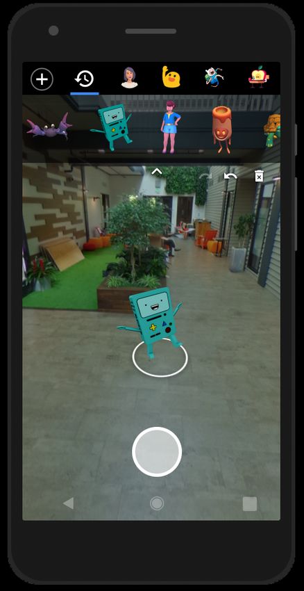
Contents
Contents 2
Overview 5
Preface 5
Objective 5
Target audience 5
Use cases 5
Augmented Reality (AR) photos 5
Depth photos 6
Normative References 9
Data Structure 9
Elements 9
Media Data Encoding 10
Concatenated File Container 10
ISO Box Media File Format Container 11
Namespace Requirements 11
Nonstandard Usage 11
Compatibility 11
Profiles 12
Profile and Use Case Extension 12
Profile: Depth Photo 12
Required Depth Photo Elements 13
Profile 13
Cameras 13
Primary image 13
Image and depth map correlation 13
Profile: Augmented Reality (AR) Photo 14
Dynamic Depth Elements 14
Required 14
Profile 14
Device 14
Camera 14
Dynamic Depth 1.0 2
Poses and Coordinate Systems                16
    Conventions                              17
              Earth Coordinate System        17
              Realm Coordinate System        18
              Object Coordinate System       19
    Orientation data format                  19
    Transform Naming Conventions             19

 Element Definitions                         21
    Device                                   21
    Container Element                        23
    Item Element                             23
    Item Mime Type Values                    24
    Profile                                  25
    Vendor Information                       26
    Application Information                  27
    Earth Pose                               28
    Pose                                     29
    Camera                                   31
    Image                                    33
              ItemSemantic                   33
    Light Estimate                           34
    Plane                                    35
    Imaging Model                            36
    Depth Map                                39
              Depth Data                     39
              RangeLinear                    40
              RangeInverse                   40
              FocalTable                     40
              Confidence Maps                41
              ItemSemantic                   42
              Depth Map Definition           42
    Point Cloud                              44

 Appendix                                    45
   EXIF Consistency                          45
    Coordinate systems                       45
              Earth Coordinate System        45
              Realm Coordinate System        45

Dynamic Depth 1.0                        3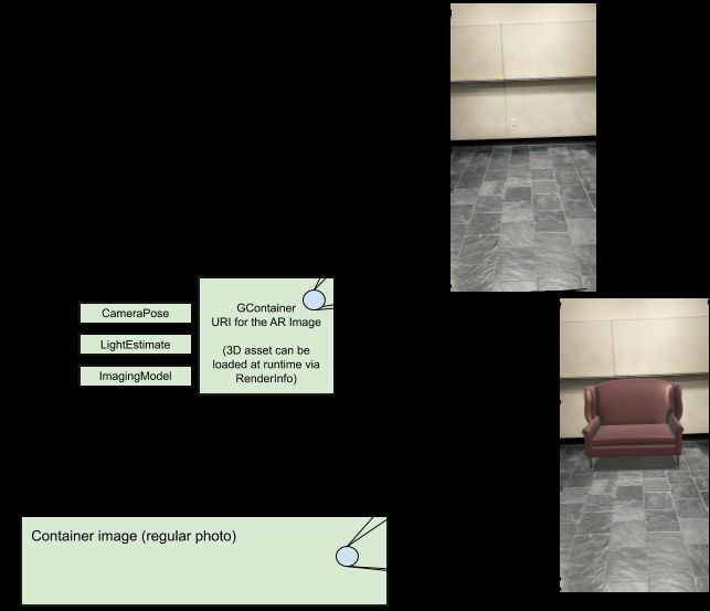
Camera Coordinate System                                                                     45
            Image Coordinate System                                                                      47
            Object Coordinate System                                                                     48
    Dynamic Depth Poses                                                                                  48
        Device:RealmPose                                                                                 48
        Camera:CameraPose                                                                                49
        Plane:PlanePose                                                                                  49
        AppInfo Pose Guidelines                                                                          50

   Parts of this document derived from the Extensible Device Metadata specification are licensed under the
                                 Creative Commons Attribution 4.0 License.

Dynamic Depth 1.0                                      4
Overview
Preface
Augmented reality (AR) and depth photos are increasingly popular camera use cases across
Android, however the OS lacks standardization in capturing, saving, and sharing such images.
A few independent solutions, primarily for depth photos, exist however none that extend across the
ecosystem. By having uniformity and consistency within the Android camera framework, partners
and developers can natively get support for Dynamic Depth with minimal effort.
Objective
Provide an easy to implement, quick to parse, and widely available depth extension to existing still
imaging formats across Android and iOS.
The extension will support two primary cases, augmented reality and depth photos. By storing
devicerelated metadata, this specification will extend common still imaging specs like JPEG, PNG,
and HEIF while maintaining compatibility with existing image viewers.
Target audience
The primary audience for this document are engineers and product managers across:
A. device makers
B. image creation applications
C. image editing applications
D. image sharing applications
E. mobile chipset makers
F. mobile chipset solution providers
This is not an enduser facing specification nor does it contain enduser specific marketing
material.
Use cases
Dynamic Depth is extensible to multiple types of depth use cases, optimizes for multicamera
sensors, and provides a foundation for computer vision/image processing extensions. The first two
usages targeted are AR and depth photos.
Augmented Reality (AR) photos
In 2017 AR Stickers were introduced where a digital object (AR content) is placed into the scene
currently viewed by the camera. An example of this is shown below with several objects being
placed within a living room.
Dynamic Depth 1.0 5AR Sticker In the scene above the AR content is placed while the viewfinder is active and capturing the scene. With Dynamic Depth a user would capture a scene, say the hallway shown above, and place AR content within the scene postcapture. Depth photos Depth photos can have various forms, some of the most popular ones include portrait mode found on many popular Android phones. An example of such an image is below: Dynamic Depth 1.0 6
Photo without (left) and with (right) depth of field effect.
Note how the effect’s synthetic shallow depth of field helps suppress the cluttered
background and focus attention on the main subject.
Today images like above cannot be edited once created. Starting with Dynamic Depth applications
can seamlessly create bokeh effects postcapture.
These depth photos contain a depthmap which is defined as an image of values (integer or real)
that represent distance from the view point (see example below). The exact definition of depth can
vary depending on the depth sensor. As an example, two common definitions are depth along the
optical axis (typically the zaxis), and depth along the optic ray passing through each pixel.
Dynamic Depth 1.0 7An example color image (left) and a corresponding depthmap (right). Dynamic Depth 1.0 8
Normative References
The following are normative references for this specification:
● Adobe XMP Specification Part 3 Storage in Files
● ISO 166841:2011(E) XMP Specification Part 1
● ISO/IEC 1449612 ISO Box media file format
● T.81 (09/92) Digital Compression and Coding of Continuoustone Still Images
● XML Schema Part 2: Datatypes Second Edition W3C Recommendation 28 October 2004
Data Structure
The metadata is serialized following ISO 166841:2011(E) XMP Specification Part 1 and embedded
inside the primary image file as described in Adobe XMP Specification Part 3 Storage in Files.
The primary image file contains the following items, formatted as RDF/XML.
Elements
The root metadata object is the Device element and it is always required. This specification
supports several Profiles or use cases and each has its own set of required elements and data.
Readers may use Profiles to identify what use cases a given Dynamic Depth file can support.
Multiple profiles can be supported by a single file. Readers and writers are not required to support
all profiles.
The following table lists the minimum set of elements that are required for each Profile in this
specification.
Profile Required Elements
AR Photo ● Device
○ Profile must be “ARPhoto”
○ Planes
● Camera
○ Pose
○ LightEstimate
○ ImagingModel
○ Image (optional, see the AR Photo Profile for more info )
○ DepthMap (optional)
Depth Photo ● Device
○ Profile must be “DepthPhoto”
● Camera
○ DepthMap
○ Image
Dynamic Depth 1.0 9Optional elements are listed in the following list and may be ignored by image parsers that handle
either of the Profiles above. Elements are defined in a separate section.
● Primary image The image external to the Dynamic Depth, visible to normal nonDynamic
Depth apps
● Device The root object of the RDF/XML document as in the Adobe XMP standard
○ Container Ordered directory of concatenated files in the file container
○ VendorInfo Vendorrelated information for the device.
○ AppInfo Applicationspecific or rendering information for the device.
○ EarthPose The pose of the Realm (i.e. local world space) with respect to the
earth.
○ Pose The pose of the device with respect to the Realm.
○ Profiles RDF sequence of one or more Profile entities
■ Profile Defines the intended usage(s) of the Dynamic Depth metadata
with the primary image.
○ Cameras RDF sequence of one or more Camera entities
■ Camera All the info for a given camera. There must be a camera for any
image. The primary image is associated with the first camera, which is
considered the primary camera for the image.
● VendorInfo Vendorrelated information for the camera.
● AppInfo Applicationspecific or rendering information for the
camera.
● Pose Camera pose relative to the Realm.
● Image Image provided by the camera
● ImagingModel Imaging (lens) model.
● DepthMap Depthrelated information and the depth map.
● PointCloud Pointcloud data.
○ Planes RDF sequence of one or more Plane entities
■ Plane All the info for a given physical planar surface..
Media Data Encoding
Dynamic Depth files consist of a primary displayready image, such as a JPEG file. Secondary
images such as depth data, intermediate images, or alternative representations of the primary
image, may be stored either in a concatenated file container defined below, or if the primary image
is an ISO/IEC 1449612 ISO Box media file format container, as other boxes in the container.
Concatenated File Container
The concatenated file container consists of a composite file where the primary image file has zero
or more secondary media files appended to it. The secondary media files may contain alternative
representations of the primary image or related media such as depth data.
The primary image contains a Container XMP metadata directory defining the order and properties
of subsequent media files in the file container. Each file in the container has a corresponding media
item in the directory. The media item describes the location in the file container and the basic
Dynamic Depth 1.0 10properties of each concatenated file. Media items in the container directory are referred to by ItemURI attributes from Image or Depth Map elements in the metadata. ISO Box Media File Format Container File containers based on ISO/IEC 1449612 may be used to store the primary image, depth data, intermediate images, or alternative representations of the primary image. The XMP metadata in the container includes a Container XMP metadata directory element where each item in the directory uses a URI to refer to boxes within the ISO/IEC 1449612 container. Namespace Requirements When Dynamic Depth is encoded in a JPEG container, all namespace declarations must appear in the main XMP section of the first 64K of the extended section. This allows clients to quickly create a list of the required namespaces by reading just those two sections (less than 128K), without having to load and parse the entire extended section. Informative: If a Reader does not support all Dynamic Depth features for a particular application, it may be helpful for the reader to efficiently obtain a list of the Dynamic Depth namespaces (i.e., features and feature versions) used in a file before they begin processing it. Unfortunately, this can be difficult when using a JPEG container. If the Device element is more than 64K (true of most Dynamic Depth files), the rules of XMP force the Device and its children out of the main XMP section and into the extended section. Thus an Dynamic Depth element and its namespace declaration might appear anywhere in the main or extended XMP. Under these conditions, building a list of all the Dynamic Depth namespaces used in a file requires checking the entire Dynamic Depth content, often megabytes in length, causing a performance hit when opening the file. Non‑standard Usage Writers are allowed to include other fields or objects that are not defined in the spec for the specified version of Dynamic Depth in Device elements. For example, these may be objects specific to a particular vendor, device, or usecase, or other extensions. Additions to the Device element must not change the behavior defined by the Dynamic Depth version value included in each element’s namespace. Readers should ignore any additions that appear, without error. Compatibility The Dynamic Depth specification is a significant expansion of the original DepthMap Metadata specification published in 2014. It still supports the original use case of a singleimage container with associated depth metadata, but expands that original specification to support more types of metadata and more use cases. The two specifications are not backwards compatible because depth media data is stored in a different way in this specification. Readers and writers that supported the DepthMap Metadata spec will require modification to support Dynamic Depth. The Dynamic Depth standard handles a number of items differently, including: Units, Confidence, Manufacturer, Model, ImageWidth, and ImageHeight. Dynamic Depth 1.0 11
In this documentation, JPEG is used as the basic model, but the metadata definition may be
applied to other file formats that support XMP.
Profiles
Profile elements describe the intended use of a Dynamic Depth image and define the structure of
other required elements in the metadata. Profile elements allow Readers to quickly identify the
intended use of a file. The Profile element contains the profile name and the indices of cameras
used by the profile. Currentlysupported use cases are depth photos and augmented reality (AR)
photos.
The required Dynamic Depth elements for each profile are outlined below.
Profile and Use Case Extension
Future versions of the Dynamic Depth specification may add new Profiles to support new
functionality and use cases. First, they can define the required Dynamic Depth elements, values,
and semantics similar to the Depth Photo and AR Photo sections below. Next, their image reader
and writer could support their use case name in the Profile:Type field, the list of Camera indices
in Profile:CameraIndices.
Profile: Depth Photo
Depth photos are defined as an image of scalar values (integer or real) that represent the distance
from the camera viewpoint, to the object viewed in a corresponding color image, see the figure
below. The exact definition of the depth value may vary based on the type of depth sensor. As an
example, two common definitions are depth along the optical axis (typically the zaxis), and depth
along the optical ray passing through each pixel.
An example color image (left) and a corresponding depth image (right).
Dynamic Depth 1.0 12Required Depth Photo Elements
Profile
● Profile:Type must be set to DepthPhoto.
● Profile:CameraIndices. This list must have only one integer i, which represents the ith
camera in the Device:Cameras list.
Cameras
● Camera i
○ DepthMap (1 or more)
○ Image (1 or more)
Dynamic Depth metadata structure for depth photography
Primary image
In depth photography, the primary image is the presentation or displayready copy of the image.
The image is not required if the camera index is 0 and the image and primary image are identical.
Image and depth map correlation
All images and depth maps within a Camera must be rectified to the same pose and cropped to the
common field of view (same aspect ratio). It is not necessary for images and depth maps to have
the same resolution.
Dynamic Depth 1.0 13Writers may store additional intermediate images inside subsequent Camera elements. Writers
may store additional Camera elements for other intermediate representations of the color and
depth images. Each additional Camera element may include a CameraPose element to define its
position and orientation.
Profile: Augmented Reality (AR) Photo
An augmented reality (AR) photo is an image that contains the pose of the capturing device,
lighting estimate information, horizontal and/or vertical surface planes in the world, and camera
intrinsics.
Optionally, developers may include applicationspecific metadata. One example is the identifier(s)
of 3D asset(s) and their poses. When the image is parsed, these assets can be loaded only by that
application, with their poses, so that endusers may edit and move the asset interactively in the
photo.
Optionally, a photo can be embedded inside an AR Photo. Should there be an embedded photo, it
should be the one used by the image viewer when parsing back the photo. An example use case is
yinwhere the embedded image is the one without 3D assets (which we will call the AR image), and
the container has the 3D assets visible (the enduser facing image). This enables users to preview
a thumbnail with the 3D assets in a gallery, while being able to interact and move objects in the AR
image. Developers may choose to update the primary image if endusers save their edits to the AR
photo.
If the embedded photo use case is employed, its parent Camera should be anything other than
Camera 0, and it should hold all the AR metadata. Otherwise, if there is no embedded image,
Camera 0 should contain all the AR metadata.
Dynamic Depth Elements
Required
Profile
● Profile:Type must be set to ARPhoto.
● Profile:CameraIndices. This list must have exactly one integer i, which represents the
ith camera in the Device:Cameras list.
Device
● Planes a list of horizontal or vertical planes, representing detected physical surfaces in
the world (e.g. floors or walls)
Camera
● Camera i holds the AR metadata, and optionally the embedded AR image.
○ Pose
○ LightEstimate
○ ImagingModel camera intrinsics information
○ Image optional, AR image for the embedded use case
Dynamic Depth 1.0 14Dynamic Depth metadata structure for an AR Photo without an embedded image. Dynamic Depth 1.0 15
Dynamic Depth metadata structure for an AR Photo with an embedded AR image. Poses and Coordinate Systems Dynamic Depth stores the pose (that is, the position and orientation) of the camera(s) relative to the world, or the poses of objects (e.g. 3D assets) in the world. This enables applications to use multiple images together, as when mapping depth data onto a photograph, and provides information about the image capture, such as the position and orientation of the image sensor. The following sections define the conventions, coordinate systems, and formats used throughout this specification. Most of the math involved can be handled by thirdparty math libraries. More details on additional coordinate systems, conventions, and math are available in the Appendix. Dynamic Depth 1.0 16
Conventions
Handedness. Unless otherwise noted, all Cartesian spaces are right handed. This means that
cross(X, Y) == Z. Please see also the OpenGL section on handedness.
Position is expressed in three dimensions. For the device pose, these are latitude, longitude, and
altitude. For the camera pose, they are the distance in meters from the device origin point along
the device's x, y, and z axes.
Orientation is also expressed in three dimensions, as a rotation around x, y, and z axes relative to
a frame of reference. For each Dynamic Depth element, the frame of reference is the local world
coordinate system, which we define and describe below as the Realm coordinate system in this
specification. For the Realm itself, the frame of reference is a standard "ENU" (eastnorthup) earth
coordinate system, described below.
Each of these 3D coordinate systems has a defined origin from which x, y, and z axes emerge in
defined directions.
Dynamic Depth Pose. Dynamic Depth stores elements’ Poses with respect to the local world
coordinate system, which we define in this specification as the Realm coordinate system. The
exception is EarthPose, which is the GPS reading of the Android device.
Note that some elements’ pointwise locations are stored with respect to their local object
coordinate system, such as with Plane:Boundary.
Below are the two major coordinate systems used in this specification. More details on the
remainder are in the Appendix.
Earth Coordinate System
Dynamic Depth uses a righthanded, eastnorthup (ENU) world
coordinate system. This is the same world coordinate system used in the
Android and iOS operating systems, and in ARCore.
The 3D position is represented in WGS84 coordinates as longitude,
latitude, and altitude. In keeping with the WGS84 documentation, altitude
is height in meters above the standard ellipsoid reference surface, and
latitude is geodetic latitude. This is consistent with the GPS data provided
by most mobile devices.
Origin The location specified by latitude, longitude, and altitude.
Orientation ● X is tangential to the ground at that location and points roughly East.
(It is the vector cross product y × z.)
● Y is tangential to the ground at that location and points towards the
North Pole.
Dynamic Depth 1.0 17● Z is perpendicular to the ground at that location and points towards the
sky.
Units Meters or degrees
Handedness Right
Range ● Latitude: 90º to +90º
● Longitude: 180º to +180º
● Altitude: 0 to 100,000 meters (the edge of the atmosphere).
Precision Double
Realm Coordinate System
The Realm coordinate system is an application’s reference coordinate system in a real world. It is
equivalent to ARCore’s Session space, which serves as the reference space for all of the poses
provided by its API.
Informational: The term “Realm” refers to this coordinate system, as to ensure clarity between this
one and “Earth” space.
Origin Arbitrary, depends on the application.
● For rendering applications, see the origin of OpenGL’s rendering
world space.
● For ARCore, it is generally the point in the real world when the user
starts running the AR application.
Orientation Local level with
● Y up
● Arbitrary X/Z axes, but generally Z = projection of the device’s
“forward” vector at startup time into the locallevel plane.
Note: “Forward” refers to the direction that a user is facing when they
start the app with their device held out in front of them at arm’s length,
arm parallel to the ground.
Units Meters
Handedness Right
Range Unbounded
Precision Single
Dynamic Depth 1.0 18Object Coordinate System
This coordinate system is used for a Plane’s points, and aligns with the Anchor coordinate system
defined in ARCore. If applications choose to store serialized poses in AppInfo, it is recommended
that they use this coordinate system as those objects’ respective frames of reference.
The following definitions are recommended, but applications can choose to use the values that
work best for their use case.
Origin The center of the object on the XZ plane, and the bottommost Y point on the
object.
Orientation +X right, +Y up, +Z out of the object, when looking headon at the object.
Units Meters
Handedness Righthanded
Range Depend on the use case
Precision Single
Orientation data format
Mathematically, the task of describing orientation or rotation can be difficult and counterintuitive.
Each of the popular formalisms for this – rotation matrix, Euler angles, axisangle representation,
and quaternions – has advantages and disadvantages. Dynamic Depth uses the quaternion
representation, which is used throughout Android and ARCore APIs.
Informational: Readers can use library functions to convert it to matrices for calculations, if desired.
Transform Naming Conventions
Transformations are always named in the following form: _T_ (with
camelcasing for functions). For instance, this transform can map a point from the coordinate
space_b into space_a coordinates. The “T” stands for “transformation” and should be pronounced
“T” and not “to” to avoid confusion.
This naming makes it easy to see visually at a glance that the math is correct simply from the
ordering of the space names. In the equation below the two “device” terms are adjacent to each
other, and the order of “realm” and “camera” is preserved on both sides of the equation.
Recall that poses are just another name for rigid transformations. Since they are both abstract
concepts and not implementations, we do not distinguish between poses and matrices where
possible.
Dynamic Depth 1.0 19Example
● Camera poses are equivalent to realm_T_camera, which represents the pose of the
camera in the Realm coordinate space.
● Coordinate system change. Inverse has the same semantics as an inverse matrix.
camera_T_realm = Inverse(realm_T_camera)
camera_T_plane = camera_T_realm * realm_T_plane;
● Linear point mapping: foo_T_bar * bar_p, where the point bar_p is transformed from
frame bar to foo with a right sided vector multiplication (using homogeneous coordinates).
Dynamic Depth 1.0 20Element Definitions
This section defines and provides details of each Dynamic Depth element.
Device
The Device element contains information about the capture device and contains a sequence of
Camera elements related to the primary image.
● The namespace URI is http://ns.google.com/photos/dd/1.0/device.
● The default namespace prefix is Device.
The first camera in the sequence is the one that created the primary image in the file container. At
least one Camera element must be present in the Cameras element for a Device to be valid.
If Container
Default
Name Type Required Property Content Image
Value
Modified
Profiles Sequence No N/A Describes the intended purpose(s) of the No change
of Profile image and its metadata. If the fields for
(rdf:Seq) more than one use case are present, all
the applicable profiles should be listed.
Cameras Sequence Yes. Quantity N/A Each Camera in the Cameras sequence Needs
of Camera depends on contains the properties of a camera on the update
(rdf:Seq) Profile device associated with this JPEG. If the
first Camera in the sequence does not
contain an Image, it references the
primary image.
Container Container Yes, if Image or N/A Lists the directory of media items in all the No change
DepthMap Camera items under the Cameras
elements are element.
present in any
Camera
element
Planes Sequence Depends on N/A Each Plane in the Planes sequence No change
of Plane Profile contains the properties of a vertical or
(rdf:Seq) horizontal plane in the world, such as a
wall or floor surface.
EarthPose EarthPose No The pose of the Realm, with respect to No change
the Earth. Please see the description in
the Poses and Coordinate Systems
section.
Pose Pose No The pose of the Device, with respect to
the Realm. Please see the description in
the Poses and Coordinate Systems
section.
VendorInfo VendorInfo No Vendor information for the device No change
AppInfo AppInfo No Application information for this device
Dynamic Depth 1.0 21Container Element
The container element is encoded into the XMP metadata of the primary image and defines the
directory of media items in the container. Media items must be located in the container file in the
same order as the media item elements in the directory and must be tightly packed.
● The namespace URI is http://ns.google.com/photos/dd/1.0/container.
● The default namespace prefix is Container.
The directory may contain only one primary image item and it must be the first item in the directory.
Element Name Type Description
Directory Ordered Array Ordered array of Container:Item structures defining the layout
of Structures and contents of the container.
Item Element
Media item elements describe how each item should be used by the application.
The first media item must be the primary image. The primary image is usually the container image,
in which case the required field is the MIME type. The Length field must be zero for this case.
In general, an Item must contain a Mime attribute specifying one of the image MIME types listed in
Item MIME Type Values. The length of the primary item may be determined by parsing the primary
image based on its MIME type starting at the beginning of the file container.
The first media item may contain an Padding attribute specifying additional padding between the
end of encoded primary image and the beginning of the first secondary image. Subsequent media
items for secondary images may not contain Padding attributes.
Each media item must contain an Mime attribute. The secondary media items must also contain
Length attributes.
Sequential media items may share resource data within the file container. The first media item
determines the location of the resource in the file container, and subsequent shared media items
have Length set to 0. In the case that the resource data is itself a container, DataURI may be used
to determine the location of the media item data within the resource.
The location of media item resources in the container is determined by summing the Length’s of
the preceding secondary item resources to the length of the primary image encoding plus Padding
if specified.
Dynamic Depth 1.0 22Attribute Name Type Description
Mime String Required. Simple string indicating the MIME type of the
media item in the container.
Length Integer Required for secondary media items. Simple string
containing a positive integer length in bytes of the item.
Media items are expected to be in their original form, with
no encoding applied. The length value is the actual length
of the bytes in the file.
Length 0 in secondary media items indicates that the
media item resource is shared with the previous media
item. Length is expected to be 0 in a primary media item.
Padding Integer Optional for the primary media item. Simple string
containing a positive integer length in bytes of additional
padding between the end of encoded primary image and
the beginning of the first secondary image.
DataURI String Required if there is an element that references this
Container, such as Image, Depth Map, or AppInfo.
Applications should choose a URI that makes it easy for
readers to identify that the associated item belongs to the
application. Directory paths are a good example of a
DataURI’s ideal structure.
Otherwise, optional for ISO base media format ISO/IEC
1449612 mime types. URI string conforming to ISO/IEC
1449612 8.11.9 containing the relative URI of the media
data inside the media item resource.
Item Mime Type Values
The ItemMime attribute defines the MIME type of each media item.
Value Description
image/jpeg JPEG Image
image/png PNG Image
image/tiff TIFF compatible image
image/heif, image/heic HEIF image
text/plain Text data
Dynamic Depth 1.0 23Profile
The Profile element describes the use case of the photo being captured.
● The namespace URI is http://ns.google.com/photos/dd/1.0/profile.
● The default namespace prefix is Profile.
Default If Container
Name Type Required Property Content
Value Image Modified
Type string Yes DepthPhoto, ARPhoto No change
CameraIndices Sequence Depends on N/A Indicates the cameras that will be No change
of integers the use case used in the profile. See the
(rdf:Seq) as defined in respective profile description for
the Profile the intended use of each camera.
Camera indices here are
independent of indices defined or
mandated by Android camera
framework.
Dynamic Depth 1.0 24Vendor Information
The VendorInfo element describes vendor information for a camera or a device.
● The namespace URI is http://ns.google.com/photos/dd/1.0/vendorinfo.
● The default namespace prefix is VendorInfo.
Default If Container
Name Type Required Property Content
Value Image Modified
Model string No The model of the element that No change
created the content
Manufacturer string Yes N/A The manufacturer of the element that No change
created the content
Notes string No General comments No change
Dynamic Depth 1.0 25Application Information
The AppInfo element describes applicationspecific information for the given image. Example use
cases include a projection mesh of the primary image, or 3D assets’ identifiers and their poses.
Possible ways of serializing this data include a littleendian base64encoded string, or using
JavaScript Object Notation. This data would then be stored in a Container with a text mime type.
The flexibility of custom serialization mechanisms aim to enable experimentation and/or
maintaining perapplication use of this data, to name a few use cases. Applications are expected to
define their own mechanisms for parsing this data as well.
● The namespace URI is http://ns.google.com/photos/dd/1.0/appinfo.
● The default namespace prefix is AppInfo.
Default If Container
Name Type Required Property Content
Value Image Modified
Application string Yes N/A The model of the element that No change
created the content
Version string Yes. N/A The version of this application’s No change
Otherwise data serialization scheme.
the ItemURI
value must
be present.
ItemURI string Yes. The URI of the Container that No change
Otherwise holds the custom data used by
Version must this application.
be present Image readers who do not
recognize the application name
should not attempt to read the
associated Container.
Dynamic Depth 1.0 26Earth Pose
The EarthPose element describes a pose (i.e., position and orientation) with respect to the Earth
coordinate system. In Dynamic Depth, this is used for describing the pose of the Realm with
respect to the Earth in Device:RealmPose. Please see the Poses and Coordinate Systems section
for details on how the Earth, Realm, Device, Camera, and Entity coordinate systems work together.
● The namespace URI is http://ns.google.com/photos/dd/1.0/earthpose.
● The default namespace prefix is EarthPose.
The raw data used to determine the Realm’s pose (with respect to the Earth) may come from GPS
and IMU sensors. In most cases, this is equivalent to the GPS reading. When providing the
position, all three of the position fields are required, and when providing the orientation, all four
orientation fields are required.
Position data shows the Realm’s location on the Earth. Rotation (orientation) data shows the
containing entity’s orientation relative to the ENU world coordinate system, in the quaternion format
as described under Poses and Coordinate Systems.
If Container
Name Type Required Property Content
Image Modified
Latitude double Yes, if WGS84 latitude in degrees No change
providing
position.
Longitude double Yes, if WGS84 longitude in degrees No change
providing
position.
Altitude double Yes, if WGS84 altitude in meters No change
providing
position.
RotationX real Yes, if The x component of the quaternion No change
providing representation.
orientation.
RotationY real Yes, if The y component of the quaternion No change
providing representation.
orientation.
RotationZ real Yes, if The z component of the quaternion No change
providing representation.
orientation.
RotationW real Yes, if The w component of the quaternion No change
providing representation.
orientation.
Timestamp long Depends on Time of capture, in milliseconds since the Epoch No change
use case (January 1 1970, 00:00:00.000 UTC).
Dynamic Depth 1.0 27Pose
The Pose element describes the pose (i.e., position and orientation) of its container element with
respect to the Realm. Please see the Poses and Coordinate Systems section for details on how
the Earth, Realm, Device, Camera, and Entity coordinate systems work together.
● The namespace URI is http://ns.google.com/photos/dd/1.0/pose.
● The default namespace prefix is Pose.
The position and orientation of the device, each camera, and each plane relative to the Realm are
based on information provided by the manufacturer, Android APIs, or AR APIs. Imagecreation
apps need this information in order to create the Dynamic Depth file. Image consumers do not
need this information; they just need the pose data.
If it is not possible to know the device pose relative to the Realm, it is assumed to have the same
pose as that of Camera 0, which is the primary camera. Both are assumed to have the same pose,
and the DevicePose is set to identity (no difference).
For nonAR use cases, the pose of the device (with respect to the Realm) is the zero pose (i.e.
identity matrix), and this field will not be needed.
Pose is also used in an Entity context when describing the pose of a Plane. Applications may also
choose to adopt this usage convention for customized use cases, such as encoding 3D assets and
their poses in the AppInfo Element.
Position data shows the x, y, z coordinates of the center of the device, plane, or camera lens with
respect to the Realm, in meters where possible. Rotation (orientation) data shows the device,
plane, or camera orientation relative to the Realm, in quaternion format as described under Poses
and Coordinate Systems.
The table below shows the components of the Pose element.
Default If Container
Name Type Required Property Content
Value Image Modified
PositionX real Yes, if 0 The x position in meters, relative to the No change
providing Realm.
position.
PositionY real Yes, if 0 The y position in meters, relative to the No change
providing Realm.
position.
PositionZ real Yes, if 0 The z position in meters, relative to the No change
providing Realm
position.
Dynamic Depth 1.0 28RotationX real Yes, if 0 The x component of the quaternion No change
providing representation.
orientation.
RotationY real Yes, if 0 The y component of the quaternion No change
providing representation.
orientation.
RotationZ real Yes, if 0 The z component of the quaternion No change
providing representation.
orientation.
RotationW real Yes, if 0 The w component of the quaternion No change
providing representation.
orientation.
Timestamp long Yes Time of capture, in milliseconds since the No change
Epoch (January 1 1970, 00:00:00.000
UTC).
Dynamic Depth 1.0 29Camera
The Camera element describes a camera imaging sensor, and must reference an image. This
image may be a Container URI, or the primary image if the given camera is the first one in the
Cameras list (i.e. Camera 0).
● The namespace URI is http://ns.google.com/photos/dd/1.0/camera.
● The default namespace prefix is Camera.
The first Camera that appears in the data structure is referred to in this documentation as Camera
0. In a simple case (e.g., a smartphone or tablet), Camera 0 should be the primary camera, and
may reference the primary image; the rest of the Camera sequence is arbitrary. The semantics of
each camera are defined by the Profiles and specified use cases; please see the Profiles section
for a detailed description.
All images and depth maps within a single Camera element are presumed to be rectified that same
Camera. That is, the elements have the same pose, proportions, and field of view. Any additional
Camera element should either include accurate pose data for that camera relative to the Realm.
If Container
Default
Name Type Required Property Content Image
Value
Modified
Trait string Depends “Physical” One of “Logical” or “Physical” to No change
on Profile indicate the nature of this
camera. Assumed Physical if
this field is not present.
DepthMap DepthMap Depends The DepthMap property of this If image
on Profile Camera scaled or
cropped,
update
accordingly
Image Image Yes The Image property of this If image
Camera scaled or
cropped,
update
accordingly
PointCloud PointCloud Depends The PointCloud property of If image
on Profile this Camera scaled or
cropped,
update
accordingly
ImagingModel ImagingModel Depends The imaging model of this If image
on Profile Camera. scaled or
cropped,
update
accordingly
Dynamic Depth 1.0 30Pose Pose Depends The pose of this Camera. The No Change
on Profile poses of Camera elements are
all relative to the Realm.
LightEstimate LightEstimate Depends The lighting estimation data of No change
on Profile this Camera.
VendorInfo VendorInfo Depends Vendor info for this camera No change
on Profile
AppInfo AppInfo Depends Applicationspecific data for this Depends on
on Profile camera use case
Dynamic Depth 1.0 31Image
The Image element contains a reference to a color image stored elsewhere in the file container.
● The namespace URI is http://ns.google.com/photos/dd/1.0/image.
● The default namespace prefix is Image.
Default If Container
Name Type Required Property Content
Value Image Modified
ItemSemantic string Yes. N/A A defined ItemSemantic No change.
value, which describes the
intended use or contents of
the image. See table below.
ItemURI string Yes N/A The URI of the Container for No change.
this camera’s image.
Informative: One use of the Image element is described under Profile: Depth Photo, in which a
backup of the original image is stored along with the matching depth data in the Camera 0 Image,
and the primary image is treated as a "presentation" or "display" copy.
For other uses, such as storing an infrared photograph to accompany a normal color photograph,
it's better to put the Image in a separate Camera. It's likely that this approach will correspond to the
actual equipment – for instance, an infrared image is taken by a separate IR camera on the same
device. The additional Camera element should either include accurate pose data for that camera
relative to the device, or have no pose data, indicating that the image has already been rectified to
the Camera 0 image.
ItemSemantic
The Image:ItemSemantic attribute defines the intended use of each image captured by a
Camera. In addition to the Depth semantic defining the container element storing the depth map
data, the following item semantics may be used:
Value Description
Primary Indicates that the item is the primary display ready image in the container. The container may
have only one Primary item.
Original Indicates that the media item is an original version of the primary image, such as an unfiltered
color image that may be used to render a depth effect.
Dynamic Depth 1.0 32Light Estimate
The LightEstimate element provides the color correction RGB values and average intensity of a
realworld scene, as seen by an image sensor.
● The namespace URI is http://ns.google.com/photos/dd/1.0/lightestimate.
● The default namespace prefix is LightEstimate.
Informative: This data can be obtained using the ARCore APIs. These values are conventionally
used for adjusting the color of virtual objects when they are rendered in an image, such as in
OpenGL fragment shaders.
If Container
Name Type Required Default Value Property Content
Image Modified
ColorCorrectionR float Yes, if G or 1.0 The red color correction Scale/crop: No
B are scaling factor to be applied change
present. to the final color computed
Optional by the fragment shader to
otherwise. match the ambient color.
ColorCorrectionG float Yes, if R or 1.0 The green color correction Scale/crop: No
B are scaling factor to be applied change
present. to the final color computed
Optional by the fragment shader to
otherwise. match the ambient color.
ColorCorrectionB float Yes, if R or 1.0 The blue color correction Scale/crop: No
G are scaling factor to be applied change
present. to the final color computed
Optional by the fragment shader to
otherwise. match the ambient color.
PixelIntensity float Yes 1.0 The average pixel intensity No change.
of the image sensor.
Dynamic Depth 1.0 33Plane
The Plane element describes a vertical or horizontal planar surface in the world.
● The namespace URI is http://ns.google.com/photos/dd/1.0/plane.
● The default namespace prefix is Plane.
Informative: This data can be obtained using the ARCore APIs.
If Container
Default
Name Type Required Property Content Image
Value
Modified
Pose Pose Yes N/A The pose of this Plane. No Change
ExtentX float Optional 1 The extent of the plane in the X No change
dimension, centered on the plane
position.
ExtentZ float Optional 1 The extent of the plane in the Z No change
dimension, centered on the plane
position.
BoundaryVertexCount Integer Yes, if 0 The number of vertices in the No change
(even) providing enclosing boundary polygon.
Boundary
Boundary string Yes, if N/A A littleendian base64encoded No change
providing list of (float) vertex pairs,
BoundaryVe representing the enclosing
rtexCount polygon vertices on the XZ plane.
These points are in the Plane’s
local coordinate system. Please
see the definition of the Object
Coordinate System in this
specification.
Dynamic Depth 1.0 34Imaging Model
The ImagingModel element describes the imaging model of a camera lens.
● The namespace URI is http://ns.google.com/photos/dd/1.0/imagingmodel.
● The default namespace prefix is ImagingModel.
The imaging model can be used to describe a fisheye distortion model, or a standard pinhole
camera model with 5DoF radial distortion.
Skew is the clockwise angle by which the y axis of the image slants away from the vertical.
The pixel aspect ratio is the x/y ratio of pixel width to pixel height. If pixels are perfectly square,
the ratio is 1/1 = 1.0 (the default). In the image below, the ratio would be 5/6 = 0.83. When the
pixel aspect ratio is 1.0 (the default), this ImagingModel element describes a standard pinhole
camera model with 5DoF radial distortion. In this model, skew is the clockwise angle by which the
y axis of the image slants away from the vertical.
The lens distortion model supports the BrownConrady model. The Distortion field stores a list of
value pairs [k1, p1, k2, p2, …, kn, pn] and supports a variety of parameter configurations:
● For applications using LENS_RADIAL_DISTORTION, kappa_0 through kappa_3 maps to k1
through k4, while kappa_4 to kappa_5 maps to p1 and p2. Note that p3 and p4 must be zero
in this case, so the stored values in Distortion are:
[k1, p1, k2, p2, k3, p3, k4, p4] = [kappa_0, kappa_4, kappa_1, kappa_5, kappa_2, 0, kappa_3,
0]
where the lens distortion correction equations are:
x_c = x_i * (kappa_0 + kappa_1 * r^2 + kappa_2 * r^4 + kappa_3 * r^6)
+ kappa_4 * (2 * x_i * y_i) + kappa_5 * (r^2 + 2 * x_i^2)
y_c = y_i * (kappa_0 + kappa_1 * r^2 + kappa_2 * r^4 + kappa_3 * r^6)
+ kappa_5 * (2 * x_i * y_i) + kappa_4 * ( r^2 + 2 * y_i^2 )
Dynamic Depth 1.0 35● For applications using LENS_DISTORTION, kappa_1 through kappa_3 maps to k1 through
k3, while kappa_4 to kappa_5 maps to p1 and p2. Note that p3 must be zero in this case, so
the stored values in Distortion are:
[k1, p1, k2, p2, k3, p3] = [1, kappa_4, kappa_1, kappa_5, kappa_2, 0, kappa_3, 0]
where the lens distortion correction equations are:
x_c = x_i * (1 + kappa_1 * r^2 + kappa_2 * r^4 + kappa_3 * r^6) +
kappa_4 * (2 * x_i * y_i) + kappa_5 * ( r^2 + 2 * x_i^2 )
y_c = y_i * (1 + kappa_1 * r^2 + kappa_2 * r^4 + kappa_3 * r^6) +
kappa_5 * (2 * x_i * y_i) + kappa_4 * ( r^2 + 2 * y_i^2 )
● For other parameter configurations of the BrownConrady model, such as the 2polynomial
[k1, k2] or 3polynomial [k1, k2, k3], zeroes must be the value for any pi parameter that is
not used.
If Container
Default
Name Type Required Property Content Image
Value
Modified
FocalLengthX real Yes N/A The focal length of the lens along the X If image
axis, normalized by the maximum cropped,
dimension of the sensor. I.e., given the update
focal length in pixels ƒx and the size of the accordingly
sensor in pixels (width, height), then:
FocalLengthX = ƒx / max(width, height)
FocalLengthY real Yes N/A The focal length of the lens along the Y If image
axis, normalized by the maximum resized or
dimension of the sensor. I.e., given the cropped,
focal length in pixels ƒy and the size of the update
sensor in pixels (width, height), then: accordingly
FocalLengthY = ƒy / max(width, height)
PrincipalPointX real No 0.5 The x position indicating where the If image
camera optical axis crosses the image resized or
plane center of the camera along the X cropped,
axis, normalized by the sensor width. update
accordingly
PrincipalPointY real No 0.5 The y position indicating where the If image
camera optical axis crosses the image resized or
plane center of the camera along the Y cropped,
axis, normalized by the sensor height. update
accordingly
ImageWidth integer Yes, if N/A The width of the image, in pixels. If image
ImageHei resized or
ght is cropped,
present update
accordingly
Dynamic Depth 1.0 36ImageHeight integer Yes, if N/A The height of the image, in pixels. If image
ImageWid resized or
th is cropped,
present update
accordingly
Skew real No 0 The skew of the image camera in
degrees
PixelAspectRatio real No 1.0 The aspect ratio of the X scale factor over
the Y scale factor (defined above).
DistortionCount integer Yes, if 0 The number of distortion parameter pairs
Distortion in the Distortion field. That is, the total
is present number of values in Distortion is twice
this number.
Distortion string Yes N/A Littleendian base64 serialization of a list
of BrownConrady distortion parameters
[k1, p1, k2, p2, …, kn, pn] where:
k1, k2, …, kn are radial distortion
coefficients, and
p1, p2, ..., pn are tangential distortion
coefficients.
Please see the description above on
appropriate storage values.
Dynamic Depth 1.0 37Depth Map
The DepthMap element contains a depth map image and information about its creation and format.
● The namespace URI is http://ns.google.com/photos/dd/1.0/depthmap.
● The default namespace prefix is DepthMap.
Depth maps are images of integer or real values that represent distance from the view point to a
viewed object. The definition of depth values can vary depending on the type of depth sensor. For
example two common definitions are depth along the optical axis (typically the Z axis), and depth
along the optical ray passing through each pixel. That is, the distance of an object from the plane
perpendicular to the Z axis, versus the distance from the object directly to the camera lens. The
MeasureType element specifies which definition is used.
Writers may store depth maps using only Camera 0, or may rectify images from additional cameras
before storing them (i.e., adjusting the depth data as if it had been captured at the pose of Camera
0, and cropping both images down to just the overlapping area). Writers may store the DepthMap
under Camera i (as defined in the respective Profile) along with the primary image.
Depth images for the first camera must have no holes. The writer must encode an estimated value
in any region where depth value cannot be calculated.
Depth Data
The depth map distance data is serialized into an image format and then stored as a separate item
in the file container. The encoding pipeline contains two steps:
1. Convert from the input format (e.g., float or int32 values) to an integer grayscale image
format as 16bit words.
2. Compress using an image codec supported by the file container type.
Informative: The pipeline can be lossless or lossy, depending on the number of bits of the original
depth map.
Two conversion formats are supported: RangeLinear and RangeInverse. RangeInverse is the
recommended format if the depth map will lose precision when encoded, such as when converting
from float to 16bit. RangeInverse allocates more bits to the near depth values and fewer bits to
the far values.
Dynamic Depth 1.0 38RangeLinear Let d be the depth distance value of a pixel, and near and far the minimum and maximum depth values considered. The depth value is first normalized to the [0, 1] range as: then quantize to 16 bits as: Conversely, given the quantized depth dn, one can recover depth d as: RangeInverse Let d be the depth distance value of a pixel, and near and far the minimum and maximum depth values considered. The depth value is first normalized to the [0, 1] range as: then quantize to 16 bits as: Conversely, given the normalized depth dn, one can recover depth d as: FocalTable Writers may optionally include metadata describing a lens focal model for the depth data. Readers may use this to render a depthoffield effect. The model defines the radius of the circle of confusion at different distances from the viewer. Distance and radius pairs are used to construct a lookup table defining the circle of confusion as a function of depth distance value. Dynamic Depth 1.0 39
The FocalTable attribute is a string value consisting of base64 encoded little endian floating point pairs, which are actual distance values, not 8 or 16 bit quantized and encoded values. These , pairs define a lookup table that may be used to compute the radius of the circle of confusion at distance values between the near and far values of the depth map. Pairs must appear in ascending order sorted by the distance value. Distance coordinates are defined in depth map distance value Units. Radius values are defined in pixel coordinates. Radius values must be greater or equal to zero. The radius value zero denotes an infocus depth distance on the focal plane of the image. The lookup table must contain at least two pairs for the near and far values of the depth map. Radius values are linearly interpolated between points defined in the table. Informative: Most applications require lookup table with three values for the near plane, focal plane of the image, and the far plane. Objects at the focal plane depth value would be rendered infocus. Readers should accept focal tables with more than one distance value in focus. Confidence Maps The confidence values can be interpreted either directly as [0, 255] after decompression or the client should normalize to [0.0, 1.0f], where 0 means no confidence, 1.0 means 100% confidence, and everything in between is a linear interpolation between 0% and 100%. These values have the same semantics as the confidence definition in Android’s DEPTH16 format. Confidence maps are not rangeencoded or compressed, and near/far values are not to be used in the maps. Dynamic Depth 1.0 40
ItemSemantic
The DepthMap:ItemSemantic attribute defines the intended use of each depth map captured by a
Camera.The following item semantics may be used:
Value Description
Depth This field’s default value. Indicates that the depth image is intended to be used as a depth map.
Segmentation Indicates that the depth image is intended to be used as a segmentation mask.
Depth Map Definition
If Container
Name Type Required Default Value Property Content
Image Modified
Format string Yes N/A The conversion format used Scale/crop: No
to encode depth: change
"RangeInverse" or
"RangeLinear"
ItemSemantic string Yes Depth String value defined above No change.
describing the intended use
or contents of the depth
image. See table above.
Near real Yes N/A The near distance value of Scale/crop: No
the depth map. If “Units” is change
set to “Meters”, the units are
meters. Otherwise the units
are undefined.
Far real Yes N/A The far distance value of the Scale/crop: No
depth map. If “Units” is set to change
“Meters”, the units are
meters. Otherwise the units
are undefined.
Units string Yes None The units of the depthmap, No change
i.e. "Meters" for meters,
“Diopters” for nonmetrically
accurate data, or “None” for
no units.
DepthURI string Yes N/A The URI of the Container for Scale: No
the depth image. change as long
as aspect ratios
match.
Crop: Decode
data into an
image, crop to
matching ratio,
then reencode.
Dynamic Depth 1.0 41ConfidenceURI string No N/A The URI of the Container for Scale: No
the confidence map. The change as long
container item must support as aspect ratios
16 bit data. match.
Crop: Decode
data into an
image, crop to
matching ratio,
then reencode.
MeasureType string No "OpticalAxis" The type of depth No change
measurement. Current valid
values are "OpticalAxis" and
"OpticRay". "OpticalAxis"
measures depth along the
optical axis of the camera,
i.e., the Z axis. "OpticRay"
measures depth along the
optic ray of a given pixel.
Software string No N/A The software that created this No change
depth map
FocalTableEntr integer Yes if N/A The number of pairs (i.e. No change
yCount FocalTab entries) in FocalTable.
le is This value must be no less
present than 2.
FocalTable string No N/A Littleendian base64 Decode data
serialization of a list of x, y and update
floatingpoint pairs. The x radius
coordinate is the quantized dimensions.
depth value and the y
coordinate is the radius of the
circle of confusion.
Dynamic Depth 1.0 42Point Cloud
The PointCloud element contains properties that provide information regarding the creation and
storage of a point cloud.
● The namespace URI is http://ns.google.com/photos/dd/1.0/pointcloud.
● The default namespace prefix is PointCloud.
Requir Default If Container
Name Type Property Content
ed Value Image Modified
PointCount integer Yes N/A Number of points (specified by x, y, z, No change
confidence 4tuples) in the data
Points string Yes N/A Littleendian base64 serialization of a list of No change
(x, y, z, c) floatingpoint 4tuples, where the
first three values are the point’s XYZ
coordinates in the Realm's coordinate
system, and the fourth value is the
confidence value. Points are in the order:
[X1, Y1, Z1, C1, X2, Y2, Z2, C2, ...]
Please see the DEPTH_POINT_CLOUD
definition in Android’s ImageFormat.
Metric boolean No Whether the Position values are expressed No change
in meters. If set to false or not set, the
units are unknown (i.e., the point cloud is
defined up to a scale). If this value is not
set, then some cases (such as
measurement) will not be possible.
Dynamic Depth 1.0 43You can also read