Earth Systems Science Grades K-4 Lesson 1: The Blue Planet
←
→
Page content transcription
If your browser does not render page correctly, please read the page content below
Earth Systems Science

                      Grades K-4

     Lesson 1: The Blue Planet

The Earth can be considered a family of four major components;
a biosphere, atmosphere, hydrosphere, and geosphere. Together,
these interacting and all-encompassing subdivisions constitute
the structure and dynamics of the entire Earth. These systems do
not, and can not, stand alone. This Module demonstrates, at every
grade level, the concept that one system depends on every other
for molding the Earth into the world we know. For example, the
biosphere could not efficiently prosper as is without gas exchange
from the atmosphere, liquid water from the hydrosphere, and food
and other materials provided by the geosphere. Similarly, the other
systems are significantly affected by the biosphere in one way or
another. This Module uses Earth’s systems to provide the ultimate
lesson in teamwork.

                            March 2006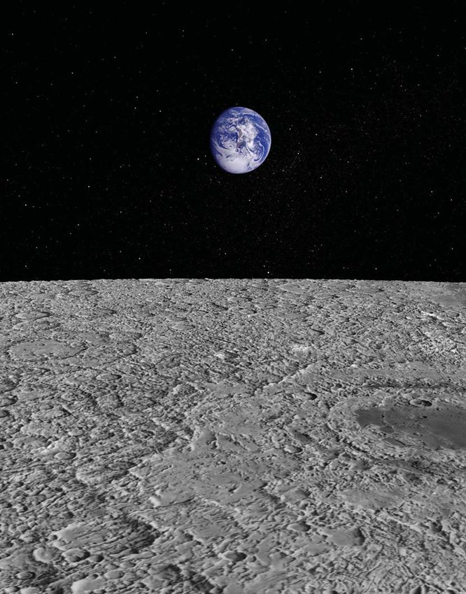
2                                JOURNEY THROUGH THE UNIVERSE

    Lesson 1: The Blue Planet

    Lesson at a Glance
    Lesson Overview
    In this lesson, students use NASA photographs and hands-on activities
    to compare the amounts of land and water on our planet. They discover
    that the world has five oceans, and that they cover 70% of Earth’s sur-
    face. Students learn how this affects the entire Earth system.

    Lesson Duration
    Two 45-minute classes

    Core Education Standards

    National Science Education Standards
    Standard D1: Soils have properties of color and texture, capacity to
    retain water, and ability to support the growth of many kinds of plants,
    including those in our food supply.

    Related Education Standards

    National Science Education Standards
    Standard F3: Some resources are basic materials, such as air, water, and
    soil; some are produced from basic resources, such as food, fuel, and
    building materials; and some resources are nonmaterial, such as quiet
    places, beauty, security, and safety.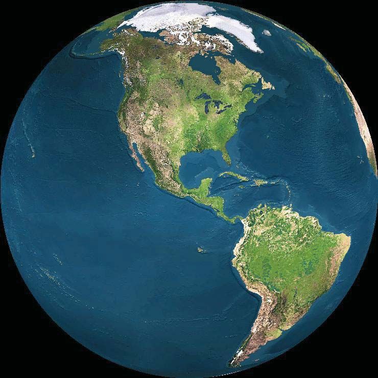
JOURNEY THROUGH THE UNIVERSE                                         3

Essential Questions
◗   Why is the Earth described as the “blue planet?”

Concepts
Students will learn the following concepts:
◗ Two-thirds of Earth’s surface is covered by water, the remaining
    one-third is covered by land.
◗ The entire Earth is surrounded by our atmosphere.

Objectives
Students will be able to do the following:
◗ Compare the amount of water to the amount of land on our
    planet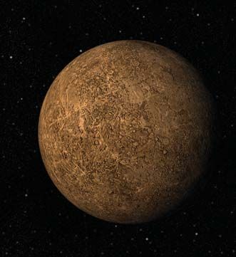
4                                 JOURNEY THROUGH THE UNIVERSE

    Science Overview
    People take vacations all over the world to experience different land-
    scapes, climates, and cultures. If you were to explore a section of land
    the size of the state of Delaware (5,294 km2) every day, it would take
    you 65 years to see every kilometer of land on Earth. There is a lot of
    land to explore! Have you ever thought about taking a vacation to the
    middle of the ocean? Just to see the oceans’ surfaces, you would have
    to explore about two and a half times faster than you explored the land
    to fit it all in! Even though most vacations are to places on land, the
    Earth is covered mostly in water. In fact, about 70% of the surface of
    the Earth is water; over 362 million square kilometers.

    Earth is truly a water planet. It is the only body in our Solar System
    with the unique feature of oceans. In order for liquid water to exist,
    certain temperature requirements must be met. If the area is too hot,
    water will evaporate and become steam. If a region is too cold, the water
    will freeze into ice. Earth is situated within the Solar System at just the
    right distance from the Sun for liquid water to exist on its surface.

    Most of the Earth’s water (97.24 %) is found in Earth’s five oceans.
    Icecaps and glaciers hold 2.14% of the water, with the remaining 0.62%
    consisting of ground water, freshwater lakes, inland seas, soil moisture,
    water vapor, and rivers (in descending order). Of these resources, the
    only types immediately useable for human consumption are ground
    water, freshwater lakes, and rivers: 0.3% of the Earth’s water.

    Water Resource    Water volume (km3)          Percent of total water
    Oceans             1,320,000,000                    97.24%
    Icecaps, Glaciers       29,000,000                  2.14%
    Ground water             8,000,000                  0.61%
    Freshwater lakes           125,000                  0.009%
    Inland seas                104,000                  0.008%
    Soil moisture               67,000                  0.005%
    Atmosphere                  13,000                  0.001%
    Rivers                       1,000                  0.0001%

    The Hydrologic Cycle
    A pan of water on a window sill will evaporate. Water molecules jump
    around in the liquid and eventually some of the ones at the surface
    will pop out, if they have enough thermal energy. If provided plenty of
    thermal energy and fresh dry air, eventually all the water will be gone.
    So why do the oceans not dry up? They must be replenished somehow,
    and in fact, they are replenished by rain water. The rain water comes
    from ocean water that has evaporated and formed clouds. The hydro-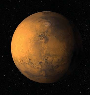
JOURNEY THROUGH THE UNIVERSE                                                                      5

logic cycle on Earth, the exchange of water in every form between the
Earth’s systems, is part of what makes Earth so unique.
                                                                               The Blue
                                                                                Planet
The Earth is made up of four interdependent systems: hydrosphere
(water), atmosphere (air), geosphere (land), and biosphere (life). The
hydrologic cycle is an example of how these four systems interact and
depend on one another. It begins with the Sun and wind (atmosphere)            Lesson at a Glance
evaporating water from the oceans (hydrosphere). The water vapor
may cool and mix with air to become clouds. Clouds create precipita-
tion, 77% of which falls directly back over the oceans. Rain water that
falls on land (geosphere) flows into rivers which empty into the oceans.
                                                                                    Science Overview
This cycle has been occurring for billions of years.

The biosphere on Earth could not have evolved as it has without the
hydrologic cycle acting as it does. The hydrosphere is home to most
of the life on Earth, and the rest rely on it for nourishment. Since over                 Conducting the
97% of the Earth’s water is in the oceans, this is what we focus on in                       Lesson
this lesson.

The Earth’s Oceans
In reality, Earth has only one ocean that is divided into five regions by                    Resources
continents and human definitions. The oceans flow into one another
continuously. The borders between them are fictitious, similar to divi-
sions of countries on the land. The placements and relations of the
oceans and continents have been changing slowly ever since Earth was
very young, and will continue to change in the future. As the surface of
the Earth crumples and stretches, the divisions, locations, and shapes
of the oceans, seas, and continents will be modified, as well.

The Pacific Ocean is located between Asia, Australia, North America,
and South America. The largest of the five oceans, it covers about 28%
of the global surface. The Pacific is the deepest ocean (with an average
depth of 4,188 m or 13,740 ft), and with such a vast volume, it is easy
to imagine the number of living creatures who call it home. It harbors
many endangered marine species, and in 1996, provided over 60% of
the world’s fish catch.

Between Africa, Europe, and North and South America lies the Atlantic
Ocean. It is second in size to the Pacific, but has less than half its area,
and its deepest point lies almost 2,400 m (7,874 ft) above the deepest
point in the Pacific. The most noticeable feature of this ocean is the
ridge that runs its entire length from north to south. Most of this Mid-
Atlantic ridge lies below sea level, but protrudes above the surface at
Iceland, the Azores, Ascension Island, and Tristan de Cunha.
Not much smaller than the Atlantic Ocean is the Indian Ocean, located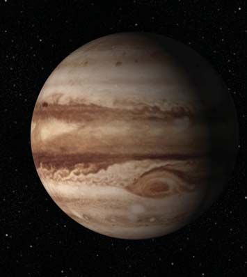
6                                 JOURNEY THROUGH THE UNIVERSE

    between Asia, Australia, and Africa. The Middle East, Africa, and
    East Asia are connected with Europe and the Americas via shipping
    routes in this ocean. These access waterways include the Suez Canal
    in Egypt and the Strait of Malacca between Indonesia and Malaysia.
    Approximately 40% of the world’s offshore oil production is from the
    Indian Ocean.

    The Arctic Ocean lies between Europe, Asia, and North America, mostly
    north of the Arctic Circle. Although the smallest of the oceans, it is
    almost one and a half times the area of the United States. The Arctic
    has harshly cold winters with continuous night, and damp and foggy
    summers with continuous daylight. The winters make it almost impos-
    sible to use the waterways for shipping, and even in the summer there
    is not much travel by air, ocean, or land.

    The decision to define a fifth ocean was made in the spring of 2000 by
    the International Hydrographic Organization. The Southern Ocean
    extends from the coast of Antarctica north to the 60˚ south latitude,
    including the southern parts of the Pacific, Atlantic, and Indian Oceans.
    It is the fourth largest of the world’s five oceans, bigger than the Arctic
    Ocean. Sea temperatures range from -2˚ C to 10˚ C. Winds here are on
    average the strongest of any on Earth. Despite its harsh environment,
    the Southern Ocean is home to many sea creatures such as squid,
    whales, and seals.

    The Continents
    Earth’s oceans are delineated by large land masses; these are the seven
    continents. Like the oceans, the continents have changed shape and
    location over geologic time scales. The continents of today are broken
    up from one continent that existed over 225 million years ago. The
    modern continents encompass many bodies of water including seas,
    lakes, ponds, streams, and rivers.

    The largest continent in both size and population is Asia. This continent
    is home to about three-fifths of the world’s people (3.7 billion), and cov-
    ers almost one-third of the total land area on Earth (43.7 million km2).
    Its borders include the Pacific Ocean in the east, and Europe and Africa
    in the west. Both the highest point (Mount Everest at 8,850 m of 27,035
    ft) and the lowest point (Marianas Trench at 11,033 m or 36,198 ft) on
    Earth are in Asia. It holds some of the world’s longest rivers, including
    the Yangtze River, which winds through China for almost 6,400 km.

    Africa is second to Asia in both size and population. Its 30 million km2
    is an immense plateau, and includes terrain of many extremes. The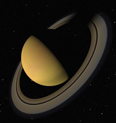
JOURNEY THROUGH THE UNIVERSE                                                                   7

largest desert in the world, the Sahara, is nearly the size of the entire
United States. Africa also encompasses the Nile River, the world’s
                                                                            The Blue
longest river, flowing through the northern part of the continent for
                                                                             Planet
6,670 km.

North America covers 24 million km2, making it the third largest con-
tinent, but fourth in population, after Asia, Africa, and Europe. This      Lesson at a Glance
continent is bordered almost completely by water, with the Arctic,
Atlantic, and Pacific Oceans bordering its three sides. A narrow strip
of land (Central America) connects it to South America. The five Great
Lakes exist in the middle of the continent, holding one-fifth of the
                                                                                 Science Overview
world’s fresh surface water (95% of the United States supply).

The fourth largest continent in area, 17.6 million km2, and fifth in
population, is South America, which, like North America, is almost
completely surrounded by water. The Pacific and Atlantic Oceans                        Conducting the
border much of South America, and the Drake Passage separates it                          Lesson
from Antarctica in the south. The world’s largest tropical rain forest
exists in the basin of the Amazon River, the second longest river on
Earth at 6,447 km.
                                                                                          Resources
Bordered by the Southern Ocean, Antarctica would be last on the list
of continent sizes if it were not for its icecap. The cap, which averages
2,164 m thick, makes this southern-most continent fifth in size with 14
million km2. The cold climate makes it nearly impossible for water
to exist there in liquid form. Ice and snow cover 98% of the continent.

One-eighth of the Earth’s population lives in Europe, making it third
in population, but sixth in area (10 million km2). Europe is part of the
same land mass as Asia, which is why they are sometimes referred to
collectively as Eurasia. The world’s largest lake, or land-locked body
of water, is the Caspian Sea at 371,000 km2, and is one feature that
separates Europe from Asia.

The smallest continent by area and sixth in population is Australia, the
only country that includes a whole continent. Australia lies between
the Indian and Pacific Oceans, and covers an area of 8 million km2.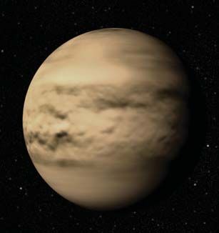
8                                  JOURNEY THROUGH THE UNIVERSE

    Conducting the Lesson
    Warm-Up & Pre-Assessment

    Teacher Materials
    ◗    Globe

    Preparation & Procedures
    1.   Ask students if any of them have a nickname that has special
         meaning. Allow students to share their nicknames with the class.
         Tell students that the Earth also has a special nickname that has
         meaning.

    2.   Show students a globe. Ask them if anyone has seen an object like
         this before. If they have, ask them if they know what it is called.
         (Desired answer: globe) Ask students to tell you one thing that they
         know about the globe.

    3.   Tell students that the globe shows where the land and water is
         on the Earth. Ask students how they could tell where the water
         is. (Desired answer: if you are using a standard globe the water will
         be represented in blue) Then ask students
         how they could tell where the land is.
                                                            Teaching Tip
         (Desired answer: it is the other colors)
         Point to a spot on the globe and
                                                     For older or more advanced
         ask students if your finger is on
                                                   students, you can ask students
         land or water.
                                                  if the land on the Earth is really
                                                  the colors that are shown on the
    4.   Tell the students that there is
                                                    globe. Ask students why the
         another part of the Earth, and
                                                       different colors might be
         it is all around us. Ask them if
                                                          helpful on a globe.
         they know what it is, you can give
         your students a hint by holding your
         breath. (Desired answer: air) Tell them that
         the air is called the atmosphere, ask the students to repeat it with
         you.

    5.   Ask the students if you can see the atmosphere in the classroom.
         (Desired answer: no) Ask them if they could see the atmosphere
         outside. (Desired answer: yes, as clouds)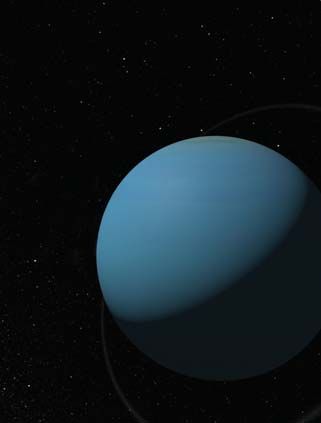
JOURNEY THROUGH THE UNIVERSE                        9

Notes:
                               The Blue
                                Planet

                               Lesson at a Glance

                                    Science Overview

                                          Conducting the
                                             Lesson

                                                 Warm Up &
                                             Pre-Assessment

                                                   Activity 1:
                                           Earth's Nickname

                                                  Activity 2:
                                                  Globe Toss

                                            Lesson Wrap-Up

                                            Resources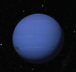
10 JOURNEY THROUGH THE UNIVERSE
Activity 1: Earth's Nickname
In this activity, students look at the Earth from space. They observe the
Earth as a whole, and compare the amounts of land and water.
Teacher Materials
◗ Overhead Projector
◗ Color overhead transparencies of Figures 1-4
Student Materials (per student)
◗ Student Worksheet 1
◗ Blue and brown crayon (one set per pair of students)
Preparation & Procedures
1. Make color overhead transparencies of Figures 1-4.
2. Dim the lights and ask the students to close their eyes. Read the
following description to the class: “Suddenly from behind the rim
of the Moon . . . there emerges a sparkling blue and white jewel, a
light, delicate blue sphere laced with slowly swirling veils of white,
rising like a small pearl in a thick sea of black mystery.” Stop at this
point and ask students what they think the author is talking about.
Take suggestions before reading the final sentence. “It takes more
than a moment to fully realize this is Earth... home.”
3. Ask students where they think the author might have been in order
to see the Earth this way. (Desired answer: in space or on the Moon)
Ask students who goes into space or to the Moon. (Desired answer:
astronauts) Tell students that the comments were from astronaut
Edgar Mitchell, who saw Earth from the Moon in 1971.
4. Ask students if they would like to see a picture of the Earth taken
from the Moon. Show students Figure 1 on the overhead projector
and ask the following questions:
◗ What is Astronaut Mitchell seeing that is a “delicate blue?”
(Desired answer: Earth’s oceans)
◗ What are “swirling veils of white?” (Desired answer: clouds)
◗ What is the “thick sea of black mystery?” (Desired answer: space
appears black because it cannot reflect any light from the Sun)
◗ Why can’t we see the lower half of the Earth from space? (De-
sired answer: it is the nighttime side of Earth)
5. Show students Figure 2. Ask them if they can recognize the United
States. Label the United States. Ask older students to identify the
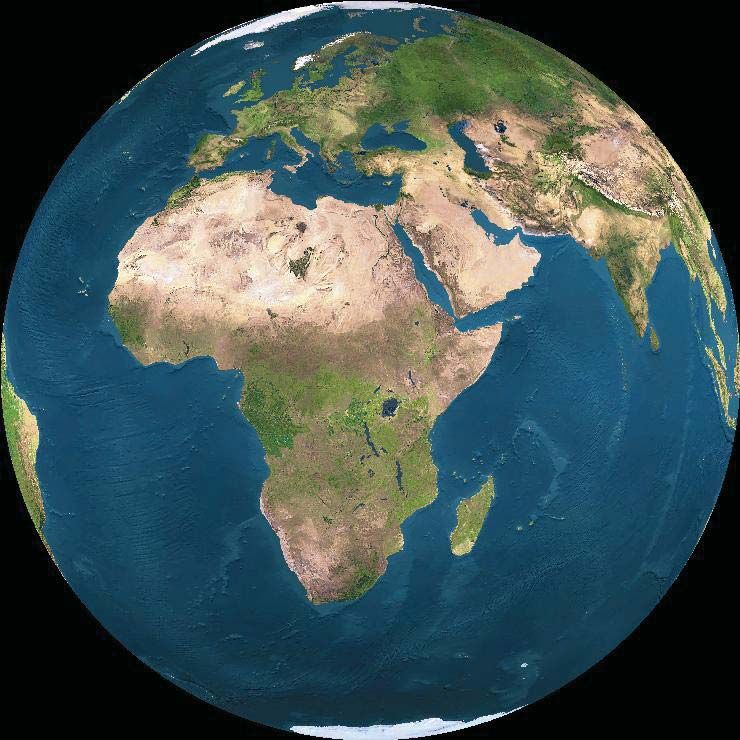
other continents in the picture. Label the contintents.JOURNEY THROUGH THE UNIVERSE 11
6. Have the students identify the oceans in the
Teaching Tip picture. (Desired answer: Atlantic, Pacific, Arc-
The Blue
tic, and Southern). Label the oceans. Display
Planet
Ask students if they, or anyone Figure 3 and ask older students to label the
in their family are from a different oceans and continents. (Oceans: Indian,
continent. Have students describe Pacific, Atlantic, Artic, Southern. Con-
some of the unique features of that tinents: Asia, Europe, Africa, Australia, Lesson at a Glance
location. You can use the Science and a sliver of Antarctica)
Overview to share some inter-
esting facts with your 7. Ask students, based on these pictures,
students. do they believe that the Earth is covered
Science Overview
with more land or more water. (Desired answer:
water) Ask students if they can use that information
to come up with a nickname for the Earth. Take some suggestions
before telling the students that the Earth’s nickname is the “blue
planet.” Ask students why they think the Earth is sometimes called Conducting the
this. (Desired answer: from space, Earth looks blue because so much of Lesson
its surface is water. Oceans cover about two-thirds, or most, of Earth’s Warm Up &
surface, and more is covered by large seas and lakes.) Pre-Assessment
Activity 1:
Teaching Tip 8. Using blue and brown crayons, have Earth's Nickname
students draw a picture of Earth on Activity 2:
Ask students if the atmo- Student Worksheet 1 as Astronaut Globe Toss
sphere is still present in Figures Mitchell saw it.
Lesson Wrap-Up
2 and 3. Explain that Figures 2 and
3 were created from many different Reflection & Discussion
images. Clouds are always present 1. Discuss with students why it
in the atmosphere, and it would is helpful to look at the entire Earth in
be impossible to get one pho- one picture. Have students share the
tograph that showed no pictures they drew with the rest of the Resources
clouds. class and ask them the following ques-
tions:
◗ What parts of the Earth did you include in
your picture?
(Desired answer: land, water, and atmosphere)
◗ Which Earth material is not always seen? How did you repre-
sent this in your picture? (Desired answer: the air, it can be shown
as clouds)
◗ Ask students why the Earth is called the “blue planet.” (De-
sired answer: it appears blue from space because of all the water on
its surface)
2. Have students read the descriptions they wrote of the Earth. Have
other students in the class try to figure out when they are describing
the land, water, and atmosphere.12 JOURNEY THROUGH THE UNIVERSE
Assessment Criteria for Activity 1
4 Points
◗ Student’s picture and description of Earth displayed a deep understanding of informa-
tion learned in the activity.
◗ Student accurately described the physical characteristics of their planet based on the
images provided, and used those characteristics to develop an appropriate nickname.
◗ Student presented information in logical, interesting sequence, which audience can fol-
low.
◗ Student correctly responded to all questions asked throughout the activity.
3 Points
◗ Student’s picture and description of Earth displayed an understanding of information
learned in the activity.
◗ Student accurately described some physical characteristics of their planet based on the
images provided, and used those characteristics to develop a nickname.
◗ Student presented information in logical sequence, which audience can follow.
◗ Student correctly responded to most questions asked throughout the activity.
2 Points
◗ Student’s picture and description of Earth displayed an understanding of some of the
major concepts presented in the activity.
◗ Student accurately described a few physical characteristics of their planet based on the
images provided, and used those characteristics to develop an appropriate nickname.
◗ Student presented information in a difficulut to follow sequence.
◗ Student correctly responded to a few questions asked throughout the activity.
1 Point
◗ Student’s picture and description of Earth displayed an understanding of a few of the
major concepts presented in the activity.
◗ Student attempted to describe the physical characteristics of their planet based on the
images provided, but did not use those characteristics to develop an appropriate nick-
name.
◗ Student presented information with no logical sequence.
◗ Student correctly responded to very few questions asked throughout the activity.
0 Points
◗ No work is completed.JOURNEY THROUGH THE UNIVERSE 13
Transfer of Knowledge
In order for students to apply what they have learned, have them
The Blue
compare the Earth to other planets. Students can record their answers Planet
on Student Worksheet 1.
1. Show students Figure 4 on the overhead projector. It contains
images of the other planets in the Solar System from NASA’s pho- Lesson at a Glance
tojournal web site: http://www.photojournal.jpl.nasa.gov
2. Have students choose a planet and imagine that they are explorers
that are going to visit that planet for the first time. Have students Science Overview
come up with a nickname for their planet, like ”blue planet.”
3. Let students use their creativity to write a description of their planet
as if they are the first person to see the planet. Students should
compare their planet to Earth. Conducting the
Lesson
Extensions Warm Up &
◗ Have students research who discovered each of these planets for Pre-Assessment
the first time. Activity 1:
◗ Have students create a three-dimensional model of the planet they Earth's Nickname
described and created a nickname for in Student Worksheet 1. Activity 2:
Globe Toss
Placing the Activity Within the Lesson Lesson Wrap-Up
Discuss with students that, by looking at the different pictures, they
can see that the Earth is made up of land, water, and the atmosphere.
Show the students Figure 1 again. As a class, brainstorm experiments
you could create to determine whether there is more land or water on
Earth. How would you determine the amount of cloud cover?
Resources
Notes on Activity 1:14 JOURNEY THROUGH THE UNIVERSE
Activity 2: Globe Toss
In this activity, students play a globe toss game to collect data, and
use probability to determine if the surface of the Earth is covered with
more land or water.
Teacher Materials
◗ A globe removed from its frame or an inflatable globe
◗ An overhead transparency of the grade appropriate Globe Toss
Game Tally Sheet, in the back of the lesson
◗ Plastic wrap
◗ Chalkboard or large piece of paper to make a graph
◗ Permanent Marker
Student Materials (per student)
◗ One post-it note per student
◗ Blue and brown crayon (one set per pair of students)
◗ Marker for the tally student
Preparation & Procedures
1. Select the appropriate tally sheet from the back of the lesson and
create an overheard transparency of it.
2. Have students sit or stand in a circle. Select one student to tally the
results of the game.
3. Show students a globe and ask them to identify the parts of the
Earth that they can see. (Desired answer: land and water) Ask stu-
dents what part of the Earth is not represented on the globe, it is
the part that is all around us right now. (Desired answer: the air or
atmosphere)
4. Cover the entire globe with the plastic wrap.
Using a marker, draw some clouds on the
plastic wrap. Ask students, what does Lesson Adaptation
the plastic wrap covering the globe rep-
resent? (Desired answer: the atmosphere) Talented and Gifted: Have
If students need a hint, draw their at- students create all of the graph
tention to the clouds. Place your thumb components, including the
on a random spot on the globe. Ask the graph title, axis titles, and
students if your thumb is on land or water. scale.
Ask them what else it is on. (Desired answer:
atmosphere)JOURNEY THROUGH THE UNIVERSE 15
5. Explain the following directions for the Globe Toss game to the
students:
The Blue
The globe is tossed or rolled to a student across the circle. The
Planet
student receiving the globe will look at his/her right thumb to
see where it has landed: on water or land. In addition, students
should note if that location is covered by the atmosphere. (Note: the
atmosphere covers the entire Earth, just like the plastic wrap, even Lesson at a Glance
where clouds are not present) Students should give the information
to the tally person, who should record it on the tally sheet.
6. Ask students to predict whether the final tally of the game will
Science Overview
have more points for the land or water. (For older students, have
them calculate percentages and compare to actual percentages of
land and water.)
7. Begin the Globe Toss game. The student tallying the results will Conducting the
record the thumb landings on water, land, and atmosphere on the Lesson
grade appropriate tally sheet. Make sure each student gets to toss Warm Up &
the globe at least once. Pre-Assessment
Activity 1:
8. When you end the game, use a chalkboard or a large piece Earth's Nickname
of paper, and make a bar graph of the tally sheet as a Activity 2:
class. Give each student a post-it note. Have them Globe Toss
label it water or land, depending on where their
Curriculum Lesson Wrap-Up
thumb landed during the globe toss game. Cre-
Connections
ate the skeleton of the graph on the board. Ask
students to put their post-it notes in the correct
Mathematics: Review with stu-
column on the graph.
dents the difference between
a bar graph, line graph, Resources
Reflection & Discussion
and pie chart.
Ask students, based on the information gained from
the activity, what covers most of the surface of the Earth?
(Desired answer: water covers two-thirds or most of the surface) Ask
students what covers the rest of Earth’s surface. (Desired answer: land
covers one-third or the rest of the surface) Ask students where the atmosh-
phere is. (Desired answer: it is everywhere, it can be seen as clouds)
Transfer of Knowledge
Have students go back and look at the pictures they drew of the Earth
in Activity 1. After graphing the amount of water versus land on Earth,
have students evaluate the accuracy of their drawings. Would they
make any changes? Why or why not? Have students re-draw the Earth
to show the correct ratio of land to water. (Desired answer: students should
determine if they have too much or too little water. Students should also note
if they represented the atmoshphere with clouds.)16 JOURNEY THROUGH THE UNIVERSE
Assessment Criteria for Activity 2
4 Points
◗ Student actively participated in the Globe Toss game.
◗ Student correctly participated in completing the bar graph for the tally sheet.
◗ Student demonstrated a deep understanding by answering all class questions with
explanations and elaboration.
◗ Student accurately evaluated and corrected their drawing of the Earth.
3 Points
◗ Student participated in the Globe Toss game.
◗ Student correctly participated in completing the bar graph for the tally sheet.
◗ Student demonstrated an understanding of the major concepts by answering class
questions with explanations.
◗ Student accurately evaluated and corrected their drawing of the Earth.
2 Points
◗ Student participated in the Globe Toss game with prompting.
◗ Student participated in completing the bar graph for the tally sheet, but needed
some prompting to do so correctly.
◗ Student demonstrated an understanding of some of the major concepts by answer-
ing class questions.
◗ Student attempted to evaluate and correct their drawing of the Earth.
1 Point
◗ Student did not participate in the Globe Toss game.
◗ Student participated in completing the bar graph for the tally sheet, but did so
incorrectly.
◗ Student’s answers to class questions demonstrated limited knowledge of major
concepts.
◗ Student incorrectly evaluated and modified their drawing of the Earth.
0 Points
◗ No work completed.JOURNEY THROUGH THE UNIVERSE 17
Extensions
The Earth is two-thirds water. Have students research how humans
The Blue
use water on Earth, and what living things rely on it.
Planet
Placing the Activity Within the Lesson
Discuss with students how they were able to collect data to determine
that the Earth has more water on its surface than land. Ask students Lesson at a Glance
to share how they used this information to go back and improve their
illustrations of the Earth.
Science Overview
Notes on Activity 2:
Conducting the
Lesson
Warm Up &
Pre-Assessment
Activity 1:
Earth's Nickname
Activity 2:
Globe Toss
Lesson Wrap-Up
Resources18 JOURNEY THROUGH THE UNIVERSE
Lesson Wrap-Up
Transfer of Knowledge for the Lesson
In order to assess students understanding, have them apply what they
have learned to answer the question below.
Draw a pie chart on the board and ask students to complete the pie
chart to show how much land and water are on the Earth. Use a blue
crayon to show water and a brown crayon to show land. Ask students
to label their chart.
Assessment Criteria for the Lesson
4 Points
◗ Student colored in two sections of the pie chart blue to represent water and one
section of the pie chart brown to represent land.
◗ Students work was neat and labeled.
3 Points
◗ Student represented more water than land.
◗ Students work was neat and labeled.
2 Points
◗ Student represented water and land.
◗ Students work was readable and labeled.
1 Point
◗ Student attempted to complete the pie chart.
◗ Students work was readable.
0 Points
◗ No work was completed.JOURNEY THROUGH THE UNIVERSE 19
Lesson Closure
In this lesson, students familiarized themselves with the different parts
The Blue
of the Earth: land, water, and atmosphere. Students experimented to
Planet
determine that two-thirds of its surface is covered by water and the
remaining one-third is covered by land. Students also realized that the
atmosphere is all around the Earth even though they cannot always see
it. Discuss with students how these different components make the Lesson at a Glance
Earth a unique place in the Solar System, one that can support life.
Extensions for the Lesson
Have students research other planets in the Solar System. How are Science Overview
they similar to Earth? How are they different?
Conducting the
Lesson
Warm Up &
Pre-Assessment
Activity 1:
Earth's Nickname
Activity 2:
Globe Toss
Lesson Wrap-Up
Resources20 JOURNEY THROUGH THE UNIVERSE
Resources
Internet Resources & References
Student-Friendly Web Sites:
How much water is there on (and in) the Earth?
ga.water.usgs.gov/edu/earthhowmuch.html
How Stuff Works
www.howstuffworks.com/question157.htm
NASA Photojournal
www.photojournal.jpl.nasa.gov
Teacher-Oriented Web Sites:
NASA's Photojournal
photojournal.jpl.nasa.gov
National Science Education Standards
www.nap.edu/readingroom/books/nses/html/
Water Science for Schools
ga.usgs.gov/edu/mearth.htmlJOURNEY THROUGH THE UNIVERSE 21
Notes:
The Blue
Planet
Lesson at a Glance
Science Overview
Conducting the
Lesson
Resources
Internet Resources
& ReferencesFigure 1: Earthrise
Figure 2: Earth Without Shadows or Clouds

Source: http://www.fourmilab.ch/cgi-bin/uncgi/Earth
Figure 3: Earth Without Shadows or Clouds

Source: http://www.fourmilab.ch/cgi-bin/uncgi/Earth
Figure 4: Planets in the Solar System

                           Venus
Mercury
                                                    Mars

 Jupiter                    Saturn
                                                    Uranus

                                            Pluto

            Neptune
Globe Toss Game Tally Sheet K-2
Name ______________________________________________ Date ___________
Is the atmosphere over
Water Land
this spot?
Toss 1
Toss 2
Toss 3
Toss 4
Toss 5
Toss 6
Toss 7
Toss 8
Toss 9
Toss 10
Toss 11
Toss 12
Toss 13
Toss 14
Toss 15
Toss 16
Toss 17
Toss 18
Toss 19
Toss 20
Total
page 1 of 1Globe Toss Game Tally Sheet 3-4
Name ______________________________________________ Date ___________
Is there atmosphere over
Water
this spot? Yes or no.
Atlantic Ocean
Arctic Ocean
Indian Ocean
Pacific Ocean
Southern Ocean
Other
Total
Is there atmosphere over
Land
this spot? Yes or no.
Africa
Antarctica
Asia
Australia
Europe
North America
South America
Total
page 1 of 1Student Worksheet 1: The Blue Planet
Name ______________________________________________ Date ___________
Draw a picture of the Earth as Astronaut Edgar Mitchell saw it.
How do other planets compare to the Earth?
Choose a planet from the pictures your teacher shows you.
Imagine that you are an explorer going to visit that planet for the first time!
Planet Name: _______________________ Nickname your planet: ______________________
Write a description of your planet as if you are the first person to see it.
page 1 of 1You can also read