ECOLOGICAL IMPACT ASSESSMENT (ECIA) OF FLOOD IMPROVEMENT WORKS ANNE VALLEY WALKWAY, DUNHILL, CO.WATERFORD. BY JOHN DERWIN BSC., MSC. AGR. APRIL ...
←
→
Page content transcription
If your browser does not render page correctly, please read the page content below
Ecological Impact Assessment (EcIA)
                of
    Flood Improvement Works
      Anne Valley Walkway,
      Dunhill, Co.Waterford.
                by
   John Derwin BSc., MSc. Agr.
            April 2021

                                      1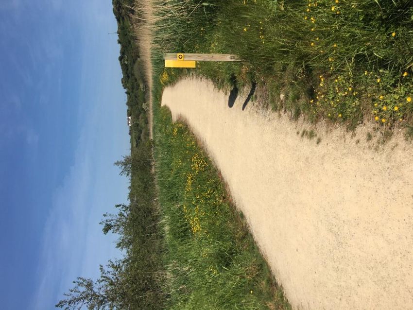
Introduction:
Waterford City and County Council (WCCC) carried out an Appropriate Assessment (AA)
Screening of the proposed trail improvements at Anne Valley Wetlands. There are 4 Natura
sites within 15km of the project site. These are Tramore Backstrand and Dunes SAC (000671),
9km to the east, Tramore Backstrand SPA (004027), also 9km to the east, Lower River Suir
SAC (002137), 10km to the north and Mid Waterford Coast SPA (004193), 970m to the south.
The AA screening concluded that there was no potential for significant effects on any
NATURA sites. Therefore, it is concluded that a Natura Impact Statement (NIS) is not required
for the proposed development (WCCC, 2021).

However, it was recommended that an Ecological Impact Assessment (EcIA) be carried out to
ensure that there were no adverse impacts to the local ecology, including Annestown Stream
and associated habitats and species. This report outlines the results of this EcIA.

The Anne Valley Walkway is a 5km recreational trail located between Dunhill and Annestown,
Co. Waterford. It is situated 13km west of Waterford City, 8km west of Tramore and 24km
east of Dungarvan. The trail runs through the Anne Valley Wetlands (approx. 55ha) along the
riverbank of the Annestown Stream, which flows south to Dunabrattin Bay at Annestown. The
initial 2.2km trail from Dunhill village to Dunhill Castle was developed in 2013 with support
from LEADER Funding and was further extended south to Annestown Village in 2018. This
easy grade trail is 2m wide with a gentle slope and level surface. This trail is popular with
visitors and locals, especially during summer months.

However, as the trail is within a 100 yr flood zone (HES, 2021), there are sections that are
prone to flooding. These sections become inaccessible to walkers, who must divert onto the
adjacent narrow country road. The proposed development is to raise the level of the trail to
prevent flooding and to allow year-round access to the trail.

The proposed development area is 0.42ha. The proposed walking track upgrade is between
Dunhill Castle and Annestown. The trail improvements begin 300m south-west of Dunhill
Castle and extend south for 940m.The improvements will involve raising the level of the trail
by 0.85m and widening the base of the path to 4.5m. Culverts will be regularly placed along
low points of the trail to maintain existing drainage pathways and further limit the flood
impact around the raised walkway, by allowing flood waters drain freely.

                                                                                           2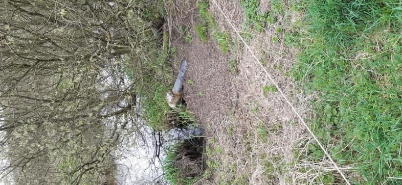
Ecological Survey:
On the 23/03/2021, the proposed development site was visited by Ecologist John Derwin
with Johnny Brunnock, Trails Officer, Waterford City and County Council (WCCC) and the
extent, purpose and nature of the proposed development was outlined. The entire area
within and adjacent to the proposed development area(2.96ha) was surveyed and the main
habitats were mapped. The habitats within and adjacent to the proposed development site
were, Buildings and Artificial Surfaces (BL3), Other Artificial lakes and ponds (FL8), Dense
Bracken (HD1), Wet Grassland (GS4), Scrub (WS1), Wet Woodland (WN6), Reedbeds and
Large Sedge Swamps (FS1), Marsh (GM1), Drainage Ditches, (FW4)and Depositing Lowland
Rivers (FW2). These habitats are described in detail in the next section and outlined in
Table1and Map 1.

Table 1: HabitatDescriptions

A: Buildings and Artificial surfaces (BL3):   Area: 0.4ha

                                              The existing path is 2m wide, with a level
                                              gravel surface, is constructed in a shallow
                                              trench. Wet grassland with Yorkshire Fog
                                              (Holcus lanatus), Creeping Bent-grass
                                              (Agrostis stolonifera), Creeping Butter-cup
                                              (Ranunculus repens) and Common Reed
                                              (Phragmites australis) occurs on either
                                              side.

                                              There is a drainage culvert at the southern
                                              section of track, allowing water to drain
                                              under the path.

                                                                                            3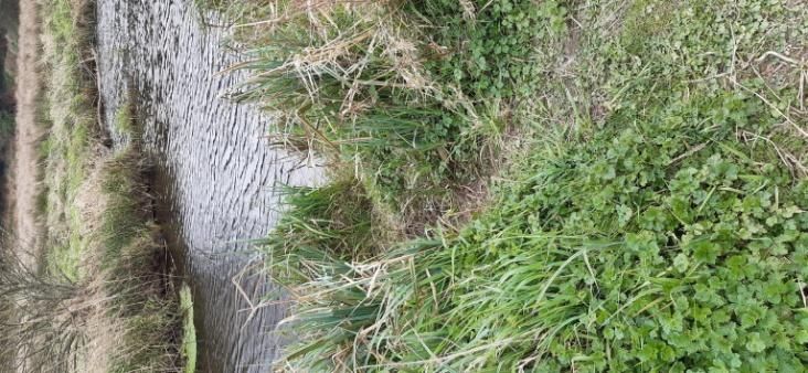
B: Other Artificial Lakes and Ponds (FL1):   Area: 0.4ha
                                             There are 3 wet hollows present that were
                                             excavated as part of an Integrated
                                             Constructed Wetland, which are lined with
                                             Willow (Salix spp.).

                                             Two of these inter-linked channels are in-
                                             filled with wetland species Yellow Flag (Iris
                                             pseudacorus), Soft Rush (Juncus effusus)
                                             and Common Reed (Phragmites
                                             australis).The third hollow has open water
                                             and an outflow pipe to adjacent
                                             Ballylenane Stream.

                                             Cattle graze on the poached banks that
                                             support wet grassland with Yorkshire Fog
                                             (Holcus lanatus), Creeping Bent-grass
                                             (Agrostis stolonifera), Creeping Butter-cup
                                             (Ranunculus repens), Soft Rush (Juncus
                                             effusus), Thistle (Cirsium spp.) and Curled
                                             Dock (Rumex crispus).

                                                                                             4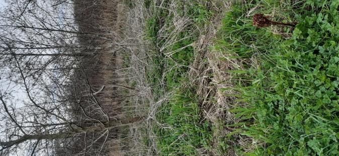
C: Dense Bracken (HD1):   Area: 0.4ha
                          Extensive areas of Dense Bracken (Pteridium
                          aquilinum) dominate this section of higher
                          ground. There is some encroachment of
                          Common gorse (Ulex europaeus) scrub with
                          Downy Birch (Betula pubescens).

                                                                        5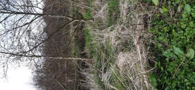
D: Wet Grassland (GS4):   Area: 0.2ha

                          The wet grassland vegetation along the
                          stream is dominated by Soft Rush (Juncus
                          effusus) with Yorkshire Fog (Holcus
                          lanatus), Creeping Bent-grass (Agrostis
                          stolonifera), Creeping Butter-cup
                          (Ranunculus repens), Thistle (Cirsium spp.),
                          Common Nettle (Urtica dioica) and Curled
                          Dock (Rumex crispus).

                                                                         6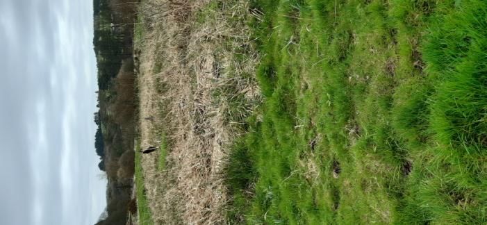
E: Scrub (WS1):   Area: 0.3ha

                  This scrub is dominated by Willow (Salix
                  spp.) and Alder (Alnus glutinosa)with
                  Bramble (Rubus fruticosus), Common
                  Nettle (Urtica dioica), Creeping Bent-grass
                  (Agrostis stolonifera) and Curled Dock
                  (Rumex crispus).

                                                                7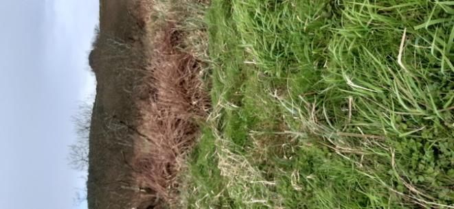
F: Wet Woodland (WN6):   Area: 0.4ha
                         Alder (Alnus glutinosa) woodland with
                         Downy Birch (Betula pubescens) occurs
                         along western margin of the track. The
                         ground flora consists of Rosebay Willow-
                         herb (Epilobium angustifolium), Common
                         Nettle (Urtica dioica), Bramble (Rubus
                         fruticosus),Creeping Butter-cup
                         (Ranunculus repens), Thistle (Cirsium
                         spp.),Herb Robert (Geranium robertianum),
                         Reed Canary-grass (Phalaris arundinacea),
                         and Curled Dock (Rumex crispus). Of
                         particular interest is the presence of Royal
                         Fern (Osmunda regalis).

                         There are wet hollows in the woodland and
                         otters cross track from hollows to access
                         the river.

                                                                        8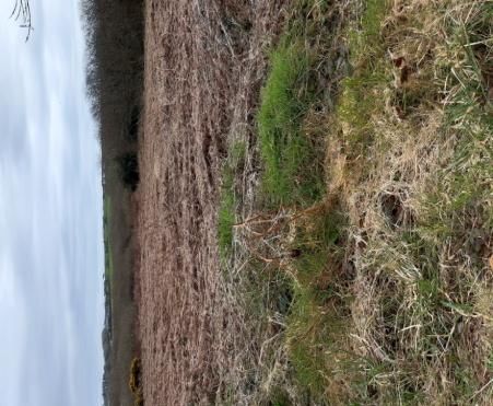
G: Reedbeds and Large sedge Swamps Area: 0.2ha
(FS1)
                                   Common Reed (Phragmites australis) lines
                                   the banks of the Annestown Stream. This
                                   thin margin of reedbed expands around the
                                   back channel at the footbridge and extends
                                   to the east of the river. This footbridge will
                                   need to be raised as part of the track
                                   upgrade. The footbridge will be
                                   repositioned on raised piers to increase
                                   height by 600mm.

                                         The back channel is used by otters, with
                                         tracks visible beside the footbridge. The
                                         current outflow will be retained to prevent
                                         to the drainage pattern.

                                                                                       9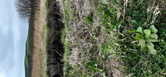
H: Marsh (GM1):   Area: 0.3ha
                  To the south-west of the site the ground
                  surface drops away behind the track and a
                  wet marshland has developed with
                  Common Reed (Phragmites australis),
                  Yellow Flag (Iris pseudacorus), Reed Canary-
                  grass (Phalaris arundinacea), Great Tussock
                  Sedge (Carexpaniculata) and Marsh
                  Bedstraw (Galiumpalustre). Of particular
                  interest is the presence of Royal Fern
                  (Osmunda regalis). Care must be taken to
                  prevent the raised path becoming a barrier
                  between this marsh and the stream. The
                  installation of out flow pipes will ensure
                  that there is no alteration of drainage
                  patterns.

                  Note: Royal Fern (Osmundia regalis)
                  tussocks

                                                                 10
I: Drainage Ditch (FW4) Area: 0.1ha
There are numerous drainage ditches
and back channels in this wetland.
The main back channel extends into
the wet woodland for 250m from the
footbridge. These drainage ditches
are lined by Willow (Salix spp.) with
Common Reed (Phragmites australis),
Nettle (Urtica dioica), Yorkshire Fog
(Holcus lanatus), Yellow Flag (Iris
pseudacorus), Reed Canary-grass
(Phalaris arundinacea) and Soft Rush
(Juncus effusus).
Outflow from constructed wetland:
Outflow drainage pipe from the
constructed wetland into the
Ballylenane stream that flows from
Dunhill Castle.
11J: Depositing Lowland Rivers (FW2) Area: 0.2ha
The riverbank of this lowland stream is
lined with Common Reed (Phragmites
australis),Reed Canary-grass (Phalaris
arundinacea) and Reedmace (Typha
latifolia) with scattered Willow (Salix
spp.). Also, there is evidence of tidal
influence on the river at southern section
of the project site with algae and
mudbanks on back channel.
The tidal flow will be allowed to drain
unimpeded by the installation of outflow
pipes.
Enlarged culverts will be used in sections
to allow unrestricted access to the
stream for Otters.
Note otter track on riverbank
12Fauna:
The following species have been noted at Anne Valley Wetlands.
Raven (Corvus corax):Ravens were noted on field visit and may roost in Dunhill Castle.As
development works will be 300m south of the castle, there will be no impact on this species.
Wren (Troglodytes troglodytes): Wren were noted on the field visit and may nest in scrub
and wet grassland. However, as development works will be restricted to the track and will
avoid scrub vegetation, there will be no impact on this species.
Thrush (Turdus philomelos): Song thrush were noted on field visit and may be nesting in
scrub and wet woodland. However, as development works will be restricted to the track and
will avoid scrub vegetation, there will be no impact on this species.
Mallard(Anas platyrhynchos): Mallard feed and breed within the Anne Valley Wetlands.
However, no nests were noted within the vicinity of the proposed development. As works
which will be restricted to the track, riverbank vegetation will be avoided. Therefore, any
impact would be small-scale, short-termand temporary.
Heron (Ardea cinerea):Heron feed along the riverbank of Annestown Stream. As there is no
breeding heronry within the vicinity of the proposed works any disturbance to Heron would
be small-scale, short-term and temporary.
Kingfisher (Alcedoatthis):Kingfisher feed along the riverbank of Annestown Stream and may
nest in hollows along the riverbank. As the proposed works will avoid disturbance to
riverbanks, any impact on kingfisher would be small-scale, short-termand temporary.
Mute Swan (Cygnus olor):Mute Swan feed and breed along the riverbank of Annestown
Stream. However, nesting sites are located north of Dunhill Castle. As there are no nest sites
within the vicinity of the proposed works any disturbance to Mute Swan would be small-
scale, short-term and temporary.
Otter (Lutralutra):Otter presence was confirmed by the identification of fresh tracks, trails
and spraints along the northern section of the project area. Otter trails cross the track,
emerging from wet hollows in the scrub and entering the stream. Back channels and wet
hollows within the scrub provide ideal habitat for otter holts. As the project works are
restricted to the path margins, any disturbance to Otter within the vicinity of the proposed
works will be small-scale, short-term and temporary. To ensure minimal disturbance all
works will be carried out in day-light hours using light machinery and follow Transport
Infrastructure Ireland (TII) Guidelines, which restrict light machinery to>15m from otter holt.
As 3 of the wet hollows are >15m from the development area, no restriction areas are
required. However, three hollows to the east of the project area are< 15m from the
development area and will require restriction zones.
13Mitigation
The proposed development will have impact on habitats and species within the affected area.
For somehabitats and species, the impact will be minor, but for others the impact may
require mitigation to compensate for habitat loss. Areas of high ecological interest will be
avoided to prevent any potential damage. Areas of medium ecological interest that may be
damaged by the development will be compensated by habitat improvement in the adjacent
area. The mitigation actions for the listed habitats are:
A: Buildings and Artificial Surfaces (BL3):Upgrade
This proposed development aims to improve the pedestrian safety to the trail by preventing
flooding and to allow year-round recreational access between Dunhill and Annestown.
Expansion of the current trail footprint will be required, and the trail will need to be raised.
Culverts will be installed to maintain drainage outflows.
The proposed track upgrade will consist of 0.42ha (4.5m x 940m), which will be constructed
over the existing track. The upgrade will extend for 940m and which will require the removal
of some of the trackside wet grassland. The upgraded track will be 2.0m wide and raised by
0.85m with shallow slopes (1:2m) extending 1.25m either side. There will also be a
requirement to lift a pedestrian bridge by raising piers by 0.6m.
Construction works will be governed by a health and safety statement. Following best
practice, the risk of accidents which are significant in scale is low.
B: Other Artifical Lakes and Ponds (FL1):Avoid.
In 2000, the initial Dunhill Integrated Constructed Wetlands were developed by Waterford
County Council, adjacent to the Annestown River to protect water-quality from agricultural
run-off from the adjacent slopes and sewage treatment from Dunhill Village. The constructed
wetlands were extended in 2012 to increase the number of wastewater treatment ponds. The
constructed wetland adjacent to the project location, consists of 3 inter-linked channels with
wetland species such as Yellow Flag (Iris pseudacorus) and Common Reed (Phragmites
australis). Two of the channels are filled-in with wetland vegetation, while the third channel,
adjacent to the river has open water and has an outflow to the adjacent stream.
Thisconstructed wetland is outside the development area.
C: Dense Bracken (HD1): Encourage scrub encroachment
The section of dense Bracken (Pteridium aquilinum) adjacent to the road, occurs on higher
ground. These is encroachment of Common gorse (Ulex europaeus) and Downy Birch (Betula
pubescens) scrub and this should be encouraged,to increase the biodiversity value of the site.
14D: Wet Grassland (GS4):Control Drainage.
Wet grassland is present adjacent to the Constructed Wetlands and adjacent to the trail. As
the Constructed Wetlands are outside the development area, there will be no impact on the
adjacent wet grassland. The footprint of the proposed trail improvement may impact on the
adjacent wet grassland and obstruct drainage. Culverts will be inserted at intervals into the
base of the trackway, to maintain drainage outflows.
E: Scrub:Avoid.
The Willow (Salix spp.) scrub, which may support Otter, will not be impacted by the proposed
development works, as works will be restricted to the footprint of the trackway.
F:Wet woodland (WN6):Restock.
The immature wet woodland will be avoided and will not be impacted by the proposed by
development works, as works will be restricted to the footprint of the trackway. The natural
regeneration of native trees such as Alder (Alnus glutinosa), Willow (Salix spp.), and Downy
Birch (Betula pubescens) should be encouraged to enhance the biodiversity of this woodland.
G: Reedbeds and Large sedge Swamps (FS1): Avoid, Control Drainage
As the proposed development works are restricted to the trackway and margins, the
reedbeds along the stream will be avoided. Any potential impact on drainage will be
prevented with the installation of culverts along sections of the upgraded trail that are
adjacent to reedbeds.
H:Marsh (GM1):Avoid, Control Drainage.
As the proposed development is restricted to the trackway and margins, the marsh areas will
be avoided and there will be no impact on habitats or species, including the Royal Fern. Any
potential impact on drainage will be prevented with the installation of culverts along sections
of the upgraded trackway that are adjacent to the marsh.
Zone I: Drainage ditches (FW4): Control Drainage.
The proposed development does not require any alteration of existing drainage channels. Any
outflows that may be restricted by the improved walkway, will be allowed to flow un-
impeded by the installation of culverts under the trackway, to maintain current drainage
patterns.
15Zone J: Depositing Lowland Rivers (FW2): Control Run-off, Re-plant
The Annestown Stream flows south from Ballylegat to Dunabrattin Bay and is within the
Dunhill Sub Basin. The Ballylenane tributary flows into Annestown stream just south of
Dunhill Castle. The proposed works begin adjacent to this tributary. However, the proposed
development does not require any alteration of riverbank.
There is a 3-5m margin between the proposed development works and Standard Measures
will be undertaken to prevent run-off of building material, oils, plastic piping etc. into the
streams.
Otter: Avoid Disturbance
Currently the otters cross the trail to access the river. Disturbance to otters will be minimised
by working in daylight hours over a short time-period, with speed-limits for light machinery
and restriction zones along the track. The site will be monitored for the presence of otters
daily. Some of the drainage culverts will be enlarged to allow access for otter to the river.
16Conclusion: This habitat survey identified ten habitat types within the proposed development area. None of these represented Annex I Habitats of the EU Habitats Directive. Of these, there are three habitats, Buildings and Artificial Surfaces(BL3),Other Artificial Lakes and Ponds (FL1) and Dense Bracken (HD1) that are of low ecological interest. The remaining seven habitats of medium ecological interest are Wet Grassland (GS4), Scrub (WS1), Wet Woodland (WN6), Reedbeds and Tall Sedge Swamps (FS1), Marsh (GM2), Drainage Ditches (FW4) and Depositing lowland Rivers (FW2). The wet grassland adjoins Annestown River and acts as a buffer to the river. This area floods during periods of high water-levels. The scrub is dominated by Willow (Salix spp.), which is expanding into the bracken dominated field and this should be encouraged to improve biodiversity. The wet woodland was planted on cutover bog in 2015 (ref. Dunhill Tourism Walking Trail CLG) and is developing into a natural wet woodland. The reedbeds adjacent to the riverbank consist of Common Reed and will not be impacted by the development. The entire riverbank will be avoided and run-off to the river channel will be prevented. The marsh habitat will not be impacted by the development. All development works will be restricted to the trackway and all drainage channels will be maintained with the installation of culverts. The Annestown Stream is a lowland depositing river that becomes tidal south of the project area. There are silt deposits evident in back-channels, but the water is clear. Annestown Stream is within the Dunhill sub-catchment. Irish Water have been working in partnership with Waterford City and Council at Dunhill since 2014.TheWater-quality Status for Dunhill sub catchment is ‘Moderate’ based on the latest EPA RWB data (2013-2019). Previously, the water-quality was recorded as ‘Poor’ status in 2010-2015. Therefore, water-quality has improved since the installation of the constructed wetlands. As the footprint of the project area is small
Table 2: Habitats and Species Adjacent to the Development Site and proposed Mitigation.
Zone Fossit Fossit Species Ecological Potential Impact/
Code Habitat Importance Mitigation
A BL3 Buildings Yorkshire Fog (Holcus lanatus) Low Medium:
and Roads Creeping Butter-cup (Raunculus repens) Upgrade to
Creeping Bent-grass (Agrostis prevent flooding.
stolonifera) Culvert to allow
Common Reed (Phragmites australis) water-flow
B FL1 Artificial Common Reed (Phragmites australis) Low Low: Outside
Lakes/ Yellow Flag (Iris pseudacorus) Proposed
Ponds Willow (Salix spp.) Development
Soft Rush (Juncus effusus) Zone.
Curled Dock (Rumex crispus)
C HD1 Dense Bracken (Pteridium aquilinum) Low Low: Allow scrub
Bracken encroachment.
D GS4 Wet Soft Rush (Juncus effusus) Medium Medium:Some
Grassland Creeping Butter-cup (Raunculus repens) habitat loss at
Creeping Bent-grass(A. stolonifera) trackway margins.
Yorkshire Fog (H.lanatus) Avoid River Buffer
Common Nettle (Urtica dioica) Zone, control
Curled Dock (R. crispus) drainage.
E WS1 Scrub Willow (Salix spp.) Medium Low: Encourage
Alder (Alnus glutinosa) spread into Dense
Bramble (Rubus fructicosus) Bracken.
Common Nettle (Urtica dioica) Protect Otter
Creeping Bent-grass (A. stolonifera)
F WN6 Wet Alder (Alnus glutinosa) Medium Low: Encourage
Woodland Willow (Salix spp.) native trees such
Downy Birch (Betula pubescens) as Alder, Birch
Common Nettle (Urtica dioica) and Willow to
Bramble (Rubus fructicosus) develop.
Herb Robert (Geranium robertianum)
Creeping Butter-cup (Raunculus repens)
G FS1 Reedbeds Common Reed (Phragmites australis) Medium Low:Avoid
and Large Reedmace (Typha latifolia) reedbeds and
Sedge Yellow Flag (Iris pseudacorus) maintain drainage
Swamps pattern
H GM2 Marsh Common Reed (Phragmites australis) Medium Low: Avoid,
Yellow Flag (Iris pseudacorus) marsh and
Reed Canary-grass (Phalaris maintain drainage
arundinacea) pattern
Great Tussock Sedge (Carex paniculate)
Marsh Bedstraw (Galiumpalustre)
Royal Fern (Osmunda regalis)
I FW4 Drainage Common Reed (Phragmites australis) Medium Low: Avoid,
Ditches Willow (Salix spp.) drainage ditches
Yellow Flag (Iris pseudacorus) and maintain
Reed Canary-grass (P. arundinacea) drainage pattern.
Soft Rush (J. effusus) Protect Otter
J FW2 Depositing Willow (Salix spp.) Medium Low: Avoid,
Lowland Common Reed (P. australis) riverbank,
Rivers Reed Canary-grass (P.arundinacea) maintain
Reedmace (Typha latifolia) drainage.
Protect Otter
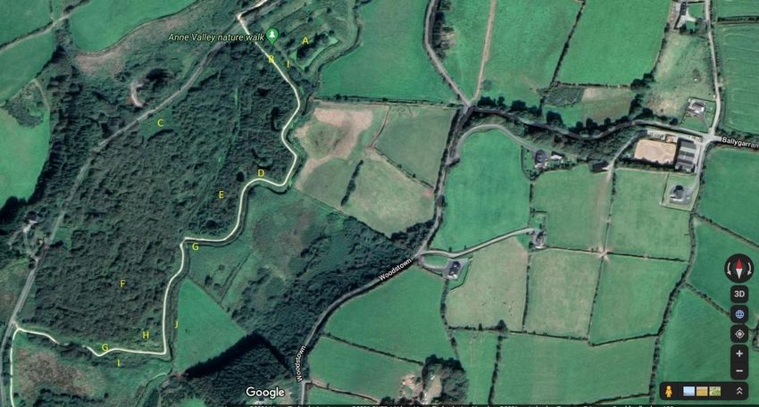
18Map 1: Anne Valley Trail and Associated Habitats
Key: A: Artificial Lakes and Ponds (Constructed Wetland), B: Buildings and Artificial Surfaces (Trail), C: Dense Bracken, D: Wet Grassland, E: Scrub, F: Wet Woodland, G:
Reedbeds and Large Sedge Swamps, H: Marsh, I: Drainage Ditches, J: Depositing Lowland Rivers
19References
Department of the Environment, Heritage & Local Government (DoEHLG). 2010.
Appropriate Assessment of Plans & Projects in Ireland. Guidance for Planning Authorities.
Department of Environment, Heritage & Local Government. Available at:
www.npws.ie/sites/default/files/publications/pdf/NPWS_2009_AA_Guidance.pdf
HES (2021). Hydro Environmental Services, Flood Risk Assessment Report, 2021.
Fossitt, J.A. (2000). A Guide to Habitats in Ireland. The Heritage Council, Kilkenny.
National Biodiversity Data centre (NBDC) website
National Parks and Wildlife Service (NPWS) website.
Transport Infrastructure Ireland (TII) website
WCCC, 2021. Habitats Directive Project Screening Assessment. Waterford City and County
Council, The Mall, Water City, County Waterford.
20You can also read