EFFICIENT MOBILITY OneNYC 2050 - BUILDING A STRONG AND FAIR CITY
←
→
Page content transcription
If your browser does not render page correctly, please read the page content below
OneNYC 2050
BUILDING A STRONG AND FAIR CITY

EFFICIENT
MOBILITY
VOLUME 8 OF 9

New York City will enable reliable,
safe, and sustainable transportation
options so that no New Yorker needs
to rely on a car.

 1 | OneNYC 2050 : EFFICIENT MOBILITY   NYC.GOV/OneNYC
ONENYC 2050 IS A STRATEGY TO SECURE OUR CITY’S
FUTURE AGAINST THE CHALLENGES OF TODAY AND
TOMORROW. WITH BOLD ACTIONS TO CONFRONT OUR
CLIMATE CRISIS, ACHIEVE EQUITY, AND STRENGTHEN
OUR DEMOCRACY, WE ARE BUILDING A STRONG AND
FAIR CITY. JOIN US.

 OneNYC 2050                            OneNYC 2050                                           OneNYC 2050                            OneNYC 2050
 BUILDING A STRONG AND FAIR CITY        BUILDING A STRONG AND FAIR CITY                       BUILDING A STRONG AND FAIR CITY        BUILDING A STRONG AND FAIR CITY

 A VIBRANT                              AN INCLUSIVE                                          THRIVING                               HEALTHY
 DEMOCRACY                              ECONOMY                                               NEIGHBORHOODS                          LIVES
 VOLUME 2 OF 9                                                                                VOLUME 4 OF 9                          VOLUME 5 OF 9
                                        VOLUME 3 OF 9

 New York City will involve             New York City will grow and                           New York City will foster              New York City will reduce inequities
 every New Yorker in the civic          diversify its economy so that                         communities that have safe and         in health outcomes by addressing
 and democratic life of the city,       it creates opportunity for all,                       affordable housing and are well-       their root causes in residents’ daily
 welcoming immigrants, advancing        safeguards the American                               served by parks, cultural resources,   lives, guaranteeing health care, and
 justice, and leading on the            dream and addresses the                               and shared spaces.                     facilitating both healthy lifestyles
 global stage.                          racial wealth gap.                                                                           and a healthy physical environment.

 OneNYC 2050                            OneNYC 2050                                           OneNYC 2050                            OneNYC 2050
 BUILDING A STRONG AND FAIR CITY        BUILDING A STRONG AND FAIR CITY                       BUILDING A STRONG AND FAIR CITY        BUILDING A STRONG AND FAIR CITY

 EQUITY AND
 EXCELLENCE                             A LIVABLE                                              EFFICIENT                             MODERN
 IN EDUCATION                           CLIMATE                                                MOBILITY                              INFRASTRUCTURE
                                        VOLUME 7 OF 9                                                                                VOLUME 9 OF 9
                                                                                               VOLUME 8 OF 9
 VOLUME 6 OF 9

 New York City will have a diverse      New York City will lead a just                        New York City will enable reliable,    New York City will invest in
 and fair school system that delivers   transition to achieve carbon                          safe, and sustainable transportation   reliable physical and digital
 a high-quality education to children   neutrality and adapt the city to                      options so that no New Yorker needs    infrastructure that is readyto meet
 of all backgrounds and serves as a     withstand and emerge stronger from                    to rely on a car.                      the needs of a 21st century city.
 national model.                        the impacts of climate change.

 OneNYC                                                                      Learn more about how we are
 2050                                                                        building a strong and fair city:
 BUILDING A STRONG
 AND FAIR CITY
 VOLUME 1 OF 9
                                                                             NYC.GOV/OneNYC
 APRIL 2019

                                                                             Join the conversation on social
                 THE CITY OF NEW YORK
                 MAYOR BILL DE BLASIO
                 DEAN FULEIHAN
                 FIRST DEPUTY MAYOR

                 DOMINIC WILLIAMS
                 CHIEF POLICY ADVISOR

                                                                             media and tag us at #OneNYC.
                 DANIEL A. ZARRILLI
                 OneNYC DIRECTOR

2 | OneNYC 2050 : EFFICIENT MOBILITY                                                                                                                                         NYC.GOV/OneNYC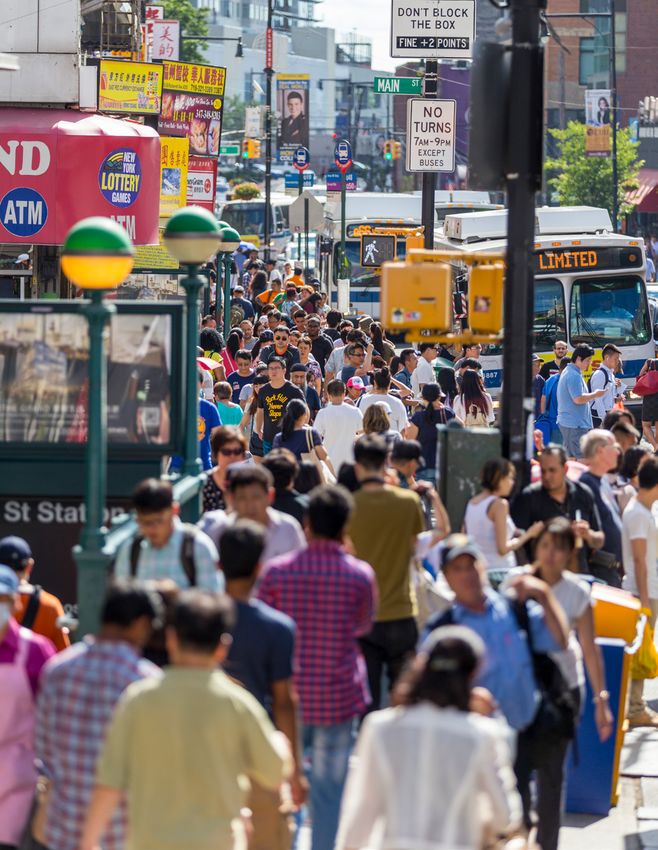
OneNYC 2050 CONSISTS OF 8 GOALS AND 30 INITIATIVES TO SECURE OUR CITY'S FUTURE.

                      1.    Empower all New Yorkers to participate in our democracy

                      2.    Welcome new New Yorkers from around the world and involve them fully in civic life
   A VIBRANT
  DEMOCRACY           3.    Promote justice and equal rights, and build trust between New Yorkers and government

                      4.    Promote democracy and civic innovation on the global stage

                      5.    Grow the economy with good-paying jobs and prepare New Yorkers to fill them

                      6.    Provide economic security for all through fair wages and expanded benefits
 AN INCLUSIVE
   ECONOMY            7.    Expand the voice, ownership, and decision-making power of workers and communities

                      8.    Strengthen the City’s fiscal health to meet current and future needs

                      9.    Ensure all New Yorkers have access to safe, secure, and affordable housing

                      10.   Ensure all New Yorkers have access to neighborhood open spaces and cultural resources
   THRIVING
NEIGHBORHOODS         11.   Advance shared responsibility for community safety and promote neighborhood policing

                      12.   Promote place-based community planning and strategies

                      13.   Guarantee high-quality, affordable, and accessible health care for all New Yorkers

                      14.   Advance equity by addressing the health and mental health needs of all communities
    HEALTHY
     LIVES            15.   Make healthy lifestyles easier in all neighborhoods

                      16.   Design a physical environment that creates the conditions for health and well-being

                      17.   Make New York City a leading national model for early childhood education
  EQUITY AND
  EXCELLENCE          18.   Advance equity in K-12 opportunity and achievement
 IN EDUCATION
                      19.   Increase integration, diversity, and inclusion in New York City schools

                      20.   Achieve carbon neutrality and 100 percent clean electricity

                      21.   Strengthen communities, buildings, infrastructure, and the waterfront to be more resilient
   A LIVABLE
    CLIMATE           22.   Create economic opportunities for all New Yorkers through climate action

                      23.   Fight for climate accountability and justice

                      24.   Modernize New York City’s mass transit networks

                      25.   Ensure New York City’s streets are safe and accessible
   EFFICIENT
   MOBILITY           26.   Reduce congestion and emissions

                      27.   Strengthen connections to the region and the world

                      28.   Make forward-thinking investments in core physical infrastructure and hazard mitigation
    MODERN            29.   Improve digital infrastructure to meet the needs of the 21st century
INFRASTRUCTURE
                      30.   Implement best practices for asset maintenance and capital project delivery

 3 | OneNYC 2050 : EFFICIENT MOBILITY                                                                             NYC.GOV/OneNYC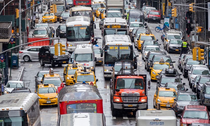
EFFICIENT
MOBILITY

                                       New York City will enable
                                       reliable, safe, and sustainable
                                       transportation options so that
                                       no New Yorker needs to rely
                                       on a car.

4 | OneNYC 2050 : EFFICIENT MOBILITY                            NYC.GOV/OneNYC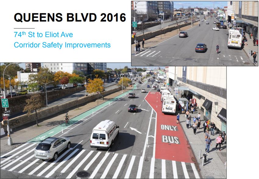
transportation options than ever before, getting
EVERY DAY, MILLIONS OF                                   to a doctor’s appointment, work, or a ball game on
                                                         time has become more difficult, and frustrating.
NEW YORKERS ARE ON THE                                   The subways are frequently delayed, overcrowded,
MOVE—COMMUTING TO THEIR                                  and unreliable. Buses get stuck in congested
JOBS, DROPPING KIDS OFF AT                               streets, and car and truck traffic is harmful to
                                                         our neighborhoods. At the same time, more of us
SCHOOL, VISITING FAMILY AND                              are competing for the same amount of space on
FRIENDS, OR RACING TO THE                                sidewalks.
AIRPORT TO CATCH A FLIGHT.
                                                         To meet the demands of a growing population
The ways we get around town are familiar: we             and a thriving economy, it is urgent that we
walk or take a bus, hop on the subway, or grab a         invest in and better manage our neglected
cab. Increasingly, we are also biking, taking ferries,   transportation infrastructure. Public transit must
and using apps to hail taxis and for-hire vehicles.      be made reliable, and our roads, bridges, tunnels,
We also drive when necessary.                            and airports modernized. We must also invest in
                                                         sustainable transportation modes such as walking,
While never perfect, transportation in the city          biking, and mass transit, and encourage a citywide
has always gotten us where we needed to go.              transition to sustainable fuels. We will work
Over the past few years, however, things have            toward creating a safe, affordable, energy efficient
changed. Even though New Yorkers have more               transportation system worthy of a global city in
                                                         the 21st century.

INDICATORS
NEW YORK CITY WILL MEASURE PROGRESS BY TRACKING THE FOLLOWING INDICATORS:

 INDICATOR                                                   LATEST DATA                   TARGET

 SHARE OF NEW YORK CITY TRIPS BY
                                                                68%
 SUSTAINABLE MODES (WALKING, BIKING,                                                    80% BY 2050
                                                               (2017)
 MASS TRANSIT)

                                                              8.0 MPH                    10.0 MPH
 AVERAGE CITYWIDE BUS SPEEDS
                                                               (2018)                 BY END OF 2020

                                                                202
 TRAFFIC FATALITIES                                                                    0 FATALITIES
                                                               (2018)

 NEW YORKERS THAT LIVE WITHIN 1/4 MILE OF                       80%
                                                                                        90% BY 2022
 THE BIKE NETWORK                                              (2016)

                                                              2,189,374
 VEHICLE REGISTRATIONS IN NEW YORK CITY                                                  DECREASE
                                                                (2017)

5 | OneNYC 2050 : EFFICIENT MOBILITY                                                           NYC.GOV/OneNYC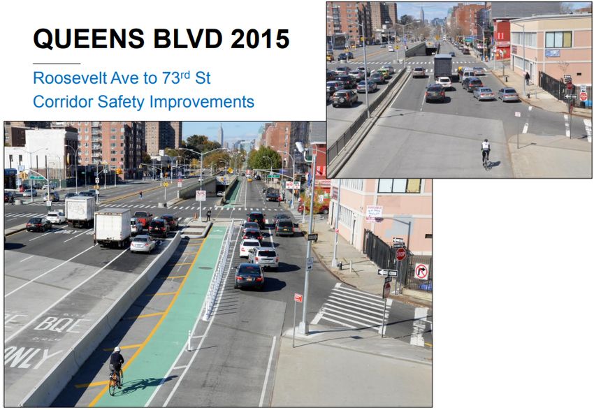
Subway and bus ridership have decreased
CONTEXT                                                              since 2015, while ferry and cycling
                                                                     show growth amidst City investment.
                                                                     Source: MTA, DOT
NEW YORK CITY’S VAST TRANSIT SYSTEM, COUPLED WITH                    Ferry ridership is measured by fiscal year, other modes by calendar year
THE CITY’S DENSITY, HAS ENABLED OUR SUSTAINED
GROWTH, ADVANCED HEALTH EQUITY, AND ALLOWED US                       TRIPS BY MODE
TO MAINTAIN A SMALLER PER CAPITA CARBON FOOTPRINT
                                                                                     SUBWAY
THAN ANY OTHER BIG CITY IN THE UNITED STATES. However,
the declining reliability of our subways and bus systems poses                       BUS
serious threats to a city existentially reliant on public transit.
                                                                                     CYCLING
As more than half of New Yorkers get to work using transit,
delays and disruptions can cascade across the city. Over the                         FERRY (STATEN ISLAND, NYC FERRY, PRIVATE)
past five years, subway delays have almost tripled, deteriorating
on-time performance. Over the same time period, ridership has
                                                                                                                    1,751.3M   1,762.6M   1,756.8M   1,727.4M
decreased, particularly on weekends, even though the population         1,604.2M   1,640.4M   1,654.6M
                                                                                                         1,707.6M

and economy are growing. While new revenues sources identified
in the State budget help address gaps in the Metropolitan
Transportation Authority's (MTA) capital program, sustainable
long-term funding will always be needed.

                                                                         2010       2011       2012       2013       2014       2015       2016       2017

                                                                        696.9M
                                                                                   670.7M     667.9M     677.6M     667.1M     650.7M     638.4M
                                                                                                                                                     602.6M

   The Sustainable Development Goals (SDGs) are the
   global blueprint adopted by the United Nations to
   achieve a better and more sustainable future for all,
   encompassing strategies to end poverty, improve health
   and education, reduce inequality, spur economic growth,
   and tackle climate change. By integrating our efforts to
   achieve the SDGs directly into OneNYC, we strengthen
   our efforts to build a strong and fair city. Our goal to              2010       2011       2012       2013       2014        2015      2016       2017

   achieve Efficient Mobility supports the following SDGs:                                                                                            178.8M
                                                                                                                                164.3M     167.9M
                                                                                                                     153.3M
                                                                                                          138.7M

                                                                                               117.1M

                                                                                    98.6M
                                                                          91.3M

                                                                          2010       2011       2012       2013       2014        2015      2016       2017

                                                                                                                                                      35.1M
                                                                                                                                           34.0M
                                                                                               31.2M      31.3M                 31.7M
                                                                                                                     30.7M
                                                                         29.4M      29.7M

   Learn more about the SDGs online at
   sustainabledevelopment.un.org/sdgs

                                                                         2010       2011       2012       2013       2014       2015       2016       2017

6 | OneNYC 2050 : EFFICIENT MOBILITY                                                                                                       NYC.GOV/OneNYC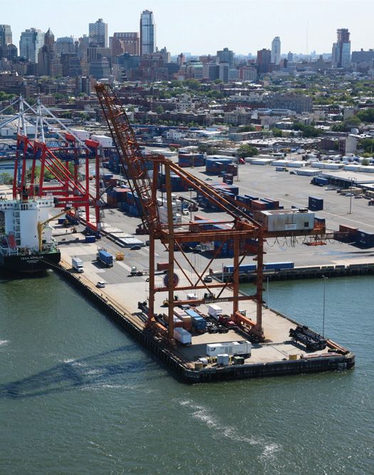
Technology and new transportation options are transforming
how we get around the city, and will continue to do so. While
autonomous vehicle technology is still nascent, its potential
future deployment could have impacts on the city. We must
ensure that it serves residents equitably, helps achieve Vision
Zero goals, and accounts for its impacts to communities, workers,
and infrastructure. Already, app-based for-hire vehicles (FHVs)
have attracted significant numbers of riders away from subways
and buses. They have also contributed to increased congestion,
especially in Manhattan below 60th Street, where travel speeds
have fallen by more than 20 percent since 2010.
Slowed by congestion, buses have seen ridership decrease to
below 2010 levels. Between 2016 and 2017, annual bus ridership
decreased by almost 40 million rides, while for-hire car trips
increased by nearly 40 million. The City has worked with the
MTA to improve bus service on the busiest routes, doubling the
pace of Select Bus Service routes since 2015. But given these
challenging underlying conditions on the streets, the City must
continue to expand and improve bus service.
With New York City’s population projected to exceed 9 million
by 2050, and with capacity already stretched thin on congested
roads and subways, we must prioritize and invest in efficient and
sustainable transportation modes: biking, walking, and mass
transit. By doing so, we will be able to reduce greenhouse gas
(GHG) emissions, support sustainable growth, and achieve the
WHAT WE HEARD FROM
ambitious goal we set in 2015 to have 80 percent of all trips in the NEW YORKERS
city taken by sustainable modes by 2050. The city will prioritize
sustainable modes in the planning and design of the built
APPROXIMATELY 57 PERCENT OF THE MORE THAN
environment, and help make them the default choice in New York
14,000 RESPONDENTS TO OUR CITYWIDE SURVEY
City so no one needs to rely on a car.
CITED TRANSPORTATION-RELATED CONCERNS
AS AMONG THE CITY’S MOST PRESSING NEEDS. In
particular, many were concerned about the reliability
and efficiency of the MTA subway system, along with
the need to improve the speed and frequency of bus
routes, support mass transit, and reduce congestion.
Others cited the need to make our streets safer and
transportation more accessible. One respondent
recommended “limiting free parking, encouraging
cycling, and making driving more expensive.” Another
suggested, “The subway and bus system should be
updated with a tap system, permanent cards, and a
mobile pay app.”
In addition, during a February 2019 discussion with
more than 50 New York City small business owners, we
heard a need for new strategies to reduce congestion
and better manage curb space given the competing
demand from private vehicles, delivery companies, for-
hire vehicles, cyclists, pedestrians, and buses, including
through technology and new regulations that create
priority zones.
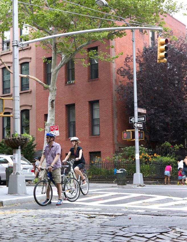
PEDESTRIANS, BUS USERS, SUBWAY RIDERS, AND A BICYCLIST IN MORNINGSIDE
HEIGHTS, MANHATTAN.
7 | OneNYC 2050 : EFFICIENT MOBILITY NYC.GOV/OneNYC
The number of app-based FHVs licensed by TLC has increased
dramatically since their introduction in 2012.

TAXIS AND FOR-HIRE VEHICLES LICENSED BY NEW YORK CITY
Sources: TLC
App-Based FHVs are those affiliated with TLC-licensed bases owned by four largest companies by trip volume.

120K

100K

80K                                                                                                                                                           APP-BASED FHV
                                                                                                                                                              (UBER, LYFT,
                                                                                                                                                              JUNO, ETC.)
60K
                                                                                                                                                              BLACK CAR /
                                                                                                                                                              LIVERY
40K

                                                                                                                                                              GREEN TAXIS
20K

                                                                                                                                                              YELLOW TAXIS
0K
                     2012                  2013                  2014                  2015                   2016          2017             2018

                                                                                                    The City does not control the subways but does manage the streets
PROGRESS                                                                                            on which the buses run. Since 2015, in partnership with the MTA,
                                                                                                    the City upgraded nine corridors to Select Bus Service (SBS). To
                                                                                                    date, SBS has improved service and shortened travel times for about
WE HAVE MADE PROGRESS OVER THE PAST YEARS TO                                                        300,000 daily riders. Further efforts are underway to optimize
IMPROVE THE CITY’S TRANSPORTATION NETWORK. VISION                                                   and expand the bus network and to use enforcement measures to
ZERO, THE CITY’S INITIATIVE TO ELIMINATE TRAFFIC                                                    increase the priority of buses on City streets. At the same time,
FATALITIES AND SERIOUS INJURIES, HAS REDUCED THE                                                    the state budget enacted new revenue sources which will allow
ANNUAL DEATH TOLL TO ITS LOWEST LEVEL SINCE 1910.                                                   the authority to make needed upgrades and improve service and
Investments through Vision Zero have improved our quality of life                                   accessibility across the system.
by making city streets more navigable and pleasant places to be.
We have expanded the bicycle network, adding 244 miles of bike
lanes—including 77 miles of protected lanes—since 2015. With
new infrastructure and the dramatic expansion of bike share, daily
bicycle trips rose to nearly half a million by 2017—three times more
                                                                                                    WHAT WE WILL DO
than in 2000.
                                                                                                    ONENYC 2050 WILL PRIORITIZE EXPANDING SUSTAINABLE
Since 2015, the usage of app-based FHVs and ferries has increased.                                  TRANSPORTATION MODES—PUBLIC TRANSIT, WALKING, AND
New FHV services have provided improved transportation options,                                     BICYCLING—TO LIMIT GHG EMISSIONS THAT CONTRIBUTE
especially in outer borough neighborhoods, but have disrupted                                       TO CLIMATE CHANGE. We will continue efforts to eliminate
traditional taxi services and exacerbated congestion. The City is                                   traffic injuries and fatalities and foster a livable streetscape in all
taking steps to improve regulation of the FHV industry to maximize                                  our neighborhoods. We will reduce traffic congestion, increase
benefits while minimizing adverse impacts. NYC Ferry offers a new                                   bus performance, modernize our subway system, and improve
option to the transportation network, cutting travel times from                                     connections to the region and world—because an efficient
many parts of the City, while connecting more New Yorkers to the                                    transportation network values reliability, accessibility, safety, and
waterfront. Since its launch in 2017, NYC Ferry has served close to                                 sustainability, and enables us to embrace our status as a city in
eight million riders and will expand with new routes and stops.                                     which New Yorkers do not need to rely on a car.

8 | OneNYC 2050 : EFFICIENT MOBILITY                                                                                                                      NYC.GOV/OneNYC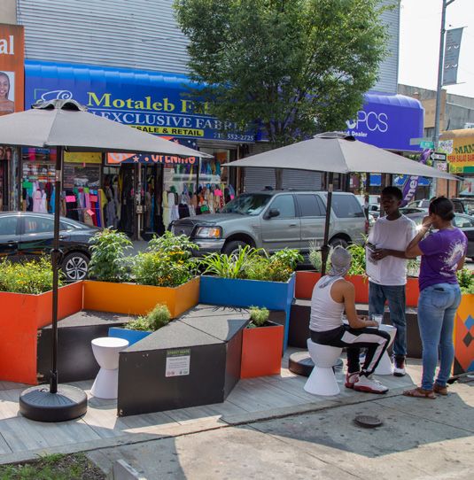
WHAT WE MEAN BY
SUSTAINABLE MODE SHARE

NEW YORK CITY WILL MEASURE                                                                        congestion-mitigation, safety, health,
its progress toward its efficient mobility                                                        and sustainability goals, we must chart
goals by tracking the sustainable mode                                                            a new future and reach 80 percent
share of transportation: the percentage                                                           sustainable mode share by 2050.
of New Yorkers walking, biking, and                                                               OneNYC 2050 reflects New York
using transit to get around the City.                                                             City’s commitment, in the “Roadmap
By 2015, our city already had the                                                                 to 80x50” to a safe, sustainable
highest proportion of trips made by                                                               transportation future. The plan
sustainable mode of any large U.S. city:                                                          prioritizes walkability, safe streets, and
67 percent of all trips. But to reach our                                                         improved public transit.

                                                             OneNYC
                2015 Baseline                              2050 Target

                                                              16%
  PERSONAL
   DRIVING          31%
                                                               4%

 CAR-SHARE
   & FHV            2%
                                                              32%
                                                                                                        OneNYC reflects
                                                                                                        New York City’s
    MASS            28%
                                                                                                        commitment to a
                                  SUSTAINABLE MODES: 67%

   TRANSIT
                                                                         SUSTAINABLE MODES: 80%

                                                              10%                                       safe, sustainable
                                                                                                        transportation future.
    BIKING           1%

  WALKING
                   38%                                        38%

9 | OneNYC 2050 : EFFICIENT MOBILITY                                                                                              NYC.GOV/OneNYC
64% of New York residents live with-
                 in 1/2 mile of a MTA subway station
                 or Select Bus Service stop and 97%
                 live within 1/4 mile of a bus stop.
                 Source: DCP

New York City
                 Area within walking distance from a:
tance from a:
                        Subway Station or SBS bus stop
th a subway or SBS stop within a 1/2 mile
n 1/4 mile              Non-SBS bus stops

            10 | OneNYC 2050 : EFFICIENT MOBILITY        NYC.GOV/OneNYC
INITIATIVE 24 OF 30
MODERNIZE NEW YORK CITY’S
MASS TRANSIT NETWORKS
THE CITY MUST HELP REVERSE THE DECLINE IN TRANSIT The subway must also be affordable and accessible. The Fair Fares
USE BY SUPPORTING PLANS TO FIX UNRELIABLE SUBWAY Program, which provides half-priced fares for low-income New
PERFORMANCE AND OPTIMIZING STREETS FOR THE Yorkers, will help defray transportation costs for low-income
EFFICIENT OPERATION OF BUSES. In addition, new capacity families. However, lack of Americans With Disability Act (ADA)
is needed to accommodate the mobility needs of a growing accessibility excludes people with mobility disabilities from too
population, and foster our regional economy, including efficiency much of the system, and must be remedied.
improvements to existing mass transit, evaluations of transit
expansion, and new transportation options such as NYC Ferry • FUND THE MTA CAPITAL PLAN
and the Brooklyn Queens Connector (BQX). The MTA’s substantial capital needs require significant,
dedicated funding sources. The City supports the congestion
pricing plan enacted in the New York State Fiscal 2019-2020
MODERNIZE THE SUBWAY SYSTEM AND Budget that dedicates revenue to a lockbox for MTA capital and
IMPROVE AFFORDABILITY AND ACCESSIBILITY prioritizes subway upgrades, bus improvements and expanding
transit availability. The enacted budget also includes
The precipitous decline of subway reliability and performance governance reforms to improve operations, management, and
has underscored the need for massive, system-wide repairs construction practices. With additional dedicated revenue
and upgrades, as well as major reforms to management and from an internet sales tax, a progressive mansion tax, and
operations. Carrying out this significant system overhaul to a progressive real estate transfer tax, the budget provides
improve performance and capacity requires new sources of significant revenue to help modernize mass transit and bring
dedicated revenue to sustainably fund modernization and the system to a state of good repair.
maintain a state of good repair. Beyond funding, the MTA
requires a fundamental reimagining of its structure, practices,
and vision for the future to meet the needs of all New Yorkers.
THE SUBWAY SYSTEM IS THE LIFEBLOOD OF NEW YORK CITY.
11 | OneNYC 2050 : EFFICIENT MOBILITY NYC.GOV/OneNYCFewer than a quarter of subway
stations are equipped with elevators.
Source: MTA
! Stations with elevator access
! Stations with no elevator access
• ENDORSE NEW YORK CITY TRANSIT’S FAST FORWARD PLAN • OFFER DISCOUNT METROCARDS FOR LOW-INCOME NEW
TO MODERNIZE SUBWAYS AND BUSES YORKERS THROUGH THE FAIR FARES PROGRAM
Beyond fundamental reforms, the City endorses the New York Launched in January 2019 in partnership with the City Council,
City Transit Fast Forward plan to modernize and upgrade the Fair Fares NYC helps low-income New Yorkers manage their
subway and bus system, and will advocate for its cost effective transportation costs, allowing them to buy MetroCards for half
and timely delivery. The plan also focuses on redesigning the bus the regular price. The first phase made Fair Fares available to
network, increasing accessibility, and deploying a new contactless approximately 130,000 New Yorkers receiving cash assistance
fare system. and/or Supplemental Nutrition Assistance Program (SNAP)
benefits. In fall 2019, the City plans to expand the program to
• SUPPORT SIGNIFICANT CHANGES TO MTA CAPITAL eligible New Yorkers living at or below the poverty line in New
PLANNING AND PROJECT DELIVERY York City Housing Authority (NYCHA), enrolled students at
To effectively deliver the improvements needed, the MTA CUNY, and certain military veterans.
must tackle its persistent cost overruns and project delays.
Expanding the use of design-build to deliver its major • INCREASE SUBWAY ACCESSIBILITY
construction projects provides the opportunity to minimize Roughly 75 percent of subway stations remain inaccessible to
cost, accelerate delivery, and incentivize performance. Even hundreds of thousands of New Yorkers. Although some progress
so, the MTA must undergo a radical transformation in its has been made, people with mobility disabilities and parents
planning and project-delivery processes. The City supports the with strollers still face formidable obstacles. MTA’s Fast Forward
independent audits required in the State budget to maximize plan strives to bring our transit system closer to compliance with
efficiency, including the creation of a unit of internal and the ADA. The MTA plans to make more than 50 stations newly
external experts to review all large-scale projects. accessible within five years, so all subway riders are never more
than two stops from an accessible station. In partnership with the
MTA, the City will continue to close gaps in accessibility and call
for improved language access to enable better navigation of the
mass transit system.
12 | OneNYC 2050 : EFFICIENT MOBILITY NYC.GOV/OneNYCFast Forward, announced in 2018, will deliver
advanced signaling for five million daily riders WESTCHESTER
THE BRONX
within 10 years.
Source: MTA MANHATTAN
NA
S
QU SAU
EE
NS
NS
AU
EE
SS
QU
NA
NS
QUEE
KLYN
BROO
MANHATTAN
St. George
Tompkinsville
Stapleton
Clifton
S51
STATEN
ISLAND Grasmere
Old Town
Dongan Hills
Jefferson Av
Grant City
S51/81
ay
New Dorp
ilw
Ra
d
an
Oakwood Heights
Is l
S57
te n
S ta
Bay Terrace
TA
M
Great Kills
S54 X7 X8
Eltingville
Annadale
S55
Huguenot
S55 X17 X19
Prince's Bay
S56
Pleasant Plains
Richmond Valley
Arthur Kill
Tottenville
S78
WHEELCHAIR USER BOARDS AN ACCESSIBLE BUS. HIGHLIGHTED RAIL LINE SEGMENTS WILL BE UPGRADED WITH MODERN SIGNALS.
• USE CITY ZONING TOOLS TO INCREASE ACCESSIBLE • EXPLORE FURTHER OPPORTUNITIES FOR SUBWAY
ENTRANCES EXPANSION
The New York City Department of City Planning (DCP) will The capacity of the subway system must be expanded to serve
work closely with the MTA to expand citywide the zoning tools the city’s growing population. The completion of the first
recently created as part of neighborhood rezonings, which phase of the Second Avenue Subway in 2017 was met with
require developments adjacent to transit stations to consult great acclaim, providing new transit options for the Upper East
with the MTA about providing an easement for elevator and/or Side, freeing up capacity on the Lexington Avenue lines, and
stair access to stations. In order to ensure the transit easement relieving surface congestion in the area. Subsequent phases of
does not impair the value of privately-owned sites, the proposal the Second Avenue Subway will provide important capacity and
would in turn provide limited zoning relief. connections to accommodate passengers traveling to the core
from other parts of the city, particularly from Queens. The
• ADVOCATE FOR BETTER LANGUAGE ACCESS TO HELP ALL MTA should continue exploring other opportunities for system
NEW YORKERS AND VISITORS NAVIGATE MASS TRANSIT expansion, such as the study underway to explore extending
Navigating the subway and bus system in New York City is the 3 and 4 subway lines along Utica Avenue to Kings Plaza in
mostly only possible in English, which creates a hardship for Brooklyn.
millions of visitors and the nearly 25 percent of New Yorkers
with limited English proficiency (LEP). While the MTA posts
service notifications in the languages of the communities
most impacted, it should continue to improve language access
for rider navigation. This could include multilingual digital
signage, recorded service announcements incorporating
multiple languages, and/or improved customer-service training
and resources for staff to serve riders with LEP.
13 | OneNYC 2050 : EFFICIENT MOBILITY NYC.GOV/OneNYCIMPROVE BUS PERFORMANCE BY EXPANDING
BUS PRIORITY CITYWIDE
The City recognizes the opportunity buses represent for
expanding the capacity and accessibility of the region’s transit
network, while helping to achieve critical sustainability goals.
The Department of Transportation (DOT) will work with the
MTA to dramatically improve bus service through the installation
and improvement of bus lanes and enforcement to ensure bus
priority in bus lanes. Furthermore, DOT will double the current
pace of implementing transit-signal priority intersections that
will prioritize buses as they travel through city streets. In 2019,
bus priority projects benefiting 600,000 daily bus riders will be
underway in all five boroughs.
• SUPPORT THE REDESIGN OF THE BUS NETWORK THROUGH
STREET IMPROVEMENTS IN EVERY BOROUGH
Over the next few years, the MTA, with support from DOT, will
be redesigning the bus network in all five boroughs. Planning
for new bus priority projects on our streets will occur in tandem
with MTA’s bus network redesign process, which is already
underway for the Bronx and will then focus on Queens.
THE BX6 SOUTH BRONX SBS LEVERAGES NEW YORK CITY’S FIRST CENTER-
LANE BUS ROUTE IN ORDER TO HELP SPEED UP TRAVEL TIMES. • IMPROVE BUS SPEEDS BY 25% BY END OF 2020
To facilitate better and more reliable service, bus lanes will be
installed at an average of 10–15 miles per year (up from seven
miles per year), with five miles of existing citywide bus lanes to be
IMPROVING BUS SPEED IN THE upgraded annually. The City will also pilot the installation of two
SOUTH BRONX miles of physically separated lanes, with work starting in 2019.
New York City will continue to advocate for the Select Bus
Recent improvements to the Bx6 South Bronx Crosstown Service (SBS) Program, which includes dedicated bus lanes, signal
corridor showcase the critical role New York City plays priority, off-board fare collection, and all-door boarding—critical
in speeding up the bus network. The Bx6 is a critical bus components to an overall improvement in bus speeds citywide.
route connecting 24,000 daily riders to eight subway
lines, Metro-North Railroad, and 20 bus routes. Seventy- • EXPAND PRIORITIZATION OF BUS LANES THROUGH NYPD
six percent of households within a quarter-mile of the TOW-TRUCK CREWS AND CAMERA ENFORCEMENT
route do not own a vehicle, yet the existing route was The enforcement of bus lanes is critical to improving
notoriously slow, averaging 56 minutes to travel just 4.8 performance as illegal parking slows down buses and increases
miles due to significant congestion and persistent double- travel times for riders. In an effort to keep bus lanes clear,
parking issues. the MTA will install an Automated Bus Lane Enforcement
(ABLE) system on 123 buses serving SBS routes in Manhattan
In 2016, the Department of Transportation implemented a and Brooklyn, with plans to expand based on success of the
series of aggressive bus priority improvements focused on pilot. The ABLE system captures license plate information
the half-mile bottleneck on 161st Street to improve speeds and multiple pieces of evidence to enforce bus lane violations.
in this section, and reliability on the full route, including To further support enforcement efforts, NYPD will use seven
New York City’s first two-way center-running bus lanes, dedicated tow-truck teams to keep bus lanes clear.
and repurposing a preexisting tunnel under a major
arterial to bus-only. These improvements led to significant
speed increases of between 15 percent and 45 percent,
depending on the direction of travel.
14 | OneNYC 2050 : EFFICIENT MOBILITY NYC.GOV/OneNYCNYC FERRY TRANSPORTING COMMUTERS ACROSS NEW YORK HARBOR.
By 2021, NYC Ferry Service will add routes to PROVIDE NEW YORKERS WITH MORE
Staten Island, Coney Island, and a Throgs Neck/ TRANSIT OPTIONS
Ferry Point Park stop to the Soundview route.
NYC Ferry and BQX projects demonstrate the City’s commitment
to developing new transit options to connect underserved
Source: EDC
neighborhoods and shorten lengthy commutes. By introducing
new, affordable transit routes, the City can help reduce crowding
on existing routes and bring reliable and resilient transit service
to new parts of the five boroughs.
• EXPAND NYC FERRY TO IMPROVE CONNECTIONS TO STATEN
ISLAND, CONEY ISLAND, THE WEST SIDE OF MANHATTAN,
AND EASTERN BRONX
The City will expand NYC Ferry routes, launched in 2017, to
serve 11 million riders annually by 2023, up from 4.1 million
today, adding routes to Staten Island and Coney Island, and a
Throgs Neck/Ferry Point Park stop to the Soundview route.
While the NYC Ferry is already the same fare as a subway and bus
ride, going forward, the City will seek to integrate it with other
mass transit systems, and explore the use of alternative fuels and
electrification of ferries, as these technologies continue to develop
and become more affordable at scale.
• ADVANCE THE BQX
The City is currently conducting an environmental review
for the BQX, a state-of-the-art streetcar route being planned
by the City to connect waterfront communities from South
Brooklyn to Queens. The BQX will add new mass transit
capacity and advance the City’s sustainable mode share goals,
and willl be resilient in the event of flooding. The system will
run on tracks flush with the existing roadway—mainly in
dedicated lanes to increase reliability—and BQX streetcars will
be ADA accessible.
15 | OneNYC 2050 : EFFICIENT MOBILITY NYC.GOV/OneNYCINITIATIVE 25 OF 30
ENSURE NEW YORK CITY'S STREETS
ARE SAFE AND ACCESSIBLE
NEW YORK CITY’S STREETS MUST BE SAFE AND PRIORITIZE • IMPLEMENT AT LEAST 50 VISION ZERO SAFETY
THE USE OF SUSTAINABLE MODES. The streets are public ENGINEERING IMPROVEMENTS ANNUALLY AT THE UPDATED
spaces in their own right—not just places to store vehicles or LOCATIONS CITYWIDE
travel through in a car. Launched in 2014, Vision Zero is New DOT will continue its program of street redesigns, focusing
York City’s traffic safety program based on two key principles: on locations with the highest level of pedestrian deaths and
crashes are preventable, and there is no acceptable level of death serious injuries, guided by the new priority maps and updated
or serious injury on our streets. The program, now in its sixth Borough Pedestrian Safety Action Plans. This includes designs
year, has resulted in fewer road deaths every year since it was known to work (such as protected bike lanes, curb extensions,
established, reaching its lowest level ever in 2018. The City and left-turn traffic-calming tactics) and newer designs that
will achieve Vision Zero through a combination of education, show promise, such as roundabouts and traffic circles, raised
enforcement, and engineering, including expanding bike lanes crosswalks, and chicanes.
and implementing pedestrian priority areas. Additionally, the
City will ensure that its streetscape is accessible for all New • ADD EXCLUSIVE PEDESTRIAN CROSSING TIME AND MODIFY
Yorkers, including those with mobility disabilities. SIGNAL TIMING IN PRIORITY CORRIDORS
DOT will add a leading pedestrian interval, which gives
IMPLEMENT THE VISION ZERO ACTION PLAN pedestrians exclusive time to cross, at every feasible
intersection in new Priority Corridors. The agency will also
The initial 2015 Vision Zero Action Plan laid the groundwork for modify signal timing to help keep motor vehicles moving at or
how New York City approaches pedestrian and cyclist safety and below the speed limit.
mobility. That plan designated Priority Intersections, Corridors,
and Areas based on pedestrians killed or serious injured (KSI)
data and community input. By the end of year five of Vision Zero,
DOT had addressed 90 percent of Priority Intersections and 86
percent of Priority Corridor miles with design and engineering
treatments, contributing to a 36 percent drop in pedestrian
deaths at those locations.
In 2019, DOT reevaluated pedestrian KSI data, demonstrating
marked safety improvements in high-priority locations and
defining new locations for intervention. The City will continue to
execute the fundamentals of the Action Plan, and build on past
accomplishments by focusing on reducing speeding and making
turns safer.
PEDESTRIAN AND BICYCLE SAFETY IMPROVEMENTS IN LONG ISLAND CITY, QUEENS
16 | OneNYC 2050 : EFFICIENT MOBILITY NYC.GOV/OneNYCDOT's Vision Zero program uses
detailed crash and injury data to
identify Priority Corridors, Intersec-
tions, and Areas for improvement.
DOT has already completed nearly
500 safety improvement projects
since 2014.
VISION ZERO PRIORITY CORRIDORS AND
SAFETY IMPROVEMENT PROJECTS
Source: DOT
PAST WORK
WORK TO BE COMPLETED
• PRIORITIZE TARGETED ENFORCEMENT AND OUTREACH ON • KEEP SENIORS SAFE ON CITY STREETS THROUGH
PRIORITY CORRIDORS, INTERSECTIONS, AND AREAS ENGINEERING INTERVENTIONS AND TARGETED OUTREACH
The driving violations that are most likely to kill or seriously Although seniors 65 years old and over make up only 13
injure pedestrians include speeding, failing to yield the right percent of New York City’s population, they represent
of way to pedestrians, using a cell phone or texting, disobeying nearly half of annual pedestrian fatalities. To address this
red lights or stop signs, and making improper turns. To disparity, DOT is undertaking a comprehensive study of
systematically enforce, and increase awareness of, traffic safety senior pedestrian fatalities and injuries, investigating crash
issues at the highest injury Priority Corridors, Intersections, locations, types, and severity outcomes. The study will identify
and Areas across New York City, NYPD and DOT are improving systematic engineering interventions, along with new channels
their successful High Visibility Enforcement Program. and methods for delivering traffic safety messages with seniors
in mind.
17 | OneNYC 2050 : EFFICIENT MOBILITY NYC.GOV/OneNYCUnder Vision Zero, 2018 was the safest year on record, with the fewest
New Yorkers lost on city roadways since record keeping began in 1910.
Source: DOT
394 387
381
364
321 324 VISION ZERO
146 133
143 299
297 292
132
275 273 278
107 260 259
108 61
99 77 250
61 234 231
TRAFFIC FATALITIES
41 46 75 73
61 222
32 52 62
35 42
46 202
31 59
18 13 21 34 40
39 12 58
18 27 29 36
36 33 37
18 37 19
22 22 22
16 12 19
22 18 18
24 20 33
14 40
24 10
194 187
188
179 184
168 158
155 157 154 153 151 148
140 143 140 139
115
107
2000
2004
2006
2008
2009
2003
2002
2005
2007
2001
2010
2014
2018
2016
2013
2015
2012
2017
2011
TRANSFORM DANGEROUS ARTERIAL ROADS REDUCE FATALITIES AND SERIOUS INJURIES
INTO VISION ZERO GREAT STREETS INVOLVING FLEETS MANAGED OR REGULATED
BY CITY AGENCIES
In the past, several major arterial roads have gained a notorious
reputation for their high numbers of crashes and for not Under Vision Zero, the City’s role administering our own
accommodating pedestrians or cyclists. The Vision Zero municipal fleet and regulating FHVs and private sanitation trucks
Great Streets initiative aims to turn roads known for dividing provides the opportunity to demonstrate best practices for safe
neighborhoods and inaccessibility into safe and thriving driving. Each agency has devised training plans, new rules, and
community connectors, adding bike lanes, pedestrian islands, procurement programs, and are all actively working toward
and other safety elements. ensuring their drivers and vehicles model the high standards
demanded by Vision Zero.
Great Streets invested in four major reconstruction projects—
Queens Boulevard, Fourth Avenue and Atlantic Avenue in • CONTINUE TO IMPLEMENT THE SAFE FLEET TRANSITION
Brooklyn, and Grand Concourse in the Bronx—with operational PLAN
safety improvements followed by more permanent capital The Safe Fleet Transition Plan guides the upgrades the City
construction. DOT is looking to expand the Great Streets must make to its fleet of more than 30,000 vehicles, managed
program to target other dangerous arterial roads, including by the Department of Citywide Administrative Services
Northern Boulevard in Queens. (DCAS), to ensure state-of-the-art safety features become
standard. Because larger vehicles tend to cause more serious
harm in crashes, DCAS will continue to work toward ensuring
all City fleet trucks are equipped with side guards, high-vision
cabs, and other necessary equipment.
18 | OneNYC 2050 : EFFICIENT MOBILITY NYC.GOV/OneNYCQueens Boulevard before and after
Vision Zero improvements
Source: DOT
BEFORE
AFTER
PEDESTRIAN PLAZA AT MYRTLE AND WYCKOFF AVENUES HELPED REDUCE TRAFFIC
INJURIES WHILE PROVIDING VALUABLE PUBLIC SPACE TO RESIDENTS.
INCREASING SAFETY AT MYRTLE AND
BEFORE WYCKOFF AVENUES IN BROOKLYN
For many years, the six-legged intersection at Myrtle Avenue,
Wyckoff Avenue, and Palmetto Street, on the border of Queens
and Brooklyn underneath the elevated tracks at Myrtle-
Wyckoff Station, had been the site of multiple pedestrian
fatalities, and was notoriously difficult to cross. Following
intensive planning and community consultation, DOT’s
in-house crews created a plaza on Wyckoff Avenue between
Gates Avenue and Myrtle Avenue, and converted the section
of Wyckoff between Myrtle and Madison Street into one-way
AFTER southbound traffic. They also widened crosswalks, painted
AFTER sidewalk extensions, installed flexible bollards, reconfigured
signal timing to increase pedestrian crossing times, installed
new traffic control and curb-regulation signage, and painted
new road markings. The result was a 48 percent decrease
in crashes with injuries, and a valuable new public space
linking the neighborhood with a transportation hub. These
improvements will be made permanent as part of the
reconstruction of Wyckoff Avenue, scheduled to begin in 2020.
19 | OneNYC 2050 : EFFICIENT MOBILITY NYC.GOV/OneNYCDOT is prioritizing expanding bicycle
infrastructure in areas that have high
KSI rates but low or medium bicycle
network coverage.
Source: DOT
Bicycle Network
High Cyclist KSI and Low Network
Coverage
High Cyclist KSI and Medium
Network Coverage
• REFORM COMMERCIAL WASTE HAULING EXPAND AND INCREASE CONNECTIVITY OF THE
With the inception of Vision Zero, the City's Business Integrity BIKE NETWORK
Commission (BIC) is working with City Council on legislation
that would allow it to hold private carting companies and their Bicycles represent a significant opportunity to expand mobility
drivers accountable for failing to comply with regulations options at a relatively low cost, while helping to meet sustainability
related to traffic safety. Specifically, BIC seeks the ability goals. Making it safer, easier, and more convenient to bicycle
to deny applications of companies and/or drivers who throughout the city helps reduce congestion and air pollution,
demonstrate unsafe practices (including excessive work hours while improving overall traffic safety and public health.
or failure to maintain equipment), and the ability to license
drivers to operate within New York City. Over the past decade, annual bicycle trips have increased nearly
150 percent, far faster than population or employment growth.
• PROVIDE VISION ZERO TRAINING TO FOR-HIRE VEHICLE In 2017, there were an estimated half million bicycle trips per day.
DRIVERS Cycling in New York City has become safer as more and more
The Taxi & Limousine Commission (TLC) provides a 24-hour people choose this mode of transport—and is evidence of a “safety
pre-licensure course to taxi and for-hire vehicle drivers to in numbers” effect.
educate them on street design changes such as protected bike
lanes, high-risk driving behaviors that lead to crashes, and the To facilitate further growth, the City will expand and improve
important role professional drivers play in promoting a culture bike lanes and bike sharing. Well-designed bike lanes not only
of safe driving. In 2018 alone, over 27,000 drivers licensed protect cyclists, but also organize and calm traffic. In addition, the
by TLC took this course. TLC plans to develop a Vision Zero islands created by the installation of protected bike-lanes assist
course that will be required every three years for license pedestrians by shortening street-crossing distances.
renewal.
20 | OneNYC 2050 : EFFICIENT MOBILITY NYC.GOV/OneNYCBy 2023, Citi Bike will cover almost 70 square • EXTEND GREENWAYS
miles and plans to have more than 37,000 The City will continue to build a connected network of
greenway paths for cycling, including the Jamaica Bay Greenway
bicycles, six times more than it had in 2013. and the Brooklyn Waterfront Greenway, and the Manhattan
Source: DOT, Citi Bike
circumferential greenway network. DOT will also study the
feasibility of an Eastern Queens Greenway. High-quality
Total Citibike coverage (Sq Mi) Total Bikes cycling infrastructure will increase cycling as both a mode of
transportation and a recreational activity, and bring with it
associated mobility safety and health benefits.
80 40,000
• EXPAND CITI BIKE AND DOCKLESS BIKE-SHARE NETWORKS
37,250 35,000 In the next five years, the City will expand its Citi Bike dock-
70
based bike-share system to 40,000 bikes, from 12,000 today,
doubling the size of the service area by adding another 35
30,000
60 square miles of coverage. This expansion will also increase the
TOTAL COVERAGE AREA (SQ MI)
density of coverage in the previously served areas, with more
BIKES IN CIRCULATION
50 25,000 stations and higher service standards. A portion of the fleet will
be converted to pedal-assist bicycles, which is likely to make
cycling more attractive to a broader population and encourage
40 20,000
people to cycle longer distances, but must be done with careful
consideration to public safety.
30 15,000
The City will also implement new, expanded dockless bike-share
13,250 pilots in areas of the City not covered by the dock-based system.
20 6,000 10,000
If successful, and the private companies providing these services
remain viable, the City will implement a dockless bike-share
10 5000 program at a large scale outside of the Citi Bike service area.
0 • PRIORITIZE PUBLIC SAFETY WHEN CONSIDERING
2013 2015–2018 2019–2023 LEGISLATION RELATED TO EMERGING MODES OF MOBILITY
PHASE 1 PHASE 2 PHASE 3 Emerging modes of transportation, such as e-bikes and
e-scooters, have the potential to expand mobility options, but
come with public safety concerns. With both the City Council
and State considering bills to sanction their use, any new
legislation should ensure these modes are integrated safely and
• ENABLE GREATER ACCESS TO THE BIKE NETWORK FOR NEW seamlessly into our existing transit network.
YORKERS
For more New Yorkers to choose cycling as a transportation
option, they must have access to safe places to ride. DOT will
continue to build out its bicycle network, installing at least 50
miles of bike lanes—including 10 miles of protected bike lanes—
per year, and facilitate the expansion of bike-share programs
“Increase the number of
to more neighborhoods. The City is committed to ensuring 90
percent of New Yorkers live within a two-minute (¼ mile) ride
of the bike network by 2022, up from 80 percent in 2016, and
ultimately 95 percent in the future.
bike lanes and exclusive
bus lanes.”
• CREATE OR ENHANCE BICYCLE LANES IN PRIORITY BICYCLE
DISTRICTS
The City will prioritize building bike infrastructure in the ten
community districts where cyclist deaths and serious injuries are
- Resident of Long Island City, Queens
disproportionately high and bike-network mileage is relatively
low. These neighborhoods, which are home to 23 percent of
serious crashes, but only 14 percent of bicycle lanes, have been
designated Priority Bicycle Districts, and will receive 75 miles of
new or enhanced bike lanes by 2022.
21 | OneNYC 2050 : EFFICIENT MOBILITY NYC.GOV/OneNYCENHANCE WALKABILITY AND ACCESSIBILITY
New York City’s walkability is one of its hallmarks, with nearly
three out of every 10 trips taken on foot. As demand for pedestrian
space increases, the City's DOT is responding by expanding car-
free or car-light “People Priority Streets” that build on successful
programs such as pedestrian plazas, shared streets, and expanded
sidewalks, by designing streets for people at the corridor and
districtwide scale. DOT will also enhance the accessibility of
our streetscape for all New Yorkers, with significant capital
improvements and new, app-based navigation technologies.
• PILOT A SPECTRUM OF PEDESTRIAN ZONES THROUGHOUT
THE CITY
Working with the community and stakeholders, the City will
pilot People Priority Streets at the neighborhood level, beginning
with the phased implementation of improvements in Lower SHARED STREET PILOT IN FLATIRON, MANHATTAN
Manhattan. Holistic assessment of a neighborhood or district, Source: DOT.
particularly with potential vehicle reductions from congestion
pricing, will allow DOT to prioritize pedestrians and bicyclists
wherever demand is greatest, while still accommodating
essential vehicular access. This approach would apply carefully
coordinated implementation of successful DOT pedestrian
improvements such as time-of-day closures, seasonal streets,
shared streets, curb-management strategies, sidewalk
expansions, and/or pedestrian plazas. The City will look to
the successful models in Barcelona, Oslo, Madrid, and Paris,
which have shown remarkable promise in calming and reducing
through traffic and improving air quality, while allocating more
public space to pedestrians.
• INCREASE ACCESSIBILITY OF STREETS AND SIDEWALKS,
AND INTRODUCE PEDESTRIAN NAVIGATION TECHNOLOGY
The streetscape must be made safe and accessible for all people,
including those with mobility and vision disabilities. To this
end, DOT will continue its efforts to make all sidewalks,
pedestrian ramps and spaces, and bus stops accessible. The
agency will dramatically expand its pedestrian ramp program,
and invest in pedestrian ramp upgrades and new installations
citywide.
DOT has installed Accessible Pedestrian Signals (APS) in all
five boroughs by collaborating with the disability community
on identifying priority corners. DOT will also develop and pilot
new, app-based accessible pedestrian navigation technologies
and invest in the supporting infrastructure. Internally, DOT
will build capacity related to accessibility through training and
targeted research, and by providing resources and tools to staff.
DOWNTOWN BROOKLYN SHARED STREETS
Source: DOT
22 | OneNYC 2050 : EFFICIENT MOBILITY NYC.GOV/OneNYCGROWING DEMAND FOR FINITE ROAD SPACE HAS CONTRIBUTED TO SEVERE CONGESTION, PARTICULARLY IN THE CORE.
INITIATIVE 26 OF 30
REDUCE CONGESTION AND EMISSIONS
TO INCREASE LIVABILITY AND SUSTAIN THE CITY’S ECONOMIC
VITALITY, STREET CONGESTION MUST BE MANAGED AND "Get New Yorkers
REDUCED. Congestion has been estimated to cost the economy
of the metropolitan region up to $15 billion annually, consuming
nearly 300 million extra gallons of fuel. While app-based ride
out of their cars.
services and home-delivery of goods provide convenience for New
Yorkers, the growing demand for the city’s finite road space has It will lead to safer
streets and a cleaner
contributed to falling traffic speeds.
In addition to reducing congestion, the City must also reduce the
carbon footprint of unsustainable modes of transportation. We will
significantly cut GHG and other polluting emissions by building
environment."
out a citywide network of electric vehicle charging infrastructure,
reducing the size and emissions of the City’s fleet, and incentivizing —Resident of Richmond Hill, Queens
adoption of low and zero emissions vehicles.
23 | OneNYC 2050 : EFFICIENT MOBILITY NYC.GOV/OneNYCMANAGE VEHICLE DEMAND ON CITY STREETS Congestion pricing is an effective method to
manage demand on the city’s busiest streets,
The City will reduce congestion by managing demand on city while generating revenue for the MTA
streets, through the implementation of congestion pricing in
partnership with the State, prioritizing the use of curbs for CENTRAL BUSINESS DISTRICT TOLLING ZONE
strategic purposes, and stricter enforcement of existing traffic
laws. We will also implement new programs to mitigate the
impact of FHV on congestion, and consider expanding programs
such as car share that encourage people to trade in their personal
vehicle for a more sustainable option.
• IMPLEMENT CENTRAL BUSINESS DISTRICT TOLLING IN
COORDINATION WITH THE MTA TO REDUCE TRAFFIC
Congestion pricing is an effective method to manage demand
on the city’s busiest streets, and will also generate revenue for
the MTA. As cities such as London, Stockholm and Singapore
have shown, congestion pricing can substantially reduce traffic,
noxious emissions, and improve quality of life. Recommendations
for New York City’s congestion pricing program will be made by
the Traffic Mobility Review Board to the MTA at the end of 2020.
The board will consider managing demand through variable
pricing and will consider many factors including, but not limited
to, safety, hardships, vehicle types and environmental impact. As
revenue from congestion pricing helps ensure transit reliability,
ridership will grow and attract people who may be currently be
using FHVs or personal vehicles.
• CONTINUE RECENT CONGESTION ENFORCEMENT EFFORTS
• LEVERAGE NEW TECHNOLOGIES TO ENFORCE TRAFFIC LAWS New technologies will supplement recent congestion-fighting
Congestion can be addressed not only by managing vehicle enforcement efforts which have included increased NYPD
demand in core business districts, but also by enhancing existing focus on block-the-box, streamlined curbside regulation
traffic law enforcement via new technologies and innovative to allow moving lanes during peak hours, and improved
approaches. In particular, NYPD will work with DOT to deploy enforcement of HOV lanes.
handheld license plate readers and a license plate-based system
for parking administration and enforcement to create a culture of • OPTIMIZE CURB USE
compliance with traffic laws, increase parking-space turnover, and The City will optimize the use of curbside space by expanding
reduce vehicle circling and double-parking. bus and bike lanes, commercial loading/unloading, safety
designs, and other high value uses of the curb. An effective
Similarly, DOT will research, and pending state legislation, pilot curbside management system supports the City’s economic
sensor and camera-based enforcement of double parking, “block development, social equity, and environmental sustainability
the box” solutions, commercial vehicle violations, overweight and goals. Working with communities and other agencies, DOT
over-dimensional rules, truck routes and other parking rules. will enhance neighborhood safety, desirability, and accessibility
These initiatives are likely to reduce congestion and air pollution, to support commerce, create strong vibrant communities, and
accelerate progress on GHG emissions goals, and support Vision reduce the harmful impacts of vehicles on the environment.
Zero safety initiatives.
DOT will launch a Parking Improvement Program focused on
Automated enforcement devices deter problem behaviors as existing commercial districts across the city to reduce double-
drivers quickly come to realize they will likely be penalized. parking, improve the overall efficiency of the roadways, and
As a result of speed camera enforcement, speeding is down expand commercial loading/unloading zones. This builds on
by over 60 percent at fixed-camera locations, and red-light DOT’s existing Street Improvement Program, which improves
violations have fallen 75 percent at active locations. Thanks pedestrian safety and adds bus and bike lanes as well as plazas
to leadership from the State legislature, the number of school and other street amenities where appropriate. DOT is also
speed camera zones will increase from 140 to 750, and the partnering with the Department of Sanitation to evaluate the
hours and locations of operation will be extended. The City will potential for innovative solutions to curbside collection and
advocate for State legislation for automated enforcement of select storage of waste to reduce sidewalk clutter, increase collection
road laws, including automatically assessing parking fines and efficiency, and improve quality of life. The City will utilize
lane violations. these and other programs to apply effective principles for curb
management.
24 | OneNYC 2050 : EFFICIENT MOBILITY NYC.GOV/OneNYCPOTENTIAL CURBSIDE USES
Working with communities, the City will enhance neighborhood safety, desirability, and accessi-
Curb
bility to Management
support commerce, create strong vibrant communities, and reduce the harmful impacts
Curb Management
Curb Management
of vehicles on the environment.
Typical Condition
TYPICALTypical
Typical Condition
Condition
CONDITION
Typical Condition
BICYCLEBicycle
Bicycle
Bicycle
and
and Pedestrian
and Pedestrian
AND PEDESTRIAN Treatment
Treatment
ENHANCEMENTS
Pedestrian Treatment
Bicycle and Pedestrian Treatment
Citi Bike Protected City Public Pedestrian
Citi Bike
Citi Bike Protected
Protected City
City Public
Public Pedestrian
Pedestrian
Station Bike Lane Racks Wifi Island
Station
Citi Bike
Station Bike Lane
Lane
Protected
Bike Racks
City
Racks Wifi
Public
Wifi Island
Pedestrian
Island
Station Bike Lane Racks Wifi Island
Bus and Delivery Enhancements
BUS ANDBus and Delivery
Bus Delivery Enhancements
and ENHANCEMENTS
DELIVERY Enhancements
Bus and Delivery Enhancements
Curb Bus Green Loading Zone Bus
Curb
Curb Bus
Bus Green Loading
GreenDelivery Zone
LoadingVehicles
Zone Bus
Bus
Extension Lane Freight Bulb
Extension
Curb
Extension Lane
Bus
Lane Freight
GreenDelivery
Freight LoadingVehicles
Delivery Zone
Vehicles Bulb
Bus
Bulb
Extension Lane Freight Delivery Vehicles Bulb
Community
Community Amenities
Community Amenities
COMMUNITY
Amenities
AMENITIES
Community Amenities
Electric Vehicle WalkNYC Electric Vehicle Street Community City Curb
Electric
Electric Vehicle
Vehicle WalkNYC
WalkNYC Electric
Electric Vehicle
Vehicle Street
Street Community
Community City
City Curb
Curb
Charging Sign Car Sharing Seat Waste Facilities Bench Extension
Charging
Electric Vehicle
Charging Sign
WalkNYC
Sign Car
Car Sharing
Electric Vehicle
Sharing Seat
Street
Seat Waste Facilities
Community
Waste Facilities Bench
City
Bench Extension
Curb
Extension
Charging Sign Car Sharing Seat Waste Facilities Bench Extension
25 | OneNYC 2050 : EFFICIENT MOBILITY NYC.GOV/OneNYC• IMPLEMENT NEW PROGRAMS TO REDUCE CONGESTION,
BOOST DRIVER INCOME, AND SUPPORT EQUITABLE AND
ACCESSIBLE FHV SERVICE CITYWIDE
In an effort to curb the increasing number of new FHVs and
their associated impacts, the City paused the issuance of new
FHV licenses for one year beginning in August 2018, with an
exemption for wheelchair-accessible vehicles in partnership
with the City Council. This legislation enabled TLC to protect
workers by establishing a minimum payment for drivers working
for the largest FHV companies. It also provided an incentive
for companies to increase the amount of time drivers transport
a passenger reducing the time spend circling with an empty
vehicle.
Going forward, we will recommend sensible ways to address
FHV-induced congestion and vehicles circling without passengers
in the most congested parts of the city, while ensuring equitable
access throughout the five boroughs based on a comprehensive
study by TLC and DOT by the end of 2019.
The City has made considerable efforts to ensure taxis, street-
hail liveries, and FHVs are accessible and meet the needs of all
New Yorkers. TLC’s Citywide Accessible Dispatch Program,
which expanded to all five boroughs in 2018, allows passengers
to request wheelchair accessible taxi service by phone or mobile
app, or online. In 2019, TLC enacted new rules to ensure greater
FHV access for people in wheelchairs. In 2017, the MTA approved NEW YORK CITY POLICE PERSONNEL DIRECTING TRAFFIC.
a formal pilot with TLC to use taxis and FHVs in its Access-A-
Ride (AAR) program, and started offering on-demand services via
taxis to some AAR users.
• EVALUATE CAR-SHARE PILOTS AND ENCOURAGE ELECTRIC-
VEHICLE ADOPTION BY CAR-SHARE COMPANIES
In 2018, the City launched a two-year citywide pilot
designating nearly 300 parking spaces to car-share services.
These services, such as Zipcar and Enterprise, give members
access to a vehicle for short-term use (by the hour or even
minute) at a cost that includes gas and insurance, thereby
reducing the need for private vehicle ownership and demand
for parking. The City, through DOT, will consider expanding
the pilot in the coming years, and explore prioritizing electric
vehicles (EVs) in the expanded pilot deployment.
• ELIMINATE PARKING PLACARD ABUSE
To curb abuse of City-issued parking placards, the City
will develop new technology to replace physical placards
by 2021 and deploy a 10-person DOT placard enforcement
unit. By phasing out physical placards, DOT and the NYPD
enforcement agents will be better able to identify fraud. These
efforts will be supplemented with an increase in penalties
and a strict three-strike policy for misusing a placard, that
culminates in revocation. DOT’s dedicated enforcement team
will initially focus on the two areas of the city most plagued by
placard abuse: Lower Manhattan and Downtown Brooklyn.
THE CITY'S STREET SEATS PROGRAM PROVIDES VALUABLE PUBLIC SPACE TO NEIGHBORHOODS.
26 | OneNYC 2050 : EFFICIENT MOBILITY NYC.GOV/OneNYCYou can also read