Fairbank Ghost Town Area Presidio Santa Cruz de Terrenate - EXTRAORDINARY ADVENTURES. UNCOMMON ROAD TRIPS - Visit Sierra Vista
←
→
Page content transcription
If your browser does not render page correctly, please read the page content below

EXTRAORDINARY ADVENTURES.
                UNCOMMON ROAD TRIPS.

Fairbank Ghost Town Area
Presidio Santa Cruz de Terrenate
      Fairbank Ghost Town
     Little Boquillas Ranch
The information contained in this booklet was derived from public
sources. The City of Sierra Vista is not liable for the accuracy of
information contained herein.

All of the Travel Adventure Plus trips start at the intersection of
Arizona Highway 90 and 92, Sierra Vista. It is recommend you have
a full fuel tank as it will not be readily available on some of the
segments. Bring along water, and consider packing some snacks
and a lunch, or plan to stop along the way for food. There are so
many places you can stop and take a driving break and enjoy the
scenery. I always like to start a day trip with a nice breakfast. There
are several places to get a full breakfast or something light in Sierra
Vista. (See the Dining & Lodging Guide for local restaurants. Pick
up a copy at the Sierra Vista Visitor Center or find one online at
VisitSierraVista.com.)

Overview
We start this journey in Sierra Vista and travel north to Intestate 10;
east to Arizona Hwy 191; east AZ Hwy 82 to Presidio Santa Cruz de
Terrenate Trail Head, then to Fairbank Ghost Town, to Tombstone,
and back Sierra Vista. This journey is approximately 53 miles, all
on paved roads. The driving portion is approximately one hour and
15 minutes. You can return to Sierra Vista using the route you took
to Fairbank; however, returning via Tombstone is almost the same
mileage and provides you other opportunities to explore. Each stop
and your length of stay adds up quickly as there is a lot to see.
Depart after sunrise so you can see all of the great scenery along
the way.

See below for the Google Maps and imagery.

                                            Fairbank Ghost Town Area 1
Organization
Each segment highlights driving directions (with mileage to next
turn or primary designation); maps and Google Earth Imagery;
sights along the way; historical references and photographs; current
photographs; where you can get gas and food; and if a future Travel
Adventure Plus is planned.
Driving in Arizona
Recommend picking up and reviewing the Driving in Arizona tips at
the Visitor Center or at VisitSierraVista.com, before you depart.
The Trip Begins
Sierra Vista, Arizona (Google Maps)
Start Point
From the start point, drive on AZ Hwy 90 Bypass and travel toward
Huachuca City. The Van Deman Gate, the main entrance to Fort
Huachuca, is at the intersection of Hwy 90 Bypass and Hwy 90 North.
Turn right for Huachuca City.
Huachuca City1
Huachuca City is a town in Cochise County, Arizona. The town
started out as a stop along the Southern Pacific Railroad. The rail
stretched between Tombstone and Patagonia, Arizona and is no
longer in operation today. With the re-opening of Fort Huachuca in
1954, the area began to grow, and while it went through many name
1 Wikipedia, https://en.wikipedia.org/wiki/Huachuca_City,_Arizona
2 Travel Adventure Plus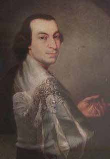
changes (Campstone Station, Sunset City, and Huachuca Vista),
before finally settling with the name Huachuca City. It incorporated
in 1958.

Today, Huachuca City (population 1,853) is located at the north exit
of Fort Huachuca, the major employer for the region. With retirees
moving in and tourism a major business because of the proximity
to Tombstone and Kartchner Caverns State Park, Huachuca City is a
growing area.

Watch your driving speed as they take the speed limits seriously.

You can get gas, snacks, and breakfast in Huachuca City.

Whetstone2
Continuing on Hwy 90 North you will come to the intersection
of SR 82 and Hwy 92, and a small community called Whetstone.
Whetstone is a census-designated place in Cochise County, with
a population of 2,617 (2010 Census). Whetstone was often referred
to as the “Y” because the intersection of SR 82 and Hwy 90 has an
eastbound lane on Hwy 90 and a southbound lane on SR 82 that
created a Y at the intersection. A left turn will take you to Elgin,
Sonoita, Patagonia, and Nogales (look for a Travel Adventure Plus for
these communities). A right turn on SR 82 takes you to the Presidio
Santa Cruz de Terrenate Trailhead and the ghost town of Fairbank,
then on to Tombstone (look for a Travel Adventure Plus for these
destinations). You can get gas and snacks at the station on the right.

Turn right onto SR 82 East and drive 8.4 miles. Turn left onto
N. Balance Ranch Road (Note: Google Maps list Kellar Road; the street
sign reads N. Balance Ranch Road). Destination will be on the right
(1.8 miles) Presidio Santa Cruz de Terrenate Trailhead.

Spanish Presidio Santa Cruz de Terrenate:3 The Presidio Santa
Cruz de Terrenate is a former Spanish military presidio, or fortress,
located roughly west of the town of Tombstone. The Presidio was
established on a bluff overlooking the San Pedro River by an Irish-
born Spanish Army Colonel, Hugo Oconór (Hugh O’Conor), in 1775.
This is one of the best-preserved sites from among the chain of
similar presidios that extended from Los Adaes, Louisiana, in the
east to Alta, California in the west.

2 Wikipedia, https://en.wikipedia.org/wiki/Whetstone,_Arizona
3 Wikipedia, https://en.wikipedia.org/wiki/Presidio_Santa_Cruz_de_Terrenate

                                                                              Fairbank Ghost Town Area 3
Hugh O’Conor (Hugo Oconór)4 Hugh O’Conor (Gaelic-Irish aristocratic O’Conor Don Family) by birth, or Hugo Oconór in Spanish, was born in 1732 in Dublin, Ireland.5 He was a descendant of Toirdhealbhach Mór Ua Conchobhair, King of Connacht and High King of Ireland. Because of the penal laws that restricted the political, religious, and commercial rights of Irish Catholics, O’Conor left his homeland and moved to Spain, where his cousins Alexander (Alejandro) and Dominic O’Reilly were serving as officers in the Spanish Royal Army. In his youth he joined the regiment of Volunteers of Aragon, eventually acquiring the title of major. During his years in the military, he was sent to Cuba and Mexico City. There he distinguished himself by his ability as a military strategist and was appointed captain for the Northern Territory to exercise dominion in the region. He was appointed governor of Texas by the Spanish viceroy of New Spain in 1767. O’Conor rode well over 10,000 miles on horseback in the course of conducting his duties. In 1771, he became commander of the Chihuahua frontier and on January 20, 1773 he was appointed commandant inspector of presidios under the office of Coronel. To strengthen the protection of Nueva Vizcaya, Coahuila, Sonora, Mexico, he decided to expel the Apaches in the region, making war against them in 1775 and 1776. Many Apaches died in the war. The Apaches who survived fled to 4 https://www.reddit.com/r/ireland/comments/d5ukgn/this_is_hugh_hugo_oconnor_an_irishman_who_founded/ 5 Wikipedia, https://en.wikipedia.org/wiki/Hugo_Ocon 4 Travel Adventure Plus
more western areas. O’Conor was called “The Red Captain” by the
Apache, both for the color of his hair and his formidable military
leadership.

O’Conor was the founding father of the city of Tucson, Arizona,
having authorized the construction of a military fort there in 1775.

Due to failing health, O’Conor requested to be transferred to
the Yucatan Peninsula in 1777, whereupon he was promoted to
brigadier general and appointed Governor of Yucatan Peninsula.

He died on March 8, 1779 at Quinta de Miraflores, in Merida,
Yucatan, New Spain.

A Bit of History
Who was there before the Presidio?6 In 1951, Charles DiPeso
excavated the site and reported that he believed that the evidence
found on site indicated that O’Conor had located the presidio
over the abandoned Sobaipuri7 Indian village of Quiburi.8 Other
historians and archaeologists did not support this assessment.

In 2007 through 2010, archaeologist Deni Seymour excavated
portions of the site not initially investigated by DiPeso. She also
reexamined some of the features and artifacts excavated by DiPeso
and obtained chronometric dates on features to settle some of the
feature-dating issues. Evidence showed that there was a Sobaipuri
site present that predated the presidio but historical documents
indicate it was not Quiburi. Additionally, Hohokam and Archaic
occupations were also in evidence preceding the occupation of the
presidio. Evidence of the prehistoric Hohokam occupation consists
of sherds scattered on the surface and eroding out of the adobe
walls of the later Spanish presidio. Archaic points and tools are also
present on the surface, in adobe walls and in house fills, having
eroded from the citadel walls. (Note: Someone was there, scholars
just can’t agree on who). Please note: It is illegal to remove artifacts
from public lands.

6 Wikipedia, https://en.wikipedia.org/wiki/Presidio_Santa_Cruz_de_Terrenate
7 The Sobaipuri (soh-BY-per-ee or soh-by-poorh-ee) Indians were an Upper Piman group who occupied southern Arizona and northern
  Sonora (the Pimería Alta) in the 1400–1800s. They were a subgroup of the O’odham or Pima, surviving members of which include the
  Tohono O’odham, the Akimel O’odham, and the Wa:k O’odham; http://www.seymourharlan.com/My_Homepage_Files/Page1.html
8 When referencing Quiburi — or “Many Houses” in the O’odham language of the Sobaipuri — it is important to consider that the Kino period
  Quiburi and the Quiburi of the late eighteenth century were clearly in two different locations. This is indicated by the documentary record,
  which has now been affirmed by the archaeological record; http://www.seymourharlan.com/My_Homepage_Files/Page23.html

                                                                                        Fairbank Ghost Town Area 5
The Garrison Terrenate was in three different locations throughout its life. Beginning in 1742 it was established near a rancho referred to as Terrenate in northern Sonora, Mexico. The Regulation of 1772 called for a realignment of the presidios. The Terrenate garrison was moved east to Las Nutrias in 1775.9 The garrison at Las Nutrias was little more than a camp. In 1775, during an inspection by Hugo O’Conor, he found the camp unacceptable. The garrison was moved was to near present-day Fairbank, Arizona, on the San Pedro River. The site was chosen on August 22, 1775 by Hugo O’Conor. He chose a spot on a bluff overlooking the San Pedro River, which seemed to provide a natural fortification on several sides. The area had pasturage, wood, and water. In the early 1776, the garrison marched to its new location. The garrison commander was Captain Francisco Tovar with a company of 56 men, 352 horses, and 51 mules. The soldiers were “leather- jacket cavalry,” a type of heavy cavalry equipped with six horses apiece, a pair of pistols, musket, sword, and lance. Friendly Native Americans from San Xavier del Bac and San Agustin de Tucson missions helped with the construction of the buildings and the walls. The Apaches began to harass the presidio, attacking anyone who ventured out for water or to try to plant crops in the nearby fields. The Apaches were attracted by the large number of horses kept at the presidio and ran off the herds whenever they were unguarded. As the number of horses became fewer, the soldiers were less and less able to pursue the raiders to try to reclaim them. On July 7, 1776 Captain Francisco Tovar and 29 of his men were killed in the Battle of Las Mesitas with the Apache. Captain Francisco Ignacio de Trespalacios replaced the fallen commander and brought reinforcements, bringing the garrison up to 83 men. In mid-November, Trespalacios led 30 of them almost 100 miles south to the aid of the mission of Magdalena on the Rio San Ignacio. When they arrived, they found that 40 raiders had looted the settlement, murdered the inhabitants, and burned the church. 9 http://www.seymourharlan.com/My_Homepage_Files/Page72.html 6 Travel Adventure Plus
In February 1778, the Apaches made a successful raid on the fort’s
horse herd. Between June and September 1778, Captain Francisco
Ignacio de Trespalacios and 19 other soldiers and settlers died in
another battle with the Apache. Lieutenant Colonel Pedro Fages
brought additional reinforcements to the presidio.

In 1779, when Inspector Roque de Medina came to Santa Cruz
de Terrenate, he found 46 soldiers, 98 horses and 23 mules. Only
26 of the leather-jacket cavalry survived, and only 16 of the
reinforcements were still alive. Four Native American scouts
remained and 20 others had deserted. On inspection, 19 of the
muskets in the armory were useless and 38 of the lances were of
such inferior workmanship they were unserviceable. Eight of the
men did not even have uniforms.

After examining the situation at Santa Cruz de Terrenate, Medina
strongly recommended that the garrison be moved back to its
former position, citing poor communications, the isolation of the
presidio and the extreme difficulties of getting supplies to the
present location.

The San Bernardino fort, Terrenate’s nearest neighbor, had already
been abandoned during the previous year because of similar
problems: strong opposition by the Apaches, difficulties with
communications, and the impossibility of secure supply lines.
Worsening attacks prevented the settlers from either receiving
outside help or harvesting their own crops; they were literally
starving to death. In 1780, the decision was made to move the troop
back to Las Nutrias, near the former site of the Terrenate garrison.
Teodoro de la Croix summarized the reason:

   “The terror instilled in the troops and settlers of the presidio of
   Santa Cruz that had seen two captains and more than eighty men
   perish at the hands of the enemies in the open rolling ground at a
   short distance from the post, and the incessant attacks which they
   suffered from the numerous bands of Apache, who do not permit
   the cultivation of the crops, who surprise the mule trains carrying
   effects and supplies, who rob the horse herds and put the troops in
   the situation of not being able to attend their own defense, making
   them useless for the defense of the province.”

Today, there are only faint remains of the fort. Traces of numerous
buildings and adobe walls stand, including the gate and fortified
wall, the chapel, the soldiers’ barracks, and the commandant’s

                                              Fairbank Ghost Town Area 7
quarters. The traditional Spanish fort warfare was ineffective
against the lightning raids and guerrilla tactics of the Apache. The
presidio was abandoned in 1780.
In 1878, the presidio was briefly occupied by the United States Army
but abandoned later that same year.
Presidio Santa Cruz de Terrenate trailhead
The main entrance of the presidio was guarded by a gatehouse.
Most agree the bottom section served as guardhouse, soldiers’
quarters, and weapon storage. The walls of the Terrenate were never
completed.
Main gate and guardhouse10
Social life in a presidio community revolved around the Church. Two
Franciscan priests were assigned to Terrenate. The first was killed by
Native Americans before reaching the post. The next priest assigned
requested retirement soon after arriving. His request was granted
in 1780.
10 Presidio Santa Cruz de Terrenate by Dept. of the Interior, Call Number: Google Scholar eResource, Publication Date: 1992
8 Travel Adventure PlusChapel11
Jacals were the quarters for the settlers living inside the fort. The
jacals were normally 12 feet square.
Jacal12
The bastion walls were never completed. The basic configuration
was a bastion 12 feet high with four small bronze cannons with a
powder magazine in the center.
Bastion13
11 Presidio Santa Cruz de Terrenate by Dept. of the Interior, Call Number: Google Scholar eResource, Publication Date: 1992
12 ibid.
13 ibid.
Fairbank Ghost Town Area 9The commandant’s quarters were luxurious compared to the
soldiers’ quarters. During the five years of Spanish occupation
four commandants served at the Terrenate. The first commandant,
Captain Francisco Tovar, spent less than eight months at the post.
He and 29 of his men died during a battle with the Apache.
Captain Don Francisco Ignacio de Trespalacios replaced Tovar for
a little more than two years until his death during a fight with the
Apache in September 1778.
Lieutenant Colonel Pedro Fages brought Catalonian volunteers to
replace the fallen. In January 1780 he left to recruit more volunteers.
Don Jose Antonio de Vildosola was the final comandante at
Terrenate. He served for less than three months before Don Teodoro
de Croix, commander of the northern frontier of New Spain ordered
a retreat from the presidio.
Commandant’s quarters14
Don Geronimo de Rocha y Figueroa took charge of the evacuation.
By March 1780 no one remained at the presidio. More than 80 people
lost their lives at Terrenate.
14 ibid.
10 Travel Adventure PlusArtist’s reconstruction if the Presidio had been completed15
During the hike back to the trailhead enjoy walking on the former
railbed.
Old railbed used during the 1800s
15 ibid.
Fairbank Ghost Town Area 11Fairbank
Fairbank Cemetery and Grand Central Mill16
Fairbank ca. 189017
From the presidio trailhead, turn left on N. Balance Ranch Road
toward Hwy 82. Turn left on Hwy 82 and drive 1.5 miles. There is
parking on both sides of road. Recommend turning left into the
Fairbank parking lot. The parking on the right side of road has the
trailhead for the little Boquillas Ranch, another hike. There are signs
for the trails.
Your options are to take the trail to the Fairbank Cemetery and on to
Grand Central Mill or go to the Fairbank Town site first. There is a loop
trail that you can hike for all of the attractions. Note: You can hike to
Contention (another ghost town) from the Fairbank trails. It will take
much longer.
Fairbank is a ghost town located within the San Pedro Riparian
National Conservation Area.18 Fairbank was a frontier town located
on the banks of the San Pedro River 10 miles west of Tombstone.19
Initially, the area was first part of an old Mexican land grant called
the “San Juan de las Boquillas y Nogales.” It was first settled in the
1870s as a stagecoach stop on the way to Tombstone called “Junction
16 BLM Website, https://www.blm.gov/visit/fairbank-historic-townsite
17 http://www.apcrp.org/FAIRBANK/Fairbank_Master_Doc.htm
18 Wikipedia, https://en.wikipedia.org/wiki/Fairbank,_Arizona
19 op. cit.
12 Travel Adventure PlusCity.” Then, it was named “Kendall” before officially becoming a
town with the name “Fairbank” in 1881 when the New Mexico and
Arizona (NM&A) railroad established a train station, naming the
town for a Chicago investor, Nathaniel Kellogg Fairbank.
Nathaniel Kellogg Fairbank20
Kellogg was also one of the main organizers of the Central Mining
Company in Tombstone. A “wye” for turning locomotives was
installed in town, bringing at least three railroad lines to establish
depots.21 A short NM&A line connected the Southern Pacific track
in Benson southwest through Fairbank and on to Nogales, Arizona
and Nogales and Guaymas, Mexico. The depots were important for
shipping cattle as well as ore coming from Tombstone.
Freighters hauled ore from the Tombstone mines to mills at
Contention City and Charleston. Fairbank was not connected to
Tombstone by railway until 1903. Until then, travelers continued
the last 10 miles to Tombstone by stagecoach on the Butterfield
Overland Mail line, which opened in 1885.
The railway line to Tombstone started out as a two-mile graded
right-of-way heading east out of the town of Fairbank. The grading
was done by the NM&A from a connection with their Benson-
Nogales mainline, constructed in 1882. However, the NM&A’s parent,
the Atchison, Topeka and Santa Fe Railway, decided to not pursue a
line to Tombstone, leaving a trackless, graded rail bed.22
In 1902, the El Paso and Southwestern Railway (EP&SW) constructed
a line between Benson and Bisbee, which also traveled through
Fairbank (paralleling the nearby NM&A line for some of its length).
20 https://www.geni.com/people/Nathaniel-Fairbank/6000000017532405142
21 Wikipedia, en.wikipedia.org; In railroad structures and rail terminology, a wye or triangular junction is a triangular joining arrangement of
three rail lines with a railroad switch at each corner connecting to each incoming line. A turning wye is a specific case.
22 https://www.abandonedrails.com/tombstone-branch
Fairbank Ghost Town Area 13The EP&SW constructed a branch line from Fairbank (utilizing the
prior right-of-way graded by the NM&A from 1882) into Tombstone,
completing it in 1903.
Let’s Start Hiking
Starting from the parking lot take the Loop Trail to the Fairbank
Cemetery and Grand Central Mill and on to the town of Fairbank.
Start of the Loop Trail to Fairbank Cemetery, Grand Central Mill, and Fairbank
Fairbank Cemetery this way
Fairbank Cemetery23 contains an estimated 60 gravesites,
with causes of death ranging from illness to building
fires to even murder. See the Fairbank Cemetery roster
(http://www.apcrp.org/FAIRBANK/FAIRBANK_CEM_MAST.htm) for
causes of death and demographics.24
23 Only in Your State-AZ, https://www.onlyinyourstate.com/arizona/ghost-town-cemetery-hike-az/
24 http://www.apcrp.org/FAIRBANK/Fairbank_Master_Doc.htm
14 Travel Adventure PlusFairbank Cemetery
Grand Central Mill25 was completed in December 1880 to process
ore from the Grand Central Mine, Tombstone. The size of the
building was 200 feet by 130 feet. Built on a hillside to utilize gravity
to feed ore, the building was 90 feet from the upper level to the
bottom level. The mill had 30 stamps and was the largest and most
efficient mill to be built along the San Pedro River.
A stamp was a rod of steel about 14 feet long and about 3 inches
in diameter with an iron shoe (8.5 inches in diameter by 7 inches
tall and weighing 800 pounds) attached to the lower end. The
total weight of each stamp was between 2,500 and 3,000 pounds.
At the top of the stamp there was a collar that was engaged by a
pawl connected to a drive shaft. The drive shaft was turned by a
belt driven by a steam engine. This drive shaft lifted and dropped
each stamp approximately 50 times per minute. This crushed the
ore to a powder. To see this in person, visit the Tucson museum
of the Arizona Historical Society, where stamp mill equipment is
on display. Some mining equipment is also on view at the Bisbee
Mining Museum.
The resulting powder was mixed with water and quicksilver
(mercury) to form a paste. The silver and other metals in the powder
would adhere to the mercury. After settling and straining, the
25 Herald Review, https://www.myheraldreview.com/news/the-grand-central-mill/article_e92b2116-dacd-11e6-aecd-f3b2c53236eb.html
Fairbank Ghost Town Area 15amalgam of mercury and metals was heated to boil off the water
and mercury leaving silver and traces of other metals (gold, copper,
zinc, and lead) to be transported more easily, usually 180-pound
bars. The bars were taken to a smelter to separate the various metal
elements.
Grand Central Mill was in operation from 1880 to 1889. All the San
Pedro River mills were closed when water became available in
Tombstone. The Grand Central Mill was demolished in 1889. Some of
the equipment (five railcar loads) was sold to the Oso Negro Mine in
Sonora, Mexico. In the summer of 1905, 20 of the remaining stamps
were moved to the Girard Mill in Tombstone during a renovation
to that mill. This made the Girard Mill a 40-stamp mill. Today all
that remains of the Grand Central Mill are the massive foundations
stacked up the hillside.
Grand Central Mill
One of the men responsible for the Grand Central Mill was Eliphalet
Butler (E.B.) Gage. Gage was born October 2, 1839 in Pelham, New
Hampshire.26 Gage was a businessman and mining executive. He
graduated from Dartmouth College in 1858. In 1877 he came to
Arizona to pursue mining and a year later, reached the town of
Tombstone where he took control of the Grand Central Mines
and the Grand Central Mill.27 In 1901 he founded and became
president of the Tombstone Consolidated Mines Company and
began acquiring and reopening many of the other mines located
around the town. In addition, he also served as Arizona Prison
Commissioner and President of the Arizona Capitol Building
Commission.
26 https://www.findagrave.com/memorial/53633457/eliphalet-butler-gage
27 https://www.soldiersofthequeen.com/StreetsOfLerado-TombstoneMinesStockCertificate.html
16 Travel Adventure PlusE.B. Gage
To Old West historians, E. B. Gage is probably best known as a
partisan on the side of the Earp faction in Tombstone during the
troubles between the Earps and the Clantons.
He settled in Tombstone where he pursued a career as a mining
engineer and investor. He also became acquainted with the Earps
after Wyatt Earp, a former Kansas lawman, arrived in Tombstone in
late 1879.
Following the infamous shootout at the O.K. Corral, the Cowboys,
a band of outlaws, retaliated against the Earps. On March 18, 1882
Morgan Earp was shot in the back and killed while playing billiards.
This began the infamous Vendetta Ride, during which Wyatt and a
group of adherents would hunt down and kill many of his brother’s
suspected assailants.
E. B. Gage would, for all intents, bankroll Wyatt Earp’s ride of
vengeance. On March 23, Wyatt dispatched Charlie Smith and Dan
Tipton back to Tombstone to seek out Gage and secure a $1,000
cash loan, which would enable them to continue their pursuit of
the Cowboys. Both Smith and Tipton ended up getting arrested and
thrown in jail by Johnny Behan but made bond, and Smith was able
to get the required cash from Gage. It is uncertain if Wyatt ever
repaid the loan.
In 1901, newly re-elected President William McKinley was making a
trip around the country and decided to tour the Congress Gold Mine,
one of E. B. Gage’s many holdings in Arizona. During the visit, Gage
served as the president’s personal tour guide. The president was
quite impressed and the first lady was presented a small ribbon-
bound gold bar by Gage and other company representatives.
Fairbank Ghost Town Area 17Gage died March 12, 1913 in San Francisco, California and was
buried in Colma, California. His old friend, Wyatt Earp, was also
buried in Colma when he died in 1929.
Continue on the loop trail until you see the sign below:
If you chose to hike to Contention City and Mill it is another 2 miles.28
The trail is at times difficult to follow. There are few ruins at the site.
If you chose to hike to the Presidio, it is not far. However, it is on the
other side of the San Pedro River and with very steep banks.
If you chose to hike via the River Loop Trail to Fairbank it is only 2.1
miles. The terrain and views are different than your hike to this point.
San Pedro River
28 Wikipedia, https://en.wikipedia.org/wiki/Contention_City,_Arizona. Contention City or Contention is ghost mining town in Cochise County.
It was occupied from the early-1880s through the late-1880s in what was then known as the Arizona Territory. Only a few foundations now
remain of this boomtown, which was settled and abandoned with the rise and fall of silver mining in and around the area of Tombstone.
18 Travel Adventure PlusThe hike is easy. You will see a railroad bridge and you may start
thinking that you are close to Fairbank and the bridge is across
highway 82. Its not. You have about 20 to 25 more minutes of hiking
before you reach Fairbank.
Railroad bridge across the San Pedro29
Fairbank
There are several buildings at the town site. During its peak,
Fairbank featured four stores, a butcher shop, the Montezuma
House (a hotel) with a restaurant (established in 1889), two other
restaurants, five saloons, a Wells Fargo office, the railroad depot, a
stage coach station, a jail, post office, and a school. It also had the
Grand Central Mill.30
Both historic and present-day photos follow.
Railroad Depot. Fairbank’s importance as a railroad town grew and
it soon boasted three different railroad lines and depots, becoming
the central point of entry and exit for miners, prospectors,
materials, and ore, primarily headed to and from Tombstone, which
wasn’t connected to the railway until 1903. During this time, the
stage continued to do a brisk business to carry travelers those last
ten miles to Tombstone.
29 Wikipedia, Abandoned railroad bridge near Fairbank, Arizona by Old Pueblo
30 http://www.apcrp.org/FAIRBANK/Fairbank_Master_Doc.htm
Fairbank Ghost Town Area 19Fairbank Depot, ca. 190031
Schoolhouse. The gypsum block schoolhouse, built in 1920 to
replace the old one that burned down in 1917, was opened as a
museum and information center for Fairbank in March 2007. The
Fairbank Schoolhouse has been restored to include a classroom,
as well as multiple exhibits on the history and prehistory of the
area. The BLM manages the site with valuable assistance from
the Friends of the San Pedro River, which operates a gift shop in a
portion of the schoolhouse.32
Schoolhouse33
31 https://commons.wikimedia.org/wiki/File:Fairbank_Railroad_Depot_Arizona_Circa_1900.jpg
32 https://www.blm.gov/blog/2020-12-08/restored-fairbank-mercantile-beckons-visitors
33 Wikipedia, https://en.wikipedia.org/wiki/Fairbank,_Arizona
20 Travel Adventure PlusMercantile (adobe commercial building).34 The Mercantile
housed a general store, post office, and a saloon. The post office was
established on May 16, 1883. The post office finally closed in the
1970s. The General Store remained opened for a number of years.
The building was restored by the Bureau of Land Management.
Fairbank Mercantile, 193735
Mercantile, before restoration Mercantile after restoration
Photo by Kathy Weiser-Alexander
34 https://www.blm.gov/blog/2020-12-08/restored-fairbank-mercantile-beckons-visitors
35 Photo: Library of Congress, Prints & Photographs Division, HABS ARIZ,2-FAIRB,2--1
Fairbank Ghost Town Area 21Mercantile
Stable and outhouse from the early 1940s
Teacherage
Montezuma House (hotel). Montezuma Hotel was constructed in
1889 just south of the Mercantile Building. The building was torn
down when Hwy 82 was built. Only a few foundations remain. The
Montezuma House offered draft beer, foreign and domestic liquors,
and dining. It was managed by Leon Larrieu.36
Larrieu was born in Saint-Gaudens, France in October 1837. He was
best known as “Mine Host” at the Montezuma House. He died at his
home in Fairbank on August 16, 1904 at the age of 68.37
36 https://ancestors.familysearch.org/en/KJ56-FBD/eugene-paul-antonio-larrieu-1877-1933
37 https://www.newspapers.com/image/40684088/?terms=Leon%20Larrieu&match=1
22 Travel Adventure PlusAd in the Tombstone Prospector, February 12, 189138
Montezuma House (hotel), Late 1890s39
The Fairbank Train Robbery40
This reads like an old Hollywood western movie.41 On February 21,
1900, the express car of a Benson-to-Nogales train was held up by
six gunmen when it arrived at the Fairbank railroad station. Two
of the robbers, Billy Stiles and Burt Alvord, were former deputy
sheriffs. They mingled with the crowd, milling about the station
and pretended to be drunken cowboys. Suddenly they attacked the
baggage car.
A lawman, Jeff D. Milton, who was working for Wells Fargo as
an express messenger on the Southern Pacific run from Benson,
Arizona to Guaymas, Mexico, was inside the express car guarding
the Wells Fargo box and its payroll (many of the cargos were often
comprised of gold and silver bullion).
38 Montezuma House, Fairbank ad - Tombstone Prospector, Thurs. Feb. 12, 1891, pg. 3
39 Arizona Historical Society
40 Wikipedia, https://en.wikipedia.org/wiki/Fairbank_train_robbery
41 http://www.arizonaghosttowntrails.com/fairbank.html
Fairbank Ghost Town Area 23As he was hit by gunfire, Milton threw the key to the box into a
corner so the gang couldn’t open it. He fought the men with a
shotgun even though his left arm was shattered by bullets from
their Winchesters. Milton slammed the car door shut and collapsed
unconscious between two large boxes. This saved his life when the
outlaws riddled the car with bullets. The robbers opened the door of
the baggage car but were unable to find the keys, so they mounted
their horses and rode away.
One outlaw who was left behind, Jeff Dunlap, alias Three-fingered
Jack, was a well-known horse thief. He died a day later of buckshot
wounds to the chest from Milton’s shotgun. Before he died on
February 22, 1900, he confessed who the gang members were,
with Burt Alvord named as the leader. Dunlap was buried at Boot
Hill, in Tombstone. The robbers were eventually hunted down and
imprisoned. One had fled to Mexico. The penalty for train robbery
was hanging. Leniency was exercised for the attempted robbery, and
all the outlaws ended up with lesser sentences.
Burton Alvord, lawman and outlaw
Who was Burton Alvord? Albert “Burt” Alvord was born
September 11, 1867 in Plumas County, California.42 Alvord was an
American lawman and later outlaw. He began his career in law
enforcement in 1886 as a deputy under Sheriff John Slaughter in
Cochise County, Arizona.
Alvord’s education was informal. He spent time working at the
O.K. Corral, where he got to know the townspeople very well, and
claimed to have witnessed the infamous gunfight at the O.K. Corral
in 1881. This claim was unsubstantiated.
Despite Alvord’s reputation for frequenting saloons and his
participation in several bar altercations, Cochise County Sheriff
John Slaughter recruited Alvord as a deputy in 1886. Alvord served
42 Wikipedia, https://en.wikipedia.org/wiki/Burt_Alvord
24 Travel Adventure Plusprimarily as the muscle behind Slaughter’s operations. He was
reportedly “not noble, temperate, far seeing, or unselfish.” He did
assist Slaughter in capturing or killing several rustlers and other
outlaws between 1886 and 1889, but his reputation suffered when
his alcoholism became increasingly apparent. Alvord continued to
frequent saloons and eventually began to associate with gamblers
and suspected outlaws. When Slaughter reprimanded Alvord,
he quit.
Alvord next worked as a lawman in several towns in the 1890s,
including Fairbank and Pearce. He turned in his badge, left his
wife, and turned to crime. He formed a gang comprised of outlaws
he had pursued as a law officer: Billy Stiles, Bill Downing, and
“Three Fingered Jack” Dunlop. Alvord’s gang committed several
armed robberies in Cochise County, where he and Stiles were both
captured but managed to escape. On February 15, 1900, Dunlop and
Bravo Juan Yoas were wounded by Jeff Milton during Fairbank train
robbery. Later that year, Alvord was again captured and taken to
Tombstone. Billy Stiles rode to Tombstone and wounded the deputy
on duty, allowing Alvord and 24 other prisoners to escape.
In 1902, Alvord assisted Arizona Rangers Captain Burton C. Mossman
in capturing the notorious Mexican bandit Augustine Chacon, in
exchange for a share of the reward money and a reduced sentence.
When Chacon was convicted of murder and hanged at Solomonville,
Arizona, Alvord and Stiles returned to crime, now pursued by the
Arizona Rangers. They were captured in December 1903, but again
managed to escape.
The Arizona Rangers finally pursued the outlaws across the
international border into Mexico, trapping them near Naco in
February 1904. The outlaws resisted, but surrendered after both
were wounded. Alvord spent two years in the Yuma Territorial
Prison. Following his release, he announced he was going by ship to
start anew in Central America. He was last seen in 1910 working as
a Panama Canal employee. Following this, Alvord’s fate is unknown.
Fairbank Ghost Town Area 25Jefferson Davis Milton Who was Jefferson Davis Milton? Milton was born November 7, 1861 in Marianna, Florida.43 Milton was lawman and a descendant of the English poet, John Milton (1608 – 1674). At age 15 or 16, Jeff Milton joined his sister in Texas where he worked at her husband’s mercantile stores and later as a cowboy. On July 27, 1880, he appeared at the Texas Rangers headquarters in Austin, armed with a couple of letters of recommendation from prominent citizens. By adding three years to his real age, he became the requisite 21 and was sworn in as a Ranger private. After serving with the Rangers for four years, he moved through west Texas and into New Mexico, where he became a Deputy U.S. Marshal in 1884. Milton worked under Sheriff John Slaughter in Cochise County, during which time the two were involved in several manhunts and shootouts with outlaws. One of their most well-known accomplishments was their pursuit of the Jack Taylor Gang in late 1886 to the middle of 1887. Milton joined the U.S. Customs Service in 1887 and was appointed a Customs Mounted Inspector headquartered in Tucson, in the Customs Collection District of El Paso. Milton spent two years with Customs, riding the line from Nogales westward to the Colorado River. As a political appointee, Milton found himself out of a job in 1889, when a new party took over. On June 21, 1895, Milton, who was at that time chief of police in El Paso, Texas, was accompanying his partner, Deputy U.S. Marshal George Scarborough, when Scarborough shot and killed Martin M’Rose, a notorious Texas rustler. 43 Wikipedia, https://en.wikipedia.org/wiki/Jeff_Milton 26 Travel Adventure Plus
In July 1898, working again with Scarborough, the pair tracked
down, shot, and captured “Bronco Bill” Walters near Solomonville,
and scattered the Walters gang from their hideout, killing another
gang member in the process.

Milton was employed for a period of years with the Southern
Pacific Railroad and/or Wells Fargo. On February 15, 1900, Milton
substituted on a train for another express agent who was sick.
In Fairbank, he was handing packages to the station agent when
former lawman-turned-outlaw Burt Alvord and five others
attempted to rob the express car of its cash. Milton shot outlaw
“Three Fingered Jack” Dunlop, badly wounding him. He died days
later. Milton also shot and wounded Bravo Juan Yoas. Milton was
seriously wounded in his left arm, fracturing it and severing an
artery, for which he improvised a tourniquet. Before Alvord and his
men boarded the car, Milton threw the keys to the express car’s safe
into a pile of packages at the far end of the car.

The gang was about to shoot Milton again when the train engineer
intervened, saying he was already dead. The robbers were unable to
open the safe and escaped with only a few dollars.

The railroad dispatched a special engine and boxcar to transport
Milton from Benson to Tucson for treatment. Dr. H. W. Fenner tied
the shattered bone together with piano wire. When the wound
wouldn’t heal, he sent Milton to San Francisco where he could be
seen by experts at the Southern Pacific Hospital. They wanted to
amputate his arm at the elbow, but he refused and got a ride to his
friend Dr. George E. Goodfellow’s office. Goodfellow cleaned and
treated Milton’s wound but told him he would never regain use of
the arm. As predictied, Milton’s left arm was permanently disabled
and shorter than his right.

Milton joined the Bureau of Immigration in 1904 as a “mounted
Chinese inspector” charged with enforcement of the Chinese
Exclusion Act. At 62, he became the first officer appointed to the U.S.
Immigration Service Border Patrol in 1924, and for the next eight
years he pursued border patrol work “with unbridled enthusiasm.”

The Economy Act of 1932 forced the still-active Milton into
retirement at age 70. Milton retired to Tombstone and then to
Tucson where he lived the remainder of his life. Louis L’Amour
wrote in his book Education of a Wandering Man that he met Milton,
who bought him breakfast and gave him a ride to Tucson.

                                          Fairbank Ghost Town Area 27
On August 15, 1936, the Immigration Service dedicated the “Jeff D.
Milton,” a new patrol boat in San Francisco harbor. In 1937, Milton
received his commission and the rank of “colonel” from Gov. B.B.
Mouer, who made him the lifetime military aid of the governor of
Arizona. Milton is also recognized as the father of the United States
Border Patrol.
Milton died on May 7, 1947 at the age of 85 in Tucson, Arizona.
The Decline of Fairbank
Fairbank began its decline starting with a drought that impacted
farmers who traded there. The Tombstone mines closed in 1887
from flooding, thus depriving the stamp mills of ore. This forced the
mills to shut down.
Fairbank sustained moderate to heavy damage during the Sonora
Earthquake of 1887, which shifted the railroad tracks out of place.44
Flooding of the San Pedro River in September 1890 caused
significant property damage, thinning down the population
further.45
In 1901, the Mexican land grant on which the town was situated
was purchased by the Boquillas Land and Cattle Company. The
owners extended leases only on the commercial buildings and
several residences into the 1970s. Any remaining residents left the
town when the buildings were declared unsafe. The former land
grant was acquired by the Bureau of Land Management in 1986, and
the town site and cemetery were incorporated into the San Pedro
Riparian National Conservation Area.
Fairbank, Arizona in 1890
44 https://earthquake.usgs.gov/earthquakes/eventpage/ushis262/impact
45 Wikipedia, https://en.wikipedia.org/wiki/Fairbank,_Arizona
28 Travel Adventure PlusLittle Boquillas Ranch46 is an historic ranch property near the
Fairbank Historic Townsite. The Little Boquillas Ranch gets its name
from the San Juan de las Boquillas y Nogales (Saint John of the
Little Springs and Walnut Trees) land grant, which was granted to
the family of Rafael Elias Gonzales by the Mexican government in
1833. The grant ran from a point near what is now the ghost town of
Charleston, Arizona, north to a point just to the south of Fairbank,
along the San Pedro River.
The San Rafael del Valle grant, owned by Rafael’s cousin, Captain
Ignacio Elias Gonzales, was immediately to the south of the
Boquillas grant and ran from what is now the community of
Hereford north to Charleston. Both were roughly four sitios, or
approximately 18,000 acres, in size.
In 1880, San Francisco businessman George Hearst and his partner,
George Hill Howard, purchased the Boquillas land grant from
the Elias family in Sonora. Hearst, who eventually became the
sole owner of the property, began selling off parcels of land for
townsites, mills, ranches, farms, and a railroad soon after, making
him responsible for much of the early development of the region.
In 1891, the U. S. government established the Court of Private Land
Claims to validate land grant claims and attempt to sort out the
problems caused by the surveyor office, which had previously
validated claims. The same year George Hearst died and his son,
William Randolph Hearst, and his widow, Phoebe Hearst, filed
papers to have their exclusive claim to the Boquillas land grant
recognized.
In 1899, the Land Claim Court ruled that only the Hearst family had
valid title to the land grant, but not everyone was in agreement. A
group of some thirty residents of the land grant soon filed a lawsuit
to dispute the ruling, and although the case eventually made it to
the highest court in the nation, the Supreme Court affirmed the
decision of the Land Claims Court in 1906.
In 1901, while their case was still pending in the Supreme Court,
the Hearst family sold the Boquillas land grant to the Kern County
Land and Cattle Company, which was a large mining and ranching
conglomerate based in California. Kern formed the Boquillas Land
and Cattle Company in 1901 and began raising cattle from a new
headquarters, established two miles south of Fairbank, called the
Little Boquillas Ranch.
46 Wikipedia, https://en.wikipedia.org/wiki/Little_Boquillas_Ranch
Fairbank Ghost Town Area 29The Boquillas Land and Cattle Company also moved to clear out the rangeland for cattle by evicting all of the “squatting” homesteaders. The Supreme Court’s ruling in 1906 further served to depopulate the San Pedro Valley by triggering an exodus from the area. Boquillas allowed only a handful of favored families and their businesses to remain in Fairbank, along with a few other families living on land that had been sold previously by George Hearst. The Little Boquillas Ranch continued to raise livestock along the San Pedro River until 1971, when the Tenneco Oil Company gained title to the Del Valle and Boquillas land grants through the acquisition of the parent Kern County Land and Cattle Company. In 1986, the Boquillas and Del Valle grants were acquired by the Bureau of Land Management in a land exchange to form what is now the San Pedro Riparian National Conservation Area. This was one of the filming locations for the 1948 western Red River with John Wayne, Montgomery Clift, Tess Dru, and Walter Brennan.47 You can reach the Ranch by starting from the trailhead located in the parking lot across the parking lot for Fairbank by following the Old North Fairbank Road for approximately 2.3 miles. You may want to consider hiking back on the railbed that parallels the road. There are several places where the railbed may not be safe, such as crossing streambeds, so use caution. You can hike back to the road, get across the streambed and continue. If there is water in the streambeds or if it is rainy season, it is recommend that you stay out of the streambeds. The following historic buildings and structures are currently maintained by the BLM, which believes that most of the ranch development was in place by 1910.48 47 https://www.imdb.com/title/tt0040724/ 48 Wikipedia, https://en.wikipedia.org/wiki/Little_Boquillas_Ranch 30 Travel Adventure Plus
Little Boquillas Ranch

Little Boquillas Ranch House                  Foreman House

           Barn                           Blacksmith’s shop

                          Smokehouse

                                        Fairbank Ghost Town Area 31
The Return to Sierra Vista You have two options. Return to the starting point in Sierra Vista by backtracking along the route you took. The other option is to return via Tombstone. (Tombstone will have its own Adventure Travel Plus.) You will pass Charleston on your return. See the Adventure Travel Plus booklet, 9000 BCE to 2021 AD in Four Easy Trails. From the Fairbank parking lot, head east on Hwy 82 East (5.9 miles); turn right onto Hwy 80 East (3.1 miles); turn right onto N. 4th Street (Tombstone); head south on S. 4th Street toward E. Toughnut Street; turn right at the first cross street onto E. Toughnut Street, then turn left onto S. Sumner Street. Continue onto S. Charleston Road (16.0 miles). Use the left two lanes to turn left onto Hwy 90 South to return to the start point in Sierra Vista. 32 Travel Adventure Plus
Carry “Doc” Morgan

Doc moved to Sierra Vista is the mid-1970s and started exploring
the area — and hasn’t stopped yet. He worked as a member of the
U.S. military, civil service, and defense contractor to Fort Huachuca
and after retirement chose to stay in the area, dividing his time
between exploring and volunteering for the Red Cross, the Arizona
Rangers, Sierra Vista Tourism Commission, and contributing data as
an Advanced Arizona Weather Watcher.

With a deep passion and respect for the desert, Doc is a champion
of the local environment, terrain, and history. By viewing the area
simultaneously through these lenses, he can explain the “why”
behind the “what.”

Sierra Vista’s Sky Islands, abundant wildlife, and visible history
dating back to 9,000 BCE offer endless discovery. And Doc’s Travel
Adventure Plus series weaves all three into memorable journeys.
Take a drive with Carry “Doc” Morgan, a Sierra Vista local who puts
   exploring at the top of his “to-do” list.

   About this Journey
   Welcome to Sierra Vista Arizona! This is another installment of
   Travel Adventure Plus. This provides you a travel event with history,
   maps, photographs, imagery, and good to know information for
   your knowledge, enjoyment, and safety. There are also options and
   notices for additional or follow-on trips.

   Buckle up and enjoy the ride!

Produced by City of Sierra Vista Marketing & Communications   08/2021   50
You can also read