GEOLOGICAL SURVEY WORK PROGRAM FOR 2020-21 - RECORD 2020/1 - Government of Western Australia Department of Mines, Industry Regulation and Safety
←
→
Page content transcription
If your browser does not render page correctly, please read the page content below
RECORD 2020/1

         GEOLOGICAL SURVEY
         WORK PROGRAM FOR 2020–21

Government of Western Australia
Department of Mines, Industry Regulation
and Safety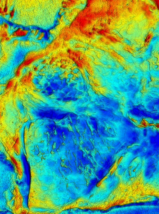
Government of Western Australia
             Department of Mines, Industry Regulation
             and Safety

Record 2020/1

GEOLOGICAL SURVEY
WORK PROGRAM FOR 2020–21

Perth 2020
MINISTER FOR MINES AND PETROLEUM
Hon Bill Johnston MLA

DIRECTOR GENERAL, DEPARTMENT OF MINES, INDUSTRY REGULATION AND SAFETY
David Smith

EXECUTIVE DIRECTOR, GEOLOGICAL SURVEY AND RESOURCE STRATEGY
Jeff Haworth

REFERENCE
The recommended reference for this publication is:
Geological Survey of Western Australia 2020, Geological Survey work program for 2020–21: Geological Survey of Western Australia,
  Record 2020/1, 68p.

ISBN 978-1-74168-904-4
ISSN 2204-4345

Disclaimer
This product uses information from various sources. The Department of Mines, Industry Regulation and Safety (DMIRS) and the
State cannot guarantee the accuracy, currency or completeness of the information. Neither the department nor the State of Western
Australia nor any employee or agent of the department shall be responsible or liable for any loss, damage or injury arising from the use
of or reliance on any information, data or advice (including incomplete, out of date, incorrect, inaccurate or misleading information,
data or advice) expressed or implied in, or coming from, this publication or incorporated into it by reference, by any person whosoever.

Published 2020 by Geological Survey of Western Australia
This Record is published in digital format (PDF) and is available online at .

                © State of Western Australia (Department of Mines, Industry Regulation and Safety) 2020

With the exception of the Western Australian Coat of Arms and other logos, and where otherwise noted, these data are provided under
a Creative Commons Attribution 4.0 International Licence (http://creativecommons.org/licenses/by/4.0/legalcode).

Further details of geoscience products are available from:
Information Centre
Department of Mines, Industry Regulation and Safety
100 Plain Street
EAST PERTH WESTERN AUSTRALIA 6004
Telephone: +61 8 9222 3459 Email: publications@dmirs.wa.gov.au
www.dmirs.wa.gov.au/GSWApublications

Cover image: Packing up the campsite in a claypan about 5 km south of Minilya in the southern Pilbara (photo by Olga Blay, DMIRS)

                                                                   ii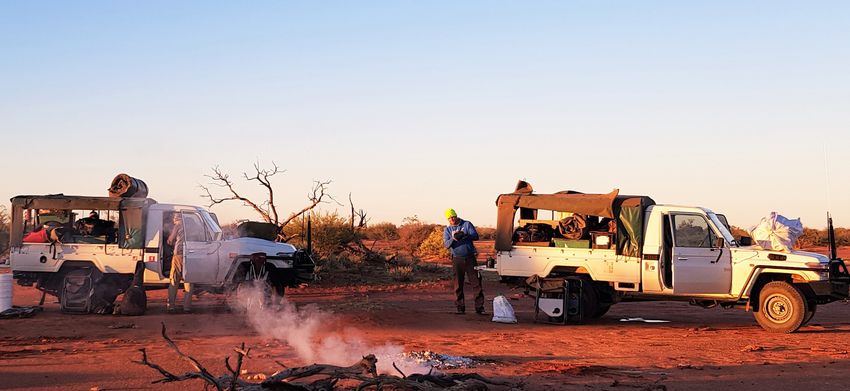
Contents
Executive summary..............................................................................................................................................1
PART ONE Economic recovery program
Economic recovery program...................................................................................................................................4
PART TWO Detailed work programs
GS10 Energy Geoscience and Carbon Strategy......................................................................................................7
GS12 Land Use Planning........................................................................................................................................8
GS14 Statutory and Resource Information.............................................................................................................9
GS20 Mineral Systems Studies.............................................................................................................................10
GS52 East Yilgarn.................................................................................................................................................11
GS53 State Geoscience and Chief Geoscientist ...................................................................................................13
GS54 Geochronology and Geochemistry.............................................................................................................14
GS55 Geophysics Acquisition and Processing.....................................................................................................15
GS58 West Yilgarn................................................................................................................................................16
GS62 3D Geoscience............................................................................................................................................18
GS63 Pilbara and Hamersley................................................................................................................................19
GS64 Geoscience Mapping Through Cover.........................................................................................................20
GS65 Proterozoic Margins....................................................................................................................................21
GS80 Editing and Publishing ...............................................................................................................................23
GS81 Mapping and Events ..................................................................................................................................23
GS82 Graphics .....................................................................................................................................................23
GS83 GIS Services ..............................................................................................................................................23
GS84 Spatial Systems ..........................................................................................................................................23
GS87 Data Capture ..............................................................................................................................................23
GS88 Data Integrity .............................................................................................................................................23
GS89 Spatial Projects ..........................................................................................................................................23
GS90 Native Title..................................................................................................................................................23
GS85 Resource Investment Information...............................................................................................................25
GS91 Mineral Exploration Information Management..........................................................................................26
GS92 Statutory Petroleum Exploration Information............................................................................................27
GS94 and GS96 Core Library Services................................................................................................................28
GS95 HyLogger and the National Virtual Core Library.......................................................................................29
PART THREE Exploration Incentive Scheme – detailed work programs
ES20 Government Co-funded Exploration Drilling..............................................................................................31
ES21 Stakeholder Engagement ............................................................................................................................33
ES30 Airborne and Ground Geophysical Surveys................................................................................................34
ES31 Deep Seismic Survey Program....................................................................................................................35
ES34 Regolith and 3D Paleosurface Mapping......................................................................................................36
ES36 Participation in MinEx CRC.......................................................................................................................37
ES38 Proterozoic Margins....................................................................................................................................40
ES42 3D Lithosphere Visualization Project..........................................................................................................41
ES43 Mineral Systems..........................................................................................................................................42
ES46 Enhanced Geochronology and Isotopic Mapping.......................................................................................44
ES47 Petroleum Systems......................................................................................................................................46
ES49 Greenstone Geochemical Barcoding Project...............................................................................................48
ES51 Yilgarn Granite Project................................................................................................................................49
Figures
1. Outline of completed and planned bedrock geology mapping, East Yilgarn project .................................12
2. Simplified geological map of the northern Youanmi Terrane showing existing mapping and
current working areas .................................................................................................................................17
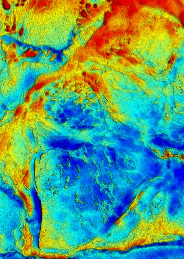
3. Gravity image showing the project areas covered by ES38 Proterozoic Margins .....................................22
4. Perth Core Library usage statistics since 2004–05 for the number of clients, pallets accessed and
core laid out ................................................................................................................................................28
5. EIS Co-funded Exploration Drilling program statistics and timeline ........................................................32
6. AusAEM20–WA location map ...................................................................................................................34
7. AusAEM20–WA 2020–21 proposed Stage 1 survey area ..........................................................................34
8. Location of ‘The Gap’.................................................................................................................................39
Appendix
GSWA collaborative research projects .................................................................................................................51
iii
iv
Geological Survey work program for 2020–21

Geological Survey work program for 2020–21
                           Executive summary

As I prepare this summary, Western Australia is in the middle of a pandemic. The
resources sector, especially the exploration industry, has suffered a 7.4% loss in
employment due to mandatory restrictions introduced to stop the spread of COVID-19.
Most impacted are the small- to medium-sized enterprises (SME) and the Mining,
Equipment, Technical and Services (METS) sector. Petroleum companies have been
doubly impacted, with the COVID-19 pandemic combining with a simultaneous collapse
in the crude oil market and prices dropping from US$69/barrel in January to US$22/barrel
in April.
While iron ore and gold prices have increased, the battery metals and critical mineral
commodities have generally borne the brunt of the market fallout, and it is in these areas
that the State and Commonwealth Governments are developing recovery strategies.
This year (2020), possibly for the first time in its history (except perhaps during the
world wars), the Geological Survey of Western Australia (GSWA) has cancelled its field
season. This is mainly due to regional travel restrictions and concern for possible effects
on remote communities when accessing native title lands. The uncertainty as to how long
these restrictions will remain in place compelled GSWA to decide to invest in updating
and installing its communication equipment and focus on delivering products.
GSWA has taken these events and issues into account when developing its 2020–21 work
program. This year you will see the program move into three distinct themes, namely the
Accelerated Geoscience program, business improvement and business as usual.

Accelerated Geoscience program
A program of accelerated geoscience data synthesis and delivery in areas of new and
emerging mineral potential will see a number of dedicated geoscientists from across
GSWA concentrate their efforts on four main projects:
•   publication of existing data into geographic information system (GIS) layers
•   data integration and analyses – the Yilgarn Craton
•   statewide critical minerals prospectivity study
•   energy systems including petroleum, geothermal and carbon capture and storage.
The results will be published as GIS layers available online within current GSWA
systems, as well as within three standalone Geological Exploration Packages (GEP). These
packages will include a Southwest Yilgarn GEP, East Yilgarn GEP and Critical Minerals
GEP, and will facilitate use for all levels of technical competency and software, from
prospectors to Tier 1 companies.

Business improvement
This theme includes a series of short-term, big-win data synthesis projects. These
projects aim to increase mineral prospectivity across the State by integrating pre-
existing geoscience datasets and delivering them in ways that can be used by exploration
companies to develop and generate new exploration targets.

                                             1
GSWA Record 2020/1
Business as usual
These are standard services and products that need to be completed as part of GSWA’s
service delivery requirements. This will also include the Exploration Incentive Scheme
(EIS) programs, such as the Co-funded Exploration Drilling program.
In 2020–21, the Geological Survey and Resource Strategy budget totals $31.37 million
(excluding departmentally funded projects). The GSWA allocation of this budget is $27.49,
which is a combination of recurrent GSWA related projects and EIS funding.
Staffing will comprise:
• 180 permanent full-time equivalent (FTE)
• nine permanent part time in 2020–21 (6.03 FTE)
• eight FTE staff funded from the EIS
• six contract full or part time
• ~14 short-term fee-for-service contractors (as of 1 July 2020).
We anticipate approximately 34 active collaborative research projects partly funded by
GSWA, in addition to the ongoing nine National Collaborative Framework agreements.
GSWA plans to publish the following flagship products:
• Manuscripts 28
• Maps 4
• Digital data layers 4
• Data packages 7
• Online data releases 5
GSWA will also deliver the following:
• Release of map symbol database to manage colours and patterns for regolith and
rock units
• Release of geochronology and mineral geochemistry data via an online application
• Implement the new Geocentric Datum of Australia 2020 (GDA2020) for the
Department of Mines, Industry Regulation and Safety’s (DMIRS) Geoscience and
Titles Information spatial datasets
• Complete the electronic lodgement of survey field books under Regulation 120E of
the Mining Regulations 1981
• Decommission NORM2 format data files and move to ESRI geodatabase files
• Replace Tengraph maintenance modules with ArcPro maintenance processes in
support of decommissioning Tengraph Old.
The post-COVID-19 economic recovery for Western Australia has become a major
challenge for GSWA, and one that will certainly impact on products delivered in the
coming year. GSWA is meeting this challenge head-on. In keeping with the State and
Commonwealth Government’s strategic intent around battery and critical minerals, GSWA
has designed the 2020–21 work program to leverage our vast data stores to deliver timely,
focused and interoperable geoscience data for the industry.
Jeff Haworth
Executive Director
Geological Survey and Resource Strategy
Note: all currencies are Australian dollars unless otherwise indicated.
2Geological Survey work program for 2020–21
PART ONE
Economic recovery program
3GSWA Record 2020/1
Economic recovery program
Managers: Michele Spencer and Simon Johnson
Team members: Minerals and Petroleum, Regional Geoscience Directorates staff
As a consequence of current travel and operational The results will be published online as GIS layers available
restrictions, GSWA will reprioritize its 2020–21 work in current GSWA systems, and within three standalone
program specifically to aid economic recovery and GEP. These will include a Southwest Yilgarn GEP, East
stimulate the exploration industry by using its extensive, Yilgarn GEP and Critical Minerals GEP, which will
pre-competitive geoscience datasets and archived rock facilitate use for all levels of technical competency and
collection. GSWA will deliver new interpretive datasets, software, from prospectors to Tier 1 companies.
across all areas of geoscience, in a number of key regions
of the State in which we are already working, in order to Publication of existing data into GIS layers
accelerate our understanding of the region's geology and
mineral prospectivity. This project will deliver numerous, previously non-digital
datasets as new, spatial datasets. The outcome will improve
GSWA will, however, continue to provide its key statutory our understanding of the prospectivity of the State which
and regulatory business functions as well as a number will feed into other projects in the Accelerated Geoscience
of other core projects critical for economic recovery. It stream.
is anticipated that no additional funding will be required
to facilitate this modified work program. The majority of Data integration and analyses – the Yilgarn Craton
resources can be sourced within GSWA, although some
The Yilgarn Craton is one of Western Australia’s most
staff may need to be moved temporarily to new areas
prospective regions, and contains significant deposits of
and the program will provide all GSWA staff with an
gold, nickel, lithium, copper–zinc, iron ore, tantalum,
opportunity for upskilling within the division.
aluminium and uranium. Recent high-grade gold and
nickel discoveries in the craton’s far eastern (Gruyere,
Planned work program Tropicana, Neale) and southwestern margins (Julimar),
have shown that these two poorly exposed and geologically
The modified GSWA work program for 2020–21 will not well-understood regions are likely to be as prospective
be structured around two main streams, both focusing as the craton’s interior (i.e. Eastern Goldfields). Despite
on creating and adding value for the resources industry both regions being covered by a thick blanket of regolith,
through data-driven exploration: GSWA holds a vast amount of geoscientific data relating
to the bedrock and regolith geology with the potential for
1. Accelerated Geoscience – a program of accelerated uncovering significant, new mineral deposits.
geoscience data synthesis and delivery, in areas of new
or emerging mineral potential including areas with The minerals industry is increasingly aware that the
critical mineral prospectivity. new era of Tier 1 deposits is likely to be under deep
cover. Working to the UNCOVER plan, the Accelerated
2. Business improvement – a series of short-term, Geoscience program will deliver new integrated geoscience
big-win, data synthesis projects that aim to increase datasets for the southwest and far eastern Yilgarn Craton
mineral prospectivity across the State by integrating margins. The work will incorporate the results of ongoing
pre-existing geoscience datasets and delivering them in work in the Eastern Goldfields, as well as performing new
ways which can be utilized by exploration companies analyses on archived samples, which will accelerate our
to develop and generate new exploration targets. understanding of these regions and will define new areas
of high mineral prospectivity.
Accelerated Geoscience program
Statewide critical minerals prospectivity study
The Accelerated Geoscience program will see dedicated
geoscientists from across GSWA concentrate their efforts Both the State and Federal Governments have outlined
on four main projects: a list of minerals that are deemed critical for emerging
high-tech applications and that are considered essential for
• Publication of existing data into GIS layers economic and industrial development over the next decade.
• Data integration and analyses – the Yilgarn Craton Western Australia is well placed to capitalize on increasing
demand for critical minerals as we transition globally to
• Statewide critical minerals prospectivity study low-carbon technologies. Knowledge of the geological
• Energy systems including petroleum, geothermal and addresses where these deposits are likely to be located
carbon capture and storage. not only reveals emerging exploration plays but allows
the government the foresight to manage land for strategic
industrial purposes such as downstream processing.
4Geological Survey work program for 2020–21
The aim of this project is to catalogue the known critical Business improvement program
mineral resources of the State to better understand the
mineral systems in which they occur and the associated This program aims to streamline our digital business by
alteration systems. These genetic associations can then be synthesizing and publishing key, spatial digital datasets to
explored in existing GSWA datasets to provide a series of enhance the mineral prospectivity of the State.
prospectivity maps for individual critical minerals. The
results aim to stimulate and increase investment into the
critical minerals sector by defining new exploration targets Products planned for release
and opening up new parts of the State to exploration. • Numerous raw and interpreted spatial geoscience
data layers highlighting the mineral and petroleum
Energy systems prospectivity of key areas of the State, delivered online
This project will investigate the prospectivity of the State’s in GeoVIEW.WA
potential energy resources and will include low-carbon • Standalone Southwest Yilgarn Geoscience Exploration
technology and geothermal projects. Package (USB)
The petroleum industry has been one of the most affected • Standalone East Yilgarn Geoscience Exploration
by COVID-19, having a simultaneous supply and Package (USB)
demand shock caused by an oil price war that coincided
with the start of the pandemic. This project aims to • Standalone statewide critical minerals Geoscience
produce a graphical summary of the State’s well data Exploration Package (USB)
in addition to other GIS layers that will directly benefit
petroleum industry exploration. Other initiatives relate to
decarbonization such as CO2 geosequestration.
5GSWA Record 2020/1
PART TWO
Detailed work programs
6Geological Survey work program for 2020–21
GS10 Energy Geoscience and Carbon Strategy
Manager: Deidre Brooks
Team members: Norman Alavi, Richard Bruce, Louisa Dent, Ameed Ghori, Peter Haines, Arthur Mory,
Leon Normore, Charmaine Thomas, Yijie (Alex) Zhan
The primary goal of the Energy Geoscience and Carbon program (EFTF) and was operated by DMIRS, in particular
Strategy branch is to develop consistent, basinwide the geoscientists within this branch. A related ES47 project
stratigraphic, structural and petroleum system frameworks that will continue in 2020–21 is the interpretation of the
for Western Australia’s onshore sedimentary basins. The Kidson Sub-basin seismic survey, which was acquired in
aim is to encourage increased exploration for energy 2018 and co-funded by the EIS and EFTF.
resources such as petroleum, coal and geothermal energy
resources, as well as identify areas for potential CO2
sequestration and thus secure the State’s energy future. Planned work program
The team works in collaboration with other divisions Business as usual projects
of DMIRS and other organizations, including the
Commonwealth Scientific and Industrial Research Projects listed at the end of this section were the focus of
Organisation (CSIRO), Western Australian Energy geoscience studies during 2019–20 and will be released
Research Alliance, The University of Western Australia in 2020–21. All data produced from these projects will be
(UWA), Curtin University, Northern Territory Geological incorporated into the Energy Systems Atlas.
Survey (NTGS), Geological Survey of South Australia,
Geological Survey of New South Wales and Geoscience Projects that will continue to provide relevant data that
Australia (GA). can eventually feed into the Energy Systems Atlas in
future years include: compilation of a Digital Core Atlas
The current focus of the branch is the Amadeus, Canning, for Waukarlycarly 1 and Nicolay 1 (both in the Canning
Carnarvon and Perth Basins. All these basins have proven Basin); age and composition of the basement underlying
petroleum systems but are underexplored, particularly the Canning Basin; structure, stratigraphy and prospectivity
in the case of the vast Canning Basin and the Western of the Amadeus Basin; Permian and Triassic source rocks
Australian side of the Amadeus Basin. The branch has
of the Carnarvon Basin; sedimentological description of the
recently commenced a new geological assessment of the
Harvey 2, 3 and 4 cores; Mesozoic unearthed book; Perth
Officer Basin and is interpreting results to better understand
Basin field guide.
the petroleum potential.
During the 2020–21 financial year, GSWA is committed Projects on hold for 12 months due to
to accelerating geoscience projects that can deliver
meaningful data in useful formats to the energy and Accelerated Geoscience projects
minerals industries. This is to assist the take up of company • Compilation of data and a review of the Lucas Outlier
exploration following the COVID-19 economic disruption
and Prices Creek Group of the Canning Basin based
and the oil price crash of early 2020. The projects described
on fieldwork
below are categorized as belonging to ‘business as usual’,
because the Accelerated Geoscience program is included • Stratigraphy and correlation of the Fairfield Group
in a separate section of this Record. A list of projects that
have been delayed due to the Accelerated Geoscience • Stratigraphy and biostratigraphy of the Permian Byro
program is also presented. Group (Carnarvon Basin)
The Energy Systems Atlas is an Accelerated Geoscience • Bonaparte Basin Carboniferous stratigraphy
project that will be established during 2020–21. This atlas
will consist of GIS layers within GeoVIEW.WA and the Products planned for release
Western Australian petroleum and geothermal management
system (WAPIMS) relating to energy such as oil, gas, • Middle Carboniferous – Permian (Grant Group and
geothermal, CO2 sequestration, helium and hydrogen. Reeves Formation) palynostratigraphy (Report)
Layers showing data availability, plots of key data types, • Cobb Embayment of the Canning Basin (Record)
and existing structure maps will be the focus for the year.
Other interpretive information will be added as studies are • Sally May 2 Digital Core Atlas (digital product)
completed in future years. • 3D structural model of the southern Perth Basin
A key ‘business as usual’ project the branch will continue (digital product)
to be involved with in 2020–21 is the post-well analysis
• 3D structural model of the southwest Canning Basin
and interpretation of Waukarlycarly 1 (see ES47 Petroleum
(digital product)
Systems), a stratigraphic well drilled in the Waukarlycarly
Embayment during 2019, in the western margin of the • Petroleum source rocks of Western Australia (Report)
Canning Basin. The drilling of this well was funded by
the Commonwealth Government Exploring for the Future
7GSWA Record 2020/1
GS12 Land Use Planning
Manager: Samantha Carter
Land Use Management: Mike Critch
Land Use Geoscience: Steven Batty, Mark Fleming, Jordana Gardiner-Haukohl, David Hamdorf,
Shane Kenworthy, Lisa Kirby, Kevin Ridge, Hannah Wallace
Land Use Planning plays a key role in providing geological Planned work program
information, advice and approval to assist in government
decision making related to the most appropriate use of The branch will continue to provide information, advice,
land. The provision of relevant geological information to assessment and approval in response to routine requests
State and local government authorities, planners and the from other government agencies, and continue to be
community contributes to Western Australia’s economic involved in the following priority government projects:
sustainability and helps to ensure that the interests and
rights of all parties are recognized. • South West Native Title Settlement
Proposals for land subdivisions and other land use changes • Plan for our Parks conservation initiative.
are routinely received from State and local government
Funding will continue for the South West Native Title
authorities. Each proposal is examined, its implications
Settlement project to fund one additional geologist to
for access to mineral and energy resources assessed,
facilitate the branch’s role in this project. It is anticipated
recommendations, advice and, where necessary, approvals
that there will continue to be substantial land approvals and
made accordingly.
recommendations associated with this project.
Roles of the Land Use Planning branch include:
Plan for our Parks is a major conservation initiative
• providing geological input to other government comprising a minimum of five million hectares of new
activities such as mapping, and advice to support conservation reserves.
planning policies, strategies and schemes
The branch will continue to engage collaboratively with
• providing approvals and recommendations for other government agencies, including local government
proposed land tenure and land use changes throughout to help to clarify roles, streamline administrative
the State arrangements and to provide strategic land use planning
advice.
• assisting with the development of land use planning
policy both within DMIRS and across government
Product planned for release
• publishing resource potential for land use planning
mapping and the provision of mapping of strategic • Aboriginal land, conservation areas, mineral and
basic raw materials, and other strategic mineral and petroleum titles and geology, Western Australia – 2021
petroleum resources, for inclusion into State planning (map)
policies, and regional and local planning strategies
and schemes.
8Geological Survey work program for 2020–21
GS14 Statutory and Resource Information
Manager: Nicole Wyche
Team members: Cecilia D’Ercole, Amanda Jones, Sue Murray, Jutta Pagel,
Sarah Sargent, Caroline Strong
The Statutory and Resource Information (SRI) branch Planned work program
tracks mineral exploration and mining activities in
Western Australia by collating data on mineralized sites, In 2020–21, the branch will focus on the following core
exploration and mining projects, mineral resources and business tasks:
mineral production. This allows DMIRS to provide • population of MINEDEX with current industry activity
data and specialist technical advice on most mineral data
commodities. Data users include other DMIRS divisions,
other government agencies, research organizations and a • management of the RMS production report and the
range of industries and individuals. The SRI branch also data generated by this report
has a regulatory role, performing compliance assessments • servicing other DMIRS databases via MINEDEX data
relating to the Mining Act 1978 and related legislation and
providing industry advice. • completion of the Mining Act and related assessments
A key component of this work is the maintenance and • providing specialist information to internal and
enhancement of Western Australia’s mines and mineral external stakeholders on mining industry activities
deposits information database (MINEDEX). MINEDEX • specialist publications (see product list below).
is a core DMIRS business system that provides a broad
range of searchable data on minerals industry activity
(current and historic), and hosts compliance documents Business improvement
such as environmental registration files. MINEDEX
provides spatial and textual data for internal use, and public The following projects are planned to improve our service
data is made available for external users. MINEDEX also delivery:
generates unique site and project identification codes used
• MINEDEX training has been added to the DMIRS
throughout DMIRS to reference activities for compliance
online systems training schedule
reporting in departmental business systems, including
the Environmental Assessment and Regulatory System • MINEDEX SQL reports used to extract resource
(EARS), the Royalties Management System (RMS) and estimate data from MINEDEX will be improved and
the Safety Regulation System (SRS). MINEDEX also documented with the goal of making this information
provides nightly updates of spatial data for use in DMIRS easy to extract. This work is required in preparation for
spatial data applications, including TENGRAPH and future applied projects (e.g. live map layers of resource
GeoVIEW.WA, and provides data downloads via the Data estimates)
and Software Centre.
• Production of the Major projects map will be revised
Compliance applications processed by the branch to make this product more consistent.
include mineralization and resource reports submitted
in support of mining lease applications, applications for
expenditure exemptions, extensions of term, retention
Products planned for release
licences, retention status, combined reporting and special • Major resource projects, Western Australia 2021 (map)
prospecting licences. The branch also assesses sterilization
reports submitted with mining proposals. • Mines – operating and under development, Western
Australia 2021 (map)
The SRI branch also produces commodity-related • Significant exploration activity in Western Australia
publications including the annual Mines — operating and (poster for GSWA Open Day and Diggers and Dealers)
under development and Major resource projects maps, the
Atlas of mineral deposits and major petroleum resources • Atlas of mineral deposits and major petroleum
book and map (produced every second year), investment resources (book and map)
opportunity commodity flyers, and posters showcasing
• Investment opportunity/commodity flyers
trending exploration results.
9GSWA Record 2020/1
GS20 Mineral Systems Studies
Manager: Trevor Beardsmore
Team members: Paul Duuring, Joshua Guilliamse, Lena Hancock, Sidy Morin-Ka
The Minerals Exploration Geoscience branch focuses on The branch also continues to develop its recently created
mineral systems in Western Australia, with the objectives online Mineral Systems Atlas and associated Guide.
of building metallogenic models and improving our The Atlas contains GIS-based map layers of significant
understanding of the geodynamic environment of ore geological ‘proxies’ for critical metallogenic processes, for
formation, thereby assisting with making exploration the komatiite-hosted nickel and BIF-hosted iron mineral
targeting in greenfields areas more predictive. Such systems. Other mineral systems are being systematically
work typically involves fieldwork (mapping, core analysed (drawing upon other in-house and external
logging and sampling) and laboratory studies (petrology, expertise where possible), and readily created subsets of
geochronology and isotope chemistry), and is supported defined mappable geological proxies are being created.
by, and supplements, existing databases. The branch makes
extensive use of the GSWA HyLogger (Project GS95) The rare-element pegmatite and orthomagmatic vanadium
to assist with detailed studies of alteration assemblages systems will be added to the Mineral Systems Atlas in
in diamond drillcore and other specimens from mineral 2020–21. The branch will also continue its involvement
deposits. The work in this area has been complemented with current EIS-funded collaborative studies, including
by projects funded by the EIS (reported herein under the ‘gold fingerprinting’ study of gold nuggets from the
ES43 Mineral Systems). All mineral systems knowledge Pilbara Craton (see ES43 for a project description). The
is ultimately made available for the benefit of resource Paterson Orogen metallogeny study will complement
companies, research groups, other government agencies GSWA’s contribution to Projects 8 and 9 of the Mineral
and the wider community. This knowledge is disseminated Exploration Cooperative Research Centre (MinEx CRC;
via Geological Information Series (GIS) packages, and see ES36 Participation in MinEx CRC), by documenting
internal and external publications. the geological setting and characteristics of Cu–Au
mineralization (e.g. at the Obelisk and Citadel prospects),
using drillcore stored at the Perth Core Library and sourced
Planned work program from resource companies working in the region.
The branch has a well-established program that studies The other ‘regular’ Mineral Systems programs will be
Western Australian terrane-scale metallogeny and placed on hold for 2020–21, and the branch will instead
selected mineral systems, to provide new knowledge be integrated into GSWA’s Accelerated Geoscience
that assists with prospectivity evaluation and targeting of initiative, a program of rapid data delivery developed to
mineralization. Current projects include: support the recovery of the resources industry during and
beyond the COVID-19 pandemic. The branch will lead
• metallogeny of hydrothermal rare earth element (REE) Project C — critical minerals prospectivity — tasked
mineralization in northern Western Australia with delivering GIS-based data packages relevant to
• regional prospectivity for orthomagmatic (komatiite- REE, lithium, tantalum, potash and other critical mineral
and mafic intrusion-hosted) nickel sulfide deposits mineralization. Branch staff will also lead or be involved in
mineral systems-oriented themes in most other Accelerated
• evaluating prospectivity for bedrock gold systems Geoscience projects. See Part one Economic recovery
using detrital gold ‘fingerprinting’ program for a complete description of the initiative.
• targeting Archean banded iron-formation (BIF)-hosted
iron ore systems Products planned for release
• metallogeny of the Paterson Orogen. • Rare-element pegmatite and orthomagmatic vanadium
The branch integrates these activities with other GSWA mineral systems (added to the Mineral Systems Atlas
geoscience programs. It also works with other government and Guide)
and academic institutions, and an expanding network • Mineralization characteristics of the Obelisk Cu–Au
of affiliated exploration and mining companies via prospect (Report)
collaborative Mineral Systems-oriented research projects
funded by the EIS (see ES43 Mineral Systems).
10Geological Survey work program for 2020–21
GS52 East Yilgarn
Manager: Jyotindra Sapkota
Team members: Matthew De Paoli, Melissa Drummond
The Eastern Goldfields Superterrane (EGST) occupies sequences older than 2800 Ma are also locally exposed
the eastern third of the Archean Yilgarn Craton and is around Leonora (~2817 Ma), Menzies (>2803 Ma) and
widely considered a typical Archean upper crustal granite– Norseman (~2930 Ma). Above the Kalgoorlie Group,
greenstone terrane. This highly mineralized region contains the Black Flag Group (2690–2665 Ma, equivalent to
world-class gold and nickel deposits, and significant the Mount White Group in the Agnew–Lawlers region),
deposits of other commodities including base metals, REE, comprises mainly turbidite-type deposits, and felsic
lithium, uranium, gemstones and industrial minerals. volcanic and volcaniclastic rocks. Younger siliciclastic to
felsic volcaniclastic sequences, such as the Scotty Creek
The EGST is divided into four tectonostratigraphic terranes Formation (Agnew–Lawlers region), the Navajo Sandstone
bounded by high-strain zones; from west to east: the (southwest of Kalgoorlie), the Merougil Formation (west
Kalgoorlie, Kurnalpi, Burtville and Yamarna Terranes. The of Kambalda), and the Kurrawang Formation, overlie the
present terrane configuration is traditionally interpreted to Black Flag Group along low-angle unconformities.
reflect accretion of a number of pre-existing ‘continents’
in a series of collisional events between c. 2800 and
2650 Ma. The effects that mantle plumes may have had on Planned work program
the magmatic stratigraphy of the greenstones is reflected
by the local abundance of komatiites and associated Work aimed at generating a seamless bedrock stratigraphic
basalts. However, systematic geological mapping and interpretation across the EGST at 1:100 000 scale (Fig. 1)
the acquisition of a substantial body of geochronological is currently suspended. Geological studies in 2020–21
and geochemical data, indicate that evolutionary models will focus on the area covered by the high-resolution
involving rifting of an autochthonous basement also need seismic survey conducted in early 2019 by GSWA,
to be (re)evaluated. These different models can lead to between Ora Banda and Kambalda. Detailed structural,
different interpretations of the nature of magma source metamorphic, geochemical, geochronological and isotopic
regions and the evolution of translithospheric structures data will be collected from outcrop and diamond drillcore
that form pathways for mineralizing magmas and fluids. to support the geological interpretation of the seismic
data, together with the formulation of a model for the
Basalt-dominated greenstone sequences are mapped, geological evolution of the area. After field verification,
intersected in drillcores and recognized in geophysical the available company geological maps and drillhole
surveys throughout the EGST. However, linking geological data will be used to consolidate GSWA’s mapping
events (e.g. depositional/crystallization or deformation and stratigraphic interpretation in selected areas. The
events), stratigraphy or structures within and between greenstone geochemical barcoding program will work
individual greenstone belts remains one of the most towards a geochemical fingerprint of local to regional
significant challenges towards a better geological magmatic greenstone stratigraphy and support regional
understanding of the region. Only in the Kalgoorlie correlation. Work is ongoing to create a virtual field guide
Terrane, between Norseman and Agnew, has a significant of important geological localities in the East Yilgarn.
stratigraphic correlation been attempted. Here, most of
the exposed greenstones belong to the 2801–2690 Ma
Kalgoorlie Group, which comprises the lowermost Products planned for release
mafic–ultramafic sequence in most individual greenstone • East Yilgarn GIS 2020 (including updated interpreted
belts. These sequences are not physically contiguous bedrock geology layers across the northern part of the
but have a broad similarity in rock types, stratigraphic region imaged by the seismic survey)
variations and age, and so have been distinguished
as subgroups of the Kalgoorlie Group. Greenstone • Explanatory notes and stratigraphy update
11GSWA Record 2020/1
120° 122° 124°
Wiluna
Leinster
28° Agnew
Laverton
Leonora
Menzies
30°
Ora Banda
Kalgoorlie–Boulder
Coolgardie
Kambalda West Kambalda
Ida/Waroonga Shear Zone
32°
High-resolution seismic survey lines
Norseman
Current 1:100 000 IBG coverage
1:100 000 IBG — beyond 2022
50 km
03.08.20
Figure 1. Outline of completed and planned bedrock geology mapping, East Yilgarn project, draped over a composite
gravity–aeromagnetic image. Abbreviation: IBG, interpreted bedrock geology
12Geological Survey work program for 2020–21
GS53 State Geoscience and Chief Geoscientist
Manager: Fawna Korhonen
Team members: Heidi Allen, Huntly Cutten, Terry Farrell, Sarah Martin, Angela Riganti
The State Geoscience branch is responsible for maintaining Despite this, a number of ‘business as usual’ activities
a coherent geological framework for Western Australia will continue resulting in the annual release of the Western
and ensuring that the geoscience information delivered Australian field observation database (WAROX); an update
by GSWA is relevant, appropriate and of a high standard. to the 1:500 000 tectonic units and orogenic events layers
This includes delivering GSWA geoscience as multithemed in GeoVIEW.WA; and the completion of a geochronology,
products developed and extracted from information stored isotope and mineral chemistry (WAGIM) database that
in GSWA databases, with single-layer datasets, documents will allow all external stakeholders to access and search
and static, printed or downloadable maps only part of the our extensive geochronology and mineral chemistry data
total product. The role of the State Geoscience branch as well as access the geochronology and metamorphic
in achieving this are twofold. They work with project history records. The paleontology section will continue
teams and groups as appropriate, guiding and overseeing work on statewide issues including the palynology of the
development and population of GSWA databases, southern Perth Basin and the paleontology and stratigraphy
coordinating capture of spatial and textual legacy data, of the Kalbarri area. Considerable time will be invested in
contributing to products as appropriate, validating database cataloguing the current condition of the State’s vulnerable
content, reviewing and approving manuscripts and spatial geoheritage sites along with improving approval and
products, and coordinating work that spans more than one permitting times.
project. They work independently on geological problems
not part of current GSWA project work and on statewide
geological issues and datasets. To that effect, in mid-2019 Products planned for release
a new Paleontology section was added to the branch in
• Update of the 1:500 000 tectonic units and orogenic
order to address paleontological and geoheritage issues
events layers in GeoVIEW.WA
more efficiently and effectively across the State. The work
of the State Geoscience team is thus partly process, with • Completion of the geochronology, isotope and mineral
definable standards but no clearly defined outcomes, and chemistry database (WAGIM)
partly program, for which there are outcomes. Explanatory
• Ongoing paleontology analysis including
Notes System (ENS) content management and monitoring,
interpretation on the Waukarlycarly 1 stratigraphic
legacy data capture and management of quality control and
drillhole
product relevance are the processes; whereas outcomes and
products arise from delivery of State-level datasets. • Extended ENS content (including regolith)
• Delivery of geochronology and metamorphic history
Planned work program records through ENS
The planned work program for 2020–21 will be • Kalbarri unearthed (non-series book)
significantly reduced, with much of the State Geoscience
team focused on the Accelerated Geoscience program.
13GSWA Record 2020/1
GS54 Geochronology and Geochemistry
Manager: Michael Wingate
Team members: Imogen Fielding, Frances James, Jack Lowrey, Yongjun Lu, Marlene Papiccio,
Sandra Romano, Tom Scillieri, John Williams
Geochronology, isotope geology and geochemistry are groups (e.g. precious metals, platinum group elements)
integral components of GSWA’s geoscience programs depending upon project requirements. Analytical services
and mineralization studies. The geochronology program are outsourced to several Perth-based laboratories with the
determines precise and accurate ages of minerals, rocks main techniques applied being X-ray fluorescence (XRF)
and geological events to understand the geological history spectrometry for major elements and some trace elements,
of Western Australia and contribute to enhancing the and ICP-MS for trace elements. All data are compiled in
prospectivity of the State. Geochemical studies of rocks the WACHEM database and made available through the
and regolith are essential for understanding the sources online GeoChem Extract application.
and petrogenesis of igneous suites, the relationships within
and between igneous suites, the sources (provenance) and Geochronology and geochemistry results and derivative
compositional characters of sedimentary rocks and regolith, materials are used extensively in GSWA’s isotope
and for constraining metamorphic modelling. geology studies, led by Yongjun Lu (see ES46 Enhanced
Geochronology and Isotopic Mapping). These include
Geochronological techniques are applied to constrain specialized isotope geochemistry studies, including whole-
the timing of magmatism, metamorphism, deformation rock Sm–Nd, Lu–Hf and Pb isotope analyses, zircon Lu–Hf
and mineralization, using a range of isotope systems and oxygen isotope analyses, and Re–Os mineral analyses.
(e.g. U– Pb, Ar/Ar and Re–Os) and a variety of minerals These investigations are conducted in collaboration with
(zircon, baddeleyite, monazite, titanite, hornblende, external university laboratories.
feldspars and micas). The Sensitive High-Resolution Ion
Microprobe (SHRIMP) instruments in the John de Laeter The Laboratory section, managed by John Williams,
Centre at Curtin University are used extensively by GSWA supports the varied aspects of GSWA’s geochronology,
for U–Pb geochronology. GSWA also uses laser ablation geochemistry and isotope geology programs with world-
inductively coupled mass spectrometry (LA-ICP-MS) class sample preparation services provided in house by
instruments in the John de Laeter Centre to date detrital the GSWA laboratory at Carlisle. The Laboratory section
zircons, to date monazite and xenotime in thin sections also manages archiving and retrieval of materials in
in support of metamorphism and pressure–temperature– GSWA’s extensive sample collection to support numerous
time (P–T–t) studies, and to measure the trace element in-house and external research projects, and coordinates
compositions of minerals. petrographic services for geologists.
Whole-rock geochemistry is typically carried out for the Project work for GS54 is funded through ES46.
complete set of major element oxides and a large suite of Accordingly, details of the work program are discussed
trace elements, but may also be restricted to certain element within ES46.
14Geological Survey work program for 2020–21
GS55 Geophysics Acquisition and Processing
Manager: David Howard
Team member: John Brett
The role of the Geophysics Acquisition and Processing The section will continue to manage the airborne
section is to plan and manage regional geophysical data geophysics index data repository (MAGIX) and the
acquisition projects, to prepare datasets for delivery to submission, archive and release of airborne and some
the public and internal users, and to provide internal ground survey datasets supplied by the exploration
processing, interpretation services and advice as required. industry.
Planned work program and products
The planned acquisition program for 2020–21 is described
separately under program ES30 (Airborne and Ground
Geophysical Surveys). All new data acquired will be
included in updates to the relevant statewide compilation
datasets.
15GSWA Record 2020/1
GS58 West Yilgarn
Manager: Tim Ivanic
Team member: Jack Lowrey
The Youanmi Terrane in the western part of the Archean This new interpretation will offer a wider appreciation
Yilgarn Craton comprises an extensive Archean granite– of the configuration of the protocraton onto which
greenstone terrain that contains significant deposits the voluminous Norie, Polelle and Glen Groups were
of gold, iron ore, nickel, copper, lead, zinc, tungsten, deposited, and through which the giant layered intrusions at
molybdenum, bismuth, vanadium, titanium, beryllium, 2.8 Ga were channelled. An expanded temporal framework
lithium, tin, tantalum and uranium. The region clearly has with documentation of new magmatic suites will allow for
the potential for more discoveries of these commodities. an improved context for exploring terrane endowment by
The Youanmi Terrane has a long and complex geological volcanogenic massive sulfide, nickel, iron and gold mineral
history. An understanding of the tectonic evolution of the systems.
region, including its structure and stratigraphy, is essential
to understanding the controls on formation and distribution
of mineralization. Planned work program
Youanmi Terrane greenstones were deposited between Most activities within this program will be suspended
2.99 and 2.71 Ga and can be subdivided into four main over the 2020–21 period with efforts redirected to the
time intervals: Accelerated Geoscience projects within the economic
recovery program. However, limited geochemical and
1. 2.99 – 2.91 Ga, for example the Madoonga and Gossan geochronological sampling will be undertaken in the
Valley Formations southern and western Youanmi Terrane in order to target
and characterize 3.1 – 2.9 Ga geology (Fig. 2). The aim
2. 2.82 – 2.80 Ga Norie Group is to understand the petrogenesis and geodynamic history
3. 2.80 – 2.74 Ga Polelle Group of these rocks in relation to the existing stratigraphic and
magmatic framework developed in the northern Youanmi
4. 2.74 – 2.71 Ma Glen Group and Marda Complex. Terrane.
Felsic plutonic rocks intruded during each of these Cooperative projects will continue, including geochemical,
time periods followed by voluminous plutonism from metamorphic and structural studies in the northern Youanmi
2.7 – 2.6 Ga, which led to cratonization of the Yilgarn Terrane, 3D modelling in the western Youanmi Terrane and
Craton. Much of the geoscientific work conducted so far structural and isotopic studies in the Narryer Terrane.
in the Youanmi Terrane has concentrated on its Neoarchean
greenstone sequences. However, there is a large temporal
gap in the understanding of the crustal evolution of the Products planned for release
proto-Yilgarn Craton and its architecture during the
Mesoarchean from 3.1 to 2.9 Ga. Most rocks of this age • Youanmi Terrane stratigraphy and explanatory notes
within the Yilgarn Craton are in less well-known portions update including the Gossan Hill Formation (Golden
of the Youanmi Terrane, typically where data density is low Grove)
and map coverage relatively poor.
Thus, the main objective of the West Yilgarn project is not
only to expand the existing understanding of Neoarchean
rocks but also add a new level of interpretation to the
Mesoarchean history of the Youanmi Terrane.
16Geological Survey work program for 2020–21
1:100 000 regolith–landform geology
1:100 000 surface geology MOORARIE PADBURY
2446 2546
1:100 000 and 1:500 000 interpreted bedrock geology
Earlier mapping not merged26°00'
into data layers
Updated 1:100 000 interpreted bedrock geology
(to be released in the Youanmi MILLY
BYRO 2020 GISMILLY MILEURA
update) KOONMARRA TIERACO GLENGARRY
2145 2245 2345 2445 2545 2645
Current working areas
BYRO BELELE GLENGARRY 26°30' WILUNA
50 km SG50-11 SG50-12
120°30'
SG50-10 SG51-09
MERE-
BOOLARDY KALLI MADOONGA GABANINTHA YAGANOO WETHER WILUNA
2144 2244 2344 2444 2544 2644 2744 2844 2944
BILLA- NOW- YOUNO
BALONG MURGOO MEKA NOONDIE CUE REEDY THANNA DOWNS MONTAGU YEELIRRIE
2043 2143 2243 2343 2443 2543 2643 2743 2843 2943
AJANA MURGOO CUE SANDSTONE SIR SAMUEL
SG50-13 SG50-14 SG50-15 SG50-16 SG51-13
COOL- MUGGA- DALGA- DEPOT
CALALAYA MURRA TARDIE MELANGATA RANGA AUSTIN WYNYANGOO WOODLEY SANDSTONE LAKE MASON SPRINGS SIR SAMUEL
1942 2042 2142 2242 2342 2442 2542 2642 2742 2842 2942 3042
MOUNT WINDI- EVERETT
MUNGO TALLERING WURARGA YALGOO EDAH MAGNET CHALLA MURRA ATLEY CREEK MUNJEROO WILDARA
1941 2041 2141 2241 2341 2441 2541 2641 2741 2841 2941 3041
GERALDTON YALGOO KIRKALOCKA YOUANMI LEONORA
SH50-01 SH50-02 SH50-03 SH50-04 SH51-01
THUNDE- COOLA-
INDARRA MULLEWA MELLENBYE BADJA LARRA KIRKALOCKA MANINU YOUANMI RAYS ROCKS RICHARDSON WILBAH
1940 2040 2140 2240 2340 2440 2540 2640 2740 2840 2940 3040
YANDA- MOUNT
NOOKA PERENJORI ROTHSAY NINGHAN MARANALGO BUNGAR MALGAR BARLEE MARMION MASON BALLARD
2039 2139 2239 2339 2439 2539 2639 2739 2839 2939 3039
115°30'
PERENJORI NINGHAN BARLEE MENZIES
29°30' SH50-06 SH50-07 SH50-08 SH51-05
MOUNT JOHNSTON
CARON MONGERS GIBSON JAELEAN EAROO ROSS RANGE LAKE GILES MULLINE RIVERINA
2138 2238 2338 2438 2538 2638 2738 2838 2938 3038
02.06.20
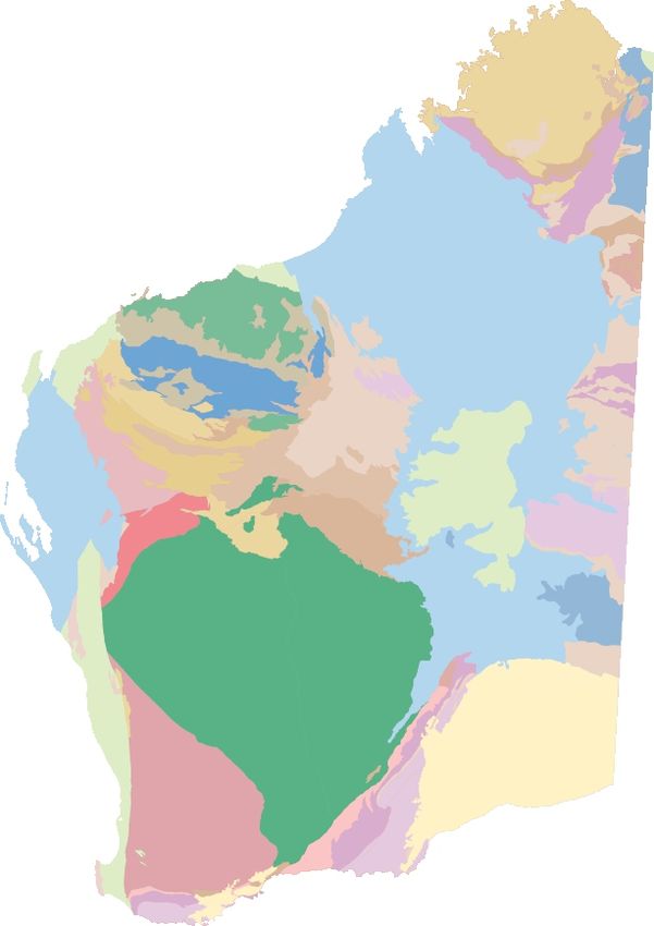
Figure 2. Simplified geological map of the northern Youanmi Terrane showing existing mapping and current working areas
17You can also read