GNSS Positioning Using Mobile Devices with the Android Operating System - MDPI
←
→
Page content transcription
If your browser does not render page correctly, please read the page content below
International Journal of
           Geo-Information

Article
GNSS Positioning Using Mobile Devices with the
Android Operating System
Paolo Dabove * , Vincenzo Di Pietra                    and Marco Piras
 Department of Environment, Land and Infrastructure Engineering; Politecnico di Torino, 10129 Torino, Italy;
 vincenzo.dipietra@polito.it (V.D.P.); marco.piras@polito.it (M.P.)
 * Correspondence: paolo.dabove@polito.it; Tel.: +39-011-090-7662

 Received: 3 February 2020; Accepted: 4 April 2020; Published: 7 April 2020

 Abstract: The access and the use of the global navigation satellite system (GNSS) pseudo-range and
 carrier-phase measurements mobile devices as smartphones and tablets with an Android operating
 system has transformed the concept of accurate positioning with mobile devices. In this work, the
 comparison of positioning performances obtained with a smartphone and an external mass-market
 GNSS receiver both in real-time and post-processing is made. Particular attention is also paid to
 accuracy and precision of positioning results, also analyzing the possibility of estimating the phase
 ambiguities as integer values (fixed positioning) that it is still challenging for mass-market devices.
 The precisions and accuracies obtained with the mass-market receiver were about 5 cm and 1 cm both
 for real-time and post-processing solutions, respectively, while those obtained with a smartphone
 were slightly worse (few meters in some cases) due to the noise of its measurements.

 Keywords: smartphone positioning; GNSS; Android; raw measurements

1. Introduction
      Nowadays, smartphone technology is widespread. Almost everybody has one. It is not only used
for calling but also to navigate to destinations and sometimes to share their location. Thus, navigation
systems have become an important part of everyday life.
      In the absence of global navigation satellite system (GNSS) signals or in any situation where the
signal is disturbed or shielded, such as an urban canyon or partially indoors [1], other sensors embedded
in smartphone devices provide reliable information for performing navigation and positioning [2].
      To devise a successful outdoor navigation solution, it is important to understand the quality and
accuracy of smartphones’ integrated sensors [3]. Using smartphone can provide good accuracy using
assisted GNSS (A-GNSS) systems, which can obtain the required data from other GNSS permanent
stations or from an internet-connected server [4]. In both cases, it is mandatory to have access to GNSS
raw measurements, as pseudo ranges and carrier-phase.
      Typically, each modern Smartphone has an internal GNSS receiver, and since 2017, it has been
possible to have GNSS raw data by mobile platform; likewise high-level Application Programming
Interface (API), so it means that it is possible to get raw measurements from GNSS receivers for
performing precise positioning (also using a single frequency chipset).
      Thus, with the advent of the Android Nougat operating system (version 7.x or 8.x), some smart
devices allow direct access to raw data and the PVT (position velocity time) solution by acquiring
pseudo ranges and carrier-phase from the chipset inside [5,6]. Many other sensors are available today
on smartphones; most of them are related to internal applications (e.g., proximity sensor, light sensors),
while others (e.g., inertial measurements unit and camera) can be used for estimating a positioning
solution, but these aspects are out of the scope of this paper. The ability to store and provide raw
observations directly from the Android operating system API makes smartphones very interesting

ISPRS Int. J. Geo-Inf. 2020, 9, 220; doi:10.3390/ijgi9040220                         www.mdpi.com/journal/ijgi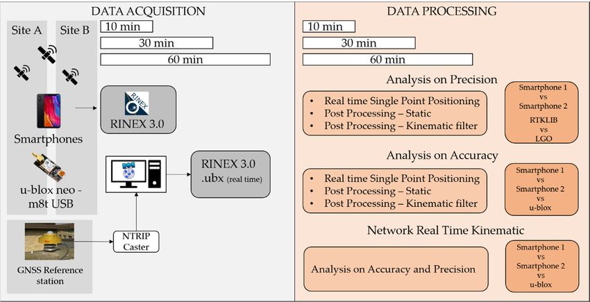
ISPRS Int. J. Geo-Inf. 2020, 9, 220                                                                   2 of 13

tools for positioning in a whole series of fields that do not require the performance of a geodetic receiver.
Relevant applications in commercials are product detection, location-based billing, location-based
advertising, and proximity-based notification. In law enforcement, interesting applications are search
and rescue, geofencing, crime scene recovery, and more. Other field are intelligent transport systems,
health care, museum, environmental monitoring, and teaching. In this last case, the spread of these
devices, together with the easy access to the API level required to store the GNSS data, could allow
instructors to easily set up teaching methodologies and share knowledge in the positioning field [7].
     Many studies have already been done regarding positioning solutions [8,9], considering GPS/GNSS
chipset, and a European task force has been activated in recent years (https://www.gsa.europa.eu/gnss-
raw-measurements-task-force).
     However, this paper presents the performances of two smartphones (Huawei P10+ and Samsung
Galaxy S8+) with the Android operating system compared to those obtainable with another mass-market
GNSS receiver (u-blox NEO M8T), with the same characteristics of the smartphones, equipped with a
patch antenna.
     To reach the goal previously described, the authors have conducted many outdoor tests, considering
the two main positioning approaches (static and kinematic) under different conditions in terms of
multipath effects and number of visible satellites. For making the obtained results independent by
the processing algorithms, different software for obtaining post-processed positioning solutions have
been used. The paper is organized as follows: after this introduction, a section related to the GNSS
positioning techniques available with smartphone technology is provided. Then, the test cases and the
obtained results will be shown before some comments and conclusions.

2. GNSS Positioning Technique with Smartphones
      Only by measuring the distances (pseudo ranges) between the user’s receiver and the position
of at least four satellites of the same constellation, is it possible to obtain a GNSS solution [10,11].
The distance between receiver and satellite is proportional to the signal propagation time if the
transmitter and receiver clock are perfectly synchronized. As is widely known, if this condition is not
satisfied, then the satellites’ and receivers’ clock biases have to be estimated. Moreover, other biases
affect GNSS signals, such as thermal noise, uncompensated biases, multipath, and other propagation
effects. Nevertheless, the main error source is given by two atmospheric propagation effects: the
ionospheric and tropospheric delays and sometimes the ionospheric scintillations (only in particular
conditions). If you do not estimate or remove these biases, the positioning error can be greater than
30 m, making the GNSS positioning useless for most applications. For solving these issues, one of these
two principal approaches can be adopted, as widely described in the literature: the post-processing
or real-time techniques. This last method can be used when the required accuracy has to be 5 cm at
least [12], a condition that cannot be generally satisfied and obtained especially considering smart
devices, such as smartphones or tablets [13,14].
      If the previous level of accuracy is not enough or if it is not possible to estimate some biases in
real-time in an accurate way, the post-processing approach is the only method that allows reaching
better performances, exploiting, for example, the use of two or more frequencies, as in case of geodetic
or handled receivers [15]. The use of these kinds of devices was really expensive, and only research
institutes and few private companies were able to buy and use them. But starting from the last decade,
with the advent of mass-market receivers, GNSS positioning has become more common because
the cost of GNSS receivers and antennas has decreased to few US dollars, and many open source
applications have increased the diffusion of these devices and techniques.
      Most GNSS receivers available inside smartphones are only single-frequency (and not
multi-frequency [16]) receivers, so all collected measurements are referred to the L1 frequency
(L1 band). In this case, it is not possible to apply neither the most common differencing methods, also
known as double or triple differences [12,15], nor to combine different observations [17]. Therefore, the
only two possible solutions are represented by the single difference approach (considering one receiver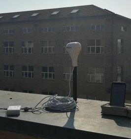
ISPRS Int. J. Geo-Inf. 2019, 8, x FOR PEER REVIEW 3 of 13
and a reference satellite) or to model most of the GNSS biases (e.g., ionospheric and tropospheric
delays,
ISPRS
ISPRS satellite
ISPRSInt.
Int.
Int. and
J.J.J.Geo-Inf.
Geo-Inf.
Geo-Inf. 2019,receiver
2019,
2019,8,8,8,xxxFOR
FOR clock
FORPEER drifts)
REVIEWusing mathematical models [18].
PEERREVIEW
PEER REVIEW 333ofof13
of 13
13
ISPRS Int. J. Geo-Inf. 2020, 9, 220 3 of 13
3.
and
and Materials
and aaareferenceand satellite)
reference
reference Methods
satellite)or
satellite) orto
or tomodel
to modelmost
model mostof
most ofthe
of theGNSS
the GNSSbiases
GNSS biases(e.g.,
biases (e.g.,ionospheric
(e.g., ionosphericand
ionospheric andtropospheric
and tropospheric
tropospheric
anddelays,
delays,
delays, satellite
satellite
satellite
a reference
As just andreceiver
and
and receiver
receiver
satellite)
described or to
in the clock
clock
clock
modeldrifts)
drifts)
drifts)
introductionmost using
using
using
section, mathematical
mathematical
mathematical
of the GNSSdifferent
many biasesmodels
models
models
(e.g., [18].
tests[18].
[18].
ionospheric
were done both and tropospheric
in static and
delays, satellite and receiver clock drifts) using mathematical models
kinematic conditions. Two different smartphones, the Huawei P10+ and the Samsung Galaxy S8+, were [18].
3.3.3.Materials
Materialsand
Materials andMethods
and Methods
Methods
employed in these tests. Their main characteristics are summarized in Table 1, as well as those of the u-
3. Materials and Methods
blox NEO Asjust
As
As M8T
just
just GNSS receiver,
described
described
described ininthe
in the used as a comparison
theintroduction
introduction
introduction section,many
section,
section, (reference)
many
many system.
different
different
different testswere
tests
tests weredone
were doneboth
done bothin
both instatic
in staticand
static and
and
As just
kinematic
kinematic
kinematic describedTwo
conditions.
conditions.
conditions. in the
Two
Two introduction
different
different
different section,the
smartphones,
smartphones,
smartphones, many
the
the different
Huawei
Huawei
Huawei P10+
P10+ tests
P10+and andthe
and were
the done both
theSamsung
Samsung
Samsung Galaxy
Galaxyin static
Galaxy and
S8+,were
S8+,
S8+, were
were
kinematic
employedin
employed
employed conditions.
inthese
in thesetests.
these tests.Two
tests. Their
Their
Their Table
different
main
main 1. The instruments
smartphones,
maincharacteristics
characteristics
characteristics are
are
are used
the in theseP10+
Huawei
summarized
summarized
summarized tests.
in
in and 1,
inTable
Table
Table the
1,1,asSamsung
as
as wellas
well
well Galaxy
asthose
as those
those of S8+,
ofthe
of the
the u-
u-
u-
were
blox
blox employed
bloxNEO
NEOM8T
NEO M8T in
M8TGNSS these
GNSS
GNSS tests. Their
receiver,
receiver,
receiver, used
used
used main
as
asas
aaa characteristics
comparison
comparison
comparison are summarized
(reference)
(reference)
(reference) system.
system.
system. in Table 1, as well as those of
Huawei
Receiver
the u-blox NEO M8T GNSS receiver, used as Samsung Galaxy(reference)
a comparison S8+ system.u-blox NEO M8T
P10+
Table1.1.1.The
Table
Table Theinstruments
The instrumentsused
instruments usedin
used inthese
in thesetests.
these tests.
tests.
Table 1. The instruments used in these tests.
Huawei
Huawei
Huawei
Receiver
Receiver
Receiver SamsungGalaxy
Samsung
Samsung GalaxyS8+
Galaxy S8+
S8+ u-bloxNEO
u-blox
u-blox NEOM8T
NEO M8T
M8T
Receiver P10+P10+
Huawei
P10+
P10+ Samsung Galaxy S8+ u-blox NEO M8T
Image
Image
Image
Image
Image
GPS + GLONASS + BeiDou + GPS + GLONASS +
Constellation GPS
Galileo BeiDou
C/A, L1,
Observations C/A, L1, SNR C/A, L1, SNR
Constellation SNRGPS GPS GPS
GPS
GPS +++GLONASS
GLONASS
+ GLONASS
GLONASS +++BeiDou
+ BeiDou BeiDou +++
+ Galileo
BeiDou GPSGPS GPS +++GLONASS
+ GLONASS
GPS GLONASS
GLONASS +++
+ BeiDou
Constellation
Constellation
Constellation GPS
GPS
GPS
Cost
Observations € 300
C/A, L1, SNR C/A,€Galileo
590
L1, SNR
Galileo
Galileo C/A, €L1,
70 SNR
BeiDou
BeiDou
BeiDou
Weight Cost[g] € 300
145
C/A,
C/A,
C/A, L1,
L1,
L1, € 590
155 €8.1
70
Observations
Observations
Observations
Weight [g] 145 C/A,L1,
C/A,
C/A, L1,SNR
L1,
155 SNR
SNR C/A,L1,
C/A,
C/A, L1,SNR
L1,
8.1 SNR
SNR
Dimension SNRSNR
SNR
Dimension [mm] 145.3×69.3×7 145.3×69.3×7 148.9×68.1×8.0
148.9×68.1×8.0 40×18×8
40×18×8
[mm]Cost
Cost
Cost €€€300
300
300 €€€590
590
590 €€€70 70
70
Weight[g]
Weight
Weight [g]
[g] 145145
145 155155
155 8.1
8.1
8.1
To generalize
Dimension
Dimension
Dimension
To generalize the the results
results in in terms
terms of of environmental conditions, two
environmental conditions, two different
different test test sites
sites were
were
investigated: thefirst 145.3×69.3×7
145.3×69.3×7
145.3×69.3×7
firsttest-site
test-site was 148.9×68.1×8.0
148.9×68.1×8.0
148.9×68.1×8.0 40×18×8
40×18×8
40×18×8
[mm]the
[mm]
[mm]
investigated: was oneone
thethe rooves
rooves at Politecnico
at Politecnico di Torino
di Torino (Italy),(Italy),
an area anwhere
area where
the noisethe
noise and multipath effects are very high and where the satellite visibility
and multipath effects are very high and where the satellite visibility is reduced due to the presence of is reduced due to the presence
of other
other To
To buildings.
buildings.
Togeneralize
generalize The
The the
generalize second
the second
theresults one was
results
results one
in was
an
interms
in terms
terms an
open-sky
of
of open-sky
ofenvironmental
environmental
environmental site characterized
site characterized by the two
conditions,
conditions,
conditions, by the
absence
two
two absence
of reflective
different
different
different ofsites
test
test
test reflective
surfaces,
sites
sites were
were
were
surfaces,
investigated:
investigated:electromagnetic
electromagnetic
investigated:the thedisturbances,
the firsttest-site
first
first disturbances,
test-site and
test-sitewaswasone
was with
one the and
optimal
onethe
therooves
rooveswith
rooves at
at optimal
conditions
atPolitecnico
Politecnico conditions
for tracking
Politecnico didiTorino
di Torino
Torino for tracking
satellites
(Italy),an
(Italy),
(Italy), (e.g.,
anarea
an satellites
no
area
area where
where
where (e.g.,
obstructions). no
thenoise
the
the noise
noise
obstructions).
These
and
and multipath These
two sites,effects
andmultipath
multipath namely
effects two
effectsare are sites,
Avery
are and
veryB,
very namely
depicted
high
high
high A and
andwhere
and
and where
where B,
in Figure depicted
1,
thesatellite
the
the satellite
satellite in Figure
respectively,
visibility
visibility
visibility 1, respectively,
represent
isisisreduced
reduced
reduced thedue
due
due represent
twoto main
to
to the
conditions
thepresence
the
the two
presenceof
presence of
of
main
where
other
other conditions
a user
otherbuildings. works
buildings.
buildings.The where
Theor
Thesecond a
tries
second
secondoneuser
to works
perform
one
onewas was
wasan or
an tries to
positioning
open-sky
anopen-sky
open-skysiteperform
site positioning
activities.
characterized
sitecharacterized
characterizedby byactivities.
bythe the absence
theabsence
absenceof of reflective
ofreflective surfaces,
reflectivesurfaces,
surfaces,
electromagneticdisturbances,
electromagnetic
electromagnetic disturbances,and
disturbances, andwith
and withoptimal
with optimalconditions
optimal conditionsfor
conditions fortracking
for trackingsatellites
tracking satellites(e.g.,
satellites (e.g.,no
(e.g., noobstructions).
no obstructions).
obstructions).
Thesetwo
These
These twosites,
two sites,namely
sites, namelyA
namely AAand andB,
and B,depicted
B, depictedin
depicted inFigure
in Figure1,1,1,respectively,
Figure respectively,represent
respectively, representthe
represent thetwo
the twomain
two mainconditions
main conditions
conditions
whereaaauser
where
where userworks
user worksor
works orortries
triesto
tries toperform
to performpositioning
perform positioningactivities.
positioning activities.
activities.
site A site B
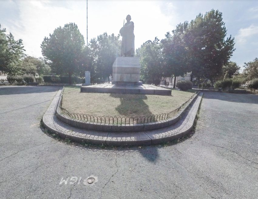
Figure 1. The two test sites: the place that represent the noisy environment (left, site A) and an
undisturbed place (right, site B).
siteA
site
site AA siteBBB
site
siteISPRS Int. J. Geo-Inf. 2019, 8, x FOR PEER REVIEW 4 of 13
ISPRS Int. J. Geo-Inf. 2020, 9, 220 4 of 13
Figure 1. The two test sites: the place that represent the noisy environment (left, site A) and an
undisturbed place (right, site B).
Coupled with the two smartphones, the u-blox receiver was also used. This instrument needs
Coupled
software withonthe
installed antwo smartphones,
external device forthe u-blox receiver
collecting both thewas also used. This instrument
raw-measurements and the real-timeneeds
software installed on an external device for collecting both the raw-measurements
results. There are many software available today on the market (e.g., those proposed in [19]) that and the real-time
results.
can exploitTheretheare manybinary
owner software available
format (.ubx)today on the market
for obtaining (e.g., INdependent
Receiver those proposedEXchangein [19]) that can
format
exploit the owner binary format (.ubx) for obtaining Receiver INdependent
(RINEX) files or real-time solutions. In this work, we used the RTKLIB suite (version 2.4.3) both forEXchange format (RINEX)
files or real-time
extracting the rawsolutions. In this work,
data, for converting we in
them used the RTKLIB
RINEX (using the suite (version 2.4.3)
RTKCONV tool), both
and for for performing
extracting
the post-processing (using the RTKPOST tool) and real-time (using the RTKNAVI tool) the
the raw data, for converting them in RINEX (using the RTKCONV tool), and for performing post-
solutions.
processing (using the RTKPOST tool) and real-time (using the RTKNAVI tool) solutions. This software
This software is particularly interesting because it is an open source program package for standard and
is particularly interesting because it is an open source program package for standard and precise
precise positioning with GNSS many constellations (GPS, GLONASS, Galileo, BeiDou, QZSS, SBAS)
positioning with GNSS many constellations (GPS, GLONASS, Galileo, BeiDou, QZSS, SBAS) and
and supports various positioning modes with GNSS for both real-time and post-processing approaches:
supports various positioning modes with GNSS for both real-time and post-processing approaches:
single, differential GPS/GNSS (DGPS/DGNSS), kinematic, static, moving-baseline, fixed, PPP-kinematic
single, differential GPS/GNSS (DGPS/DGNSS), kinematic, static, moving-baseline, fixed, PPP-
(precise point positioning kinematic), PPP-static, and PPP-fixed. It also includes a graphical user
kinematic (precise point positioning kinematic), PPP-static, and PPP-fixed. It also includes a graphical
interface (GUI) and command-line user interface (CUI) with many library functions related to satellite
user interface (GUI) and command-line user interface (CUI) with many library functions related to
and navigation system functions, stream data input and output functions, standard, real-time, and
satellite and navigation system functions, stream data input and output functions, standard, real-time,
post-processing positioning. This software, as already described in the literature [20], is particularly
and post-processing positioning. This software, as already described in the literature [20], is particularly
interesting because it allows managing the stream data coming from a network of permanent stations
interesting because it allows managing the stream data coming from a network of permanent stations
using the Networked Transport of RTCM via Internet Protocol (NTRIP) authentication. In addition,
using the Networked Transport of RTCM via Internet Protocol (NTRIP) authentication. In addition,
RTKLIB allows fixing the phase ambiguities as integer values, applying the modified Least-squares
RTKLIB allows fixing the phase ambiguities as integer values, applying the modified Least-squares
AMBiguity Decorrelation Adjustment (LAMBDA) method (MLAMBDA) [21], an interesting and very
AMBiguity Decorrelation Adjustment (LAMBDA) method (MLAMBDA) [21], an interesting and very
famous
famoustechnique,
technique,especially
especially for for real-time applications, where
real-time applications, where computational
computationalspeed speedisismandatory
mandatory[22]. [22].
Unfortunately,
Unfortunately,RTKLIB RTKLIBis is not
not useful
useful for the smartphone
for the smartphonebecausebecauseititisisnotnotstill
stillavailable
available asas
anan app.
app.
Thus, in this case, the GEO++ RINEX app was used to help to get the raw
Thus, in this case, the GEO++ RINEX app was used to help to get the raw measurements and to store measurements and to store
these
theseinto
intoaaRINEX
RINEX file.
file. This application isisaaRINEX
This application RINEXparser
parserandandan anobservation
observationanalyzer
analyzer which
which allows
allows
defining
definingspecific
specific parameters
parameters to to extract
extractonly
onlythe
theuseful
usefuldata
datafor
forthe
the user.
user. In In particular,
particular, it isitpossible
is possibleto to
choose
choose which constellation to store and the RINEX format version. The methodology of this work is is
which constellation to store and the RINEX format version. The methodology of this work
summarized
summarizedin in Figure
Figure 2. 2.
Figure2.
Figure 2. Synthetic
Synthetic outline
outline of
of the
the data
data acquisition
acquisition and
and data
data processing
processingprocedures.
procedures.
4.4.Results
Resultsand
and Discussion
Discussion
Since
Sincedifferent tests
different were
tests conducted
were following
conducted both static
following both and kinematic
static approaches,
and kinematic as described
approaches, as
indescribed
the previous section, now the main interesting results are shown, also considering the two different
in the previous section, now the main interesting results are shown, also considering the
software used for the post-processing analysis. To make a more readable paper, these results willISPRS Int. J. Geo-Inf. 2020, 9, 220 5 of 13
be shown and commented on in two sub-sections, the first related to the behavior considering the
two different environments and the second comparing the smartphones’ results with those obtained
with the u-blox receiver. In both cases, the results were obtained considering the post-processing
approach, while in the third Section 4.3, the real-time results will be shown. We have considered two
main statistical information for analyzing the obtained results: the precision estimated through the
root mean square error (RMSE) and the accuracy as the difference between the mean estimated values
and the reference ones.
4.1. Positioning Performances Considering Different Environments
First, the behavior of the GNSS internal chipset was analyzed considering a post-processing
approach. As it is well known, to perform a relative post-processing approach, it is necessary to
consider a master station, that in this case is represented by the TORI (Turin) permanent station: this
GNSS station, that belongs to the European Reference Frame (EUREF) permanent GNSS network
(www.epncb.oma.be), is composed by a multi-frequency and multi-constellation receiver and a choke
ring antenna and is about 250 m distance from the test sites.
Both smartphones were settled in two different test sites previously cited, reference points, which
coordinates were known with an accuracy level of a few millimeters. Regarding site A, the coordinate
of the point was measured statically with a geodetic receiver (Leica GS14 receiver) for several hours and
then post-processed. The point in site B is part of the national geodetic network. The first analyses were
made considering the RTKLIB software and different positioning techniques: single point positioning
(SPP), static, and kinematic. Moreover, different sessions’ lengths were considered (10, 30, and 60 min)
to verify if there was a correlation between the length of the session and the precision of the solutions.
The results are presented in Tables 2 and 3. All solutions were obtained by applying the following
atmospheric corrections. The Saastamoinen model was used to mitigate the tropospheric delay using
dry and wet components, while the Klobuchar model for the ionospheric one, setting the cut off
elevation as 10◦ . All results were obtained fixing the phase ambiguities as integer values, according to
the “Fix and hold” method [18].
Table 2. Precision of the positioning results using Huawei P10+ in meters.
Sites Session Length Method East North Up
Static 35.827 16.135 21.665
A 10 Kin 53.085 33.152 80.066
SPP 58.724 39.226 88.549
Static 0.959 0.445 2.071
B 10 Kin 47.321 33.935 39.535
SPP 50.047 35.247 39.707
Static 3.915 6.844 10.131
A 30 Kin 22.475 16.146 56.759
SPP 33.267 24.791 71.716
Static 0.864 0.736 1.817
B 30 Kin 12.938 9.756 15.376
SPP 15.932 12.784 19.766
Static 8.991 10.462 10.933
A 60 Kin 23.867 18.414 36.343
SPP 27.983 20.626 42.507
Static 0.048 0.142 0.118
B 60 Kin 5.505 4.821 9.373
SPP 6.418 5.791 11.126ISPRS Int. J. Geo-Inf. 2020, 9, 220 6 of 13
Table 3. Precision of the positioning results using Samsung Galaxy S8+ in meters.
Sites Session Length Method East North Up
Static 8.221 7.985 11.121
A 10 Kin 11.452 9.768 16.433
SPP 15.109 14.344 19.674
Static 2.011 1.974 3.858
B 10 Kin 3.986 3.884 4.112
SPP 6.101 7.254 8.114
Static 3.985 4.465 6.110
A 30 Kin 6.158 6.552 8.764
SPP 8.552 7.986 9.992
Static 1.107 2.213 4.101
B 30 Kin 3.201 2.120 2.988
SPP 5.124 4.442 5.899
Static 4.231 5.102 8.101
A 60 Kin 7.532 6.422 10.101
SPP 11.365 9.105 13.421
Static 0.123 0.113 0.201
B 60 Kin 1.101 1.632 2.115
SPP 4.102 3.986 5.221
Analysing the results in Tables 2 and 3, it seems that location A was noisier than B because the
precision obtained in the first case was lower because of multipath effects due to reflective surfaces
and limited satellites’ visibility. At the same time, it seems that there was no correlation between the
session length and the precision, that generally happens if geodetic or handled receivers are used.
This is due to the quality of the raw measurements, that are noisier than those obtainable with other
mass-market receivers, such as the u-blox. The analysis of the signal is not the topic of this paper, but
the same devices were analyzed in [23].
Even in the case of the kinematic solutions, the smartphones were settled in a fixed place as a
static survey. The only difference was due to the different transition matrix considered in the Kalman
filter. By analyzing these results, it is possible to affirm that this kind of method was not feasible for
these instruments, so it will be neglected in the following sections of this work.
For verifying the repeatability of these results, another dataset in the same places, with the same
techniques, was collected. Considering only the Huawei P10+ and the RTKLIB (Table 4), it seems that
there were no evident differences with those obtained in the other data collection.
The same dataset was also processed with the Leica Geo Office 8.3 software, to obtain another
independent solution to demonstrate that the performances obtainable today with smartphones are
independent of the software used for processing. Table 5 shows the results obtained with Huawei
P10+ smartphone and demonstrates that the results obtained with this commercial software were
generally slightly better than those obtained with RTKLIB, even if the behavior in terms of session
length and environmental conditions was the same. Even if no results are reported here, it is important
to underline that no differences could be found when the Samsung Galaxy S8+ smartphone was used.ISPRS Int. J. Geo-Inf. 2020, 9, 220 7 of 13
Table 4. Huawei P10+. Results obtained with RTKLIB software, considering different session lengths
and locations. Values in meters.
Method Time East North Up
Static 8.991 10.462 10.933
10 min site A
SPP 27.983 20.626 42.507
Static 0.048 0.142 0.118
10 min site B
SPP 6.418 5.791 11.126
Static 3.915 6.844 10.131
30 min site A
SPP 33.267 24.791 71.716
Static 0.864 0.736 1.817
30 min site B
SSP 15.932 12.784 19.766
Static 35.827 16.135 21.665
60 min site A
SPP 58.724 39.226 88.549
Static 0.959 0.445 2.071
60 min site B
SPP 50.047 35.247 39.707
Table 5. Huawei P10+. Results obtained with LGO software, considering different session lengths and
locations. Values in meters.
Method Time East North Up
Static 1.246 0.955 1.346
10 min site A
SPP 0.782 0.668 0.527
Static 0.024 0.016 0.034
10 min site B
SPP 0.492 0.321 0.593
Static 34.991 33.448 81.132
30 min site A
SPP 3.071 1.222 2.81
Static 0.058 0.013 0.044
30 min site B
SSP 0.908 0.443 0.794
Static 156.024 303.553 287.713
60 min site A
SPP 5.425 2.696 4.748
Static 1.246 0.955 1.346
60 min site B
SPP 0.782 0.668 0.527
4.2. Comparison between U-Blox and Smartphones Results
Another dedicated test was performed for comparing the results obtained with the smartphones
and those with the other low-cost receiver (u-blox). All receivers were settled only on the site with
the best satellite visibility (site B), close to each other, to verify the performances in the best possible
conditions (good satellite visibility, no obstacles, or electromagnetic disturbances).
The authors performed two different measurement campaigns with a session length of 10 mins
and 30 mins, respectively. In the first case (Table 6), it seems that the smartphones’ performances were
better than those obtainable with the u-blox receiver. This is really a strange behavior and was not
confirmed if the longer session is analyzed (Table 7). This strange result is probably due to the noise of
the raw GNSS measurements collected by the smartphone. Generally, it is really difficult to filter and
de-noise these observations.ISPRS Int. J. Geo-Inf. 2020, 9, 220 8 of 13
Table 6. Accuracy results of Huawei P10+, Samsung S8+, and u-blox for a session length of 10 min. All
results exceeding a threshold of 3 m are highlighted inside the table.
Device Method East North Up
Static 0.070 0.111 0.507
Huawei P10+ Kinematic 7.461 7.287 15.181
SPP 8.197 6.913 14.763
Static 0.235 0.181 0.465
Samsung S8+ Kinematic 2.101 3.257 4.188
SPP 4.133 6.434 9.982
Static 0.140 0.233 0.717
u-blox Kinematic 7.740 9.529 9.424
SPP 3.016 2.31 6.274
Table 7. Accuracy results of Huawei P10+, Samsung S8+, and u-blox for a session length of 30 min. All
results exceeding a threshold of 3 m are highlighted inside the table.
Device Method East North Up
Static 2.910 0.948 16.599
Huawei P10+ Kinematic 16.585 12.393 74.289
SPP 16.646 12.991 74.778
Static 1.645 1.487 5.126
Samsung S8+ Kinematic 5.132 4.934 12.864
SPP 9.846 11.021 32.169
Static 0.001 0.001 0.006
u-blox Kinematic 0.618 0.462 1.079
SPP 3.154 2.003 11.063
Particularly interesting is the analysis of precision and accuracy obtainable. Tables 8–10 show
these values for session length of about 1 h, 30 min, and 10 min, respectively.
Table 8. Accuracy (upper line for each method) and precision (lower line for each method) results
considering a session length of 1 h. All results exceeding a threshold of 3 m are highlighted inside
the table.
Device Method East North Up
0.160 −0.177 −1.602
Static
0.280 1.313 2.055
−0.015 −3.842 −7.398
Huawei P10+ Kinematic
10.001 64.420 57.218
0.272 −1.043 −7.887
SPP
10.909 66.828 58.167
0.201 0.023 −0.988
Static
0.223 0.342 1.243
0.198 0.212 −1.117
Samsung S8+ Kinematic
0.632 0.457 1.114
1.564 1.996 2.012
SPP
1.201 2.092 3.421
−0.009 −0.072 −0.011
Static
0.000 0.003 0.002
−0.009 −0.073 −0.011
u-blox Kinematic
0.015 0.04 0.065
−0.009 −0.073 −0.011
SPP
0.015 0.040 0.065ISPRS Int. J. Geo-Inf. 2020, 9, 220 9 of 13
Table 9. Accuracy (upper line for each method) and precision (lower line for each method) results
considering a session length of 30 min. All results exceeding a threshold of 3 m are highlighted inside
the table.
Device Method East North Up
0.283 −0.222 −0.295
Static
0.242 0.488 1.124
0.253 −0.198 −0.223
Huawei P10+ Kinematic
4.205 7.384 18.997
0.253 −0.198 −4.025
SPP
4.671 8.569 19.180
0.325 −0.213 −0.675
Static
0.853 0.422 1.322
0.201 −0.185 0.857
Samsung S8+ Kinematic
1.106 0.825 1.984
1.004 1.032 −0.862
SPP
2.012 1.796 2.965
−0.017 −0.076 −0.105
Static
0.004 0.008 0.007
0.098 0.010 0.058
u-blox Kinematic
0.194 0.205 0.357
1.249 2.77 −0.020
SPP
1.921 5.119 4.818
Table 10. Accuracy (upper line for each method) and precision (lower line for each method) results
considering a session length of 10 min. All results exceeding a threshold of 3 m are highlighted inside
the table.
Device Method East North Up
0.437 0.010 0.402
Static
0.189 0.783 0.797
0.529 0.287 0.510
Huawei Kinematic
3.584 7.795 14.788
1.143 0.767 −2.597
SPP
4.056 9.071 15.447
0.384 0.195 0.432
Static
0.221 0.784 1.041
0.345 0.201 1.072
Samsung S8+ Kinematic
1.456 0.423 1.674
1.114 1.101 3.115
SPP
2.354 2.124 3.568
−0.254 −0.947 0.970
Static
0.385 0.195 1.404
−0.262 −0.979 0.678
u-blox Kinematic
4.630 6.600 19.21
−0.248 −0.922 −3.437
SPP
4.910 6.746 19.134
According to the Table 5, the results are more accurate than precise for smartphone while u-blox
provides better results both for accuracy and precision during the same time interval. For the session
length equal to 30 minutes (Table 9) the smartphone results are slightly worse than in the previous case
because the session length is half of that (Table 8).ISPRS Int. J. Geo-Inf. 2020, 9, 220 10 of 13
4.3. Real-Time Kinematic Positioning
The main concept behind the real-time kinematic (RTK) positioning is that you need to obtain
real-time differential corrections broadcasted by one or more permanent stations. In this work, the
“Servizio di Posizionamento Interregionale” GNSS (SPIN GNSS) Network (https://www.spingnss.it/
spiderweb/frmIndex.aspx) was considered, selecting the Virtual Reference Station (VRS) as differential
correction, and the Radio Technical Commission for Maritime (RTCM) 3.0 message for the broadcasted
throw. To use both u-blox and smartphone contemporarily, it is necessary to have the GNSS
Internet Radio software (https://igs.bkg.bund.de/ntrip/download) that allows obtaining the differential
corrections for a location near to the test site. This last software also allows us to save the corrections in
a text file, to provide the same input data for both the u-blox and smartphone. Then, the RTKNAVI
tool that is part of the RTKLIB software, was used to perform the network real-time kinematic
(NRTK) positioning.
Even in this case, the authors performed two different measurement campaigns with a session
length of 5 and 10 minutes, respectively. This choice was due to the time interval that a generic user
can wait for obtaining a positioning accuracy of about 5 cm, as described in [12]. As in the previous
case, the test site that is in the open-sky area (site B) was chosen. Nevertheless, using the Huawei
P10+ smartphone, no signal observation with phase ambiguities fixed as an integer value [24] were
obtained, as it is possible to see from Table 11. Completely different results were obtained considering
the u-blox receiver (Table 12). In this case, in 83% of solutions, the phase ambiguities were fixed as
integer values, and the accuracies were about 3–4 cm both for 2D and up component. The second part
of this analysis regards the positioning quality for observation epochs, where the phase ambiguities
are not fixed (float solutions). Analyzing these results, it should be emphasized that the u-blox receiver
provided precisions comparable to the fixed solutions, while accuracies were around 40 cm for both 2D
and up components.
Table 11. Real-time positioning results using Huawei receiver and a session length equal to 5 min.
Values in meters.
Fix 0%
East North Up
Precision N/A N/A N/A
Accuracy N/A N/A N/A
Float 100%
East North Up
Precision 3.089 2.677 4.888
Accuracy 4.822 3.184 5.516
Table 12. Real-time positioning results using the u-blox receiver and a session length equal to 5 min.
Values in meters.
Fix 83%
East North Up
Precision 0.004 0.005 0.013
Accuracy 0.034 0.012 0.041
Float 17%
East North Up
Precision 0.014 0.007 0.042
Accuracy 0.293 0.359 0.391
Considering Tables 11 and 13, it is evident how these two different smartphones provided
completely different results, not only in terms of percentage of fix solutions but also in terms ofISPRS Int. J. Geo-Inf. 2020, 9, 220 11 of 13
precision and accuracy. The Samsung S8+ provided good results in terms of accuracy, even if the
precision values were not so elevated, reaching a low percentage of fix epochs (14%).
Table 13. Real-time positioning results using Samsung S8+ receiver and a session length equal to 5 min.
Values in meters.
Fix 14%
East North Up
Precision −0.200 0.532 2.336
Accuracy 0.037 0.026 0.046
Float 86%
East North Up
Precision −0.260 0.923 2.452
Accuracy 0.047 0.061 0.092
The behavior of Huawei P10+ results was completely different. The accuracies were in the
interval between 3.18 m and 5.52 m, while the precisions were within 2.67 m and 4.88 m. Moreover,
no fix solutions were available with this kind of device. This means that also considering previous
studies [18], not all GNSS receivers installed inside smartphones can provide the same results because
the raw observations have different conditions in terms of noise and accuracy. For the future, it will be
interesting to perform the same tests considering new GNSS chipsets and the employment of new
GNSS constellations and signals.
5. Conclusions
Until a few years ago, low-cost sensors and smart technologies were considered as “mass-market”
solutions, able to estimate a very approximate positioning and adapt only for navigation or
geolocalization. Nowadays, new technologies, new user requirements, new platforms (e.g., Android
8.0), and new challenges have allowed a very powerful “geomatics” tool to be brought to our hands.
The modern smartphones or mass-market receivers are able to reach very impressive quality, both
in static or kinematic positioning, widening the doors to an enormous quantity of applications and
research fields. UAV, pedestrian positioning, unmanned ground vehicle, object tracking, security
issues, are only a short list of possible domains where the quality reachable with these kinds of
sensors could be exhaustive. The improvement is also allowed by the quality of the GNSS signals,
the modern infrastructure dedicated to GNSS positioning (e.g., CORS, network, NRTK, etc.), and by
the increasing interest due to user communities and big players in the use of these technologies for
high-quality positioning.
In this paper, it is strongly demonstrated that the quality of the signals collected using these
technologies is completely able to reach good positioning. Surely, by combining the sensors with a
better external antenna, the performances could be better, and other possible applications could be
founded. We have presented the results obtained with only one frequency. This is not expected to
be the same concerning the performance of all smartphones, especially, because, in 2018, the first
smartphone with a dual-frequency multi-constellation GNSS receiver was released (Xiaomi Mi8).
This study aimed to show how different results can be obtained in the function of different positioning
techniques that can be chosen according to the precision and accuracy requested. Future steps will be
to test the performances of other smartphones with other GNSS chipsets installed to provide a deeper
overview of possible results obtainable today. Certainly, this will also be done considering the new
instruments released on the market in these few last months.
If a few years ago, smart technologies were only tools for calling and chatting, today, these tools
are becoming potential tools for geomatics applications. In the near future, new constellations and
signals promise us an improvement in the quality in terms of precision and performance. Therefore,
this is only the first step of this new positioning revolution.ISPRS Int. J. Geo-Inf. 2020, 9, 220 12 of 13
Author Contributions: Conceptualization: P.D. and M.P.; Methodology: M.P. and V.D.P.; Software: P.D.; Validation:
V.D.P.; Formal Analysis: P.D. and V.D.P.; Writing—Original Draft Preparation: P.D. and V.D.P.; Writing—Review
and Editing: P.D. and M.P.; Supervision: P.D. and M.P. All authors have read and agreed to the published version
of the manuscript.
Funding: This research received no external funding.
Acknowledgments: The authors would like to thank Shady Hatem for helping the authors during the measurement
campaign and the reviewers for their helpful comments and suggestions.
Conflicts of Interest: The authors declare no conflict of interest.
References
1. Masiero, A.; Guarnieri, A.; Pirotti, F.; Vettore, A. A particle filter for smartphone-based indoor pedestrian
navigation. Micromachines 2014, 5, 1012–1033. [CrossRef]
2. Federici, B.; Giacomelli, D.; Sguerso, D.; Vitti, A.; Zatelli, P. A web processing service for GNSS realistic
planning. Appl. Geomat. 2013, 5, 45–57. [CrossRef]
3. Zandbergen, P.A.; Barbeau, S.J. Positional accuracy of assisted GPS data from high-sensitivity GPS-enabled
mobile phones. J. Navig. 2011, 64, 381–399. [CrossRef]
4. Van Diggelen, F.S.T. A-GPS: Assisted GPS, GNSS, and SBAS; Artech House: Norwood, MA, USA, 2009.
5. Humphreys, T.E.; Murrian, M.; van Diggelen, F.; Podshivalov, S.; Pesyna, K.M. On the feasibility of
cm-accurate positioning via a smartphone’s antenna and GNSS chip. In Proceedings of the IEEE/ION
Position, Location and Navigation Symposium (PLANS), Savannah, GA, USA, 11–14 April 2016; pp. 232–242.
6. Zhang, K.; Jiao, F.; Li, J. The Assessment of GNSS Measurements from Android Smartphones. In China
Satellite Navigation Conference; Springer: Singapore, 2018; pp. 147–157.
7. Pepe, M. CORS architecture and evaluation of positioning by low-cost GNSS receiver. Geod. Cartogr.
2018, 44, 36–44. [CrossRef]
8. Lachapelle, G.; Gratton, P.; Horrelt, J.; Lemieux, E.; Broumandan, A. Evaluation of a Low Cost Hand Held
Unit with GNSS Raw Data Capability and Comparison with an Android Smartphone. Sensors 2018, 18, 4185.
[CrossRef] [PubMed]
9. Zhang, X.; Tao, X.; Zhu, F.; Shi, X.; Wang, F. Quality assessment of GNSS observations from an Android N
smartphone and positioning performance analysis using time-differenced filtering approach. GPS Solut.
2018, 22, 70. [CrossRef]
10. Kaplan, E.; Hegarty, C. Understanding GPS: Principles and Applications; Artech House:
Norwood, MA, USA, 2005.
11. Misra, P.; Enge, P. Global Positioning System: Signals, Measurements and Performance, 2nd ed.;
Ganga-Jamuna Press: Lincoln, MA, USA, 2006.
12. Dabove, P.; Manzino, A. GPS & GLONASS mass-market receivers: Positioning performances and peculiarities.
Sensors 2014, 14, 22159–22179.
13. Fissore, F.; Masiero, A.; Piragnolo, M.; Pirotti, F.; Guarnieri, A.; Vettore, A. Towards surveying with a
smartphone. In New Advanced GNSS and 3D Spatial Techniques; Lecture Notes in Geoinformation and
Cartography; Cefalo, R., Zieliński, J., Barbarella, M., Eds.; Springer: Cham, Switzerland, 2018.
14. Dabove, P.; Di Pietra, V.; Hatem, S.; Piras, M. GNSS Positioning using Android Smartphone. In Proceedings
of the 5th International Conference on Geographical Information Systems Theory, Applications and
Management, Heraklion, Greece, 3–5 May 2019; Volume 1, pp. 135–142.
15. Hoffmann-Wellenhof, B.; Lichtenegger, H.; Wasle, E. GNSS—GPS, GLONASS, Galileo and More; Springer Wien:
New York, NY, USA, 2008.
16. Robustelli, U.; Baiocchi, V.; Pugliano, G. Assessment of dual frequency GNSS observations from a Xiaomi Mi
8 android smartphone and positioning performance analysis. Electronics 2019, 8, 91. [CrossRef]
17. Cina, A.; Dabove, P.; Manzino, A.M.; Piras, M. Augmented Positioning with CORSs Network Services
Using GNSS Mass-market Receivers. In Proceedings of the IEEE/ION Position, Location and Navigation
Symposium (PLANS), Monterey, CA, USA, 5–8 May 2014; pp. 359–366.
18. Dabove, P.; Di Pietra, V. Towards high accuracy GNSS real-time positioning with smartphones.
Adv. Space Res. 2019. [CrossRef]ISPRS Int. J. Geo-Inf. 2020, 9, 220 13 of 13
19. Kaselimi, M.; Doulamis, N.; Delikaraoglou, D.; Protopapadakis, E. GNSSGET and GNSSPLOT
platforms-matlab GUIs for retrieving GNSS products and visualizing GNSS solutions. In Proceedings of the
VISIGRAPP, Funchal, Portugal, 27–29 January 2018; pp. 626–633.
20. Takasu, T.; Yasuda, A. Development of the low-cost RTK-GPS receiver with an open source program package
RTKLIB. In Proceedings of the International Symposium on GPS/GNSS, International Convention, Jeju, Korea,
4–6 November 2009.
21. Chang, X.W.; Yang, X.; Zhou, T. MLAMBDA: A modified LAMBDA method for integer least-squares
estimation. J. Geod. 2005, 79, 552–565. [CrossRef]
22. Teunissen, P.J.G. The least-squares ambiguity decorrelation adjustment: A method for fast GPS ambiguity
estimation. J. Geod. 1995, 70, 65–82. [CrossRef]
23. Gogoi, N.; Minetto, A.; Linty, N.; Dovis, F. A controlled-environment quality assessment of android GNSS
raw measurements. Electronics 2019, 8, 5. [CrossRef]
24. Teunissen PJ, G.; Verhagen, S. GNSS carrier phase ambiguity resolution: Challenges and open problems.
In Observing Our Changing Earth; Springer: Berlin/Heidelberg, Germany, 2009; pp. 785–792.
© 2020 by the authors. Licensee MDPI, Basel, Switzerland. This article is an open access
article distributed under the terms and conditions of the Creative Commons Attribution
(CC BY) license (http://creativecommons.org/licenses/by/4.0/).You can also read