GOAL - Town of Blacksburg
←
→
Page content transcription
If your browser does not render page correctly, please read the page content below
GOAL
Provide a safe, connected multi-modal transportation system for people and goods that prioritizes less
impactful modes, supports community health and improves air quality, works in concert with desired
land uses, and equitably serves community needs.

Sustainability Goal
Foster a transportation network that expands options for traditionally underserved populations,
reduces car dependency, results in mode shift away from single occupancy vehicle trips that are the
primary driver of traffic congestion, accelerates the transition to electric and other low emission
vehicles, and reduces greenhouse gas emissions and air pollution.

Community Engagement
Meaningful community engagement is key to the Town’s ethic of governance. To foster an inclusive
planning process, the Town should ensure that all community members feel welcome and empowered
to participate. This can be achieved by providing a wide range of convenient opportunities, providing
transparent and responsive communication, and applying innovative engagement methods. In
addition, there are a number of standing committees and working groups that advise staff and Town
Council on transportation topics such as the Corridor Committee, the Planning Commission, and the
Traffic Committee. Community members are also encouraged to attend and share their priorities and
concerns at Planning Commission and Town Council public hearings when transportation topics are
being discussed.

OVERVIEW
Transportation in Blacksburg has been influenced by historical growth patterns and by the mode of
transportation dominant during the different periods of the Town’s development. Early transportation
was by foot or by horse and the local network was built as a grid with narrow streets to serve these
principal modes. By 1913, the railroad served Blacksburg and terminated at the Huckleberry Station on
Main Street. By the 1960s, this rail service had ceased, individual car ownership had increased, and
cars became the preferred mode of travel. Over the next two decades, streets were widened to
accommodate more automobiles, as families went from one car to two or more to meet daily needs.
By 1979, Prices Fork Road was four lanes and crossed the U.S. 460 Bypass. Transit service began in
Town in 1983 in order to address daily traffic congestion to and from the university campus. The
postwar dominance of the car allowed for and promoted the clear separation of land uses in less
compact forms and resulted in the devaluation of other modes of travel.

Comprehensive Plan                                                                  Transportation - 156
April 27, 2021
Some modes are more sustainable, better for public
health, and less costly - most notably walking and
bicycling.      This graphic displays a SUSTAINABLE
TRANSPORTATION HIERARCHY that arranges transportation
modes for moving people according to the most space
efficient, lowest infrastructure cost, and least
environmental impact. This arrangement shows that
driving alone is the least efficient and most impactful form
of travel.                                                       Sustainable Transportation Hierarchy

The Town should prioritize and promote a shift to modes that reduce congestion, improve air quality
and public health, reduce greenhouse gas emissions, alleviate parking challenges, and are less
expensive both for households and for infrastructure maintenance. Consideration of the transportation
system should give weight to all modes of travel as opposed to one mode overshadowing all others. In
particular, transportation by single-occupancy vehicle should not be considered the “standard” with all
other modes considered as “alternative” modes.

The Town should support and adapt to advances in transportation technology and proactively provide
transportation mode choices for its residents. Relatively recent technology advancements in
transportation have led to the rise of ridesharing, telecommuting, micromobility, unmanned aerial
vehicle (drone) delivery services, and autonomous vehicles as well as increases in the share of zero-car
households in Blacksburg (Census ACS 2010 & 2019).

The Town seeks to balance competing elements of the transportation system to provide safe,
convenient, and accessible options for all users in Town while also connecting the Town to the New
River Valley and beyond. Creating an integrated transportation system in Blacksburg requires regional
coordination with other entities, particularly with Virginia Tech to ensure seamless transitions between
campus and Town networks.

The Blacksburg transportation network includes a variety of different transportation elements
including trails, sidewalks, bicycle infrastructure, transit service, roads, alleys, parking, rail, and air
transportation. The chapter begins with a review of the Transportation Network, followed by a
discussion of Vehicular Parking. Review of Transit and Transportation Partners, Planning, and
Funding including the Town’s Transportation Project Priorities is next. Lastly are sections covering
Regional Access, Rail Transportation, Air Transportation, and Emerging and Continuing
Transportation Trends.

TRANSPORTATION NETWORK
To improve mobility, access, and safety, the Town values maintaining and expanding a grid network for
transportation. Much of that grid system occurs in roadways which primarily serve the automobile but
with thoughtful design can also serve pedestrians and bicyclists.

Comprehensive Plan                                                                      Transportation - 157
April 27, 2021
The Blacksburg Grid
Early development in Blacksburg was laid out in a five by five grid, serving the primary modes of the
time period such as travel by foot and by horse. Other older areas of Town, such as the Miller-
Southside and Bennett-Hill Progress neighborhoods, were also developed with a grid street system.
Following World War II, growing in popularity in the 1960s, and still constructed today, new suburban
developments prioritized street designs with cul-de-sac layouts to limit traffic from outside the
neighborhood. Most development over this time period in Blacksburg followed this trend with
numerous neighborhoods in Town lacking a connected street grid.

This type of development and others that lack connectivity have lasting effects on the transportation
network/livability such as increasing vehicular traffic and vehicle miles traveled leading to higher
greenhouse gas emissions, greater neighborhood isolation, public health impacts due to less walking
and bicycling, and longer emergency service response times. Once developed, the transportation
network is difficult to retrofit. The Town values transportation connectivity, evaluates this connectivity
in the development review process, and should continually seek to enhance the STREET GRID.

            Example of distance traveled in a grid network versus a cul-de-sac neighborhood

  Source: Neighborhood Streets Project Stakeholders. “Neighborhood Street Design Guidelines: An Oregon Guide for Reducing
                                               Street Widths.” November 2000.

At present, Main Street serves as the only north/south route and Prices Fork Road serves as the only
major east/west connector. To expand the grid network and provide alternative north/south and
east/west corridors, a number of transportation projects have been considered over the years. Several
streets have been widened to provide for additional capacity and other streets were extended to
improve efficiency and create better connections. South Main Street widening, the Progress Street
extension, and the Givens Lane/Chickahominy Drive connection are examples. However, providing
additional vehicular capacity is not a sustainable solution to achieve the Town’s Transportation Goal.
While historically there have been limited opportunities to widen streets and increase vehicular
capacity, the Town has worked to reduce vehicular congestion through adjustments to signal timing.

Comprehensive Plan                                                                                    Transportation - 158
April 27, 2021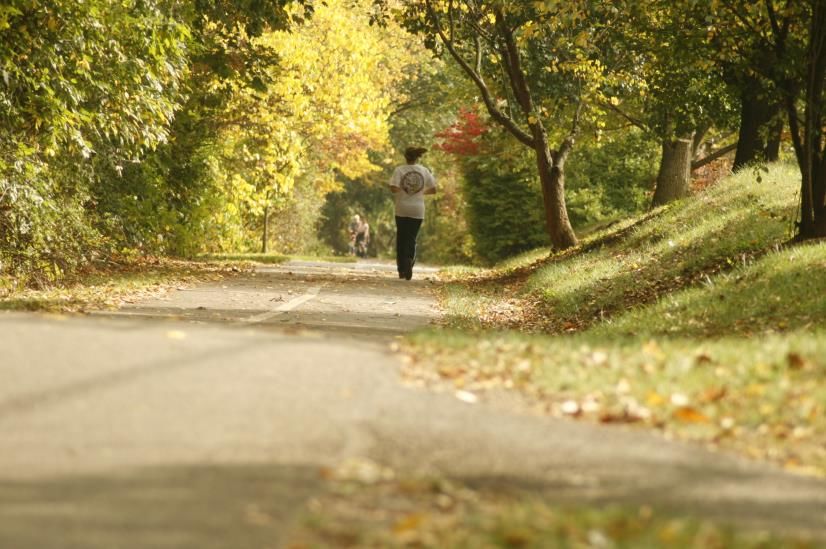
Other opportunities have been whittled away with intervening growth and development or have been
discarded by neighborhood objections as too detrimental to the areas in which they were located. This
was to the benefit of specific neighborhoods but not to the benefit of the whole community. For
example, the following routes were previously planned but not constructed: the Patrick Henry
Extension to Clay Street and the Hubbard Street Extension to Southgate Drive. The Town should
actively pursue expanding the street grid by identifying and planning for future connections so that
opportunities for connectivity are not missed.

   Multimodal Transportation Metrics
   Measuring the effectiveness of the transportation network should consider all modes of travel.
   Information on common transportation metrics and policies is detailed below.

   Bicycle Level of Traffic Stress is a rating given to a road segment or intersection indicating a
   comfort rating for bicyclists using the facility. Common factors include speed, facility type and
   width, and traffic volumes.

   Vision Zero is a transportation safety policy that seeks to eliminate all traffic related fatalities and
   severe injuries, while increasing safe, healthy, equitable mobility for all.

   Walkability Measurements such as Walk Friendly Community Designation and Walkscore seek to
   measure the safety and convenience of walking in the community.

   Bicycle Friendly Designation measures the overall bikeability for a community, university, business,
   or state.
Measuring the Effectiveness of the Transportation Network
The Highway Capacity Manual (HCM) has historically used Level of Service (LOS) as the measurement
to analyze the efficiency, through vehicular delay, of transportation systems. The system uses letters A
through F to measure road segment or intersection functioning. This measurement is one component
used in identifying potential improvement projects related to traffic operations. However, this
measure does not evaluate the safety of the roadway (i.e., lane width or site distance) or consider
other modes of transportation. For example, a roadway with Level of Service A (free flowing traffic)
may not support bicyclist and pedestrian mobility. In recognition of the narrow scope of vehicular level
of service analysis, the newest edition of the HCM (2016) includes methods to measure performance
for pedestrian, bicycle, and transit facilities, as well as interactions with vehicles. Additional metrics to
evaluate the overall transportation system include Bicycle Level of Traffic Stress, Pedestrian Level of
Service, accessibility metrics, and safety indicators. The Town should use these metrics to evaluate the
multi-modal transportation network and to prioritize moving people rather than vehicles.

Signalized and Other Intersections
Another way to increase efficiency is through maximizing the utility of the existing infrastructure. As of
2021, excluding the Virginia Tech campus, there are 33 traffic signals in Town, 29 of which contain
pedestrian crossing phases, and 4 roundabouts. Signalization or de-signalization of intersections should
occur as warranted, based upon traffic counts and surrounding development patterns. As an
alternative to traffic signals, there are a number of intersection designs that can be employed,
including roundabouts which should be considered where appropriate. The Virginia Department of
Transportation (VDOT) provides guidance for innovative intersection and interchange design through

Comprehensive Plan                                                                           Transportation - 159
April 27, 2021
the VDOT Junction Screening Tool (VJuST). As transportation patterns change, signal timing should be
reviewed to consider safety and convenience for all users. With signalization, there are several
opportunities for prioritizing pedestrians and bicyclists such as leading pedestrian intervals, dedicated
bicycle signals, and adjusting signal timing to lower travel speeds. The Town has made a concerted
effort in the last decade to replace old signals with new signals with technology that allows for
integrated signal timing. This has improved efficiency within existing capacity on roadways such as
Main Street and Prices Fork Road.

Complete Streets
As transportation has evolved over time, new policies have been established to address challenges and
opportunities in transportation planning. In response to auto-oriented transportation design, the idea
of accommodating other modes in everyday transportation planning resurfaced – eventually coined
“Complete Streets.” Complete Streets now encompasses the concept of a safe, accessible, and
convenient street for all users regardless of transportation mode, age, or physical ability. Complete
Streets benefit the community through increased safety with attention to vulnerable users, improved
public health through active modes such as walking and bicycling, and reduced car dependency.

   Complete Streets Policies
   “Pedestrians, bicyclists, motorists and transit riders of all ages and abilities must be able to safely
   move along and across a complete street.”

   “A good complete streets policy:
      • Includes a vision for how and why the community wants to complete its streets.
      • Specifies that “all users” includes pedestrians, bicyclists, and transit passengers of all ages
         and abilities, as well as automobile drivers and transit-vehicle operators.
      • Encourages street connectivity and aims to create a comprehensive, integrated,
         connected network for all modes.
      • Is adoptable by all relevant agencies to cover all roads.
      • Applies to both new and retrofit projects, including design, planning, maintenance, and
         operations, for the entire right-of-way.
      • Makes any exceptions specific and sets a clear procedure that requires high-level
         approval of exceptions.
      • Directs the use of the latest and best design standards while recognizing the need for
         flexibility in balancing user needs.
      • Directs that complete streets solutions will complement the context of the community.
      • Establishes performance standards with measurable outcomes.
      • Includes specific next steps for implementing the policy.”

   Source: McCann, Barbara and Suzanne Rynne, editors. Complete Streets: Best Policy and Implementation Practices.
   American Planning Association Planning Advisory Service Report Number 559, 2010.

Comprehensive Plan                                                                                     Transportation - 160
April 27, 2021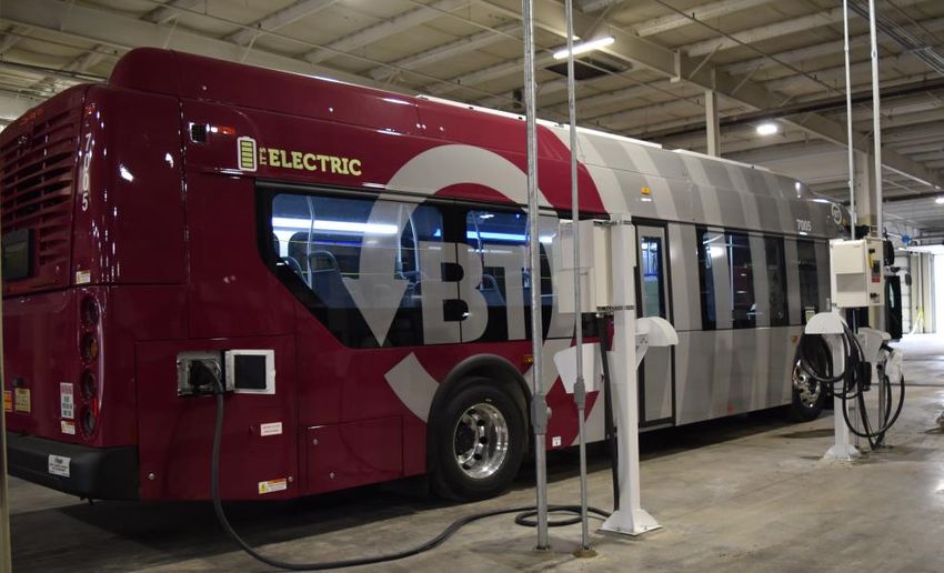
Working to create Complete Streets within an existing transportation network presents specific
challenges that require flexibility in policy implementation. In its guidance for accommodating bicycle
and pedestrian travel, the Federal Highway Administration (FHWA) recognizes these challenges and
defines three exceptions commonly used in Complete Street policies:
1. Corridors where non-motorized use is prohibited, such as a freeway.
2. Where cost is excessively disproportionate to the need or probable use.
3. Where sparsity of population or other factors indicate an absence of need.
The Town is committed to providing Complete Streets for new transportation projects and pursuing
this concept for the existing transportation network. The biggest implementation challenge for this is
the limitations of existing right-of-way for adequately accommodating all modes of transportation. As
new development and redevelopment occur, the community must evaluate the existing right-of-way
and acquire additional right-of-way, if necessary, to reach community goals.
The Town currently reviews opportunities to employ the Complete Streets concept in Town-initiated
transportation projects such as streetscape improvements and street rebuilding. For example, the
redesign of Givens Lane considered improvements to the vehicular travel lanes, transit access, bicycle
lanes, trail, and sidewalks for improved safety and convenience. Likewise, the Town utilizes
opportunities with repaving existing roadways to incorporate improved facilities for all users.
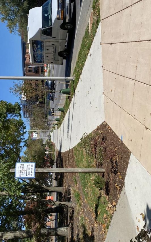
Pedestrian Network
As of 2021, there are approximately 64 miles of sidewalks and 46 miles of trails in Blacksburg,
excluding the Virginia Tech campus. Pedestrian infrastructure is a vital component of the
transportation network providing a safe, accessible, and convenient location for pedestrians to travel.
The vast majority of trips in Town begin and end with connections to sidewalks, whether public or
private. The pedestrian network provides connections to and from transit stops, vehicular and bicycle
parking areas, residences, schools, recreational areas, and businesses throughout Town. Conflicts
between drivers and pedestrians occur where adequate facilities for pedestrians are not provided.
Completing and maintaining a contiguous system of walkways, instead of a fragmented system, is
critical to avoiding such conflicts, which put pedestrians at risk.
Many arterial and collector roads in Blacksburg have sidewalks or trails on at least one side. Sidewalk
on both sides of the street is preferred for a complete pedestrian network. While some older
neighborhoods have sidewalk on both sides, a few heavily traveled existing collector roads do not have
sidewalks on either side. New subdivision construction must provide sidewalks, or in some cases trail,
on at least one side of streets. Retrofitting and completing the existing fragmented network requires a
long-term commitment that prioritizes pedestrian infrastructure. To achieve this, the Town must
address several challenges such as allocation of limited right-of-way, location of existing utility
infrastructure, and funding.
Pedestrian network needs within the Town exceed current funding. To maximize construction of
pedestrian infrastructure, the Town utilizes a variety of funding sources, which include VDOT Revenue
Sharing programs and allocations of funds or labor through the Town’s Capital Improvement Program.
The Town completed several projects using the Safe Routes to School program which funds
improvements to pedestrian networks surrounding schools. As part of this program the Town
Comprehensive Plan Transportation - 161
April 27, 2021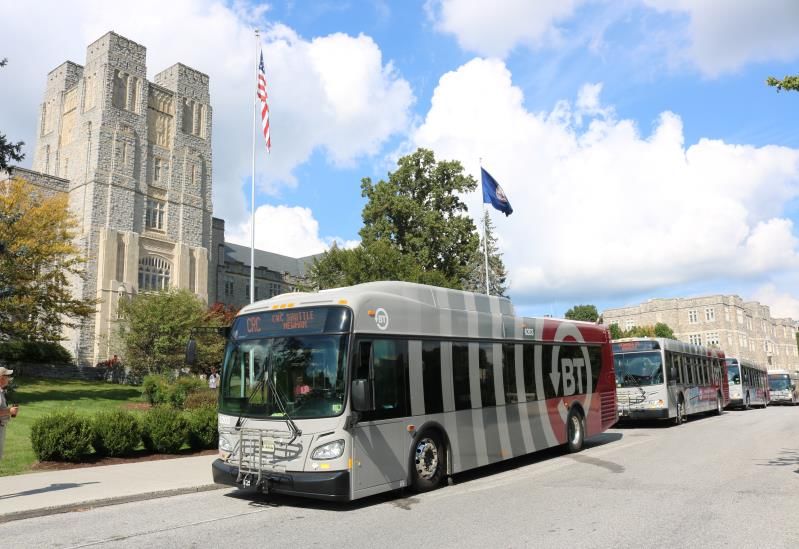
developed travel plans for Gilbert Linkous Elementary, Harding Elementary, and Margaret Beeks
Elementary schools. The Town intends to implement additional projects from the program when
funding becomes available.
The Corridor Committee advocates for and assists with the planning and development of a well-
connected pedestrian network. Sidewalk projects funded by the Town are maintained in a prioritized
list by the Corridor Committee. Projects vary in scale and complexity, from short infill segments to full
redesign of a street in coordination with stormwater improvements. Funding is allocated to the highest
priority projects which are typically in the most heavily traveled pedestrian areas to create safe
corridors to key destinations. The Corridor Committee updates the matrix periodically to reflect
completed work, add new segments to the list, and review priorities.
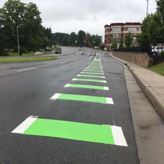
Sidewalk improvements along Prices Fork Road
Bicycle Network
As of 2021, there are approximately 19 miles of bicycle infrastructure and 46 miles of trails in
Blacksburg, excluding the Virginia Tech campus. This infrastructure is another vital component of the
transportation network providing safe, accessible, and convenient routes for bicyclists to travel.
Nationally, 35% of all vehicle trips are less than 2 miles in length and 46% of vehicle trips are less than 3
miles in length which is a distance ideally suited for bicycle travel (National Household Travel Survey
2017). A robust bicycle network will allow for the community to consider bicycling as the primary
option for these short trips. As with the pedestrian network, conflicts between drivers and bicyclists
often occur where adequate infrastructure for bicyclists is not provided. Creating and maintaining a
contiguous system of bicycle infrastructure, instead of a fragmented system, is critical to improving
safety for cyclists.
Retrofitting and completing the existing fragmented network requires a long-term commitment that
prioritizes bicycle infrastructure. To achieve this, the Town must address the same challenges as the
pedestrian network such as allocation of limited right-of-way, location of existing utility infrastructure,
and funding.
Comprehensive Plan Transportation - 162
April 27, 2021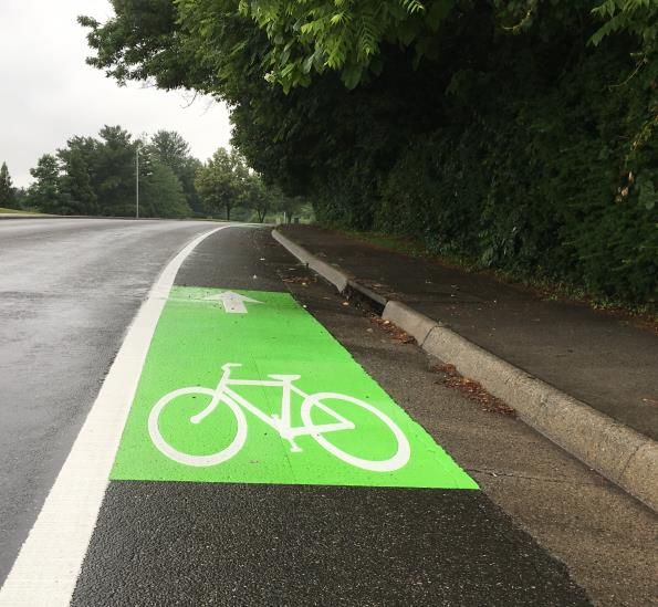
Green bicycle lane on Prices Fork Road

Bicycle facilities include on-street options such as protected bicycle lanes, off-street options such as
trails, intersection treatments such as bike boxes, and markings/signage. While bicycle facilities can
also include bicycle parking and repair stations, bicycle infrastructure primarily refers to bike lanes,
trails, and intersection treatments. Further details on bicycle facilities can be found in Bike Blacksburg,
the Blacksburg Bicycle Master Plan adopted in 2015. Developed through a community led effort with
assistance from the Corridor Committee, Bike Blacksburg provides a detailed plan for comprehensive
improvements to the on-street bicycle network. Implementation of Bike Blacksburg will result in the
development of an integrated network of bicycle facilities and supporting programs, linking
neighborhoods and activity centers throughout the Town. The 2019 Downtown Strategic Plan
reinforced the idea of prioritizing moving people rather than cars and included recommendations for
an enhanced bicycle-pedestrian corridor using Progress Street and Draper Road.

The Corridor Committee also provides strong advocacy for planning and development of off-street
bicycle routes. Addressing both on-street and off-street bicycle infrastructure ensures the
development of a complete network for all cyclists regardless of type of user and level of comfort. For
example, on-street bicycle lanes work well for recreational road cyclists, off-street trails work well for
recreating families, and protected on-street bicycle lanes work well for people commuting to work or
making household trips.

The needs of the bicycle network within the Town exceed current funding. To maximize improvements
to bicycle infrastructure, the Town utilizes a variety of funding sources, which include VDOT Revenue
Sharing, Transportation Alternatives, and allocations of funds or labor through the Town’s Capital
Improvement Program. Projects vary in scale and complexity, from adding on-street facilities during
repaving to completing segments of off-street trail. In 2019, the Town completed a segment of the
Huckleberry Trail connecting to the Jefferson National Forest, a rails-to-trails project that began as a
one mile section in Blacksburg and now stretches 14 miles. The Town also embraces innovative bicycle
infrastructure such as the cycle track, a protected two-way bicycle facility, planned for Eheart Street
and bike boxes to be installed in several locations in 2021.

Comprehensive Plan                                                                      Transportation - 163
April 27, 2021
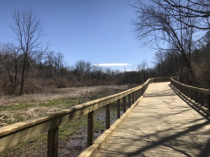
Boardwalk section of the Huckleberry Trail

Bicycle Parking and Amenities
Bicycle parking and related amenities are an essential component that support the bicycle network in
Town. Bicycle parking is required for new development through the Zoning Ordinance. However, lack
of existing bicycle amenities can be a significant barrier to bicycle ridership. For example, cyclists
commuting to work may need secure, weather-protected bicycle parking, a bicycle repair area, and
shower facilities with lockers and changing areas. Recognizing this obstacle, the Town completed the
Downtown Bicycle Parking Study in 2014 to assess existing conditions and provide recommendations
to enhance the safety, convenience, and capacity of bicycle parking in the Downtown. To help increase
ridership, the Town recommends employers provide bicycle parking and shower facilities, particularly
for larger employers. In addition, the Town has received VDOT funding for additional bicycle parking in
the Downtown and at Town parks and facilities. This project is currently underway, with completion
expected in 2021.

To further support an integrated transportation network, Blacksburg Transit buses are equipped to
carry bicycles for passengers. Blacksburg Transit is also working to increase bicycle parking at transit
stops to provide first-mile/last-mile connections.

Bikeshare
The Town is in partnership with Virginia Tech, Christiansburg, and Montgomery County for the regional
Bikeshare program. Bikeshare programs offer bikes for short-term rental and allow users to pick up
and drop off bikes at bikeshare stations. Bikeshare programs have risen in popularity throughout the
country as a method of transportation and to support recreation. The program provides access to
bicycles for community members who may not own a bicycle as well as anyone who desires a
convenient mode to travel in the region. The program promotes bicycle use for commuting, recreation,
and access to services – for residents and visitors alike.

Paths to the Future
The Town of Blacksburg’s Comprehensive Plan Land Use Map Series is a series of four maps A-D, with
maps A-C addressing future land use within the Town. Map D, titled Paths to the Future, illustrates
existing and proposed connectivity in the Town of Blacksburg for non-motorized modes of

Comprehensive Plan                                                                    Transportation - 164
April 27, 2021
transportation. The map depicts the link between transportation and land use. Land use decisions
impact transportation networks and, at the same time, transportation systems can influence nearby
land use patterns. It is very important that these elements are coordinated to create an environment
where people are able to choose any mode of travel to access goods, services, and amenities.
The map shows on-street infrastructure such as bike lanes and cycle tracks, and off-street
infrastructure such as trails, that create a more walkable and bikeable community. The map focuses
on providing future pedestrian and bicycle infrastructure to improve accessibility and mobility
regardless of age or ability throughout Town.
While most proposed infrastructure is shown in specific locations, some areas of Town show proposed
infrastructure such as trails in a more general location to represent broad connectivity through a less
developed area. Specific locations should be identified for these areas as part of planning studies,
Town construction projects, and the development review process. The Town should prioritize
implementation of this map through Town projects and private development to bolster the multimodal
transportation network. Please refer to the Land Use chapter for discussion on the use of the Paths to
the Future map as part of the development review process.
The map incorporates proposed multi-modal infrastructure from multiple Town plans and documents
such as Bike Blacksburg, the Corridor Committee’s sidewalk list, and the Prices Fork Road Safety and
Mobility Study. The Paths to the Future Map is updated periodically to reflect construction of new
infrastructure as well as proposed multi-modal infrastructure from new and updated Town documents
and plans. It is also reviewed when the Comprehensive Plan is updated.
Huckleberry Trail near the Downtown trailhead
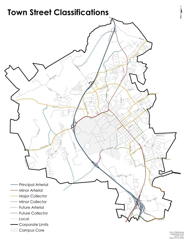
Blacksburg Street Classification System
As of 2021, the Town maintained street network consists of approximately 290 lane miles of local,
collector, and arterial streets. This network does not include roads in the VDOT system such as the U.S.
Route 460 Bypass and streets on the Virginia Tech campus. Lane mileage is determined by the linear
mileage of a roadway segment multiplied by the number of vehicular travel lanes but does not include
turning lanes. All streets within the Town of Blacksburg are assigned a speed limit of 25 miles per hour
Comprehensive Plan Transportation - 165
April 27, 2021unless otherwise posted. Streets are classified into one of the following functional classifications based
on the 2014 FHWA standards: arterial which includes principal and minor arterials, collector which
includes major and minor collectors, and local.
Local streets serve primarily residential and neighborhood traffic and provide direct access to
individual properties. These make up approximately 75% (or 217 lane miles) of the total street
mileage, while carrying a relatively small proportion of the vehicle miles traveled. Speed limits
on these streets in the Town are 25 miles per hour and may be posted as low as 15 miles per
hour in areas with high pedestrian activity or hazardous terrain. Palmer Drive and McBryde
Drive are examples of local streets.
Collector roads include major and minor collector roads. Minor collector roads are typically
characterized by lower speeds and fewer signalized intersections than major collectors.
Collector roads connect the local street system to the arterial roads and, thus, carry a higher
level of traffic than local streets. These roads comprise approximately 14% (or 41 lane miles) of
the Town’s total street mileage. Collector roads may provide direct access to individual
properties; however, they primarily route traffic from neighborhoods to major employment
and commercial centers. Speed limits on these roads range from 25 to 40 miles per hour.
Patrick Henry Drive and Airport Road are examples of collector roads.
Arterial roads include principal arterials defined as interstates, freeways and expressways, as
well as minor arterials. These are major routes for traffic movement within and between urban
areas. One principal arterial, the U.S. Route 460 Bypass, runs through Town but is not included
in the Town’s street network since it is regulated and maintained by VDOT. Minor arterials
make up approximately 11% (or 32.2 lane miles) of the Town’s total street mileage. Speed limits
on these roads range from 25 to 65 miles per hour in Town. Main Street and Prices Fork Road
are Blacksburg’s arterial streets. No primary north-south alternative to Main Street exists, nor
is there currently an east-west alternative to Prices Fork Road.
Comprehensive Plan Transportation - 166
April 27, 2021Comprehensive Plan Transportation - 167 April 27, 2021
Alleys
In Town, public alleys can be found in older neighborhoods where they developed as part of the
historical pattern separating service uses from residences, as well as in newer developments that
intentionally mimic this traditional layout. They provide access to many of the Town’s older homes,
which may be “street locked” due to small lots and no driveways. They also provide secondary, and in
some cases primary, access to garages and utilities in the rear of properties. Most alleys contain public
utility lines, and several provide locations for refuse and recycling pick-up. In some parts of Town,
alleys provide an alternate path for pedestrians and bicycles. Alleys are being rediscovered as
communities seek to keep or expand this important part of the street system, particularly as an
opportunity for non-vehicular modes.

Alleys must be carefully designed and constructed to ensure vehicular traffic remains low speed and
low volume. Heavy commercial use of alleys in residential areas can potentially degrade the nature of
the neighborhood. Policies regarding alley usage, maintenance, and encroachment should be
standardized and enforced (e.g., the 15-mile per hour speed limit) to ensure safety throughout
Blacksburg.

Alleys in Town are generally very narrow, ranging from 7.5 to 15 feet, and often limit two-way travel. If
low speeds are enforced, alleys can function as a type of shared streets, allowing for one-directional
vehicular traffic as well as two-directional non-vehicular traffic. Some alleys are paved while others
remain unimproved. The Town receives no maintenance funding for alleys from the state; thus they
are inevitably a lower priority and not maintained or maintained to a lesser level than streets.

Unbuilt Streets
Before Blacksburg had a subdivision ordinance, a number of subdivisions were developed in which
streets were platted but never built. The right-of-way for these streets was dedicated to the Town
through the recordation of a plat. Most of these streets have never been constructed and appear as
extensions of yards or overgrown areas. These "paper streets" vary significantly in width. Future
construction of these rights-of-way may enhance the transportation grid for multiple modes of travel.

Alley and Right-of-Way Vacation
Requests to vacate right-of-way have historically served only the individual property owner’s interests
and have removed rights-of-way from the Town’s system so that the alley can no longer be accessed
by the public or used for any future project. Before any alley or unbuilt right-of-way is vacated, the
future implications on mobility should be carefully evaluated. Alleys and public rights-of-way are
essential to the Town’s transportation network and should be retained whenever possible. The Alley
and Right-of-Way Vacation Policy process can be found in the Blacksburg Administrative Manual.

Private Streets
In Town, there are private driveways that function like streets in both residential and commercial
areas. This development of private driveways has been used to avoid constructing access ways to the
Town’s public street standards. When private driveways are constructed as streets, sidewalks are not
built, parking can be accessed directly from the driveway, and maintenance is not provided by the
Town. These issues create confusing expectations for the public since the driveway functions the same

Comprehensive Plan                                                                     Transportation - 168
April 27, 2021
as a public street without the same level of amenities. Since this is not preferable for street
construction, the Town should update related policies and regulations to prevent this practice moving
forward.

Road Maintenance
Roadway conditions are generally good within Town and are supported by regular maintenance and
paving schedules. Maintenance of public roads, including repairing pot holes or repaving streets, is
coordinated by the Blacksburg Public Works Department. However, VDOT provides funds for the
maintenance of public roads utilizing a statewide formula based upon road classification and number
of miles of road. The Town also puts funds toward the regular paving and maintenance program and,
while robust, the program cannot meet the desired level of maintenance on a yearly basis for
roadways within the Town. In addition to paving and repair, the Town Public Works Department also
performs maintenance on tree and vegetation encroachments and median plantings as well as
providing snow removal services on Town streets. The Town prioritizes a high level of roadway
maintenance and provides a service where community members can report potholes or overgrown
vegetation to the Public Works Department for action.

Traffic Committee
The Town Manager appoints a Traffic Committee to consider and make recommendations to the Town
Manager’s office on issues relating to traffic safety and parking, such as street lighting and speed limits.
The Traffic Committee promotes better compliance with the traffic laws in order to provide safer
streets for pedestrians, cyclists, children, and the elderly. The committee consists of representatives
from the Police, Public Works, Transit, Planning and Building, Engineering and GIS departments,
Blacksburg Volunteer Fire Department, Blacksburg Volunteer Rescue Department, as well as
community members. Complaints, concerns, and suggestions relating to traffic, parking, or pedestrian
and cyclist safety are forwarded to this committee monthly for review. Recommendations, which can
include minor road improvements or upgrades, are funded through the Town’s Capital Improvement
Plan.

VEHICULAR PARKING
Parking facilities serve as support to the vehicular mode of Blacksburg's transportation system. Parking
areas should be attractively constructed, safely accessible, and connected to the broader
transportation network. Parking areas should be carefully designed and located in a manner that
respects surrounding uses and sense of place. The Town strives to reduce surface parking lots as they
are a non-vibrant, inefficient land use with significant environmental impacts. Most existing parking
areas in Town are surface lots. However, the Town anticipates growth in the construction of
structured parking, such as parking garages, in the future, particularly near high volume destinations.

Campus Parking
Virginia Tech sells parking permits to students, faculty, and staff but does not guarantee availability in
specific locations. The Virginia Tech Alternative Transportation Office promotes and encourages
bicycling, walking, vanpooling, carpooling, car sharing, and transit use for local, regional, and out of
state travel. The University completed an update to the Parking and Transportation Master Plan in
2016 which recommends strategies to enhance mobility while preserving campus character.

Comprehensive Plan                                                                       Transportation - 169
April 27, 2021
Recommendations from the Plan include efficient use of parking resources paired with new roadway
connections, increased transit service, and improved pedestrian and bicycle routes. As existing parking
resources are shifted away from the campus core, parking demand may spillover into adjacent
neighborhoods within Town. The Town recently expanded the permit parking program to reduce
spillover in neighborhoods adjacent to the University. The Town should continue to evaluate areas
where permit parking may be appropriate to ensure access to neighborhoods for residents and guests.
The Town supports strategies to encourage transit ridership, increased walkability, and enhanced
bicycle routes on campus. Other measures, such as restricting students from having cars during their
first year, would help address parking conflicts as well as reduce vehicle trips within Town.
Downtown Parking
Adequacy of parking in Downtown is a long-standing community concern. Downtown Blacksburg is an
urban area that intentionally emphasizes pedestrian activity and vibrant gathering places, making it
unlikely that vehicular parking will ever be available directly in front of desired destinations. There is
limited availability of parking in the downtown core and limited opportunities to provide new parking.
Another issue in evaluating the adequacy of Downtown parking is the perceived convenience, typically
visual distance, of available parking from the intended destination. Strategies to address this
perception include improved parking signage, technology providing real-time availability, and
education around convenient parking locations. For example, the Kent Square parking garage is
located less than 1/10th mile from Market Square Park in the heart of Downtown.
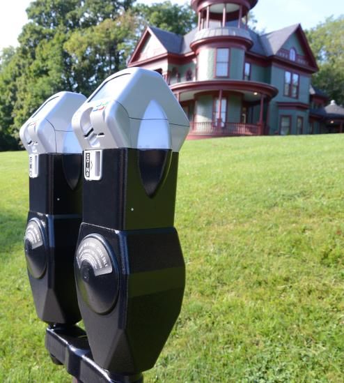
Downtown parking meters
The Town continually works on parking management and has implemented multiple strategies to
address community concerns including maintaining updated parking information, which can be found
at www.blacksburg.gov/parking. The Town has implemented new parking technology to minimize the
historical problem of “meter-feeding” by students and Downtown business employees. To address the
overall parking needs in the Downtown core, the Town acquired a surface parking lot between Main
Street and Progress Street in 2012. The Town is currently planning for a future parking garage in this
location. A parking garage is also planned as part of the new public safety building in the Midtown
Development and construction is expected to begin in 2021.
Comprehensive Plan Transportation - 170
April 27, 2021In addition to the Kent Square parking garage serving the eastern end of Downtown, the Turner Street
parking garage serves parking needs at the western end of Downtown. The Town supports the
construction of a University parking garage where campus meets the Downtown, to maintain vibrancy
along College Avenue and enhance the interface between the campus and Town. Parking garages
constructed in the Downtown area should be designed to minimize their visual impact on the
landscape and be connected to the Town’s transportation network.
TRANSIT
Local and regional public transit options are an important component of the transportation network.
Blacksburg Transit provides local transit service and is essential to Blacksburg’s network. Through
connections to regional public transportation systems, Blacksburg residents can also travel in the
New River Valley, to Roanoke and beyond.
Blacksburg Transit
Blacksburg Transit (BT), a department of the Town of Blacksburg, operates public transportation
services in the Town and on the Virginia Tech campus as well as in Christiansburg and portions of
Montgomery County. From 2018 to 2019, ridership reached an all-time high of 4.6 million total
passenger trips. While use of the transit system is open to the general public, riders are predominantly
students at 90% with the other 10% being comprised of University faculty and staff and the general
public.
BT operates 19 fixed routes, where buses follow a standard route servicing specific stops on a regular
schedule, and two demand response services, where passengers call to schedule trips. BT serves over
300 bus stops that are spread across 28 square miles. Blacksburg Transit’s fully-accessible fleet is
comprised of 71 vehicles; this includes 53 fixed-route buses, 13 of which are 60-foot articulated buses
as well as 18 vans. In 2020, BT purchased 5 battery electric buses as part of an initial step towards an
all-electric, sustainable fleet.
Blacksburg Transit electric bus charging
Comprehensive Plan Transportation - 171
April 27, 2021BT has 58 bus shelters with bench seating and interior lighting at bus stops including 34 in Blacksburg,
16 on the Virginia Tech campus, and 8 in Christiansburg. Eighteen have solar-powered interior lighting.
Of the total, 20 shelters are maintained by the apartment complexes that installed them. BT generally
places shelters at bus stops with high average daily boardings, where wait times may be longer on less
frequent routes, or in conjunction with private developers who want to offer a shelter as an additional
amenity for their residents. Like other public infrastructure such as storm drains and utility boxes, bus
shelters may be an opportunity for creative design and public art in certain locations. Other amenities,
such as concrete standing pads, benches, bike racks, and trash cans are provided at many BT-
maintained sheltered stops and at other selected stops.
Between 2016 and 2019, ridership grew by 33% while most public transportation systems experienced
significant decreases in ridership. BT actively planned for this growth by adding large articulated buses
to the fleet, offering more frequent service on heavily used routes, adding Sunday service, and
expanding off-peak service.
The Town offers a bus pass program that allows employees to ride fare-free as a way to reduce car-
dependency. The Town supports other employers providing this incentive for their employees.
Awards
In 2019, BT was awarded the American Public Transportation Association’s (APTA) Outstanding Transit
System award for North America. Blacksburg Transit earned the award in the small urban system
category. The award recognized BT as the “best of the best” for excelling in overall performance as an
organization and the benefit to the community. BT was also recognized with two APTA Adwheel Grand
Awards for advertising campaigns and numerous Virginia Transit Association awards.
Blacksburg Transit buses wrapped with new logos
BT ACCESS
BT ACCESS is a paratransit demand response service that bolsters fixed route bus service in Blacksburg.
The service is available for people who are unable to independently access or use the fixed route
system either all of the time, temporarily, or under certain circumstances. Certified passengers can
make reservations for door-to-door service within town limits during the same days and hours that
Comprehensive Plan Transportation - 172
April 27, 2021fixed route buses are in service. BT ACCESS provides over 15,000 passenger trips annually. Regional Public Transportation Services BT also provides public transportation in neighboring Christiansburg with demand response service, a commuter route that connects the towns, and two deviated-fixed routes that follow a specific route but may deviate from it upon passenger request. Regional connections to other parts of the New River Valley, Roanoke, and locations elsewhere in the state are offered by several service providers including Radford Transit, Pulaski Area Transit, New River Valley Senior Services, Community Transit, the SmartWay, the Virginia Breeze, Virginia Tech, and private bus companies. Blacksburg Transit is actively involved with these regional transportation providers to share stops, streamline connections, and expand transportation options for residents. Blacksburg Transit’s Future Blacksburg Transit is guided by a Transit Development Plan that provides a vision and recommendations to meet demand over the next ten years. Additionally, BT is supported by other planning efforts facilitated by the New River Valley Metropolitan Planning Organization (NRV MPO) and Virginia Tech, such as the NRV MPO’s Long Range Transportation Plan. Decisions about service and infrastructure improvements are informed by a robust data collection and analysis program, stakeholder input, public comments, and funding availability. Major initiatives are described below. Service Enhancements The demand for service continues to increase, including requests to expand BT’s service area, as well as requests to increase capacity with larger vehicles. BT has launched two new routes serving non- traditional ridership areas, Givens Lane and Airport Acres, and is exploring demand response service for other lower density neighborhoods that are beyond walking distance to fixed routes. BT also plans to increase capacity to service apartment complexes that are being redeveloped at higher densities. Multi-Modal Transit Facility A Multi-Modal Transit Facility is being constructed by the Town in the vicinity of Perry Street on the campus of Virginia Tech. The facility will include 17 bus bays on two loops (east and west) along with a 13,500 square foot building with a passenger waiting area, space for transit support services and the Hokie Bike Hub for bicycle maintenance and education. The site will also incorporate other site amenities to enhance pedestrian and bicycle movements. This major transit center will improve the Conceptual Plan for Multi-Modal Transit Facility safety and efficiency of transit operations as Comprehensive Plan Transportation - 173 April 27, 2021
well as will serve the transportation needs of the Blacksburg community and regional public
transportation providers. The project is designed for LEED Silver certification (see Public Safety &
Community Facilities chapter) and construction will be completed in 2023.

Electric Buses
BT plans to replace heavy-duty diesel buses with electric buses as diesel buses age and reach the end
of their service life, and as funds become available. Based on the current replacement schedule, a
completely electric fleet is achievable by 2032.

Facility Renovation and Expansion
The existing transit facility has significant space constraints and the building is aging. It was
constructed in 1992 and expanded in 2006. Since the expansion, Blacksburg Transit’s ridership has
increased by 61%, service has increased by nearly 50%, the fleet has expanded by 121%, and staff has
grown by 71%. The result is crowded and increasingly inefficient space, with more growth anticipated.
A facility renovation and expansion project is in the design phase and will include construction
associated with replacement, upgrade, and expansion of the building and site.

Passenger Amenities and Technology
Each year BT updates signage, adjusts stop locations and, when necessary, consolidates closely
grouped stops. Future improvement plans include upgrading existing bus stops with bus pull-offs to
enhance safety, adding stop amenities such as bike racks, and replacing shelters. BT will also continue
to improve the existing suite of rider information tools to provide users with real-time information
using a smartphone app, web browser, text messaging, and an interactive phone service. To remain
up-to-date, BT is an active participant in research studies and follows the latest advancements and
developments in public transportation.

The SmartWay Commuter Bus
The SmartWay Commuter Bus is a service operated by Valley Metro of Roanoke that links the Roanoke
Valley to the New River Valley. Service is provided between downtown Roanoke and the Virginia Tech
Squires Student Center with stops in downtown Blacksburg, the Corporate Research Center,
Christiansburg, the Roanoke-Blacksburg Regional Airport, Virginia Tech/Carilion Research Institute, and
several Park & Ride areas along the route. Blacksburg Transit provides connecting service to and from
SmartWay Bus stops in Blacksburg.

Long Distance Bus Service
Strong community interest has facilitated the provision of multiple transit options for long distance
travel, particularly to Richmond and Washington, D.C. The Virginia Breeze provides bus service
connecting Blacksburg with Washington, D.C., on a daily basis. The Breeze also includes stops in
several locations including Harrisonburg (James Madison University) and the Dulles International
Airport. For Greyhound service, Roanoke, VA, is the closest location with connecting service via the
Smart Way Commuter Bus. In addition, Virginia Tech offers a Blacksburg/Roanoke to Ballston/Arlington
bus to connect the Blacksburg Campus with the National Capital Region Campus. Multiple private
companies also provide students with holiday and weekend bus service to in-state and popular metro
areas.

Comprehensive Plan                                                                   Transportation - 174
April 27, 2021
TRANSPORTATION PARTNERS, PLANNING, AND FUNDING
The Town partners with other localities, regional organizations, and state agencies for planning,
funding, and construction of transportation projects which are further described below. The costs for
these projects can vary widely, and while the Town funds some smaller projects, the majority of
projects are dependent on outside funding sources.

State-Wide Transportation Planning
To meet federal requirements, states are required to develop a state-wide transportation
improvement program that provides for development, management and operation of the multimodal
transportation system and facilities. Virginia’s plan, VTrans, lays out the vision and goals for
transportation, identifies investment priorities, and provides direction on implementation strategies
and programs. The current plan, VTrans 2040, was completed in 2018 and includes a vision plan, needs
assessment, and freight plan. The Town participates in the process through the Metropolitan Planning
Organization and input from localities is consolidated through the regional transportation
organizations.

Virginia Department of Transportation
The Town of Blacksburg is located within VDOT’s Salem District. The Salem District maintains more
than 9,200 miles of specific roads in a 12-county area in southwestern Virginia including 14 cities and
towns in its boundaries. The district serves more than 650,000 residents who live in this area.

Transportation Funding
Various funding sources exist for multimodal transportation projects within the VDOT administered
system. The primary funding programs are: Smart Scale, Highway Safety Programs, Transportation
Alternatives, Revenue Sharing, and State of Good Repair. These programs have different purposes,
funding allocations and breakdowns, eligibility requirements, evaluation criteria, and funding cycles.
The Town competes for these funding sources with localities across the state. Some of these programs
prioritize funding for projects based on traffic congestion, which is more common in more urbanized
areas.

Establishing Road and Transportation Project Priorities
As required by Virginia Code § 15.2-2223, the Town establishes its long-range transportation policies
and projects, including cost estimates in the Comprehensive Plan. These policies and project priorities
are forwarded to the New River Valley Metropolitan Planning Organization, which coordinates and
prioritizes the long range transportation policies of the region as detailed below. Blacksburg’s
priorities are detailed later in this chapter.

New River Valley Metropolitan Planning Organization
The NRV MPO is a transportation policy-making organization serving the towns of Blacksburg and
Christiansburg and the City of Radford, as well as surrounding urbanized portions of Montgomery and
Pulaski Counties. The NRV MPO provides the information, tools, and public input necessary to improve
the performance of the transportation system in the region. The Town and NRV MPO also coordinate
with the regional transportation planning efforts conducted by the New River Valley Regional
Commission, such as the NRV’s Bikeway, Walkway, Blueway Plan.

Comprehensive Plan                                                                   Transportation - 175
April 27, 2021
New River Valley MPO 2045 Long Range Transportation Plan (2045 Plan)
Adopted in November 2020, the 2045 Plan describes a comprehensive set of transportation
improvements for the NRV MPO area. The goals and scope of the 2045 Plan are the same as the goals
of VTrans 2040 (the State’s Transportation Plan) addressing the following transportation issues and
needs:
1. Economic Competitiveness and Prosperity
2. Accessible and Connected Places
3. Safety for All Users
4. Proactive System Management
5. Healthy Communities and Sustainable Transportation Communities
The Plan was developed in accordance with federal, state, and local requirements for an MPO Plan.
These included early and ongoing public involvement, extensive coordination with local governments
to ensure that local goals and objectives were reflected in the Plan recommendations, a 20-plus year
horizon for Plan recommendations, and consideration of anticipated transportation funding.
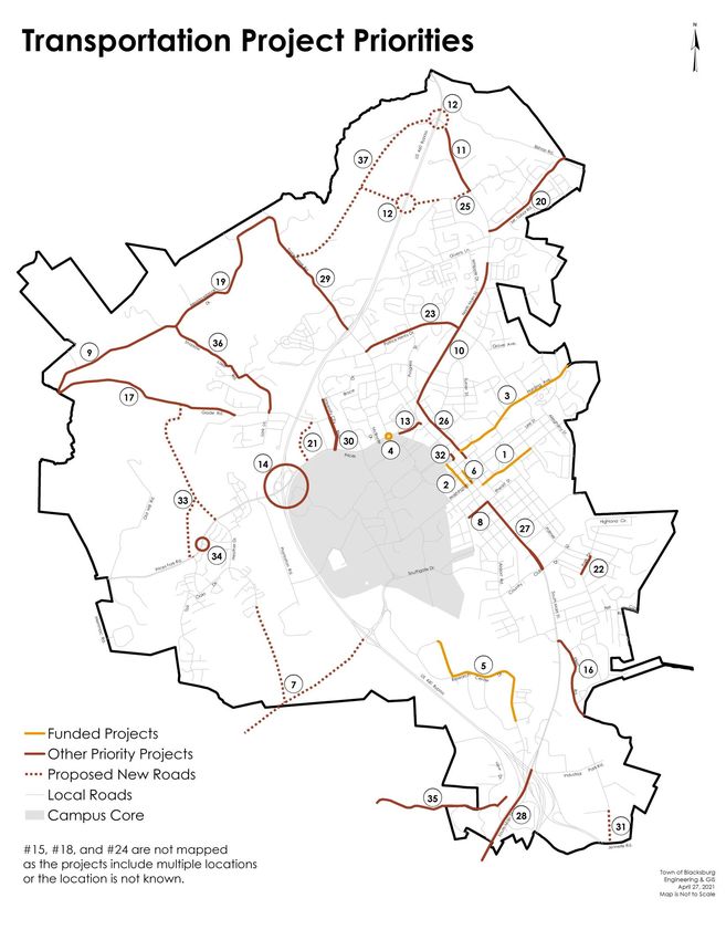
Transportation Project Priorities & Cost Estimates
The Virginia State Code Section 15.2-2223 requires comprehensive plans to “include a map that shall
show road and transportation improvements, including the cost estimates of such road and
transportation improvements from the Virginia Department of Transportation, taking into account the
current and future needs of residents in the locality while considering the current and future needs of
the planning district within which the locality is situated.” The following table and map address this
requirement with project cost estimates as of 2021. Cost estimates will need to be adjusted
accordingly prior to construction for inflation and fluctuating prices in material costs and labor and any
revisions to the scope of work. The numbering system in the following table correspond to the
locations shown on the map but does not indicate order of importance within a priority category.
Comprehensive Plan Transportation - 176
April 27, 2021Transportation Projects – Funding in Place/In Progress
1. Clay Street Sidewalk from Church Street to Jefferson Street to include sidewalk and roadway
improvements. $1.3 million
2. Draper Road Improvements from College Avenue to Miller Street to include streetscape
improvements. Schematic Design is underway. $5 million
3. Harding Avenue Improvements between Progress Street and the corporate limits to focus on
bicycle and pedestrian infrastructure as well as storm drainage. $3 million
4. Prices Fork Road/Toms Creek Road/Stanger Street Intersection Improvements to include
pedestrian and bicycle infrastructure. Construction currently underway.
5. Research Center Drive Improvements from S. Knollwood to VT Campus line. $1.4 million
6. South Main Street Improvements from Roanoke Street to Washington Street streetscape
improvements to include widened brick sidewalks, streetlights, signals and streetscape to
match Downtown. $780,000
High Priority Projects
7. Cross County Connector Extension - Connecting with Southgate Interchange as 4-lane
boulevard with median, bicycle routes/trails, sidewalks and grade-separated interchanges
with the Huckleberry Trail crossings; extending to Prices Fork Road to improve access to
Hethwood, Merrimac, and Warm Hearth areas. Detailed Routing Study is needed as the first
step towards this regional project with Montgomery County. $114 million
8. Eheart Street Improvements from Main Street to the Huckleberry trail to include bicycle and
pedestrian infrastructure. Interim $30,000; Final $750,000
9. Meadowbrook Drive Trail from Heritage Park parking area to Glade Road. $1.9 million
10. North Main Street Road Diet from Progress Street to Red Maple Drive to include bicycle and
pedestrian infrastructure. Paint only $80,000; Full rebuild $25 million
11. North Main Street Trail from Vinyard Avenue to U.S. 460/Bishop Road connection. Final
phase. $750,000
12. North Main Street/US Route 460 Grade-Separated Interchange – Specific project location to
be determined. $45 million
13. Prices Fork Road Pedestrian Improvements from Turner Street to N. Main Street. $2 million
14. Prices Fork Road/US Route 460 Bypass Interchange Modification to include bicycle and
pedestrian infrastructure. $20 million
Medium Priority Projects
15. *16 Squares Infill Sidewalk - Specific projects to be determined. No cost estimate.
16. Ellett Road Improvements from South Main to Town limits with safety improvements, bicycle
and pedestrian infrastructure. $5.9 million
17. Glade Road Improvements from Boxwood Drive to Meadowbrook Drive to include safety
improvements, bicycle and pedestrian infrastructure. $1.7 million
18. *Industrial Park Trail – Design and construction of an interconnected trail system for the
Blacksburg Industrial Park to accommodate recreational and commuter bicycle and
pedestrian travel. $609,000
19. Meadowbrook Drive Improvements from Toms Creek Road to Glade Road to include safety
improvements, bicycle and pedestrian infrastructure. $3.9 million
Comprehensive Plan Transportation - 177
April 27, 2021You can also read