Greater Hume Local Strategic Planning Statement
←
→
Page content transcription
If your browser does not render page correctly, please read the page content below

Greater Hume
Local Strategic Planning Statement

                                     greaterhume.nsw.gov.au
Local Strategic Planning Statement (LSPS)

  What is LSPS?                              Councils will show how their vision        Visit
                                             gives effect to the regional or district   www.planning.nsw.gov.
  In March 2018, amendments to the           plan, based on local characteristics       au/Policyand-Legislation/
  Environmental Planning and                 and opportunities, and the council’s       Environmental-Planning-
  Assessment Act 1979 (EP&A Act)             own priorities in the community            andAssessment-Act-updated for
  introduced new requirements for            strategic plan it prepares under local     more information on local strategic
  councils to prepare and make local         government legislation.                    planning statements and other
  strategic planning statements.                                                        planning legislation updates.
                                             Informed by the strategic and
  Local strategic planning statements        community planning work undertaken
  (LSPS) will set out:                       across regions, districts and local
  • the 20-year vision for land use in the   government areas, the LSPS will be
  local area                                 the key resource to understand how
  • the special characteristics which        strategic and statutory plans will be
  contribute to local identity               implemented at the local level.
  • shared community values to be
  maintained and enhanced
  • how growth and change will be
  managed into the future.
Forward

To develop a vision for land use for the next 20 years the      “Live a Greater Life” is the stated goal of Council
Greater Hume Local Strategic Planning Statement (the            community strategic plan and Council is committed
document) considers land use trends that are currently          to that goals realization and it sees land use planning
occurring within the shire and anticipates others that will     as a means to protects Greater Hume most important
likely emerge.                                                  assets whilst planning for the future to provide lifestyle
                                                                and employment opportunities so that the vitality of our
The continued importance of agriculture is acknowledged         communities is enhanced
and planning actions are within this document to ensure
its ongoing viability. However change in some form will
likely occur within our agricultural land as large scale        Mayor, Cr Heather Wilton
solar farms are currently being proposed and other
development such as more intensive agriculture very
likely to be developed.

Currently Greater Shire is enjoying popularity as a lifestyle
option with many new residents choosing to come and
build their home having identified that Greater Hume can
best meet their needs. This document looks to expand
upon this trend and analyses what will be needed to
further enhance the popularity of Greater Hume whilst
minimising risks to new residents posed by bushfire,
flooding and other potential hazards.

Council is looking for opportunities to increase the ability
for people to find employment within Greater Hume. It is
shown within this document that industrial development
which could include value adding agricultural industries
are possible sources of employment opportunities and
planning actions are provided for both.

Greater Hume Council Local Strategic Planning Statement
                                                                                                                             greaterhume.nsw.gov.au 3
Acknowledgement of Country

In preparation of this statement, Council acknowledges the traditional lands of the Wiradjuri people, and pay my respect to elders both past, present and emerging.

Greater Hume Council Local Strategic Planning Statement
                                                                                                                                                                      4
About this statement                                         Purpose of this Statement

This Local Strategic Planning Statement (LSPS) sets          Greater Hume’s population is projected to increase            strategic priorities identified at a regional, and the finer-
the land use framework for Greater Hume Council’s            (from 10,686) to 11,765 people by 2036. To manage this        grained planning at a local level expressed in council’s
economic, social and environmental land use needs            growth and build capacity in our townships and rural          local environmental plan and development control plans,
over the next 20 years. It addresses the planning and        communities, the Greater Hume Local Strategic Planning        to ensure consistency in strategic planning approaches.
development issues of strategic significance to the          Statement sets 20-year plan integrating land use,             See Figure 1.
Council through planning priorities and actions, spatial     transport and infrastructure planning, that aligns with the
land use direction and guidance.                             Directions set out in the Riverina Murray Regional Plan       The link or line-of-sight between Council’s Planning
                                                             2036.                                                         Priorities and the Riverina Murray Regional Plan 2036 and
The LSPS gives effect to the Riverina Murray Regional                                                                      other regional and state strategic planning instruments
Plan 2036 implementing the directions and actions at         All councils within NSW are required to prepare a local       (Albury Regional Economic Development Strategies) is
a local level. It is also informed by other State-wide and   strategic planning statement to act as a link between the     illustrated in Table 1 on the following pages.
regional policies including Future Transport Plan 2056
and the NSW State Infrastructure Strategy 2018 – 2038.

The LSPS works with Council’s Community Strategic
Plan (CSP), which has a similar but broader purpose
on how Council will through land use planning meet
the community’s needs. The planning priorities and
actions contained in the LSPS provide the rationale for
decisions about how we will use our land to achieve
the community’s broader goals and what updates are
required to the Local Environmental Plan (LEP) and
Development Control Plan (DCP).

This work will also inform future iterations of Council’s
Operational Plan and will be integral element of the
Integrated Planning and Reporting Framework.

Greater Hume Council Local Strategic Planning Statement
                                                                                                                                                                  greaterhume.nsw.gov.au 5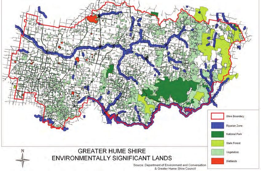
Policy Context                                                  Monitoring and reporting

This Statement has been prepared in accordance                  This LSPS describes the long-term land use strategy for the        may have on the plans of neighbouring communities. These
with section 3.9 of the Environmental Planning and              Greater Hume LGA to 2040. This statement is intended to            valued cross boundary partnerships will also help deliver
Assessment Act 1979 (the Act) which requires that it            be a living document and should be revised on an ongoing,          Greater Hume’s vision by driving efficiencies in accessing
include or identify the following:                              as-needs-basis so that the plan remains responsive, relevant       government funding, attracting inward investment and
                                                                and local. To this end, it is intended that the statement          accessing a wider field of expertise.
1.   the basis for strategic planning in the area, having       will be updated upon completion of the various actions
     regard to economic, social and environmental               identified throughout the document. Revisions to the LSPS          Funding & Investment
     matters,                                                   may also be required in response to significant changes            Strategies and studies required by this statement will
2.   the planning priorities for the area that are consistent   within the LGA, such as new infrastructure investment              primarily be funded in future 4-year delivery programs and
     with any strategic plan applying to the area and           and employment opportunities or significant changes in             annual operational plans of Council, although availability
     (subject to any such strategic plan) any applicable        projected population growth.                                       of funding via the Regional Growth fund and other state
     community strategic plan under section 402 of the                                                                             agency opportunities will also be explored.
     Local Government Act 1993,                                 Council will monitor and report on progress of the LSPS
3.   the actions required for achieving those planning          priorities, actions and outcomes in an annual report. This         Monitoring & Reporting
     priorities,                                                will inform adjustments to the LSPS to ensure local plan-          Council will monitor, review and report on its LSPS to ensure
4.   the basis on which the council is to monitor and           ning policy is effective, responsive and delivering on local       that its planning priorities are being achieved, using the
     report on the implementation of those actions.             community aspirations. A comprehensive review will be              existing Integrated Planning & Reporting framework (IP&R)
                                                                undertaken in 2026, if not earlier.                                in accordance with the Local Government Act 1993.

Consultation                                                    Community feedback will be regularly sought. It is
                                                                anticipated that this consultation will identify continuous
Council prepared this Statement by building upon                improvement opportunities and will ensure that the LSPS
the results of extensive engagement undertaken in               continues to reflect the community’s social and economic
developing Council’s Community Strategic Plan, during           needs as well as their vision of the future desired state of the
2017-2018, including community feedback regarding               local area.
what residents most like and dislike about Greater
Hume, and what residents would like to see retained and         There will be a need to collaborate with other councils
changed.                                                        in the region due to the wider role that Greater Hume’s
                                                                strategic planning and decision-making plays in achieving
Workshops were held with Councillors in mid - 2019 to           the objectives of the Riverina Murray Regional Plan 2036
confirm the values and planning direction for Greater           and the Albury Regional Economic Development Strategy as
Hume articulated in Council’s current strategic plans.          outlined in the table below. It also recognises the potential
                                                                impact that strategically important decisions regarding
                                                                critical infrastructure, environmental issues, housing,
                                                                investment and a range of other topics covered in the LSPS

Greater Hume Council Local Strategic Planning Statement
                                                                                                                                                                                                6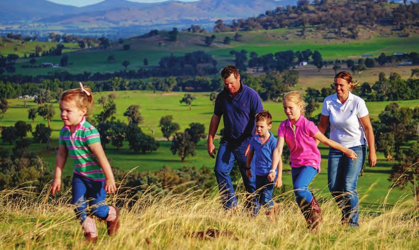
Table 1

                                                 Liveability                                                      Productivity                                              Environment and Resources

 LSPS Priority                                                                                                                                                                                        Climate Change
                                                                          Utility                                 Agribusiness-                                                      Natural
                        Housing Choice         Vibrant Places                            Agricultural Lands                             Industry        Solar and Forestry                              and Natural
                                                                     Infrastructure                                 Value Ad                                                       Environment
                                                                                                                                                                                                          Hazards
 Riverina Murray       Direction 23:         Direction 4:          Direction 23:         Direction 1:           Direction 2:       Direction 9:         Direction 9:            Direction 15:        Direction 16:
 Regional Plan         Build resilience in   Promote business      Build resilience in   Protect the region’s   Promote and grow   Support the          Support the             Protect and          Increase resilience
 Directions            towns and villages    activities in         towns and villages    diverse productive     the agribusiness   forestry industry    forestry industry       manage the           to natural hazards
                                             industrial and                              agricultural land      sector                                                          region’s many        and climate
                                             commercial areas                                                                                                                   environmental        change
                                                                                                                                                                                assets
                       Direction 25:         Direction 7:                                                                          Direction 4:         Direction 11:
                       Build housing         Promote tourism                                                                       Promote business     Promote the
                       capacity to meet      opportunities                                                                         activities in        diversification of
                       demand                                                                                                      industrial and       energy supplies
                                                                                                                                   commercial areas     through renewable
                                                                                                                                                        energy generation
                       Direction 27:         Direction 23:                                                                         Direction 9:
                       Manage rural          Build resilience in                                                                   Support the
                       residential           towns and villages                                                                    forestry industry
                       development
                                             Direction 28:
                                             Deliver healthy
                                             built environments
                                             and improved
                                             urban design
 Albury Regional       Attract and retain    Attract and retain    Attract and retain                           Support and grow   Grow the Transport   Support and grow
 Economic              talent to sustain     talent to sustain     talent to sustain                            Agribusiness       and Logistics        Agribusiness
 Development           the supply of         the supply of         the supply of                                and Softwoods      sector               and Softwoods
 Strategy 2018 -       skilled workers       skilled workers       skilled workers                              industries                              industries
 2022                  by improving          by improving          by improving                                 throughout the                          throughout the
                       liveability           liveability           liveability                                  region                                  region
                       throughout the        throughout the        throughout the
                       region                region                region
                                             Continue to
                                             develop and grow
                                             the Tourism sector
                                             and the visitor
                                             economy

Greater Hume Council Local Strategic Planning Statement
                                                                                                                                                                                                 greaterhume.nsw.gov.au 7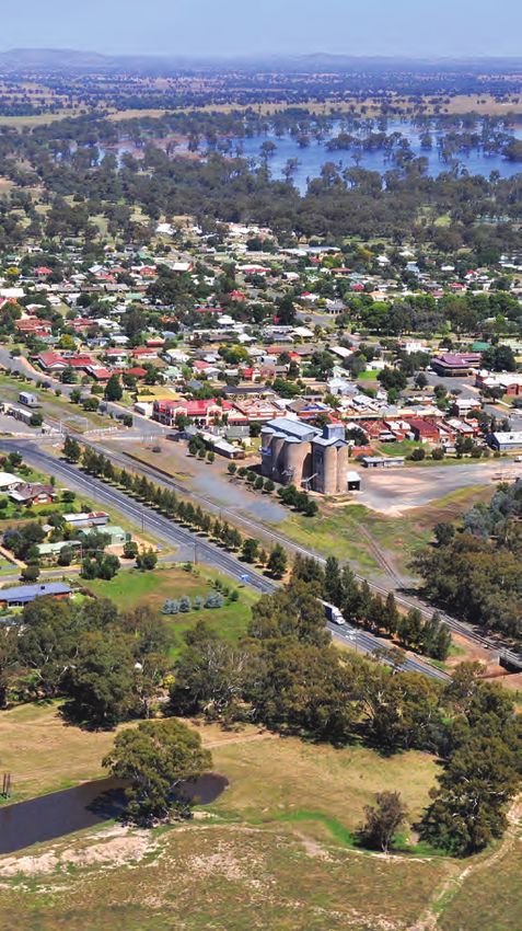
Our place in the Riverina Murray Region

                                                                                       Greater Hume Shire is located in southern New South
                                                                                       Wales, bordering with Victoria and the local government
                                                                                       areas of Wagga Wagga, Albury, Federation, Lockhart, and
                                                                                       Snowy Valleys Councils. It is approximately 110km from
                                                                                       east to west and 60km north to south and ideally linked by
                                                                                       highways to Canberra, Sydney and Melbourne. The Main
                                                                                       Southern Railway Line traverses the shire, with proximity
                                                                                       to the Ettamogah Rail Hub and regional airports nearby at
                                                                                       Albury and Wagga Wagga.

                                                                                       Due to its location there are continued opportunities
                                                                                       to grow the population of Greater Hume as the Albury,
                                                                                       Wodonga and Wagga Wagga local government areas
                                                                                       (LGA’s) have a major influence through employment
                                                                                       and access to higher level goods and services. There
                                                                                       are growing numbers of residents who work in Albury,
                                                                                       Wodonga or Wagga Wagga that have chosen the
                                                                                       affordable rural and community lifestyle offered by
                                                                                       Greater Hume.

                                                          Figure: Greater Hume’s relationship to the region.
                                                          Source: Riverina Murray Regional Plan 2036

Greater Hume Council Local Strategic Planning Statement
                                                                                                                                                8
Our community

 The population of the Greater Hume is expected to            The proximity to these cities allows the Greater
 reach 11,765 by 20361 which represents an increase of        Hume community to gain employment in a variety
 1,079 people from 2018. Proximity to jobs and higher-        of professional jobs, with 48% of our workforce
 level services in Albury, Wodonga and Wagga Wagga is         employed as managers, professionals or clerical and
 a key driver of this ongoing growth, with new residents      administration workers. The growing populations
 attracted to the rural lifestyle, basic services and large   of the regional cities and Greater Hume have also
 residential allotments on offer in the Greater Hume’s        provided opportunity for the construction industry
 towns and villages.                                          which accounts for a third of our workforce.

 Our population is dispersed across five towns and six
 villages. However many peple live and work in our rural
 areas where 32.8% of the workforce is employed.

 Our communities are ageing and by 2036, 27 per
 cent of our forecasted population in Greater Hume
 will be aged over 65 years, representing an increase
 of 46 per cent from 2016. There is also an increasing
 number of families without children in the area (44.1%
 of the family compositions an increase from 42.6% in
 2011). This change in the population demographic will
 continue to increase the importance of the health care
 and social assistance sector in Greater Hume, with
 employment in the sector rising since 2011.

 The proximity to Albury and Wagga Wagga also
 provides employment opportunities for a large portion
 of our working population (30% of the workforce is
 employed in Albury, Wodonga and 2% in Wagga
 Wagga).

Greater Hume Council Local Strategic Planning Statement
                                                                                                greaterhume.nsw.gov.au 9
Our community

       Population now                                          Population aged 65           Females
          10,357                                                   and over                  5,170
                                              Median Age            19.9 %
       Population 2036                           44                 At 2036                  Males
          11,765                                                      27%                    5,187

          Family          Lone Person    Couples with children                           Couples without
       Households         Households         households                                children households
   Greater Hume 72.5% Greater Hume 25.6% Greater Hume 42.4%                            Greater Hume 44%
        NSW 72%           NSW 23.8%          NSW 45.7%                                      NSW 36.6%

       One parent
                                         Average household
         famiies                                                     4,753                    2,354
                                                size
   Greater Hume 12.9%                                             people in the        people live and work
                                         Greater Hume 2.5
        NSW 16%                                                    workforce             in Greater Hume
                                              NSW 2.6

            1,393                                 768
      residents work in                       workers live            1,121                    260
         AlburyCity                            in Albury       people employed in       people employed
             104                                   77           the Greater Hume       in health and social
      residents work in                      workers live in   agricultural industry        assistance
       Wagga Wagga                           Wagga Wagga

Greater Hume Council Local Strategic Planning Statement
                                                                                                              10
Our Environment and Resource Lands
The environment which makes up Greater Hume is plains to the west being hotter and drier, while the
diverse and plays an integral role in the economic, easterly section is slightly cooler and usually wetter.
social and natural environment makeup of the council These conditions combine with higher than average
area. These assets have been utilized by the traditional rainfall in areas such as Culcairn (721mm per annum
land owners, the Wiradjuri people, who recognised the at 2011/2012, compared to 554.5mm across the state),
favorable climate and water resources and continue to allows the agricultural sector to thrive. Our agricultural
have long standing cultural and community connection lands leverage off the climate conditions and fertile
with the land soils and is the largest economic contributor,
contributing $211.03 million to the local gross
Our diverse environmental areas provides important domestic product (39% of the total Gross Domestic
habitat for rare and vulnerable species such as the Product).
turquoise and swift parrots, the squirrel glider, regent
honeyeater, superb parrot and powerful owl. The rising slopes to the east of the council towards
the South Western Slopes of the Snowy Mountains is
In Greater Hume the Woomargama National Park, prime agricultural land for livestock (cattle and sheep)
Benambra National Park, Murray River, Hume Dam, and livestock products (wool). This type of farming
swamps and wetlands, such as Gum Swamp and account for most of the agricultural productivity
Doodle Corner Swamp, are environmental assets in Greater Hume, contributing 63% of the total
that have a regional, state and national significance. agricultural GDP. The western part of the shire, west
For example Woomargama National Park provides of the Olympic Highway, largely supports broadacre
some of the best and largest examples of the remnant cropping and hay production, contributing 36.45% of
community of red and white box woodland vegetation the total agricultural GDP (2016 Census).
in the state and is the largest protected forested area
west of the Great Dividing Range. The beds, banks and The forestry in the north east of Greater Hume area
riparian areas adjacent to the water bodies are key makes a significant contribution to the South West
habitat areas and home to a number of important plant Slopes and Bombala forestry industry, making up 27%
and animal species. of the total regions forestry area (45,000 hectares).
The South West Slopes and Bombala forestry regions
Greater Hume has a warm and temperate, four-season contributes to a total gross value of $2,130 million
climate with cool to mild winters averaging about including the flow-on effects to other industries, which
14 degrees Celsius and very warm to hot summers is heavily reliant on the haulage and transport sector.
averaging about 30 degrees Celsius. There is some
climatic variation throughout the shire with the rolling
Greater Hume Council Local Strategic Planning Statement
greaterhume.nsw.gov.au 11Our Environment and Resource Lands
3
39,657 Ha The highest maximum
574,951.9 Ha National Parks
Protected 45,000 Ha temperature of
Greater Hume
environmental areas Forestry Land 44.8 C was recorded
Land Area 6
in February 2019
Nature Reserves
Livestock (cattle,
Average Rainfall Broadacre cropping poultry, sheep, pigs, Total agricultural
721 mm and hay production goats) & livestock land mass
(measured at 36.45% of the total products (wool &
Culcairn) agricultural GDP eggs) 62.6% of the ?
total agricultural GDP
$131.75 million 89 local listed
contributed to 28 heritage items
198,600 Ha
agriculture, forestry threatened species 2 state listed heritage
Bushfire
and fishing value identified items
prone land
added industry 50 know aboriginal
heritage items
60 km
upper Murray River
93%
8 foreshore (above Lake 42 km
grain storage of Council roads are Hume) Lake Hume
facilities all weather roads 26km Murray River foreshore
foreshore below Lake
Hume
Greater Hume Council Local Strategic Planning Statement
12Our Towns and Villages
Greater Hume’s townships very successfully convey the The below table illustrates for the period July 2014 to June
atmosphere of a nineteenth century boom and highway towns 2019 there has 349 new dwellings erected in Greater Hume.
with many having characteristic railway crossings, hotels, This demonstrates the emerging popularity of Greater Hume
shop fronts with parapets, street awnings, tree-row wide as a desirable lifestyle choice.
avenues, creek crossings, well preserved early buildings and
parks. The table below provides the localities of the 349 new
dwellings.
Communities in the Greater Hume are supported by five main
towns, six villages and rural localities. These places provide
localised services to residents and are the centre of a diverse Table
rural economy. It is anticipated that the very manageable Locality Dwelling Transportable
commuting distance from both Albury and Wagga Wagga,
Rural 100 6
the variety of housing choice, heritage streetscapes and
buildings, access to aged and health care (with hospitals Culcairn 19 2
located in Henty, Culcairn and Holbrook) and diversifying the Henty 22 0
local economy will drive these towns ability to attract new
residential development. Holbrook 20 4
Walla Walla 11 2
The southern towns and villages, such as Jindera, Walla Walla
Walbundrie 5 1
and to a lesser extent Culcairn and Holbrook, take advantage
of the fast-growing Albury and Wodonga cities and they are Jindera 129 2
expected to experience pressure for growth over the next 20 Bowna 0 1
years. It is anticipated that with the population growth, there
Burrumbuttock 3 2
will be opportunities to grow and diversify the local business
economy and upgrade existing community facilities to Gerogery 14 0
improve services to residents. Brocklesby 3 2
Further north and through the centre of Greater Hume, the Morven 3 0
townships of Culcairn, Henty and Holbrook are well supported
by major transport links (Melbourne to Sydney Rail, Olympic
and Hume Highways). The townships all have operating
hospitals, act as a highway stop over and have experienced
some diversification of commercial and retail development,
providing pass through visitors a variety of food and retail
options. They are also the centre of a diverse rural economy
and play a pivotal role in servicing their rural communities.
Greater Hume Council Local Strategic Planning Statement
greaterhume.nsw.gov.au 13Our Towns and Villages
Increase in the
number of builidng Albury City - Median Wagga City - Median
55
approval and house price house price
investmnt over last 10
Dwelling approvals
yr period currently $412,000 increased
2018
($9.5M in 2008-9 $342,000 from $332,000
to $21.8M 2016-17)
Greater Hume Greater Hume Greater Hume Greater Hume
(Culcairn) - Median (Holbrook) - Median (Henty) - Median (Jindera) - Median
house price house price house price house price
$161,000 $200,000 $183,500 $325,000
Henty district Jindera district Holbrook district Culcairn district
population population population population
1,237 persons 2,222 persons 1,715 persons 1,473 persons
Walla Walla district 1,374
3
population
Employing
hospitals - Culcairn,
836 persons businesses
Henty and Holbrook
Greater Hume Council Local Strategic Planning Statement
14Strategic Vision, Intent and Priorities
Greater Hume Council Local Strategic Planning Statement
greaterhume.nsw.gov.au 15Strategic Vision, intent and priorities
Vision Council will have a proactive approach to enabling both
agribusiness and industries in suitable locations, it will
help communities understand the likely benefits, which are
providing employment opportunities for local residents with
Over the next 20 years Greater Hume will leverage the positive economic and social flow on affects.
area’s agricultural strengths to generate economic and
social growth opportunities that continues to recognise the Greater Hume will continue to recognize the importance of
underlying agricultural value and rural strengths. the regional cities of Albury,
Wodonga and Wagga Wagga and our community’s
Agriculture will continue to drive prosperity in Greater ability to access higher level services, such as higher
Hume as the area capitalises on its favorable climate education, health services and employment. Recognising
conditions and fertile soils to attract a diversity of high end, and enhancing this connection will be a key driver to the
top quality agricultural practices and enterprises. success of Greater Hume.
Important agricultural and resource lands will be valued Our towns and villages will capitalise on growth
and protected, whereby non-agricultural land uses will opportunities so that they continue to service our rural
complement existing agricultural land practices. Local, communities. Our towns will offer variety of housing
regional, state and national freight networks, which choice to retain the ageing population but will also provide
provide access to national and international markets an alternate rural lifestyle that will attract people to the
are fundamental for the success of agriculture and area. As our towns continue to support new growth, our
partnerships with industry and other levels of government economic base will diversify. Our townships will be vibrant
will be formed to continue to effectively deliver active places to visit and live providing a variety of basic
infrastructure to support the sector. economic and community services, within a rural heritage
town setting, resilient to effects of climate change.
Greater Hume will be open for business and Council will
actively support the development of the agribusiness and Our natural environment will fully be understood and
industrial sectors. Greater Hume’s location on the national appreciated. Our existing environmental assets, national
freight network and between the growing regional cities of parks, river and water bodies will be leveraged off, and
Albury and Wagga Wagga, combined with its agricultural there will be an opportunity to connect these areas
strengths and affordable industrial lands, will provide the through biodiversity corridors. Significant environmental
opportunity for these sectors to expand. areas adjoining our development areas will be identified,
understood and protected. Our new development areas will
respect the environmental values and will also leverage off
these features to make Greater Hume a great place to live
and visit.
Greater Hume Council Local Strategic Planning Statement
16Shire wide Plan Map
growth area
Greater Hume Council Local Strategic Planning Statement
greaterhume.nsw.gov.au 17Greater Hume Council Local Strategic Planning Statement
18Achieving our Vision
Planning Priorities Implementation, monitoring
To achieve the 20-year vision for Greater Hume, Council has and reporting
identified the following 9 Planning Priorities to indicate the
focus of future strategic planning in Greater Hume, which
Council will monitor and report on the implementation of
are consistent with the:
the actions to ensure that the planning priorities are being
achieved. This will, as much as possible, be aligned to other
• Directions of the Riverina Murray Regional Plan 2036
Council review and reporting processes such as:
• Strategic direction for Greater Hume expressed in
Council’s Community Strategic Plan 2017-2030.
Review of Greater Hume’s –
• Local Environmental Plan (every five years)
Refer to Table 1 (earlier in this Statement) and the
• Development Control Plans (every five years)
Appendix.
This approach is consistent with the Integrated Planning
and Reporting (IP&R) framework under the Local
Actions Government Act 1993, which recognises that council plans
and policies are inter-connected.
Greater Hume’s Planning Priorities will be delivered
through actions and policy commitments which will be
This Statement will be reviewed at least every seven years
upheld by Council over the coming years. These may
pursuant to section 3.9(1) of the Act.
include the ensuring future development is consistent
with a particular position, research of identified planning
issues, preparation of strategies or policies, implementation
of specific projects, or amendment to existing Council
plans such as Greater Hume’s Local Environmental Plan or
Development Control Plans.
Greater Hume Council Local Strategic Planning Statement
greaterhume.nsw.gov.au 19Planning Priority One - Housing and Land Supply
Rationale Whilst there is a variety of housing options in Jindera,
through large lot and rural residential subdivision, the
Greater Hume will strive to provide opportunities in the townships of Holbrook, Henty and Culcairn do not offer
townships and their surrounds that offer diversity of the same amount of choice. These towns are traditionally
housing choice that meets the needs of the growing and filled with housing stock on lots that range from 600
changing community. meters square to 1000 meters square metres. There are
smaller amounts of land in these townships that offer rural
Housing in the Greater Hume’s towns and villages is residential opportunities similar to those in Jindera which is
dominated by single dwellings (96% of all housing), with a desirable product that attracts residents.
82% of housing containing 3 or more bedrooms. Home
ownership is also important to Greater Hume, 42% of Investigation areas for expanded housing and employment
homeowners owning their property outright and 36% uses has been identified on the towns and villages maps.
owning with a mortgage. Jindera is likely to experience the These areas have been strategically identified and will
majority of the continued growth in Greater Hume. It has be examined in greater detail as demand for these uses
experienced the construction of 129 new dwelling over the increases. Key considerations in undertaking further
period 2014-2019 as well as an increase of almost 20% in investigation include understanding the potential impacts
property values since 2010. on areas with landscape values; protecting important
agricultural land; maximising infrastructure investments;
Housing in Jindera is predominately separate houses and and avoiding natural hazards including flood and bushfire.
sheds on generous proportioned standard residential It will be important that Council consider these and other
allotments, large lot residential or larger rural residential issues when rezoning land for rural residential development
lots that are situated to the south of Jindera and enjoy in particular.
good access to Albury. Larger lots are a popular housing
product in Greater Hume and will be strategically planned There have been a number dwellings erected outside our
by Council to minimise the impact on our agricultural lands townships and rural dwellings are a popular choice to build
and to efficiently utilise existing infrastructure capacities in rural areas with 106 new dwellings being constructed in
and investments. As Jindera continues to grow it is also rural locations. These types of dwelling can have adverse
important for Council to provide a variety of housing effects on agriculture, it will be important for Council to
choices to cater for the changing demographic and consider planning controls to prevent agricultural land
household incomes. This will involve protecting land to fragmentation, as discussed in Planning Priority 4.
the west of Jindera for more traditional urban residential
expansion.
Greater Hume Council Local Strategic Planning Statement
20Planning Priority One - Housing and Land Supply
To deliver this planning priority,
Council will: Planning Priority One -
Actions
Monitor the uptake of residential land in the towns and
villages and investigate future residential areas (as
1. Update the Greater Hume
identified on the town maps). These areas will:
Development Control Plan to reflect
• Be located to avoid areas that are identified as the existing and desired built form
important agricultural land or areas that create within our residential areas
potential for land use conflict;
• Align with the utility infrastructure network and its
2. Investigate and identify future potential
capabilities;
• Avoid or mitigate the impacts of hazards, including the
for varied housing options in the
implications of climate change; townships of Henty, Holbrook, Morven
• Protect areas with high environmental value and/ and Culcairn – Short Term (refer plans)
or cultural heritage value and important biodiversity
corridors; 3. Investigate and identify future
• Not hinder development or urban expansion and will opportunities to provided fully serviced
contribute to the function of existing townships;
large lot residential allotments and
• Create new neighbourhoods that are environmentally
sustainable, socially inclusive, easy to get to, healthy partially serviced rural residential
and safe. allotment in Jindera – Short Term (refer
plans)
Investigate a mixture of smaller and larger residential lots
in the towns and villages to create opportunity, respond to 4. For the RU4 zoning in Jindera and
future demand, and to provide a range of housing options.
This includes protecting areas west of Jindera for smaller other townships investigate the
residential lots. feasibility of increasing the density
within the RU4 zoning
Greater Hume Council Local Strategic Planning Statement
greaterhume.nsw.gov.au 21Planning Priority Two - Vibrant Places
Rationale each setting brings with it the opportunity for variety and
the possibility of varied experiences. Council will try to
The towns and villages of Greater Hume play a enhance the uniqueness of each setting by providing
significant role in supporting a high quality of life that are infrastructure that responds to the local setting and is
valued by visitors and locals and attracts new residents different to the adjacent townships or villages. This
to the shire. These places are characterised by local will encourage visitation from within the shire to utilise
commercial areas that provide basic services to rural the varied infrastructure which could include parks and
communities and are home to iconic heritage buildings swimming pools.
such as historic hotels and memorial halls and parks.
Maintaining and expanding the values and services Understanding how Greater Hume’s towns and villages
provided by the towns and villages is a key consideration operate, how they relate to each other and to nearby
for Council to provide economic and social benefits to the places such as Albury, Wodonga and Wagga Wagga is
community. important so that they remain attractive locations for local
retail and services. As these areas grow and change,
As the population demographics of Greater Hume there is the potential for the demands for housing to
continues to grow and change it will be necessary for come into conflict with the retail and service offering
Council to accommodate the change by ensuring that which is why Council will not only protect these areas, but
suitable open space, sporting and community facilities and also take a flexible approach to encourage a range of
are provided. Council have committed to upgrading retail and commercial uses to support the community.
public pools, toilets, recreation grounds, skate parks and
playground facilities across the shire and will actively New retail and services will be encouraged in the towns
pursue funding opportunities so that as development and villages to increase vitality, enhance the value of the
occurs, community facilities will also be improved. public realm and attract complementary uses. Council
Key projects that Council are currently seeking to fund will seek to facilitate the innovative reuse of heritage
include the Adventure Playground in Jindera, walking buildings and provide accessible pedestrian areas in high
track at Walla Walla, Jindera multi-purpose hall, upgrade use commercial areas in Holbrook, Culcairn and Jindera.
playing surfaces for most of the shires sports grounds
and improved drainage in urban areas.
It is a unique characteristic of Greater Hume that the
population is dispersed throughout the shire in towns,
villages and in the rural setting. The individuality of
Greater Hume Council Local Strategic Planning Statement
22Planning Priority Two - Vibrant Places
To deliver this planning priority,
Council will: Planning Priority Two -
Actions
• Protect the function of core commercial areas and
provide opportunity to generate additional services 1. Undertake access masterplans for
and offerings.
our commercial core areas to provide
• Promote the active reuse of heritage buildings that
accessible public and commercial
maintain the integrity of the historic character of the
townships. spaces that attract and retain visitors
• Provide accessible pedestrian areas within main to the area
commercial areas, while maintaining the character of
main streets. 2. Undertake analysis of sporting
• Actively seek opportunities/funding to upgrade/ facilities and community facilities
provide community facilities throughout the shire. to ensure planned upgrades have
• Provide and review the adequate supply of capacity to service demands of a
community infrastructure to cater for the changing changing population
population.
3. Wherever possible provide or
encourage the provision of
infrastructure that is different to
adjacent towns and villages so that
variety is maintained and to encourage
people from nearby townships to visit
4. Review and update the Section 7.12
development control plans to provide
for opportunity to fund the upgrade of
community facilities
Greater Hume Council Local Strategic Planning Statement
greaterhume.nsw.gov.au 23Planning Priority Three - Utility Infrastructure
Rationale Water supply for the towns, villages and smaller
settlements in Greater Hume is not a constraint on
Infrastructure is critical to the proper functioning and growth, with an adequate supply secured by Council (as
wellbeing of the community both now and in the future. the water authority for Culcairn, Jindera, Burrumbuttock,
As the towns and villages continue to grow within Greater Brockelsby and Gerogery), Riverina Water (as the water
Hume, it is important to provide infrastructure in the right authority for Henty, Holbrook and Walla Walla). It will be
place at the right time. important for Council to ensure that the infrastructure
that supports the water supply can reach future growth
Understanding the current capacity and planned areas and that water treatment plants operate to meet
investments in utility infrastructure in the towns and demands. As such Council have identified several
villages will enable Council to capitalise on opportunities water supply upgrades to accommodate growth, these
for economic and housing growth. Critical infrastructure include, water main upgrades and extensions in Jindera,
investments will be identified as Council conducts more water main extensions in Culcairn and future funding
detailed analysis on the identified investigation areas opportunities to upgrade the Culcairn water supply
so that growth is aligned with upgrades to town water, reservoir.
wastewater, electricity and telecommunication facilities.
Aligning these utility infrastructure projects with future Essential Energy are the local electricity network provider
growth opportunities and Councils Delivery Program and provide adequate electricity to the townships and
(2017-2021) and Operational Plan (2019-2020) is a key villages of Greater Hume. The existing electricity network
initiative of this planning priority. capabilities provide no constraints to providing electricity
to future growth and development areas.
To meet the future needs of the community several
sewer networks and sewer treatment projects are
currently being earmarked at a local and regional level.
These include the construction of wastewater treatment
facilities in Burrumbuttock, Gerogery and Woomargama
and sewer treatment plant upgrades in Jindera, Culcairn,
Henty, Holbrook and Walla Walla. Securing future funding
opportunities to contribute to the ongoing management,
upgrade and construction of these facilities will be crucial
to the delivery of this priority.
Greater Hume Council Local Strategic Planning Statement
24Planning Priority Three - Utility Infrastructure
To deliver this planning priority,
Council will: Planning Priority Three -
Actions
• Align residential and commercial growth with water
and waste water capabilities.
1. Complete an integrated water
• Investigate funding opportunities to upgrade existing
utility infrastructure facilities to cater for our growing
management plan to ensure future
population. water and sewer aligns with future
growth
2. Complete identified upgrades
and construction projects within
Councils Delivery Program (2017-
2021), Operational Plan (2019-2020)
and Albury Regional Economic
Development Strategy
Greater Hume Council Local Strategic Planning Statement
greaterhume.nsw.gov.au 25Planning Priority Four - Agricultural Lands
Rationale To deliver this planning priority,
Greater Hume is strategically located and benefits from
connections to the national freight network, favorable
Council will:
climate conditions and fertile soils to support a diverse Protect important agricultural lands in local planning
agricultural sector. In order to leverage these strengths controls.
and take advantage of growing demand for fresh, Continue to implement and advocate the NSW Right to
high quality produce, Council will protect important Farm Policy.
agricultural land in the Greater Hume.
To avoid agricultural land fragmentation maintain the
The Department of Primary Industries (Agriculture), existing rural lands minimum lots size provisions in the
intends to prepare maps identifying the important Greater Hume Local Environmental Plans.
agricultural lands in the Greater Hume area. Managing
emerging land uses and their potential land use conflicts Manage land use conflict on agricultural land by:
and fragmentation of the land identified in the important • In the case of nuisance complaints supporting pre-
agricultural land mapping will be a challenge for Greater existing, lawfully operating agricultural land uses
Hume. Some examples of the emerging land uses
• Avoid locating incompatible land uses in and
that have caused concern include; rural residential
adjacent to agricultural production areas
development in the south of Greater Hume around
Jindera, and large-scale industries and solar projects • restrict the encroachment of incompatible land uses;
located on important agricultural land. • ensure that land use standards for minimum
subdivision sizes in the LEP reflect trends and enable
Greater Hume has already taken proactive steps in
a productive agricultural sector
managing land use conflicts and impacts on primary
producers, such as developing its own Right to Farm
Policy and committing to the NSW Right to Farm Policy,
which aims to reinforce rights and responsibilities,
Planning Priority Four -
strengthen land use planning, improve education and Actions
awareness that supports farmers exercising their right to
farm. 1. Update Council’s Right to Farm Policy
This planning priority reflects Greater Hume’s aspirations 2. On review of the Greater Hume Local
to support its agricultural identity and to ensure a strong Environment Plan investigate the
local economy that leverages the favorable climate and
appropriateness of minimum lots sizes
strategic connectivity to domestic and international
rural zones through undertaking a
markets via the regional freight route.
strategic analysis of agricultural land and
practices
Greater Hume Council Local Strategic Planning Statement
26Planning Priority Five - Agricultural Value Adding
Rationale
The Greater Hume’s strong agricultural sector is
To deliver this planning priority,
increasingly supported by value adding operations Council will:
including a tannery in Culcairn, an oat mill in Walla Walla,
a lupin production facility in Jindera and a seed producer • Encourage complementary value-add agricultural
for dryland and irrigated crops in Holbrook. The Greater opportunities through flexible planning provisions in
Hume Economic and Social Plan identifies an increased local strategies and local planning controls.
interest in intensive animal industries such as poultry and • Locate agribusiness development in areas that
artificial breeding in beef, equine and lamb production. capitalise on access to key freight networks.
Council are committed to being open to facilitating
these intensive uses as they provide positive social and • Ensure planning provisions accommodate the
economic outcomes to the community. changing needs of agriculture as well as the
development of intensive agriculture, agri-
It is anticipated that a strong agricultural economy and businesses and associated value-adding activities.
technological advances will continue to provide an
opportunity to attract boutique, innovative and more
intensive agribusinesses to Greater Hume. These types
of operations provide opportunity for the Greater Hume
residents and towns, through higher earning employment Planning Priority Five -
opportunities for local residents and will provide an
invaluable contribution to the Council’s gross domestic Action
product.
Managing these types of developments will be best 1. Council will undertake a review to
undertaken by embracing new technological changes find locations suitable for industries
that create a positive change for the agricultural industry. that require a buffer zone and good
Associated with the co-location of related industries, access to power, gas and water
Council will work alongside the agribusiness sector to
maximise infrastructure, decrease supply chain costs,
and manage conflict between existing land uses and
community expectations.
Greater Hume Council Local Strategic Planning Statement
greaterhume.nsw.gov.au 27Planning Priority Six - Supporting our Industries
Rationale To deliver this planning priority,
A diverse industrial sector is vital for the sustainability of
Greater Hume and there is the opportunity for Greater
Hume to capitalise on its strategic location to attract a
Council will:
variety of industrial operations. • Support existing industrial land uses and precincts
for freight and logistics, industry, warehousing and
Connections to industrial activity and intermodal hubs in similar activities in locations that minimise amenity
Albury (Nexus) and Wagga Wagga (Bomen), the national impacts.
freight network, productive agricultural lands, flexible • Investigate opportunities for the expansion of
industrial precincts and two regional city population existing and new industrial precincts in our
masses, provide a support network for a productive townships that do not impact on residents.
industrial sector in Greater Hume. Greater Hume is able • Protect and recognise existing industrial precincts
to leverage this opportunity by offering small industrial and uses to avoid any land use conflicts from future
precincts that are more affordable when compared to residential development
Albury, Wodonga and Wagga Wagga. • Encourage the co-location of complementary
industry alongside agricultural enterprises that
To the south of Jindera, Council has successfully enabled
enhance the efficiency of the agricultural land use
this opportunity by allowing a flexible industrial precinct
that is supported by Council owned utility infrastructure
with strong connections into Albury. As Jindera continues
to grow Council will seek to protect and investigate
expansion of this area to ensure that future residential Planning Priority Six -
uses do not detract from its industrial function.
Action
Other opportunities also exist in Henty, Culcairn,
Holbrook and Walla Walla which contain tracts of land 1. On review of the Greater Hume Local
surrounding existing industrial processes that leverage its Environment Plan 2012 Council will
location alongside the national freight network. Council investigate the practicalities of providing
will investigate future industrial land opportunities to industrial zoning where appropriate.
provide a diverse economy in these areas. This measure will minimise the risk
Greater Hume’s access to the national freight network will of land use conflict posed by non-
also present opportunity for other larger industries. These compatible land uses being permissible
will be facilitated by Council as they provide a valuable development in the RU5 zone.
contribution to diversifying the local economy. Council
will work with industry to locate larger industry in areas
where they can leverage off Greater Hume’s assets whilst
minimising impacts on the community and agricultural lands.
Greater Hume Council Local Strategic Planning Statement
28Planning Priority Seven - Resources
Rationale
The Greater Hume is home to natural resources that are
economically and environmentally important to the region
and to the State. The area is home to 45,000 ha of forestry
lands and there are currently four solar projects in the
early stages of investigation that represent a potential
combined investment of $1,100m and possibly 1,050
construction jobs1.
The softwood plantation industry in Greater Hume
provides timber to process industries in Tumut, Albury,
Tumbarumba and Wagga Wagga. To provide certainty for
existing and future forestry operations in the area one of
the key considerations to support the forestry industry
include providing adequate roads and services between
the plantation forest areas and their markets. Partnering
with industry and other levels of government to
consider strategic forestry transportation routes, identify
sustainable funding sources for upgrades, recognize
gaps in the network and other efficiency measures,
are important to ensure the forestry industry remains
sustainable in Greater Hume.
Managing the interface between forestry land and rural
land is a key focus of Council.
Rural properties adjoining forestry areas often experience
impacts associated with noxious weeds and introduced
animals, these impact on the agricultural viability of rural
land. Council will work alongside the forestry industry to
better educate forestry operators on the management
of noxious weeds and introduced animals and will
investigate measures through the planning system
to ensure new operations consider these impacts on
surrounding land.
Greater Hume Council Local Strategic Planning Statement
greaterhume.nsw.gov.au 29Planning Priority Seven - Resources
Rationale cont’d To deliver this planning
Planning Priority Seven -
Within Greater Hume there are several large scale
priority, Council will:
extractive industries that provide a range of quarry
products to the wider community. These activities are • Protect native and plantation forests in the north
Actions
a substantial source of employment and are essential east of Greater Hume from the encroachment of 1. Identify key regional forestry freight
for the construction industry and for rail and road inappropriate and incompatible land uses.
corridors that contribute to the broader
construction purposes. Council will support new and • Support solar energy projects only in suitable regional viability of the forestry sector
existing extractive industries in locations where there is locations that contribute to the long term
sustainability of Greater Hume Shire and minimise
and seek funding to ensure these roads
safe access to a well maintained local and regional road
impacts on productivity of agricultural land, have the capacity to support existing
network and where there will be minimal impacts on
surrounding residents and agricultural lands. Aboriginal cultural heritage, biodiversity, and the forestry processes
amenity of residents.
Access to transmission infrastructure, land availability • Advocate and support the establishment of local
and favourable climate conditions make Greater 2. Identify the freight networks that are
community contributions for all new major power
Hume a desirable location for large scale solar, energy generation projects; to provide opportunity for the utilised by Greater Hume’s extractive
storage, and associated renewable energy generation wider community to benefit from new developments. industries and to ensure these roads
technologies. There are some significant long-term have the capacity to support the
sustainable benefits of renewable resources that Greater extractive industries
Hume could leverage to provide necessary infrastructure,
energy security, employment, education and community
investments that can benefit both the economy and local
3. Investigate whether there are
residents. opportunities in the planning system to
encourage better land management by
When reviewing the implications and impacts of large-
the timber industry
scale solar farms and other major projects, consideration
needs to be given to the potential for conflict between
urban expansion of towns and villages and productivity 4. Investigate opportunities to secure
of agricultural land. A strategic approach is therefore community contributions from the
required and Greater Hume will work closely with industry development of solar farms through the
and other levels of government to identify suitable areas review of Council’s contribution plans
that will provide grid capacity while minimising the
potential impacts on residents and agricultural lands.
Greater Hume Council Local Strategic Planning Statement
30Planning Priority Eight - Identify and protect environmental values
Rationale To deliver this planning
Planning Priority Eight -
Greater Hume has a diverse natural environment that priority, Council will:
is valued by residents and visitors alike. Environmental
• Promote and preserve our natural environment and
Actions
assets such as the Woomargama National Park,
Benambra National Park, Doodle Comer Swamp Nature wildlife habitat. 1. On review of the Greater Hume Local
Reserve, State Forests and parts of the Murray River • Liaise with NSW Government agencies to further Environment Plan investigate the
provide significant wildlife habitat whose ecosystems develop and provide opportunity for the natural areas suitability of existing biodiversity layers
support a wide range of native flora and fauna. These of Lake Hume, Doodle Cooma Swamp, Gum Swamp, and associated controls and consider
Woomargama National Park, Murray River, Benambra
areas also provide opportunity for the Council area to
National Park and Billabong Creek.
whether less coarse biodiversity
attract visitors, with many of the national parks providing mapping should be provided
great places to camp, hike and undertake 4WD touring, • Seek (funding) opportunities to undertake
environmental management studies in consultation
all within close proximity to the regional cities of Wagga
with government and community to update and 2. To better identify land with high
Wagga and Albury.
inform new biodiversity mapping layer in the GHLEP
GHLEP. conservation attributes, Council
Understanding environmental areas outside national,
undertake a review of road and public
state and nature reserves at a local level is a key
space biodiversity mapping
challenge for Greater Hume. The opportunity to enhance
the protection of habitat and threatened species,
particularly by providing connections through private
land holdings is an important issue which Council will
consider when making planning decisions.
To enable these areas to be fully appreciated, additional
work is required to better understand the environmental
values on the land. Currently, there are significant gaps
in baseline data to accurately understand the location
of key biodiversity corridors and environmental values
throughout Greater Hume. As new development occurs
through our towns and villages, it will be important for
Council to understand the location of key environmental
values and the extent to which new development may
impact them.
Greater Hume Council Local Strategic Planning Statement
greaterhume.nsw.gov.au 31Planning Priority Nine - Climate change and natural hazards
Rationale When planning and developing new urban areas, design
It is anticipated that in the future, communities in the
and environmental considerations such as vegetation,
water management (water sensitive urban design) and
Planning Priority Nine -
Greater Hume will experience an increased occurrence of energy efficiency will be incorporated into the decision- Actions
heatwaves and hot days and an increase in average and making process. This will assist our communities to build
severe fire weather days in summer and spring. Weather resilience to climate change. 1. Undertake LEP and DCP amendments
events will be seasonal extremes, particularly rainfall to implement recommendations from
events and droughts, there will be a decrease in spring existing Floodplain Risk Management
rainfall and an increase short and intense rainfall events To deliver this planning Studies and Plans identified above
resulting in increased localised flooding. Understanding
these changing weather patterns will be important for
priority, Council will:
2. Amend the Greater Hume Development
Council to build sustainable and resilient communities.
• Review Council’s bushfire hazard mapping with NSW Control Plan to include water sensitive
Council have already undertaken extensive flood planning Rural Fire Service and update as required. urban design principles for new
work through the preparation of the Culcairn, Henty, • Require water sensitive urban design, passive development and subdivision
Holbrook, Jindera and Walla Walla flood studies, to cooling/heating and energy efficiency measures to
understand the extent of these major rain and flooding be considered in all new developments
events. These studies identify the high and low flooding
hazard areas, these areas indicate whether land is or is
not suitable for more intensive development. Ensuring the
findings of these studies are replicated in local planning
controls will be necessary to manage community
expectations and development on land subject to
inundation.
Council currently includes 198,600 hectares of bushfire
prone land across the Council area and locating new
development and expanding our towns in locations that
have a low bushfire risk will be a key commitment for
Council. In order to do this, it will be important for Council
to review existing bushfire hazard mapping with the NSW
Rural Fire Service.
Greater Hume Council Local Strategic Planning Statement
32You can also read