Improvements to Rymal Road - (Dartnall Road to New Trinity Church Corridor) Class Environmental Assessment Environmental Study Report - City of ...
←
→
Page content transcription
If your browser does not render page correctly, please read the page content below
City of Hamilton

Improvements to Rymal Road
(Dartnall Road to New Trinity Church Corridor)
Class Environmental Assessment
Environmental Study Report

Prepared by:
AECOM
45 Goderich Road, Suite 201    905 390 20022 tel
Hamilton, ON, Canada L8E 4W8   905 578 4129 fax
www.aecom.com

Project Number:
60119733

Date:
November 2011
AECOM                                   City of Hamilton                         Improvements to Rymal Road (Dartnall Road to New
                                                                                 Trinity Church Corridor) Class EA
                                                                                 Environmental Study Report

Distribution List

 # of Hard Copies     PDF Required                               Association / Company Name

Revision Log

Revision #      Revised By           Date                               Issue / Revision Description

AECOM Signatures

Report Prepared By:
                               Karin Wall, MCIP, RPP
                               Manager, Environmental Planning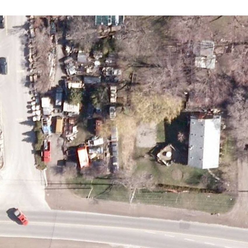
AECOM                                                 City of Hamilton                                           Improvements to Rymal Road (Dartnall Road to New
                                                                                                                 Trinity Church Corridor) Class EA
                                                                                                                 Environmental Study Report

Table of Contents

Statement of Qualifications and Limitations
Distribution List
                                                                                                                                                                  page

1.      Introduction .....................................................................................................................................1
        1.1        Background .......................................................................................................................................... 1
        1.2        Purpose of the Study ........................................................................................................................... 1
        1.3        Municipal Class Environmental Assessment Process......................................................................... 1
        1.4        Study Team Organization .................................................................................................................... 6
        1.5        Study Schedule.................................................................................................................................... 6
2.      Summary of Transportation Master Plan (Phase 1 & 2) ..............................................................7
        2.1        Purpose of the Transportation Master Plan ......................................................................................... 7
        2.2        Problem Identification (Phase 1) ......................................................................................................... 7
                   2.2.1 Problem/Opportunity Statement ............................................................................................. 7
                          2.2.1.1      Transportation Master Plan .................................................................................. 7
                          2.2.1.2      Hamilton Cycling Master Plan – Shifting Gears ................................................... 7
                          2.2.1.3      Rymal Road Planning Area Master Plan .............................................................. 8
                          2.2.1.4      Rymal Road Planning Area Class Environmental Assessment ........................... 8
                          2.2.1.5      Trinity Church Arterial Corridor Class Environmental Assessment...................... 8
                          2.2.1.6      North Glanbrook Industrial Park Transportation Master Plan .............................. 8
                          2.2.1.7      Refined Problem Statement ................................................................................. 8
3.      Public and Agency Consultation .................................................................................................10
        3.1        Consultation Plan............................................................................................................................... 10
        3.2        Summary of Phase 1 and 2 Consultation .......................................................................................... 10
        3.3        Phase 3 Consultation......................................................................................................................... 11
                   3.3.1 Regulatory Agency Involvement ........................................................................................... 11
                          3.3.1.1      Agency Mailing List ............................................................................................ 11
                          3.3.1.2      Study Notification Letter ..................................................................................... 12
                   3.3.2 Public Involvement................................................................................................................ 17
                          3.3.2.1      Public Information Centre ................................................................................... 17
                   3.3.3 First Nations Consultation .................................................................................................... 21
        3.4        Phase 4 Consultation......................................................................................................................... 21
4.      Description of the Existing Environment ...................................................................................22
        4.1        Data Collection and Review .............................................................................................................. 22
        4.2        Transportation Characteristics ........................................................................................................... 23
                   4.2.1 Existing Road Network ......................................................................................................... 23
                   4.2.2 Access .................................................................................................................................. 23
                          4.2.2.1     Signalized Intersections ..................................................................................... 23
                          4.2.2.2     Property Entrances ............................................................................................. 25
                   4.2.3 Transit Service ...................................................................................................................... 25
                   4.2.4 Pedestrian and Cycling Facilities.......................................................................................... 26
                   4.2.5 Road Safety Considerations ................................................................................................. 26
        4.3        Engineering Environment .................................................................................................................. 27
                   4.3.1 Storm Drainage..................................................................................................................... 27
        4.4        Physical Environment ........................................................................................................................ 27
AECOM City of Hamilton Improvements to Rymal Road (Dartnall Road to New
Trinity Church Corridor) Class EA
Environmental Study Report
4.4.1 Physiography, Geology and Topography ............................................................................. 27
4.4.2 Surface Water Resources .................................................................................................... 28
4.4.3 Groundwater Resources ....................................................................................................... 29
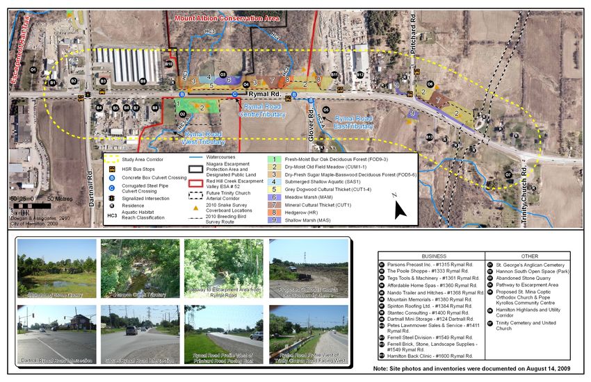
4.4.4 Soils and Agricultural Capability ........................................................................................... 30
4.5 Natural Environment .......................................................................................................................... 33
4.5.1 Designated Natural Areas .................................................................................................... 33
4.5.2 Terrestrial Habitat ................................................................................................................. 34
4.5.2.1 Vegetation .......................................................................................................... 34
4.5.2.2 Wildlife ................................................................................................................ 36
4.5.2.3 Species at Risk ................................................................................................... 37
4.5.3 Aquatic Habitat ..................................................................................................................... 38
4.6 Socio-Economic Environment ........................................................................................................... 40
4.6.1 Political Jurisdiction .............................................................................................................. 40
4.6.2 Provincial Planning Context .................................................................................................. 40
4.6.2.1 Provincial Policy Statement ................................................................................ 40
4.6.2.2 Growth Plan ........................................................................................................ 41
4.6.2.3 Greenbelt Plan.................................................................................................... 41
4.6.2.4 Niagara Escarpment Plan .................................................................................. 42
4.6.3 Municipal Planning Context .................................................................................................. 42
4.6.3.1 Building a Strong Foundation ............................................................................. 43
4.6.3.2 VISION 2020 ...................................................................................................... 43
4.6.3.3 Growth Related Integrated Development Strategy ............................................ 43
4.6.4 Designated Land Uses ......................................................................................................... 43
4.6.4.1 Region of Hamilton-Wentworth Official Plan ...................................................... 43
4.6.4.2 City of Hamilton Official Plan .............................................................................. 44
4.6.4.3 Urban Hamilton Official Plan .............................................................................. 45
4.6.5 Transportation....................................................................................................................... 47
4.6.6 Existing Land Uses ............................................................................................................... 47
4.6.7 First Nation Interests............................................................................................................. 48
4.6.8 Emergency Service Providers .............................................................................................. 48
4.6.9 School Busing ....................................................................................................................... 48
4.6.10 Noise ..................................................................................................................................... 48
4.6.11 Utilities .................................................................................................................................. 49
4.6.12 Sources of Potential Contamination ..................................................................................... 49
4.7 Cultural Environment ......................................................................................................................... 49
4.7.1 Archaeological Resources .................................................................................................... 49
4.7.2 Built Heritage and Cultural Landscapes ............................................................................... 49
5. Transportation Alternatives .........................................................................................................50
5.1 Alternative Solutions Overview (EA Phase 2) ................................................................................... 50
5.2 Alternative Design Concepts (EA Phase 3) ....................................................................................... 51
5.2.1 Generation of Design Alternatives ........................................................................................ 51
5.2.2 Evaluation Criteria ................................................................................................................ 51
5.2.3 Assessment and Evaluation of the Design Alternatives ....................................................... 52
5.2.4 Preliminary Preferred Design Alternative ............................................................................. 54
6. Project Description .......................................................................................................................60
6.1 Horizontal Alignment.......................................................................................................................... 60
6.2 Vertical Alignment .............................................................................................................................. 61
6.3 Intersections ...................................................................................................................................... 61
6.3.1 Dartnall Road Intersection .................................................................................................... 62
AECOM                                                 City of Hamilton                                             Improvements to Rymal Road (Dartnall Road to New
                                                                                                                   Trinity Church Corridor) Class EA
                                                                                                                   Environmental Study Report

                  6.3.2 Glover Road Intersection ...................................................................................................... 64
                  6.3.3 Pritchard Road Intersection .................................................................................................. 65
                  6.3.4 New Trinity Church Corridor ................................................................................................. 65
        6.4       Cross-Section .................................................................................................................................... 66
        6.5       Pedestrians and Cyclists ................................................................................................................... 66
        6.6       Transit ................................................................................................................................................ 67
        6.7       Drainage/Stormwater Management................................................................................................... 67
        6.8       Illumination ......................................................................................................................................... 67
        6.9       Utilities ............................................................................................................................................... 67
        6.10      Construction Staging ......................................................................................................................... 68
        6.11      Property Requirements ...................................................................................................................... 68
7.      Environmental Effects, Mitigation Measures and Monitoring ..................................................69
        7.1       Physical Environment ........................................................................................................................ 69
                  7.1.1 Surface Water Resources .................................................................................................... 69
                  7.1.2 Groundwater Resources ....................................................................................................... 70
        7.2       Natural Environment .......................................................................................................................... 70
                  7.2.1 Designated Natural Areas .................................................................................................... 70
                  7.2.2 Terrestrial Habitat ................................................................................................................. 70
                             7.2.2.1           Vegetation .......................................................................................................... 70
                             7.2.2.2           Wildlife ................................................................................................................ 71
                             7.2.2.3           Breeding Birds .................................................................................................... 71
                             7.2.2.4           Species at Risk ................................................................................................... 72
                  7.2.3 Aquatic Habitat ..................................................................................................................... 72
        7.3       Socio-Economic Environment ........................................................................................................... 73
                  7.3.1 Property ................................................................................................................................ 73
                  7.3.2 Access .................................................................................................................................. 73
                  7.3.3 Open Space .......................................................................................................................... 73
                  7.3.4 Noise and Air Quality ............................................................................................................ 73
                  7.3.5 Property Waste and Contamination...................................................................................... 74
        7.4       Cultural Environment ......................................................................................................................... 74
        7.5       Utilities ............................................................................................................................................... 74
        7.6       Construction Staging ......................................................................................................................... 74
        7.7       Summary of Environmental Impacts, Mitigation and Commitments to Future Work ......................... 74
        7.8       Monitoring .......................................................................................................................................... 79
8.      References.....................................................................................................................................80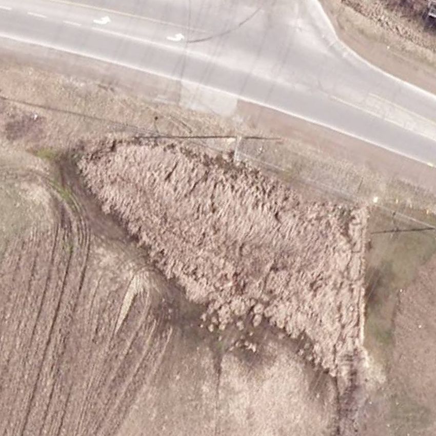
AECOM                                                  City of Hamilton                                            Improvements to Rymal Road (Dartnall Road to New
                                                                                                                   Trinity Church Corridor) Class EA
                                                                                                                   Environmental Study Report

List of Figures
Figure 1.     Study Area.................................................................................................................................................. 2
Figure 2.     Municipal Class EA Planning and Design Process .................................................................................... 5
Figure 3.     Existing Conditions ................................................................................................................................... 24
Figure 4.     Glover Road Concrete Box Culvert Crossing .......................................................................................... 29
Figure 5.     Soil Capabilities within the Rymal Road Study Area................................................................................ 31

List of Tables
Table 1.      Members of the Study Team ...................................................................................................................... 6
Table 2.      Summary of Consultation Activities (Phase 3 and 4) ............................................................................... 10
Table 3.      Agency Contact List ................................................................................................................................. 11
Table 4.      Summary of Comments and Responses Pre-Notice of PIC .................................................................... 13
Table 5.      Summary of Comments and Responses Post-Notice of PIC .................................................................. 18
Table 6.      Secondary Sources .................................................................................................................................. 22
Table 7.      Observed Number of Collisions at Intersections along Rymal Road (2004-2009) .................................. 27
Table 8.      Observed Number of Collisions on Mid-Block Road Sections along Rymal Road (2004-2009 .............. 27
Table 9.      Field Surveys Conducted by Dougan & Associates (2010) ..................................................................... 33
Table 10.     Aquatic Habitat Stream Characteristics ................................................................................................... 38
Table 11.     Link Capacity Analysis ............................................................................................................................. 51
Table 12.     Summary Evaluation of the Design Alternatives for Rymal Road............................................................ 53
Table 13.     Horizontal Alignment of the Proposed Rymal Road Improvements......................................................... 60
Table 14.     Vertical Alignment of the Proposed Rymal Road Improvements ............................................................. 61
Table 15.     Summary Evaluation of the Rymal/Dartnall Road Intersection ................................................................ 63
Table 16.     Synchro Analysis for the Dartnall Road Intersection................................................................................ 64
Table 17.     Future (2021) Traffic Operation Conditions in AM and PM peak Hours at Glover Road ......................... 65
Table 18.     Cross-Section for the Proposed Rymal Road Improvements .................................................................. 66
Table 19.     Anticipated Impacts, Proposed Mitigation Measures and Commitments to Future Work........................ 75

Appendices
Appendix A.         Public and Agency Consultation
                    Appendix A1. Notification Material
                    Appendix A2. Agency Correspondence
                    Appendix A3. PIC Materials
Appendix B.         Terrestrial Environment Report
Appendix C.         Fish Habitat Assessment Report
Appendix D.         List of Rare Species
Appendix E.         Evaluation of Alternative Road Design Concepts
AECOM City of Hamilton Improvements to Rymal Road (Dartnall Road to New
Trinity Church Corridor) Class EA
Environmental Study Report
1. Introduction
1.1 Background
In 2007, the City of Hamilton (City) completed the Hamilton Transportation Master Plan. The purpose of the
Transportation Master Plan (TMP) was to develop policies and strategies for the city-wide transportation network for
the next 30 years. The City’s TMP was prepared following the Municipal Engineers Association (MEA) Municipal
Class Environmental Assessment (Municipal Class EA) document (October 2000 as amended in 2007). Specifically,
the TMP was prepared following Section A.2.7 for Master Plans and has been accepted by the City as
documentation of Phase 1 and 2 of the Municipal Class EA process for all projects proposed within.
Among the proposed road improvements, the TMP recommended road widening on Rymal Road with provision for a
bicycle lane and possible use of the corridor for bus rapid transit (BRT) between Ryckmans Road and Trinity Church
Corridor. This study focuses on road improvements between Dartnall Road and the proposed new Trinity Church
Corridor. The TMP report classifies the proposed improvements to this section of Rymal Road as a Schedule C
project. Schedule C projects are subject to the full planning and design process outlined in the Municipal Class EA
document. AECOM was subsequently retained by the City to undertake Phase 3 and 4 of the Municipal Class EA
process for the proposed improvements to Rymal Road from Dartnall Road to the proposed new Trinity Church
Corridor.
1.2 Purpose of the Study
The purpose of this Class EA study is to identify and evaluate alternative design concepts for the proposed
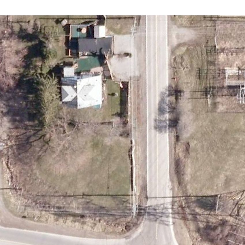
improvements to Rymal Road. The Subject Area (or Study Area), as shown in Figure 1, extends from Dartnall Road
to the proposed new Trinity Church Corridor for a distance of approximately 1 km. The study process includes
assessing the impacts of alternatives on the natural and socio-economic environments, and considering input from
the public and regulatory agencies. The objective of this study is to recommend a design concept that will
implement the proposed road improvements effectively and efficiently, while having regard for the surrounding
environment.
1.3 Municipal Class Environmental Assessment Process
Prior to the selection of a preferred design, the City must comply with the requirements of the MEA Municipal Class
EA document (October 2000 as amended in 2007). Approved under the Ontario Environmental Assessment Act, the
Municipal Class EA process incorporates the following key principles of EA planning:
• Consultation with affected parties early in and throughout the planning process;
• Consideration of a reasonable range of alternatives, both the functionally different ‘alternatives to’ and the
‘alternative methods’ of implementing the solution;
• Identification and consideration of the effects of each alternative on all aspects of the environment;
• Systematic evaluation of alternatives in terms of their advantages and disadvantages, to determine their net
environmental effects; and
• Provision of clear and complete documentation of the planning process followed, to allow ‘traceability’ of
decision-making with respect to the project.
1
AECOM   City of Hamilton                 Improvements to Rymal Road (Dartnall Road to New
                                         Trinity Church Corridor) Class EA
                                         Environmental Study Report

                  Figure 1. Study Area

                                                                                            2
AECOM City of Hamilton Improvements to Rymal Road (Dartnall Road to New
Trinity Church Corridor) Class EA
Environmental Study Report
As illustrated in Figure 2, the Municipal Class EA document outlines a five-phase planning and design process.
Each phase is summarized below:
Phase 1 Identify the problem and/or opportunity to be addressed.
Phase 2 Identify alternative solutions to address the problem or opportunity by taking into consideration the
existing environment, and determine the preferred solution taking into account public and regulatory
agency input.
Phase 3 Examine alternative methods of implementing the preferred solution taking into account the existing
environment, public and regulatory agency input, anticipated environmental impacts, and methods of
minimizing negative impacts and maximizing positive impacts.
Phase 4 Document, in an Environmental Study Report (ESR), a summary of the rationale and the planning,
design and consultation process undertaken through Phases 1 to 3. The ESR is made available for
public and agency review and comment.
Phase 5 Complete contract drawings and documents and proceed to construction and operation. Monitor
construction and operation where necessary for adherence to environmental provisions and
mitigation. Phase 5 is not part of this study. This phase will be undertaken in advance of
construction.
In addition, the Municipal Class EA document classifies transportation improvements as either Schedule A, A+, B or
C projects based on the anticipated levels of impact. Each schedule is described as follows:
Schedule A Projects are limited in scale, have minimal adverse environmental impacts, and require no public
notification or documentation.
Schedule A+ Projects are limited in scale, have minimal adverse environmental impacts, and require no
documentation. However, the public is to be advised of the project prior to implementation.
Schedule B Projects have the potential for some adverse environmental impacts. The proponent is required to
undertake a screening process, involving mandatory contact with the directly affected public and
regulatory agencies, to ensure that they are aware of the project and that their concerns are
addressed. Schedule B projects require that a Project File be prepared and made available for
public review.
Schedule C Projects have the potential for significant environmental impacts and must proceed under the full
planning and documentation procedures of the Municipal Class EA document. Schedule C projects
require that an ESR be prepared and filed on the public record for review by the public and
regulatory agencies.
This study is classified as a Schedule C project which involves completion of Phases 1 through 4 of the planning and
design process (Phases 1 and 2 were completed as part of the TMP and Phase 5 will be completed prior to
construction). The planning and design process for Schedule C projects are documented in an ESR. The ESR is
prepared for a minimum 30-day public review period. During this review period, any person or party with an
outstanding issue may bring the issue forward to the City for resolution. If the issue cannot be resolved, the person
or party with the concern may request the Minister of the Environment to order the City to comply with ‘Part II’ of the
Environmental Assessment Act. ‘Part II’ of the Environmental Assessment Act requires the completion of an
individual EA study with formal government review and approval. This request is called a ‘Part II Order Request’
3AECOM City of Hamilton Improvements to Rymal Road (Dartnall Road to New
Trinity Church Corridor) Class EA
Environmental Study Report
(formerly ‘Bump-up Request’) and must be submitted to the Minister in writing within the minimum 30-day review
period. If no requests for a ‘Part II Order’ are received during the public review period, the project may then proceed
to Phase 5 (Design and Construction).
4AECOM City of Hamilton Improvements to Rymal Road (Dartnall Road to New
Trinity Church Corridor) Class EA
Environmental Study Report
Figure 2. Municipal Class EA Planning and Design Process
PHASE
PHASE 11 -- Identify
Identify and
and Describe
Describe the
the Problem(s)
Problem(s)
Problem(s)
Problem(s)
PHASE
PHASE 22 –– Planning
Planning Alternatives
Alternatives
•• Identify
Identify reasonable
reasonable Planning
Planning Alternatives
Alternatives toto the
the problem(s)
problem(s)
•• Evaluate
Evaluate Planning
Planning Alternatives
Alternatives taking
taking into
into consideration
consideration existing
existing environmental
environmental
and
and technical
technical factors
factors
•• Identify
Identify aa Preliminary
Preliminary Preferred
Preferred Solution
Solution to
to the
the problem(s)
problem(s)
Select
Select Preferred
Preferred Solution
Solution
PHASE
PHASE 33 -- Alternative
Alternative Design
Design Concepts
Concepts for for Preferred
Preferred Solution
Solution
•• Identify
Identify Alternative
Alternative Designs
Designs to to implement
implement the
the Preferred
Preferred Solution
Solution
•• Inventory
Inventory natural,
natural, social,
social, economic
economic and and cultural
cultural environment
environment
•• Identify
Identify the
the impact
impact of
of the
the alternative
alternative designs
designs after
after mitigation
mitigation
•• Evaluate
Evaluate Alternative
Alternative Designs
Designs with
with consideration
consideration ofof the
the impacts
impacts
•• Identify
Identify aa Preliminary
Preliminary Preferred
Preferred Design
Design
Select
Select Preferred
Preferred Design
Design
PHASE
PHASE 44 -- Prepare/Submit
Prepare/Submit Environmental
Environmental Study
Study Report
Report (ESR)
(ESR)
•• Complete
Complete ESR documenting planning and decision-making processes
ESR documenting planning and decision-making processes
undertaken
undertaken through
through Phases
Phases 11 to
to 33
•• Place
Place ESR on public record for aa minimum
ESR on public record for minimum 30
30 calendar
calendar days
days for
for review
review
•• Notify
Notify the public and government agencies of completion of the ESR
the public and government agencies of completion of the ESR andand
provision
provision for
for Part
Part IIII Order
Order Request
Request
ESR
ESR
PHASE
PHASE 55 -- Implementation
Implementation of of Proposed
Proposed Improvements
Improvements
•• Proceed
Proceed toto construction
construction of
of the
the Project
Project
•• Monitor
Monitor for
for environmental
environmental provisions
provisions and
and commitments
commitments
5AECOM City of Hamilton Improvements to Rymal Road (Dartnall Road to New
Trinity Church Corridor) Class EA
Environmental Study Report
1.4 Study Team Organization
AECOM was retained by the City in 2009 to complete Phase 3 and 4 of the Class EA study for improvements to
Rymal Road. This study has been carried out by a Study Team consisting of staff from the City and AECOM. Table
1 identifies members of the Study Team.
Table 1. Members of the Study Team
AFFILIATION NAME ROLE
City
Project Team Melanie Jajko Class EA Project Manager
Chris McCafferty Technical Project Manager
Staff Technical Committee Development Engineering
Development Planning
Community Planning and Design
Community Planning and Design
Traffic Engineering
Transportation Planning
Transit Planning
Infrastructure and Source Water Planning
Infrastructure Planning
Transit (HSR)
AECOM
Class EA Team Karin Wall Class EA Project Manager
Larry Sarris Environmental Planner
Technical Team Jose Vernaza Technical Project Manager
Khalid Khan Transportation Engineer
1.5 Study Schedule
This study was initiated in June, 2009. Completion dates for each phase of the study were as follows:
Phase 1 Completed in May 2007 as part of the TMP.
Phase 2 Completed in May 2007 as part of the TMP.
Phase 3 Completed in 2010.
Phase 4 Completed in 2011.
Implementation of the proposed road improvements is tentatively scheduled to commence in 2012.
6AECOM City of Hamilton Improvements to Rymal Road (Dartnall Road to New
Trinity Church Corridor) Class EA
Environmental Study Report
2. Summary of Transportation Master Plan (Phase 1 & 2)
2.1 Purpose of the Transportation Master Plan
The Hamilton Transportation Master Plan (TMP) was initiated in 2003 as part of the Growth Related Integrated
Development Strategy (GRIDS). GRIDS was developed by the City as a planning process to determine where
future growth will occur over the next 30 years and beyond. The intent of GRIDS is to integrate planning for land use
with planning for transportation, water, wastewater and stormwater infrastructure.
As indicated in Chapter 1, the purpose of the TMP is to develop policies and strategies for the transportation
network over the next 30 years. The City’s TMP was carried out in three stages:
Stage 1 – Calibration of the existing transportation model to reflect current transportation conditions
Stage 2 – Development of underlying policies to the Master Plan
Stage 3 – Preparation of the Master Plan itself.
2.2 Problem Identification (Phase 1)
2.2.1 Problem/Opportunity Statement
As part of this study, AECOM reviewed relevant conclusions of recently completed transportation studies involving
the Rymal Road Study Area. Examples of recently completed studies include the Hamilton TMP, Hamilton’s Cycling
Master Plan – Shifting Gears, Rymal Road Planning Area Class EA Study Report (Phase 3 and 4), and Trinity
Church Arterial Corridor Class EA Report (Phase 3 and 4). Key recommendations were summarized to support the
need and justification for widening of Rymal Road within the Study Area, and to confirm the problem/opportunity
statement for consideration during Phase 3 and 4 of this Class EA Study.
2.2.1.1 Transportation Master Plan
The TMP identified the following Problem Statement (as documented by IBI Group and Dillon Consulting in
association with McCormick Rankin (MRC), 2007):
“Between 2001 and 2031, Hamilton’s population will increase by 162,000 people (32%). During the same period,
105,000 new jobs are expected to be created. If current travel characteristics remain the same, there will be 180,000
additional auto driver trips per day that will need to be accommodated by the road network. This translates into 1.2
million additional kilometres driven by Hamilton residents each day and a consumption of 40 million litres of fuel per
year. Left unchecked, significant congestion on most Escarpment crossings will result in increased delays to auto
drivers, transit riders and commercial vehicles. Accordingly, key objectives of the TMP include reducing dependence
on single-occupant vehicles and promoting improved options for walking, cycling and transit, while maintaining and
improving the efficiency of trips related to the movement of goods and servicing of employment areas.”
2.2.1.2 Hamilton Cycling Master Plan – Shifting Gears
In June 2009, Shifting Gears, a new Cycling Master Plan for the City of Hamilton was approved by Council to guide
the development and operation of its cycling infrastructure for the next twenty years. The Transportation Master
Plan (2007) proposed an expanded city-wide cycling network, as well as an update to Shifting Gears 1999. This
Cycling Master Plan update satisfied this goal. Cycling facilities were proposed in this study area through the
Transportation Master Plan (2007); however the updated Shifting Gears (2009) did not identify cycling facilities in the
Rymal Road study area.
7AECOM City of Hamilton Improvements to Rymal Road (Dartnall Road to New
Trinity Church Corridor) Class EA
Environmental Study Report
2.2.1.3 Rymal Road Planning Area Master Plan
In 2006, the City completed a Master Plan to address infrastructure and service needs for the Rymal Road
Secondary Plan Area and Special Policy Area ‘C’. The Rymal Road Secondary Plan Area is situated south of Rymal
Road and north of the hydro corridor, from Trinity Church Road to Upper Centennial Parkway. Special Policy Area
‘C’ is located north of Stone Church Road and east of Winterberry Drive.
The Rymal Road Planning Area Master Plan fulfills Phase 1 and 2 of the Municipal Class EA process and
recommends widening of Rymal Road from Trinity Church Road to Upper Centennial Parkway/Regional Road 56. In
addition, the Master Plan recommends a north-south link from the Red Hill Valley Parkway to south of Rymal Road.
This link is referred to as the Trinity Church Arterial Corridor.
2.2.1.4 Rymal Road Planning Area Class Environmental Assessment
In 2007, the City completed Phase 3 and 4 of the Class EA for the proposed widening of Rymal Road between
Regional Road 56 and the Trinity Church Arterial Corridor. Based on the assessment of alternative designs, the
recommended design includes five (5) lanes (two (2) through lanes in each direction and a centre-turning lane where
needed) with provision for a roundabout at the intersection with the Trinity Church Arterial Corridor.
2.2.1.5 Trinity Church Arterial Corridor Class Environmental Assessment
In 2007, the City completed Phase 3 and 4 of the Class EA for the proposed Trinity Church Arterial Corridor. The
study recommends a new four (4) lane (two (2) lanes in each direction) arterial corridor from the Red Hill Valley
Parkway and Stone Church Road intersection to south of Rymal Road, with provision of a roundabout at the
intersection with Rymal Road.
2.2.1.6 North Glanbrook Industrial Park Transportation Master Plan
In 2006, the City completed a TMP for the proposed North Glanbrook Industrial Business Park following Phase 1
and 2 of the Class EA process. The Study Area is generally bounded by Dickenson Road to the south, beyond
Nebo Road to the west, Trinity Church Road to the east, and the hydro corridor to the north. The Study Area also
includes connections to the Red Hill Valley Parkway/Lincoln Alexander Parkway to the north and the airport to the
west.
The TMP identified the need for additional north-south capacity within the North Glanbrook Industrial Business Park
between Rymal Road and Dickenson Road. The need for additional expansions was identified to meet traffic
demand in the long term, including north-south capacity from the Lincoln Alexander Parkway to Dickenson Road,
and protection of additional north-south capacity south of Rymal Road.
2.2.1.7 Refined Problem Statement
Based on a review of recently completed transportation studies involving Rymal Road within and beyond the Study
Area, the problem statement was confirmed as follows:
“The need for improvements to Rymal Road within the Study Area is documented in the Hamilton Transportation
Master Plan (2007). Furthermore, significant development is anticipated as part of the North Glanbrook Industrial
Business Park and Rymal Road Planning Area to the south of Rymal Road. As development occurs, traffic will
increase on roadways within and adjacent to this Business Park and Rymal Road Planning Area. The widening of
Rymal Road between Dartnall Road and the Trinity Church Arterial Corridor is expected to improve east-west
8AECOM City of Hamilton Improvements to Rymal Road (Dartnall Road to New
Trinity Church Corridor) Class EA
Environmental Study Report
capacity, traffic operations, safety, and accessibility to existing and future developments. It also presents the
opportunity to improve alternative modes of travel (i.e., walking and transit) throughout the corridor.”
9AECOM City of Hamilton Improvements to Rymal Road (Dartnall Road to New
Trinity Church Corridor) Class EA
Environmental Study Report
3. Public and Agency Consultation
3.1 Consultation Plan
Recognizing that public and regulatory agency consultation is an integral part of the Municipal Class EA process, a
Consultation Plan was developed at the outset of the study and implemented throughout Phase 3 and 4. The
objectives of the Consultation Plan were:
• To identify potentially affected stakeholders;
• To provide information to stakeholders on all components of the study;
• To obtain input from stakeholders during each phase of the study; and,
• To integrate information received from stakeholders into the planning and design process.
In keeping with the intent of the Municipal Class EA, a number of methods were used to achieve the above-stated
objectives, including:
• Contacting key agencies for data collection and identification of issues/concerns early in the study process;
• Convening a Public Information Centre (PIC) during Phase 3 of the study;
• Placement of a combined Notice of Study Commencement and PIC in the Hamilton Spectator and Mountain
News;
• Mailing project information (e.g., notification letters regarding Study Commencement, PIC, and Study
Completion) to regulatory agencies and/or the public during various stages of the study process;
• Receiving and responding to written submissions; and
• Participating in discussions with regulatory agencies and the public by telephone and electronic mail.
Table 2 summarizes the consultation activities undertaken as part of this study. Details pertaining to the
Consultation Plan are provided in the following sections, including a brief overview of consultation activities
undertaken as part of the Hamilton TMP. In addition, reference is made to feedback received throughout the ESR,
where appropriate.
Table 2. Summary of Consultation Activities (Phase 3 and 4)
PHASE 3 – ALTERNATIVE DESIGN CONCEPTS
DATE ACTIVITY TARGET STAKEHOLDERS
August 24, 2009 Study Notification Letter mailed Regulatory Agencies, First Nations
Week of October 18, Public, Regulatory Agencies, First
Notice of PIC Letter mailed
2010 Nations
Notice of PIC posted in local newspapers
October 29, 2010 and
(Proposed Improvements & Environmental Public
November 5, 2010
Assessments for Dartnall Road & Rymal Road)
Public, Regulatory Agencies, First
November 10, 2010 Public Information Centre
Nations
3.2 Summary of Phase 1 and 2 Consultation
Stage 2 of the TMP (Development of underlying policies to the Master Plan) involved a series of events to solicit
stakeholder input, including Staff/Council workshops, two (2) Public Open Houses, a Charrette with Stakeholders,
10AECOM City of Hamilton Improvements to Rymal Road (Dartnall Road to New
Trinity Church Corridor) Class EA
Environmental Study Report
and Council adoption of Policy Papers. Stage 3 of the TMP (Preparation of the Master Plan itself) involved a series
of Public Information Centres to solicit stakeholder input on the initial stages of the study, alternatives, and the
proposed preliminary plan. In addition, a number of agencies and organizations were contacted for their input, such
as the Cycling Committee, Transit User Group, Accessibility Committee, Transit Master Plan and Gas Tax
Committee, Chamber of Commerce, Transportation Club, and the Niagara Escarpment Commission. The TMP
report was placed on the public record for a 60-day review period. Feedback received in response to the above
consultation efforts support alternative transportation choices, particularly BRT and incline rail. The overall theme of
many comments acknowledged the link between transportation and land use.
3.3 Phase 3 Consultation
3.3.1 Regulatory Agency Involvement
3.3.1.1 Agency Mailing List
A list of regulatory agencies thought to be possibly affected or interested in the project was compiled by the City in
August 2009, including First Nations, provincial ministries, federal departments, the local conservation authority, and
various utility companies. A list of agencies contacted at the start of this study is provided in Table 3. This list was
updated throughout the study to ensure that it remained current.
Table 3. Agency Contact List
PROVINCIAL AGENCIES
• Ministry of Aboriginal Affairs • Ministry of Municipal Affairs and Housing
• Ministry of Agriculture, Food and Rural Affairs Ministry of Natural Resources
• Ministry of Attorney General • Ministry of the Environment
• Ministry of Culture • Ministry of tourism and Culture
• Ministry of Citizenship and Immigration • Ministry of Training, Colleges and Universities
• Ministry of Community and Social Services • Ministry of Transportation
• Ministry of Health and Long-Term Care • Ministry of Energy and Infrastructure
• Ontario Provincial Police
FEDERAL AGENCIES
• Canada Post Commercial Service Centre • Human Resources Development Canada
• Canadian Environmental Assessment Agency • Hamilton Port Authority
• Canadian Centre for Inland Waters • Indian and Northern Affairs Canada
• Canadian Geographical Names Database • Industry Canada
• (NATURAL Resources Canada) • Transport Canada
• Environment Canada
• Fisheries and Oceans Canada
MUNICIPAL CONTACTS (CITY OF HAMILTON)
• City Manager’s Office • Planning and Economic Development
• Community Services • Public Health Services
• Corporate Services • Public Works
• Hamilton Emergency Services • Ward 6, 9 and 11 Councillors
• Hamilton Police Services
• Hamilton Public Library
• Mayor’s Office
ABORIGINAL GROUPS AND COMMUNITIES
• Assembly of First Nations • Huron Wendat First Nation
• Association of Iroquois and Allied Indians • Métis Nation of Ontario
• Council of Ontario Chiefs • Métis Women’s Circle
• Cultural Explorers • Mississaugas of the New Credit First Nation
• De dwa da dehs nyes Aboriginal Health Centre • Nipissing First Nation (Union of Ontario Indians)
11AECOM City of Hamilton Improvements to Rymal Road (Dartnall Road to New
Trinity Church Corridor) Class EA
Environmental Study Report
• Hamilton Executive Directors Aboriginal Coalition • Ontario Federation of Indian Friendship
• Hamilton Regional Indian Centre • Six Nations of the Grand River
• Haudenosaunee Resource Centre
• HEDAC
UTILITIES
• Atria Networks • Mountain Cablevision
• Bell Canada • Ontario Power Generation
• Cogeco Cable Inc. • South Mount Cable Ltd.
• Enbridge Pipelines Inc. • Sun-Canadian Pipeline
• Imperial Oil • TransCanada Pipelines Limited
• Hamilton Utilities Corporation • Trans-Northern Pipelines Inc.
• Horizon Utilities (formerly Hamilton Hydro) • Union Gas
• Hydro One
OTHER KEY STAKEHOLDERS
• Canadian National Railway • Hamilton-Wentworth District School Board
• Canadian Pacific Railway • McMaster University
• Centre, French Public School Board. • Mohawk College
• Greater Toronto Transit Authority • Niagara Peninsula Conservation Authority
Hamilton Central Ambulance Communication Centre • Niagara Escarpment Commission
Hamilton Conservation Authority • Planning and Engineering Initiatives Ltd.
• Hamilton Cycling Committee • Southern Ontario Railway
• Hamilton-Wentworth Catholic District School Board
•
3.3.1.2 Study Notification Letter
Regulatory agencies were contacted by the City through a study notification letter dated August 24, 2009. The
purpose of the letter was to inform agencies of the study and invite their participation in the study process. A
summary of comments received and how they have been addressed is provided in Table 4. A copy of all
correspondence sent and received is included in Appendix A.
12AECOM City of Hamilton Improvements to Rymal Road (Dartnall Road to New Trinity Church
Corridor) Class EA
Environmental Study Report
Table 4. Summary of Comments and Responses Pre-Notice of PIC
COMMENTING COMMENTS RECEIVED RESPONSE
AGENCY
Hydro One • In our initial review, we have confirmed that Hydro One Transmission facilities are • Comments noted and will be further
Networks located within immediate vicinity of the proposed site in your Study Area. Please investigated during Phase 3.
also allow appropriate lead-time in your project schedule in the event that proposed
development impacts Hydro One infrastructure which requires relocation or
modifications, or needs an outage, that may not be readily available.
• In planning, please note that developments should not reduce line clearances and • The Hydro One Transmission facilities that
limit access to our facilities at any time in the Study Area of your Proposal. Any traverse Rymal Road on the east side of
construction activities must maintain the electrical clearance from the transmission Pritchard Road will not be impacted by the
line conductors as specified in the Ontario Health and Safety Act for the respective proposed road widening. The proposed
line voltage. improvements will not impact the transmission
• The integrity of the structure foundations must be maintained at all times, with no tower located at approximately Station No.
disturbance of the earth around the poles, guy wires and tower footings. There 10+900 (north side of Rymal Road). Section
must not be any grading, excavating, filling or other civil work close to the 6.9 details the project description pertaining to
structures. utilities.
• Note that existing rights-of-ways may have provisions for future lines or already
contain secondary land uses (i.e. pipelines, water mains, parking, etc). Please take
this into consideration in your planning.
• Once details are known and it is established that your development will affect Hydro
One facilities including the rights-of-way, please submit plans that detail your
development and the affected Hydro One facilities to Kent Taylor, 185 Clegg Road,
Markham L6G 1B7.
• Please note that the proponent will be responsible for costs associated with
modification or relocation of Hydro One facilities, as well as any added costs that
may be incurred due to increase efforts to maintain our facilities.
Enbridge • Please remove from study mailing list for this project. • Revised study mailing list.
Pipelines Inc. • Enbridge Pipelines does not have any facilities in the area of proposed work.
Hamilton • The Hannon Creek Master Drainage Plan has identified at least one (1) karst • Natural features within the Project Area are
Conservation feature in the Project Area. summarized in Chapter 4: Description of
Authority Existing Environment.
• At least three (3) tributaries of Hannon Creek traverse Rymal Road in the Project
Area, one (1) of which has been identified as a ‘high constraint’ fisheries stream.
• The Red Hill Creek Escarpment Valley Environmentally Sensitive Area (ESA)
borders Rymal Road on the north and south sides between Dartnall Road and
Glover Road.
13AECOM City of Hamilton Improvements to Rymal Road (Dartnall Road to New Trinity Church
Corridor) Class EA
Environmental Study Report
COMMENTING COMMENTS RECEIVED RESPONSE
AGENCY
• A large portion of the ESA on the north side of Rymal Road falls within the Mount • Impacts to the ESA are discussed in Section
Albion Conservation Area, which is owned by the Hamilton Conservation Authority. 7.2.1 and prescribed mitigative measures are
If the proposed road improvements involve widening the road onto or in close documented in Table 15.
proximity to conservation authority lands, then it is requested that the authority’s
Land Management Director be consulted and kept informed of project details
• The watercourses and their associated natural hazard lands are regulated by the • Impacts and the need for permits and approvals
Hamilton Conservation Authority pursuant to their Development, Interference with were assessed during Phase 3 of the Class EA
Wetlands, and Alterations to Shorelines and Watercourses Regulation 161/06 under process under Section 7.1 and in Table 15.
Ontario Regulation 97/04. Any new development, including construction and
grading activities within the regulated area will require a permit from the
conservation authority and may be subject to timing constraints (i.e., fisheries timing
windows for in-water works and breeding birds in accordance with the Migratory
Birds Convention Act and the Ontario Fish and Wildlife Conservation Act).
• Request that future reports and correspondence related to the project be circulated • Maintained on study mailing list.
to the Hamilton Conservation Authority for review.
• Satisfied with the revisions made to the Fisheries Report based on comments • Comment noted and report finalized.
provided.
Imperial Oil • Please remove from study mailing list for this project. • Revised study mailing list.
Indian and • No active litigation in vicinity of property. • Comment noted.
Northern
Affairs Canada • Contact Specific Claims Branch at (819) 953-1940 or 994-2323, Comprehensive • Contacts consulted.
Claims Branch at (819) 997-3499 or 994-7521, and Litigation Management and
Resolution Branch at (819) 997-3582.
• INAC Environmental Unit will not be providing a review of the proposed project but • Resources were reviewed for potentially
has provided a list of resources to facilitate with identifying First Nations and other affected First Nations and other Aboriginal
Aboriginal Groups within the vicinity of the area. Groups.
• All unsolicited correspondence concerning environmental assessment requests and
notifications that are taking place within the Province of Ontario should be directed • Revised study mailing list.
to the Environmental Unit.
Metrolinx/GO • Please remove from study mailing list for this project. • Revised study mailing list.
Transit
Ministry of • Interested in providing input regarding the study and would like to be kept informed. • Maintained on study mailing list.
Citizenship and • Interested in archaeological resources and impacts on recreation. • Will be provided with copy of ESR
Immigration/
Tourism and
14You can also read