InSCHIPHOL Repeated Imaging Success - BSF Swissphoto
←
→
Page content transcription
If your browser does not render page correctly, please read the page content below
Repeated
Imaging Success
in
SCHIPHOL
BSF Swissphoto’s
plane prepares for The Kreekrak
flight at the airport locks in the
in Lelystad. Scheldt-Rhine
Canal, which
runs from
Antwerp to the
Volkerak and
is part of the
Scheldt-Rhine
connection,
the shipping
route between
Antwerp and
Rotterdam.
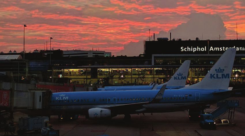
n 2018, Schiphol Airport in The Netherlands recorded Geospatial services company BSF Swissphoto knows a thing or
I 499,444 commercial air flight movements, an average of
about 1,350 take offs and landings per day. That quantity
makes the airport an impressive third in busiest airports in
Europe for passenger volumes, but it’s not a great statistic
if you’re a geodata provider that needs to conduct an airborne
survey near that crowded air space.
two about that kind of air-traffic challenge. Since 2016, it has had to
learn how to be nimble and flexible in order to successfully deliver
on an annual aerial photo campaign north of the airport.
“Roughly 85 planes are landing or taking off at Schiphol every hour,
so flight control is incredibly strict,” says Sandra Beckmann, a project
leader with BSF Swissphoto’s German office in Schönefeld. “When
» MARY JO WAGNER
June 2020 / The American Surveyor 29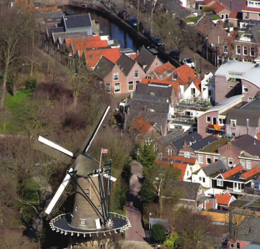
The famous Molen van Piet round stone
     flour mill in the Dutch city of Alkmaar.
     Located in North Holland, Alkmaar is              A routine exercise                               grew its business by offering multi-sensor
     a popular tourist destination well known          in coordination                                  solutions with millimeter accuracy.
     for its traditional cheese market.
                                                       Flying the skies and photographing the              With a record for successfully delivering
                                                       ground underneath their wings has been           on surveying projects near Schiphol and
     we are given a flight window, we have to be        at BSF Swissphoto’s core since it was first       other challenging areas around Europe,
     ready to go at a moment’s notice and we can’t     established in Switzerland in 1930. The          BSF Swissphoto was in a strong position
     afford any mistakes in collecting our photos      company took on its first aerial survey and       to respond to the aerial photo needs of the
     because it puts meeting our delivery deadline     photogrammetry flight in 1960 and steadily        Information & Coordination Centre (ICC)
     at risk. It’s an added level of complexity in a
     project that’s already challenging.”
        Indeed, in addition to working around
     potential weather delays and air traffic
     restrictions, the company has also had to
     meet unforgiving technical specifications
     and deadlines. They’ve had to produce
     homogenous, seamless orthomosaics with a
     ground sample distance (GSD) of 4 cm for a
     900-square-kilometer area of interest (AOI)—
     about the size of Madrid—in 11 weeks.
        However, Beckmann and her team have
     successfully shown that a smart flight plan
     and robust and efficient photogrammetry
     software are the right combination to
     navigate and land a complicated aerial
     survey and secure a route to repeat flights
     in the future.                                    An industrial area in the town of Velsen-Noord, about 10 kilometers north of Haarlem.

30    The American Surveyor / June 2020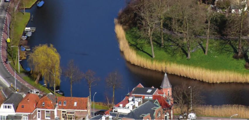
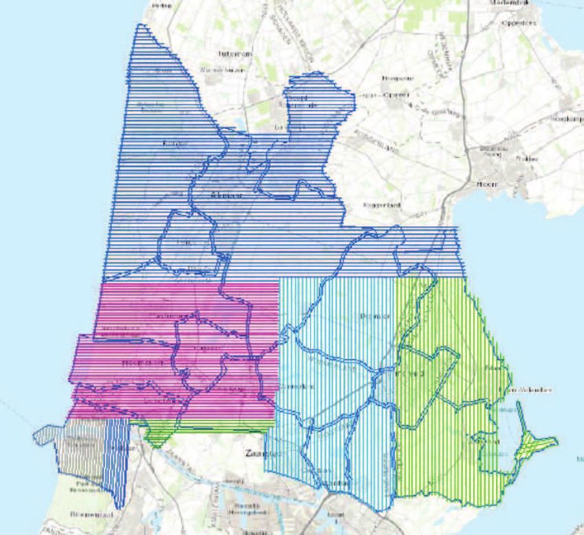
A graphic of BSF Swissphoto’s AOI area
including the municipalities. The lines
indicate the flight plan.
In 2016, BSF Swissphoto received a
two-year contract to survey one of three
AOIs under the ICC’s Vertical Aerial Photo
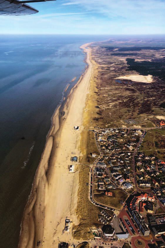
The shore along the seaside resort town program. Proving its capabilities, it was then
of Bergen aan Zee, about 9 kilometers
west of Alkmaar.
awarded a subsequent contract for the same
900-sq-km area for 2019 and 2020.
“We are skilled in developing well-crafted
of the Schiphol Region. The ICC represents and realistic flight plans that not only
about 60 government-affiliated organiza- enable us to be efficient in the air but also in
tions, including 47 municipalities, and processing the stacks of images we acquire,” A map of the complete ICC area split
works to coordinate and provide access to says Beckmann. “Equally important is into three parts. The blue parcel is BSF
up-to-date aerial photographs and other our ability to meet the exacting technical Swissphoto’s AOI.
remote sensing products on a routine basis. requirements. With Trimble’s Inpho® image
Since 2009, it has issued tenders to capture processing software we have the tools we accurate, completely clear with distinct
high-resolution photos of the 2800-sq-km need to meet the orthophoto precision and contrast, and aesthetically pleasing.
Region that extends from Alkmaar in the the delivery timeline the project demands.” The aerial campaign began in February in
north, Almere in the east and Zoetermeer order to acquire images of bare trees and to
in the south. Participating members use the Collecting the aerial ensure they capture as much ground detail
detailed photos to update their large-scale component as possible.
topographic maps, for urban and envi- For the 2019 campaign, BSF Swissphoto’s Considering the restrictive and compli-
ronmental planning, for security and for AOI included 17 ICC municipal territories in cated air traffic regulations, BSF Swissphoto
monitoring land-use changes. the northern part of Schiphol, each of which split the whole AOI into seven sub-areas,
Depending on the number of ICC partici- required its own seamless orthomosaic. delineating smaller fly zones near the airport
pants, the program’s total AOI can change In addition to the very high resolution and larger sections further north. The smaller
year on year, but the delivery requirements specifications, the orthomosaic had to be sections were carefully chosen because
are always the same: orthomosaics with a precisely color-balanced—no dark shadows the team knew they’d collect a significant
ground sample distance (GSD) of 4cm or less. or excessively bright spots—geometrically volume of photos and they wanted to ensure
June 2020 / The American Surveyor 31
A view of the Stad van de Zon housing and building project in
Heerhugowaard, The Netherlands. Heerhugowaard is one of
the 17 municipalities included in BSF Swissphoto’s AOI.
the orthophoto production would go as and laid out a total of 164 GCPs with a ment from a sudden gust of wind—can
smoothly and efficiently as possible. horizontal accuracy of better than 3 cm. impact our defined overlap or clarity in a
To coordinate with the flight plan and After setting control, BSF Swissphoto photo,” says Beckmann. “We were fortunate
to achieve consistently high accuracy over dispatched their flight crew to collect to have good weather for the flights.”
such a wide area, BSF Swissphoto used a aerial imagery. Flying at altitudes of both
base station, GNSS receiver and differential 335 meters (1,100 feet) and 427 m (1,400 Orchestrating the
GPS (DGPS) technology to establish control ft) at speeds between 120 to 155 km/h, orthophotos
for each sub-area, and they set out a they covered the entire AOI in 30 hours After downloading and processing the
network of ground control points (GCPs). over six days. They flew 261 flight paths aerial images and aircraft trajectory data,
For the GCPs, teams used a combination and collected 30,000 images with their Beckmann and colleagues imported them
of colored, physical targets and painted large-format digital camera. The images together with the GCPs into the MATCH-AT
markers on hard surfaces at set intervals had a 60 percent endlap and the average georeferencing module of Inpho to automati-
within each sub zone and measured the sidelap between the flying strips was about cally triangulate the images. The software
center points of each with a GNSS receiver. 30 percent. processed the 30,000 images in batches and
They set GCPs in groups of two, each “Flying at such low altitudes is risky automatically pinpointed 254,000 common
placed close together for point redundancy, because the slightest deviation—like move- features or tie points (TPs) with multiple
connections across the images. The precisely
surveyed GCPs were measured in MATCH-
AT, and in a second quality control step, the
team used MATCH-AT’s Stereo module to
manually verify and measure all the GCPs in
stereo. After that the imagery was precisely
oriented automatically.
“The automatic triangulation and tie-point
identification capabilities in Inpho are very
good and give us the essential foundation for
creating precise orthophotos and orthomosa-
ics,” says Beckmann. “You can’t build an
accurate result from an inaccurate base.”
After the final triangulation was done,
the team downloaded an existing LiDAR-
based digital terrain model (DTM) of the
entire AOI and analyzed it for land-cover
changes that needed to be corrected or
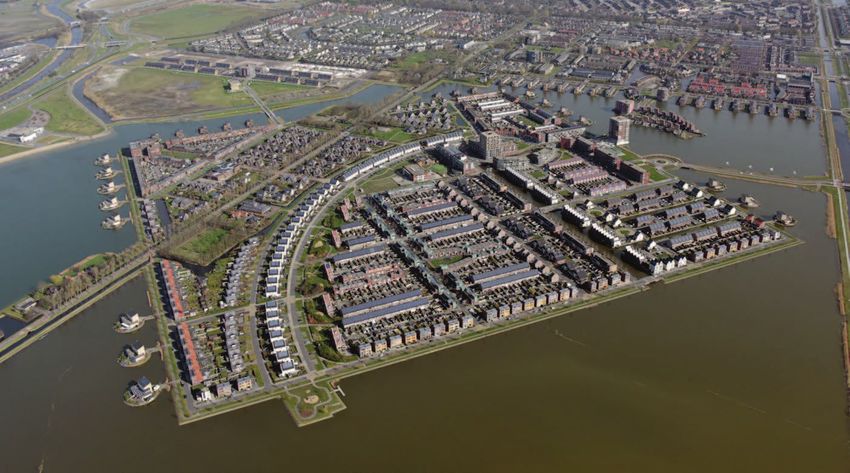
Schiphol Airport recorded 499,444 commercial air flight movements in 2018, making it the third updated. The DTM was then integrated into
busiest airport in Europe for passenger volumes. the Inpho software.
32 The American Surveyor / June 2020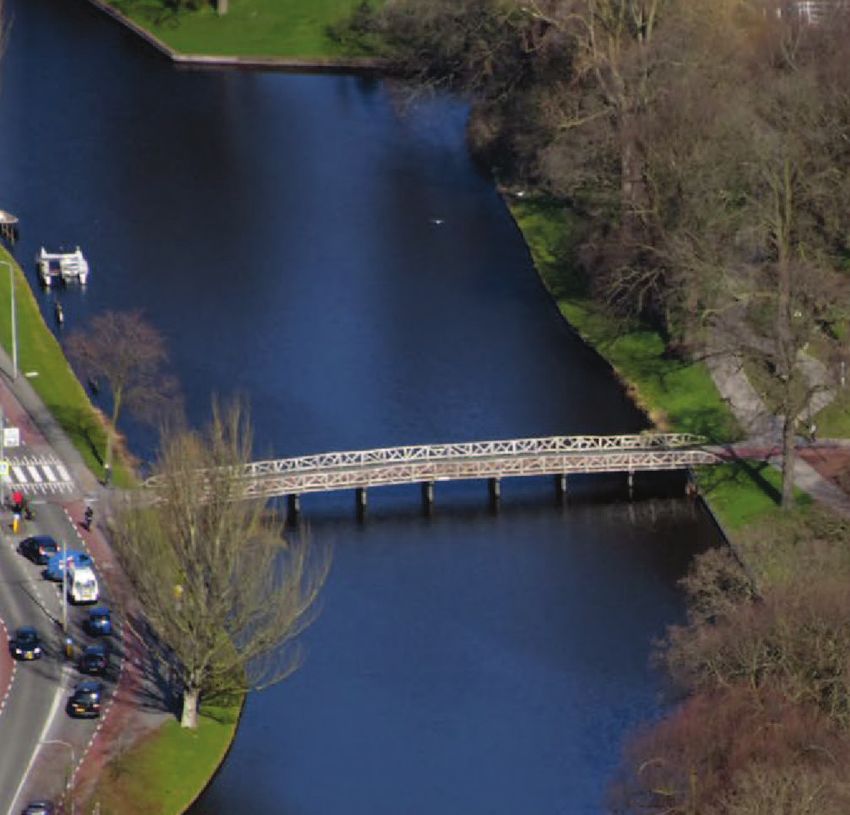

You can also read