Land at Dereham Road, Reepham - March 2020 - GNLP
←
→
Page content transcription
If your browser does not render page correctly, please read the page content below
Land at Dereham Road, Reepham
                     (HELAA Ref: GNLP0353)

D e l i v e r y   S t a t e m e n t
                              March 2020
CONTENTS

                                                                                               EXECUTIVE SUMMARY         01
                                                                                          01   INTRODUCTION              02
                                                                                          02   PLANNING POLICY CONTEXT   04
                                                                                          03   DELIVERY                  06
                                                                                          04   PHYSICAL CONTEXT          07
                                                                                          05   TECHNICAL CAPACITY        08
                                                                                          06   LANDSCAPE ASSESSMENT      12
                                                                                          07   ECOLOGY                   13
                                                                                          08   HERITAGE                  15
                                                                                          09   CONCEPT                   16
                                                                                          10   CONCLUSION                20
                                                                                               APPENDICES                22

Pegasus Group
Pegasus House
Querns Business Centre
Whitworth Road
Cirencester
GL7 1RT
www.pegasusgroup.co.uk I T 01285 641717
Prepared on behalf of Pigeon Investment Management Ltd
March 2020 Project code P20-0004

Checked by: INITIAL
     Copyright. The contents of this document must not be copied or reproduced in whole
     or in part without the written consent of Pegasus Planning Group Ltd.
     Crown copyright. All rights reserved, Licence number 100042093.

     Printed material produced by Pegasus Design Cirencester is printed on
     paper from sustainably managed sources and all parts are fully recyclable.
ane
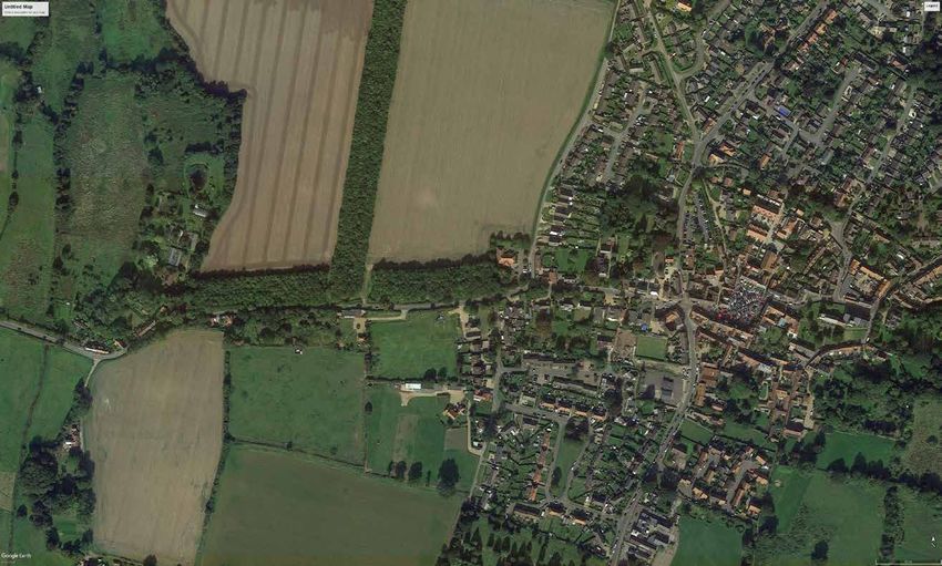
Smuggler’s L
Dereham Road
Park Lane
SITE LOCATION PLAN (NORTH AND SOUTH SITES)
N
iv Land at Dereham Road, Reepham | Delivery Statement
Project: Dereham Road, Reepham
EXECUTIVE SUMMARY
This Delivery Statement (‘the Statement’) has                       As a Key Service Centre in the Greater Norwich Local      A sensitively designed structural landscaping scheme
been prepared by Pegasus for Pigeon Investment                      Plan (GNLP) area, Reepham is a sustainable location       will also help integrate the overall scheme into the
Management Ltd (‘Pigeon’) on behalf of Michael                      well suited to the provision of new housing for the       local landscape. The Concept Plans additionally show
and Jackie Buxton (‘the Landowners’) and Pigeon                     District. The town has a good range of local services     the opportunities for creating green corridors within
Capital Management 2 Ltd, who are promoting                         and facilities including a nursery school, primary        the Site, which will provide opportunities for informal
land at Dereham Road, Reepham (the ‘Site’). The                     school, and high school, doctor’s surgery, public         recreation and wildlife access and provide links to the
Site comprises (i) land to the north of Dereham                     houses, local convenience stores and a range of other     wider public rights of way network.
Road that is being promoted for high-quality office                 food and retail outlets.
                                                                                                                              The Site is immediately available, achievable and
accommodation, land for possible future expansion
                                                                    The Concept Plans (Appendix 2) illustrate how the         suitable for development. The Landowners have
of Reepham Surgery and landscaping; and (ii) land to
                                                                    Site can provide a new high quality, landscape-led        entered into a partnership with Pigeon to progress
the south of Dereham Road to deliver a high-quality
                                                                    scheme to the west of Reepham, comprising:                the Site through the planning process and the Site
landscape-led scheme comprising around 50 new
                                                                                                                              can deliver homes within the forthcoming five years.
homes, including bungalows, affordable homes and                    • Public Open Space including strategic landscaping
                                                                                                                              The evidence prepared by the Council and the suite of
self-build plots, together with informal public open                  which will contribute to enhanced green
                                                                                                                              technical studies prepared on behalf of Pigeon also
space and landscaping.                                                infrastructure and biodiversity;
                                                                                                                              demonstrate that with appropriate mitigation there
The proposal will deliver a high-quality landscape-led              • High-quality office accommodation providing a           are no site constraints which would act as a barrier to
scheme including a site suitable for the relocation                   site suitable for the relocation of an existing local   early delivery.
of an existing local employer that is seeking new                     employer to secure their long-term contribution to
premises to allow their business to continue to grow,                 the local economy;
as well as land to facilitate the expansion of Reepham              • Land to facilitate the expansion of the existing GP
surgery thereby facilitating the provision of much                    surgery;
needed additional floorspace at the existing surgery                • Around 50 new homes including bungalows,
and housing to meet local needs.                                      affordable homes and self-build plots.

                     Land at Dereham Road, Reepham | Delivery Statement                                                                                                                1
1.0 INTRODUCTION
                              This Delivery Statement (‘the Statement’) has
                              been prepared by Pegasus for Pigeon Investment
                              Management Ltd (‘Pigeon’) on behalf of Michael
                              and Jackie Buxton (‘the Landowners’) and Pigeon
                              Capital Management 2 Ltd, who are promoting
                              land at Dereham Road, Reepham (the ‘Site’). The
                              Site comprises (i) land to the north of Dereham
                              Road that is being promoted for high-quality office
                              accommodation, land for possible future expansion
                              of Reepham Surgery and landscaping; and (ii) land to
                              the south of Dereham Road to deliver a high-quality
                              landscape-led scheme comprising around 50 new
                              homes, including bungalows, affordable homes and
                              self-build plots, together with informal public open
                              space and landscaping.
                              Reepham is recognised as a Key Service Centre in the
                              Greater Norwich area and is therefore a sustainable
                              location suited to the provision of new housing and
                              community facilities. The town has a good range of
                              services and facilities including a nursery school,
                              primary school, and high school, doctor’s surgery,
                              public houses, local convenience stores and a range of
                              other food and retail outlets.

LAND AT DEREHAM ROAD

2                     Land at Dereham Road, Reepham | Delivery Statement
The Site provides a sustainable location adjacent to                 The Greater Norwich Infrastructure Needs Report           In light of this Statement, the Councils are requested
the existing settlement edge and in close proximity                  identifies that the surgery in Reepham is too small       to give further consideration to the case for the
to the infrastructure, services and facilities within                to accommodate the registered number of patients.         allocation of the Site, as outlined, so that it may be
Reepham.                                                             Similarly, a significant local employer has identified    included as an allocation in the emerging GNLP.
                                                                     that their existing accommodation is limiting their       Pigeon is committed to delivering high-quality
This Delivery Statement demonstrates that all
                                                                     ability to operate successfully and further expand        sustainable development on Land at Dereham Road
relevant technical matters can be fully addressed
                                                                     the business. The proposed development of the Site        and would therefore welcome the opportunity to work
and that there are no known constraints to the early
                                                                     provides the opportunity to address both of these         with the Councils in further developing a deliverable
delivery of the Site. This Statement is accompanied by
                                                                     issues to the benefit of the community, by increasing     masterplan framework for the Site to support a
two Concept Plans to demonstrate how the Site will be
                                                                     the capacity of the surgery and ensuring that a           balanced, sustainable and sound Development Plan.
brought forward to deliver a high quality, landscape-
                                                                     significant local employer remains in the town. The
led scheme comprising:
                                                                     relocation of the employer is also likely to reduce the
• Public Open Space including strategic landscaping                  demand on existing car parking spaces within the
  which will contribute to enhanced green                            town centre.
  infrastructure and biodiversity;
                                                                     This Statement describes the Site’s characteristics
• High-quality office accommodation providing a                      which confirm that it is an achievable, available and
  site suitable for the relocation of an existing local              deliverable site with no known constraints which
  employer to secure their long-term contribution to                 cannot be appropriately addressed. It sets out how the
  the local economy;                                                 Site is capable of delivering a new high-quality mixed-
• Land to facilitate for the expansion of the existing               use scheme in the early years of the plan period.
  GP surgery;
• Around 50 new homes including bungalows,
  affordable homes and self-build homes.

                      Land at Dereham Road, Reepham | Delivery Statement                                                                                                               3
2.0 PLANNING POLICY CONTEXT
                            Broadland District Council, Norwich City Council and
                            South Norfolk Council are currently working together
                            with Norfolk County Council to prepare the Greater
                            Norwich Local Plan (GNLP). The plan will guide the
                            development across the three authorities up to 2038.
                            Work on the GNLP commenced in 2016. Since
                            then, the Local Authorities carried out a Call for
                            Sites exercise in May to July 2016, a Regulation 18
                            consultation on growth options and site proposals
                            in early 2018 and a Regulation 18 consultation
                            on new revised and small sites between October
                            and December 2018. The Local Plan is currently
                            subject to a third Regulation 18 Consultation, with
                            representations due by 16th March 2020.
                            A revised timetable for the Greater Norwich
                            Local Plan was published by the Greater Norwich
                            Development Partnership Board in January 2020. It
                            is anticipated that the Plan will be submitted to the
                            Secretary of State in November/December 2021 and, if
                            found sound, adopted around August/September 2022.

HELAA PLAN REEPHAM

4                   Land at Dereham Road, Reepham | Delivery Statement
National planning policy requires that local                        Reepham is identified as a Key Service Centre and         The Site Assessment Booklet for Reepham does
planning authorities produce Local Plans to meet,                   offers a sustainable location for growth. It has a wide   not identify that landscape acts as a barrier to
as a minimum, the identified future housing and                     range of services and facilities including a nursery      development at the Site and through discussions
employment needs over the plan period. To determine                 school, primary school and high school, doctor’s          with Highways Officers of the County Council it has
the minimum number of homes and jobs needed, the                    surgery, public houses, local convenience stores and a    been established that the highways constraints can
National Planning Policy Framework (NPPF) requires                  range of other food and retail outlets.                   be satisfactorily addressed through the provision
that strategic policies should be informed by local                                                                           of an alternative walking route and traffic calming
                                                                    The surrounding countryside also offers a wealth
housing and economic needs assessments.                                                                                       measures which will improve pedestrian connectivity
                                                                    of recreational and leisure opportunities including
                                                                                                                              and safety between the surgery and the town
The Site was assessed in the Housing and Economic                   access to country walks. As such, the town has the
                                                                                                                              centre to the benefit of all residents. Given that the
Land Availability Assessment (HELAA) 2017 for a                     potential to accommodate sustainable growth and the
                                                                                                                              identified issues can be addressed, including delivery
residential development of between 100 and 200                      proposed landscape-led scheme on Land at Dereham
                                                                                                                              of measures that will provide betterment for the
dwellings including affordable housing, self-build                  Road would provide much needed new homes in close
                                                                                                                              community, additional growth including that which will
plots, open space and the potential for expansion of                proximity to key community infrastructure as well as
                                                                                                                              enhance community services and support the local
the doctor’s surgery. The assessment concluded that                 ensuring that the existing community infrastructure
                                                                                                                              economy as would be provided for at the Site should
the Site is suitable for development with appropriate               and employment can be enhanced.
                                                                                                                              be included within the GNLP.
mitigation.
                                                                    Despite the sustainability credentials of Reepham,
Pigeon can confirm that the land is immediately                     the GNLP does not propose any additional allocations
available for development and that there are no major               at this Key Service Centre beyond saved allocations
constraints which cannot be appropriately mitigated                 and so the town is planned to receive significantly
which would preclude the Site from being developed                  lower proportionate growth than almost any other Key
within the anticipated timeframes. This Delivery                    Service Centre. The identified reason for this is the
Statement and the HELAA both identify that the Site                 constraints which affect Reepham including highways
can be brought forward within the immediate five                    constraints, access issues to the potential sites and
years.                                                              landscape impacts.

                     Land at Dereham Road, Reepham | Delivery Statement                                                                                                           5
3.0 DELIVERY
The Landowners have entered into a partnership           Pigeon is working with a number of landowners                   Furthermore, delivery of the new homes on land to the
with Pigeon to progress the Site through the planning    across Norfolk and the East of England to deliver               south of Dereham Road can be comfortably completed
process. As such the Site can be considered to be        high quality schemes ranging from larger sustainable            within five years, as set out in the table below:
‘available’ as defined by the National Planning Policy   urban extensions, such as Kingsfleet in Thetford                           Timescale                    Number of Homes
Framework.                                               (which will deliver 5,000 homes, 20 hectares of
                                                         employment land, Primary School provision,                                 1-5 years                          50
Pigeon has been selected by the landowners for their
                                                         community facilities and public open space) through                        6-10 years                          -
knowledge of Norfolk and their expertise in bringing
                                                         to smaller sustainable developments, such as land
together teams of leading designers and specialist                                                                                 11-15 years                          -
                                                         at Thurston, Suffolk where Pigeon is working with
advisors to deliver high quality mixed-use sustainable
                                                         Linden Homes to deliver a scheme of 200 new homes               In developing the Concept Plan for the Site,
communities.
                                                         and land to a new 2 Form Entry primary school with a            consideration has been given to the current planning
Pigeon is a private company operated by five             pre-school.                                                     policy requirements and these have either been
directors and a team of professionals from the built                                                                     accommodated or allowed for in the conceptual layout
                                                         Pigeon’s considerable delivery experience
environment sector whom each bring considerable                                                                          of the scheme. The technical assessments have
                                                         demonstrates that it has a proven track record
experience of delivering high quality schemes within                                                                     identified that there are no abnormal site conditions
                                                         of planning and delivering sustainable mixed-
the East of England.                                                                                                     and that where new infrastructure is proposed this
                                                         use schemes, such as the Site at Dereham Road,
                                                         Reepham.                                                        has been taken into consideration within the financial
                                                                                                                         calculations.
                                                         Given the above it is clear that the Site is available
                                                         and is in line with planning practice guidance in that
                                                         it is owned and controlled by a landowner/developer
                                                         partnership formed with the express intention of
                                                         developing the site. As such there are no legal or
                                                         ownership impediments to development and the Site
                                                         is immediately ‘available’.

KINGSFLEET THETFORD

6                                                                                                                Land at Dereham Road, Reepham | Delivery Statement
F
Facilities and Services Plan
4.0 PHYSICAL CONTEXT Key:
Site Boundary
Reepham Surgery
The Site is located to the west of Reepham and 1
comprises two parts: (i) Land north of Dereham Road; 2
Reepham Primary
School
and (ii) Land south of Dereham Road. The land to 3
Reepham Fire Station
the south of Dereham Road is enclosed by existing Market Place
13 4
residential development to the east, contained 13 Reepham Library and
10 5
by existing hedgerows and tree planting along its 14
Police Station
10 6
St Mary’s Church/St
southern and western boundaries, and has existing 12 14 Michael’s Church
hedgerows along Dereham Road to the north. The 12 7
Reepham Methodist
Church
land to the south of the Site is also allocated for new 8
Reepham Post Office
homes. 7 9 Reepham High School
The land to the north of Dereham Road has prominent 7 10 Reepham Recreation
Ground
boundary features in the form of woodland planting 11 Convenience Store
1
along the western and southern boundaries, and 4 11 8
12 Reepham Scout HQ
the hedgerow planting along the eastern boundary 13 5 6
1 13 Bus Stop
provides a clearly defined landscape edge. 3 4 11 8
13 5 13 14 Reepham Tennis Club
Both sites are well related to the town and existing 6
buildings located on Smuggler’s Lane and Park Lane, 13 3
to the east. 2
13
Reepham is a sustainable settlement benefiting
13
from a significant range of community facilities and 2
services including a nursery school, primary school, 9
high school, doctor’s surgery, village hall, library, and
a range of local shops. The Site is in close proximity to
all of these facilities and services. 9
Not to Scale
There are also significant employers within the
town as well as employment areas accessible from Project: Dereham Road, Reepham
Reepham including at Atlas Works, Bernard Matthews
Farms and Station Road near Lenwade.
FACILITIES AND SERVICES PLAN
Project: Dereham Road, Reeph
Land at Dereham Road, Reepham | Delivery Statement 75.0 TECHNICAL CAPACITY
Transport and Access
Pedestrian and vehicular access will be from Dereham are limited opportunities to widen the footpath on Close mean that safe pedestrian connectivity can be
Road with a new staggered priority junction formed Dereham Road due to the constraints of boundary provided between the Site and the town centre.
to serve the employment land to the north and walls and buildings. Whilst the access strategy has
Vehicular access to land north and south of Dereham
residential land to the south of Dereham Road. New been designed to encourage Park Lane and Ewing
Road can be safely provided with a staggered priority
footpaths will be constructed along Dereham Road Close as the principal walking route between the
junction as shown on the Access Strategy plan
connecting to Park Lane, and a shared footpath and Site and town centre, it is recognised that there
(Appendix 5). Traffic surveys have demonstrated
cycle link will be provided from the land south of will inevitably be some use of Dereham Road by
that suitable visibility splays can be provided in each
Dereham Road directly to Park Lane. All footpath pedestrians.
direction commensurate with the prevailing vehicle
works can be achieved either within the public Traffic surveys demonstrate that Dereham Road traffic speeds. The aforementioned gateway feature will
highway or in land controlled by Pigeon and the speeds are currently relatively low (circa 25mph). further reduce vehicle speeds ensuring there is a safe
Landowners. Traffic speeds can be further reduced to 20mph by environment for vehicles entering and exiting the Site
The Access Strategy Plan shows proposed footpaths introduction of traffic calming strategies. Norfolk and for pedestrians crossing the road.
and footway improvements to allow safe connectivity County Council Highways Officers have indicated that
The employment land will be occupied by a local
for pedestrians and cyclists between the Site and the lowering traffic speeds is an acceptable approach
employer relocating from the town centre. This
town centre, school, and local facilities. The Access and that the introduction of traffic calming will make
will have the benefit of relieving car parking issues
Strategy has been designed to encourage pedestrians a safer environment allowing for the close proximity
in the town centre whilst retaining employment
to use Park Lane and Ewing Close as the principal of vehicles and pedestrians to make this route an
opportunities within the town as part of a mix of uses.
walking route and as an alternative to Dereham Road. acceptable walking route to the town centre. This will
Sustainable travel-to-work modes including cycling
provide a significant benefit to existing patients visiting
Norfolk County Council (Highways) was consulted and car share initiatives will be encouraged helping to
the surgery. Traffic calming will include a gateway on
at an early stage and identified the Dereham Road reduce car journeys.
the approach to the town; removal of road markings
footpath as a key issue in relation to the Site. As well Dereham Road is a B category public highway, traffic
along the narrow section of the road; changes in road
as a potential walking route between the Site and surveys have shown that there is sufficient capacity to
surface; and introduction of a 20 Zone, as shown on
town centre the footpath is the principal walking route accommodate the proposed scheme and that the scale
the Indicative Traffic Calming Scheme (Appendix 4).
between the town centre and Reepham Surgery. of development generated traffic can be comfortably
Removal of road markings will encourage vehicles
The footpath gives insufficient space for pedestrians to drive more cautiously and at lower speeds and accommodated on the highway network.
and prams to pass along its full length, although hence enhancing pedestrian safety for both existing In the context of the guidelines of the NPPF it is
occasional wider sections allow pedestrians and future residents. The proposed traffic calming considered that there are no residual cumulative
(particularly with prams and wheelchairs) to pass. measures on Dereham Road in combination with an impacts in terms of highway safety or the operational
Detailed investigations have established that there alternative walking route via Park Lane and Ewing capacity of the surrounding transport network.
8 Land at Dereham Road, Reepham | Delivery StatementDEREHAM RD, REEPHAM GENERAL NOTES
1. This drawing and the works depicted thereon
N are the copyright of Willow Consulting.
Unauthorised reproduction infringes
copyright.
SMUGGLERS LN JUNCTION: WIDEN 2. This drawing is based on the Topographical
FOOTPATH ON CORNER AND Survey undertaken by BB Surveys Ltd.
PROVIDE PRAM CROSSING 3. All dimensions are in millimetres unless
3
stated otherwise.
4. All levels are in metres above ordnance
datum (AOD) unless stated otherwise.
5. All co-ordinates are in metres to UK National
Grid unless stated otherwise.
6. Do not scale from this drawing.
DEREHAM ROAD
DEREHAM ROAD REMOVE CENTRE LINE ROAD
6
12
BLOCK PAVED SURFACE MARKINGS
7
The Old FEATURE Cottages LEGEND
The Beeches
DEREHAM ROAD
Alternative pedestrian route
The Laurels
Coach House 20 ZONE SIGNAGE + BLOCK
15
6
PAVED
Co mp SURFACE FEATURE
Surgery anion 4
Cottages
2 1
6
2
Tylers
Mead
Virginia House
11
Finchley
Eynsford 6 Cottage
9
8
House Hall
9
10
Queen
7
Cob House
Merchants Yd Cottage Bank
7
1 1 to 5 Old
Telephone
Exchange
Peelers
End Sea-Holme
Sun House
Avalon
18
The Spinney DEREHAM RD
14 to
GHOST HATCHING TO IMPROVE
1t
Old
o1
VISIBILITY FROM PRIVATE ACCESS Town's
Suncourt
Court
7
DEREHAM ROAD/B1145 JUCTION
5
Oak Farmhouse House End 10:02:20
REVIEW OPTIONS FOR PROVIDING PRAM P3 Minor changes
Greenways
Manderley
Exchange
Court
Somerville
CROSSING AT1 tCORNER (CURRENTLY HIGH KERB
o
AND PROXIMITY12OF CAFE ENTRANCE STEPS P2 Modified scheme 08:04:19 ab
20
1
MAKE ALTERATIONS DIFFICULT) - POSSIBLY P1 1st issue
Old
RAISE CARRIAGEWAY LEVELS TO REDUCE LEVEL Rev Description Date By App
DIFFERENCE BETWEEN ROAD AND FOOTPATH
Telephone Bowling P: Planning T: Tender C: Construction
2
1
e
Green WILLOW CONSULTING
us
Old
Ho
Waybrook Maltings CIVIL AND ENVIRONMENTAL ENGINEERING
2
on
4
ls
Ne
30
t | 07702 119318
Garage e | andrew@willowconsulting.co.uk
1
The Nurses 13 CLIENT
2
House
32
31
1
1
El Sub Sta
2
Garage
PROJECT
33
Dereham Rd, Reepham
s
14
Cottage
2
3
Tower
10
12 36 TITLE
42 F Sta
Nelson
Dereham Rd
41
Indicative Traffic Calming Scheme
BY
ab
6
Grosv 30
enor H
38
ouse SIZE SCALE DATE
45
A3 1:500 July 2018
6a
20
8
0 5m 10m 20m 30m 40m
Drawing No. Rev
7
Park 1:500 0078.100 P3
DEREHAM ROAD - INDICATIVE TRAFFIC CALMING SCHEME OS copyright licence: LAN100022432
INDICATIVE TRAFFIC CALMING SCHEME
Land at Dereham Road, Reepham | Delivery Statement 9Flood Risk and Surface Water Drainage
The land north and south of Dereham Road is located
in Flood Zone 1 and therefore at low risk of flooding
(less than 0.1% annual probability). Consequently, the
Site location meets NPPF sequential requirements of
locating development in areas of lowest flood risk.
Preliminary infiltration testing has been undertaken
on the land north of Dereham Road and has
established that ground conditions are suitable for
infiltration drainage. Geological maps confirm that
ground conditions south of Dereham Road are similar
and hence also suitable for infiltration drainage. All
surface water runoff from impermeable surfaces
will be drained to either an infiltration basin or to
below ground soakaways, car parking areas will
where appropriate be of permeable construction. As
a consequence, there will be zero runoff from the
Site and hence meeting NPPF requirements for no
net increase in flood risk to surrounding areas and
buildings.
FLOOD ZONE PLAN
10 Land at Dereham Road, Reepham | Delivery StatementUtilities All services are available in close proximity to the Site Air Quality
with no abnormal costs and hence demonstrating
Enquiries have been made to utility companies to The Site is not located within an Air Quality
that the Site can be serviced and that utilities do not
establish capacity and points of connection to service Management Area. Impacts during construction, such
present any constraint to delivery.
the employment land and new homes. as dust generation and plant vehicle emissions, are
Noise and Amenity predicted to be of short duration and only relevant
Anglian Water Asset plans show that there is an
The Site is not located close to any significant noise during the construction phase.
existing foul sewer in Dereham Road close to the
Smugglers Lane junction. The foul water drainage sources. Given the rural character and the lack of The operational impact of the scheme on existing
strategy for the Site involves a new connection to any identified significant noise sources the Site is at receptors in the local area is predicated to be
the existing foul sewer. Discussions with Anglian low risk of noise disturbance both during the day and ‘negligible’. Regarding suitability of air quality at
Water to determine the capacity of the foul network night and as such is appropriate for the delivery of the Site for residential, office and and health uses,
are on-going. However, it is not anticipated that new homes (land south of Dereham Road) and office pollutant concentrations at the facades of the
significant reinforcement works will be required. Any accommodation and land for possible future expansion proposed buildings are predicted to be within the
reinforcement works will be funded by the scheme of Reepham Surgery (land north of Dereham Road). relevant health-based air quality objectives.
under Anglian Water’s zonal charging regime. As such The existing tree belt to the north of Dereham Road
the capacity of the foul network does not present a provides a buffer between the land north of Dereham
constraint to delivery. Road and the road itself. In respect of the land south
UK Power Networks has confirmed that the of Dereham Road, new landscaping will be provided
employment land can be serviced from the LV along the boundaries of the Site that will minimize the
network in Smugglers Lane subject to local network potential effects on existing properties. Any potential
reinforcement works. The land to the south of effects on neighbouring residential properties arising
Dereham Road is likely to require a new substation from the scheme can be fully addressed through
within the Site with an 11KV cable laid from the the design process to ensure that new and existing
nearest high voltage substation at Chapel Close. dwellings benefit from a high level of residential
Potable water services in Smugglers Lane and amenity.
Dereham Road provide suitable points of connection
for the Site. Telecom services are available in
Dereham Road and Smugglers Lane and can provide
points of connection for the Site.
Land at Dereham Road, Reepham | Delivery Statement 116.0 LANDSCAPE ASSESSMENT
The Site is not covered by any statutory landscape The land south of Dereham Road has clearly defined The Concept Plan for land north of Dereham Road,
designations and there are no non-statutory tree and hedge planting to the principal boundaries. proposes new areas of open space and tree planting
designations of landscape relevance within the Site. To the east, the land south of Dereham Road is throughout, to minimise any potential effects on
The majority of the Site is relatively flat with a gradual enclosed by existing residential properties on Park the wider landscape and existing properties along
fall to the southwest. Reepham is covered by three Lane. The Site is contained by existing hedgerows Smuggler’s Lane to the east. The proposed new
Broadland District Landscape Character Areas: Area and tree planting along its southern and western office accommodation will be designed to replicate a
A1, The Wensum River Valley (to the south); Area C1, boundaries, with existing hedgerows and Dereham traditional farmstead set within a generous landscape
Foulsham and Reepham Plateau Farmland (to the Road itself providing enclosure to the north. setting with tree planting throughout. This will reduce
west/northwest); and D1, Cawston Tributary Farmland the massing of the building and help to integrate it
To minimise any potential effects of the land south of
(to the east/northeast). with the wider landscape setting as part of a high-
Dereham Road on the wider landscape, the Concept
quality landscape-led scheme.
The Site itself falls within District Landscape Plan proposes new areas of open space to the west
Character Area C1, Foulsham and Reepham and areas of open space and tree planting throughout. The Concept Plans for both land south of Dereham
Plateau Farmland where, as noted in the Broadland Road and land north of Dereham Road have been
Furthermore, a sensitively designed landscaping
Landscape Character Assessment Supplementary developed with a landscape-led design approach, with
scheme, including new tree and hedge planting along
Planning Document (2013), the land cover is the result that a strong landscape structure will be
principal boundaries will help to integrate the scheme
dominated by predominantly arable farmland and field integral to the design. A variety of green infrastructure
into the wider local landscape.
sizes vary from medium to large and are delineated by including landscaping, public open space and bio-
a network of hedgerows. The Concept Plan also includes self-build plots, which diverse SuDS features will also be provided.
will be at a lower density, adjacent to the existing
The Site is relatively typical of the Plateau Farmland
properties on Park Lane, to minimise any impact upon
Character Area. However, unlike the wider Character
neighbouring properties.
Area where woodland cover is generally absent,
the Site includes woodland planting that provide Elsewhere, the scheme will provide lower density
prominent boundary features to the north of housing in the southwestern part of the Site,
Dereham Road and along the western boundary of consistent with the rural setting, providing an
the land north of Dereham Road. Existing hedgerow appropriate transition between the built form of the
planting along the eastern boundary of the land village and the countryside to the west.
north of Dereham Road provides a clearly defined
landscape edge, which provides a high level of
visual containment from existing properties on
Smuggler’s Lane.
EXISTING HEDGEROWS WILL BE RETAINED WITH
NEW TREE AND HEDGE PLANTING THROUGHOUT
12 Land at Dereham Road, Reepham | Delivery Statement7.0 ECOLOGY
The land north of Dereham Road comprises a single The majority of species have been scoped out, Whilst the development of the Site is unlikely to have
arable field, with a belt of plantation woodland dating including Great Crested Newts which are specifically the potential to impact on protected species, given
from the late 1990s running along the southern and scoped out due to the lack of suitable connections with the nature of the existing use and habitats present,
western edges of the Site. The land south of Dereham the nearest pond. There are three trees with low bat all required mitigation can be incorporated into the
Road comprises two fields of improved grass sward roost potential along the north side of Dereham Road. design and sensitive, appropriate working practices
with boundary hedgerows. However, these trees are to be retained as part of the implemented during the construction phase.
scheme and do not present a constraint. In addition,
A Preliminary Ecological Survey has confirmed The Site offers a good opportunity to provide an
the design of the scheme minimises impacts on the
that the Site is not subject to any statutory nature enhancement to its biodiversity interest through the
plantation, trees and hedgerows that provide bird and
conservation designations. Two European designated provision of a more diverse range of species habitats
bat habitat.
sites are located within 10.0km of the Site. These than is currently present e.g. seminatural greenspace,
include the Norfolk Valley Fens Special Area of The survey has identified that there are no species including SuD’s features and additional tree planting
Conservation (SAC) located 1.0km to the east and the present, other than is typical of local farmland, which as shown on the Concept Plans, provision of bird and
River Wensum SAC approximately 4.0km to the south. could pose a constraint to development. Given that bat boxes, and measures to allow access across the
However, the scheme would not directly impact on the Site is in agricultural use, it is likely to be of scheme for hedgehogs. There is also the potential for
these sites and a project level Habitats Regulations little inherent ecological value with any biodiversity the value of the plantation area to be increased via
Assessment screening has confirmed that impacts on value limited to plantation, hedgerows and along management. In this regard, the proposed new areas
designated sites can be adequately mitigated. Booton the field boundaries which would be protected and of open space and landscaping have the potential to
Common SSSI and Whitwell Common SSSI are located incorporated into the proposed scheme. deliver a net biodiversity gain.
1.0km east and 1.6km south of the Site respectively.
A number of County Wildlife Sites (CWS) are located
within 2.0km of the Site, the nearest of which,
Broomhill Meadows, is located approximately 250m
southwest of the Site. However, the development of
the Site would not directly impact on these sites and
any direct effects can be appropriately mitigated.
NATIVE PLANTING TO ATTRACT WILDLIFE SEMI NATURAL GREENSPACE, INCLUDING SUD’S
FEATURES
Land at Dereham Road, Reepham | Delivery Statement 13Key:
Site Boundary
World Heritage Site - buffer zone
Battlefield
Certificate of Immunity
Building Preservation Notice
Listed Building
Scheduled Monument
Park and Gardens
HISTORIC BUILDINGS PLAN
14 Land at Dereham Road, Reepham | Delivery Statement8.0 HERITAGE
There are no designated heritage assets affecting The Site is not identified within an area of high
the Site and Reepham Conservation Area, located archaeological importance. Based on the Norfolk
to the east of Smuggler’s Lane is screened from the Historic Environment Record (HER), there are
Site by existing properties on Dereham Road and no recorded heritage assets within the site and
Smuggler’s Lane, and by Reepham Surgery. There are Archaeological Desk-Based Assessment confirms
no Scheduled Monuments nearby and Salle Park, a that archaeological features are unlikely to present
Registered Historic Park and Garden, is located 1.7km a constraint to development of the Site, which lies
northeast and screened by intervening topography and outside of the historic core of Reepham. Information
landscape features. in the Norfolk HER for the immediately surrounding
area relates principally to built heritage assets within
Vale House, a Grade II Listed Building is located to
Reepham itself with little relevance to the Site.
the west of the Site on Dereham Road. However, this
is separated from the Site by existing development There is no indication that the Site contains any
and there would be no harm to this heritage asset archaeological remains that would present a
as a result of the scheme. Within the centre of constraint to development. This would be confirmed
the town to the west there are a number of listed through further survey work in due course.
buildings, including Grade I and Grade II* buildings.
However, these are separated from the Site by existing
development and would be unaffected by development
of the Site.
Land at Dereham Road, Reepham | Delivery Statement 159.0 CONCEPT
The Concept Plans that accompany this Delivery The key objectives that have informed the preparation New Homes
Statement are based upon an assessment of the of the Concept Plan can be summarised as follows:
The Concept Plan includes provision for around 50
Site’s opportunities and constraints and illustrates
• To provide an attractive high-quality, landscape new homes. A mix of housing types and tenures will
how the Site can provide a new high quality mixed use
and design led, mixed-use scheme that retains and be provided on the Site reflecting the needs of the
landscape-led scheme including the preferred site
enhances the Site’s existing landscape features; District. The Site provides a sustainable location given
for the relocation of a local employer to ensure their
• To provide a range of high-quality new homes to its close proximity to local services and facilities and
continued successful operation and the opportunity to
meet the District’s housing requirements including the wider amenities within the town.
expand, land to facilitate the much-needed extension
to the existing surgery, around 50 new homes the needs of specific groups including those The proposed scheme will deliver a range of new
including bungalows affordable housing and self-build seeking self-build housing and bungalows; homes of varying size in accordance with emerging
homes, public open space, and strategic landscaping • To provide a positive contribution towards the local Policy 5. These will include smaller homes for those
on Land at Dereham Road, Reepham. economy through the provision of the preferred looking to start on the property ladder through to
site for the relocation of an existing local employer larger family homes recognising the location of the
The Concept Plan makes provision for:
to enable their business to continue to operate Site close to the existing primary and high school
• Public Open Space including strategic landscaping successfully and provide the opportunity for the facilities. The Concept Plan also includes provision for
and SuDS features which will contribute to business to expand, which will also reduce pressure self-build plots for those seeking to design and build
enhanced green infrastructure and biodiversity; on car parking spaces in the town centre; their own homes.
• Around 50 new homes including bungalows, • To provide land for the much-needed expansion of Given the proximity to the doctor’s surgery, the Site
affordable housing and self-build homes; the existing GP surgery; can also increase opportunities for meeting the needs
• Land for the extension of the existing GP surgery; • To provide for better pedestrian connectivity and of older persons through the provision of smaller
safety between the town centre and the GP surgery; homes and bungalows for those wishing to downsize.
• The preferred site for the relocation of an existing
The scheme will also provide affordable housing
employer. • To provide a sustainable drainage strategy,
in accordance with policy, providing a significant
The Site is within easy walking and cycling distance of to ensure that surface water is managed
contribution towards meeting affordable housing
a comprehensive range of services and facilities within appropriately, including new SuD’s features.
needs locally and within the District.
the town. This makes the Site a highly sustainable
development location for additional development.
16 Land at Dereham Road, Reepham | Delivery StatementLAND SOUTH OF DEREHAM ROAD CONCEPT PLAN
Land at Dereham Road, Reepham | Delivery Statement 17Employment Land Green infrastructure
The Concept Plan includes an office site which is The proposals are landscape-led with an emphasis on
identified as being the preferred site for the relocation design including providing new areas of open space
of an existing local employer that is looking to and tree planting. This approach allows the scheme to
move from their existing premises which they have be accommodated in a manner which would not cause
outgrown. The proposed relocation provides the harm to the wider countryside. New planting along the
opportunity to secure this employer’s long-term boundaries and throughout the Site will also assist in
growth ambitions in Reepham. It would also reduce softening the appearance of the scheme, helping to
the pressure on car parking spaces within the town integrate it into its surroundings.
centre.
Additional areas of new open space and SuD’s
Healthcare features will be integrated into the overall layout of
the Site, providing additional useable amenity spaces
The size of the existing surgery is identified as being
and helping to provide a transition to the surrounding
insufficient for the number of patients registered. The NEW OPEN SPACE FOR RECREATION
landscape. New planting and landscaped areas will
Concept Plan proposes to provide land to enable the
also be designed to provide an enhancement to the
existing surgery to expand as well as providing the
Site’s biodiversity interest through the provision of
opportunity for improved car parking provision.
a more diverse range of species habitats. There is
also potential to increase the ecological value of the
plantation to the north of Dereham Road through
appropriate management.
The range of mitigation measures outlined above
will ensure that the proposals relate positively to the
character of the Site and its wider setting, and do
not appear incongruous when viewed from the wider
landscape context.
NEW OFFICES DESIGNED TO REPLICATE A LAND PROVIDED TO FACILITATE FUTURE EXPANSION
TRADITIONAL FARMSTEAD OF REEPHAM SURGERY
18 Land at Dereham Road, Reepham | Delivery StatementConcept Plan
Key:
Proposed Trees/
Landscaping
Access
Suds/Green
Infrastructure
Employment
Land for future
Surgery Expansion
Proposed footway link
to existing footway on
Dereham Road
Not to Scale
Project: Land North of Dereham Road, Reepham
LAND NORTH OF DEREHAM ROAD CONCEPT PLAN
Land at Dereham Road, Reepham | Delivery Statement 1910.0 CONCLUSION
This Delivery Statement demonstrates that the Site
is both sustainable and capable of delivering a high
quality, mixed-use, design and landscape led scheme
for around 50 new homes including bungalows,
affordable housing and self-build homes. The scheme
will also deliver land to facilitate the expansion of
the existing surgery, employment land to enable
an existing employer to remain in the town, and
new areas of open space at Land at Dereham Road,
Reepham.
As part of a Key Service Centre in Greater Norwich,
the area is a sustainable location well suited to the
provision of new housing for the District. The town has
a good range of existing local services and community
facilities including a nursery school, primary school,
high school, doctor’s surgery, and a range of retail
outlets.
20 Land at Dereham Road, Reepham | Delivery StatementThis Delivery Statement confirms that this Site is The Concept Plans illustrate how the Site can provide In conclusion, Land at Dereham Road, Reepham
immediately available, achievable and suitable for a new high quality, landscape-led scheme on the can deliver a high-quality, design and landscape-
development. The Landowners have entered into a western edge of Reepham, including strategic led scheme for the Greater Norwich area at an early
partnership with Pigeon to progress the Site through landscaping and new amenity provision, which will stage in the new Plan period. The proposed scheme is
the planning process and as set out in Section 3 of contribute to enhanced green infrastructure. sustainable and will provide much needed new homes
this Statement, the Site can deliver homes within the which respond to specific needs in close proximity to
The scheme makes provision for a range of homes
forthcoming five years. existing established services as well as providing the
including smaller homes for those looking to buy
opportunity to retain an existing employer and address
A comprehensive set of technical studies have been their first home or those looking to downsize through
the capacity of the GP surgery. The scheme can be
undertaken to date which demonstrate that there are to larger family homes. In addition, the Concept Plan
appropriately integrated into the existing landscape
no significant constraints to development and that includes homes for those seeking to design and build
through the identified design and landscape-led
in producing a Concept Plan for the scheme, all of their own home.
approach.
the necessary policy requirements have either been
accommodated or allowed for in the capacity of the
Site. Therefore, this Statement demonstrates that the
Site is achievable, and that Pigeon have undertaken all
due diligence to ensure that the scheme promoted to
the Council is deliverable.
Land at Dereham Road, Reepham | Delivery Statement 21APPENDIX 1 LOCATION PLAN
Site Location Plan

                                                                                            Key:

                                                                                                     Site Boundary

                                       ane
                           Smuggler’s L
Dereham Road
               Park Lane

                                                                                                   Not to Scale

                                             Project: Land South of Dereham Road, Reepham
Site Location Plan
Key:
Site Boundary
ane
Smuggler’s L
Dereham Road
Park Lane
Not to Scale
Project: Land North of Dereham Road, ReephamAPPENDIX 2 CONCEPT MASTERPLAN
Concept Plan

                                               Key:

                                                      Proposed Trees/
                                                      Landscaping

                                                      Access

                                                      Suds/Green
                                                      Infrastructure

                                                      Employment

                                                      Land for future
                                                      Surgery Expansion

                                                      Proposed footway link
                                                      to existing footway on
                                                      Dereham Road

                                                      Not to Scale

Project: Land North of Dereham Road, Reepham
APPENDIX 3 LAND OWNERSHIP PLAN
Land Ownership Plan

                                                                                              Key:

                                                                                                       Site Boundary

                                                                                                       Titles: NK411420,
                                                                                                       NK297603
                                                                                                       Proprietors:
                                                                                                       M. G. Buxton And
                                                                                                       J. Buxton

                                       ane
                           Smuggler’s L
Dereham Road
               Park Lane

                                                                                                     Not to Scale

                                             Project: Land South of Dereham Road, Reepham
Land Ownership Plan
Key:
Site Boundary
Title: NK411419
Proprietors:
M. G. Buxton And
J. Buxton
ane
Smuggler’s L
Dereham Road
Park Lane
Not to Scale
Project: Land North of Dereham Road, ReephamAPPENDIX 4 INDICATIVE TRAFFIC CALMING SCHEME
DEREHAM RD, REEPHAM GENERAL NOTES
1. This drawing and the works depicted thereon
N are the copyright of Willow Consulting.
Unauthorised reproduction infringes
copyright.
SMUGGLERS LN JUNCTION: WIDEN 2. This drawing is based on the Topographical
FOOTPATH ON CORNER AND Survey undertaken by BB Surveys Ltd.
PROVIDE PRAM CROSSING 3. All dimensions are in millimetres unless
3
stated otherwise.
4. All levels are in metres above ordnance
datum (AOD) unless stated otherwise.
5. All co-ordinates are in metres to UK National
Grid unless stated otherwise.
6. Do not scale from this drawing.
DEREHAM ROAD
DEREHAM ROAD REMOVE CENTRE LINE ROAD
6
12
BLOCK PAVED SURFACE MARKINGS
7
The Old FEATURE Cottages LEGEND
The Beeches
DEREHAM ROAD
Alternative pedestrian route
The Laurels
Coach House 20 ZONE SIGNAGE + BLOCK
15
6
PAVED
Co m SURFACE FEATURE
panion 4
Surgery
Cottages
2 1
6
2
Tylers
Mead
Virginia House
11
Finchley
Eynsford 6 Cottage
9
8
House Hall
9
10
Queen
7
Cob House
Merchants Yd Cottage Bank
7
1 1 to 5 Old
Telephone
Exchange
Peelers
End Sea-Holme
Sun House
Avalon
o 18
The Spinney DEREHAM RD
14 t
GHOST HATCHING TO IMPROVE
1t
Old
o1
VISIBILITY FROM PRIVATE ACCESS Town's
Suncourt
Court
7
DEREHAM ROAD/B1145 JUCTION
5
Oak Farmhouse House End 10:02:20
REVIEW OPTIONS FOR PROVIDING PRAM P3 Minor changes
Greenways
y
Exchange
Court
Somerville
Manderle
CROSSING AT1 tCORNER (CURRENTLY HIGH KERB
o
AND PROXIMITY12OF CAFE ENTRANCE STEPS P2 Modified scheme 08:04:19 ab
20
1
MAKE ALTERATIONS DIFFICULT) - POSSIBLY P1 1st issue
Old
RAISE CARRIAGEWAY LEVELS TO REDUCE LEVEL Rev Description Date By App
DIFFERENCE BETWEEN ROAD AND FOOTPATH
Bowling P: Planning T: Tender C: Construction
e
2
Telephon
1
e
Green WILLOW CONSULTING
ous
Old
nH
Waybrook Maltings CIVIL AND ENVIRONMENTAL ENGINEERING
2
lso
4
Ne
30
t | 07702 119318
Garage e | andrew@willowconsulting.co.uk
1
The Nurses 13 CLIENT
2
House
32
31
1
1
El Sub Sta
2
Garage
PROJECT
33
Dereham Rd, Reepham
es
2 14
Cottag
3
Tower
10
12 TITLE
36
42 F Sta
Nelson
Dereham Rd
41
Indicative Traffic Calming Scheme
BY
ab
6
Grosv 30
enor H
38
ouse SIZE SCALE DATE
45
A3 1:500 July 2018
6a
20
8
0 5m 10m 20m 30m 40m
Drawing No. Rev
7
Park 1:500 0078.100 P3
DEREHAM ROAD - INDICATIVE TRAFFIC CALMING SCHEME OS copyright licence: LAN100022432APPENDIX 5 ACCESS STRATEGY
BlossomDEREHAM RD, REEPHAM GENERAL NOTES
N 1. This drawing and the works depicted thereon
12
18
are the copyright of Willow Consulting.
41
Unauthorised reproduction infringes
copyright.
2. This drawing is based on the Topographical
16
Survey undertaken by BB Surveys Ltd.
3. All dimensions are in millimetres unless
stated otherwise.
4. All levels are in metres above ordnance
datum (AOD) unless stated otherwise.
5. All co-ordinates are in metres to UK National
Grid unless stated otherwise.
6. Do not scale from this drawing.
LEGEND
Existing footpath
New footpath
Grass verge
6
(future footpath)
The Old
Coach House
Surgery
Tylers
Mead
Footpath works including
kerbing and tactile paving to
improve pedestrian crossing
Eynsford
4.8m carriageway with
1.8m footpath/grass
verge each side House Hall
Cob House
[0078_SK2_P1_ACCESS STRATEGY]
2.4m x 70m
visibility splay
Peelers
2.4m x 90m
visibility splay
End
P1 1st issue
Avalon
Rev Description Date By App
2.4m x 90m Extg. footpath continues
The Spinney
visibility splay south along Park Lane to P: Planning T: Tender C: Construction
Ewing Close
Old
Suncourt
Court
2.4m x 90m
visibility splay
Oak Farmhouse House WILLOW CONSULTING
Greenways
y
Exchange
Somerville
CIVIL AND ENVIRONMENTAL ENGINEERING
Manderle
1
Old
m Barn
Entrance gateway feature
with block paved surfacing
Pedestrian crossing -
dropped kerb
t | 07702 119318
- start of 20 Zone e | andrew@willowconsulting.co.uk
e
2
New public CLIENT
Telephon
footway/cycleway to
Park Lane
Waybrook
4
PROJECT
Land to the North and South
1
The Nurses 13 of Dereham Rd, Reepham
TITLE
House
1
EWING CLOSE El Sub Sta Access Strategy
BY
2 14 ab
SIZE SCALE DATE
10
0 50m 100m
12 A3 1:1000 February 2020
42
Drawing No. Rev
1:1000
0078.SK2 P1
ACCESS STRATEGY OS copyright licence: LAN100022432www.pegasusgroup.co.uk
Pegasus Group
Pegasus House
Querns Business Centre
Whitworth Road
Cirencester
Glos
GL7 1RT
Telephone: 01285 641717
COPYRIGHT The contents of this document must not be copied or reproduced
in whole or in part without the written consent of Pegasus Planning Group.
Crown copyright. All rights reserved, Licence number 100042093.You can also read