Appropriate Assessment Screening for Cookstown Industrial Estate, Tallaght, Dublin 24 - Cookstown Castle
←
→
Page content transcription
If your browser does not render page correctly, please read the page content below
Appropriate Assessment Screening for Cookstown Industrial
                 Estate, Tallaght, Dublin 24.

                                               1st December 2020

Prepared by: Bryan Deegan (MCIEEM) of Altemar Ltd.
On behalf of: Joseph Costello, Absolute Limousines Ltd and Boherkill Property Development Ltd.

           Altemar Ltd., 50 Templecarrig Upper, Delgany, Co. Wicklow. 00-353-1-2010713. info@altemar.ie
                                    Directors: Bryan Deegan and Sara Corcoran
                                      Company No.427560 VAT No. 9649832U
                                                  www.altemar.ie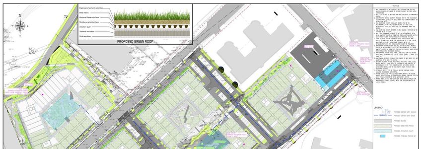
Document Control Sheet
Project       Appropriate Assessment Screening for Cookstown Industrial Estate, Tallaght, Dublin 24.
Report        Appropriate Assessment Screening
Date          1st December 2020
Project No:                               Document Reference:
Version       Author                      Reviewed                   Date
Draft 01      Bryan Deegan                Robert Farrell/MC          30th October 2020
Draft 02      Bryan Deegan                                           28th November 2020
Draft 03      Bryan Deegan                                           1st December 2020
Table of Contents
Introduction ............................................................................................................................................................1
   Altemar Ltd. ........................................................................................................................................................1
Background to the Appropriate Assessment ..........................................................................................................2
Methodology ..........................................................................................................................................................4
Stage 1 Screening Assessment ...............................................................................................................................5
   Management of the Site .....................................................................................................................................5
   Description of the Proposed Project ..................................................................................................................5
       Drainage....................................................................................................................................................... 11
   Identification of Relevant Natura 2000 Sites................................................................................................... 15
   In-Combination Effects .................................................................................................................................... 25
Conclusions .......................................................................................................................................................... 27
Findings of No Significant Effects Report ............................................................................................................ 28
Data Used for AA Screening ................................................................................................................................ 29
References ........................................................................................................................................................... 29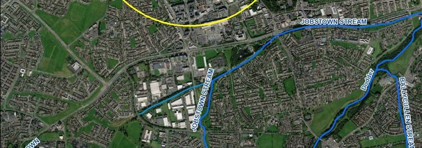
Introduction
The following Appropriate Assessment (AA) (Screening Stage) has been prepared by Altemar Ltd. at the request
of Joseph Costello, Absolute Limousines Ltd and Boherkill Property Development Ltd. The project relates to
Cookstown Industrial Estate, Tallaght, Dublin 24.

An Appropriate Assessment is an assessment of the potential effects of a proposed project or plan, on its own,
or in combination with other plans or projects, on one or more NATURA 2000 sites. Natura 2000 sites are those
sites designated as Special Areas of Conservation (SAC) or Special Protection Areas (SPA).

The AA (screening stage) examines the likely significant effects of a plan or project, either on its own, or in
combination with other plans and projects, upon a Natura 2000 site and considers whether, on the basis of
objective scientific evidence, it can be concluded that there are not likely to be significant effects on any
European site, in view of best scientific knowledge and the conservation objectives of the relevant European
sites.

Altemar Ltd.
Since its inception in 2001, Altemar has been delivering ecological and environmental services to a broad range
of clients. Operational areas include: residential; infrastructural; renewable; oil & gas; private industry; Local
Authorities; EC projects; and, State/semi-State Departments. Bryan Deegan, the managing director of Altemar,
is an Environmental Scientist and Marine Biologist with 26 years’ experience working in Irish terrestrial and
aquatic environments, providing services to the State, Semi-State and industry. He is currently contracted to
Inland Fisheries Ireland as the sole “External Expert” to environmentally assess internal and external projects.
He is also chair of an internal IFI working group on environmental assessment. Bryan Deegan (MCIEEM) holds a
MSc in Environmental Science, BSc (Hons.) in Applied Marine Biology, NCEA National Diploma in Applied Aquatic
Science and a NCEA National Certificate in Science (Aquaculture). Bryan Deegan carried out all elements of this
Appropriate Assessment Screening.

                                                        1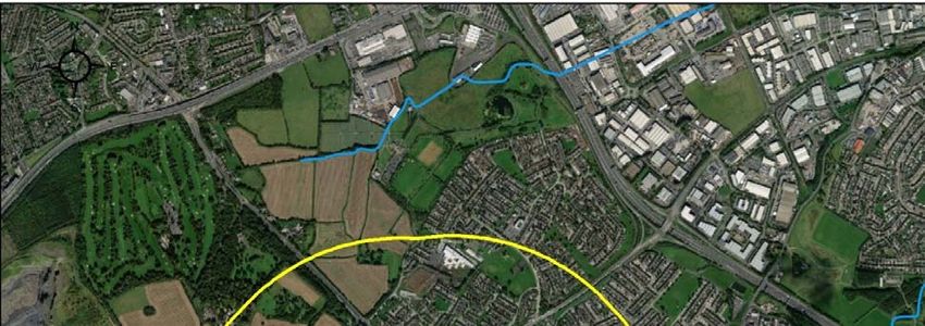
Background to the Appropriate Assessment
The Habitats Directive (92/43/EEC), together with the Birds Directive (2009/1477/EC), forms the cornerstone
of European nature conservation policy. The Directive protects over 1000 animals and plant species and over
200 "habitat types" which are of European importance. In the Directive, Articles 3 to 9 provide the legislative
means to protect habitats and species of European Community interest through the establishment and
conservation of an EU-wide network of conservation sites (NATURA 2000).

These are Special Areas of Conservation (SACs) designated under the Habitats Directive and Special Protection
Areas (SPAs) designated under the Birds Directive. Article 6(3) and 6(4) of the Habitats Directive set out the
decision-making tests for plans and projects likely to affect NATURA 2000 sites (Annex 1.1). Article 6(3)
establishes the requirement for Appropriate Assessment:

"Any plan or project not directly connected with or necessary to the management of the [NATURA 2000] site but
likely to have a significant effect thereon, either individually or in combination with other plans and projects,
shall be subjected to appropriate assessment of its implications for the site in view of the site's conservation
objectives. In light of the conclusions of the assessment of the implication for the site and subject to the
provisions of paragraph 4, the component national authorities shall agree to the plan or project only after having
ascertained that it will not adversely affect the integrity of the site concerned and, if appropriate, after having
obtained the opinion of the general public."

Furthermore, as outlined in the EC guidance document on Article 6(4) (January 2007)1:

“Appropriate assessments of the implications of the plan or project for the site concerned must precede its
approval and take into account the cumulative effects which result from the combination of that plan or project
with other plans or projects in view of the site's conservation objectives. This implies that all aspects of the plan
or project which can, either individually or in combination with other plans or projects, affect those objectives
must be identified in the light of the best scientific knowledge in the field.

Assessment procedures of plans or projects likely to affect NATURA 2000 sites should guarantee full
consideration of all elements contributing to the site integrity and to the overall coherence of the network, both
in the definition of the baseline conditions and in the stages leading to identification of potential impacts,
mitigation measures and residual impacts. These determine what has to be compensated, both in quality and
quantity. Regardless of whether the provisions of Article 6(3) are delivered following existing environmental
impact assessment procedures or other specific methods, it must be ensured that:

     •     Article 6(3) assessment results allow full traceability of the decisions eventually made, including the
           selection of alternatives and any imperative reasons of overriding public interest.

     •     The assessment should include all elements contributing to the site’s integrity and to the overall
           coherence of the network as defined in the site’s conservation objectives and Standard Data Form, and
           be based on best available scientific knowledge in the field. The information required should be
           updated and could include the following issues:

                o     Structure and function, and the respective role of the site’s ecological assets;

                o     Area, representativity and conservation status of the priority and nonpriority habitats in the
                      site;

                o     Population size, degree of isolation, ecotype, genetic pool, age class structure, and
                      conservation status of species under Annex II of the Habitats Directive or Annex I of the Birds
                      Directive present in the site;

1
  European Commission. (2007).Guidance document on Article 6(4) of the 'Habitats Directive' 92/43/EEC – Clarification of the concepts of: alternative
solutions, imperative reasons of overriding public interest, compensatory measures, overall coherence, opinion of the commission.
                                                                          2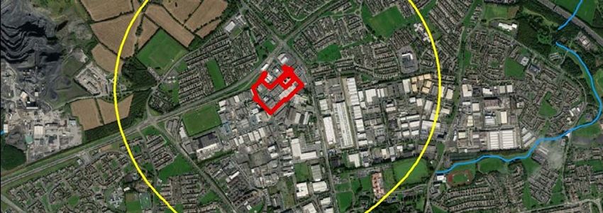
o   Role of the site within the biographical region and in the coherence of the NATURA 2000
          network; and,

      o   Any other ecological assets and functions identified in the site.

•   It should include a comprehensive identification of all the potential impacts of the plan or project
    likely to be significant on the site, taking into account cumulative impacts and other impacts likely to
    arise as a result of the combined action of the plan or project under assessment and other plans or
    projects.
•   The assessment under Article 6(3) applies the best available techniques and methods, to estimate the
    extent of the effects of the plan or project on the biological integrity of the site(s) likely to be
    damaged.
•   The assessment provides for the incorporation of the most effective mitigation measures into the
    plan or project concerned, in order to avoid, reduce or even cancel the negative impacts on the site.
•   The characterisation of the biological integrity and the impact assessment should be based on the
    best possible indicators specific to the NATURA 2000 assets which must also be useful to monitor the
    plan or project implementation.”

                                                  3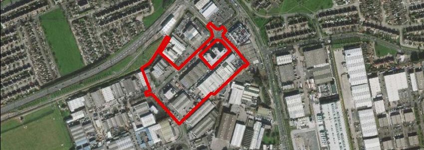
Methodology
This Appropriate Assessment screening was undertaken in accordance with the European Commission
Methodological Guidance on the provision of Article 6(3) and 6(4) of the 'Habitats' Directive 92/43/EEC (EC,
2001), Part XAB of the Planning and Development Act 2000, as amended, in addition to the December 2009
publication from the Department of Environment, Heritage and Local Government; ‘Appropriate Assessment of
Plans and Projects in Ireland: Guidance for Planning Authorities’ and the European Communities (Birds and
Natural Habitats) Regulations 2011 and the provision of Article 6 of the Habitats Directive 92/43/EEC (European
Commission, 21 November 2018).

In order to comply with the above Guidelines and legislation, the Appropriate Assessment Screening process
must be structured as follows:

        •   Description of the proposed project or plan;

        •   Identification of NATURA 2000 sites potentially affected;

        •   Identification and description of individual in combination effects likely to result from the proposed
            project;

        •   Assessment of the likely significance of the effects identified above. Exclusion of sites where it can
            be objectively concluded that there will be no likely significant effects; and,

        •   Conclusions.

                                                        4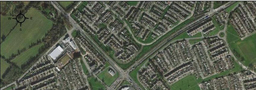
Stage 1 Screening Assessment
Management of the Site
The plan or project is not directly connected with, or necessary to the management of NATURA 2000 sites.

Description of the Proposed Project
The proposed development is a mixed-use retail and residential development at Cookstown Industrial Estate,
Dublin 24 and is comprised of: (i) Demolition of the existing industrial buildings; (ii) construction of a mixed-use
development featuring: (a) 1104 no. ‘build-to-rent’ apartments in 4 no. blocks varying in height from four to
eleven storeys; and (b) 4 no. commercial units at ground floor level of Blocks B and D, 1,500sqm of office space
across first to sixth floor levels of Block D and a crèche, with associated outdoor play area, at ground floor level
of Block C; (iii) road, junction and streetscape upgrade works along First Avenue, Cookstown Road and Old
Belgard Road, including the installation a signalized junction at the intersection of First Avenue and Cookstown
Road and Old Belgard Road and Cookstown Road; (iv) construction of 3 no. new roads and 1 no. pedestrian/cycle
link to the Belgard Luas Stop; (v) construction of a public plaza in the south-western corner of the site; and (vi)
associated site and infrastructural works are also proposed which include: foul and surface water drainage;
attenuation tanks; lighting; landscaping; boundary fences; plant areas; ESB substations; internal hard
landscaping, including footpaths and street furniture; and all associated site development works.

No Natura 2000 sites are within the potential Zone of Influence (ZoI). The ZoI of the proposed project would be
seen to be restricted to the site outline with potential for minor localised noise, dust and light impacts during
construction. Drainage from site, both foul and surface water, would be seen as the outputs form the site
during construction and operation that could potentially extend the potential ZoI. However, the proposed
development has no direct hydrological link to a Natura 2000 site.

                                                         5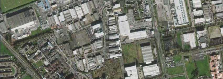
Figure 1. Site outline and location

                                      6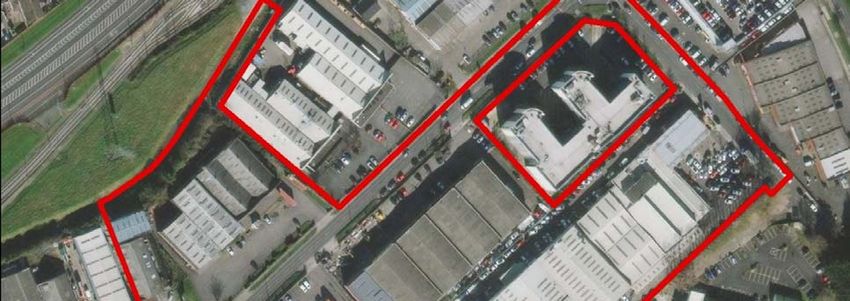
Figure 2. Site outline

                         7
Figure 3. Section 1 elevations
8Figure 4. Landscape Masterplan - Ground floor
9Figure 5. Phasing Plan
10Drainage
An Engineering Services Report (ESR) has been prepared by GDCL Consulting Engineers for the proposed
development and it contains details on the foul water and surface water drainage strategies.
Foul and surface water systems for the site will be separate and are designed in accordance with the
requirements of South Dublin County Council, the recommendations of the Greater Dublin Strategic Drainage
Study (GDSDS), the Building Regulations and the recommendations of the DOE Recommendations for Site
development works for Housing areas.
Surface Water
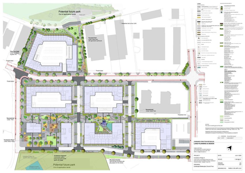
Section 2 of the ESR describes the surface water attenuation proposed as part of the development and states
the following:
‘’For each of the blocks within the development, surface water attenuation system will be provided using an off-
line Stormtech SC740 attenuation system. The attenuation facilities will be located within the courtyard areas
of the individual blocks. For maintenance purposes, the attenuation tank will be accessed via lids to be located
within the courtyard. Surface water discharge from the site will be controlled using a hydro brake at the outlet
from the attenuation system.’’
As the existing site is a brownfield, it is argued that the proposed development will provide a significant benefit
to the downstream system capacity due to the attenuation it will provide.
‘’Interception storage will be provided within the green roof and permeable paving areas located on the
apartment building roofs and podium slab. The green roof and permeable pavement will have a
substrate/subbase depth of 150mm with a void ratio of 40%. The benefit of providing interception storage is
that it allows some form of storage for small rainfall events which results in water evaporation and adsorption
in small quantities, therefore there will be less run-off from the system in small rainfall events thus mimicking
the natural response for the catchment. Also, the permeable paving car-parking spaces will reduce the amount
of run-off from the site as well as slowing down the rate of runoff.’’
‘’As all runoff is routed through the petrol interceptor and silt trap manhole as part of the offline attenuation
system this will provide treatment storage in the system. Furthermore, the green roofs and permeable
pavements will provide treatment storage.’’
The key components of the Surface Water Drainage system are:
• Green roof
• Cellular Attenuation System (Stormtech)
• Petrol Interceptor
‘’Surface water throughout the site will collected by a green roof system with addition roof and podium slab
gullies draining via downpipes and pipe slung to the underside of the ground floor slab before discharging into
the attenuation facility allocated to each block.
Flows from the attenuation tanks will be throttled at greenfield runoff rates before discharging into the existing
surface water network.
Where applicable, surface water drains will also be located within the basement and will be for incidental
spillages of water and for wheel wash only. The surface water will be collected in a pump sump chamber and
will be pumped via a rising main to the gravity foul drainage system located outside the basement at ground
floor level.’’
The proposed SUDs layout for the development is shown in Figure 6.
11Foul Drainage
It is proposed to connect the foul sewer systems of the development to the existing foul sewer network in the
area.
‘’Foul sewage within the site will be drained by a separate system via 150mm and 225mm diameter pipes. There
is an existing 300mm diameter foul sewer in running in an easterly direction along the footpath for Cookstown
Road. Block A foul drainage will discharge to this foul sewer.
There is an existing 450mm diameter foul sewer currently located within the existing access lane currently the
south of the existing warehouse where proposed Blocks C & D will be located. Proposed flows for Blocks B, C and
D will discharge to this sewer.
Where applicable, foul flows from the development would be slung under the podium slab and would connect
to the proposed gravity sewers.
There is an existing 300mm diameter foul sewer in running in a southerly direction from Cookstown road to the
existing 450mm diameter foul sewer located within the existing access lane south of the existing warehouse
where proposed Blocks C & D will be located. It is proposed to relocate this foul sewer under the proposed located
between proposed Blocks B and C.’’
The foul sewer and surface water layouts are both shown in Figure 7.
Flood Risk Assessment
A flood risk assessment was carried out and detailed in the ESR, stating that:
‘’The subject site is located more than 1.1km from the Whitestown Stream and therefore has not been included
in the ECFRAMS study. The site is therefore deemed to be within Flood Zone C, i.e. outside the 1000 year flood
events. Additionally, the site is also located more than 12km from the coast.’’
Construction, Demolition and Operational Waste Management Plan
As outlined in the AWN Construction, Demolition and Operational Waste Management Plan “The demolition
stage will involve the demolition of multiple warehouse style buildings onsite, c. 15,989 m2.”
“All movement of waste and the use of waste contractors will be undertaken in accordance with the Waste
Management Acts 1996 - 2011, Waste Management (Collection Permit) Regulations 2007 as amended and
Waste Management (Facility Permit & Registration) Regulations 2007 and amended. This includes the
requirement for all waste contractors to have a waste collection permit issued by the NWCPO. The nominated
project waste manager (see Section 7.0) will maintain a copy of all waste collection permits on-site.
If the waste is being transported to another site, a copy of the Local Authority waste COR/permit or EPA Waste/IE
Licence for that site will be provided to the nominated project waste manager (see Section 7.0). If the waste is
being shipped abroad, a copy of the Transfrontier Shipping (TFS) notification document will be obtained from
DCC (as the relevant authority on behalf of all local authorities in Ireland) and kept on-site along with details of
the final destination (COR, permits, licences etc.). A receipt from the final destination of the material will be kept
as part of the on-site waste management records.
All information will be entered in a waste management recording system to be maintained on site.”
12Figure 6. SUDs Layout
13Figure 7. Foul sewer and surface water layouts
14Identification of Relevant Natura 2000 Sites
The proposed works are not located within a NATURA 2000 site. The NATURA 2000 sites within 15 kilometres
of the subject site are detailed in Table 1 and Figures 8 and 9. Their features of interest and the potential impact
of the works on these features of interest are showcased in Table 2. Figure 10 showcases the identified
watercourses proximate to the subject site, as per EPA data. As can be seen from this figure, there are no
watercourses within 1 kilometre of the site boundary. Tributaries of the Rivers Camac, Dodder and Poddle are
located beyond 1km and the site possesses no direct connection to these watercourses or any Natura 2000
sites.
The proposed development site is located in a suburban and industrial environment surrounded by commercial
and industrial properties, brownfield sites and some residential areas. There is no intact biodiversity corridor to
Natura 2000 sites. No Natura 2000 sites are deemed to be in the potential Zone of Influence (ZoI). However,
following the precautionary principle, screening of all Natura 2000 sites within 15km and those with a
direct/indirect pathway beyond 15km is carried out. It is found there are no Natura 2000 sites with a
direct/indirect pathway beyond 15km of the subject site and no impact is foreseen on these sites.
Table 1. Proximity to designated sites of conservation importance
NATURA 2000 Site Distance
Special Areas of Conservation
Glenasmole Valley SAC 4.1 km
Wicklow Mountains SAC 6.5 km
Rye Water Valley / Carton SAC 10.4 km
South Dublin Bay SAC 11.3 km
Knocksink Wood SAC 14.2 km
North Dublin Bay SAC 14.4 km
Special Protection Areas
Wicklow Mountains SPA 8.1 km
South Dublin Bay and River Tolka Estuary SPA 11.3 km
North Bull Island SPA 14.4 km
Poulaphouca Reservoir 14.7 km
The initial screening of NATURA 2000 sites within 15km of the subject site, their features of interest and the
Source/Pathway/Receptor links between the works and the Natura 2000 site, with the potential to result in
adverse effects (without mitigation measures) on each NATURA 2000 site and features of interest, are seen in
Table 2.
Table 2. Initial screening of NATURA 2000 sites within 15km and NATURA 2000 sites within 15km with potential of hydrological
connection to the proposed development
NATURA Name Screened Details/Reason
Code IN/OUT
Special Areas of Conservation
IE001209 Glenasmole Out Conservation Objectives:
Valley SAC To maintain or restore the favourable conservation condition of
the Annex I habitat(s) and/or the Annex II species for which the
SAC has been selected.
Qualifying Interests
6210 Semi-natural dry grasslands and scrubland facies on
calcareous substrates (Festuco Brometalia)
6410 Molinia meadows on calcareous, peaty or clayey-silt-laden
soils (Molinion caeruleae)
7220 Petrifying springs with tufa formation (Cratoneurion)
15Source/Pathway/Receptor links between the works and the
Natura 2000 site, with the potential to result in significant
adverse effects.
The proposed works are located a minimum of 4.1 km from this
SAC (Figure 8). No potential impact is foreseen. There is no direct
or indirect pathway from the proposed development site to the
SAC. The construction and operation of the proposed
development will not impact on the conservation interests of the
site.
No significant effects are likely
IE0002122 Wicklow Out Conservation Objectives:
Mountains To maintain or restore the favourable conservation condition of
SAC the Annex I habitat(s) and/or the Annex II species for which the
SAC has been selected.
Qualifying Interests
3110 Oligotrophic waters containing very few minerals of sandy
plains (Littorelletalia uniflorae)
3160 Natural dystrophic lakes and ponds
4010 Northern Atlantic wet heaths with Erica tetralix
4030 European dry heaths
4060 Alpine and Boreal heaths
6130 Calaminarian grasslands of the Violetalia calaminariae
6230 Species-rich Nardus grasslands, on siliceous substrates in
mountain areas (and submountain areas, in Continental Europe)*
7130 Blanket bogs (* if active bog)
8110 Siliceous scree of the montane to snow levels
(Androsacetalia alpinae and Galeopsietalia ladani)
Source/Pathway/Receptor links between the works and the
Natura 2000 site, with the potential to result in significant
adverse effects.
The proposed works site is a minimum of 6.5 km from this SAC
(Figure 8). No potential impact is foreseen. There is no direct or
indirect pathway from the proposed development site to the SAC.
The construction and operation of the proposed development will
not impact on the conservation interests of the site.
No significant effects are likely
IE0001398 Rye Water Out Conservation Objectives:
Valley / Carton To maintain or restore the favourable conservation condition of
SAC the Annex I habitat(s) and/or the Annex II species for which the
SAC has been selected.
Qualifying Interests
7220 Petrifying springs with tufa formation (Cratoneurion)
1014 Narrow-mouthed Whorl Snail (Vertigo angustior)
1016 Desmoulin’s Whorl Snail (Vertigo moulinsiana)
Source/Pathway/Receptor links between the works and the
Natura 2000 site, with the potential to result in significant
adverse effects.
16The proposed works are located a minimum of 10.4 km from this
SAC (Figure 8). No potential impact is foreseen. There is no direct
or indirect pathway from the proposed development site to the
SAC. The construction and operation of the proposed
development will not impact on the conservation interests of the
site.
No significant effects are likely
IE0000210 South Dublin Out Conservation Objectives
Bay SAC To maintain the favourable conservation condition of Mudflats
and sandflats not covered by seawater at low tide in South Dublin
Bay SAC.
Feature of Interest
1140 Mudflats and sandflats not covered by seawater at low tide
Source/Pathway/Receptor links between the works and the
Natura 2000 site, with the potential to result in significant
adverse effects.
The development site is located within an urban area
approximately 11.3 km from the South Dublin Bay SAC (Figure 8).
There is no ‘direct’ Source-Pathway linkage between the
proposed development site and the SAC. Surface water drains to
the public surface water network. Due to the distance via the
indirect pathway (e.g. surface/foul water networks) any
pollutants or silt will be dispersed, settle or be diluted. Foul water
from the development will be processed in the existing Ringsend
Treatment works. The indirect pathway of surface water or, foul
water to Ringsend will not result in a significant effect on the
Natura 2000 site.
No potential impact is foreseen. There is no direct pathway from
this site to the SAC. The construction and operation of the
proposed development will not impact on the conservation
interests of the site.
No significant effects likely
IE000725 Knocksink Out Conservation Objectives:
Wood SAC To maintain or restore the favourable conservation condition of
the Annex I habitat(s) and/or the Annex II species for which the
SAC has been selected.
Qualifying Interests
7220 Petrifying springs with tufa formation (Cratoneurion)
91A0 Old sessile oak woods with Ilex and Blechnum
91E0 Alluvial forests with Alnus glutinosa and Fraxinus excelsior
(Alno-Padion, Alnion incanae, Salicion albae)
Source/Pathway/Receptor links between the works and the
Natura 2000 site, with the potential to result in significant
adverse effects.
The proposed works are located a minimum of 14.2 km from this
SAC (Fig. 8). No potential impact is foreseen. There is no direct or
indirect pathway from the proposed development site to the SAC.
17The construction and operation of the proposed development will
not impact on the conservation interests of the site.
No significant effects are likely
IE0000206 North Dublin Out Conservation Objectives:
Bay SAC To maintain or restore the favourable conservation condition of
the Annex I habitat(s) and/or the Annex II species for which the
SAC has been selected.
Features of Interest
1140 Mudflats and sandflats not covered by seawater at low tide
1210 Annual vegetation of drift lines
1310 Salicornia and other annuals colonising mud and sand
1330 Atlantic salt meadows (Glauco-Puccinellietalia maritimae)
1395 Petalwort (Petalophyllum ralfsii)
1410 Mediterranean salt meadows (Juncetalia maritimi)
2110 Embryonic shifting dunes
2120 Shifting dunes along the shoreline with Ammophila arenaria
2130 Fixed coastal dunes with herbaceous vegetation (grey
dunes)
2190 Humid dune slacks
Source/Pathway/Receptor links between the works and the
Natura 2000 site, with the potential to result in significant
adverse effects.
The development site is located within an urban area
approximately 14.4 km from the North Dublin Bay SAC (Figure 8).
There is no ‘direct’ Source-Pathway linkage between the
proposed development site and the SAC. Surface water drains to
the public surface water network. Due to the distance via the
indirect pathway (e.g. surface/foul water networks) any
pollutants or silt will be dispersed, settle or be diluted. Foul water
from the development will be processed in the existing Ringsend
Treatment works. The indirect pathway of surface water or, foul
water to Ringsend will not result in a significant effect on the
Natura 2000 site.
No potential impact is foreseen. There is no direct pathway from
this site to the SAC. The construction and operation of the
proposed development will not impact on the conservation
interests of the site.
No significant effects likely
18Special Protection Areas
IE004040 Wicklow Out Conservation Objectives
Mountains To maintain or restore the favourable conservation conditions of
SPA the species and/or habitats listed as Qualifying Interests for this
SPA.
Features of Interest
A098 Merlin (Falco colombarius)
A103 Peregrine (Falco peregrinus)
Source/Pathway/Receptor links between the works and the
Natura 2000 site, with the potential to result in significant
adverse effects.
The proposed works on the subject site are a minimum of 8.1 km
from the Wicklow Mountains SPA (Figure 9). No potential impact
is foreseen. There is no direct or indirect pathway from the
proposed development site to the SPA. The construction and
operation of the proposed development will not impact on the
conservation interests of the site.
No significant effects are likely
IE0004024 South Dublin Conservation Objectives:
Bay and River To maintain or restore the favourable conservation conditions of
Tolka Estuary the species and/or habitats listed as Qualifying Interests for this
SPA SPA.
Qualifying Interests
A046 Light-bellied Brent Goose (Branta bernicla hrota)
A130 Oystercatcher (Haematopus ostralegus)
A137 Ringed Plover (Charadrius hiaticula)
A141 Grey Plover (Pluvialis squatarola)
A143 Knot (Calidris canutus)
A144 Sanderling (Calidris alba)
A149 Dunlin (Calidris alpina)
A157 Bar-tailed Godwit (Limosa lapponica)
A162 Redshank (Tringa totanus)
A179 Black-headed Gull (Chroicocephalus ridibundus)
A192 Roseate Tern (Sterna dougallii)
A193 Common Tern (Sterna hirundo)
A194 Arctic Tern (Sterna paradisaea)
A999 Wetlands
Source/Pathway/Receptor links between the works and the
Natura 2000 site, with the potential to result in significant
adverse effects.
The subject site where the proposed works will take place is a
minimum of 11.3 km from the South Dublin Bay and River Tolka
Estuary SPA (Figures 9). There is no ‘direct’ Source-Pathway
linkage between the proposed development site and the SPA.
Surface water drains to the public surface water network. Due to
the distance via the indirect pathway (e.g. surface/foul water
networks) any pollutants or silt will be dispersed, settle or be
diluted. Foul water from the development will be processed in the
19existing Ringsend Treatment works. The indirect pathway of
surface water or, foul water to Ringsend will not result in a
significant effect on the Natura 2000 site.
No potential impact is foreseen. There is no direct pathway from
this site to the SPA. The construction and operation of the
proposed development will not impact on the conservation
interests of the site.
No significant effects are likely
IE0004006 North Bull Conservation Objective:
Island SPA To maintain or restore the favourable conservation conditions of
the species and/or habitats listed as Qualifying Interests for this
SPA.
Qualifying Interests
A046 Light-bellied Brent Goose (Branta bernicla hrota)
A048 Shelduck (Tadorna tadorna)
A052 Teal (Anas crecca)
A054 Pintail (Anas acuta)
A056 Shoveler (Anas clypeata)
A130 Oystercatcher (Haematopus ostralegus)
A140 Golden Plover (Pluvialis apricaria)
A141 Grey Plover (Pluvialis squatarola)
A143 Knot (Calidris canutus)
A144 Sanderling (Calidris alba)
A149 Dunlin (Calidris alpina alpine)
A156 Black-tailed Godwit (Limosa limosa)
A157 Bar-tailed Godwit (Limosa lapponica)
A160 Curlew (Numenius arquata)
A162 Redshank (Tringa tetanus)
A169 Turnstone (Arenaria interpres)
A179 Black-headed Gull (Chroicocephalus ridibundus)
A999 Wetlands
Source/Pathway/Receptor links between the works and the
Natura 2000 site, with the potential to result in significant
adverse effects.
The subject site where the proposed works will take place is a
minimum of 14.4 km from the North Bull Island SPA (Figures 9).
There is no ‘direct’ Source-Pathway linkage between the
proposed development site and the SPA.
Surface water drains to the public surface water network. Due to
the distance via the indirect pathway (e.g. surface/foul water
networks) any pollutants or silt will be dispersed, settle or be
diluted. Foul water from the development will be processed in the
existing Ringsend Treatment works. The indirect pathway of
surface water or, foul water to Ringsend will not result in a
significant effect on the Natura 2000 site.
No potential impact is foreseen. There is no direct pathway from
this site to the SPA. The construction and operation of the
20proposed development will not impact on the conservation
interests of the site.
No significant effects are likely
IE004063 Poulaphouca Out Conservation Objectives
Reservoir SPA To maintain or restore the favourable conservation condition of
the bird species listed as Special Conservation Interests for this
SPA.
Features of Interest
A043 Greylag Goose (Anser anser)
A183 Lesser black-backed Gull (Larus fuscus)
Source/Pathway/Receptor links between the works and the
Natura 2000 site, with the potential to result in significant
adverse effects.
The proposed works on the subject site are a minimum of 14.7
km from the Poulaphouca Reservoir SPA (Figure 9). No potential
impact is foreseen. There is no direct or indirect pathway from
the proposed development site to the SPA. The construction and
operation of the proposed development will not impact on the
conservation interests of the site.
No significant effects are likely
21Figure 8. Special Areas of Conservation located within 15km of the proposed development
22Figure 9. Special Protected Areas located within 15km of the proposed development
23Figure 10. Watercourses in proximity to the proposed development
24In-Combination Effects
There are several proposed developments located in the area immediately surrounding the subject site. The
following is a list of planning applications as identified on the Department of Housing, Local Government and
Heritage’s ‘National Planning Application Database’ portal2:
Ref. No. Address Proposal
SD19A/02 Lands adjacent to 1, A two storey dwelling consisting of 3 bedrooms, bathroom, open plan
65 Pinetree Grove, kitchen dining space and living room with a total combined area of
Kilnamanagh, approximately 116sq.m
Tallaght, Dublin 24
SHD3ABP- Site at the corner of Demolition of the existing industrial buildings on site (4,800sq.m) and
305763- Airton Road and the construction of 2 blocks comprising: 328 apartments (93 1-bed, 222
19 Belgard Road, 2-bed and 13 3-bed), ancillary residential support facilities and
Tallaght, Dublin 24 commercial floorspace measuring 31,147sq.m gross floor space above
a single basement level measuring 5,861sq.m. Block A is a part-5 to
part-7 storey (13,710sq.m) over basement block comprising 149
apartments with office space (222sq.m). Block B is a part-6 to part-9
storey (17,437sq.m) over basement block comprising 179 apartments,
2 double-height retail/commercial (Class 1/Class 2) units (354sq.m), a
café/restaurant (313sq.m) , a creche (360sq.m), internal residents
amenity area (644sq.m) at ground floor including reception (37.7sq.m),
residents lounge (91.3sq.m), private dining area (52.6sq.m), co-working
space (45.5sq.m), games room (47.3sq.m), gym (80sq.m) and
communal lounge (220sq.m) at 6th floor level. The development also
consists of the provision of a landscaped courtyard; public plaza at the
corner of Airton and Belgard Road; pedestrian access from Airton Road
to the Technological University campus; balconies; landscaped roof
terrace at 6th floor level (7th Storey) of Block B (671sq.m); 184 car
parking spaces at basement level including 14 club car spaces, 10
disabled parking spaces and 4 creche parking spaces; 727 basement
and surface bicycle parking spaces; 4 motorbike parking spaces; bin
storage; boundary treatments; green roofs; hard and soft landscaping;
plant; lighting; Vodafone cabin sub-station; ESB sub-stations, switch
rooms and generators; and all other associated site works above and
below ground
The Inspector’s report for the SHD application (SHD3ABP-305763-19) stated the following in relation to the
environmental impact of the development:
‘’It is concluded that, by reason of the nature, scale and location of the subject site, the proposed development
would not be likely to have significant effects on the environment. It is, therefore, considered that an
environmental impact assessment report for the proposed development is not necessary in this case.’’
The Inspector’s report also notes the contents of the AA Screening report which accompanied the planning
application, stating that the ‘’report concludes that significant effects are not likely to arise, either alone or in
combination with other plans or projects to the Natura 2000 network.’’
The foul and combined sewers terminate at Ringsend Waste Water Treatment Plant (WWTP). The foul water
from the site will transfer to the Ringsend WWTP via public foul sewer where it will be diluted and mixed with
other effluent. Treatment will take place at Ringsend WWTP prior to discharge into Dublin Bay. Irish Water
operate this facility under licence (EPA D0034-01) and are required to comply with environmental legislation.
2
https://housinggovie.maps.arcgis.com/apps/webappviewer/index.html?id=9cf2a09799d74d8e9316a3d3a4d3a8de
25In 2019 (ABP Ref. PL29S.301798), the facility received planning to upgrade capacity to 2.4 million PE, which
will be in place by the time the proposed project becomes operational. The EIAR for the upgrading of
Ringsend WWTP stated that “The likely cumulative impact of the Proposed WwTP Component is that the
resident population of the Greater Dublin Area will be capable of growing to its target population levels over
time due to the increased capacity of the Ringsend WwTP. This will enable objectives at both national and
regional levels to be met.” Emissions from the plant are currently not in compliance with the Urban
Wastewater Treatment Directive. Note that Phase 1 of these works is currently underway with a target
completion date of 2021.
Note that as part of this application an Environmental Impact Assessment Report (EIAR) was submitted.
Sections 5 and 6 of this EIAR related to Marine Biodiversity and Terrestrial Biodiversity respectively and each
contained a section on the ‘do nothing scenario’. These review the effects to biodiversity in Dublin Bay in the
absence of the upgrade works.
“If the status quo is maintained there will be little or no change in the majority of the intertidal faunal
assemblages found in Dublin Bay which would likely continue to be relatively diverse and rich across the bay .
Previous studies suggest that the outer and south bays are largely unaffected by the nutrient inputs from the
WwTP at Ringsend and from the Liffey and Tolka rivers. Therefore, the sandy communities found in those areas
will likely remain dominated by the same assemblage of Nepthys, tellinids and other pollution-sensitive species,
albeit subjected to natural spatial and seasonal variations.
However, the areas in the Tolka Estuary and North Bull Island channel will continue to be affected by the
cumulative nutrient loads from the river Liffey and Tolka and the effluent from the Ringsend WwTP. These
areas will likely continue to be colonised by opportunistic taxa tolerant of organic enrichment. There is a
possibility that an increase in the nutrient outputs from the plant due to the operational overload and storm
water discharges could result in a decline in the biodiversity of these communities as a result of low oxygen
availability caused by increased organic enrichment. Considering the existing situation, it is possible that
through the future oversupply of DIN to the area impacted by the existing outfall, benthic production could be
adversely impacted due to hypoxic or even anoxic conditions. An increase in the cover of opportunistic
macroalgae could lead to further deterioration in the lagoons in the North Bull as they add to the organic load
on the benthos and further increase the BOD. These events, although localised, could deteriorate the biological
status for Dublin Bay as a whole. Nonetheless, it is unlikely, as existing historical data suggests that pollution in
Dublin Bay has had little or no effect on the composition and richness of the benthic macroinvertebrate.
Although a localised decline could occur, it is not envisaged to be to a scale that could pose a threat to
the shellfish, fish, bird or marine mammal populations that occur in the area. (section 5.7.1)
If the Proposed WwTP Component is not implemented, there is a possibility that an increase in the nutrient
outputs from the plant due to operational overload and storm water discharges could result in a decline in the
biodiversity of invertebrate communities in the Tolka Estuary and North Bull Island channel as a result of low
oxygen availability caused by increased organic enrichment.
An increase in the cover of opportunistic macroalgae could lead to further deterioration in the lagoons in the
North Bull as they add to the organic load on the benthos and further increase the BOD. These events,
although localised, could deteriorate the biological status for Dublin Bay as a whole. It is unlikely that they
would have any significant impact on the waterbird populations that forage on invertebrates in Dublin Bay.
A graphic from the EIAR prepared by Irish Water in 2018 showed the zone of influence of the discharge from
the Ringsend WwTP and this indicated that effects from the discharge do not extend to the south side of the
bay.”
In addition, a separate WWTP at Clonshaugh with a 500,000 PE capacity has received planning (November
2019). This will increase capacity within the Greater Dublin Area to 2.9 million PE.No cumulative or in
combination effects on Natura 2000 sites are foreseen.
26Cumulatively, these other proposals will not significantly effect Natura 2000 sites. Therefore, the significance
of the impact of the proposed development, is imperceptible and is considered not to change in combination
with the other projects.
Conclusions
The proposed site is located in an urban environment 4.1 km from the nearest Natura 2000 site. Watercourses
and surface runoff are seen as the main potential pathway for impacts on Natura 2000 sites. However, the site
is not proximate to and does not have a direct pathway to watercourses that could act as potential vectors for
impact on Natura 2000 sites. There is no direct hydrological pathway from the proposed development site a
Natura 2000 site. However, there is an indirect pathway to Dublin Bay and Natura 2000 sites via the surface
water connection Dublin Bay and via foul water to Ringsend WWTP. Foul water from the development will be
processed in the Ringsend Treatment works. The proposed development will be required to comply with Water
Pollution Acts during construction. However, given the distance to Natura 2000 sites via public drainage
networks sufficient mixing and settlement will take place in the absence of controls on site. These controls are
not necessary for the protection of Natura 2000 sites.
No Natura 2000 sites are within the zone of influence of this development. Having taking into consideration
the effluent discharge from the proposed development works, the distance between the proposed
development site to designated conservation sites, lack of direct hydrological pathway or biodiversity corridor
link to conservation sites and the dilution effect with other effluent and surface runoff, it is concluded that this
development that would not give rise to any significant effects to designated sites. The construction and
operation of the proposed development will not impact on the conservation objectives of features of interest
of Natura 2000 sites. In addition, no in-combination effects are foreseen.
This report presents a Stage 1 Appropriate Assessment Screening for the Proposed Development, outlining the
information required for the competent authority to screen for appropriate assessment and to determine
whether or not the Proposed Development, either alone or in combination with other plans and projects, in
view of best scientific knowledge, is likely to have a significant effect on any European or Natura 2000 site.
On the basis of the content of this report, the competent authority is enabled to conduct a Stage 1 Screening
for Appropriate Assessment and consider whether, in view of best scientific knowledge and in view of the
conservation objectives of the relevant European sites, the Proposed Development, individually or in
combination with other plans or projects is likely to have a significant effect on any European site.
27Findings of No Significant Effects Report
Details of Project Appropriate Assessment Screening for a mixed-use development at
Cookstown Industrial Estate, Tallaght, Dublin 24.
Name and Location of Glenasmole Valley SAC
NATURA 2000 Sites Within Wicklow Mountains SAC
15km Rye Water Valley / Carton SAC
South Dublin Bay SAC
Knocksink Wood SAC
North Dublin Bay SAC
Wicklow Mountains SPA
South Dublin Bay and River Tolka Estuary SPA
North Bull Island SPA
Poulaphouca Reservoir
Project Description Mixed-use residential development.
Is the Project directly No
connected with the
management of the NATURA
2000 site?
Details of any other projects None
or plans that together with
this project could affect the
NATURA 2000 site
The assessment of significant effects
Describe how the project is No Impact Predicted
likely to affect the NATURA
2000 site
Response to consultation N/A
Data collected to carry out the Site Visit and Supporting NPWS data.
assessment
Who carried out the Altemar Ltd.
assessment
Sources of data NPWS website, standard data form, conservation objectives data of the
site and references outlined in the AA Screening Report.
Explain why the effects are Having taking into consideration the effluent discharge from the
not considered significant proposed development works, lack of direct hydrological pathway or
biodiversity corridor link to conservation sites and the dilution effect
with other effluent and surface runoff, it is concluded that this
development that would not give rise to any significant effects to
designated sites.
Level of assessment Stage 1 Screening
completed
Overall conclusions On the basis of the content of this report, the competent authority is
enabled to conduct a Stage 1 Screening for Appropriate Assessment and
consider whether, in view of best scientific knowledge and in view of the
conservation objectives of the relevant European sites, the Proposed
Development, individually or in combination with other plans or projects
is likely to have a significant effect on any European site.
28Data Used for AA Screening
NPWS site synopses and Conservation objectives of sites within 15km were assessed. The most recent SAC and
SPA boundary shapefiles were downloaded and overlaid on ESRI road maps and satellite imagery. A site visit
was carried out on the 16th September 2020 to determine if the site contained possible threats to a NATURA
2000 site.
References
The following references were used in the preparation of this AA screening report.
1. Department of Environment Heritage and Local Government Circular NPW 1/10 and PSSP 2/10 on
Appropriate Assessment under Article 6 of the Habitats Directive – Guidance for Planning Authorities
March 2010.
2. Appropriate Assessment of Plans and Projects in Ireland: Guidance for Planning Authorities, Department
of the Environment, Heritage and Local Government 2009;
http://www.npws.ie/publications/archive/NPWS_2009_AA_Guidance.pdf
3. Managing NATURA 2000 Sites: the provisions of Article 6 of the Habitats Directive 92/43/EEC, European
Commission 2000;
http://ec.europa.eu/environment/nature/Natura2000/management/docs/art6/provision_of_art6_en.
pdf
4. Assessment of Plans and Projects Significantly Affecting NATURA 2000 Sites: Methodological guidance
on the provisions of Article 6(3) and (4) of the Habitats Directive 92/43/EEC;
http://ec.europa.eu/environment/nature/Natura2000management/docs/art6/Natura_2000_assess_e
n.pdf
5. Guidance document on Article 6(4) of the 'Habitats Directive' 92/43/EEC – Clarification of the concepts
of: alternative solutions, imperative reasons of overriding public interest, compensatory measures,
overall coherence, opinion of the commission;
http://ec.europa.eu/environment/nature/Natura2000/management/docs/art6/guidance_art6_4_en.p
df
6. Guidance document on the implementation of the birds and habitats directive in estuaries and coastal
zones with particular attention to port development and dredging;
http://ec.europa.eu/environment/nature/Natura2000/management/docs/guidance_doc.pdf
7. The Status of EU Protected Habitats and Species in Ireland.
http://www.npws.ie/publications/euconservationstatus/NPWS_2007_Conservation_Status_Report.pdf
8. NPWS (2016) Conservation objectives for Glenasmole Valley SAC [001209]. Generic Version 5.0.
Department of Arts, Heritage, Regional, Rural and Gaeltacht Affairs.
9. NPWS (2016) Conservation objectives for Wicklow Mountains SAC [002122]. Generic Version 5.0.
Department of Arts, Heritage, Regional, Rural and Gaeltacht Affairs.
10. NPWS (2016) Conservation objectives for Rye Water Valley/Carton SAC [001398]. Generic Version 5.0.
Department of Arts, Heritage, Regional, Rural and Gaeltacht Affairs.
11. NPWS (2016) Conservation objectives for Wicklow Mountains SPA [004040]. Generic Version 5.0.
Department of Arts, Heritage, Regional, Rural and Gaeltacht Affairs.
12. NPWS (2013) Conservation Objectives: South Dublin Bay SAC 000210. Version 1. National Parks and
Wildlife Service, Department of Arts, Heritage and the Gaeltacht.
2913. NPWS (2015) Conservation Objectives: South Dublin Bay and River Tolka Estuary SPA 004024. Version 1.
National Parks and Wildlife Service, Department of Arts, Heritage and the Gaeltacht.
14. NPWS (2015) Conservation Objectives: North Bull Island SPA 004006. Version 1. National Parks and
Wildlife Service, Department of Arts, Heritage and the Gaeltacht.
15. NPWS (2013) Conservation Objectives: North Dublin Bay SAC 000206. Version 1. National Parks and
Wildlife Service, Department of Arts, Heritage and the Gaeltacht.
16. NPWS (2020) Conservation objectives for Knocksink Wood SAC [000725]. Generic Version 7.0.
Department of Culture, Heritage and the Gaeltacht.
17. NPWS (2020) Conservation objectives for Poulaphouca Reservoir SPA [004063]. Generic Version 7.0.
Department of Culture, Heritage and the Gaeltacht.
30You can also read