Lower Murray-Darling Region - Commonwealth Environmental Water Portfolio Management Plan
←
→
Page content transcription
If your browser does not render page correctly, please read the page content below
Commonwealth Environmental Water
Portfolio Management Plan

Lower Murray–Darling Region
2018–19

Commonwealth Environmental Water Office
Front cover image credit:
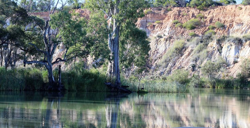
River Murray channel, Photo by Commonwealth Environmental Water Office.

Back cover image credit:
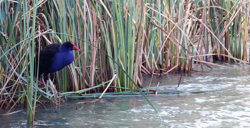
Swamphen in River Murray channel, Photo by Commonwealth Environmental Water Office.

Acknowledgement of the traditional owners of the Lower Murray-Darling Basin
The Commonwealth Environmental Water Office respectfully acknowledges the traditional owners, their Elders past and
present, their Nations of the Murray-Darling Basin, and their cultural, social, environmental, spiritual and economic
connection to their lands and waters.

© Copyright Commonwealth of Australia, 2018.

Commonwealth Environmental Water Portfolio Management Plan: Lower Murray–Darling Region 2018–19 is licensed by the
Commonwealth of Australia for use under a Creative Commons Attribution 4.0 International licence with the exception of the
Coat of Arms of the Commonwealth of Australia, the logo of the agency responsible for publishing the report, content supplied
by third parties, and any images depicting people. For licence conditions see: https://creativecommons.org/licenses/by/4.0/

This report should be attributed as ‘Commonwealth Environmental Water Portfolio Management Plan: Lower Murray–Darling
Region 2018–19, Commonwealth of Australia, 2018’.

The Commonwealth of Australia has made all reasonable efforts to identify content supplied by third parties using the following
format ‘© Copyright’ noting the third party.

The views and opinions expressed in this publication are those of the authors and do not necessarily reflect those of the
Australian Government or the Minister for the Environment and Energy.

While reasonable efforts have been made to ensure that the contents of this publication are factually correct, the
Commonwealth does not accept responsibility for the accuracy or completeness of the contents, and shall not be liable for any
loss or damage that may be occasioned directly or indirectly through the use of, or reliance on, the contents of this publication.
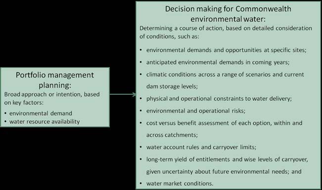
Commonwealth environmental water portfolio
management planning
Commonwealth Environmental Water Holder

The Commonwealth Environmental Water Holder is a statutory position established under the Water Act
2007 and is responsible for managing the Commonwealth’s environmental water holdings. This water must
be managed to protect and restore the rivers, wetlands and floodplains (and the native animals and plants
they support) of the Murray–Darling Basin. Ms Jody Swirepik is the current Commonwealth Environmental
Water Holder. Ms Swirepik is supported by staff of the Commonwealth Environmental Water Office. The
Office employs six local engagement officers who live and work in regional centres across the Murray–
Darling Basin.

Commonwealth environmental water

Commonwealth environmental water holdings are water entitlements that have been acquired by the
Australian Government through investments in water-saving infrastructure and purchases on the water
market. The holdings are a mix of entitlement types held across 19 catchments. The rules governing the
entitlements vary across states and across catchments. Commonwealth environmental water entitlements
are subject to the same fees, allocations, carryover and other rules as equivalent entitlements held by other
water users.

There are broadly three options for managing Commonwealth environmental water:

   •   delivering water to a river or wetland to meet an identified environmental demand
   •   leaving water in storage and carrying it over for use in the next water year (referred to as ‘carryover’)
   •   trading water, that is, selling water and using the proceeds to buy water in another catchment or in a
       future year, or investing in complementary ‘environmental activities’.

Purpose of the document

This document sets out the plans for managing the Commonwealth environmental water portfolio in the
Lower Murray–Darling for 2018–19. Efficient and effective management of Commonwealth environmental
water requires the utilisation of all portfolio management options. By taking a multi-year approach to
planning, portfolio management tools such as use, carryover and trade can be managed for maximising
environmental outcomes.

The portfolio management plans support transparent, coordinated and adaptive management of
Commonwealth environmental water, consistent with the Basin-wide environmental watering strategy and
having regard to the Basin annual environmental watering priorities.

To learn more about the planning approach see Portfolio Management Planning: Approach to planning for
the use, carryover and trade of Commonwealth environmental water, 2018–19 (available at:
http://www.environment.gov.au/water/cewo/publications under ‘Planning approach’).

Delivery partners

Commonwealth environmental water is managed in conjunction with and delivered by a range of partners.
This portfolio management plan has been developed in consultation with our delivery partners, including
South Australian Department of Environment and Water (including Natural Resources Management Boards),
NSW Office of Environment and Heritage, Victorian Environmental Water Holder, Victorian Catchment
Management Authorities, NSW Department of Primary Industries – Fisheries, the Murray–Darling Basin
Authority, the Murray–Darling Wetlands Working Group Ltd, Nature Foundation South Australia, Ngarrindjeri
Regional Authority, Renmark Irrigation Trust, scientists engaged in monitoring the outcomes of
Commonwealth environmental water use and various community groups and individuals.

                                                       1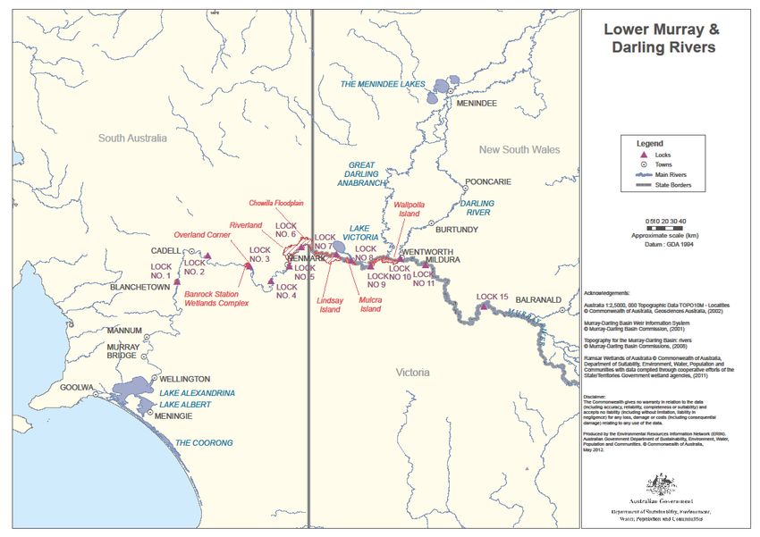
Your input

The management of Commonwealth environmental water relies on considerable advice and assistance
from local organisations, state governments and others. Individuals and groups within the Murray–Darling
Basin community are encouraged to submit suggestions for the management of Commonwealth
environmental water. Please contact the Office via: ewater@environment.gov.au.

                                                     2
Table of contents
Commonwealth environmental water portfolio management planning 1
Commonwealth Environmental Water Holder 1
Commonwealth environmental water 1
Purpose of the document 1
Delivery partners 1
Your input 2
Table of contents 3
1. Environmental watering in the Lower Murray–Darling 4
1.1. The Lower Murray–Darling Region 4
1.2. Environmental objectives in the Lower Murray–Darling Region 6
1.3. Environmental flow requirements 9
1.4. Monitoring and adaptive management 9
2. Portfolio management in 2018–19 12
2.1. Antecedent and current catchment conditions and the demand for environmental water in
2018–19 12
2.2. Water availability in 2018–19 15
2.3. Overall purpose of managing environmental water based on supply and demand 17
2.4. Water Delivery in 2018–19 18
2.5. Trading water in 2018–19 19
2.6. Carrying over water for use in 2019–20 20
2.7. Identifying Investment Opportunities 20
3. Next steps 24
3.1. From planning to decision making 24
3.2. Further information 24
Bibliography 25
Attachment A – Expected outcomes from the Basin-wide environmental watering
strategy 28
Attachment B – Operational details for watering 33
Operational considerations in the Lower Murray-Darling catchment 33
Potential watering actions under different levels of water resource availability 33
Potential watering actions – standard operating arrangements 37
Attachment C – Long-term water availability 42
Commonwealth environmental water holdings 42
Other sources of environmental water 42
Planned environmental water 42
31. Environmental watering in the Lower Murray–Darling
1.1. The Lower Murray–Darling Region
The Lower Murray–Darling Region consists of the River Murray downstream of Lock 15 at Euston to the Murray
Mouth, the Darling River below Menindee Lakes and the Great Darling Anabranch. The lower River Murray
contains several wetlands of ecological significance, including the internationally important Ramsar listed
Coorong and Lakes Alexandrina and Albert, the Riverland (including the Chowilla floodplain), Banrock
Station and Hattah Lakes.
Environmental water is sourced via managed releases from River Murray storages including Hume Reservoir,
Menindee Lakes, Lake Victoria and River Murray tributaries. Natural cues (e.g. natural flows) may be used to
inform the use of environmental water in the lower River Murray, establishing a more natural flow regime and
maximising the benefits of environmental water delivery. Environmental water delivery to specific sites within
the lower River Murray occurs in two main ways. At low river flows, regulating structures or pumping can be
used to manage the diversion of water into anabranches, creeks, wetlands and floodplains while in-channel
pulses can provide benefits for native fish. At high river flows, environmental water is used to augment
natural flow to influence the magnitude and duration of beneficial floodplain and wetland inundation.
Downstream of Lock 15 in the lower River Murray many wetlands, creeks and anabranches are permanently
connected to the main river channel at normal weir pool levels, however, some sites are only connected
through the operation of infrastructure or elevated river flows. The seasonally appropriate operation of river
infrastructure, such as weirs, barrages and pumps, provides more natural patterns of inundation and drying
sequences at these sites. Some wetland inundation can be achieved through weir pool manipulation, with
a temporary raising of weir pools increasing the area of wetland inundation in low flow conditions whilst
using much less water than the equivalent inundation from overbank flows. Water levels within the Lower
Lakes and inflows into the Coorong are managed through the operation of barrages at Lake Alexandrina.
Environmental water delivery in the River Murray channel upstream of the South Australian border, including
the operation of locks and storages, is managed by the Murray–Darling Basin Authority (River Murray
Operations). In the lower Darling River, environmental water delivery is managed by either WaterNSW or the
Murray–Darling Basin Authority (River Murray Operations) depending on who has operational control of
Menindee Lakes at the time in accordance with the Murray–Darling Basin Agreement. Within South
Australia, SA Water and the South Australian Department of Environment and Water are the responsible
agencies for environmental water delivery and management of locks and barrages. Delivery of
Commonwealth environmental water is undertaken in collaboration with these agencies.
Environmental water is managed by a number of water holders in the Murray, including the CEWH, The
Living Murray, the Victorian Environmental Water Holder, NSW Office of Environment and Heritage and the
South Australian Department of Environment and Water. Environmental water portfolios are coordinated to
maximise the effectiveness of water delivery for achieving environmental outcomes. For example, the
Southern Connected Basin Environmental Watering Committee was established by the Murray–Darling Basin
Ministerial Council in October 2014 to coordinate the efficient and effective delivery of all environmental
water in the southern-connected Basin.
4Figure 1: Map of the Lower Murray–Darling Region.
51.2. Environmental objectives in the Lower Murray–Darling Region
The long-term environmental objectives for the Murray–Darling Basin are described in the Basin Plan’s
environmental watering plan and the Basin-wide environmental watering strategy, which includes
‘quantified environmental expected outcomes’ at both a Basin-scale and for each catchment. In addition,
the Basin annual environmental watering priorities (MDBA, 2017) represent annual steps to guide
environmental watering to meet the long-term outcomes in the Basin-wide environmental watering strategy.
The expected outcomes relevant for the Lower Murray–Darling are summarised in Table 1 and described in
detail in Attachment A.
The Victorian and South Australian state governments have also developed long-term watering plans for the
Victorian (DELWP, 2015) and South Australian River Murray (DEWNR, 2015) regions. The plans identify the
priority environmental assets and ecosystem functions in the catchment, the objectives and targets for these
assets and functions, and their watering requirements. Once developed, the New South Wales Murray and
Lower Darling plans will also provide key information on the long-term environmental water demands in the
catchment.
The long term environmental watering plan for the South Australian River Murray water resource plan area is
available at: http://www.environment.sa.gov.au/managing-natural-resources/river-murray/improving-river-
health/environmental-water/environmental-water-planning
The long term environmental watering plan for the Victorian River Murray water resource plan area is
available at: https://www.water.vic.gov.au/__data/assets/pdf_file/0023/53168/Victorian-Murray-LTWP_17-11-
2015-FINAL.pdf.
In addition to the long-term watering plans, the Office will continue to draw on existing documentation on
environmental water demands developed by state governments, local natural resource management
agencies and the Murray–Darling Basin Authority.
Based on these strategies and plans, and in response to best available knowledge drawing on the results of
environmental watering monitoring programs, the objectives for environmental watering Lower Murray–
Darling are summarised in Table 1 below. The objectives for water-dependent ecosystems will continue to
be revised as part of the Commonwealth Environmental Water Office’s commitment to adaptive
management.
6Table 1: Summary of objectives being targeted by environmental watering in the Lower Murray–Darling Region
BASIN-WIDE OBJECTIVES FOR LOWER MURRAY–DARLING ASSETS
MATTERS
(Matters in red
IN-CHANNEL ASSETS END OF SYSTEM OFF-CHANNEL ASSETS
link to the Basin-
River Lower Great Coorong, Lower Lakes and Murray Hattah Floodplain and Floodplain and
wide
Environmental Murray Darling Darling Mouth Lakes wetlands from wetlands from
Watering from Euston River Anabranch Euston to South South Australian
Strategy) to Lower Australian border border to Lower
Lakes Lakes
Maintain riparian and in-channel Ensure survival and promote growth and Maintain the current extent of floodplain vegetation
vegetation condition. recruitment of Ruppia tuberosa in the near river channels and on low-lying areas of the
Increase periods of growth for non- south lagoon of the Coorong. floodplain.
VEGETATION woody vegetation communities that Maintain or improve the diversity, Improve condition of black box, river red gum and
closely fringe or occur within river condition and extent of aquatic and lignum shrublands.
channels. littoral vegetation at the Lower Lakes Improve recruitment of trees within black box and
river red gum communities.
Provide habitat and food sources to support waterbird survival and recruitment, and maintain condition and current species diversity.
Maintain habitat and food sources to Complete seasonally appropriate colonial bird
support improvement in waterbird breeding events that are in danger of failing due to
WATERBIRDS condition and populations within the drying.
Lower Lakes and Coorong lagoons
(including curlew sandpiper,
greenshank, red-necked stint and sharp-
tailed sandpiper).
Provide flows to support habitat and Maintain or improve diversity, condition Provide flow cues to promote increased movement,
food sources and promote increased and population for fish populations recruitment and survival/condition of native fish
movement, recruitment and (including estuarine-dependent and (particularly for floodplain specialists).
survival/condition of native fish. diadromous fish) through providing
suitable habitat conditions within the
Coorong lagoons and maintaining
FISH migration pathways that supports
species recruitment and
survival/condition.
Provide flow cues to promote increased
movement, recruitment and
survival/condition of native fish.
7BASIN-WIDE OBJECTIVES FOR LOWER MURRAY–DARLING ASSETS
OUTCOMES IN-CHANNEL ASSETS END OF SYSTEM OFF-CHANNEL ASSETS
(Matters in red link
to the Basin-wide River Lower Great Coorong, Lower Lakes and Murray Hattah Floodplain and Floodplain and
Environmental Murray Darling Darling Mouth Lakes wetlands from wetlands from
Watering Strategy)
from Euston River Anabranch Euston to South South Australian
to Lower Australian border border to Lower
Lakes Lakes
Provide habitat to support increased microinvertebrate and macroinvertebrate survival, diversity, abundance and condition.
INVERTEBRATES
OTHER Provide habitat to support survival, maintain condition and provide recruitment opportunities for frogs and turtles.
VERTEBRATES
Maintain baseflows and increase overall Maintain latitudinal connectivity (within constraints)
flows in the River Murray. to wetlands and floodplains, by contributing an
Maintain longitudinal connectivity along increase in the frequency of lowland floodplain flows.
the Lower Darling and Murray rivers,
including connectivity between the two
systems in order to fulfil important
environmental functions, such as
CONNECTIVITY nutrient and sediment transport,
organism dispersal and water quality.
Maintain lateral connectivity through
contributing to an increase in the
frequency of freshes, bankfull and
lowland floodplain flows.
Improve the connection of the River Murray to the Coorong and the sea,
through supporting increased barrage flows and Murray mouth openness.
Increase primary productivity, nutrient and carbon cycling, biotic dispersal and movement.
PROCESSES
Increase transport of organic matter, salt and nutrients downstream and out the Murray Mouth.
Maintain water quality and provide Maintain salinity regimes below Increase mobilisation and export of salt from the River
refuge habitat from adverse water critical thresholds for key flora and Murray system.
quality events (e.g. blackwater). fauna in the Lower Lakes and
WATER QUALITY
Coorong through supporting the
export of salt through the Murray
Mouth.
RESILIENCE Maintain drought refuge habitat and maintenance/condition of native biota (e.g. fish and other aquatic fauna).
Information sourced from: MDBA (2014a); Department of the Environment (2011 and unpublished); MDBA (2012a-i); DELWP (2015), Department of
Environment, Water and Natural Resources (2015)
81.3. Environmental flow requirements
Not all environmental demands can and will be met through the use of held environmental water. Some
demands are met by regulated water deliveries for consumptive purposes and inter-valley transfers, while
others are met by large unregulated/natural flows events or are beyond what can be delivered within
operational constraints. Figure 2 shows the broad environmental demands that are in scope for
Commonwealth environmental water. Importantly, these are broad, indicative demands and individual
watering events may contribute to particular opportunities, such as using infrastructure to deliver water to
individual wetlands that would otherwise not be possible due to constraints. There may be opportunities for
Basin State governments to remove or modify constraints, which will improve the efficiency and/or
effectiveness of environmental watering. Further information on operational delivery including constraints is
described in Attachment B.
Figure 2: Scope of demands that environmental water may contribute to in the Lower Murray–Darling Region
Based on the above objectives and delivery constraints, specific watering requirements (flow magnitude,
duration, timing and frequency) have been identified as being in scope for Commonwealth environmental
water. These water requirements are described in Table 3. As with the objectives, the environmental water
requirements will continue to be reviewed and revised in response to new knowledge.
1.4. Monitoring and adaptive management
Operational monitoring is undertaken for all Commonwealth environmental watering actions and involves
collecting on-ground data with regard to environmental water delivery such as volumes delivered, impact
on the river systems hydrograph, area of inundation and river levels. It can also include observations of
environmental outcomes.
9The Long Term Intervention Monitoring (LTIM) Project has the Lower Murray River region as a focus area. It
aims to understand the environmental response from Commonwealth environmental watering with respect
to the targeted objectives by carrying out monitoring of site condition over many years.
Information on the monitoring activities is available at
http://www.environment.gov.au/water/cewo/catchment/lower-murray-darling/monitoring. Monitoring
information is also provided by state governments and The Living Murray program.
In the lower Darling River, the Office invested in an extensive short-term intervention monitoring project in
2016–17 and 2017–18 to monitor the ecological response to Commonwealth watering actions in both the
lower Darling River (2016–17 and 2017–18) and the Great Darling Anabranch (2016–17). Analysis from this
monitoring has not yet been completed, however the environmental researchers undertaking the
monitoring are working closely with the Office to assist environmental flow planning for this region for 2018–
19.
Recent findings from monitoring at Hattah Lakes include:
• The Hattah Lakes Black Box Reproduction and Tree Health Pilot Project, developed and implemented
in 2014 to investigate the influence of environmental watering on reproduction and tree health of
floodplain Black Box trees in the northern lake system of the Hattah Lakes Icon Site, has indicated that
(Farmilo et.al., 2017):
o environmental watering is having a positive effect on Black Box tree health and reproductive
output, and that this effect varies across the year.
o in particular, attributes that changed over time due to the environmental watering were
increased seed release, reproduction extent score and canopy extent.
o shrub cover increased at watered sites indicating a recovery from environmental watering, and
grass and forb cover increased at both watered and unwatered sites indicating recovery
irrespective of environmental watering.
• In September 2017, 34 Golden Perch were tagged with acoustic transmitters and Passive Integrated
Transponders (PIT tags) and released in Hattah Lakes to investigate fish movement and dispersal. In
addition to the acoustical tracking in Hattah Lakes, the PIT tag can be read by fishway structures in
the Murray River (and other locations) and will provide additional movement data in the future, long
after the acoustic tag battery has expired (if the fish exit Hattah Lakes) (Wood and Brown, 2017). The
results of this monitoring, when available, will inform future management approaches.
Recent findings from monitoring in the Lindsay and Mulcra Island anabranch systems include (Tonkin et.al,
2017):
• The results of Murray cod movement and survival, in response to the natural flooding event and
associated hypoxic conditions in November/December 2016, has provided strong evidence for the
importance of providing connectivity between the Murray River and anabranch systems. Specifically,
it is vital that connectivity is maintained prior to, during and after these events to allow fish to disperse
and seek refuge and then return to the anabranch after the event has passed.
• Similar to Murray Cod, the likelihood of Golden Perch transitioning from the Murray River to anabranch
systems increased dramatically with small increases in discharge within the anabranch – further
highlighting the importance of lateral connectivity.
Key findings and recommendations from the first three years (2014–2017) of the Lower Murray Long Term
Intervention Monitoring Project (Ye et al, 2018; Ye et al, 2017; Ye et al, 2016) include:
• Environmental water delivered at the end of the 2016 flood event helped to slow the drop-off in
water levels, extend the period of connection between the river and floodplain and maintain
flowing habitat for fish. For example, over a two to three week period, environmental water kept the
river 70–90 cm higher than it otherwise would have been. Also following the flood, environmental
water maintained oxygen levels in the Rufus River, during a time when oxygen levels were
10dangerously low as a result of floodplain material breaking-down in the water at the end of the
natural flood. Maintaining oxygen levels in localised areas can provide refuge habitats for aquatic
organisms.
• Environmental water has contributed to the export of a significant amount of salt from the Murray
mouth. In 2016-17 Commonwealth environmental water contributed to over 500,000 tonnes of salt
export. This is the equivalent of 25,000 semi-trailers each carrying a full load of salt (around
20 tonnes). Reducing salinity levels has benefits for native plants and animals, as well as for stock,
domestic and irrigation purposes. Modelling over several years has allowed scientists to provide
guidance on the timing of flow delivery with respect to oceanic, tidal and wind conditions to inform
strategies for achieving particular outcomes such as water exchange between the Lower Lakes and
Coorong, salt export and reducing Coorong salinities.
• A range of micro-invertebrates (tiny animals that are food for fish) have benefited, with
environmental water delivery bringing species from the northern Murray-Darling Basin and other
tributaries to the Lower Murray, and transferring them between the river, lakes and wetlands.
• While golden perch spawned during the 2016 flood event, few were detected as having survived to
autumn 2017. It is likely that the low-oxygen conditions created by the natural flood affected the
survival of eggs and larvae. This follows consecutive years with negligible golden perch breeding
success, due to insufficient ‘freshes’ for spawning during dry spring periods. More recently, golden
perch were detected spawning in spring 2017, however recruitment to autumn 2018 was negligible
(Qifeng Ye, pers. comm.). The timing of environmental water flow delivery is important. A particular
area of focus in 2018-19 will be on spring/early summer freshes to improve perch breeding success,
along with other environmental outcomes.
• For three consecutive years, small Murray cod have been found in the Lower Murray. This is a
promising sign of improving population health of Murray cod.
• In terms of hydrology, new analysis of results over several years has enabled useful ‘rules of thumb’ to
be developed. For example, providing water to increase flow from 5,000 ML/day to 10,000 ML/day
has a limited influence on flow velocity. However, an increase from 10,000 ML/day to 15,000 ML/day,
and again to 20,000 ML/day, would more substantially increase flowing habitat for native fish.
• Maintaining the integrity (the physical, chemical and biological aspects) of flow from upstream to the
lower River Murray is critical to support system-scale processes and promote positive ecological
outcomes.
• Environmental water has also moved nutrients through the river system. Nutrient inputs are important
for aquatic plants and underpin the food chain for animals in the Lower Murray, Lower Lakes,
Coorong, and Southern Ocean, adjacent to the Murray Mouth.
The environmental outcomes detected by the LTIM project complement the results of other monitoring
projects, such as monitoring at the Coorong, Lower Lakes and Murray Mouth through The Living Murray
(TLM) program. Some of the outcomes from TLM monitoring include:
• In 2016-17 native fish populations in the Coorong were considered to be diverse (28 species present)
and abundant, with a two-fold increase in abundance relative to 2015-16. (Bice et. al, 2017, p.1)
• Successive years of ‘favourable’ flows into the Coorong have contributed to a diverse fish
population assemblage, including a high abundance of reproductively mature individuals (from
2015-16) which in turn contributed to strong recruitment in 2016-17, with over 90 per cent of all
Common galaxais and Catadromous congolii sampled, being newly recruited young-of-year (Bice
et. Al., 2017, p.2).
• Ruppia tuberosa (an important food source for animals in the Coorong) met three of the four targets
identified for the Coorong’s southern lagoon, and two of five local population scale targets, as
identified under the Bain Wide Environmental Watering Strategy. This reflects an improvement in both
cover and abundance of this keystone species in the Coorong (Paton et. al., 2017, p.ii).
11• Despite widespread flowering and distribution, due to a combination of factors there was no
increase in seedbank and therefore no increase in resilience of the keystone species (Paton et. al.,
2017, p.ii).
• In 2016-17 macro-invertebrates (an important food source for fish and birds) in the North Lagoon of
the Coorong have recorded the highest abundance and biomass since the monitoring program
began, 12 years ago (Dittmann et. al., 2017, p.52 ), indicating that recovery is taking place across
large parts of the site. Furthermore, several species were recorded at their widest distribution yet
(Dittmann et. al., 2017, p.25) and the north lagoon macro-invertebrate community has subsequently
been described as having shifted to a new state, with a more estuarine character, post the Millennium
Drought.
• Unfortunately, these positive monitoring results for macroinvertebrates and fish are predominantly
occurring in the North Lagoon, with the findings not being replicated in the South Lagoon. Monitoring
indicates ecological communities have had only limited recovery from the Millennium drought in areas
where water quality exceeds 64 ppt (Dittmann et. al., 2017, p.2).
• Waterbird numbers were 30% lower than 2016 with only 46 species using the site, compared to 57
species in 2016. More than half of the species that were present were below their long-term median
abundances, with particularly low numbers evident in all 13 species of shorebirds. Further to this,
shorebirds spent a comparatively long time foraging for food, demonstrating a lack of food resources
at the site (Paton et al., 2017b).
Wetland delivery partners also undertake a range of monitoring projects, which have detected outcomes
such as waterbird breeding, vegetation response, frog breeding and record numbers of the nationally
endangered Murray hardyhead fish (Natural Resources SA Murray–Darling Basin, 2018).
The outcomes from these monitoring activities are used to inform portfolio management planning and
adaptive management decision-making as outlined in Section 2.
2. Portfolio management in 2018–19
In planning for the management of Commonwealth environmental water, the Commonwealth
Environmental Water Office aims to maximise the outcomes achieved from the available water. This
includes consideration of the urgency of demands (based on targeted objectives and watering
requirements, watering history and asset condition) and the available supply under different resource
scenarios. Plans for water delivery, trade and carryover are then made in a multi-year context, with an
assessment also undertaken of need for water in future years.
This planning process is outlined in full in Table 3 below and summarised in the sections below.
2.1. Antecedent and current catchment conditions and the demand for environmental
water in 2018–19
Environmental water is important for the health of rivers, wetlands and floodplains, and the plants and
animals they support. Ecological health is influenced by flows and conditions in the past—in some cases, this
can date back many years, with parts of the environment still showing the effects of the millennium drought.
Lower Darling
Following the millennium drought, natural flows and environmental watering events from 2011 to 2013 led to
a positive environmental response in the catchment, such as improvements in river red gum and black box
vegetation in the Great Darling Anabranch. However, due to subsequent record-low inflows and very low
water levels in the Menindee Lakes, the Lower Darling River channel (downstream of the Menindee Lakes to
the confluence with the Murray River) received minimal flows in 2014–15 and ceased to flow during 2015–16.
12Similarly, the anabranch did not receive flows during 2014–15 or 2015–16. This led to detrimental impacts on
water quality and native fish populations throughout the Lower Darling region.
Significant flows down the Barwon-Darling and into the Menindee Lakes in 2016 provided an opportunity for
environmental releases to both the Lower Darling River channel and the Great Darling Anabranch. In the
Lower Darling River, environmental water supported Murray cod spawning in late 2016 with monitoring
demonstrating extremely high abundances of drifting larvae in October 2016. Subsequent water releases
from the Menindee Lakes through 2017 for consumptive purposes were ‘shaped’ by ecologists and
environmental water managers in collaboration with the river operators (Water NSW and the MDBA) to
promote recruitment of these Murray cod young, and to also promote the spawning and dispersal of other
large-bodied native fish species such as golden perch and silver perch. Small-bodied species native fish
populations also benefited from these watering outcomes (pers comm. C. Sharpe November 2016, I. Ellis
May 2018).
In the Great Darling Anabranch, environmental water releases contributed to positive responses in river red
gum and black box vegetation communities fringing the anabranch, and facilitated the successful dispersal
of native fish, particularly Golden perch juveniles, from Lake Cawndilla to the anabranch and ultimately to
the River Murray(pers comm. P. Brown May 2017). These juveniles, which were spawned in the northern
Barwon-Darling catchment during the 2016 flooding event, drifted downstream in flood waters into the
Menindee lakes including Lake Cawndilla, from which the Darling anabranch environmental flows were
released (pers comm. I. Ellis, May 2018).
Lower Darling River: There is a high demand for environmental water in 2018–19 to build upon the recent
outcomes in this reach, particularly in relation to native fish. Native fish population studies in past years
have demonstrated the importance of the Darling River for providing source populations of golden perch
and other species, which then disperse throughout other rivers of the southern-connected Basin (Ye et al,
2017; Zampatti et al, 2015). Furthermore, in light of extensive fish kills during hypoxic blackwater events
which occurred during the 2011-12 and 2016 Murray, Goulburn and Murrumbidgee floods, the Lower
Darling population of Murray cod (which was not affected by hypoxia) is critical to the recovery of the
species in the lower Murray-Darling system (pers comms. I. Ellis, May 2018). Thus, supporting native fish
populations in the Lower Darling and preventing deterioration in habitat and water quality, associated
with cease-to-flow events, will be of high importance in 2018–19.
Great Darling Anabranch: Following a significant environmental water release down the anabranch in
2016–17, there is a low to moderate demand for environmental water in this system for the coming year.
Monitoring results are still being analysed, however the environmental flows released to the anabranch in
summer-autumn 2017 generated a range of positive vegetation and water quality outcomes for this asset,
and enabled dispersal of thousands of Golden perch juveniles from Lake Cawndilla (pers comms. I. Ellis,
May 2018). These fish may otherwise have been stranded in Lake Cawndilla which is expected to dry out
without substantial rain in the northern catchment and inflows to the Menindee Lakes. There were no flows
to the Great Darling Anabranch in 2017–18. However, should substantial inflows to the Menindee Lakes
eventuate in winter 2018, there may be an opportunity for further environmental flows to the anabranch
that would build on these outcomes, and potentially support dispersal of any Golden perch juveniles that
persist in Lake Cawndilla.
River Murray
Since 2010 three high river flow events provided overbank flooding and a large flow volume to the Lower
River Murray (2010-11, 2012-13 and 2016-17). The years between the floods, and since the 2016 flood, have
been moderate or dry. Environmental flows during these drier sequences have contributed to in-channel
base flows and ‘freshes’ and enabled extended flow recession following the 2016 flood event to promote
downstream transfer of productivity benefits derived from overbank flooding.
While the natural flood in 2016 provided a range of benefits for the environment, the floods also caused a
significant hypoxic blackwater event which resulted in large-scale fish kills; particularly for older, large-
bodied native fish species. Environmental water was used to mitigate the impacts on native fish populations
in small areas where it was feasible. A positive result of the higher flows in 2016 is that there are early
indications that river channel specialist fish species (e.g Muray cod, Trout cod and Catfish) as well as
generalist species (e.g. Bony herring, Australian smelt and Gudgeons) have successfully spawned with
13evidence for subsequent recruitment (survival to juvenile life stages) in several parts of the southern-
connected Basin (pers comms. I. Ellis, May 2018).
Flow-cued spawning fish species, such as golden and silver perch, have not had sufficient opportunities to
spawn and survive in recent years. Despite some spawning occurrences, negligible recruitment was
detected in 2014–15 or 2015–16 in the southern connected rivers, likely due to inadequate availability of
recruitment habitat and/or conditions. For example, Golden perch spawned in the lower Murray during the
flood event in 2016, however it appears survival and recruitment from these spawning events has been
poor.
In the River Murray catchment, natural inundation of many wetlands occurred following a wet May–
December 2016. This supported wetland and floodplain vegetation and waterbird populations, and
additional environmental water deliveries in 2017–18 were undertaken to consolidate these outcomes.
River Murray Channel: There is a high demand for environmental water to contribute to in-channel flows
for a range of outcomes (including the recovery of native fish by providing habitat, food and
opportunities for spawning and movement) and where possible to connect the river with low-lying
wetlands, such as via weir pool manipulation or floodplain regulators where they exist.
Hattah Lakes: There is no demand for environmental water for wetlands and river red gum at Hattah Lakes
in 2018–19 following significant watering actions in 2013–14, 2014–15, 2016–17 and 2017–18. Any watering
of Hattah Lakes in 2018–19 would result from natural flows. Given the frequency of watering events that
have exceeded the retention level of the lakes and reached the higher terraces of the floodplain, the
lakes are expected to now enter a drying phase to help plant communities lower on the floodplain
germinate and grow, and promote consolidation of sediments and nutrients. In addition, drying the lakes
will assist in the management of non-native species of fish particularly carp.
Floodplain and wetlands from Euston to South Australian border: Many off-channel assets were watered
naturally during the 2010–11, 2012 and 2016–17 high river flow events. Smaller-scale inundation occurred
between 2012–13, 2015–16 and 2017–18 to complement natural high flow events, assisted by the use of
water regulating infrastructure or pumping. Across this reach there is generally a low demand for
environmental water in the coming year. However, there is a moderate demand for environmental water
in certain permanent wetlands, with a particular focus for environmental water use on wetlands that
contain Murray hardyhead or other threatened species. In the semi-permanent wetlands, there is a
moderate need to maintain aquatic vegetation, and to maintain and/or improve the condition of
mature river red gum trees. There is a low demand for environmental water in the ephemeral wetlands as
water has recently inundated many of these assets.
Floodplain and wetlands from South Australian border to Lower Lakes: Considerable parts of the South
Australian Murray floodplain were watered naturally during the 2012 and 2016 high river flow events.
Between inundation events, priority wetlands have received water via infrastructure to support on-going
ecosystem recovery (e.g. use of infrastructure within the Chowilla floodplain and pumping to individual
wetland sites). To maintain on-going recovery of vegetation communities and key fauna populations such
as Murray hardyhead, there is generally a moderate-high demand for environmental water in these
floodplain wetlands. There is a moderate demand for environmental water in the ephemeral wetlands as
water has recently inundated many of these assets.
Coorong, Lower Lakes and Murray Mouth: Large volumes of environmental water in recent years,
including from upstream watering events, have contributed to improved conditions in the Lower Lakes
and parts of the Coorong. Following unregulated flow conditions in 2016–17, environmental water in 2017-
18 provided consistent flows between the Coorong, Lower Lakes and Murray Mouth, which have resulted
in improved water quality across the site. However, the south lagoon of the Coorong is still showing limited
recovery from the Millenium Drought and the future survival of Ruppia tuberosa (a keystone aquatic
vegetation species at the site) is at risk due to a lack of successful flowering and seed set.
In 2017-18 large volumes of environmental water were delivered to the Coorong during December, up to
4 GL/day, for the creation of a ‘salt wedge’, which is required by some estuarine fish as a cue for
spawning. Following this, environmental water was also delivered through late summer to early autumn
2018, to freshen water in the north lagoon before sea level rise reconnects the two lagoons in late
14autumn, which then subsequently freshens the south lagoon. This freshening also enabled a managed
partial drawdown of water levels in the Lower Lakes, providing benefits for fringing vegetation and
improved habitat for threatened frogs and fish by creating more natural wetting and drying conditions.
Overall there remains a high demand for environmental water for the Coorong in 2018-19.
Murray–Darling Basin Plan environmental watering priorities and the Murray–Darling Basin-wide
environmental watering strategy
The Murray–Darling Basin Authority publish the Basin annual environmental watering priorities each year and
in 2017–18 also published multi-year priorities. Commonwealth environmental water delivery in the Lower
Murray-Darling will contribute to the following multi-year environmental watering priorities and the 2018–19
Basin annual environmental watering priorities.
Rolling, multi-year priorities
• Support lateral and longitudinal connectivity;
• Provide freshwater connectivity through the Coorong, Lower Lakes and Murray Mouth;
• Maintain and improve the condition and promote recruitment of forests and woodlands;
• Expand the extent and improve resilience of Ruppia tuberosa in the southern Coorong;
• Improve the abundance and maintain the diversity of the Basin’s waterbird population;
• Maintain the abundance of key migratory shorebird species in the Coorong and Lower Lakes;
• Support Basin-scale population recovery of native fish by reinstating flows that promote key
ecological processes across local, regional and system scales in the southern connected Basin;
• Support viable populations of threatened native fish, maximise opportunities for range expansion
and establish new populations.
2018-19 Annual Priorities
• Support opportunities for lateral connectivity between the river and adjacent low-lying floodplains
and wetlands to reinstate natural nutrient and carbon cycling processes;
• Maintain seasonally appropriate water levels and support a suitable salinity gradient in the Coorong;
provide regular flows for fish movement and salt export through the barrages;
• Maintain Ruppia tuberosa extent in the southern Coorong;
• Provide flows to improve habitat and support waterbird breeding;
• Maximise availability of productive foraging habitat for shorebirds;
• Support Basin-scale population recovery of native fish by reinstating flows that promote key
ecological processes across local, regional and system scales in the southern connected Basin;
• Support viable populations of threatened native fish, maximise opportunities for range expansion
and establish new populations.
In contributing to these demands, the Commonwealth Environmental Water Office will also be aiming to
contribute to the expected outcomes in the Basin-wide environmental watering strategy (see
Attachment A).
2.2. Water availability in 2018–19
Forecasts of Commonwealth water allocations
Allocations against Commonwealth water entitlements in the Murray and lower Darling catchments are
determined by state governments and will vary depending on inflows. The following forecasts in Table 2 are
based on the best available information including State forecasts and historical inflow scenarios.
15Table 2: Forecasts of Commonwealth water allocations (including carryover) in 2018–19 in the Lower Murray–
Darling Region as at 30 April 2018.
Entitlement type Forecasts of Commonwealth water allocations (including carryover) in 2018–19 (GL)2
Very dry Very wet
95 90 75 50 25 10
percentile percentile percentile percentile percentile percentile
NSW Murray
(High/Conveyance 73 133 245 346 427 427
/General security)
NSW lower Darling
(High/General 3 3 3 7 25 25
security)
Murray3
(Victorian High/ low 328 441 441 451 413 350
reliability)
Murray
(South Australian 155 155 155 155 155 155
High security)
Total – Murray
(includes lower 560 732 844 960 1021 957
Darling)
Total – Southern-
780 1123 1356 1578 1666 1595
connected Basin1
Notes:
1. The southern-connected Basin includes the Murrumbidgee, Murray, Lower Darling, Goulburn, Campaspe (excluding
Coliban) and Loddon entitlements.
2. Forecasts for regulated catchments are given to the nearest whole gigalitre except where the entitlement held by
the Commonwealth is below 1 GL.
3. Total forecast water available in the southern-connected Basin assumes that in Victoria 100 per cent of water held in
spillable accounts becomes available under a median or dry scenario and 50 per cent or less becomes available
under wetter scenarios. These figures do not include supplementary, unregulated or ground water accruals in the
southern-connected Basin.
The volume of Commonwealth environmental water likely to be carried over in the Murray and lower Darling
catchments for use in 2018–19 is estimated to be approximately 150 GL. Total carryover in the southern-
connected Basin (i.e. combined carryover in the Murray, Murrumbidgee and Northern Victoria) is estimated
to be 200–250 GL.
Information on allocations to Commonwealth environmental water holdings can be found at
http://www.environment.gov.au/water/cewo/portfolio-mgt/holdings-catchment and is updated monthly.
Water resource availability scenarios
Commonwealth environmental water is not managed in isolation. When considering the available resource
to meet environmental demands, it is necessary to also factor in the resources managed by other entities
and available to contribute to environmental objectives. Relevant resources include portfolios held by NSW
Office of Environment and Heritage, Victorian Environmental Water Holder, Department of Environment,
Water and Natural Resources, The Living Murray program, the River Murray Increased Flows program,
planned environmental water, natural and unregulated flows, conveyance water and consumptive water.
Further detail on sources of environmental water in the Lower Murray-Darling Region is provided in
Attachment C.
16By combining the forecasts of water held by the Commonwealth with streamflow forecasts, as well as taking
into account operational considerations, water resource availability scenarios can be developed ranging
from very low to very high. Based on available information, the following resource availability scenarios are
in scope for 2018–19: very low in the Lower Darling, low to very high in the Lower Murray River and low to
very high in the Coorong.
2.3. Overall purpose of managing environmental water based on supply and demand
Environmental water needs (demand) and water availability (supply) both influence the overall purpose of
Commonwealth environmental water management. Under different combinations, the management
purpose can range from ‘avoiding damage’ to the environment to ‘improving’ ecological health. This in
turn informs the mix of portfolio management options that are suitable for maximising outcomes.
Figure 3 shows how current demands and forecasted supply are considered together.
The overall ‘purpose’ for managing the Commonwealth’s water portfolio in the Lower Murray Region for
2018–19 is to protect and/or maintain the condition of most environmental assets, while seeking to primarily
protect and/or avoid damage or decline in the Lower Darling Region, and mainly protect and improve
assets in the Coorong (where feasible).
Figure 3: Determining a broad purpose for portfolio management in the Lower Murray–Darling Region for
2018–19. Note: grey lines represent potential range in demand and resource availability.
(* Water resource availability displayed is indicative of when Menindee Lakes is under NSW management. If
the Lakes return to MDBA control, water resource availability is the same as for the rest of the Lower Murray).
17Further detail on how the overall purpose for portfolio management changes under different supply and
demand scenarios is provided in Portfolio Management Planning: Approach to planning for the use,
carryover and trade of Commonwealth environmental water, 2018–19 (available at:
http://www.environment.gov.au/water/cewo/publications).
2.4. Water Delivery in 2018–19
Consistent with the demands and purpose described above, the Office is considering supplying
environmental water to the following watering actions for 2018–19 (see also Table 3 for supporting
information regarding the basis for determining these watering intentions). Specific information on the
operational arrangements are provided in Attachment B.
Lower Darling River and Great Darling Anabranch 2018–19 (See Attachment B, Table 4 options 1 and 2)
The ability for Commonwealth environmental water to be delivered to the Lower Darling River and the
Great Darling Anabranch will be dependent on inflows, and subsequent water resource conditions, into the
Menindee Lakes in 2018–19. In the absence of inflows, Commonwealth environmental watering in the Lower
Darling is unlikely to occur. If available, environmental water use will be prioritised to maintain sufficient
baseflows in the Lower Darling River channel to provide critical habitat for native aquatic fauna, in
particular large-bodied native fish species that are likely to have recruited in 2016–17 and 2017–18.
Opportunities to provide pulses targeting spawning and dispersal of native fish in the Lower Darling and the
Great Darling Anabranch will be considered if water availability significantly improves. The resumption of any
releases following a prolonged dry period will also need to include a risk assessment and mitigation regarding
the potential for adverse outcomes, associated with environmental flows mixing with poor quality water in the
remnent pools in the Lower Darling.
River Murray channel, including weir pool manipulation, fringing wetlands and floodplain sites 2018–19
(Table 4, options 3 to 10)
Environmental water is expected to be delivered as a River Murray ‘whole of system’ flow in 2018–19. Similar
to the approach followed in recent years, watering will be guided by natural hydrological triggers (rainfall
and inflows) in order to reinstate a portion of the entire flow regime through the year. The ‘whole of system’
flows will be scalable so that the environmental watering is responsive to seasonal and operational
conditions, the scale of hydrological cues and water availability. Environmental flows moving through the
system will be able to be used for other activities that are considered seasonally appropriate, such as weir
pool raising or drawdown, or delivery to off-channel wetland sites. River Murray ‘whole of system’ flows are
planned to be coordinated through the length of the River Murray(with states working together on a whole
of River Murray channel plan), and across the southern Basin with actions occurring in the Edward-Wakool,
Goulburn, Murrumbidgee and lower Darling catchments to target connectivity and system-wide
environmental benefits.
If conditions are dry and inflow triggers are small, environmental watering will be focused on in-stream
watering, such as providing flow variability and connectivity with low-lying anabranches and wetlands for
fish movement and condition, and riparian and wetland floodplain vegetation. Larger floodplain events in
the Lower River Murray would be out of scope in dry conditions.
If conditions become moderate, a high priority will be to provide appropriate conditions for spawning and
recruitment of golden and silver perch, given these species have demonstrated limited recruitment success
in the Murray/Murrumbidgee rivers in in recent years. In moderate to wet conditions, environmental water
may also be used for modest floodplain watering events (within constraints to avoid adverse third party
impacts) for encouraging fish movement between the river channel and wetlands, complete reproductive
cycles of important floodplain vegetation communities, completion of waterbird breeding events and
overall productivity outcomes utilising carbon stores on low lying floodplain areas.
Where infrastructure or works (such as pumps) are available to support the watering of floodplain wetlands,
decisions will be guided by the urgency of the ecological demand and natural cues. For example, at sites
with low to moderate ecological demands, the contribution of Commonwealth environmental water will be
informed by natural hydrological triggers—that is, if the site would have received water under natural
18conditions, subject to resource availability, water may be contributed to maintain the health of the site.
Where wetlands have high ecological demands (in terms of urgency), such as those still in a recovery phase
or maintaining critical populations of threatened species such as Murray hardyhead, Commonwealth
environmental water may be provided in the absence of hydrological cues.
Coorong, Lower Lakes and Murray Mouth 2018–19 (Table 4, option 11)
Under dry conditions, Commonwealth environmental water will be required to maintain minimum flows
through the barrages to the Coorong, throughout the year. Over spring-summer, additional environmental
water may be used to provide increased flows to the Coorong to improve water quality.
Commonwealth environmental water delivered to the Lower Murray River (including ‘return flows’ from
upstream watering events) for outcomes in the Coorong will also provide benefits to the Lower Lakes and
Murray Mouth region. In autumn and winter, return flows from upstream actions may be used to provide
attractant flows through the barrages for the migration of diadromous fish between the Lower Lakes and
Murray Mouth.
Should natural high flow events eventuate, Commonwealth environmental water may be used to extend
the duration of the event to maximise benefits to the Coorong. Where possible, flow regimes and flow
integrity will be maintained from the source of delivery throughout the system, which is important for nutrient
and biotic material transport and providing migration cues for fish. Should conditions become drier over
2018–19, the contribution of environmental water to achieving the minimum flow requirements throughout
the year will become more critical.
Stakeholder Feedback
The demands and watering actions have been developed based on input from and/or consultation with
key delivery partners (including: South Australian Department of Environment, Water and Natural Resources
(including Natural Resource Management Boards), NSW Office of Environment and Heritage, Victorian
Environmental Water Holder, Victorian Catchment Management Authorities, NSW Department of Primary
Industries – Fisheries, the Murray–Darling Basin Authority, the Murray–Darling Wetlands Working Group, Nature
Foundation South Australia, Ngarrindjeri Regional Authority, Renmark Irrigation Trust, scientists engaged in
monitoring the outcomes of Commonwealth environmental water use and various community groups and
individuals). A range of comments were received with stakeholders supportive overall of the proposed
approach. Feedback will be sought on an ongoing basis as planning transitions to implementation phase.
2.5. Trading water in 2018–19
In 2018–19, administrative transfers may be required between Commonwealth environmental water
accounts in trade zones 6, 7, 10, 11, 12 and 14 to enable environmental water delivery. Based upon water
resource availability at the time of the watering event and scale of the event, this may include:
• small transfers (~ 30 GL) within lower Murray trade zones for smaller environmental watering activities;
• small to moderate transfers (~ 50 GL) through the Barmah choke from trade zones 6, 10A or 10B, if
required and allowable given the Barmah Choke trade limit;
• moderate transfers (~ 50 GL into trade zone 7 from SA Murray trading zone 12) if agreed to by all
jurisdictions and Murray Darling Basin Authority (MDBA); and
• large transfers (> 100 gigalitres) within or between trade zones below the choke, due to the large size
of environmental watering activities.
Planning on water trade considers supply and demand within the catchment and across the Basin. As part
of the planning process, the Commonwealth Environmental Water Office undertakes a Basin-wide analysis
to identify opportunities to use allocation trade to better match differing demands across catchments.
Potential for the commercial trade of Commonwealth water allocation will be reviewed throughout the
water year. The Commonwealth Environmental Water Holder will inform the market of any intention to trade
allocation if the conditions precedent for a sale or purchase are met.
19You can also read


