MANAGEMENT PLAN 2016 2020 - Sagarmatha National Park Office
←
→
Page content transcription
If your browser does not render page correctly, please read the page content below
SAGARMATHA NATIONAL PARK AND ITS BUFFER ZONE

     MANAGEMENT PLAN
                         2016‒2020

                        Government of Nepal
              Ministry of Forests and Soil Conservation
     Department of National Parks and Wildlife Conservation
        Sagarmatha National Park Office
                Namche Bazaar, Solukhumbu, Nepal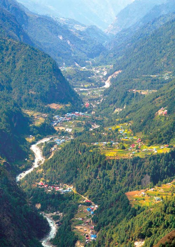
Published by : Sagarmatha National Park Office, Namche Bazaar,
Solukhumbu, Nepal
Copyright : 2016, SNP- Any reproduction in full or in part of
this publication must mention the title and credit the
above mentioned publisher as the copyright owner.
Cover Photo : Ganesh Pant, Chief Conservation Officer
Design and Printing : Creative Link Pvt. Ltd., Bagbazaar, Kathmandu, Nepal
Telephone: +977-1-4216913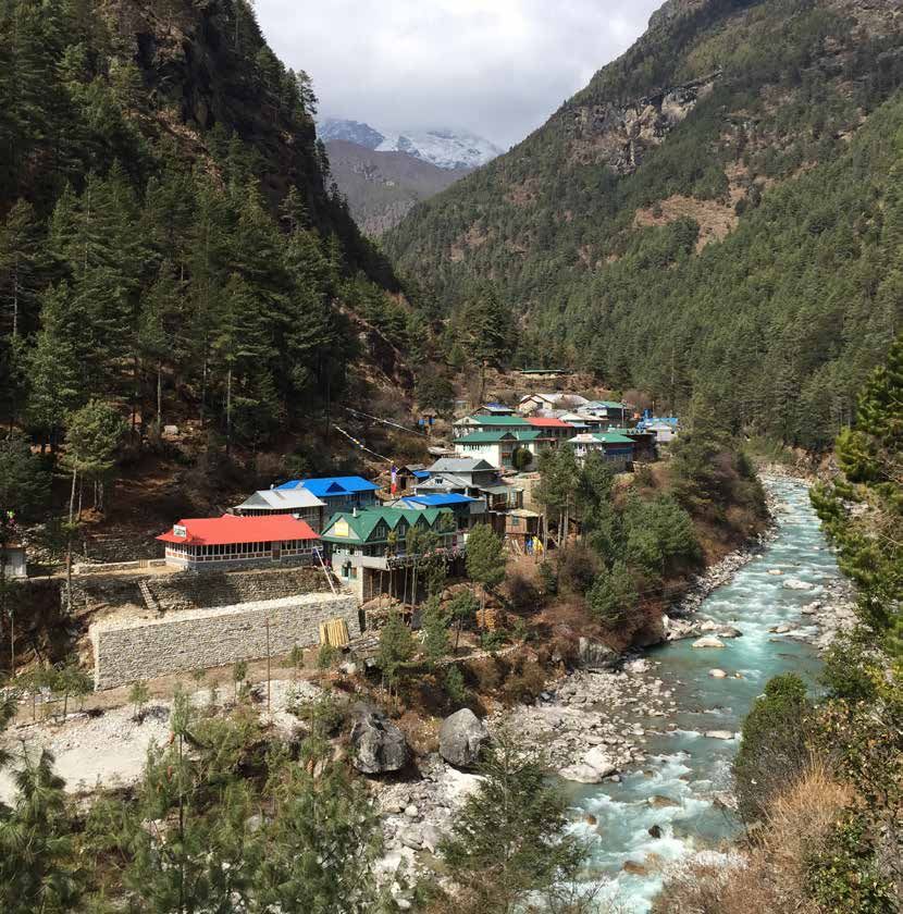
SAGARMATHA NATIONAL PARK AND ITS BUFFER ZONE
      MANAGEMENT PLAN
                        2016‒2020

                        Government of Nepal
              Ministry of Forests and Soil Conservation
     Department of National Parks and Wildlife Conservation
        Sagarmatha National Park Office
                Namche Bazaar, Solukhumbu, Nepal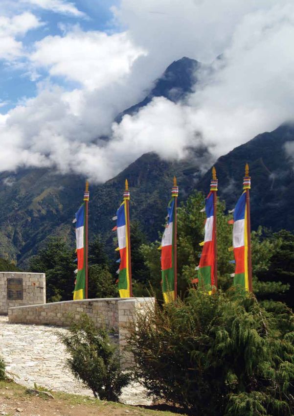
Government of Nepal
                      Ministry of Forests and Soil Conservation
Department of National Parks and Wildlife Conservation

                                 De

                                                                                      ion
                                          ni
                                            str Gove                   al          ti

                                  M

                                                                               on
                                                         rnment of Nep          rva er

                                   i
                                    pa
                                    tm

                                                                                       t
                                               yo

                                                                                    va
                                         en                                   e

                                      r
                                                  f Fo                    s           s
                                           to
                                              fN       rests and Soil Con Con
                                                 atio                     l if e
                                                      nal Parks and Wild
                                                            2037

                                              FOREWORD
                 Sagarmatha National Park was established in 1976 with the aim of conserving
                 endangered wildlife species, majestic landscape and local culture of the
                 Khumbu region. In recognition of its superlative natural phenomenon, the
                 park was listed in the World Heritage Site in 1979. The area was opened to
                 the foreigners since 1950. The region got popularity in global community,
                 when Sir Edmund Hillary and Tenzing Norgay Sherpa first climbed the Mt.
                 Everest in 1953. Since then the area has been receiving an increasing number
                 of tourists every year. No doubt, tourism has contributed a lot to flourish the
local economy. However, some management challenges have also evolved simultaneously.
The first management plan of SNP was prepared in 1981 with the view of managing the area
systematically. The Plan was reviewed in 1993, and it was felt that it needs a revision, mainly to
address the evolving socio-cultural and environmental issues together with the challenges. In this
regard, DNPWC with the support from the UNDP/TRPAP prepared an integrated management and
tourism plan for SNP for the period of 2007‒2012. However, all the activities prescribed by the
plan could not be implemented due to budget constraint, the integrated plan 2007-2012 served
as a key guiding document for carrying out conservation and management activities in SNP and
its BZ. With the aim of developing an updated plan as far as practicable, DNPWC assigned Mr.
Ganesh Pant, Chief Conservation Officer, SNP to update and prepare a management plan for SNP
and its BZ for another five years from 2016 to 2020.
This plan is an outcome of rigorous review of previous plans. The plan preparation process also
involved intensive literature review, consultation with the stakeholders as well as expert review. I
would like to extend my sincere thanks to the reviewers of this plan who provided valuable inputs
on its draft. Mr. Ganesh Pant, Chief Conservation Officer, SNP deserves special appreciation for
his tireless efforts in leading the process to update and prepare this plan. I would like to thank
the DNPWC officials especially the Deputy Director General duo Mr. Gopal Prakash Bhattarai and
Dr. Maheshwar Dhakal for their contribution to prepare this plan. I also take this opportunity
to thank the Community-based Flood and Glacial Lake Outburst Risk Reduction Project/DHM
for the financial assistance to update this plan. Last but not the least, I thank local communities
living in Khumbu region including executive committee members of BZMC and BZUC for their
continuous support in conservation of SNP.
I hope this plan will be helpful for the conservation and management of SNP and its BZ.

Man Bahadur Khadka
Director General

            G.P.O. Box: 860, Kathmandu, Nepal. Tel. 01-4227926, Fax : 01-4227675
                                    www.dnpwc.gov.np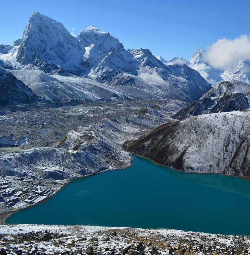
Government of Nepal
Ministry oftmeForests
str Gove and Soil
rvConservation
De
ion
ni al i
M
on
rnment of Nep at r
i
pa
t
yo
va
se se
r
nt f Fo r n n
ests and Soil Co
Department of National Parks and Wildlife Conservation Co
of
Na l ife
Sa t ion a l P il d
gar arks and W ice
math Off
Sagarmatha National Park Office
a National Park
ACKNOWLEDGEMENTS
Sagarmatha National Park, a world heritage property since 1979, is an example of
superlative and exceptional natural beauty, which is embedded in the vivid mountains,
glaciers, deep valleys and majestic peaks including Sagarmatha (Mt. Everest), the
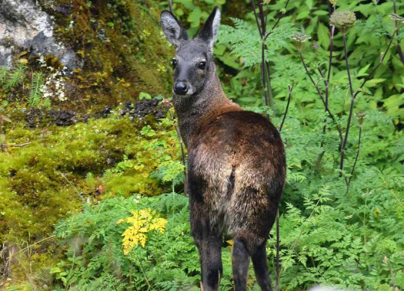
world’s highest peak. The park is home to several rare species of wildlife including snow
leopard, musk deer and red panda. The area contains the world’s highest ecologically
characteristic flora and fauna, intricately blended with the rich Sherpa culture. The
intricate linkages of the Sherpa culture with the ecosystem are a major focus of the
park, and they form the basis for the sustainable conservation of the natural resources,
which eventually contributes for the wellbeing of the local communities.
Management planning for any protected area is a dynamic process, and we must be prepared to
accommodate the changes in the management based on new facts. In this regard, the management plan
for SNP and its BZ for the period of 2016‒2020 has given more emphasis on key wildlife and its habitat
conservation as a response to the return of snow leopard in the SNP after more than three decades.
Likewise, the plan attempts to address the issues associated with the likely impacts of climate change
in order to safeguard the natural world heritage property from the vulnerability it faces at present. In
addition, the plan intends to introduce cutting-edge technologies in regulating tourism activities as an
effort for maintaining delicate balance between conservation and tourism development in the park.
First I would like to express my sincere gratitude to the Director General and the team at DNPWC for
entrusting me with the task of reviewing and updating the management plan for SNP and its BZ for
the period of 2016‒2020. During the plan preparation process, various institutions, organizations and
individuals provided their valuable inputs. In this regard, I would like to thank all the institutions and
experts consulted as the key informants for their time and contribution. I would like to extend my sincere
thanks to Mr. Gopal Prakash Bhattarai and Dr. Maheshwar Dhakal, Deputy Director Generals, DNPWC for
their continuous support and inputs.
I highly acknowledge Mr. Saurav Shrestha for his untiring efforts in plan write-up, Mr. Nawaraj Chapagain for
GIS map preparation and Mr. Laxman Prasad Paudyal, Ecologist, DNPWC for collecting primary information
through local level consultation. Likewise, I thank Mr. Shahas Man Shrestha for his input in language
editing. I am grateful to the distinguished participants of the central-level consultation meeting on the
review of the management plan for the SNP and its BZ for the period 2016‒2020 for their constructive
comments and suggestions.
Finally, I would like to thank SNP staff together with the BZ Management Committee members as well as
the BZ User Committee members, and the local communities for their valuable inputs.
Ganesh Pant
Chief Conservation Officer
Namche Bazaar, Solukhumbu, Nepal. Tel: 038-540114, Fax : 038-540395
Web Page: www.sagarmathanationalpark.gov.np, Email: info@sagarmathanationalpark.gov.np, snp.namche@gmail.com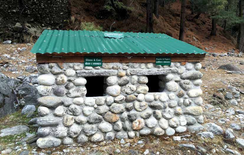
$@@)@!^
                                           g]kfn ;/sf/                             kmf]g g+= M   $@@)*%)
                                                                                                 $@@)(!@
                                      jg tyf e"–;+/If0f dGqfno                                   $@@&(@^
                                                                                     km\ofS; g+= $@@&^&%
                         /fli6«o lgs'~h tyf jGohGt' ;+/If0f ljefu
                                         -Joj:yfkg zfvf_
;+s]t g+= M–                                                                                          kf]= a= g+= – *^)
kq ;+Vof M– )&@.&# Jo= g+= $^*                                                                        aa/dxn,sf7df8f}+
rnfgL g+= M– !($$                                                                                Email: info@dnpwc.gov.np
                                           fli6 jg gk] fn ;/sf/ no            fu                 http//: www.dnpwc.gov.np

                                         /
                                               o« l tyf e–" ; f0f dGqf f lje
                                                   gs~'       +/I       I f 0
                                                       h tyf jGohGt' ;+/
                                                          @)#&
                                                                                                       ldlt M– @)&@.!@.@$

         ljifo M– ;u/dfyf /fli6«o lgs'~h tyf dWojtL{ If]qsf] k~rjlif{o Joj:yfkg of]hgf -@)!^–
                  @)@)_ / ;f] sf] k|f/lDes jftfj/0fLo k/LIf0f k|ltj]bg (IEE) :jLs[t ul/Psf] ;DaGwdf .

       >L ;u/dfyf /fli6«o lgs'~h sfof{no
       gfDr], ;f]n'v'Da'
       k|:t't ljifodf ;u/dfyf /fli6«o lgs'~h tyf To;sf] dWojtL{ If]qsf] k~rjlif{o Joj:yfkg of]hgf
       -@)!^–@)@)_ / ;f]xL Joj:yfkg of]hgfsf] k|f/lDes jftfj/0fLo k/LIf0f k|ltj]bg (IEE) :jLs[ltsf]
       nflu To; sfof{nosf] kq ;+Vof @)&@.&# r=g+= &%# ldlt @)&@.!@.!( sf] kq;fy l6Kk0fL ;lxtsf]
       kmfO{n k]z x'g cfPsf] .
       pk/f]Qmdf pNn]lvt ljifosf] l6Kk0fL kmfO{ndfly sf/jfxL x'Fbf ljZj ;Dkbf dxf;GwLsf] d'Vofnoaf6
       xfn ;Dd s'g} ;'emfj k|fKt gePsf] t/ !–@ dlxgf leq k7fpg ;Sg] ;+s]t u/] cg';f/ tfFxfaf6 k|fKt
       x'g] ;sf/fTds ;'emfjx¿ k|fKt eP kl5 sfof{Gjog ug]{ u/L k]z x'g cfPsf] k|f/lDes jftfj/0fLo
       k/LIf0f k|ltj]bg / ;u/dfyf /fli6«o lgs'~h tyf To;sf] dWojtL{ If]qsf] k~rjlif{o Joj:yfkg of]hgf
       -@)!^–@)@)_ ldlt @)&@.!@.@# sf] ljefuLo lg0f{ofg';f/ :jLs[t ul/Psf] x'Fbf :jLs[t k|f/lDes
       jftfj/0fLo k/LIf0f k|ltj]bg / ;u/dfyf /fli6«o lgs'~h tyf dWojtL{ If]qsf] k~rjlif{o Joj:yfkg
       of]hgf -@)!^–@)@)_ o;};fy /fvL sfof{Gjogsf] nflu k7fO{Psf] Joxf]/f lg0f{ofg';f/ cg'/f]w 5 .

                                                                                       ========================
                                                                                     -lji0f' k|;fb yklnof_
                                                                                   ;xfos Joj:yfkg clws[t
       jf]wfy{M
       >L ;u/dfyf /fli6«o lgs'~h dWojtL{ If]q Joj:yfkg ;ldlt
       gfDr], ;f]n'v'Da' .
Management Plan for Sagarmatha National Park and its Buffer Zone 2016-2020
EXECUTIVE SUMMARY
Sagarmatha National Park (SNP), established in 1976 is one of the pioneer protected areas of
Nepal. The park was inscribed as world heritage property in 1979 because of its superlative and
exceptional natural beauty, which is embedded in the vivid mountains, glaciers, deep valleys and
majestic peaks including the world’s highest peak, Mt. Everest. The Gokyo and the associated
wetlands, the wetlands of global significance, also lie within Park. The park is a home to some
of the endangered wildlife species including snow leopard, musk deer and red panda. The area
contains the world’s highest ecologically characteristic flora and fauna, intricately blended with
the rich Sherpa culture. The Buffer zone, encompassing the major part of the Chaurikharka VDC
to the south as well as the settlements within SNP traditionally considered as village enclaves,
was created in 2002. There are nearly 7,800 people living in 1,619 households in buffer zone
of the SNP. In order to institutionalize participatory conservation and development practices in
the buffer zone, the local communities are organized into 28 Buffer Zone User Groups (BZUGs),
three Buffer Zone User Committees (BZUCs) and one Buffer Zone Management Committee
(BZMC).
SNP is one of the most popular tourist destinations in Nepal. Tourism is the major source
of income, which not only benefits the local communities, but also generates significant
amount of revenue for the country. SNP at present faces several challenges which need to be
addressed carefully for maintaining the delicate balance between biodiversity conservation,
tourism promotion and livelihood enhancement of the local communities. The park protection,
management of the key wildlife habitats, sustainable tourism and infrastructure development,
garbage management, glacial lake outburst flood risk, and the livelihood enhancement of the
local communities have been identified as the major issues of concern. This management plan
is expected to address most of these pertinent issues.
The current Management Plan 2016−2020 is the continuation of the previous management
plan of the SNP and its BZ developed through numerous interactions and consultation meetings
with stakeholders, field works and observations, central and local-level workshops followed
by expert review. The plan has been prepared for conservation, management and utilization
of the park and its buffer zone resources in scientific and participatory approach with due
consideration of its significance as the world heritage property. The objective of SNP and its
BZ management is to enhance biodiversity of the park, promote tourism and regulate it where
necessary to maintain delicate balance between conservation and tourism, and also support
the livelihoods of the local communities through effective management of the natural and
cultural heritages. The specific objectives are:
To conserve biodiversity of the park with special focus on nationally protected and globally
threatened wildlife species and their habitats in order to maintain ecological functions and
processes;
To promote sustainable tourism, and regulate it for maintaining ecological integrity and
cultural heritage;
i
Management Plan for Sagarmatha National Park and its Buffer Zone 2016-2020
To enhance community stewardship on biodiversity conservation by increasing awareness
and improving livelihood of the people living in the BZ; and
To strengthen institutional capacity through research, capacity building, coordination and
collaboration.
The broad thematic areas incorporated in the management plan are protection and conservation
of biodiversity, habitat management, tourism and interpretation, BZ management and research,
monitoring and capacity building. Special programmes on species conservation have also been
formulated focusing on snow leopard, musk deer and red panda. The plan also attempts to
manage the park in the face of likely impacts of climate change in order to safeguard the
Outstanding Universal Value (OUV) of the Park as well as to enhance the resilience of the local
communities living in the BZ. The major programmes outlined in the management plan include
park protection, habitat management, basic physical infrastructure construction, tourism
promotion, community development, public awareness, monitoring, research and capacity
building.
The total budget for the implementation of the plan is estimated to be Rs. 71,45,30,000
(equivalent to 65,55,321 US$) excluding operation costs. The expected government budget of
Rs. 19,50,00,000 (equivalent to 17,88,991 US$) for the management of the BZ for the next five
years has been included in this total budget. The implementation of the activities prescribed
in this plan is expected to enhance the conservation of biodiversity in this region, maintain
the OUV of the world heritage site, promote tourism for improvement of the living standard
of the local communities, and enrich the capacity of SNP staff and BZ communities. On the
other hand, it is estimated that 2,85,800 man days of employment will be generated in this
region through implementation of the activities prescribed by the management plan which is
expected to contribute for enhnancing the livelihood of the local communities.
iiManagement Plan for Sagarmatha National Park and its Buffer Zone 2016-2020
;f/f+z
;g\ !(&^ -la=;+= @)##_ df :yfkgf ePsf] ;u/dfyf /fli6«o lgs'~h g]kfnsf] Pp6f cu|0fL ;+/lIft
If]q xf] . ljZjsf] ;jf]{Rr lzv/ ;u/dfyf nufotsf ;'Gb/ lxd>[ªvnf, lxdgbL, dgf]/d pkTosf
;lxtsf] cg'kd k|fs[lts ;f}Gbo{tfn] el/k"0f{ of] /fli6«o lgs'~h ;g\ !(&( df ljZj ;Dkbf ;"rLdf
;"lrs[t ePsf] 5 . To;}u/L cGt/f{li6«o dxTjsf] l;d;f/ If]qsf] ?kdf /fd;f/ ;"rLdf ;"lrs[t
uf]Sof] tyf j/k/sf tfnx? o; /fli6«o lgs'~h If]qleq cjl:yt /x]sf] 5 . of] /fli6«o lgs'~h
lxpF lrt'jf, s:t'/L d[u, xfa]| nufotsf b'n{e Pj+ dxTjk"0f{ jGohGt'x?sf] af;:yfg klg xf] . o;
If]qdf ljZjs} clt pRr kfl/l:yltsLo k|0ffnL cGtu{tsf hLj tyf jg:kltx? kfOG5g h;sf]
:yfgLo z]kf{ ;+:s[lt;+u cGof]Gofl>t ;DaGw /xL cfPsf] 5 . ;g\ @))@ -la=;= @)%*_ df rf}/Lvs{
uf=lj=;=sf] clwsf+z e"–efu / lgs'~hsf] rf/lsNnfleq cjl:yt dfgj a:tLx? ;d]6]/ ;u/dfyf
/fli6«o lgs'~hsf] dWojtL{ If]q 3f]if0ff ul/Psf] 5 . dWojtL{ If]qleq /x]sf !,^!( 3/w'/Lx?df s/La
&,*)) dflg;x? a;f]af; ub{5g\ . dWojtL{ If]qdf ;xeflutfd"ns ;+/If0f / ljsf;sf] cEof;nfO{
;+:yfut ug{sf] nflu :yfgLo ;d'bfonfO{ @* j6f dWojtL{ If]q pkef]Qmf ;d"xx?df cfj4 u/L
tLgj6f dWojtL{ If]q pkef]Qmf ;ldltx? / Pp6f dWojtL{ If]q Joj:yfkg ;ldlt u7g ul/Psf] 5 .
;u/dfyf /fli6«o lgs'~h g]kfnsf] Pp6f k|l;4 ko{6sLo uGtJo xf] . ko{6g Joj;fo o; If]qsf
:yfgLo ;d'bfosf] nflu cfDbfgLsf] d'Vo ;|f]t dfq geO{ /fi6«s} nflu pNn]vgLo /fhZjsf] ;|f]tsf]
?kdf /x]sf] 5 . ;u/dfyf /fli6«o lgs'~hdf h}ljs ljljwtf ;+/If0f, ko{6g k|j4{g tyf :yfgLo
;d'bfosf] lhljsf]kfh{gnfO{ ;Gt'lnt ?kdf cufl8 a9fpgsf] nflu ljljw r'gf}ltx? ljBdfg /x]sf
5g\ . pNn]lvt ;Gbe{df lgs'~hsf] ;+/If0f, dxTjk"0f{ jGohGt'xsf] af;:yfg Joj:yfkg, lbuf] ko{6g
k|j4{g, cfjZos ef}lts k"jf{wf/x?sf] ljsf;, kmf]xf]/d}nf Joj:yfkg, lxdtfn ljikmf]6gsf] hf]lvd
tyf :yfgLo ;d'bfosf] lhljsf]kfh{g ;'wf/nfO{ d'Vo ;jfnx?sf] ?kdf klxrfg ul/Psf] 5 . o;
Joj:yfkg of]hgfn] oL clwsf+z ;jfnx?nfO{ ;Daf]wg ug]{ ck]Iff ul/Psf] 5 .
;u/dfyf /fli6«o lgs'~h tyf dWojtL{ If]qsf] Joj:yfkg of]hgf ;g\ @)!^–@)@) lautsf Joj:yfkg
of]hgfx?sf] lg/Gt/tf xf] h;nfO{ ;/sf]/jfnfx?;+usf] cGtlq{mof, 5nkmn, :ynut cjnf]sg,
pkef]Qmf ;ldlt :t/Lo a}7s ;d]taf6 tof/ ul/Psf] d:of}bfnfO{ lj1x?af6 k'g/fjnf]sg u/fO{ clGtd
?k lbO{Psf] 5 . of] Joj:yfkg of]hgf ;u/dfyf /fli6«o lgs'~h tyf dWojtL{ If]qdf /x]sf ;|f]tx?sf]
j}1flgs Pj+ ;xeflutfd'ns k2ltaf6 ;+/If0f, Joj:yfkg / bLuf] pkof]u ug{sf] nflu tof/ ul/Psf]
xf] eg] ljZj ;Dkbfsf] ?kdf /x]sf] of] lgs'~hsf] dxTjnfO{ ;d]t of] Joj:yfkg of]hgfdf laz]if Wofg
lbOPsf] 5 . ;u/dfyf /fli6«o lgs'~h tyf dWojtL{ If]q Joj:yfkgsf] d'Vo p2]Zo o; If]qsf] k|fs[lts
tyf ;f+:s[lts ;Dkbfsf] k|efjsf/L Joj:yfkg dfkm{t h}ljs ljljwtf ;+/If0f, ;+/If0f / ko{6gaLr
;Gt'ng sfod /fVgsf] nflu ko{6g Joj;fo k|j4{g tyf lgodg ub}{ :yfgLo ;d'bfosf] lhljsf]kfh{g
;'wf/ ug{df 6]jf k¥'ofpg' /x]sf] 5 . ;u/dfyf /fli6«o lgs'~h tyf o;sf] dWojtL{ If]qsf] Joj:yfkg of]hgf
@)!^–@)@) sf lgDgfg';f/ rf/j6f vf; p2]Zox? /x]sf 5g\\ .
iiiManagement Plan for Sagarmatha National Park and its Buffer Zone 2016-2020
kfl/l:yltsLo sfo{ tyf k2lt sfod /fVgsf] nflu lgs'~hdf kfOg] ;+/lIft Pj+ ;+s6fkGg jGohGt'
k|hfltx? tyf ltgLx?sf] af;:yfgnfO{ laz]if Wofg lbO{ h}ljs ljljwtf ;+/If0f ug'{ .
kfl/l:yltsLo cI'f0ftf sfod ub}{ ;f+:s[lts ;Dkbfsf] ;+/If0f ;d]t x'g]u/L ko{6g Joj;fo k|j4{g
tyf cfjZostf cg';f/ ko{6g Joj;fo;+u ;DalGwt lqmofsnfkx? lgodg ug'{ .
h}ljs ljljwtf ;+/If0fdf :yfgLo ;d'bfonfO{ clek]|l/t ug{sf] nflu dWojtL{ If]qsf afl;Gbfx?sf]
;+/If0f ;DalGw ;r]tgf clej[l4 tyf lhljsf]kfh{g ;'wf/ ug'{ .
cWoog cg';Gwfg, Ifdtf clej[l4, ;dGjo tyf ;xsfo{sf] dfWodaf6 ;u/dfyf /fli6«o lgs'~h
tyf dWojtL{ If]qsf] ;+:yfut Ifdtf clej[l4 ug'{ .
Joj:yfkg of]hgfdf ;dfj]z ul/Psf d'Vo laifoa:t'x?df h}ljs ljljwtf ;+/If0f, af;:yfg
Joj:yfkg, ko{6g tyf k|s[ltsf] JofVofg, dWojtL{ If]qsf] Joj:yfkg, cWoog cg';Gwfg, cg'udg /
Ifdtf clej[l4 /x]sf 5g\ . To;}u/L lxpF lrt'jf, s:t/L d[u / xfa]|nfO{ b[li6ut u/L k|hflt ;+/If0f ljz]if
sfo{qmd tof/ ul/Psf] 5 . o; Joj:yfkg of]hgfn] hnjfo' kl/jt{gsf] k|efjsf] ;Gbe{df lgs'~hsf]
laz]if k|fs[lts ;f}Gbo{ tyf dxTjdf kg{;Sg] c;/ tyf dWojtL{ If]qsf :yfgLo afl;Gbfx?nfO{ kg{;Sg]
c;/ Go"lgs/0f ub}{ lgs'~h tyf dWojtL{ If]qsf] Joj:yfkg ug{sf] nflu ;d]t k|of; u/]sf] 5 . o;
Joj:yfkg of]hgfdf ;dflji6 d'Vo d'Vo sfo{qmdx?df lgs'~hsf] ;+/If0f, af;:yfg Joj:yfkg,
cfwf/e't ef}lts k"jf{wf/ lgdf{0f, ko{6g k|j4{g, ;fd'bflos ljsf;, hgr]tgf clej[l4, cWoog
cg';Gwfg, cg'udg / Ifdtf clej[l4 /x]sf 5g\ .
o; Joj:yfkg of]hgfn] kfFr aif{ calwsf] nflu k|:tfj u/]sf lqmofsnfkx? sfof{Gjog ug{sf nflu
tna eQf nufotsf k|zf;lgs vr{ afx]s &! s/f]8 $% nfv #) xhf/ ?k}+of -s/La ^% nfv %%
xhf/ #@! cd]l/sL 8n/_ cfjZos kg]{ cg'dfg ul/Psf] 5 . o;df cfufdL kfFr aif{df dWojtL{ If]qsf]
Joj:yfkgsf] nflu k|fKt x'g ;Sg] ;/sf/L ah]6 ?= !( s/f]8 %) nfv ?k}+of -s/La !& nfv **
xhf/ ((! cd]l/sL 8n/_ ;dfj]z ul/Psf] 5 . o; Joj:yfkg of]hgfn] k|:tfj u/]sf lqmofsnfkx?
sfof{Gjog ePdf ;u/dfyf /fli6«o lgs'~h tyf o;sf] dWojtL{ If]qsf] h}ljs ljljwtf ;+/If0f x'g],
ljZj ;Dkbfsf] ?kdf /x]sf] o; lgs'~hsf] laz]if dxTj sfod /xg], :yfgLo afl;Gbfx?sf] lhjg:t/
;'wf/ x'g] u/L ko{6g k|j4{g x'g] ;fy} ;u/dfyf /fli6«o lgs'~h sfof{nosf sd{rf/Lx? tyf dWojtL{ If]qsf
;d'x ;ldltx?sf] ;+:yfut Ifdtf clej[l4 x'g] ;d]t ck]Iff ul/Psf] 5 . csf]t{ km{ Joj:yfkg of]hgf
sfof{Gjogaf6 @,*%,*)) >dlbg /f]huf/L l;h{gf x'g] cg'dfg ul/Psf] 5 h;af6 :yfgLo ;d'bfosf]
lhljsf]kfh{g ;'wf/df of]ubfg k'Ug] ck]Iff ul/Psf] 5 .
ivManagement Plan for Sagarmatha National Park and its Buffer Zone 2016-2020
Acronyms
0
C Degree Centigrade
AoR Area of Responsibility
APPA Appreciative Project Planning and Action
APU Anti-poaching Unit
BZ Buffer Zone
BZMC Buffer Zone Management Committee
BZUC Buffer Zone User Committee
BZUG Buffer Zone User Group
CBAPO Community-based Anti-poaching Operation
CFUG Community Forest User Group
CITES Convention on International Trade in Endangered species of Wild Flora and Fauna
DHM Department of Hydrology and Meteorology
DLSO District Livestock Service Office
DNPWC Department of National Parks and Wildlife Conservation
E East
ERFD Eastern Regional Forestry Directorate
FY Fiscal Year
GCA Gaurishankar Conservation Area
GIS Geographical Information System
GLOF Glacial Lake Outburst Flood
gm Gram
GoN Government of Nepal
GPS Global Positioning System
ha. Hectare
HQ Headquarters
HRD Human Resource Development
ICIMOD International Center for Integrated Mountain Development
IOF Institute of Forestry
IT Information Technology
IUCN International Union for Conservation of Nature
KBC Khumbu Bijuli Company
KCA Kanchanjunga Conservation Area
kg Kilogram
km Kilometer
km2 Square kilometer
LAC Limit of Acceptable Change
LPG Liquid Petroleum Gas
m Meter
m3 Cubic meter
MAPs Medicinal and Aromatic Plants
vManagement Plan for Sagarmatha National Park and its Buffer Zone 2016-2020
MBNP Makalu Barun National Park
MFSC Ministry of Forests and Soil Conservation
mm Millimeter
MSL Mean Sea Level
Mt. Mountain
N North
NAST Nepal Academy of Science and Technology
NGO Non-governmental Organization
NMA Nepal Mountaineering Association
No. Number
NTFP Non-timber Forest Product
NTNC National Trust for Nature Conservation
OUV Outstanding Universal Value
OVI Objectively Verifiable Indicator
PA Protected Area
PDNA Post Disaster Need Assessment
QNP Qomolangma Nature Preserve
Qty Quantity
RIS Ramsar Information Sheet
Rs. Rupees
SAARC South Asian Association for Regional Cooperation
SLIMS Snow Leopard Information Management System
SMART Spatial Monitoring and Reporting Tool
SN Serial Number
SNP Sagarmatha National Park
SPCC Sagarmatha Pollution Control Committee
SPSS Statistical Package for Social Sciences
SWOT Strengths, Weaknesses, Opportunities and Threats
TAR Tibet Autonomous Region
ToT Training of Trainer
TRPAP Tourism for Rural Poverty Alleviation Programme
UC User Committee
UG User Group
UNDP United Nations Development Programme
UNESCO United Nations Educational, Scientific and Cultural Organization
USA United States of America
VDC Village Development Committee
WHC World Heritage Convention
WHS World Heritage Site
WWF World Wide Fund for Nature
viManagement Plan for Sagarmatha National Park and its Buffer Zone 2016-2020
TABLE OF CONTENTS
EXECUTIVE SUMMARY i
;f/f+z iii
ACRONYMS v
TABLE OF CONTENTS vii
SAGARMATHA NATIONAL PAK AND ITS BUFFER ZONE AT A GLANCE ix
MANAGEMENT PLAN PREPARATION PROCESS x
PART A - EXISTING SITUATION 1
Chapter I - Introduction 2
1.1 Name, Location, Constitution and Extent 2
1.2 Access 2
1.3 Statement of Significance 3
Chapter II - Background Information and Attributes 4
2.1 Boundaries 4
2.2 Geology and Soil 4
2.3 Topography and Drainage 5
2.4 Climate 6
2.5 Biodiversity Status 6
Chapter III - Past Management and Present Practices 8
3.1 Conservation History 8
3.2 Park Protection 8
3.3 Habitat Management 8
3.4 Anti-poaching and Intelligence Gathering 9
3.5 Tourism and Interpretation 9
3.6 Research and Monitoring 9
3.7 Human-Wildlife Conflict 9
3.8 Administration and Organization 10
3.9 Achievements of Preceding Management Plan 10
3.10 Strength, Weakness, Opportunity and Threat Analysis 11
PART B - THE PROPOSED MANAGEMENT 12
Chapter IV- Vision, Goal and Objectives 13
4.1 Vision Statement 13
4.2 Management Goal 13
4.3 Management Objectives 13
4.4 Problems in achieving Objectives 13
viiManagement Plan for Sagarmatha National Park and its Buffer Zone 2016-2020
Chapter V - Management Strategies 15
5.1 Boundaries 15
5.2 Zonation 15
5.3 Theme Plans 16
Chapter VI - Research, Monitoring and Capacity Building 21
6.1 Research 21
6.2 Monitoring 23
6.3 Capacity Building 24
Chapter VII - Species Conservation Special Programme 25
7.1 Snow Leopard Conservation 25
7.2 Himalayan Musk Deer Conservation 28
7.3 Red Panda Conservation 31
Chapter VIII - Tourism and Nature Interpretation 33
8.1 Background 33
8.2 Tourism Scenario 33
8.3 Interpretation Facilities 35
8.4 Issues 35
8.5 Objectives 35
8.6 Activities 35
Chapter IX - Special Programme 37
9.1 Moderating the Climate Change Impact 37
9.2 Enhancing the World Heritage Value 39
9.3 Coping with the Impact of Earthquake 40
9.4 Keeping Everest Region Clean 41
Chapter X - Buffer Zone Management 43
10.1 Introduction 43
10.2 Past Management and Present Practices 44
10.3 Management Strategies 44
10.4 Implementation and Mainstreaming Strategy 47
Chapter XI- Activities, Budget and Logical Framework 48
11.1 Activities and Budget 48
11.2 Logical Framework Analysis 49
11.3 Gender Equity and Social Inclusion 49
REFERENCES 50
ANNEXES 52
viiiManagement Plan for Sagarmatha National Park and its Buffer Zone 2016-2020
SAGARMATHA NATIONAL PARK AND ITS BUFFER ZONE AT A GLANCE
Location : Northern mountain of eastern Nepal
National Park Designation Year : 19 July 1976 (04 Shrawan, 2033)
World Heritage Site Declaration : 1979 (UNESCO)
IUCN Category : II
National Park Area : 1,148 km2
Buffer Zone Gazetted Year : 01 January, 2002 (17 Poush, 2058)
Buffer Zone Area : 275 km2
Buffer Zone District : 1
Buffer Zone VDCs : 3
Buffer Zone User Committees 3
Buffer Zone User Groups : 28
Buffer Zone Households : 1,619
Buffer Zone Population : 7,745
Major Ethnic Group : Sherpa
Major Religion : Buddhism
Major Glaciers : Khumbu, Imja, Ngozumpa, Nangpa
Ramsar Enlisted Site : Gokyo and the associated wetlands
Major Rivers : Dudh Koshi, Bhote Koshi and Imja Khola
Major Peaks : Sagarmatha (8,848 m), Lhotse (8,501 m), Cho Oyu
(8,153 m), Nuptse (7,896 m)
Bioclimatic Zone : Lower Temperate, Upper Temperate, Sub-alpine, Alpine
and Nival
Climate : Temperate to Arctic
Elevation Range : 2,300 m to 8,848 m above MSL
Main Mammals : Snow Leopard, Musk Deer and Red Panda
Major Trees : Pine, Hemlock, Fir, Juniper and Birch
Annual Visitors : 34,412 in the FY 2014/15
Annual Revenue : Rs. 8,90,26,022 (US $8,47,867) in the FY 2014/15
ixManagement Plan for Sagarmatha National Park and its Buffer Zone 2016-2020
MANAGEMENT PLAN PREPARATION PROCESS
The Management Plan for SNP and its BZ (2016−2020) is the outcome of the team effort
of the individuals representing various organizations and groups. It has been prepared
in participatory approach on the basis of the format endorsed by the DNPWC. The plan
is based on holistic approach and envisages bottom-up planning process. It has been
prepared with the active involvement of the BZ communities, relevant government
agencies, NGOs, technicians, social activists, tourism entrepreneurs, community
organizations, and other stakeholders. The management plan preparation team was
led by the Chief Conservation Officer of SNP to precede the plan formulation process.
The team was responsible for coordinating and organizing consultation meetings for
management planning as well as preparation of draft management plan for SNP and
its BZ. In the course of plan preparation, the team not only went through numerous
literature reviews, consultations, meetings, workshops, field works and observations but
also collected primary data relevant for the management plan.
The management plan has been divided into two parts: Part A dealing with the existing
situation and Part B mentioning about the proposed management. The preparation of
the first part of the management plan involved gathering of suggestions and comments
from the relevant stakeholders and their subsequent organizations in predesigned
management plan format. On the other hand, buffer zone user committees prepared the
second part with the facilitation of the park staff. A number of consultation meetings and
interaction programmes were conducted at different areas during the course of the plan
preparation process. In addition, numerous formal and informal meetings were held
as per the requirements. Similarly, a central level sharing workshop was held amongst
the officials from the relevant government agencies, conservation partners, donors,
professionals, academicians and other stakeholders within the DNPWC premises. The
workshop identified the key gaps in the plan, and provided valuable suggestions to fill
up these gaps. The comments and suggestions from these meetings and workshops
were incorporated in the draft management plan. The draft plan was then sent to the
concerned experts for reviewing. The comments, suggestions and constructive criticisms
from the experts were subsequently incorporated in the final plan.
xManagement Plan for Sagarmatha National Park and its Buffer Zone 2016-2020
PART A
THE
EXISTING
SITUATION
1Management Plan for Sagarmatha National Park and its Buffer Zone 2016-2020
Chapter I
Introduction
1.1. Name, Location, Constitution and Extent
1.1.1. Name
Sagarmatha National Park and its Buffer Zone
1.1.2. Location
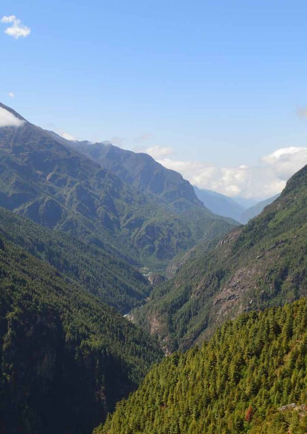
SNP and its BZ is situated in the northern mountains of eastern Nepal, which covers part of Solukhumbu
district (see Figure 1). The Park is located between 27°45′-28°07′N latitudes and 86°28′-87°07′E longitudes.
Figure 1: Location of Sagarmatha National Park and its Buffer Zone
1.1.3. Constitution and Extent 1.2. Access
The area of SNP, designated in 1976, is 1,148 km2 SNP is located in the northern part of Solukhumbu
whereas the buffer zone, gazetted in 2002, extends district, about 140 km east of Kathmandu City. The
over an area of 275 km2. The core area of the Park possesses only a limited number of access
National Park covers Namche and Khumjung VDCs points. The main entry route lies in the Dudh Koshi
as well as the northern part of the Chaurikharaka Valley on its south. The majority of the visitors
VDC whereas its buffer zone covers parts of enter SNP first by flying up to the Lukla (Tenzing-
Chaurikharka VDC and the village enclaves in Hillary) Airport located within the BJ, and then on
Namche and Khumjung VDCs which are physically foot. The second most used entry point is Nangpala
inside the National Park boundaries, but excluded Pass (5,716 m) located at the north-western part
from the National Park area. of SNP. This pass links SNP with Qomolangma
2Management Plan for Sagarmatha National Park and its Buffer Zone 2016-2020
Nature Preserve in Tibet Autonomous Region rivers and views of the distant Himalayas. Besides,
(TAR) of China. The trans-himalayan traders use the UNESCO has also recognized the Park for the
this pass, but it is prohibited for tourists. The Tashi rich Sherpa culture.
Latse Pass links SNP with Rolwaling Valley on the
west. This pass is used by a limited number of SNP is an ecological unit in the highest region of the
adventure trekking groups. Occasionally, trekkers world; the area is of important scientific value, and
and mountaineers cross the Ama Latse Pass at the offers unique research opportunities to scientists
head of the Imja Glacier that links SNP with Makalu- throughout the world because of its extreme
Barun National Park. Likewise, the BZ on the south elevation, associated flora and fauna, culture
can also be accessed through several passes that and environment. The high-altitude forests and
are not commonly used. The Zatarwa Pass above rangeland environment of the Park are not only of
Lukla links the BZ with the Hinku Valley and the aesthetic value but are vital to the local people of
Mera Peak areas. There is also a rarely used route the area as a source of fuel and building material.
passing through Sengma and Tate villages, and links The glaciers and rivers of the area are important
the BZ with the Upper Junbeshi Valley. source of water for the people downstream.
Gokyo and associated wetlands, the wetlands of
1.3. Statement of Significance international significance, also lie within the Park.
SNP is of high significance not only to Nepal but also The wetlands, with a catchment area of 7,700 ha
to the whole world. Its status as a National Park has have been enlisted in Ramsar Site in 2007.
further elevated the international prestige and led
to inscription of the area in the list of World Heritage The park is of major religious and cultural
Site (WHS) by the UNESCO for its outstanding significance in Nepal since it abounds in sacred
universal value for aesthetic and scientific values. mountains and holy places. The Sherpa people
The Park was inscribed as a world heritage property respect their homeland as a sacred hidden valley
in 1979 under the natural category of the UNESCO as and refrain from hunting and slaughtering animals.
it meets criterion (vii)- superlative natural features These indigenous belief systems and practices
of exceptional natural beauty in terms of its scenic provide important cultural basis for conservation.
attractions of the forested hills, grasslands, great The Park has become an important destination for
international visitors to Nepal.
3Management Plan for Sagarmatha National Park and its Buffer Zone 2016-2020
Chapter II
Background Information and Attributes
2.1. Boundaries Khumjung, Taasinga, Fungkithanga, Tangboche,
2.1.1. Legal Boundaries Deboche, Milingo, Thangboche, Taaboche, Mingbo,
SNP was gazetted in 04 Shrawan, 2033 (19 July, Raala, Samsho, Wogma, Surowog, Samsochopa,
1976). The area of the Park is duly notified and Suroteng, Tubonawogma, Sambur, Jongla, Dugla,
demarcated on the ground. The boundaries of Phulungkarpo, Dusa, Lobuche, Gorkchep, Pheriche,
the Park as per the gazette notification of the Dingboche, Saanja, Bibre, Chukung, Nayarajong,
Government of Nepal are as follows: Phortse, Kinar, Thore, Somwog, Naala, Shosung,
North: Lhotsesaar Himal, Sagarmatha (Mt. Gokyo, Longponga, Pangka, Machherama, Luja,
Everest), Nangpla Bhanjyang (Pass) through Laphama, Dole, Gele, Tongba, Gongla, Mendo,
the Nepal-China (Tibet) border Laaudo, Thamo, Thogde, Paare, Saamde, Thame,
Thamegompa, Tengbo, Wotrse, Aarthe, Chule,
East: Mingbola Bhanjyang (Pass), Aamphulapsa Sonjo, Jimko, Lunaak and Nangpaighataya.
Bhanjyang (Pass), Chopol Himal and
Lhotsesaar Himal 2.1.2. Ecological Boundaries
South: Mingbola Bhanjyang (Pass), Kangtaiga SNP itself is an ecological unit in the highest region
Himal, Tamaserku Himal and Pigpheragosaar of the world. The Park and its buffer zone (1,423
through Kongderi Himal across the Luka- km2) has landscape continuity with the Makalu
Namche Trail Barun National Park and its buffer zone (2,330
West: Pigpheragosaar, Tashilapsa Bhanjyang km2) to the east, Qomolangma Nature Preserve
(Pass), Tangiraagi Himal and Menlungla (35,000 km2) in the TAR of China to the north and
Bhanjyang (Pass) the Gaurishankar Conservation Area (2,179 km2) to
The human settlements and the private lands the west. The combined area of the SNP, the MBNP,
that fall within the above mentioned boundaries, the QNP and the GCA is over 40,000 Km2, which
but legally excluded from the area of the forms one of the largest protected area complexes
National Park are Jorsalle, Taaboth, Ghumbada, in the high mountain ecosystem. SNP along with its
Namche Bazaar, Sangboche, Khunde, Khumjung, surrounding landscape is, therefore, considered to
Taasinga, Fungkithanga, Tangboche, Deboche, be an ecologically inclusive.
Milingo, Thangboche, Taaboche, Mingbo,
Raala, Samsho, Wogma, Surowog, Samsochopa, 2.2. Geology and Soil
Suroteng, Tubonawogma, Sambur, Jongla, Dugla, The outstanding features of the Park are its
Phulungkarpo, Dusa, Lobuche, Gorkchep, Pheriche, majestic peaks higher than 8,000 m including
Dingboche, Saanja, Bibre, Chukung, Nayarajong, Sagarmatha (8,848 m), Lhotse (8,501 m) and Cho
Phortse, Kinar, Thore, Somwog, Naala, Shosung, Oyu (8,188 m). These magnificent mountain peaks
Gokyo, Longponga, Pangka, Machherama, Luja, have been uplifted by collision of the Eurasian and
Laphama, Dole, Gele, Tongba, Gongla, Mendo, Indian continental plates about 120 million years
Laaudo, Thamo, Thogde, Paare, Saamde, Thame, ago. The process of continental collision is known
Thamegompa, Tengbo, Wotrse, Aarthe, Chule, to be continuing. As a result, the Himalayas are
Sonjo, Jimko, Lunaak and Nangpaighataya. rising, although very slowly. The Himalayan peaks
of the SNP are not only the highest but are among
The buffer zone of the SNP was gazetted on 17 the youngest in the world. The young and steep
Poush 2058 (01 January, 2002). The enclave landscape is subject to erosion and other changes,
settlements and surrounding area of the Park both gradual and sudden. The upper valleys of the
has been declared as BZ. The area under the Park are dominated by wider U-shaped valleys of
Chaurikharka VDC excluding the area included in glacial origin while the lower buffer zone area is
the SNP and the MBNP was declared as BZ of the marked mostly by the river-carved V-shaped valleys.
SNP. Likewise, the settlements which are located
inside the SNP are legally excluded from the core The soils of SNP and its BZ are mostly of glacial,
area of the Park. The enclave settlements which fluvio-glacial and fluvial origin. Their development
are part of the BZ of the SNP are Jorsalle, Taaboth, is highly influenced by climate that changes with
Ghumbada, Namche Bazar, Sangboche, Khunde, elevation. Inceptisols are found within 2,000-3,000
4Management Plan for Sagarmatha National Park and its Buffer Zone 2016-2020
m elevation; Inceptisols are young soils with slightly viz. Bhote Koshi and Dudh Koshi along with their
more advanced development with some leaching tributaries (see Figure 2 below). Dudh Koshi river is
of the topsoil and weathering of the sub-soil. At fed by three major glaciers including the Khumbu,
around 3,000 m elevation, Spodosol may be found the Ngozumpa, and the Imja. Bhote Koshi river is
on stable sites under existing or previous coniferous fed mainly by the Nangpa and the Chhule glaciers.
and birch-rhododendron forests of cool sub-alpine There are altogether 28 rivers and streams flowing
zone. On the eroded slopes at higher elevations across the Park and its BZ. The Nangpa and the Imja
above 4,500 m, Entisols with a limited profile are two main valleys that have a number of side-
development, formed on fresh alluvial deposits or tributaries including the Gokyo, the Chunkung and
the Khumbu glaciers on Dudh Koshi river, and the
actively eroding rocks are common.
Thengpo and the Mingbo glaciers on Bhote Koshi
2.3. Topography and Drainage river. The two major rivers meet at Larcha Dovan
below Namche to form Dudh Koshi river. The Dudh
The elevation of SNP and its BZ ranges from 2,300 Koshi river flows through the BZ for nearly 14 km
m at Surke to 8,848m at the top of Sagarmatha. before exiting the BZ below the Surke Village. A
The terrain is steep and rugged and broken by the number of side streams of the Dudh Koshi river
deep river gorges below while there are glaciers such as the Monjo Khola, Kusum Khola and Lumding
and glacial valleys at the upper reaches. The Park Khola drain the rugged side slopes of the BZ.
is drained north to south by two major rivers
Figure 2: Drainage System of Sagarmatha National Park and its Buffer Zone
5Management Plan for Sagarmatha National Park and its Buffer Zone 2016-2020
2.4. Climate altitude of 2,800‒3,300 m followed by Himalayan
The climatic conditions of the SNP and its BZ are Silver Fir (Abies spectabilis) at 3,000 m - 3,900 m
determined by the monsoon. In the summer elevation, and tree juniper (Juniperus recurva) in
months (July‒August), the advancing summer the drier slopes above 3500 m. Hemlock (Tsuga
monsoon cloud penetrates into the Dudh Koshi dumosa) is found in the lower valleys below 3,000
Valley carrying moisture. The moist-cloud is forced m. Intermixed with the large conifers are many
to lift by the increasingly higher mountain ranges as broadleaved species such as birch, rhododendron,
it advances northwards and precipitates. Seventy to oak and maple. Birch-rhododendron forests are
eighty percent of the annual precipitation occurs in found between the altitudes of 3,600 m and 4,200
the summer (June‒September) with the remainder m, mostly on the cold slopes, sometimes mixed
of the year being relatively dry and cool. The relative with firs.
humidity remains at 100% even in the upper valleys
during the monsoon whereas the humidity rapidly The forests in SNP and its BZ are extensively used
decreases after the monsoon. The climate of the for extracting firewood, fodder, and non-timber
SNP and its BZ, therefore, can be described as forest products. The forests in the Park and its BZ
generally moist and cool in the summer and cold are equally used for grazing livestock and harvesting
and dry in the winter. tree fodder. Grazing seems to have a strong
influence on the development of the forests in the
There are marked variations in the temperature Park and its BZ. Continuous grazing and burning
and precipitation influenced by the altitude and can suppress the forest-regeneration, and turn
seasons in the SNP and its BZ. The mid-summer the forest areas into grassy meadows again; when
(June‒July) temperature recorded at the Thamo pressures ease, grassland can revert to forests
Village (3,400 m) is above 180C while the minimum again. However, the selective harvesting of large
temperature falls to minus 60C in January. Light trees for timber has made the forests increasingly
snow begins to fall in the autumn, but the winter- younger. Periodic-fires play an important role in
snow accumulation rarely exceeds 1 m in the park, forest structure. Some forest patches in the SNP
and less so in the lower buffer zone. Gale force and its BZ are controlled and protected by the local
winds are common in the higher elevation during communities, but planting tree-saplings is not a part
the winter months. Most days from October to of the traditional forest management system in the
December remain bright with sunshine and clear SNP and its BZ. Reforestation has been in practice
blue sky. since 1988 from the support of the Himalayan
Trust, and later promoted by various international
The Upper Park area is slightly drier than its BZ as organizations in cooperation with the BZ-CFUGs.
the Park is partially screened from the full force
of monsoon by the Kongde and Tamserku Ranges. Much of the upper elevation landscapes between
To the north of the park lies the great Himalayan 3,500 m and 5,000 m altitudes are dominated by
massif, which allows only a limited amount of shrubs and grass. The dominant shrub species
moisture to cross its heights into Tibet. Towards include dwarf juniper (Juniperus wallichiana)
the north, the QNP located on the rain shadow, has and rhododendron species (R. anthopogon, R.
arid conditions with the annual rainfall of less than lepidotum, R. setosum and R. nivale), which
150‒200 mm. generally occur above 3,500 m and mostly on, cool
aspects. Myricaria rosea, Hippophae thibetana and
2.5. Biodiversity Status Salix spp. are found along the streams. The snow
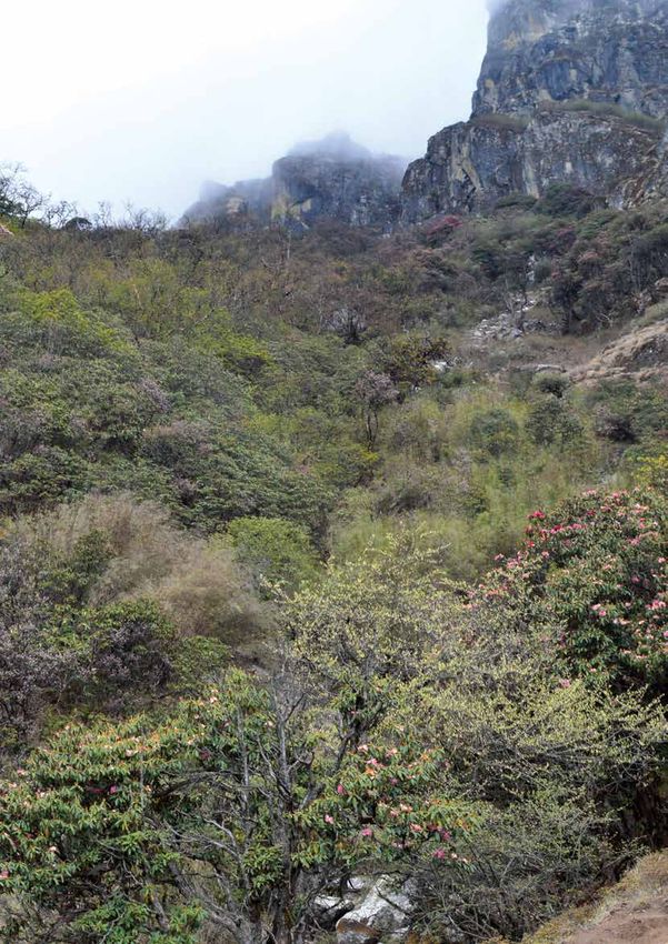
2.5.1. Vegetation rhododendron (R. nivale) extends up to 5,000 m.
These landscapes are used primarily for livestock
Forests occupy less than 10 % of the total area of
grazing and collecting fodder, wild foods, and
the SNP and its BZ. Forest-cover is found mostly in
medicinal and aromatic plants. Livestock-dung is
the lower valley gorges below 3,500 m elevation,
collected from the shrub and grassland areas, and
and is concentrated in the areas where farming,
is an important source of organic-manure and fuel.
settlements, and grazing activities are difficult. Cool
The alpine areas are also becoming increasingly
aspects and inaccessible areas retain more forest-
important for tourism. The traditional herding
cover as they are protected from fire and heavy
camps (chhu sa) are now being developed in some
harvesting pressure. The most common tree species
tourist villages, leading to pressure on the alpine
are Himalayan blue pine (Pinus wallichiana) at the
vegetation resources.
6Management Plan for Sagarmatha National Park and its Buffer Zone 2016-2020
The diverse topography and steep slopes provide a these ecological zones have become important
wide range of habitats for many plant and animal resting sites and habitats for a significant number
species. The terrestrial habitat can be divided of migratory and some resident water birds. The
into a variety of ecological zones and ecosystem high-altitude flora and fauna are important for
types such as temperate mixed-forests, sub-alpine global biological diversity as there are very few
conifer forests, broadleaved forests, alpine shrubs, other places where life exists at such unique high
grasslands and nival zone. The different forests and altitudes.
rangeland ecosystems support different plants and
animal species. So far, a total of 865 species of plants SNP has a comparatively low number of mammalian
have been recorded. Of these, 62 species are MAPs species as a result of the recent origin of the
belonging to 47 genera and 33 families. Six species Himalayas and climatic factors. The main mammals
of MAPs are included under the threatened and found are snow leopard (Panthera uncia), Himalayan
protected list of the IUCN, four species belonging to musk deer (Moschus chrysogaster), Himalayan black
the GoN Protected Category and four species under bear (Selenarctos thibetanus), red panda (Ailurus
the CITES appendix II (Gaire, 2006). A study in the fulgens), Himalayan tahr (Hemitragus jemlahicus)
SNP and its BZ has recorded 150 mushroom species
and wolf (Canis lupus). Many of these mammals
belonging to 37 families and 65 genera from Lukla
are listed as endangered or threatened species. In
(2,480 m above msl) to Pangboche (4,000 m above
msl) (Rana and Giri, 2006). addition to this, 8 species of reptiles, 7 species of
amphibians and 30 species of butterflies have been
2.5.2. Wildlife recorded in the area. The park provides habitat
SNP and its BZ are rich in floral and faunal diversity for at least 194 species of birds (Basnet, 2004)
owing to its diverse ecological conditions ranging including Danphe (Lophophorus impejanus), blood
from almost temperate to nival zones. The sub- pheasant (Ithaginis cruentus), yellow-billed chough
alpine zone exhibits a higher number of species (Pyrrhocorax graculus) and Himalayan griffon
followed by the lower alpine and temperate zones. (Gyps himalayensis). Out of the 194 bird species
The water bodies have cold temperatures and recorded in the SNP, 14 are globally significant. The
low nutrient contents. This prevents the high- lists of wild animals, wild birds and Herpetofauna
elevation lakes, streams and rivers from supporting recorded in the SNP and its BZ are presented in
a high diversity of aquatic life. Nevertheless, Annexes II, III and IV, respectively.
7Management Plan for Sagarmatha National Park and its Buffer Zone 2016-2020
Chapter III
Past Management and Present Practices
3.1. Conservation History such as office buildings, staff quarters and outlying
The first official commitment to establish the guard posts began soon after. The formal declaration
Khumbu Region as a National Park was made by of the 1,148 km2 Park took place in June 1976 by
the then Prince Gyanendra at a meeting of the announcing its boundaries in the Nepal Gazette.
WWF in Bonn, Germany in 1973. A feasibility The Himalayan National Park Regulations was
study for setting up of the park began in 1974 introduced in 1979 to provide the legal framework
and the groundwork for establishing the Park was for managing the SNP and other mountain national
initiated in 1975 with technical assistance from the parks. At the same time, the process of preparing
Government of New Zealand. The Mendalpu Hill a management plan for the Park was initiated. The
above the Namche Bazaar was selected as site for Park was inscribed in the UNESCO’s World Heritage
the Park Headquarters. Construction of facilities Site in 1979 (DNPWC, 2007). The historical
summary of the SNP is presented in Table 1 below:
Table 1: Historical summary of Sagarmatha National Park
Year Major Events/Activities
1950 Everest region opened for tourism
1953 Sir Edmund Hillary and Tenzing Sherpa climbed the Summit of Mount Everest
1974 Feasibility study for the establishment of the Park
1975 Initiation of ground work for the establishment of the Park
1976 The SNP established with an area of 1,148 km2
1979 The SNP designated as the World Heritage Site
1981 First management plan for the Park prepared
1993 First management plan for the Park reviewed
2002 BZ of the SNP declared
2004 Management Plan for the BZ of the SNP prepared
2007 Gokyo and the associated lakes declared as Ramsar Site
Management and Tourism Plan for the SNP (2007−2012) prepared and implemented
Sources: DNPWC, 2007; Garratt, 1981
3.2. Park Protection leopard in the SNP after almost four decades is
The illegal activities inside the SNP were prohibited an indicator of an effective park management,
since its establishment in 1976. Regular patrolling especially park protection after its establishment.
effort from the security posts established in the Park Poaching of musk deer for illegal trade of its musk
was the major activity to ensure the protection of pod has remained one of the major challenges for
the Park. At the beginning, a unit of the Nepal Army the Park management.
with the strength of 40 individuals was deployed
in the Park, and later one company of the Army 3.3. Habitat Management
has been deployed to protect the wildlife species In order to maintain mosaic of suitable habitat
and their habitats in the Park and its BZ. The list of in the Park, management of rangelands and
the existing Security Posts in the SNP and its BZ is wetlands has been in practice as habitat
presented in Annex V. management intervention. The main focus of
habitat management in the SNP has been to keep
The protection of the Park has resulted in the rangelands free from anthropogenic pressure such
increase in wildlife population. The return of snow as unsystematic collection of forest products from
8Management Plan for Sagarmatha National Park and its Buffer Zone 2016-2020
the Park and unregulated grazing in the rangelands areas of the Park through garbage pit construction.
within the Park. The previous plan of the SNP Later in 1991, a non-governmental organization,
has recommended park zonation to reconcile the Sagarmatha Pollution Control Committee (SPCC)
conservation needs and fulfillment of the basic dedicated to garbage management in the Khumbu
requirements of the local communities. However, region was established and the Park authority
this could not be fully implemented. On the other has been promoting the SPCC as a local-level
hand, garbage management is another important conservation partner to keep the Everest region
activity under the habit management which not clean. It is a local environmental institution, and
only helps in keeping rangeland and other wildlife has been actively engaged in waste management
habitat clean but also helps in controlling pollution in the three VDCs viz. Chaurikharka, Namche and
in the wetlands. However, there is always a risk Khumjung of the SNP and its BZ. The Ministry of
of forest fire as a threat to the wildlife habitats as Tourism and Civil Aviation also coordinates with
frequent accidental fire deteriorates the wildlife the SPCC to respond for monitoring garbage in the
habitats in the Park. permit-required mountains and the NMA-registered
peaks. In direct coordination with the SNP and the
3.4. Anti-poaching and Intelligence Gathering local communities, SPCC also manages garbage in
Intelligence gathering is the first step towards the major settlements and along the trekking-trails.
an effective anti-poaching operation. However, This NGO, with permission from the SNP, built some
the park at present does not have a network of solid waste containers along some trekking-routes
informants for intelligence gathering. In order to (Lukla to Namche, Namche to Tengboche and
control poaching of wildlife species and illegal trade Namche to Thame).
of their body parts, there is a need of informants’
network to collect reliable information regarding 3.6. Research and Monitoring
the probable wildlife crimes in this area. There were SNP is among well studied mountain PAs as it has
several legal cases filed in the SNP based on the received more attentions from both the national
information provided by the local volunteers. Thus, as well as international researchers compared to
there is a need to form and strengthen informants’ other mountain PAs in Nepal. However, most of the
network to obtain reliable information for effective research results are scattered and results of many
anti-poaching operations. research works are not even known to the Park
3.5. Tourism and Interpretation Manager. There is a very limited infrastructure for
research in the Park as there are no permanent
The SNP is one of the most popular tourist research stations in the Park except the Ev-K2-CNR/
destinations in Nepal. Tourism is the major source NAST Pyramid Research Laboratory.
of income, which not only benefits the local
communities, but also generates significant amount 3.7 Human-Wildlife Conflict
of revenue for the country. Mountaineering and
Human-wildlife conflict is not a pronounced issue
trekking are the major attractions for the visitors
in the Park and its BZ. However, there are few
in the Everest region. Proximity to the Mt. Everest
reported cases of wildlife damage recorded in the
is a prime factor in the area’s popularity. In 1963,
20 tourists visited the Everest region whereas the buffer zone. Crop depredation by Himalayan tahr
number of tourists increased to 3,500 in 1973. is a management issue in the buffer zone over the
In 1980, there were 6,000 tourists. In 2000, the period. The Sherpa culture of the Khumbu region is
number of tourists who visited the Park peaked at beneficial for wildlife conservation as they believe
26,500. However, the number of visitors dropped in non-violence religious value. Thus, killing of
to 14,000 in 2002 due to political instability in the wildlife species by the local people is not a common
nation. With improved political situation in 2004, practice in this region. However, crop depredation
the number of tourists increased to 21,000, and by Himalayan tahr and livestock killing by leopard
there are slightly more than 30,000 tourists visiting are frequently reported. In the recent years,
the Park annually in the recent years. human-wildlife conflict is becoming one of the
major hindering factors for maintaining harmonious
Garbage management is a major challenge in the relationship between the wildlife and the local
Park area. In 1988, the Park authority initiated people and increasing people’s participation in
garbage management in Topdanda and Tengboche conservation.
9Management Plan for Sagarmatha National Park and its Buffer Zone 2016-2020
3.8 Administration and Organization
The Chief Conservation Officer (Gazetted Class II Officer) heads the SNP administration with the
Headquarters at Namche, Solukhumbu. The organizational structure of the Park is presented in Figure 3
below:
Chief Conservation Officer -1
Under Secretary (Technical)
Planning Section Legal and Buffer Zone and Account Section Administration
Ranger-1 Anti-poaching Section Evaluation Section Account Officer-1 Section
S. Gamescout-1 Ranger-1 Assistant Accountant-1 Section Officer-1
Gamescout-3 S. Gamescout-1 Conservation Computer
Gamescout-3 Officer-1 Operator-1
Ranger-1 Kharidar-1
S. Gamescout-1 Helper-1
Gamescout-3
Chaurikharka Range Khumjung Range
Post Post
Assistant Ranger-1
Conservation Kharidar-1
Officer-1 Furte Post Thame Post S. Gamescout-1
Ranger-1 S. Gamescout-1 S. Gamescout-1 Gamescout-3
Kharidar-1 Gamescout-3 Gamescout-3
S. Gamescout-1
Gamescout-3
Jorsalle Post Lukla Post Debuche Post Dole Post
S. Gamescout-1 S. Gamescout-1 S. Gamescout-1 S. Gamescout-1
Gamescout-3 Gamescout-3 Gamescout-3 Gamescout-3
Kongde Post Tashinga Post
S. Gamescout-1 S. Gamescout-1
Gamescout-3 Gamescout-3
Figure 3: Existing organizational structure of Sagarmatha National Park
In addition to the regular management activities, 3.9 Achievements of Preceding Management Plan
a company of Nepal Army has been deployed for An integrated management and tourism plan was
ensuring the protection of the Park. The company, prepared and implemented in the SNP and its BZ for
headed by a Major, has its Headquarters at Namche, the period of 2007−2012. It consisted of 3-pillared
and there are altogether 3 security posts (at structure of management, viz. i) Park Management,
Namche, Thame and Lukla) in operation at present ii) Tourism Management and iii) Buffer Zone
for the security of the Park and its BZ. The number Management. A number of achievements have
of security posts can be increased as per the need been made with the implementation of the plan
considering the emerging issues and challenges of particularly in the protection of the endangered
the Park management. The existing organizational species and the conservation and management of
composition of the staff in the SNP is presented in the natural resources.
Annex VII.
10You can also read