Nepalese Journal on Geoinformatics -18, 2019
←
→
Page content transcription
If your browser does not render page correctly, please read the page content below
Nepalese Journal on Geoinformatics -18, 2019 | 77
Khim Lal Gautam, Chief Survey Officer
                                                                    from Survey Department participating
                                                                    in "International GNSS Summer school
                                                                    2018 at Tokyo Japan"         from July,
                                                                    30,2018 to March 4,2018, organised by
                                                                    Tokyo University of Marine Science and
                                                                    Technology and co-organised by Institute
                                                                    of Positioning, Navigation and Timing of
                                                                    Japan.

 Chief Survey Officer Mr. Krishna Sapkota
 and Chief Survey Officer Mr. Ishwor Lal
 Nakarmi, participating in "2018 Boundary
 Affairs and Surveying and Mapping
 Training Program" from 22 October - 2
 November 2018, Wuhan China.

                                                                    Newly constructed big river pillar with
                                                                    riverine design at Nepal-India boundary.

 Hon Minister Padma Kumari Aryal,
 Joint Secretary Mr Janak Raj Joshi,
 Under Secretary Mr Tek Prasad Luitel,
 Chief Survey Officer Mr Sudarshan
 Singh Dhami, Survey Officer Mr Sharad
 Chandra Mainali, Survey Officer Mr
 Sumeer Koirala and Survey officer Mr
 Bhagirath Bhatta participating in "United
 Nations World Geospatial Information
 Congress" from 19-21 November 2018,
 Deqing China.

78 | Nepalese Journal on Geoinformatics, Survey Department, Nepal
Nepalese Journal on Geoinformatics

                                Number : 18

                           Jesth 2076 BS
                          May/June 2019 AD

         Annual publication of Survey Department, Government of Nepal

    The content and the ideas of the articles are solely of authors.

                                                   Nepalese Journal on Geoinformatics -18, 2019   | i
Published by:
                                           Government of Nepal
                                       Ministry of Land Management,
                                      Cooperatives & Poverty Alleviation
                                            Survey Department
                                          Min Bhawan, Kathmandu
                                                    Nepal

                                                No. of copies : 500

                                       © Copyright reserved by Survey Department

ii | Nepalese Journal on Geoinformatics, Survey Department, Nepal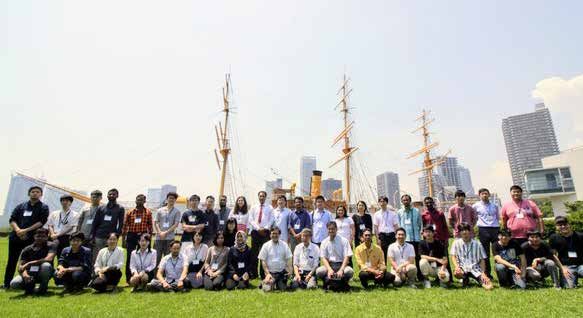
Nepalese Journal                 Features                                        Contents
               on

  GEOINFORMATICS
          Jesth 2076, May 2019
                    Number 18       Articles   1   Remote Sensing of Nepal’s
                                                   Forests and Trees:Ascertaining
                                                   the Front Line of Human-Induced
                                                   Tree Cover Changey
                                                   Prof. Amulya R Tuladhar
                                                   Page 1
Product Price
    Maps
    Page 14                                    2   Application of Geographic
    Control Points                                 Information Infrastructure: In
    Page 14                                        the context of restructuring the
    Price of Aerial Photograph
                                                   country
    Page 50                                        By Er. Jyoti Dhakal
                                                   Page 15
    Land Use Digital Data Layers
    Page 50
                                               3   Address System in Korea
    Digital Orthophoto Image Data                  By Byungyong Kwak, Susheel Dangol
    Page 50
                                                   Page 21
    Digital Topogrphical Data
    Page 50                                    4   Image Fusion Technique:
                                                   Algorithm to Application
    Obituary
                                                   Prakash Ghimire & Dr. Lei Deng
    Page 42
                                                   Page 27

                                               5   Gravity for Geodetic Purpose:
Cover Page
                                                   Geoid-Ellipsoid Separation and
Activities conducted during
Everst Height Measurement                          Orthometric Height System
Programme (2018-19).                               Shanker KC
                                                   Page 35
Contents                                        Contents

                                  Nepal Geomatics           6   Coding the Administrative Units
                                  Engineering Society           of Nepal for Data Integration and
                                  (NGES)
                                                                Visualization
                                  Page 71
                                                                Suresh Man Shrestha, Cartographic
                                                                Engineer
                                  Nepal Surveyor's
                  Professional                                  Page 44
                                  Association (NESA)
                  Organization
                        Pages     Page 72
                                                            7   Road Network Rating Based on
                                  Nepal Remote                  Land Use of Pokhara
                                  Sensing and
                                                                Sushmita Subedi & Roman Pandit
                                  Photogrammetric
                                                                Page 51
                                  Society
                                  Page 73
                                                            8   Precise Point Positioning (PPP):
                                  Editorial                     Method and its Geodetic Usage
                                  Page vi                       By Timilsina, Sushmita
                       Regular
                       Column                                   Page 59
                                  Forewords
                                  Page ix

                      Diamond     Messages
                Jubilee Special   Page vii-viii

                                  Calender of
                                  International Events
                                  Page 43
                                  Articles in Previous
                                  Issues
                                  Page 64
                                  Call for Papers
                  Informations
                                  Page 74
                                  Instruction and
                                  Guidelines for
                                  Authors Regarding
                                  Manuscript
                                  Preparation
                                  Page 74

iv | Nepalese Journal on Geoinformatics, Survey Department, Nepal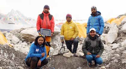
Advisory Council

                                      Prakash Joshi
                                      Chairperson

 Karuna K.C.       Rameshraj Rajbhandari   Sushil Narsingh Rajbhandari     Amir Neupane
  Member                 Member                      Member                  Member

                            Editorial Board

                                     Karuna K.C.
                                    Editor-in-Chief

Krishna Sapkota   Kamal Ghimire      Susheel Dangol     Damodar Dhakal       Sudeep Shrestha
    Member          Member              Member             Member               Member

                                                      Nepalese Journal on Geoinformatics -18, 2019   | v
EDITORIAL
                         Since 2058 BS (2002 AD) Survey Department has been publishing "Nepalese Journal
                         on Geo-informatics" which has been an important asset as well as a means to propagate
                         professional knowledge, skills and expertise in the field of Surveying, Mapping and
                         Geo-information. Continuing its commitment to share knowledge, Survey Department
                         is publishing the 18th issue of "Nepalese Journal on Geo-informatics".

                         In last seventeen issues more than 100 articles in a variety of themes related to Surveying,
                         Mapping and Geo-information science and its applications in different field have been
                         published. I would like to express sincere thanks to all those incredible authors for their
                         contributions and members of Advisory Councils and Editorial Boards of all those issues
                         of the journal for their persistent efforts to publish the journal.

                         This eighteenth issue of the journal contains a wide variety of interesting and worth
                         reading articles on different topics viz. "Remote Sensing of Nepal’s Forests and
                         Trees:Ascertaining the Front Line of Human-Induced Tree Cover Changey by Prof.
                         Amulya R Tuladhar, Application of Geographic Information Infrastructure: In the
                         context of restructuring the country By Er. Jyoti Dhakal, Address System in Korea
                         By Byungyong Kwak and Susheel Dangol, Image Fusion Technique: Algorithm to
                         Application by Prakash Ghimire & Dr. Lei Deng, Gravity for Geodetic Purpose: Geoid-
                         Ellipsoid Separation and Orthometric Height System by Shanker KC, Coding the
                         Administrative Units of Nepal for Data Integration and Visualization by Suresh Man
                         Shrestha, Road Network Rating Based on Land Use of Pokhara Sushmita Subedi &
                         Roman Pandit, Precise Point Positioning (PPP): Method and its Geodetic Usage By
                         Timilsina, Sushmita

                         At this point, I am very much thankful to the Survey Department for entrusting me
                         with the responsibility of the Editor-in-Chief for this eighteenth issue of the journal.
                         Following the advice and suggestions of Advisory Council, we, the members of Editorial
                         Board have been able to bring forth the eighteenth issue of the journal. On behalf of
                         all the members of the Editorial Board, I would like to express sincere thanks to all
                         contributing authors, members of Advisory Council and all others who have contributed
                         for the publication of this issue of the journal.

                         Before I stop, on behalf of the Editorial Board, let me humbly request all of you to
                         contribute your valuable thoughts, articles, research papers, success story for the
                         upcoming issue of this journal.

                                                                                                    Karuna K. C.
                                                                                                  Editor-in Chief,
                                                                                                      Jesth, 2076

vi | Nepalese Journal on Geoinformatics, Survey Department, Nepal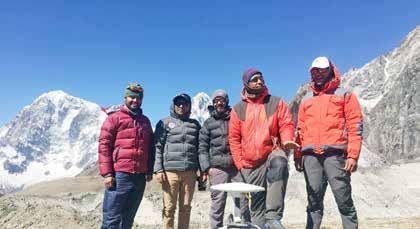
Nepalese Journal on Geoinformatics -18, 2019 | vii
viii | Nepalese Journal on Geoinformatics, Survey Department, Nepal
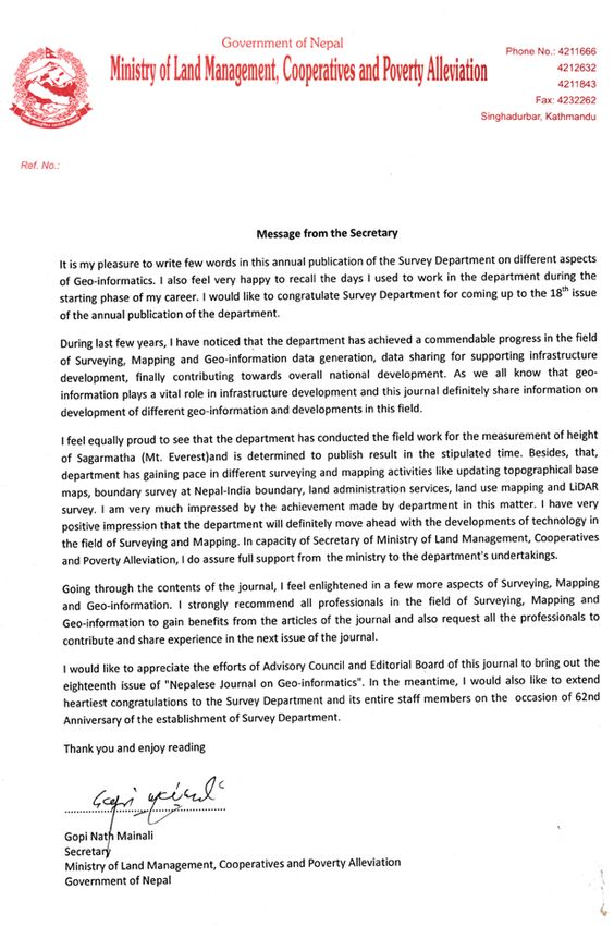
FOREWORDS

   I am delighted to be able to write a few words on the eighteenth issue of "Nepalese Journal
   on Geo-informatics" on the Sixty-Second Anniversary of Survey Department. Let me
   take a moment on this special occasion of the Sixty-second anniversary, I would like to
   congratulate entire staff of the Department and extend sincere thanks to those who have
   contributed, in the past in different capacities for the betterment of the Department in the
   occasion of this 62nd anniversary of the department.

   It is my pleasure to mention Survey Department, the only National Mapping Organization
   of Nepal, has been continuously contributing in the sector of Surveying, Mapping, Geo-
   information Science and Earth Observation, which are very much crucial for the planned
   development of the country. Furthermore, the organization is contributing not only in
   Land Administration but also in International Boundary Management.

   Some initiative taken have the potential to leave a historic legacy of the department.
   Initiatives taken by the department to scale the Sagarmatha (Mt. Everest) has drawn
   attention of the international community. We consider this initiative to be not only a
   matter of pride for our profession but also an opportunity to enhance our capacity to cope
   with the challenges that has come alongside. Furthermore, department has also initiated
   the activities of LiDAR survey for the first time in country. This shall be a milestone for
   the development of high resolution Digital Elevation Model that will support in different
   development activities and disaster mitigation plan and management. Department is
   also conducting Land Use mapping that will support in optimum use, monitoring and
   management of land and land resources for implementation of Land Use Policy.

   One of the major activity of the department is to prepare topographical base maps which
   is base for planning every development activities. Department is preparing activity plans
   for implementing National Spatial Data Infrastructure (NSDI). In this regard, geoportal
   is introduced for clearing house and sharing of data and information. We are further
   updating applications for the clearing house. Department prepared series of topographical
   base of whole country some decades ago and now running with the updates of these
   maps. In few years department will come up with updated topographical base maps. In
   near future, department is also planning to densify the Continuously Operating Reference
   Station (CORS) over the country.

   After assuming the office of the Director General, I have been trying to invest all my energy
   in the endeavors aimed at strengthening the Department, its staff and the profession as a
   whole and my entire staff of the Department from their respective positions, have been
   together with me in every efforts taken to enhance the Department. I do believe in team
   work and coordination. I am confident that we will be successful in showing the tangible
   results if we continue our efforts sincerely in the days to come.

                                                       Nepalese Journal on Geoinformatics -18, 2019   | ix
This year is the year of celebration for successful completion of Mt Everest expedition for the
measurement of the height of the Everest. This year we are felicitating the expedition team who did
a commendable job of expedition. Survey Department will work hard to disseminate the result of the
height measurement program in stipulated time.
Finally, let me express my sincere appreciation to the fellow colleagues, the members of Advisory
Council, and Deputy Director General Ms Karuna K.C, entire team of the Editorial Board, specially
Chief Survey Officer Mr. Susheel Dangol for their invaluable contribution in this issue who deserves
special thanks for their tireless efforts in bringing this issue in the stipulated time. More importantly,
I extend sincere gratitude to all the authors for their resourceful professional contribution. I would
expect such kind of support and professional contribution in the upcoming issues too. At the same
time, I encourage fellow colleagues from the Department to contribute to the journal by providing
quality articles.
As we were aware at the first issue, a journal needs commitment, not only from editors but also from
editorial boards and the contributors. Without the support of our editorial boards we would not dare
to start and continue. Special thanks, also, go to the contributors of the journal for their trust, patience
and timely revisions.
I am confident that this journal is proficient not only to the surveying and mapping professionals, but
also to other scientific community and researchers as well.
Enjoy Reading!
Thank you!
Jesth 14, 2076 (May 28, 2019) Prakash Joshi
Kathmandu, Nepal Director General
prakash.joshi@nepal.gov.np
x | Nepalese Journal on Geoinformatics, Survey Department, NepalRemote Sensing of Nepal’s Forests and Trees:
Ascertaining the Front Line of Human-Induced
Tree Cover Change
Prof. Amulya R Tuladhar
tuladharamulya@gmail.com
KEYWORDS
Remote Sensing, Tree cover change, Forest
ABSTRACT
Synoptic, remote sensing of the national-scale, societal response of trees and forests to
human driving forces in Nepal has been a wicked problem. This problem is a complex of
four ancillary issues, namely, minimum mapping unit, radiometric scatter due to terrain,
modeling of human dimensions, and democratizing robust environmental analysis.
Beginning with the November 2018 conference convened by the East-West Center (EWC),
USA, in Nepal, the state-of-the-art and key works in this problem-solving has been reviewed
in this paper. Though this technology has improved the detection of forest and tree changes
due to human driving forces at earlier stages, it is still not robust enough to inform global
and national policy.
1. INTRODUCTION canopy for identifying forests and trees for
global carbon sequestration assessments (Sasaki
Remote Sensing has been used to monitor and Putz, 2009).
synoptic, spatiotemporal changes in tree and
forest cover due to human driving forces and For detecting front-line, individual tree stands,
societal responses. It is desirable to detect such the definite precursors of the wide-scale, tree
changes as early as possible, in units that can and forest recolonization of abandoned farms
be used over large scales such as nations and and public lands over the past 40 years in Nepal,
globes. However, the state-of-the-art in remote it is necessary to detect such changes in plots
sensing of forest and trees for these scales are less than 0.5 ha, with less than 10% crown cover
constrained to detecting only “latter” stages of (Rudel et al., 2016; Fox, 2018). This has been
changes. These “latter stages” refer to “forests technically possible with finer spatial scales
or tree cover” of woody vegetation plots over of 5 m, 2 m and even 0.5 m of IKONOS and
0.5 ha, 30% crown cover, and 30 m spatial QuickBird satellite imageries, tested in Jumla
resolutions, such as the Global Forest Cover (Uddin et al., 2015) but difficult to upscale it to
(Hansen et al., 2013), following FAO protocol national level due to various problems (Saksena,
(Lambrechts, Wilkie and Rucevska, 2009; 2018; Hurni, 2018; and Smith, 2018). For these
FAO, 2014). However, the Forest Resources reasons, even the “best” global data for tree
Assessment (FRA) of the Government of Nepal, cover change provided by Hansen et al., (2013)
stretched the lower threshold of “forests” to have reached accuracies of only 75% (Weiss
include woody plots with 10% crown cover at and Peterson,
spatial resolution of 5 m (Khanal et al., 2014).
But the United Nations Framework Convention 2015) versus acceptable levels over 85%,
for Climate Change, UNFCCC, recommends achieved for national FRA (Pokharel, 2018).
even lower threshold of 0.05-1 ha with 10-30%
Nepalese Journal on Geoinformatics -18, 2019 | 12. East-West Center Conference in Nepal, Sharma; ICIMOD’s remote sensing experts,
Nov 29-30, 2018 Kabir Uddin and Mir Matin, on national and
regional modeling of decadal landuse land cover
Reviewing the state-of-the-art in the remote changes; experts on sub-regional remote sensing
sensing of tree and forest cover change, a studies by HELVETAS for Churia (Pokharel et
conference was convened by the EWC, USA, al., 2018) and watersheds (Shrestha, 2018), and
in Nepal on November 29-30 (Fox, 2018). This other ground level studies of tree and community
conference compared three Landsat datasets forestry change by the Institute of Forestry;
for Nepal from 1988 to 2017, based on their and other individual researchers. I have also
suitabilities: a) by the International Center for contributed my own NASA-funded, doctoral
Integrated Mountain Development, ICIMOD; b) research experience at Clark University, on
by Hansen et al., (2013); and c) by the EWC/ ‘The Pattern and Conditions for Forest Increase
OSU (Smith, 2018) with the FRA RapidEye over the Himalaya’ using Advanced Very High
(Pokharel, 2018) and other relevant works. Resolution Radiometer (AVHRR) (Wikipedia,
The suitabilities were analysed by quantifying 2019) using Time Series Analysis.
the rate, extent, and socioeconomic importance
to understand tree transition over the last three 3. Why is this Problem Important?
decades of Landsat satellite data and spatial
modeling. Here, it was concluded that whilst Single trees and ultimately entire forest patches
significant progress had been achieved, critical respond to driving forces of human dimensions
problems persisted, in the smallest spatial from individual decision-making on whether
units that could be sampled, economically with to out-migrate or stay on farms; whether to
acceptable accuracy and precision, to ascertain steal fuelwood and fodder from forests for
the earlier stages of tree response to human livelihoods; or come together in legal community
dimensions on mountains. These problems are forestry user groups; or at large, on what
analyzed and discussed and in this paper. policies the government make and implement
on forest logging, forest protection, permits for
This Conference was convened by Jeff Fox forest clearance for development of airports,
who has been familiar with the challenges and transmission lines, gas pipes and roads; or to
approaches of working with Nepal forestry, permit political disturbance overcutting during
community forestry and remote sensing from Maoist rebellion; or government sponsored
the 1980s (Fox, 2016). Accordingly, he had forest cutting to generate votes; and finally, to
assembled a team of experts to explore how fail to control population pressures for forest
remote sensing could more effectively ascertain lands and products due to inadequate forest
tree recovery and Community Forests at national protection institutional machinery.
scales. These experts included Alexander C
Smith (Smith_a, 2018), a doctoral student of Tree dynamics which were undetectable by
Remote Sensing and Community Forestry at conventional remote sensing include the farm
the OSU who had worked on Nepal Community and social forestry trees which were coming
Forestry for his Masters and was now working on up on the abandoned, farming landscapes due
his PhD on a NASA funded grant; his Professor, to outmigration or the reduction of population
Jamon Van Den Hoek, an expert on Google Earth pressure for livelihoods. Such trees on farm
Engine; Dr. Kasper Hurni of University of Bern, lands, groves, roadsides or scattered shrubs
an expert on topographic corrections for Landsat would need up to 30-40 years, or more to reach
Time Series database; and ecological modelers, a ‘visible’ stage as per the aforementioned FAO
with particular experience on Nepal tree and remote sensing protocol.
forest cover change linked human dimensions
from EWC and NASA, Sumeet Saksena and Various solutions for detecting tree and forest
Atul Jain. This team interacted with participants changes have been explored. Generally, the
from the FRA, Deputy Director Yam Pokharel, smaller the pixel, the more weight a few trees’
and Community Forest Division Chief Anuja crowns will have, to swing the net pixel reflectance
2 | Nepalese Journal on Geoinformatics, Survey Department, Nepalsignature to ‘tree’ category, especially if they between 0.5-2.00 ha, whose measurements
cover over 50% of the pixel. Nepal recently used maybe subject to errors due to terrain and
RapidEye (Wikipedia, 2018) satellite images partial pixel overlay (Community Forestry
with spatial resolution of 5 m and this is partly Database, 2019). Community Forests range
a reason for national forest increase over its from less than 1 ha to 4000 ha, with 60% under
1994 forest area by 5.14% (Khanal et al., 2016). 100 ha and 40% under 50 ha (Sharma, 2010).
The use of complex algorithms for principal
components and maximum-margin hyperplanes The conventional remote sensing used for forest
has enabled the discrimination of early stages, cover analysis are appropriate for measuring
such as 10% crown cover, by reducing errors large swathes of forest lands, clear-felled by
due to spatial collinearity (DFRS, 2015; Guo et loggers (Hansen et al., 2003 and Hansen et
al., 2015; Saksena, 2018); and similarly, due to al., 2013; Roy et al., 2013) but not good for
terrain reflectance (Hurni, 2018) Selection Silviculture, pick and choose forest
trees cut, used by encroachers and illegal cutters
Millette et al., (1995) tried to detect by remote (Fox, 2018). When trees are mined from within
sensing unsuccessfully, the increased incidence forests, making them thinner or with lesser
of tin roofs, as a measure of village affluence, crown densities, resulting in forest degradation,
over thatched huts from bare terrace surfaces, even with no change in area, it is less easy to
because of an excess of noise over signals in ascertain, even by remote sensing (Millette et
pixels. Similarly, even with sophisticated, pre- al., 1993). It is also impractical to verify all such
processing of remotely sensed time series data areas on foot (Rayamajhi and Tachibana, 2018);
from 1977 to 2010, econometric modelers at the therefore, remote sensing has been necessary
International Food Policy Research Institute, with all the needed processing.
IFPRI, were able to explain only 56% of the
total variation in village household income Nonetheless, we still do not have adequate means
as a function of tree cover change (Man Li et to monitor nationwide the front-line ground
al., 2015). With the latest cutting-edge, terrain effects of forest policy applications exclusively
correction pre-processing for 2001-2016 Landsat through remote sensing but have to depend on
imageries, Saksena (2018) could explain upto extensive ground-truthing. This was done for
69% of variation in tree cover change with the four-year 2010-2014 FRA (DFRS, 2015).
village level human factors. It reported a 5.14% increase in forest area from
1994-2014 (Khanal et al., 2016) but this public
Additionally, even the widespread Community impression of forest increase discourse was
Forestry which now cover over 2 million ha obfuscated with counter-claims of deforestation
(FECOFUN President Speech, 2018) could of 0.83% from 2001-2016, in a June 4, 2018
be partially ‘invisible’ when they are in forest news (Kathmandu Post, 2018), quoting research,
patches, less than 0.5 ha, scattered on terraces using Global Forest Watch satellite database
of varying terrain (Sharma, 2018), constraining (Hansen et al., 2013) by Sujata Shrestha, et al.,
verifiable estimates of net forest and tree cover (2018).
by global remote sensing for the Measuring,
Reporting, and Verification, MRV, protocol This was the backdrop for the 2018 Annapurna
for seeking carbon trade dividends and conference. The key problem of measuring forest
compensation for the carbon sequestration by and tree cover change on Nepal Mountains can
the large community forestry area (Acharya et be broken down to four sub-problems as follows:
al., 2009). According to the latest and official
Forest User Groups (FUGs) Records available Problem one : Measurement of Forest and
in MIS, Department of Forests, Babar Mahal, Tree Cover Dynamics
Kathmandu, dated Aug 15, 2017, of the 1.8
Problem two : Radiometric Errors due to
million ha under community forests, 46 forests
Mountain Terrain
were under 0.5 ha, hence totally invisible to
remote sensing; and 486 such forests were Problem three : Modeling Human Dimensions
Nepalese Journal on Geoinformatics -18, 2019 | 3of Forest and Tree Cover Nepal mountains for Regions at Risk (Millette,
Dynamics et al., 1993; Kasperson et al., 1995). Time
Series with AVHRR had been successfully
Problem four : Democratization of Robust
used to monitor El Nino vegetation effects in
Remote Sensing Analysis of
Africa and China so I applied this to Nepal
Forest/Tree Cover
forest to uncover a net national increase in
4. Problem one: Measurement of Forest woody vegetation, a finding later corroborated
Patch and Tree Cover Dynamics by JAFTA (2001) and Nepal FRA, 2010-2014
study (DFRS, 2015; Khanal et al., 2016). The
What is a “forest”? This is a vexing remote AVHRR 1 km spatial resolution have now
sensing problem: or what is the ‘smallest visible been bested with Moderate Resolution Imaging
forest spatial unit’, or the Minimum Mapping Spectroradiometer (MODIS) satellite imagery
Unit, the MMU, for “forest” (Saura, 2002)? data at 0.5 km resolution (Hansen et al., 2003)
When satellites were used for remote sensing, the and used for regional land cover mapping in the
platforms were at least 500 km above the surface ICIMOD mountains (Uddin, 2018).
of the earth, so small patches were difficult
to identify (Jensen et al., 1999). Satellites can The amount of all the woody vegetation in a
only identify or characterize an event or process pixel would affect the amount of Normalized
if the event/process produces a measurable Difference Vegetation Index, NDVI, score for
change (spatial, temporal, and spectral) on the large landscape; the total amount of woody
Earth’s surface. Satellite imagery are most often vegetation per pixel would increase or decrease
designed for systematic monitoring of condition its total Vegetation Index (Tuladhar, 1995). For
of the Earth’s surface rather than supporting this vegetation index, the theory was to assess
visual interpretation or feature detection (Hoek, the difference in energy capture from reflectance
et al., 2018). The spatial resolutions of satellite of woody vegetation versus that of other mixed
remote sensing have steadily improved from or homogenous land cover types (Lillesand et
the 79 m of the earliest Multi-Spectral Scanner al., 2014; Crowther et. al., 2015).
(MSS) to 0.5 m for IKONOS, and QuickBird,
but the standard is FAO/Landsat resolution of Other techniques include pre-processing for
30 m because of costs and easy availability: the clouds, object-based image analysis, and
exception was the 5 m RapidEye used for Nepal hyperspectral multivariate analysis, from 4 for
FRA (Pokharel, 2018). Therefore, tree and MSS, to 7 for TM, and 8 for Enhanced Thematic
forest patches under these specifications have Mapper (ETM) (Guo et al., 2015; Hansen et al.,
been “invisible” for global and national forest 2003; Hansen et al., 2013; Uddin, 2018) that
monitoring. have improved remote sensing accuracy upto
75%; good, but less than the desirable accuracies
There have been several strategies to circumvent of over 85%.
the cost and technical limitations for finer
resolution remote sensing for large scale forest 5. Problem two: Radiometric Error due to
and tree cover change mapping. For instance, Terrain
during my doctoral research at Clark University
Another wicked problem is the errors due to
(Tuladhar, 1995), I used time series analysis
inadequately corrected radiometric dispersion
of 1985-95, with 3650 daily images of 1 km
by the mountain terrain in conventional Digital
spatial resolution AVHRR, to robustly enhance
Elevation Model of the Advanced Spaceborne
the discernment of woody tree vegetation, after
Thermal Emission and Reflection Radiometer,
encountering limitations in the two-date, $7000
Global Digital Elevation Model, ASTER
Landsat images, for my professors’ research on
4 | Nepalese Journal on Geoinformatics, Survey Department, NepalG-DEM (Digital Geography, 2019), second
generation DEM (Digital Geography, 2019), the
Shuttle Radar Topography Mission or SRTM
(Georgopoulos, 2015; Guo et al., 2015; Internet
Archive Wayback Machine, 2019). These models,
available for the globe for 30 m contours, have
been unable to distinguish land covers due to a
lot of noise (Bhattarai et al., 2009; Bajracharya
et al., 2009). Worse, radiometric scatter is
exacerbated by a Nepal’s mountain specificity
(Jodha and Shrestha, 2012): the tremendous
diversity of terrain (Ishtiaque et al., 2017; Guo et
al., 2015). To reduce terrain-induced radiometric
uncertainties, spatial statistical corrections for
collinearity and autocorrelations on Digital b) Objective 1: 1988-2016 Tree Cover
Terrain Models or DTM have been explored to Change Methodology, Fox (2018):
produce principal components for more robust Right
discrimination (Guo et al., 2015; DFRS, 2015);
in particular, for three Nepal mountain, satellite Have these errors been tamed? Not Really.
imageries datasets of, a) ICIMOD decadal data Terrain correction algorithms, despite their
for 1990, 2000 and 2010; b) Hansen et al., sophistications and power, have not captured
the full range of variability of forest and tree
(2013) global forest cover database for 2000-
landscapes over the entire Nepal Mountains.
2016; and c) the EWC/OSU database for 1988 to So, for those who cannot afford the expensive
2016, (Hurni, 2018; Table below). This revealed ground-truthing, certain “standard” satellite
that differences crept in for slope class 4 to 5 imagery have been used as Bench Marks, like
(Smith_b, 2018), due to diffraction and diffuse Google Earth imagery (Tuladhar, 2015; Uddin,
back radiation on mountain terrain (Hurni, 2018; Pokharel, 2018).
2018). So a major section of the EWC study of
community forestry and tree cover dynamics 6. Problem three: Modeling Human
has been devoted to using the best trigonometric Dimensions of Forest and Tree Change
corrections of Hurni (2018) below to Fox’s The whole rationale for studying and improving
methodology (Objective 1 box), below: remote sensing of forest and trees is to understand
the human dimensions of landscape changes
a) Hurni’s Terrain Corrections Tested (Kasperson et al., 1989). HDGEC, or the Human
for Nepal Satellite Data from 1988- Dimensions of Global Environmental Change,
2016, Left: include Human Driving Forces and Societal
Response Patterns (Ehrlich and Holdren,
1971). In Third World Countries, Population
(P) is the overwhelming driver (Chowdhury,
2006; UN_REDD/REDD Cell, 2014; Wang
and Wu, 2019) whereas in First World, it is
Affluence (A) and Technology (T) (Meyer and
Turner, 1994; Rudel et al., 2016; Shrestha et al.,
2018). Scholars later expanded this concept to
IPATIC, to include Institutions (I) and Culture
(C) (Meyer and Turner, 1994). Research on
Nepal Driving forces across scales include, for
instance, Bhattarai and Conway, 2008; Bhattarai
Nepalese Journal on Geoinformatics -18, 2019 | 5et al., 2009; Pandey, et al., 2016; Ishtiaque et 2018). Further other social drivers include:
al., 2017; and Saksena, 2018. Scale and the socioeconomic variables of income, source
determination of quantifiable, social variables of income, number of people per household,
for human dimensions have been challenges education, gender, number of livestock, etc.
for these modeling (Meyer and Turner, 1994; while biophysical and spatial variables could
Hansen et al., 2013; Khanal et al; 2016; Saxena, include aspect, slope, elevation, distance
2018; World Resources Institute, 2019). from markets (Schweik, et al., 2003; Saksena,
2018). Researchers trying to relate migration,
Societal Responses come from the Hazard remittance and other socioeconomic variables to
School (White, 1961) which use neoclassical empirically georeferenced tree cover and forest
fundamental concepts of the Rational Man and cover changes have found modeling difficult,
Bounded Rationality to explain why people and with only modest R2 and limited remote sensing
firms at different scales make what seems like accuracies (Bhattarai and Conway, 2008;
‘irrational choices’, to live in dangerous areas Bhattarai et al., 2009; Man Li et al., 2015;
(Burton et al., 1978; Kasperson et al., 1995). Ishtiaque et al., 2017; Fox, 2018; Saksena, 2018;
This is because such “rational decision making” Shrestha, 2018). Current IPAT models fail when
occurs in a bounded rationality of a range of we try to count individual trees, instead of forest
choices delimited by access to information by patches, as the empirical traces of societal driving
class, region, education and other institutional forces and response processes at the pixel level,
factors (Allan, 1986; Brookfield, 1988; Allan, because interpolating from higher-order pixels
1995; Schweik, et al., 2003). The HDGEC has of 1 km to 30 m spatial resolutions introduces
used these concepts to quantitatively model Modifiable Area Unit Problems (MAUP) for
these factors across scales from global, regional mixed boundary pixels in addition to terrain-
to national scales in Land Use and Land Cover induced errors (Saksena, 2018; Smith_b, 2018).
Change, LULC, Disaster, and Climate Change
Vulnerability Studies (Matin, 2018; Ishtiaque et 7. Problem four: Democratization of
al., 2017; Gilani, 2015; Guo et al., 2015; K.C. et Remote Sensing of Forest & Tree Cover
al., 2012; Ministry of Environment, Government Dynamics
of Nepal, 2010; Turner II et al., 2002; Meyer and
Turner, 1994). Remote Sensing by satellites has traditionally
been a specialist preserve, requiring specialized
Modeling human dimensions of forest and tree skills, expensive access to data, hardware
cover change through remote sensing presents and software; so it often requires government
a unique problem of spatial scale. Most
national studies work with district level data
on spatiotemporal changes in trees and forest
change with social data (K.C. et al., 2012).
However, the EWC/OSU has modeled at the
village level, the link between human factors
such as community forestry and outmigration
with tree cover changes for 1988-2016 (Fox,
2018; Saksena, 2018). What type of social data is agencies with external financial and technical
available at different scales is both a theoretical support to carry out large national studies as
and a methodological challenge. For instance, has been the case till FRA 2014. However,
population data from census is available for this is rapidly changing. Individual specialists
district, village to global and regional scales; with access to free satellite imagery and widely
but not governance data, presumably a major available software have been able to carry out
cause of success of community forestry in extensive remote sensing as with El Nino effects
Nepal, relating to Institutions (I) in IPATIC, is in China and Africa and Nepal Himalaya forestry
available in georeferenced forms (Schweik, et change at Clark University in 1995, and, at
al., 2003; Bhattarai and Conway, 2008; Matin, University of Massachusetts at Boston, in 2018,
6 | Nepalese Journal on Geoinformatics, Survey Department, Nepal(Shrestha et al., 2018). The democratization forest and tree change. For instance, while the
of remote sensing to non-specialists, akin to discourse of Nepal’s forest change was swinging
Google Earth Pro or Microsoft Office, have been from the Himalayan Theory of Environmental
greatly improved with the publicly accessible, Degradation (THED) inspired population driven
Hansen’s Global LUCC data base and Google deforestation from the 1980s (Eckholm, 1976) to
Earth Engine which are continuously updated a net forest increase of 5.14% from 1994-2014,
and upgraded global satellite imagery. Google after FRA 2010-2014 (DFRS, 2015), it is again
Earth Engine is a web-based tool for interactive muddled, in the public perception, by reports
data exploration that provides access to over of deforestation of 0.83% from 2000-2016 by
20 Petabytes of 40 years of satellite imagery Global Forest Watch (Shrestha et al., 2018).
(with daily updates), with algorithms to analyze Forests Increase or Decrease? The Public is
those data (as well as your own data), that has confused, although the two assessments measure
revolutionized large volume image processing two different phenomena. This confusion has
to allow calculating, visualizing, and exporting been analysed as due to: a) MMU, b) Forest
EWC/OSU Nepal forest cover products (Hoek and Tree Crown Density definition, c) Forest
et al., 2018). The Google Earth Engine (GEE), Plot Size, d) Hyperspectral and Time Series
however, still has limitations with algorithms Discriminant Analysis, e) Radiometric Error
to minimize radiometric scatter due to high due to Terrain, f) MAUP, g) Ground Truthing,
mountain slopes and spatial resolutions that h) Segmented Expertise, and i) Operationalizing
cannot detect the front line of individual tree of Holistic Theories of HDGEC on Tree Cover
level response to depopulation, outmigration, Change in Nepal.
community forestry governance etc. The Global
Forest Watch is more user-friendly by not Amongst the aforementioned issues, Segmented
requiring any coding skills to access Hansen’s Expertise and the Operationalizing of Holistic
data base and Google Earth Engine (World Theories deserve explication. Segmented
Resources Institute, 2019). expertise refers to sectors of works on forest and
tree cover change that have made substantial
Because of these known sources of errors, Nepal progress but have been constrained by the lack
forestry and tree data based on global land cover of expertise in more holistic analysis. First, is
analysis maybe off by as much as 30%, on top of the series of four, national-scale forest change
overall accuracy of 70% (Smith_a, 2018). So the assessments made by the Government of Nepal
“best” solution, over other cutting-edge remote technicians, with the financial and technical
sensing analysis of Nepal, is actual ground- assistance of international parties from 1964 to
truthing, to identify vegetation structure and 2014, involving latest technology, from aerial
function, which Nepal government has done for photography, Landsat satellite imagery, GIS,
FRA 2014 but global data bases cannot afford using RapidEye, LIDAR and extensive field
do it (Hurni, 2018). For FRA 2014, for instance, ground truthing of permanent sample plots
upto 50,000 + permanent, Global Positioning (DFRS, 2015). These reports are considered
System (GPS) tagged plots and trees all over officially authoritative though holistically, not
Nepal tested and measured by hundreds of well- necessarily the most robust, because the foresters
trained specialists over 4 year period of remote who work in these have strong training and
sensing projects, at a great expense of 1.7 billion expertise in forest biology and ecology, together
rupees of bilateral government technical support with ground reality experience but their mastery
(DFRS, 2015; Pokharel, 2018). The overall of remote sensing theory and skills involving
accuracy was 97.9%. the math, science, survey and computer
programming skills are less than cutting-edge.
8. Conclusions: This is generally true of individual foresters,
botanists, or natural resource managers who
This review suggests substantial, but not have worked on landuse land cover changes
satisfactory, progress in ascertaining the early with remote sensing in Universities abroad.
stages of the human dimensions of Nepal’s
Nepalese Journal on Geoinformatics -18, 2019 | 7Unlike foresters, however, ICIMOD update, upgrade and test the theories of HDGEC
technicians have a surfeit of skills in computer on Nepal tree and forest change. What is
analysis, programming, access to the cutting- happening in national scale forest and tree
edge hardware, software, online access, change and how is that changing with time,
and institutional support for international space, and scale are mostly empirical problems
cooperation (Matin, 2018) and they have of remote sensing and ground truthing? Why
produced highly attractive studies that fall is this happening? Due to community forestry,
short of analytical rigor (Manandhar, 2014; outmigration, transition of subsistence
Gilani, 2015) and ground-truthing accuracy agricultural economy to service-based urban
(Uddin, 2018) because technicians lack strong market economy, econometric variables, or
background in forestry, ecology, environmental due to ecological resilience? All these are
science, field verification knowledge, and almost possible, partial or holistic explanations, for
zero familiarity with holistic geographical or spatiotemporal distribution of tree cover and
economic theories of global environmental forest change in Nepal. Agricultural economists
change that link spatial changes in forests and of the International Food Policy Research
trees with human dimensions such as community Institute tried to model outmigration and
forestry, outmigration, remittance, despite their remittance with village level forest and tree cover
copious productivity (Bajracharya et al., 2009; change using remote sensed Landsat imageries
Jodha and Shrestha, 2012; Matin, 2018). (Man Li et al., 2015; and Guo et al., 2015), and
cultural anthropologists linked watershed level
The other sector of segmented expertise are changes in forest and tree cover change with
scattered in fewer works by individual experts local livelihood changes (Shrestha and Brown,
in pursuit of graduate degrees in geography, 1995) or institutional governance (Schweik et
engineering, natural resources at foreign al., 2003) while geographers such as Tuladhar
universities. They include Amulya Tuladhar of Clark University have drawn on HDGEC
who pursued a NASA-funded doctoral research research to study spatiotemporal patterns of
to link the patterns and causes of tree cover forest change with human dimensions of driving
change in the Nepal Himalayas in 1995 to forces and societal responses (Tuladhar, 1995).
more recent Him Lal Shrestha, who modeled
forest and tree change in watersheds as a
function of human dimensions to predict the
changes to 2030. These studies are holistically,
more robust than either the abovementioned
foresters’, or the computer engineers’, in that
they have the exposure to holistic theories
and access to cutting-edge, remote sensing
analytical tools afforded with international
institutional resources. But these studies lack
sustained resources for longer term, leading-
edge research analysis that needs institutionally According to the theory of Driving Forces for
backed support to access the latest development Nepal, for instance, the Theory of Himalayan
in hardware, software, theories and trainings. Environmental Degradation (THED) (Eckholm,
This is where the EWC of the University of 1976) posited that population growth was
Hawaii has come in, for research on the 25 years the major cause of deforestation in Nepal
of tree and forest cover change remote sensing hills, leading to a suite of societal response
in Nepal. in increasing scale from Man and Biosphere
studies (MAB) (UNESCO, 1973) to Integrated
Besides segmented expertise, another Watershed Management studies in Jhikhu
confounding problem is the paucity of holistic Khola over 15 years (Providoli et al., 1995),
theory and methodology. There is a need to as well as large scale Resources Conservation
Project (RCUP), in mid-1980s to the successful
8 | Nepalese Journal on Geoinformatics, Survey Department, Nepalcommunity forestry program resulting in 2
million ha or 35% of Nepal’s forestry, leading to
forest recovery in the hills, the societal response
noted first a decline in rate of deforestation, e.g.
from 1947 to 1970s, see figure of, Overall Land
Use Dynamics of Jhikhu 1947-90 (Shrestha
and Brown, 1995) and then the upswing from
1970s to 1990; a trend, first documented in
Jhikhu Khola, and confirmed over and over
again all over Nepal in many subsequent studies smartphone application developed by Global
(Pokharel et al., 2018; DFRS, 2018) including a Forest Watch to enable any user to monitor and
national forest increase of 5% from 1994-2014, map in georeferenced accuracy any forest and
as overall population pressure on forests and tree cover change on the ground he or she can
trees declined with the Demographic Transition visit (World Resources Institute, 2019).
population growth rate decline from 2.25% to
1.25% from 1991-2011, and the depopulation REFERENCES
of one-third of Nepal’s 75 districts of 2 million Acharya, K.P., Dangi, R.B., Tripathi, D.M., Bushley,
people in last census and the gradual decline B.R., Bhandary, R.R. and Bhattarai, B.
of agricultural based livelihoods to 65% of the (Eds.). (2009). Ready for REDD? Taking
national population. Stock of Experience, Opportunities and
Challenges in Nepal. Nepal Foresters’
For a more coherent theorization of the overall Association: Kathmandu, Nepal.
trajectory of environmental change in the Nepal Allan, N. J. R. (1986). Accessibility and Altitudinal
Himalayas, Kasperson et al., (1995) studied Zonation Models of Mountains. Mountain
Nepal along with 9 Regions at Risk of the world Research and Development, 6(3): 185-194.
as a whole, and concluded that the trajectory for
Allan, N.J.R. (Ed). (1995). Mountains at Risk,
Nepal was not “critical”, or likely collapse in the Current Issues in Environmental Studies.
next generation, but impoverished to endangered, Manohar, New Delhi.
and likely to improve in the coming decades
(see figure, from 2012-2030). They noted that Bajracharya, Birendra, Uddin Kabir and Shrestha
economic growth and well-being was increasing, Basanta. (2009). Land Cover Mapping in the
HKKH Region, Cases from Three Mountain
along with the increasing societal learning due
Protected Areas. ICIMOD. Kathmandu,
to increasing signals of environmental distress; Nepal. 114pg
so the net degradation rate of environment was
declining aided by natural ecological resilience Bhattarai, Keshav and Conway Dennis. (2008).
of Nepal Mountains was improving. Evaluating Land Use Dynamics and
Forest Cover Change in Nepal's Bara
The current research of EWC/OSU on 25 District (1973-2003). Human Ecology:
years of community forestry and tree cover An Interdisciplinary Journal. Volume 36,
Number 1.
dynamics aims to bring the latest in remote
sensing technology to investigate the relative Bhattarai, Keshav, Conway D., Yousef M. (2009).
roles of outmigration and community forestry Determinants of Deforestation in Nepal’s
change using the most accurate data set of 1988- Central Development Region. Journal of
2016. We are now approaching an era where Environmental Management 91(2):471-488.
exclusive government discourse based on its Brookfield, H. C. (1988). Human Responses to
privileged access to data and expertise can now Global Change: A Review, a Critique and
be challenged and supplemented by independent a Proposal. Paper for the symposium
researchers and local people with smart phones on Geography and Global Change, 26th
and rudimentary knowledge of remote sensing Congress, IGU, Sydney.
and access to powerful satellite imagery database Burton, I., Kates, R.W. and White, G.F. (1978). The
and applications. Forest Watcher is one such Environment as Hazard. New York: Oxford.
Nepalese Journal on Geoinformatics -18, 2019 | 9Chowdhury, R. R. (2006). Driving forces of tropical Guo, Zhe, Shrestha Ranjay, Zhang Wei, Bhandary
deforestation: The role of remote sensing Prapti, Yu Gennong, Di Liping. (2015).
and spatial models. Singapore Journal of Seeing is believing: Land cover classification
Tropical Geography, 27: 82-101 and land use changes from 1980 to 2010.
International Food Policy Research Institute,
Community Forestry Database. (2019). Community Center for Spatial Information Science and
Forestry Database Detail in Xcel and pdf. Systems, George Mason University.
Ministry of Forests Department of Forests,
Government of Nepal. 319 pg. Hansen, M.C., DeFries, R. S., Townshend, J. R. G.,
Carroll, M., Dimiceli, C., and Sohlberg, R.
Crowther, T. W., Glick, H. B., Covey, K. R., Bettigole, A. (2003). Global Percent Tree Cover at
C., Maynard, D. S., Thomas, S. M., Smith, a Spatial Resolution of 500 Meters: First
J.R., Hintler, G., Duguid, M. C., Amatulli, Results of the MODIS Vegetation Continuous
G. and Tuanmu, M. N. (2015). Mapping tree Fields Algorithm, Earth Interactions. Volume
density at a global scale. Nature 525 (7568):
201–205. 7 (2003). Paper No. 10. Page 1. https://www.
researchgate.net/publication/236769908_
DFRS, Government of Nepal. (2015). State of Nepal’s Global_Percent_Tree_Cover_at_a_Spatial_
Forests. Forest Resource Assessment (FRA) Resolution_of_500_Meters_First_Results_
Nepal, Department of Forest Research and of_the_MODIS_Vegetation_Continuous_
Survey (DFRS), Kathmandu, Nepal. Fields_Algorithm
Digital Geography. (2019). DEM comparison: Hansen M, Potapov P.V, Moor R, Hancher M,
SRTM 3 vs. ASTER GDEM v2. http://www. Turubanova S, Tyukavina A, Thau D,
digital-geography.com/dem-comparison- Stehman SV, Goetz S.J, Loveland T.R,
srtm-3-vs-aster-gdem-v2/ Kommareddy A. (2013). High-resolution
global maps of 21 st-century forest
Eckholm, E. P. (1976). Losing Ground, Environmental
cover change. Science 342(6180):850-
Stress and World Food Prospects. New
853. http://www.yadvindermalhi.org/
York, Norton.
uploads/1/8/7/6/18767612/hansen_
Ehrlich, Paul R. and Holdren, John P. (1971). science-2013.pdf
"Impact of Population Growth". Science.
Hoek, Jamon Van Den, Smith, Alex, Hurni, Kaspar.
American Association for the Advancement
(2018). Workshop on Forest Cover Mapping
of Science. 171 (3977): 1212–1217.
using Google Earth Engine. Oregon State
FECOFUN President. (2018). Speech to International University, College of Earth, Ocean and
meeting on 25 years of community Atmospheric Sciences.
forestry: Mapping tree dynamics in Nepal,
Hurni, Kaspar. (2018). Assessing the spatial, spectral,
Kathmandu, Nov. 29-30, 2018
and temporal consistency of correction
FAO. (2014). Global Forest Resources Assessment methods in mountainous forests of Nepal.
2015 Country Report Nepal. Rome, 2014 International meeting on 25 years of
community forestry: Mapping tree dynamics
Fox, Jefferson Metz. (2016). Jefferson Metz Fox in Nepal, Kathmandu, Nov. 29-30, 2018
CV. https://www.researchgate.net/profile/
Jefferson_Fox Impat, P., (1980). Phewa Watershed: Soil Survey
Interpretation and Land Capability. IWM,
Fox, Jefferson. (2018). Twenty-five years of Department of Soil Conservation and
community forestry: Mapping tree dynamics Watershed Management, Kathmandu,
in Nepal. Kathmandu, Nov. 29-30, 2018. Nepal.
Georgopoulos, Jan (2015). Digital Elevation Models Ishtiaque, Asif, Shrestha, Milan and Chhetri,
(DEM): Terrain (DTM) or Surface (DSM) Netra. (2017). Rapid Urban Growth in the
data? US Dept. of State Geographer, © Kathmandu Valley, Nepal: Monitoring Land
2015 Google, Data SIO, NOAA, U.S. Navy, Use Land Cover Dynamics of a Himalayan
NGA. City with Landsat Imageries. Environments
Gilani, Hamid. (2015). Land and forest cover change 2017, 4, 72.
dynamics in Nepal: 1990 - 2000 – 2010. Internet Archive Wayback Machine. (2019). ASTER
ICIMOD, IFPRI, Nepal. Global Digital Elevation Model. https://
10 | Nepalese Journal on Geoinformatics, Survey Department, Nepallpdaacaster.cr.usgs.gov/GDEM/Summary_ and Smallholder Income: Evidence from
GDEM2_validation_report_final.pdf Remittances to Nepal. The workshop
of “Irrigation Development and Land
JAFTA, (2001). Information System Development Use Change: Experience from Nepal”,
Project for the Management of Tropical Kathmandu, Nepal, July 20, 2015
Forest. Activity Report of Wide Area
Tropical Forest Resources Survey (Kingdom Manandhar, Anil. (2014). Patterns of Land use
of Nepal), Kathmandu: Japan Forest Change according to Landsat Analysis from
Technology Association. 1993-2013. MSc Thesis to Khwopa College.
Jensen, John R. (1999). Remote Sensing of Matin, Mir. (2018). The Regional Land Cover
the Environment: An Earth Resource Monitoring System and Its Application to
Perspective. Prentice Hall. Nepal. International meeting on 25 years of
community forestry: Mapping tree dynamics
Jodha, N. P. S. and Shrestha, B. (2012). Sustainable in Nepal, Kathmandu, Nov. 29-30, 2018
Mountain Development and GIS/RS.
ICIMOD, Kathmandu. Meyer, William B. and Turner II, B. L. (1994).
Chapter V: Human Driving Forces. In
Kathmandu Post. (June 8, 2018) news. 46,000 ha Changes in Land Use and Land Cover, A
of forest cover stripped between 2001 and Global Perspective. Cambridge University
2016. Press, Boston.
Kasperson, R. E. et al., (Eds.). (1989). Understanding Millette, Thomas L., Tuladhar, Amulya R.,
Global Environmental Change: The Kasperson, Roger E., Jodha, Narpat S.,
Contributions of Risk Analysis and
Management. Clark University: The Earth Shrestha, Sugandha and Turner II, B.
Transformed Program. 45-62. L. (1993). Criticality in the Himalayan
Midhills of Nepal. Himalayan Research
Kasperson, Jeanne X., Kasperson, Roger E., and Bulletin, XIII (1-2)
Turner II, B. L. (1995). Regions at risk:
comparisons of threatened environments. Millette, Thomas, Amulya R Tuladhar, Billie Lee
United Nations University Press. Tokyo - Turner II, Roger E. Kasperson, (1995).
New York The use and limits of remote sensing for
analyzing environmental and social change
KC, Binita, Brenton, James, Shrestha, Eliza, Thapa, in the Himalayan Middle Mountains of
Laxmi, Tuladhar, Florencia, Luvall, Jeff, Nepal. Global Environmental Change, Vol
Shepherd, Marshall. (2012). Climate 5. No. 4, pp. 367-380.
Change Vulnerability in Nepal: Developing
a climate change vulnerability index for Ministry of Environment, Govt. of Nepal. (2010).
Nepal using NASA EOS data and predicting Climate Change Vulnerability Mapping for
vulnerability in the future. Nepal.
Khanal, S. B., Poudel, S., Mathema, P., Pokharel, Y. Pandey, D., Heyojoo, B. P. and Shahi, H. (2016).
P. and Kharal, D. K. (2016). Comparison Drivers and dynamics of land use land cover
of forest cover mapping results of two in Ambung VDC of Tehrathum district,
successive forest resource assessments of Nepal, Banko Janakari, Vol. 26, No. 1, IOF.
Nepal. Banko Janakari, Vol. 26, No. 1 Pokharel, Bharat K., Uprety, Dharam Raj, Niraula,
Lambrechts, C, Wilkie M.L, Ruceveska I. (2009). Rabin Raj. (2018). Land and Forest Cover
Vital forest graphics. Rome: Food and Change in Chure: What is the role of
Agriculture Organization of the United Community Forestry? HELVETAS
Nations. Pokharel, Yam Prasad. (2018). Forest Resource
Lillesand, T., Kiefer, R. W. and Chipman, J. (2014). Assessment in Nepal. International meeting
Remote Sensing and Image Interpretation. on 25 years of community forestry: Mapping
John Wiley and Sons, New York, USA tree dynamics in Nepal, Kathmandu, Nov.
29-30, 2018
Man Li, W. Zhang, Z. Guo, Y. Liu, and P. Bhandary,
International Food Policy Research Providoli, I., Bhuchar, S., White, R., Sthapit, K.M.,
Institute (IFPRI). (2015). Deforestation Dhakal, M. (1995). People and Resource
Dynamics Project, (PARDYP), Participatory
Nepalese Journal on Geoinformatics -18, 2019 | 11options for sustainable sloping land Shrestha, Bhuwan and Brown, S. (1995). ‘Land Use
management promoted in 5 watersheds in Dynamics and Intensification’. In Schreier,
the Himalayas. ICIMOD, Kathmandu, Nepal H.; Brown S.; Shah P.B. (eds) Challenges
in Mountain Resources Management in
Rayamajhi, S and Tachibana, Towa. (2018). Impacts Nepal –Processes, Trends, and Dynamics in
of Community Management on Forest Middle Mountain Watersheds, pp 141-154.
Conditions: Observations of the 102 Sample Kathmandu: ICIMOD/IDRC/UBC
Forests over the Two Decades. Twenty-five
years of community forestry: Mapping tree Shrestha, Him Lal. (2018). Mapping and Modeling
dynamics in Nepal, Nov 29-30. Nepal. Land use change using remote sensing data
at Watershed level in Nepal. International
Roy, P. S., Murthy, M. S. R., Roy, A., Kushwaha, S. meeting on 25 years of community
P. S., Singh, S., Jha, C. S., Behera, M. D., forestry: Mapping tree dynamics in Nepal,
Joshi, P. K., Jagannathan, C., Karnatak, H. Kathmandu, Nov. 29-30, 2018
C., Saran, S., Reddy, C. S., Kushwaha, D.,
Dutt, C. B. S., Porwal, M. C., Sudhakar, S., Shrestha, Sujata, Shrestha, Uttam B., and Bawa,
Srivastava, V. K., Padalia, Hitendra, Nandy, Kamal. (2018). Socio-economic factors
Subrata and Gupta, Stutee. (2013). Forest and management regimes as drivers of tree
fragmentation in India. Current Science, cover change in Nepal. PeerJ 6:34855: DOI
Vol. 105, No. 6, 25 September 2013. 10.7717/peerj.4855.
Rudel, T. K, Sloan S, Chazdon R, Grau R. (2016). Smith_a, Alexander C. (2018). Alexander C
The drivers of tree cover expansion: global Smith CV. ceoas.oregonstate.edu/profile/
temperate and tropical zone analyses. Land smitha. Directory of People. https://ceoas.
Use Policy 58:502-513. oregonstate.edu/profile/smithal/
Saksena, Sumeet. (2018). Modeling Drivers of Smith_b, Alexander C. (2018). A comparisons of
Tree Cover Change in Nepal. International Landsat derived forest cover products
meeting on 25 years of community for Nepal: thematic, temporal and spatial
forestry: Mapping tree dynamics in Nepal, differences. International meeting on 25
Kathmandu, Nov. 29-30, 2018 years of community forestry: Mapping tree
dynamics in Nepal, Kathmandu, Nov. 29-30,
Sasaki N, and Putz F.E. (2009). Critical need for 2018.
new definitions of “forest’ and “forest
degradation” in global climate change Tuladhar, A. R. (1995). The patterns and conditions
agreements. Conservation Letters 2(5):226- for forest increase in the Himalayas. George
232. Perkins Marsh Institute, Clark University:
NASA Doctoral Grant Proposal for Global
Saura, S. (2002). Effects of minimum mapping unit Change Fellowship.
on land cover data spatial configuration
and composition. International Journal of Tuladhar, Florencia. (2015). Determination of factors
Remote Sensing 23 (22): 4853–4880. influencing recession of Himalayan Glaciers
in context of supraglacial lakes. ICIMOD/
Schweik, Charles M., Nagendra, Harini and Sinha, TERI University.
Deb Ranjan. (2003). Using Satellite Imagery
to Locate Innovative Forest Management Turner II, B. L., Matson, P. A., Kasperson, R. E.,
Practices in Nepal. Ambio Vol. 32 No. 4, & Kasperson, J. E. X.. (2002). Vulnerability
June 2003 in Human-Environment Relationships.
Research and Assessment Systems for
Sharma, Anuja, (2010). Impact of Community Sustainability Program. AAAS Symposium:
Forestry on Income Distribution: With Case Science and Technology for a Transition
Studies from Nepal. Lambert Academic toward Sustainability, Boston, MA.
Publishing. 292 pgs.
Uddin, Kabir, Gilani, Hammad, Murthy, M. S. R.,
Sharma, Anuja, Community Forestry Division, Kotru, Rajan, and Qamer, Faisal Mueen.
(2018). Status of Community Forestry in (2015). Forest Condition Monitoring Using
Nepal. International meeting on 25 years of Very-High-Resolution Satellite Imagery in
community forestry: Mapping tree dynamics a Remote Mountain Watershed in Nepal,
in Nepal, Kathmandu, Nov. 29-30, 2018
12 | Nepalese Journal on Geoinformatics, Survey Department, NepalYou can also read